
Why Alte Fulda bei Blankenheim stands out
Alte Fulda bei Blankenheim is best known as one of the most important bird protection sites in the Fulda valley, combining a re-naturalised oxbow with traditionally grazed floodplain meadows. The reserve's significance lies in the combination of a still-water oxbow, seasonal flood channels, and open grassland that together support breeding waterbirds, meadow species, and migratory stop-over populations. Its identity is shaped by the unusual management approach of using the old, robust Red Hill cattle breed to graze the floodplain from April to November, a practice that maintains the open character of the meadows and supports ground-nesting birds and amphibians. The site is also associated with active floodplain renaturation, including re-excavation of the oxbow in the 1980s and the creation of additional flood retention channels that benefit both nature conservation and the adjacent settlement of Blankenheim.
Alte Fulda bei Blankenheim history and protected-area timeline
The hydrological history of Alte Fulda bei Blankenheim reaches back centuries. The protected old river arm is thought to have originated either from a natural shift in the Fulda's meandering course or, possibly, from medieval hydraulic works aimed at improving navigability on the Fulda as far upstream as Hersfeld. Over the subsequent centuries the disconnected arm gradually silted up, losing its permanent connection with the main river and becoming a periodically flooded depression within the surrounding meadows.
Modern protection began with the recognition that the lower Fulda floodplain around Blankenheim was coming under intense pressure from roads, pipelines, railway infrastructure, gravel extraction, and intensive agriculture. In response, the regional forestry and nature conservation office in Kassel issued a protection order on 7 December 1981 establishing the area as a Naturschutzgebiet, primarily to safeguard breeding and resting habitat for threatened bird species. After designation, the reserve underwent several phases of active renaturation in the 1980s, when portions of the silted-up old meander were re-excavated to create persistent open water bodies while retaining the natural shoreline features.
In 2008 the management regime was updated, replacing earlier sheep grazing with cattle from the old Red Hill breed, a traditional German landrace that had once nearly disappeared but is now used in mother-cow pasture projects across Hesse. By 2008 the reserve had reached its present size of about 23.64 hectares and carried the federal identifier 1632004 and the World Database on Protected Areas code 81266. In January 2008 the area was formally integrated into the Hessian Natura 2000 framework through the Hessian ordinance on Natura 2000 sites, embedding it within the broader FFH and Birds Directive sites that cover much of the Fulda valley.
Alte Fulda bei Blankenheim landscape and geographic character
The protected area lies within the broad alluvial plain of the middle Fulda River, set between the wooded ridges of the East Hessian Highlands. To the west rise the heights of the Neuenstein-Ludwigsecker Höhenzug, while to the southeast the Seulingswald forms a low, forested upland. The reserve itself is flat and low-lying, at about 190 metres above sea level, and forms part of the natural Bebra basin along the Fulda valley.
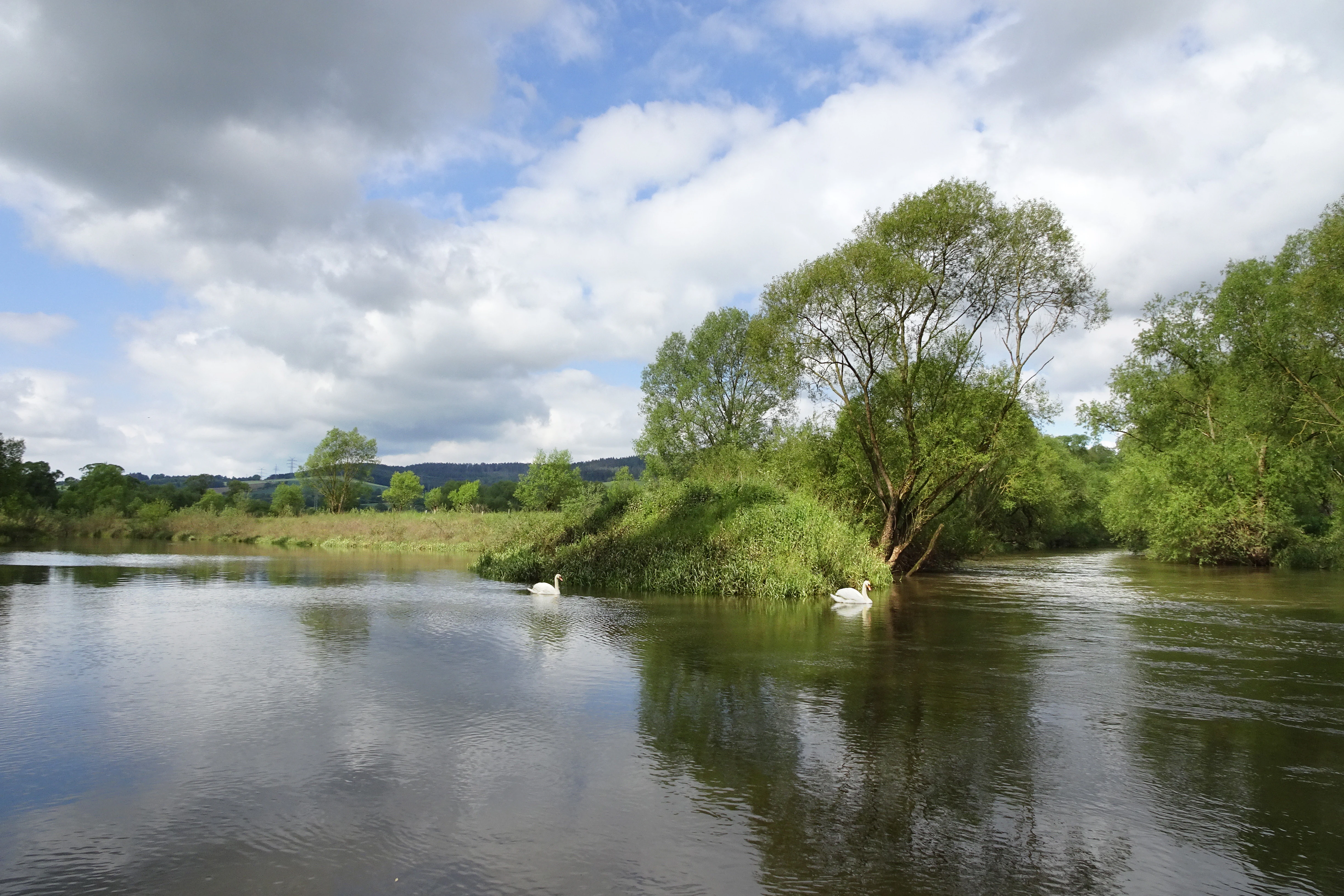
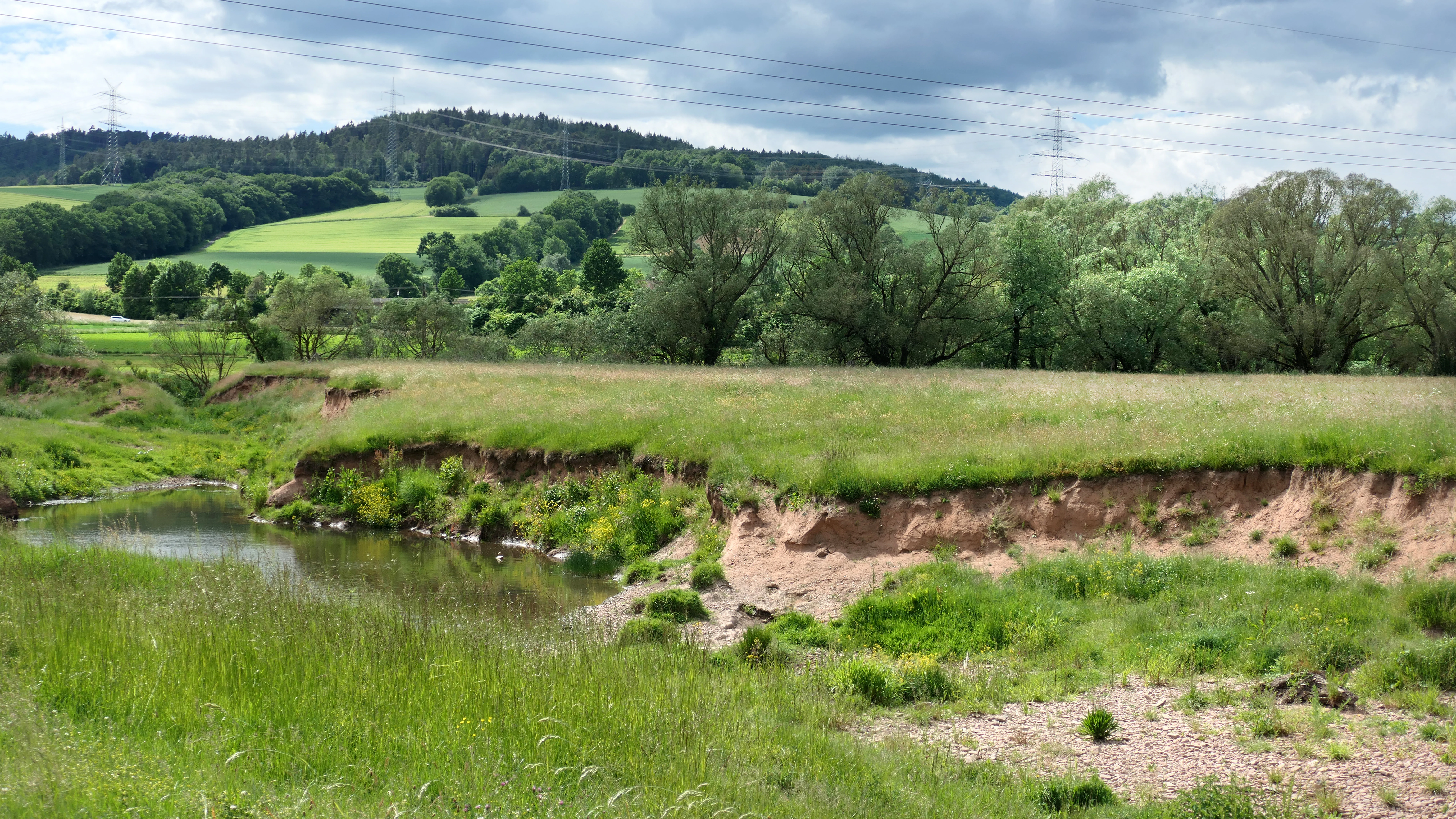
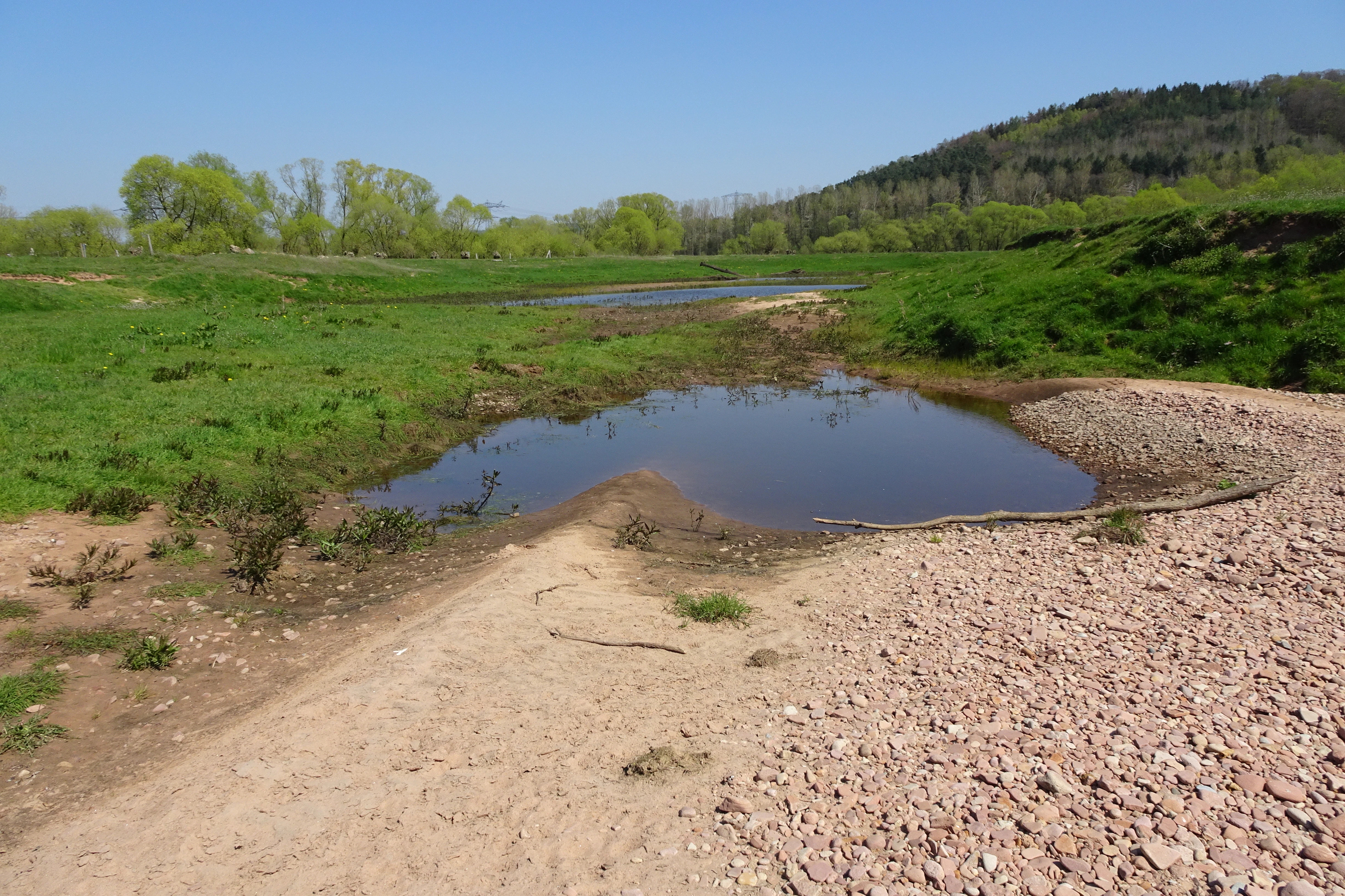
The dominant landscape feature inside the reserve is the curving course of the former river meander itself. Where this oxbow remains open, it forms a series of still-water pools edged by fringing vegetation; in other sections, the old channel exists as a damp, periodically flooded depression within the surrounding meadows. Beyond the oxbow, the floodplain carries a mosaic of moist and intermittently wet grasslands, intersected by a network of secondary flood channels and shallow swales that have been reshaped to improve both habitat quality and floodwater retention.
Beyond the immediate reserve, the wider Fulda valley is characterised by wide meadows punctuated by riverside woodland, with settlements such as Blankenheim and Bebra sitting on slightly higher terrace ground. The river itself defines the western edge of the protected area, while the eastern edge is marked by the raised embankment of the Bebra–Fulda railway line, beyond which the small wetland component of the reserve extends toward the slopes of the Lämmerberg. The Fulda long-distance cycle route passes close to the area, offering a low-impact way to experience the broader landscape character of this stretch of the valley.
Alte Fulda bei Blankenheim ecosystems, habitats, and plant life
Alte Fulda bei Blankenheim protects one of the more intact examples of a natural-eutrophic standing-water habitat along the middle Fulda. The re-excavated oxbow is classified under the EU Habitats Directive as habitat type 3150, Natural eutrophic lakes and ponds, characterised by nutrient-rich water supporting submerged aquatic vegetation. Aquatic plant communities include hornwort, spiked water-milfoil, Canadian waterweed, and yellow water-lily, with three-lobed duckweed and fennel pondweed present in smaller amounts.
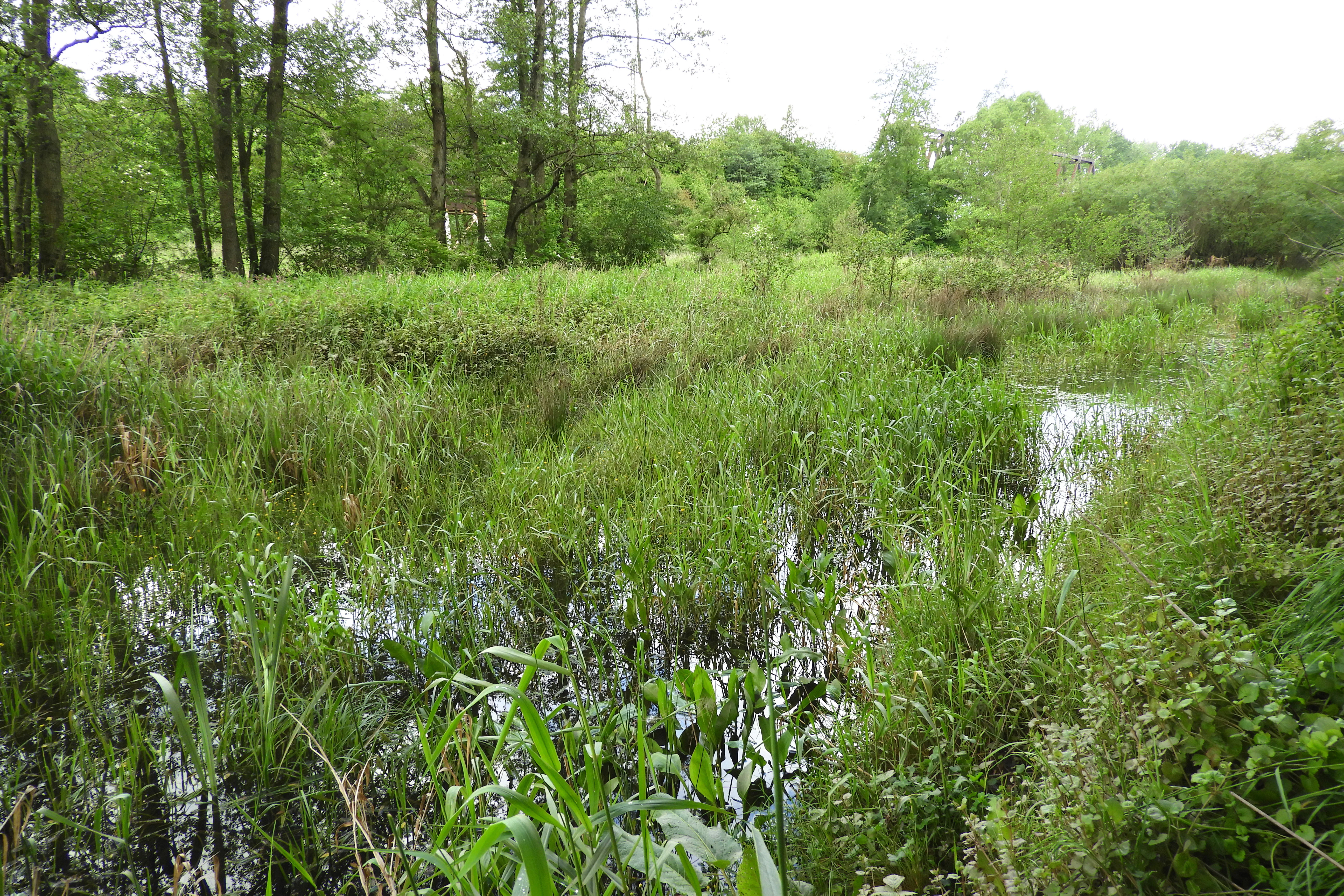
Along the moist margins and in the seasonally flooded zones, emergent vegetation is well developed. Common species include club-rush, amphibious bistort, and Austrian cress, together with tall herb and sedge communities that dominate the smaller eastern part of the reserve. The wetland beneath the Lämmerberg also supports small stands of great water-parsnip, common water-plantain, and yellow iris. The combination of permanent open water, seasonal flood channels, tall herb fringes, and grazed meadow creates a layered habitat mosaic that supports a wide range of species groups within a very small area.
This rich habitat structure is sustained and shaped by an unusual combination of water dynamics and grazing. Periodic flooding of the Fulda replenishes the floodplain soils and distributes seeds, while cattle grazing from April to November suppresses woody encroachment and keeps the sward open. The deliberately placed stone mounds add micro-relief to the otherwise flat floodplain, creating warm, dry niches that complement the surrounding wet habitats and increase overall habitat heterogeneity.
Alte Fulda bei Blankenheim wildlife and species highlights
The reserve is most strongly identified with its birdlife, and is regarded as regionally significant both for breeding species and for migrating birds that use the Fulda valley as a stepping-stone. A 2016 bird survey published in 2017 by the local working group of the Hessian Society for Ornithology and Nature Conservation recorded 23 waterbird species, though generally in low individual numbers, a pattern attributed in part to ongoing silting and partial drying of the oxbow. Notable records included resting shelducks, black storks, and ruff.
Water-associated species observed in or near the reserve include mute swan, Egyptian goose and shelduck, teal and mallard, cormorant, great and grey heron, black and white stork, black kite, lapwing, little ringed plover, common sandpiper, green sandpiper, wood sandpiper, ruff, common kingfisher, sand martin, and grey wagtail. Breeding species documented during long-term monitoring include European bee-eater, common cuckoo, skylark, yellow wagtail, common whitethroat, red-backed shrike, northern wheatear, whinchat, grasshopper warbler, marsh warbler and reed warbler, spotted flycatcher, common linnet, yellowhammer, and reed bunting.
Beyond birds, the mosaic of water bodies, wet grassland, and stone piles provides habitat for amphibians, reptiles, and insects. Stone mounds placed in the open pasture function both as perches for shrikes, wheatears, and chats and as shelter for amphibians, reptiles, and a diverse insect fauna. Although fire-bellied toads were historically targeted when the small ponds east of the railway were created, surveys for the FFH baseline data did not confirm their continued presence, suggesting local declines or shifts in distribution.
Alte Fulda bei Blankenheim conservation status and protection priorities
Alte Fulda bei Blankenheim was established in 1981 in response to intense pressure on the lower Fulda floodplain from road, pipeline, and railway infrastructure, gravel extraction, and intensive agriculture. The underlying conservation aim was to preserve one of the few remaining near-natural floodplain wetland complexes in the Bebra basin, both for its ecological value and as a buffer against further habitat loss in the valley.
The reserve sits within a layered system of overlapping designations. It is a nationally recognised Naturschutzgebiet under the German nature conservation framework, an IUCN Category IV Habitat/Species Management Area. It lies entirely within the FFH site Auenwiesen von Fulda, Rohrbach und Solz and within the European bird protection area Fuldatal zwischen Rotenburg und Niederaula, both forming part of the cross-border Natura 2000 network designated under Hessian law in January 2008. It is also embedded in the Auenverbund Fulda landscape protection area, established in 1993, which aims to preserve varied meadow and riparian vegetation types and to encourage the conversion of arable land back to extensively used grassland along the Fulda.
Practical conservation management combines habitat restoration and traditional land use. Selective re-excavation of the old meander re-established open water surfaces while preserving shoreline structure, and the creation of additional flood channels has simultaneously improved habitat for wetland species and increased flood retention capacity for the nearby community of Blankenheim. The cattle grazing regime using Red Hill cattle, a historic landrace once close to extinction, is itself a conservation measure, preserving both grassland openness and a threatened domestic breed while providing culturally rooted landscape management.
Alte Fulda bei Blankenheim cultural meaning and human context
The cultural context of Alte Fulda bei Blankenheim is closely tied to the long history of human modification of the Fulda River. The oxbow itself may be a relic of medieval efforts to render the Fulda navigable up to the town of Hersfeld, placing the protected site within a broader regional tradition of river engineering and waterway use that shaped settlement patterns in the Fulda valley.
The grazing tradition that sustains the reserve today is another element of local cultural heritage. The use of Red Hill cattle, an old three-purpose Hessian breed, connects modern conservation management with the historical agricultural practices of the Osthessische Bergland. Through the Weideverein Taurus and other pasture projects, the site participates in regional efforts to keep traditional, robust livestock breeds alive as living agricultural heritage while using them as practical tools for landscape management.
The reserve also sits in a landscape shaped by transport infrastructure. The Bebra–Fulda railway defines its eastern edge, and the Fulda long-distance cycle route, also known as the Hessian long-distance cycle route R1, passes close by, linking the protected floodplain to broader regional networks of recreational movement between the Rhön highlands and the southern Weser Uplands.
Top sights and standout views in Alte Fulda bei Blankenheim
The reserve's most distinctive quality is the way a single small protected area combines a restored oxbow still-water habitat, seasonally flooded channels, traditional grazed meadows, and a deliberately managed mosaic of open ground and stone structures. This layered habitat supports an unusually broad spectrum of breeding and migratory birds for a site of its size, even though individual waterbird numbers remain modest.
Equally notable is the management partnership between modern conservation science and traditional land use. The use of Red Hill cattle from April to November, the re-excavation of the old meander, and the placement of stone mounds as perches and micro-habitats together produce a working floodplain where species protection, flood risk reduction for Blankenheim, and the survival of an old Hessian landrace all coincide.
Best time to visit Alte Fulda bei Blankenheim
Because the reserve is a working floodplain rather than a visitor attraction, seasonal character is more relevant than specific timing. Spring and early summer bring the highest bird activity, with breeding meadow species such as yellow wagtail, whinchat, skylark, and red-backed shrike establishing territories, while water levels in the oxbow tend to be more stable before the main summer drawdown.
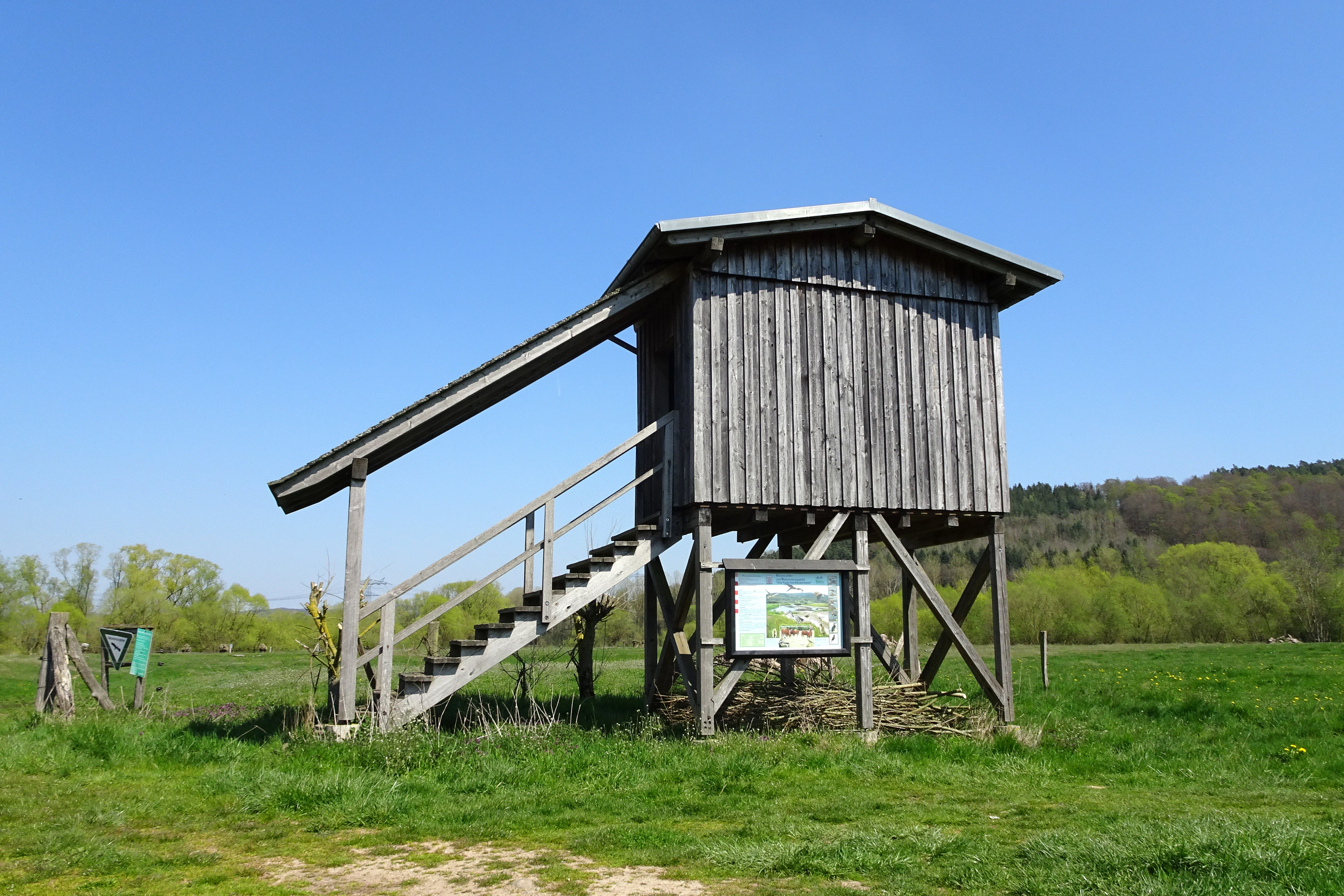
Late summer and autumn are shaped by the annual grazing cycle and seasonal flooding. Cattle graze the meadows from April to November, maintaining the open sward that is critical for ground-nesting birds, and autumn floods of the Fulda replenish the floodplain and create temporary wetland conditions. Winter visits offer a quieter atmosphere, often with the possibility of observing waterbirds and late-season raptors in the unflooded parts of the floodplain. Visitors should keep in mind that the reserve itself is not crossed by public paths, and observation is generally undertaken from the information-equipped viewpoint on the southwestern edge or from the nearby Fulda cycle route.