
Why Anholt and the Sea North of Anholt (Natura 2000 area 46) stands out
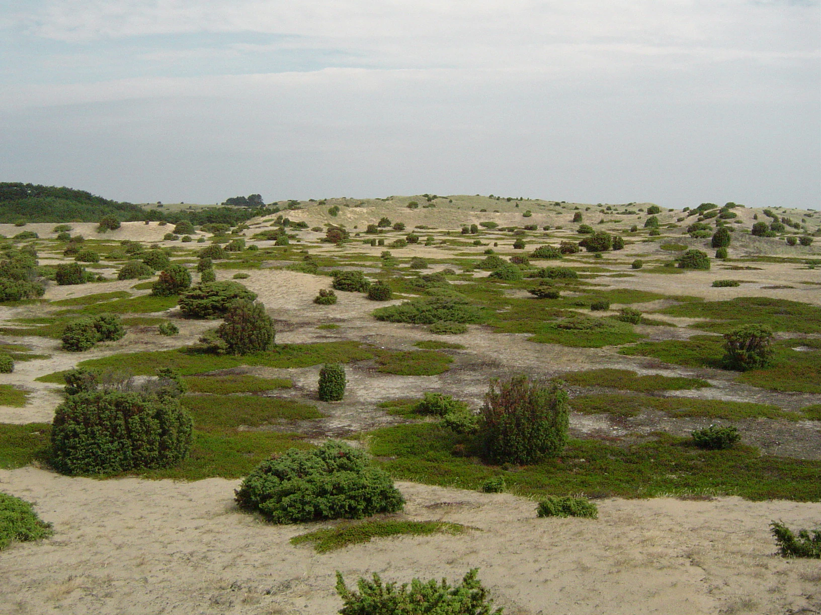
Anholt and its surrounding sea are best known for Ørkenen, one of the largest and most active dune landscapes in Denmark, which occupies roughly 85 percent of the island's land area and creates an unusually arid, desert-like interior. The protected site is also notable for combining terrestrial dune and heath habitats with a sizable marine component in the Kattegat, creating a single integrated natural area covering thousands of hectares of sea. Within the marine area, the site is recognized for its seal colonies, particularly the breeding grounds of both gray seals and harbor seals at the eastern tip of the island called Totten, which is managed as a wildlife reserve. The surrounding waters also host wintering populations of sea ducks such as common eiders, common scoters, and velvet scoters, reinforcing the area's identity as a meeting point between arid dune ecosystems and productive North Sea, Kattegat marine habitats.
Anholt and the Sea North of Anholt (Natura 2000 area 46) history and protected-area timeline
Long before its Natura 2000 status, Anholt's landscape was recognized as worthy of formal protection through a series of national conservation orders, or fredninger, that began in the early twentieth century. The dunes of Ørkenen were protected in 1938, followed by Sønderbjerg in 1960, and then Nordbjerg and Vesterklit in 1972. Together these orders brought much of the island's dune and heath interior under long-term protection, setting the stage for later international designations.
The eastern tip at Totten was later set aside as a wildlife reserve specifically to protect breeding colonies of gray seals and harbor seals, whose presence helped draw attention to the area's broader marine significance. Anholt's land portion was subsequently recognized as a Ramsar wetland site, reflecting both its dune slack habitats and its importance for waterbirds, while the surrounding sea and island together were eventually incorporated into Denmark's Natura 2000 network as site number 46.
In 2011 a Natura 2000 plan was adopted for the site, and municipal authorities together with Naturstyrelsen developed binding action plans to implement it. The plan was coordinated with the broader water plan for the Djursland area, recognizing that the management of Anholt's terrestrial and marine environments ties into wider regional water and nature management goals. Subsequent planning periods have continued to build on this framework, extending and refining the conservation approach for the site.
Anholt and the Sea North of Anholt (Natura 2000 area 46) landscape and geographic character
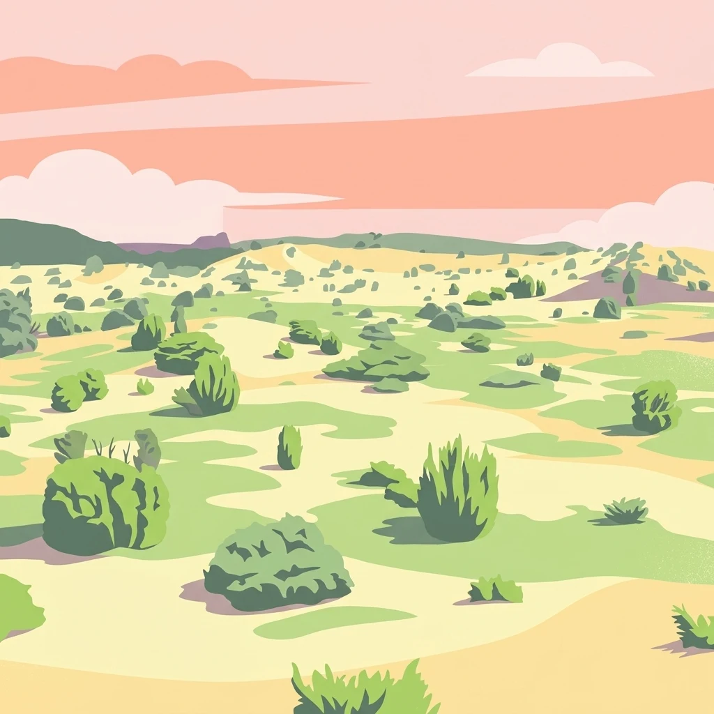
The landscape of Anholt and the Sea North of Anholt is defined by contrast: an island interior dominated by shifting sand and open dunes, ringed by a relatively narrow band of coastal habitats, and surrounded by open Kattegat waters. Ørkenen forms the geographic heart of the site, an extensive dune system covering about 85 percent of Anholt's land area. Within it, active white dunes and shifting dunes still move across the landscape, while more stable gray and green dunes, dune heaths, and juniper dune shrublands occupy the older parts of the system.
Smaller but ecologically important features punctuate the dune landscape. Dune slacks form low, moist depressions between dune ridges and contribute to habitat diversity within an otherwise dry environment. Along the coast, foredunes, wooded dunes, and a coastal lagoon mark the transition from the dry interior to the sea. There are also limited areas of freshwater lake, bog, freshwater meadow, dry grassland, and protected forest, along with small amounts of agricultural land and settlement. Most of the habitat area on land has been formally protected since the mid-twentieth century.
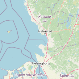
To the north, the landscape extends into a broad marine area of sandbanks and open Kattegat water. This sea component dwarfs the land area in size and shapes the visual and ecological identity of the site from offshore approaches to the island. The eastern tip at Totten, where seal colonies breed on shore, forms the meeting point between this marine landscape and the island's dune coast, anchoring the site's combined land-sea character.
Anholt and the Sea North of Anholt (Natura 2000 area 46) ecosystems, habitats, and plant life
Anholt and the Sea North of Anholt protects an unusually tight cluster of habitats on a small land area. The terrestrial Natura 2000 habitats include sandbanks, a coastal lagoon, foredunes, white dunes, gray and green dunes, dry dune heaths, juniper dune shrublands, wooded dunes, dune slacks, and forested peat bog. This combination, particularly the large-scale presence of active dunes and dune heaths, makes the site a stronghold for habitat types that have become scarce elsewhere in Denmark.
The dune heath habitat is by far the most extensive protected land type on the island, supported by the rain-poor, sandy conditions of Ørkenen. Within the dune matrix, dune slacks provide locally wetter microhabitats and break the otherwise uniform dry character of the interior. Small bog and mire areas, along with restricted freshwater meadow, dry grassland, and forest patches, add further structural variety. Although the absolute areas of wetland and forest are modest, they form important ecological complements to the dominant dune and heath systems.
On the marine side, the sandbank habitat and the open sea together make up the majority of the site. This marine environment supports the seal populations that breed on Anholt's eastern point and provides feeding and wintering areas for seabirds. The integration of these habitat types under one designation reflects an understanding that Anholt's terrestrial and marine ecosystems influence each other across the shoreline and into the Kattegat.
Anholt and the Sea North of Anholt (Natura 2000 area 46) wildlife and species highlights
The wildlife profile of Anholt and the Sea North of Anholt is shaped by the combination of a near-desert dune interior and a productive surrounding sea. The marine portion supports two species of seals: the gray seal and the harbor seal, both of which breed on the shores around Totten on Anholt's eastern tip. This area is formally managed as a wildlife reserve to limit disturbance at the breeding colonies, underlining how important the site is for pinniped conservation in Danish waters.
The site's bird protection designation reflects its importance for seabirds and waterbirds associated with the Kattegat. Key species listed in the designation include common eiders, common scoters, and velvet scoters, all of which use the marine area around Anholt, particularly during the non-breeding season. Their presence in winter flocks ties the marine component of the site to broader migration and wintering patterns in the Kattegat.
On land, the large heath and dune areas support the characteristic fauna of these open, dry habitats. Though the source material does not detail specific terrestrial species, the habitat mosaic of dune heaths, juniper shrublands, dune slacks, and small bog areas provides niches for invertebrates, reptiles, and smaller vertebrates typical of Danish sandy landscapes. The site's wildlife value is therefore best understood as the interaction between its internationally recognized seal colonies and seabird aggregations offshore and its specialized dune and heath fauna on land.
Anholt and the Sea North of Anholt (Natura 2000 area 46) conservation status and protection priorities
Anholt and the Sea North of Anholt is a layered conservation site. It is protected simultaneously as a Natura 2000 Habitat Area, a Natura 2000 Bird Protection Area, and a Ramsar wetland site, with the designations covering different but overlapping portions of the same island and marine area. The land component also benefits from a longer history of national protection, with much of the dune and heath interior under formal nature conservation orders dating as far back as 1938.
The site's conservation significance rests on several factors. It contains a large share of Denmark's remaining active dune systems and one of the country's most extensive dry dune heaths, habitat types that have declined strongly elsewhere in Denmark. It also supports breeding populations of both gray seals and harbor seals in the Kattegat, a particularly meaningful contribution to seal conservation given the historical pressures on these species. Its marine area is large enough relative to the island that the designation can effectively protect foraging and resting habitat for waterbirds as well as breeding habitat for seals.
Management is shared between municipal authorities and Naturstyrelsen, the Danish Nature Agency, with a Natura 2000 plan adopted in 2011 and coordinated with the regional water plan for Djursland. This integrated approach recognizes that conserving Anholt's dunes, heaths, and wetlands requires coordinated decisions about water management, land use, and marine use, and that the wildlife reserve at Totten must be managed alongside the broader marine and terrestrial designations. Continued planning cycles have built on this framework, reinforcing the site's long-term protected status.
Anholt and the Sea North of Anholt (Natura 2000 area 46) cultural meaning and human context
Anholt has a long cultural identity as one of Denmark's most isolated inhabited islands, situated far from the Jutland coast in the middle of the Kattegat. Its remoteness, combined with the unusual, almost desert-like character of Ørkenen, has shaped local traditions, sense of place, and the way the island is perceived in Denmark. Because much of the island's land falls within the Natura 2000 site, modern land use on Anholt has long been shaped by nature conservation orders dating back to the 1930s.
The terrestrial area within the site includes small portions of agricultural land and settlement, reflecting the long-standing coexistence of a small island community with extensive protected dune and heath landscapes. Management of these areas, from traditional land use to contemporary conservation planning, has been coordinated between local municipalities and national authorities, fitting Denmark's broader approach to combining inhabited landscapes with international nature protection.
Top sights and standout views in Anholt and the Sea North of Anholt (Natura 2000 area 46)
Anholt's Ørkenen is the single most striking feature of the site, covering about 85 percent of the island's land area and including active, shifting white dunes that are exceptional in Denmark. Around it, dry dune heaths, juniper dunes, wooded dunes, and dune slacks form one of the most complete dune habitat mosaics in the country. The combination of these habitats with a coastal lagoon and forested peat bog on a small island gives the site an unusually high habitat density for its size.
The marine portion of the site dominates its total area and is what makes the designation genuinely unusual. Roughly 46,000 hectares of Kattegat sea are protected together with the island, providing habitat for seal breeding colonies at Totten and wintering areas for sea ducks such as common eiders, common scoters, and velvet scoters. The site's layered protection, as Habitat Area, Bird Protection Area, Ramsar site, and long-protected national nature reserve, gives Anholt and its surrounding sea a conservation depth that few other Danish sites can match.
Best time to visit Anholt and the Sea North of Anholt (Natura 2000 area 46)
The character of Anholt and the Sea North of Anholt changes meaningfully with the seasons. Late spring and summer bring the most accessible conditions on land, with warmer temperatures, longer days, and active wildlife across the dunes, heaths, and coastal areas. This is also when the island's vegetation is most visible, from flowering heaths to green juniper stands, and when walking through Ørkenen is at its most comfortable.
Winter and the colder months shift the emphasis to the marine part of the site. The surrounding Kattegat waters host wintering flocks of common eiders, common scoters, and velvet scoters at this time of year, and rough seas can make the offshore dimension of the protected area more visually dramatic. Visitors interested in seal populations should be aware that breeding activity around Totten is sensitive, and access may be restricted to avoid disturbance; planning around published guidance from the managing authorities is advisable. Overall, the site's combined dune, heath, and marine identity means that both warm and cold seasons can offer rewarding experiences, with land and sea presenting different faces at different times of year.