
Mori Atlas logo
Protected areaAnholt og havet nord for (Natura 2000-område nr. 46)

A combined terrestrial and marine protected area anchoring the desert landscapes of the Kattegat

Anholt og havet nord for (Natura 2000-område nr. 46): Mapped Boundaries and Island Geography

(Natura 2000-område nr. 46 Anholt og havet nord for)

Anholt og havet nord for (Natura 2000-område nr. 46) encompasses the vast dune wilderness of Anholt island and the surrounding marine waters of the Kattegat. This protected area stands out for its desert like interior known as Ørkenen, which contains active white dunes, heathlands, and juniper shrublands. Beyond the coastal dunes, the site extends into significant marine zones that provide critical breeding grounds for harbor and gray seals alongside wintering habitats for sea ducks.

Kattegat islanddune landscapeactive dunesdry heathjuniper dunescoastal lagoon
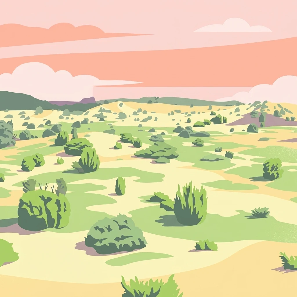
A stylized digital illustration showing a sparse landscape with scattered green bushes and shrubs on light green and beige ground, under a pink and peach sky with clouds.

Anholt og havet nord for (Natura 2000-område nr. 46)

Protected area

Park overview

Structured park overview, official facts, and landscape profile for Anholt and the Sea North of Anholt (Natura 2000 area 46)

Anholt and the Sea North of Anholt (Natura 2000 area 46) park facts, protected area profile, and essential visitor context

Review the core facts for Anholt and the Sea North of Anholt (Natura 2000 area 46), including designation, size, terrain, visitor scale, habitats, and operating context in one park-focused overview.

About Anholt and the Sea North of Anholt (Natura 2000 area 46)

Anholt and the Sea North of Anholt is a Natura 2000 protected site in Denmark that blends an unusually large island dune landscape with a substantial marine area. The site is centered on Anholt, an island that sits within the Kattegat at a significant distance of about 40 kilometers from the Jutland mainland. Because the designation covers most of the island together with the sea to its north, the site functions as both a terrestrial and a marine protected area, an integrated approach that reflects the close ecological connection between the island's dune systems, its coastal waters, and the seabed habitats offshore.

The terrestrial identity of the area is defined by Ørkenen, an extensive dune complex that dominates the interior of Anholt and gives the island its distinctive character. Although Danish dunes are found elsewhere along the west coast, Ørkenen stands out for its scale and for the presence of living, shifting dunes. Around and within this dune matrix lie other habitats covered by the site's Natura 2000 designation, including dry heaths, juniper-dominated dune shrublands, wooded dunes, dune slacks, and shore dunes along the coast. A coastal lagoon, sandbanks, and forested peat bog complete the habitat list, illustrating how compressed and varied the island's ecological profile is despite its relatively small land area.

The marine portion of the designation is roughly twenty-five times larger than the land portion and forms an integral part of the site's ecological value. It provides foraging and resting habitat for waterbirds and supports the seal populations that breed on the rocky and sandy shores around Totten on Anholt's eastern tip. By designating land and sea together, the management framework recognizes that the dune, heath, lagoon, and offshore systems are functionally connected, and that protecting Anholt's internationally rare desert-like landscape requires safeguarding the surrounding Kattegat waters as well.

Quick facts and research context for Anholt and the Sea North of Anholt (Natura 2000 area 46)

Anholt and the Sea North of Anholt is Natura 2000 site number 46 in Denmark, located in Region Midtjylland within Norddjurs Municipality. The total designated area covers roughly 47,878 hectares, of which about 45,965 hectares are sea and around 1,857 hectares are land. The site is simultaneously an EU Habitat Area (H42, 13,357 ha) and a Bird Protection Area (F32, 46,137 ha), and the land component is also listed as Ramsar site R12 (11,560 ha).

The land area is dominated by the Ørkenen dune system, which accounts for about 85 percent of the island's land surface and includes actively shifting white dunes. A significant portion of the land within the habitat area has been under formal nature protection for decades through successive conservation orders from 1938, 1960, and 1972. The eastern tip around Totten is designated as a wildlife reserve to protect breeding colonies of gray seals and harbor seals.

Park context

Deeper park guide and search-rich context for Anholt and the Sea North of Anholt (Natura 2000 area 46)

Anholt and the Sea North of Anholt (Natura 2000 area 46) history, landscape, wildlife, and travel context

Explore Anholt and the Sea North of Anholt (Natura 2000 area 46) through its history, landscape character, ecosystems, wildlife, conservation priorities, cultural context, and seasonal travel timing in a structured park guide built for atlas discovery and search intent.

Why Anholt and the Sea North of Anholt (Natura 2000 area 46) stands out

Anholt and its surrounding sea are best known for Ørkenen, one of the largest and most active dune landscapes in Denmark, which occupies roughly 85 percent of the island's land area and creates an unusually arid, desert-like interior. The protected site is also notable for combining terrestrial dune and heath habitats with a sizable marine component in the Kattegat, creating a single integrated natural area covering thousands of hectares of sea. Within the marine area, the site is recognized for its seal colonies, particularly the breeding grounds of both gray seals and harbor seals at the eastern tip of the island called Totten, which is managed as a wildlife reserve. The surrounding waters also host wintering populations of sea ducks such as common eiders, common scoters, and velvet scoters, reinforcing the area's identity as a meeting point between arid dune ecosystems and productive North Sea, Kattegat marine habitats.
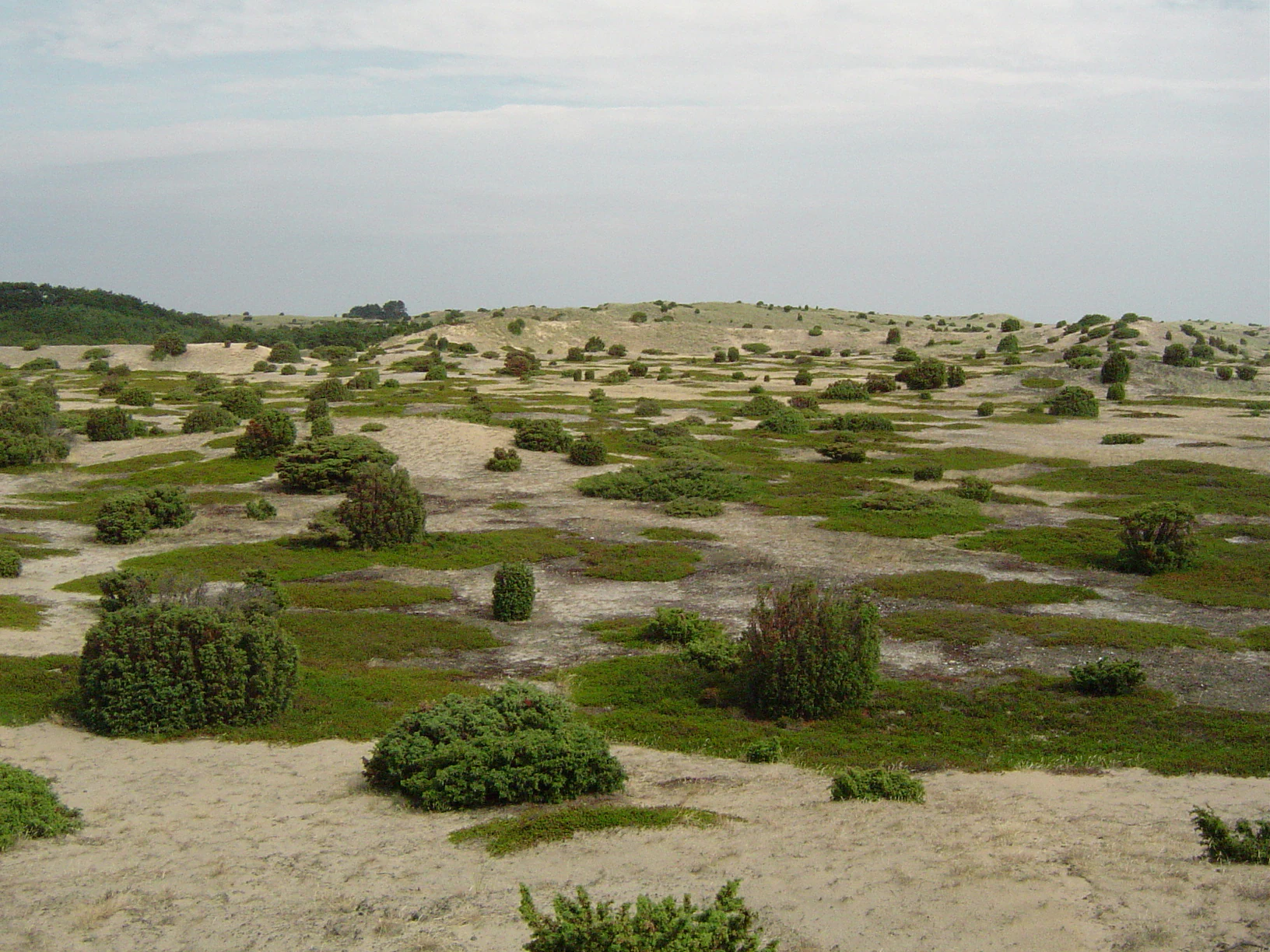
A wide view of sandy dunes scattered with green juniper bushes under a cloudy sky.
Junipers growing on sand dunes on Anholt island, Denmark

Anholt and the Sea North of Anholt (Natura 2000 area 46) history and protected-area timeline

Long before its Natura 2000 status, Anholt's landscape was recognized as worthy of formal protection through a series of national conservation orders, or fredninger, that began in the early twentieth century. The dunes of Ørkenen were protected in 1938, followed by Sønderbjerg in 1960, and then Nordbjerg and Vesterklit in 1972. Together these orders brought much of the island's dune and heath interior under long-term protection, setting the stage for later international designations.

The eastern tip at Totten was later set aside as a wildlife reserve specifically to protect breeding colonies of gray seals and harbor seals, whose presence helped draw attention to the area's broader marine significance. Anholt's land portion was subsequently recognized as a Ramsar wetland site, reflecting both its dune slack habitats and its importance for waterbirds, while the surrounding sea and island together were eventually incorporated into Denmark's Natura 2000 network as site number 46.

In 2011 a Natura 2000 plan was adopted for the site, and municipal authorities together with Naturstyrelsen developed binding action plans to implement it. The plan was coordinated with the broader water plan for the Djursland area, recognizing that the management of Anholt's terrestrial and marine environments ties into wider regional water and nature management goals. Subsequent planning periods have continued to build on this framework, extending and refining the conservation approach for the site.

Anholt and the Sea North of Anholt (Natura 2000 area 46) landscape and geographic character

The landscape of Anholt and the Sea North of Anholt is defined by contrast: an island interior dominated by shifting sand and open dunes, ringed by a relatively narrow band of coastal habitats, and surrounded by open Kattegat waters. Ørkenen forms the geographic heart of the site, an extensive dune system covering about 85 percent of Anholt's land area. Within it, active white dunes and shifting dunes still move across the landscape, while more stable gray and green dunes, dune heaths, and juniper dune shrublands occupy the older parts of the system.

Smaller but ecologically important features punctuate the dune landscape. Dune slacks form low, moist depressions between dune ridges and contribute to habitat diversity within an otherwise dry environment. Along the coast, foredunes, wooded dunes, and a coastal lagoon mark the transition from the dry interior to the sea. There are also limited areas of freshwater lake, bog, freshwater meadow, dry grassland, and protected forest, along with small amounts of agricultural land and settlement. Most of the habitat area on land has been formally protected since the mid-twentieth century.

To the north, the landscape extends into a broad marine area of sandbanks and open Kattegat water. This sea component dwarfs the land area in size and shapes the visual and ecological identity of the site from offshore approaches to the island. The eastern tip at Totten, where seal colonies breed on shore, forms the meeting point between this marine landscape and the island's dune coast, anchoring the site's combined land-sea character.

Anholt and the Sea North of Anholt (Natura 2000 area 46) ecosystems, habitats, and plant life

Anholt and the Sea North of Anholt protects an unusually tight cluster of habitats on a small land area. The terrestrial Natura 2000 habitats include sandbanks, a coastal lagoon, foredunes, white dunes, gray and green dunes, dry dune heaths, juniper dune shrublands, wooded dunes, dune slacks, and forested peat bog. This combination, particularly the large-scale presence of active dunes and dune heaths, makes the site a stronghold for habitat types that have become scarce elsewhere in Denmark.

The dune heath habitat is by far the most extensive protected land type on the island, supported by the rain-poor, sandy conditions of Ørkenen. Within the dune matrix, dune slacks provide locally wetter microhabitats and break the otherwise uniform dry character of the interior. Small bog and mire areas, along with restricted freshwater meadow, dry grassland, and forest patches, add further structural variety. Although the absolute areas of wetland and forest are modest, they form important ecological complements to the dominant dune and heath systems.

On the marine side, the sandbank habitat and the open sea together make up the majority of the site. This marine environment supports the seal populations that breed on Anholt's eastern point and provides feeding and wintering areas for seabirds. The integration of these habitat types under one designation reflects an understanding that Anholt's terrestrial and marine ecosystems influence each other across the shoreline and into the Kattegat.

Anholt and the Sea North of Anholt (Natura 2000 area 46) wildlife and species highlights

The wildlife profile of Anholt and the Sea North of Anholt is shaped by the combination of a near-desert dune interior and a productive surrounding sea. The marine portion supports two species of seals: the gray seal and the harbor seal, both of which breed on the shores around Totten on Anholt's eastern tip. This area is formally managed as a wildlife reserve to limit disturbance at the breeding colonies, underlining how important the site is for pinniped conservation in Danish waters.

The site's bird protection designation reflects its importance for seabirds and waterbirds associated with the Kattegat. Key species listed in the designation include common eiders, common scoters, and velvet scoters, all of which use the marine area around Anholt, particularly during the non-breeding season. Their presence in winter flocks ties the marine component of the site to broader migration and wintering patterns in the Kattegat.

On land, the large heath and dune areas support the characteristic fauna of these open, dry habitats. Though the source material does not detail specific terrestrial species, the habitat mosaic of dune heaths, juniper shrublands, dune slacks, and small bog areas provides niches for invertebrates, reptiles, and smaller vertebrates typical of Danish sandy landscapes. The site's wildlife value is therefore best understood as the interaction between its internationally recognized seal colonies and seabird aggregations offshore and its specialized dune and heath fauna on land.

Anholt and the Sea North of Anholt (Natura 2000 area 46) conservation status and protection priorities

Anholt and the Sea North of Anholt is a layered conservation site. It is protected simultaneously as a Natura 2000 Habitat Area, a Natura 2000 Bird Protection Area, and a Ramsar wetland site, with the designations covering different but overlapping portions of the same island and marine area. The land component also benefits from a longer history of national protection, with much of the dune and heath interior under formal nature conservation orders dating as far back as 1938.

The site's conservation significance rests on several factors. It contains a large share of Denmark's remaining active dune systems and one of the country's most extensive dry dune heaths, habitat types that have declined strongly elsewhere in Denmark. It also supports breeding populations of both gray seals and harbor seals in the Kattegat, a particularly meaningful contribution to seal conservation given the historical pressures on these species. Its marine area is large enough relative to the island that the designation can effectively protect foraging and resting habitat for waterbirds as well as breeding habitat for seals.

Management is shared between municipal authorities and Naturstyrelsen, the Danish Nature Agency, with a Natura 2000 plan adopted in 2011 and coordinated with the regional water plan for Djursland. This integrated approach recognizes that conserving Anholt's dunes, heaths, and wetlands requires coordinated decisions about water management, land use, and marine use, and that the wildlife reserve at Totten must be managed alongside the broader marine and terrestrial designations. Continued planning cycles have built on this framework, reinforcing the site's long-term protected status.

Anholt and the Sea North of Anholt (Natura 2000 area 46) cultural meaning and human context

Anholt has a long cultural identity as one of Denmark's most isolated inhabited islands, situated far from the Jutland coast in the middle of the Kattegat. Its remoteness, combined with the unusual, almost desert-like character of Ørkenen, has shaped local traditions, sense of place, and the way the island is perceived in Denmark. Because much of the island's land falls within the Natura 2000 site, modern land use on Anholt has long been shaped by nature conservation orders dating back to the 1930s.

The terrestrial area within the site includes small portions of agricultural land and settlement, reflecting the long-standing coexistence of a small island community with extensive protected dune and heath landscapes. Management of these areas, from traditional land use to contemporary conservation planning, has been coordinated between local municipalities and national authorities, fitting Denmark's broader approach to combining inhabited landscapes with international nature protection.

Top sights and standout views in Anholt and the Sea North of Anholt (Natura 2000 area 46)

Anholt's Ørkenen is the single most striking feature of the site, covering about 85 percent of the island's land area and including active, shifting white dunes that are exceptional in Denmark. Around it, dry dune heaths, juniper dunes, wooded dunes, and dune slacks form one of the most complete dune habitat mosaics in the country. The combination of these habitats with a coastal lagoon and forested peat bog on a small island gives the site an unusually high habitat density for its size.

The marine portion of the site dominates its total area and is what makes the designation genuinely unusual. Roughly 46,000 hectares of Kattegat sea are protected together with the island, providing habitat for seal breeding colonies at Totten and wintering areas for sea ducks such as common eiders, common scoters, and velvet scoters. The site's layered protection, as Habitat Area, Bird Protection Area, Ramsar site, and long-protected national nature reserve, gives Anholt and its surrounding sea a conservation depth that few other Danish sites can match.

Best time to visit Anholt and the Sea North of Anholt (Natura 2000 area 46)

The character of Anholt and the Sea North of Anholt changes meaningfully with the seasons. Late spring and summer bring the most accessible conditions on land, with warmer temperatures, longer days, and active wildlife across the dunes, heaths, and coastal areas. This is also when the island's vegetation is most visible, from flowering heaths to green juniper stands, and when walking through Ørkenen is at its most comfortable.

Winter and the colder months shift the emphasis to the marine part of the site. The surrounding Kattegat waters host wintering flocks of common eiders, common scoters, and velvet scoters at this time of year, and rough seas can make the offshore dimension of the protected area more visually dramatic. Visitors interested in seal populations should be aware that breeding activity around Totten is sensitive, and access may be restricted to avoid disturbance; planning around published guidance from the managing authorities is advisable. Overall, the site's combined dune, heath, and marine identity means that both warm and cold seasons can offer rewarding experiences, with land and sea presenting different faces at different times of year.

Monthly climate preview

Long-term temperature ranges and precipitation normals for Anholt og havet nord for (Natura 2000-område nr. 46)

Anholt og havet nord for (Natura 2000-område nr. 46) Average Temperature and Monthly Precipitation Profile

Representative coordinate records show measured temperature swings from sub-zero winter lows to warm summer maximums alongside consistent monthly precipitation across the year. Reviewing this structured climate baseline helps analyze multi-month meteorological trends and regional environmental conditions.
Annual mean9 °C
1 °C18 °C
Jan
Feb
Mar
Apr
May11°
Jun15°
Jul18°
Aug18°
Sep15°
Oct11°
Nov
Dec
Warmest month
August

17.8 °C

Coolest month
February

1.4 °C

Wettest month
August

3 mm/day

Driest month
April

1.5 mm/day

Park location guide

Geography guide, regional context, and park location map for Anholt and the Sea North of Anholt (Natura 2000 area 46)

Anholt and the Sea North of Anholt (Natura 2000 area 46) park geography, regions, and map view in Denmark

Understand where Anholt and the Sea North of Anholt (Natura 2000 area 46) sits in Denmark through a broader geographic reading of the surrounding landscape, nearby location context, and its mapped position within the national park landscape.

How Anholt and the Sea North of Anholt (Natura 2000 area 46) fits into Denmark

Denmark is a constitutional monarchy and Nordic country in Northern Europe. It is the southernmost of the Scandinavian countries, bordering Germany to the south, Norway to the north, and Sweden to the southwest. The country consists of the Jutland peninsula and an archipelago of islands, with Copenhagen as its capital and largest city. Denmark has a population of over 6 million and is characterized by flat, arable land, sandy coasts, and a temperate climate.

Wider geography shaping Anholt and the Sea North of Anholt (Natura 2000 area 46) in Denmark

Denmark occupies the Jutland peninsula and roughly 406 islands in Northern Europe. It is situated between the North Sea to the west and the Baltic Sea to the east. The country borders Germany to the south and is connected to Sweden via the Øresund Bridge. Denmark is predominantly flat terrain with low elevation, the highest point being Møllehøj at 170.86 meters.

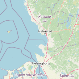
Map view of Anholt and the Sea North of Anholt (Natura 2000 area 46)

Use this park location map to pinpoint Anholt and the Sea North of Anholt (Natura 2000 area 46) in Denmark, understand its exact geographic position, and read its mapped placement within the surrounding landscape more clearly.

Pigeon | © OpenStreetMap contributors

Photographic reference for dune topography, coastal habitats, and marine environments across the protected area.

Visual Exploration of Anholt og havet nord for (Natura 2000-område nr. 46) Landscapes and Protected Scenery

Visual records illustrate the shifting dune systems, dry heaths, and marine expanses that define the protected area. Examining park photography provides a clearer understanding of terrain morphology, habitat diversity, and the ecological boundary between land and sea.

A wide view of sandy dunes scattered with green juniper bushes under a cloudy sky.

Park atlas

Compare regional marine reserves, island habitats, and surrounding Danish coastal landscapes

Parks Near Anholt og havet nord for (Natura 2000-område nr. 46) and Related Protected Areas

Browsing related protected areas helps place Anholt og havet nord for (Natura 2000-område nr. 46) within the broader network of Kattegat island nature and coastal reserves. Regional comparisons reveal shared conservation patterns across marine environments, shifting dune systems, and wintering seabird habitats.
Watercolor illustration showing rolling hills, a lake, pink flowering trees, and distant mountains
National parkDenmark
About 65 km away#1 closest

Southwest

Mols Bjerge National Park: Glacial Geography and Protected Terrain in Central Jutland

Mapping the coastal cliffs and rolling heathland of Denmark

Mols Bjerge National Park protects a sweeping mosaic of glacial hills, woodlands, and coastal zones on the Djursland peninsula. With a landscape shaped by ancient ice sheets, the park offers a detailed view into Denmark's geological history, preserved ancient barrows, and rich botanical diversity along the Kattegat sea.

Area
180 km²
Established
2009
IUCN
II
Relief
Upland
Watercolor painting showing a green and tan coastal marshland with low hills in the distance.
Nature reserveLæsø
About 71 km away#2 closest

North

Østdelen af Læsø Nature Reserve: Mapped Coastal Geography and Protected Danish Island Terrain

Explore active dune systems, beach ridges, and coastal heath-mire habitats

Østdelen af Læsø features a distinct interplay of coastal geology and traditional heathland vegetation across its 266 hectares. The reserve spans from the elevated Danzigmand dunes to the dynamic, growing barrier islands of Store Knot and Lille Knot, offering a comprehensive look at Denmark's shifting coastal margins and vital seabird nesting grounds.

Area
2.66 km²
Established
1963
Relief
Lowland
Climate
Temperate
Watercolor painting of a low-lying coastal landscape with grasses, shrubs, and soft, hazy distant hills.
Nature reserveLæsø
About 71 km away#3 closest

Northwest

Bovet Nature Reserve and Coastal Habitat Geography in Læsø, Denmark

A protected coastal corridor of heathland and salt marsh

Bovet is a 65-hectare nature reserve on the island of Læsø that safeguards a pristine 2.5 km stretch of Danish coastline. Characterized by a flat, open topography of heath, beach meadow, and reedbed, the site is defined by its sweeping views across Bovet Bugt and scattered glacial erratics. Its status as a bird protection area and Ramsar wetland highlights its importance as a habitat for breeding and resting waders within the Kattegat region.

Area
0.65 km²
Established
1964
Relief
Lowland
Climate
Temperate
A soft watercolor painting showing a panoramic view of trees, water, and marshy land, rendered in a muted color palette.
Nature reserveRegion Midtjylland
About 71 km away#4 closest

Southwest

Eldrup Skov og søer og moser i Løvenholm Skov: Geographic Map and Protected Landscape

An ecologically layered nature reserve in Region Midtjylland

This protected area unit unites five distinct parcels, including Gjesing Mose and Løvenholm Langsø, to preserve a rare slice of Danish forest and peatland. Use this mapping resource to understand the transition from dense broadleaf woodland to open raised bog habitats. The area represents a primary example of habitat restoration and conservation, showcasing how small, fragmented ecosystems retain their ecological integrity within a larger forest complex.

Area
1.55 km²
Established
2011
Relief
Lowland
Climate
Temperate
Nature reserveRegion Midtjylland
About 73 km away#5 closest

Southwest

Stubbe Sø Nature Reserve: A Geographic Exploration of Djursland Protected Landscapes

Mapping the wetlands, forest fringes, and mire systems of eastern Jutland.

Stubbe Sø is a central protected feature within the landscape of eastern Jutland, comprising a large shallow lake surrounded by alder-birch shorelines and coniferous plantations. This nature reserve offers deep insight into the glaciated terrain and wetland mosaic of the Djursland peninsula, providing an essential geographic reference for understanding local conservation habitats and regional waterbird migration corridors.

Area
7.78 km²
Established
1963
Relief
Lowland
Climate
Temperate
Protected areaDenmark
About 75 km away#6 closest

West

Aalborg Bugt: Geography and Protected Area Overview in Northern Denmark

Coastal wetlands, shallow marine habitat, and fjord systems

Aalborg Bugt represents a defining seascape for northern Denmark, stretching along the Kattegat coast to include diverse coastal features like dunes, salt meadows, and rich fens. As the largest Natura 2000 site in the country, the bay supports a continuous conservation corridor that bridges marine environments with inland fjord networks, offering a deep look into the regional geography and protected-land dynamics of the Jutland peninsula.

Area
1,774 km²
Nature reserveLæsø Municipality
About 79 km away#7 closest

Northwest

Nordre Rønner: Protected Island Landscapes and Geographic Mapping of Læsø Municipality

Remote coastal nature reserve and marine habitat within the Danish Kattegat sea

Nordre Rønner represents a significant cluster of islets in the Kattegat, showcasing the interplay of post-glacial land rise and coastal ecology. Managed within Læsø Municipality, these eleven hectares of protected land include essential nesting grounds for terns and harbor seals. This resource outlines the physical geography, mapped island connections, and the status of this unique maritime nature reserve.

Area
0.11 km²
Relief
Lowland
Climate
Temperate
Access
Moderate access
Watercolor painting of a panoramic landscape featuring green rolling hills, light foliage, and patches of pink wildflowers in the foreground.
National parkCentral Jutland
About 85 km away#8 closest

Southwest

Nationalpark Mols Bjerge: A Geographic Overview of Central Jutland's Glacial Landscape

Mapped terrain, dead-ice hills, and prehistoric monuments

Nationalpark Mols Bjerge offers a deep look into the glacial heritage of Central Jutland. The area features steep, sun-exposed slopes, heathland, and coastal fringes that provide a unique perspective on the Danish landscape. By examining the park's mapped boundaries, one can identify the convergence of geological landforms and ancient cultural history preserved within this protected environment.

Relief
Mountain
Access
Easy access
Water
Major water bodies

Common questions about visiting, size, designation, and location context for Anholt and the Sea North of Anholt (Natura 2000 area 46)

Anholt and the Sea North of Anholt (Natura 2000 area 46) FAQs for park facts, access, geography, and protected area context

Find quick answers about Anholt and the Sea North of Anholt (Natura 2000 area 46), including protected-area facts, park geography, trail and visitor context, and how the park fits into its surrounding country and regional landscape.
MoriAtlas Explorer

Continue Your Protected Areas Search Across the Global Atlas

Deepen your exploration by continuing the structured search for national parks and protected areas worldwide. Utilize the comprehensive filtering capabilities to compare different conservation landscapes and refine your understanding of global park geography. Discover more about the distribution and characteristics of protected natural areas.

Global natural geography