
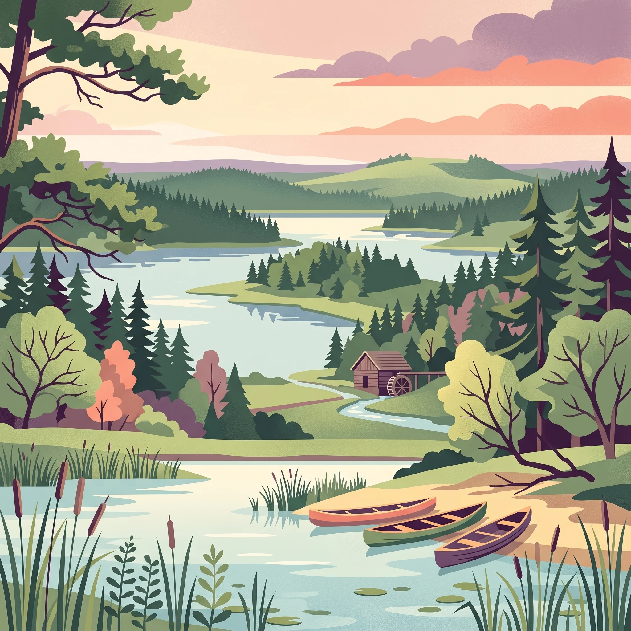
Trip Timing
Best time to visit Aukštaitija National Park: The short answer
For those planning a trip to Aukštaitija National Park, the primary window for visiting stretches from June through August. This period aligns with the park's warmest thermal profile and most generous daylight hours, creating conditions that are essential for the region's signature water-based recreation. Because over 70 kilometers of interconnected paddling routes form the core of the park's tourism infrastructure, the summer months offer the most reliable accessibility for navigating the dense lake networks and the Žeimena River. During this peak time, temperatures frequently reach comfortable highs, allowing visitors to utilize the park's developed sites in Palūšė with the fewest logistical challenges related to seasonal weather transitions.
Balancing Weather with Quietude
While summer provides the most versatile conditions for outdoor activities, travellers seeking a quieter experience often find the shoulder months of May and September to be a strategic alternative. During these transition periods, the landscape experiences lower humidity and fewer crowds, yet the climate remains generally accessible. The decision to visit outside of the peak summer window involves a direct trade-off: cooler temperatures and shorter days versus a more solitary encounter with the park's old-growth forests and historic hillforts. It is important to note that because the park's primary appeal lies in its water landscape, the utility of the trip during shoulder seasons depends heavily on a traveller's tolerance for cooler air and water temperatures, as swimming and extended paddling become less inviting as the summer warmth fades.
Understanding Climate Constraints
Visitors should view the park's climate not just as a matter of temperature, but as a complex interaction between boreal-influenced weather patterns and the park's hydrological character. Even in the peak of summer, rain is a consistent factor. The park does not experience a distinct dry season, and while summer months record higher precipitation levels, this moisture is what sustains the lush, dense woodland that characterizes the Ažvinčių-Minčios giria. Furthermore, the significant temperature swings,often dropping well below freezing in winter months,mean that late autumn, winter, and early spring require specialized planning. During these colder times, the park shifts from a water-centric destination to a landscape focused on quiet, forest-based observation, where the accessibility of trails and cultural sites changes significantly compared to the high-activity summer season. Travellers should always verify current conditions, as the regional weather can be unpredictable and transition periods are prone to rapid shifts in atmospheric comfort.
Visitor Timing
Aukštaitija National Park Visiting Seasons and Ideal Monthly Windows
Selecting the right time for a visit involves balancing the desire for warm, long-daylight exploration against the reality of Lithuania's temperate, often damp climate. The park functions as a seasonal entity where accessibility and activity types shift significantly between the bright, active summer months and the cooler, atmospheric shoulder seasons. Decisions should be grounded in the primary goal of the trip, whether that is water-based recreation or landscape-focused hiking.
Summer: The Peak Window for Water Activities
From June through August, the park experiences its most reliable weather for kayaking and lake swimming. This period provides the longest daylight hours, reaching a peak of over 17 hours in June, which extends the usable time for outdoor engagement. These months are statistically the warmest, with mean temperatures often ranging between 15°C and 18°C. However, this is also the period with the highest precipitation levels, with July averaging 3.1 millimeters of rain per day. Travelers choosing this window should prioritize water activities and be prepared for sudden, passing showers, which are a characteristic feature of the landscape during the heat of summer.
Shoulder Seasons: Focus on Solitude and Hiking
May and September represent the most distinct transition periods, offering a different trade-off between temperature and crowds. May stands out for its rapid transition toward warmth, with average maximums climbing toward 24°C, though mornings remain brisk with temperatures near freezing. September offers a moderate environment as the landscape begins to cool, with mean temperatures dropping back to 11.8°C. These months are generally drier than mid-summer, making them suitable for visitors interested in hiking the forested trails of the Ažvinčių-Minčios giria or exploring archaeological sites without the intensity of peak-summer humidity. The trade-off is a shorter daylight window and cooler water temperatures that are generally unsuitable for sustained swimming.
Cold-Weather Considerations: Atmospheric and Quiet
Outside of the primary visiting months, the park undergoes a transition toward dormancy. From November through March, temperatures frequently drop well below freezing, often falling toward -20°C in the depth of winter. While these months offer a unique, crystalline perspective on the lakeland forests and ethnographic villages, they effectively restrict most water-based tourism. Visitors seeking to visit during this period must have a clear understanding of low-light conditions, as daylight drops to as little as seven hours in December, and be equipped for arctic-style cold. Access during these times is largely limited to dry-land exploration, and travelers must verify the status of local tourism infrastructure, as many services oriented toward warm-weather water sports are seasonally suspended.
Annual Climate Overview
Understanding Aukštaitija National Park Weather and Climate by Month
Annual Climate Rhythms and Thermal Shifts
The climate of this northeastern Lithuanian landscape is defined by a north temperate regime that transitions into boreal characteristics. Throughout the year, the interplay between the dense lake networks and widespread coniferous woodlands influences local temperature and humidity. Visitors should note that the values recorded for this location, based on observations from 1991 to 2020 at an elevation of approximately 150 meters, represent long-term climate normals. These figures serve as a guide to expected conditions rather than a guarantee, as daily weather can fluctuate significantly due to regional maritime and continental influences.
The Peak Warmth and Humidity Window
Summer months, spanning June through August, represent the period of highest thermal activity. Daily mean temperatures peak in July at approximately 17.92 degrees Celsius, with average daily highs reaching 28.43 degrees Celsius. This phase is characterized by extended daylight, peaking at over 17 hours in June, which provides the longest windows for outdoor recreation. However, travelers should be prepared for higher relative humidity levels during these months, typically hovering around 80 percent. While summer offers the most comfortable thermal environment for water-based activities, this is also historically the wettest time of year, with precipitation reaching its maximum at 3.1 millimeters per day in July. The coincidence of warmer temperatures and increased rainfall means that even peak summer visits should involve preparation for intermittent, often localized, convective storms.
Transitioning Through the Shoulder Seasons
May and September function as distinct transition periods that depart from the mid-summer norms. May experiences a rapid warming trend, with mean temperatures climbing from 5.79 degrees Celsius in April to 11.88 degrees Celsius. This month benefits from substantial daylight,nearly 16 hours,and lower relative humidity compared to mid-summer, making it a compelling alternative for those avoiding the peak heat. September initiates a gradual cooling, with mean temperatures receding to 11.83 degrees Celsius. A notable feature of September is the reduction in precipitation compared to the July peak, dropping to 2.1 millimeters per day. This period often provides the most stable atmospheric conditions for those prioritizing hiking over aquatic activities.
Winter Hardiness and Atmospheric Extremes
From November through March, the park experiences a dramatic reduction in both temperature and daylight. The most rigorous conditions occur between December and February, when mean temperatures consistently fall below freezing, often dipping toward averages of -6 degrees Celsius. Average minimum temperatures during these months frequently fall well below -15 degrees Celsius, reflecting the continental climate influence that reaches into the northeastern highlands. Humidity levels are highest during this period, often exceeding 97 percent, which can increase the perception of cold in the damp, forested environment. Daylight hours reach their minimum in December, providing less than seven hours of illumination, a significant factor for anyone planning activities during the winter window. Wind speeds remain relatively stable throughout the year, but the absence of foliage in winter may make the effects of air movement more noticeable in exposed, open landscape areas near the larger lake basins.
Annual Patterns
Seasonal Shifts and Weather Cycles in Aukštaitija National Park
Defining the Active Warm Season: June to August
The park experiences its most distinct period of thermal and daylight stability from early June through August. This window represents the core active season for the area, characterized by the highest mean temperatures of the year, typically settling between 15 and 18 degrees Celsius. Visitors should note that while this period offers the most substantial daylight hours, reaching a peak in late June, it also coincides with the highest frequency of precipitation. The weather remains temperate rather than tropical, as heatwaves are rare and humidity levels remain relatively consistent throughout the summer months. This phase is defined by the full growth of deciduous forests and the complete availability of the water-based infrastructure in the lake districts, making it the most reliable period for those looking to traverse the interconnected waterways.
The Transitional Shoulder: May and September
May and September serve as the critical transition phases that bridge the dormant winter months and the short, intense summer. These shoulder months are marked by rapid environmental flux. In May, the landscape undergoes a quick transformation as deciduous foliage emerges and lake temperatures begin a slow climb from their spring lows. September acts as the inverse, where the park transitions into a period of cooling. During these months, the risk of frost remains a factor, particularly in early May or late September evenings. Visitors during these times often encounter more variable weather than in the peak summer, with daily highs that can vary significantly depending on incoming weather systems. These periods are characterized by a sense of quiet compared to the peak summer weeks, offering more space for those prioritizing solitude in the forest trails.
The Long Dormant Cycle: October to April
From October through April, the park enters a prolonged period of dormancy. This cycle is defined by a significant reduction in daylight hours and temperatures that frequently drop below freezing, particularly from December through February. While this span covers seven months of the year, it is not a monolithic block of winter conditions. The transition begins in earnest in October, with falling temperatures and increased humidity, and it does not fully conclude until the final thaw in late April. During the coldest stretch from January to February, the lake surfaces often freeze and the landscape takes on a winter character that contrasts sharply with the activity of the summer. Snow cover and ice duration vary annually, and readers should interpret these months as a period of restricted access for standard paddling activities, as infrastructure such as boat rentals and seasonal services are largely inactive. Travellers during this time require specialized preparation for low-light conditions and cold-weather hazards, as the park remains an exposed landscape rather than a sheltered winter resort.
Seasonal Experiences
Experiencing the Landscapes and Waterways of Aukštaitija National Park Throughout the Year
Navigating the Lake Systems and Waterways
The defining experience of the park is its dense network of over 120 lakes connected by rivers and channels, forming a natural paddling circuit. The timing of your visit fundamentally changes how these waters are encountered. During the warmer months of June through August, when daylight extends well into the evening and water temperatures rise to their annual peak, the interconnected lake systems are most accessible for kayaking and canoeing. This period offers the highest degree of connectivity, allowing for longer routes through the Žeimena River basin without the logistical constraints of cold-water exposure. Travelers focused on water-based recreation should note that while the summer provides the longest daylight hours for navigation, the primary activity here is tied to the physical accessibility of the paddling routes, which become significantly more challenging and less supported during the late autumn and winter freeze cycles.
Accessing Cultural Heritage and Historic Sites
The park preserves a distinct cultural landscape that remains accessible across a broader spectrum of the year than its waterways. Sites such as the 18th-century wooden church in Palūšė and the historic watermill in Ginučiai are foundational to the park identity and can be visited even during the cooler, shorter days of late spring or early autumn. For those interested in the ethnographic architecture found in villages like Šuminai, the shoulder months offer a quieter experience, away from the high-traffic summer season. The Bee-keeping Museum in Stripeikiai serves as a specific reference point for travelers, generally maintaining a visitor-facing season from May through October. Beyond this window, while the structures remain, the curated museum experience is typically unavailable, meaning that heritage-focused itineraries are most rewarding when aligned with the standard operating season of these cultural entities.
Hiking and Panoramic Viewpoints
Landscapes such as those visible from the Ladakalnis observation point provide a perspective on the park's morainic highlands and lake-filled valleys. Because these viewpoints rely on trail access rather than boat navigation, they are less dependent on the peak summer warmth. Hiking through the Ažvinčių-Minčios giria,the park's old-growth forest complex,is a pursuit that can be enjoyed during the transitions of May and September, when the forest floor is less prone to the high humidity and insect activity often found in the deep summer heat of July. Travelers seeking to visit these natural sites should verify that trail conditions are suitable for the specific time of year, as the forest can experience significant changes in soil conditions following spring thaws or autumn precipitation. While hillforts and castle mounds remain accessible year-round, the quality of the surrounding terrain and the clarity of sightlines from elevated points like Ladakalnis are naturally dictated by weather patterns rather than formal closures.
Visitor Priorities
Choosing the Best Time to Visit Aukštaitija National Park Based on Travel Goals
Balancing Daylight and Warmth for Water Activities
For travelers focused on the park’s extensive paddling routes and lake network, the peak summer window of July offers the most reliable combination of sustained daylight and thermal comfort. July features the year’s highest mean temperatures, peaking at an average maximum of 28.43 degrees Celsius. These conditions are ideal for extended time on the water, where the longer daylight duration of 16.53 hours provides a significant margin for navigation and exploring the interconnected lake systems. The trade-off for this prime activity window is a higher frequency of precipitation compared to spring, as summer months see increased rainfall totals that can impact planned excursions. Travelers should prioritize these weeks for water-based recreation but remain prepared for the humidity, which averages over 80 percent throughout the peak summer months.
Finding Cooler Conditions for Forest Hiking
Those prioritizing forest exploration and hiking through the Ažvinčių-Minčios giria often find the transition month of September more suitable than the heat of midsummer. While daylight begins to decrease to an average of 12.39 hours, the reduction in maximum temperature to 23.32 degrees Celsius creates a more comfortable thermal environment for long-distance treks across the rolling morainic highlands. September also presents a distinct decrease in mean precipitation compared to the July peak, offering a slightly more stable weather pattern for traversing the park's sandy plains and forest paths. The compromise here is the loss of the prolonged evening light, which limits the available time for late-day navigation or scenic photography compared to the midsummer period.
Navigating Dry and Milder Transitional Periods
Visitors looking for the driest conditions for land-based activities should consider the balance between May and September. May offers the benefit of very long daylight hours, reaching nearly 16 hours, coupled with the onset of warming trends. However, May remains thermally volatile, with average minimums hovering near 0 degrees Celsius, requiring careful layering. Conversely, September provides a more stable, albeit cooling, transition as the landscape prepares for the dormant phase. Travelers choosing these shoulder months avoid the peak humidity and the occasional intense afternoon summer rain, but they must accept that water temperatures will be significantly lower than in midsummer, making swimming or casual paddling less inviting. This tension between thermal comfort on land and the suitability of the water for immersion remains a consistent trade-off for any visit outside of the primary June to August window. Regardless of the month chosen, visitors should verify current conditions, as local trail and water accessibility can shift based on rainfall intensity and seasonal park maintenance.
Visitor Access
Seasonal Access and Operational Considerations in Aukštaitija National Park
Navigating to and within the Park
Aukštaitija National Park is located approximately 100 kilometers north of Vilnius, making the capital city the primary gateway for most international travelers. While the park is accessible by a combination of public and private transport, the internal geography, characterized by fragmented forested terrain and numerous lake networks, strongly favors the use of a private vehicle. A car provides the most practical means to reach trailheads, access varying lake entry points, and manage the logistics of transporting equipment such as kayaks or bicycles.
For those relying on public transport, regional trains from Vilnius typically service the town of Ignalina, which sits on the eastern edge of the park. Bus connections are also available from Vilnius, passing through Pabradė and Švenčionys before reaching the area. Travelers using public transit should be prepared for the fact that these services often terminate at regional transit hubs rather than specific trailheads or remote park entrances, necessitating additional local travel arrangements to reach final destinations like Palūšė, which serves as the central administrative hub for the park. Always check the latest schedules via official transit provider websites, as service frequencies and routes are subject to change and may vary significantly between weekdays and weekends.
Operational Considerations and Local Regulations
The park headquarters in Palūšė is the primary point of contact for administrative inquiries and current site information. Because the park acts as both a protected ecological zone and a recreational area, certain land-use regulations are in place to preserve the environment. Notably, there are specific restrictions regarding the proximity of vehicles to water bodies. Throughout Lithuania, parking is generally prohibited within 20 meters of a lake shore or riverbank to mitigate erosion and habitat disruption. Visitors should look for designated parking areas and access points, which are typically marked within the more developed sections of the park.
Beyond basic transit, visitors planning complex itineraries,such as multi-day paddling expeditions across the interconnected lake systems or extended stays in backcountry areas,should verify whether current permits or specific registrations are required. While the park offers significant freedom for water-based recreation, operational status for visitor centers, equipment rentals, and specific archaeological or cultural site access can fluctuate based on the time of year and maintenance cycles. Never assume that facilities mentioned in guidebooks or historical records are currently operating with the same terms, hours, or availability. Before finalizing travel dates, confirm the current operational status of the specific activities you intend to pursue by contacting official park authorities or checking their latest published advisories.
Safety and Preparation
Seasonal Weather Hazards and Packing for Aukštaitija National Park
Adapting to Temperature Fluctuations and Thermal Lag
Preparing for a visit requires awareness of the difference between air temperatures and the thermal reality of the water. Because the park relies heavily on lake activities, recognize that water temperatures often lag behind the landward climate by several weeks. Even during a warm June or July, the deep basins of lakes like Tauragnas remain significantly cooler than the ambient air. When planning your gear, prioritize versatile layers that allow you to adapt to these shifts, particularly if you are switching from hiking in sun-exposed forest trails to paddling in the shade of dense woodland or open water environments.
Preparing for Daily Weather Dynamics
The climate of this region is characterized by high humidity throughout the year, which can make temperatures feel more intense at both ends of the scale. During the peak summer months, humidity levels remain consistently around 80 percent, which can increase the feeling of warmth during active days. Conversely, in the transition periods of May and September, this moisture contributes to rapid cooling as soon as the sun dips below the horizon. Regardless of when you visit, pack clothing that manages moisture effectively. While light, quick-drying fabrics serve well in summer, the shoulder months necessitate wind-resistant layers, as steady breezes across the interconnected lake systems can make exposed ridges and water surfaces feel colder than the sheltered forest interiors.
Managing Daylight and Seasonal Terrain Considerations
Daylight duration varies dramatically, ranging from under seven hours in December to over 17 hours in June. This fluctuation dictates the timing of your daily activities more than any other environmental factor. During the short days of winter, your safety planning must center on avoiding travel in low light, as the forest trails and uneven terrain near hillforts become difficult to navigate. Always aim to conclude outdoor activities well before dusk. In summer, the abundance of light allows for greater flexibility, yet it also necessitates careful preparation for prolonged sun exposure. Use local sources to monitor for current forest fire warnings, as periods of low precipitation during peak summer can lead to dry conditions that require caution near campsites and fire pits. Always check official park authority alerts and local weather forecasts immediately before your departure, as these resources provide the only accurate picture of current conditions and potential access limitations that long-term normals cannot reflect.
Final Planning
How to Select Your Ideal Time to Visit Aukštaitija National Park
Choosing the right time for your visit requires balancing the region's intense, short-lived summer peak against the quieter, cooler atmosphere of the shoulder seasons. If your primary objective is water-based recreation, such as kayaking or swimming, the period from June through August provides the highest thermal averages and the most reliable access to the park's extensive lake network. During these months, the extended daylight hours allow for longer excursions through the interconnected waterways, though you should remain prepared for occasional rainfall, which occurs more frequently during the height of summer than in the drier spring transitions.### Weighing Priorities Against Thermal Constraints Travelers who prefer solitude or active forest exploration may find the shoulder months of May and September to be a more strategic choice. While water temperatures remain refreshing and often chilly during these times, the ambient air is typically more comfortable for sustained hiking through the old-growth forests. You avoid the peak crowds of the summer holiday season, but you must accept shorter daylight windows and a greater likelihood of rapid temperature fluctuations, particularly in the evenings. These months require a more versatile approach to packing, as the transition between the lingering warmth of the day and the sharp chill of the evening is significant.### Making Your Final Decision A successful trip to this park is rarely determined by a single universal window, as the ideal conditions for a paddler are quite different from those sought by a hiker. If you are planning around specific cultural events or require full service from local operators in Palūšė, aim for the mid-summer months when tourism infrastructure is most active. If you prioritize the natural landscape and the ability to move through the environment with fewer distractions, the late spring or early autumn months offer a distinct, quieter experience. Regardless of when you choose to go, remember that climate data represents long-term averages rather than active forecasts. Always verify current operating status, park alerts, and immediate weather conditions with official authorities before finalizing your travel dates or heading into the more remote forested regions of the highlands.