Mori Atlas logo
National parkAukštaitija National Park

Discover mapped boundaries and regional geography within this unique Baltic protected area.

Aukštaitija National Park: Lithuania's Oldest National Park and Protected Landscape Atlas

Aukštaitija National Park, established in 1974, represents Lithuania's foundational protected landscape and a vital component of Baltic regional geography. This detail page offers an atlas-driven exploration of the park's intricate network of over 120 lakes scattered across undulating morainic highlands and ancient pine forests, covering more than 70% of its territory. Understand the park's mapped boundaries and its significance as a conserved natural area within the broader Eastern European atlas.

national parkslake districtsold-growth forestspine forestswetlandsBaltic region

Aukštaitija National Park

National park

Park overview

Structured park overview, official facts, and landscape profile for Aukštaitija National Park

Aukštaitija National Park park facts, protected area profile, and essential visitor context
Review the core facts for Aukštaitija National Park, including designation, size, terrain, visitor scale, habitats, and operating context in one park-focused overview.

About Aukštaitija National Park

Aukštaitija National Park represents the flagship protected area of Lithuania, established in 1974 as the first national park in the Lithuanian SSR and the third such park in the Soviet Union after Estonia and Latvia. The park was originally named Lithuanian SSR National Park to emphasize its pioneering status within the republic, and was renamed Aukštaitija National Park in 1989 following the establishment of four additional national parks named after Lithuania's ethnographic regions. The park occupies a geologically diverse terrain where two distinct highland regions—the older Švenčionių-Naručio morainic highlands and the younger Aukštaičių highlands—are separated by the sandy Žeimena plain, creating a complex mosaic of landforms, soils, and ecological communities. This geographic diversity, combined with the park's extensive lake network and large forest blocks, has produced an exceptionally biodiverse landscape that supports species assemblages found nowhere else in Lithuania. The park's administrative center is located in Palūšė, a village that has developed into the primary tourism hub with accommodations, boat rentals, and visitor services. The park spans three administrative municipalities—Ignalina, Utena, and Švenčionys—reflecting the regional identity of Aukštaitija, Lithuania's highlands in the northeastern part of the country.

Quick facts and research context for Aukštaitija National Park

Aukštaitija National Park covers approximately 410 square kilometers in northeastern Lithuania, making it the second-largest national park in the country. The park is administered by Ignalina district municipality, with contributions from Utena and Švenčionys districts. The landscape is characterized by rolling morainic hills, extensive pine forests, and a dense network of interconnected lakes forming part of the Žeimena river basin. Lake Kretuonas is the largest in the park at 8.29 square kilometers, while Lake Tauragnas reaches 60.5 meters in depth—making it the deepest lake in Lithuania. The park contains over 100 lakes larger than half a hectare, many connected by channels that create popular kayaking routes stretching approximately 70 kilometers. Strictly protected areas occupy about 2.1% of the park, requiring guided access.

Park context

Deeper park guide and search-rich context for Aukštaitija National Park

Aukštaitija National Park history, landscape, wildlife, and travel context
Explore Aukštaitija National Park through its history, landscape character, ecosystems, wildlife, conservation priorities, cultural context, and seasonal travel timing in a structured park guide built for atlas discovery and search intent.

Why Aukštaitija National Park stands out

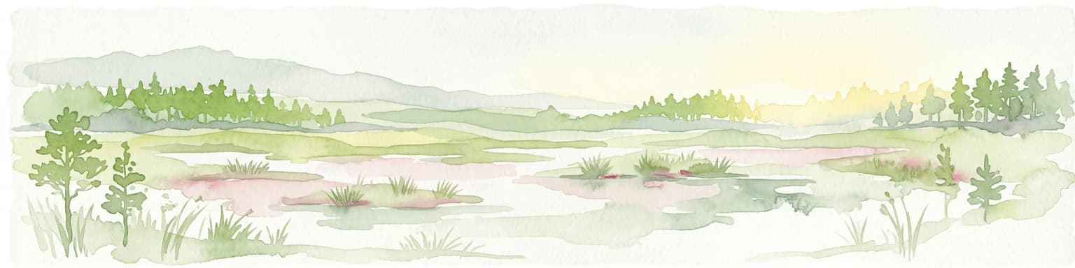
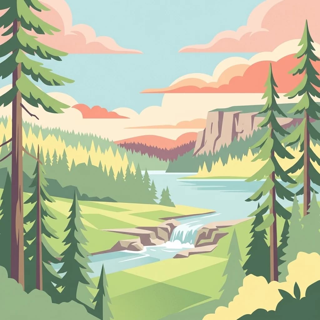
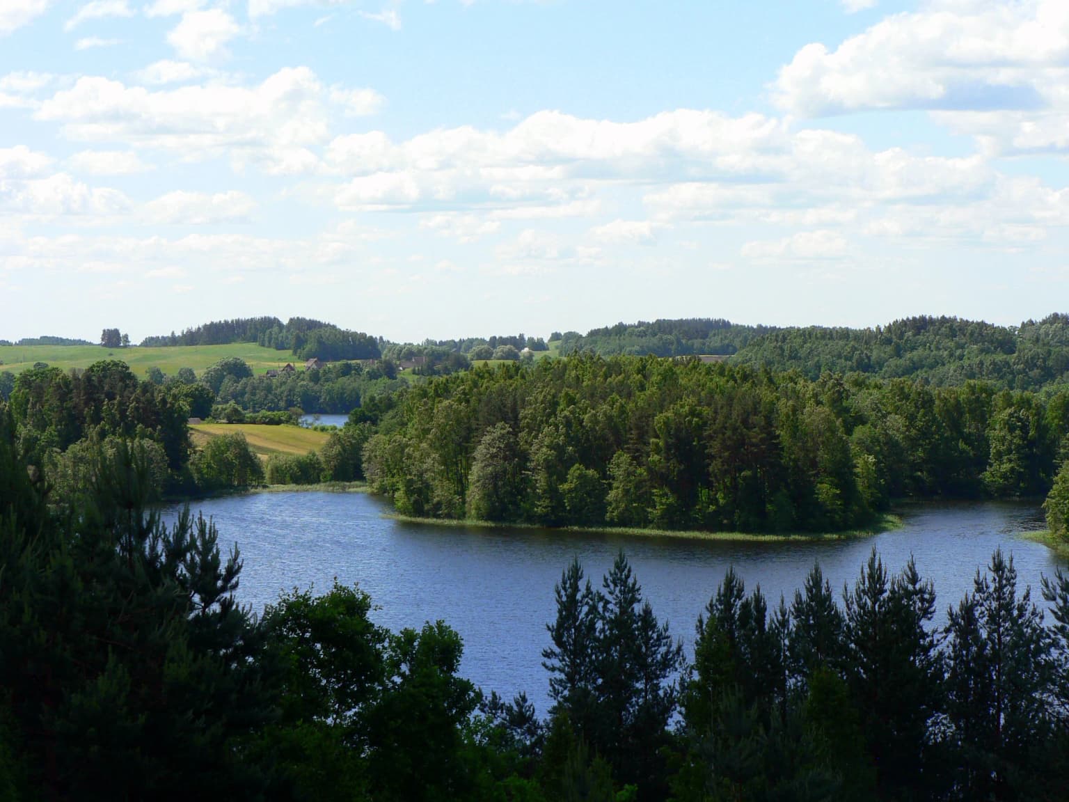
Aukštaitija National Park is best known for its exceptional density of lakes and its status as Lithuania's oldest national park. The park protects one of the country's most significant old-growth forest complexes within the Ažvinčių-Minčios giria, a vast forest area that harbors rare species and ancient ecological communities. The interconnected lake system, centered on Lake Žeimenys and connected through the Žeimena River, offers one of Lithuania's most developed water tourism infrastructures with over 70 kilometers of paddling routes. The park also contains Lithuania's deepest lake, Lake Tauragnas, and safeguards significant populations of large mammals including wolves, lynx, elk, and occasional brown bears. The cultural landscape preserves traditional villages with ethnographic architecture, historic watermills, and archaeological sites including hillforts and burial mound complexes.

Aukštaitija National Park history and protected-area timeline

The protection of Aukštaitija's natural landscape began in 1960 when Professor Česlovas Kudaba, a pioneering Lithuanian geographer and conservationist, established the 9,030-hectare Ignalina Landscape Reserve. Simultaneously, the 4,200-hectare Ažvinčių Botanical-Zoological Reserve was created within the Ažvinčių giria forest. These early protected areas recognized the exceptional ecological and landscape value of the region, which combines extensive forests, numerous lakes, and traditional rural settlements. On March 29, 1974, the Lithuanian SSR National Park was officially established, incorporating the Ignalina and Ažvinčių reserves along with adjacent territories and ethnographic villages. The park was the third national park established in the Soviet Union, following parks in Estonia and Latvia. The park's scheme was developed by a team from the Institute of Construction and Architecture led by architect V. Stauskas. In 1989, following Lithuania's restoration of independence and the creation of additional national parks named after the country's ethnographic regions, the park was renamed Aukštaitija National Park to reflect its location in the Aukštaitija highlands region.

Aukštaitija National Park landscape and geographic character

The physical landscape of Aukštaitija National Park is defined by its location at the intersection of two distinct geological formations—the Švenčionių-Naručio morainic highlands and the Aukštaičių highlands—separated by the sandy Žeimena plain. The terrain is characterized by very wavy, undulating topography with typical elevations around 155 meters above sea level. The park's most distinctive feature is its extraordinary concentration of lakes, with over 120 lakes exceeding 0.5 hectares in area, concentrated primarily in the central part of the park. Fourteen lakes exceed one square kilometer in surface area, while another six range between 0.5 and 1 square kilometers. The lakes are interconnected by channels and rivulets, with the Žeimena River serving as the primary watercourse, flowing from Lake Žeimenys and traversing 22 kilometers through the park. The largest lake is Kretuonas at 829 hectares, while Lake Tauragnas reaches 60.5 meters in depth—Lithuania's deepest lake. The park's soils reflect this geomorphic diversity, including gleyic soils, cambic soils, planosols, and alluvial deposits. Wetlands occupy approximately 2,000 hectares, including the Pliaušė and Minčia marsh complexes. The dominant landscape feature is the extensive pine forests of the Ažvinčių and Minčia forest blocks, which dominate over 69% of the park's area.

Aukštaitija National Park ecosystems, habitats, and plant life

The ecological character of Aukštaitija National Park is defined by its extensive pine-dominated forests, dense lake network, and the complex of wetlands that connect the aquatic and terrestrial systems. Pine forests comprise approximately 81% of the woodland area, with smaller proportions of birch, spruce, alder, aspen, oak, and hornbeam. The old-growth forest sections within the Ažvinčių giria represent some of Lithuania's most pristine woodland, harboring ancient trees and complex ecological communities. The park supports an exceptional diversity of habitats, from lakes and rivers to marshes, peat bogs, and various forest types, creating ecological corridors that support species movement across the landscape. The botanical richness is particularly notable—59% of all plant species found in Lithuania occur within the park, which covers less than 1% of the country's territory. The Gervėčių raised bog represents a small but significant peatland conservation area. Soils are diverse, supporting different forest community types across the park's elevation gradient. The interconnected lake system creates important aquatic habitats, with the Žeimena River providing spawning grounds for salmon.

Aukštaitija National Park wildlife and species highlights

Aukštaitija National Park supports diverse wildlife populations across its forest, wetland, and aquatic habitats. The park's large forest blocks provide habitat for substantial populations of large mammals, including wolves, lynx, elk (moose), red deer, and roe deer, with occasional brown bear sightings reported. Beavers are common along watercourses and around lake shores. The avian fauna is particularly significant, with 243 bird species recorded, including several that nest in the park's large colonies. The island on Lake Kretuonas hosts a significant colony of black-headed gulls. The park protects 48 bird species listed in Lithuania's Red Book, including the pygmy owl, black-throated diver, black stork, greater spotted eagle, merlin, three-toed woodpecker, lesser spotted eagle, and the Ural owl. The amphibian and reptile communities include 17 species, while 41 fish species inhabit the lakes and rivers. The invertebrate fauna is exceptionally diverse, with over 2,600 species recorded. The park protects 64 plant species, 8 fungus species, and 48 bird species in Lithuania's Red Book, reflecting the national conservation significance of this protected area.

Aukštaitija National Park conservation status and protection priorities

Aukštaitija National Park serves as a flagship conservation area for Lithuania, protecting a landscape of exceptional ecological significance at the national and Baltic regional level. The park's conservation importance stems from its role as a repository of Lithuania's biological diversity—supporting nearly 59% of the country's plant species within a relatively small area—and its function as a habitat for populations of large mammals including wolves, lynx, and elk that require extensive forest territories. The protected area network within the park includes multiple categories of nature reserves: strict nature reserves where access is restricted, botanical-zoological reserves protecting specific ecological communities, hydrological reserves protecting lakes and river systems, landscape reserves preserving scenic areas, and telmological reserves for wetland conservation. The park's lakes and rivers support spawning populations of salmon in the Žeimena River, highlighting its role in migratory fish conservation. The old-growth forests of Ažvinčių giria represent rare remaining examples of primeval woodland in Lithuania. Several species found in the park are classified as rare or endangered at the national level, including the black stork, greater spotted eagle, lesser spotted eagle, and Ural owl.

Aukštaitija National Park cultural meaning and human context

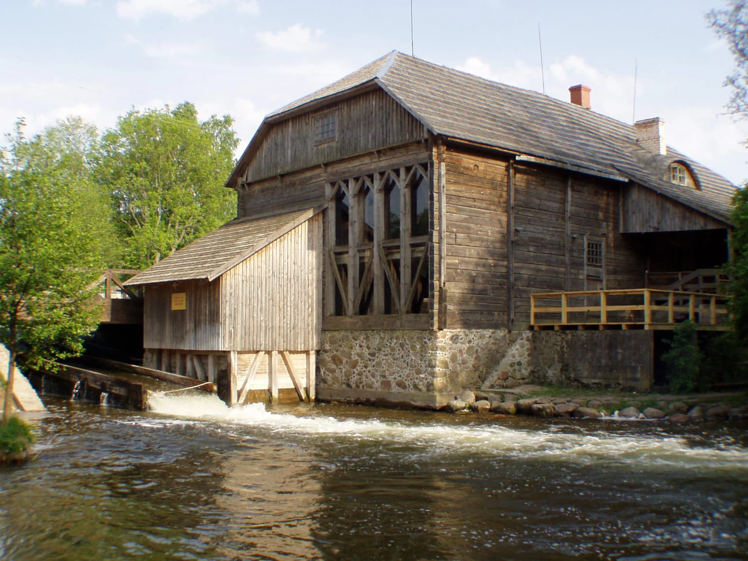
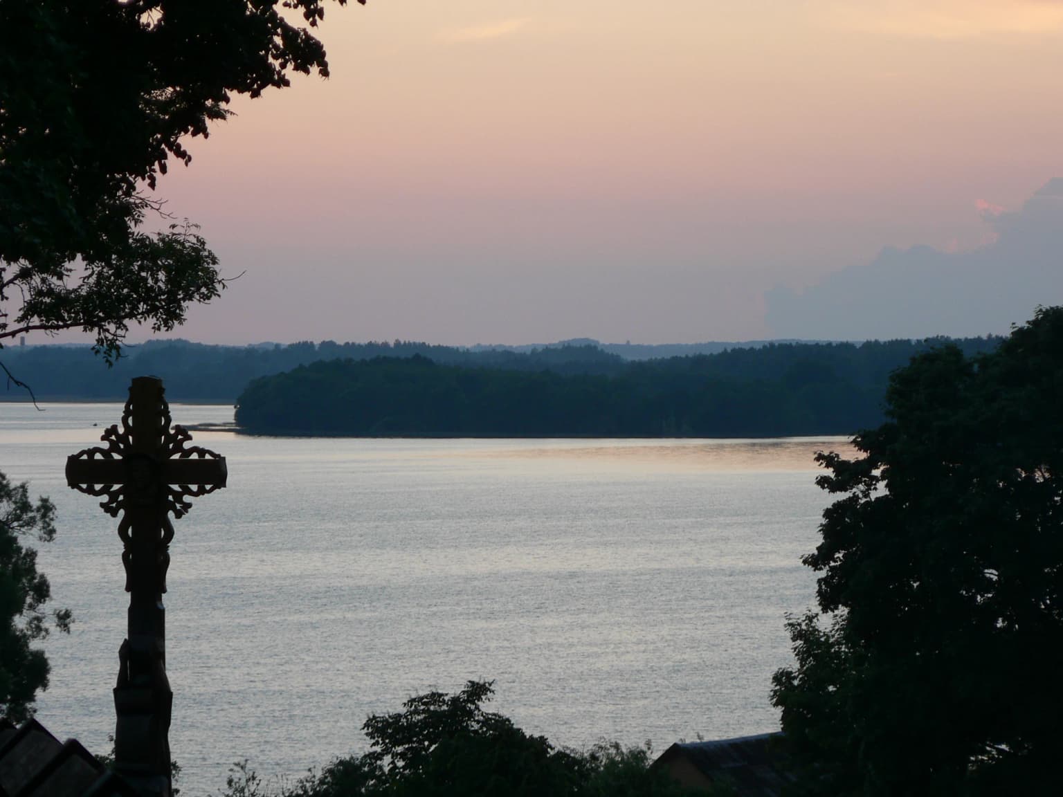
The cultural landscape of Aukštaitija National Park reflects centuries of human settlement in northeastern Lithuania, with the park containing 116 villages ranging from small hamlets to more substantial settlements. Several villages retain traditional ethnographic character and building patterns, including Salų II, Varniškės II, Vaišnoriškės, Šuminai, Strazdų, Kretuonių, and Benediktavas. The park preserves significant archaeological heritage, including nine hillforts (piliakalniai) representing the defensive systems of northeastern Lithuania from the 12th-15th centuries, with notable sites at Taurapilis, Ginučiai, Puziniškis, Linkmenų, and Vajuonio. The park contains the second-largest burial mound complex (pilkapynas) in Lithuania, with over 300 burial mounds around Lake Kretuonas representing Iron Age funerary practices. Traditional watermills, including the historic Ginučių watermill from the 19th century, represent the region's agricultural heritage. The cultural landscape includes ethnographic churches such as Palūšė's St. Joseph church, traditional farmsteads, and historic routes that connected settlements across the lake-dotted terrain.

Top sights and standout views in Aukštaitija National Park

Aukštaitija National Park stands out as Lithuania's premier destination for water-based recreation, with over 70 kilometers of kayaking routes through interconnected lakes and channels. The park offers exceptional landscape diversity, from the deep waters of Lake Tauragnas—the deepest in Lithuania—to the old-growth forests of Ažvinčių giria and the panoramic views from Ladakalnis hill. The park's concentration of lakes is unmatched in Lithuania, with over 120 lakes creating a distinctive archipelago-like landscape accessible by boat. The cultural heritage includes unique ethnographic villages, historic watermills, and archaeological sites representing Lithuania's medieval defensive systems. The wildlife experience includes opportunities to observe black storks, white-tailed eagles, and the park's population of wolves and lynx. The developed tourism infrastructure in Palūšë offers boat rentals, accommodations, and guided excursions. The park's status as Lithuania's oldest national park and its role in protecting the Aukštaitija highlands region give it particular significance in the country's conservation history.

Best time to visit Aukštaitija National Park

The park offers distinct seasonal experiences throughout the year, with each season revealing different aspects of its character. Summer brings the peak season for water-based activities, with the interconnected lake network ideal for kayaking and the warm weather suitable for camping at the numerous lakeside sites. The forest trails are lush and the wild berry season—particularly blueberries and lingonberries—adds foraging opportunities. Autumn transforms the pine forests with golden light and creates exceptional conditions for wildlife watching as animals become more active before winter. The lake landscape in autumn, with mist rising from the water and colorful forests reflected on the surface, is particularly photogenic. Winter offers completely different appeal when frozen lakes provide opportunities for ice fishing and, near Ignalina, for winter sports. The quiet of the winter forest reveals animal tracks and offers a contemplative experience. Spring brings bird migration and the awakening of the wetland systems, with breeding activity creating excellent birdwatching opportunities. The shoulder seasons of late spring and early autumn generally offer the best combination of favorable weather, fewer visitors, and the natural rhythm of the park's ecosystems.

Park location guide

Geography guide, regional context, and park location map for Aukštaitija National Park

Aukštaitija National Park park geography, regions, and map view in Lithuania
Understand where Aukštaitija National Park sits in Lithuania through a broader geographic reading of the surrounding landscape, nearby location context, and its mapped position within the national park landscape.

How Aukštaitija National Park fits into Lithuania

Lithuania is a unitary semi-presidential republic and one of three Baltic states in Northern Europe. It lies on the eastern coast of the Baltic Sea, with Vilnius as its capital and largest city. The country regained independence in 1990 after Soviet occupation and joined the European Union in 2004. Lithuania has a population of about 2.9 million and covers an area of 65,300 km².

Wider geography shaping Aukštaitija National Park in Lithuania

Lithuania is situated on the eastern shore of the Baltic Sea in Northern Europe. It borders Latvia to the north, Belarus to the east and south, Poland to the south, and Russia's Kaliningrad Oblast to the southwest. The country also has a maritime border with Sweden to the west. The terrain is largely flat with rolling hills, numerous lakes, and rivers. The Nemunas River is the longest river in the country.

Map view of Aukštaitija National Park

Use this park location map to pinpoint Aukštaitija National Park in Lithuania, understand its exact geographic position, and read its mapped placement within the surrounding landscape more clearly.

Pigeon | © OpenStreetMap contributors

Location context for Aukštaitija National Park

Ignalina district municipality
Park atlas

Trace the regional spread of protected areas and compare similar natural landscapes in the Baltic.

Explore Other National Parks and Protected Areas Near Aukštaitija National Park in Lithuania
Continue exploring from Aukštaitija National Park by browsing a broader selection of national parks and protected areas across the surrounding Baltic region. Compare park geography, trace the spread of conservation landscapes, and discover how diverse ecosystems are protected in this part of Europe.
National park

Braslaw Lakes National Park: Protected Glacial Lake Landscape Atlas

Mapped boundaries and terrain of a key Belarusian protected area.

Braslaw Lakes National Park presents a fascinating protected landscape defined by its extensive glacial lake chain, lush forests, and vital wetland ecosystems. As a significant natural region in northern Belarus, it offers valuable insights into lacustrine environments and glacially formed terrain. This park serves as a prime example of protected land within the Vitebsk Region, ideal for exploring its mapped geography, understanding its ecological importance, and appreciating the unique character of Eastern Europe's lake districts through a structured atlas lens.

National parkMinsk Region

Narachanski National Park: Belarus's Premier National Park and Lake District Atlas

Explore protected glacial terrain and diverse lake systems.

Narachanski National Park is the crown jewel of Belarus's lake district, a protected national park safeguarding a landscape defined by glacial origins and extensive freshwater systems. Centered around Lake Narach, the park's territory within Minsk Region showcases a varied terrain of moraine hills, depressions, and over 30 lakes. This atlas perspective highlights the park's unique geological features, extensive forests, and its role as a vital protected area for understanding regional geography.

Area
933 km²
Established
1999
IUCN
II
Relief
Lowland
National park

Trakai National Historic Park: Medieval Heritage and Lake District Protected Landscape

Explore Lithuania's historic park and its mapped geographic context.

Trakai National Historic Park offers a rich tapestry of medieval history intertwined with a captivating lake district landscape. As a protected area in southeastern Lithuania, it preserves significant architectural monuments, including the iconic Trakai Castle, set against a backdrop of interconnected lakes, forests, and wetlands. MoriAtlas provides a structured overview of its geographic boundaries and regional setting, facilitating atlas-style exploration of this historically significant protected landscape.

Access
Moderate access
Scope
Mixed
Watercolor illustration showing a lake, trees, and distant hills
National parkLatgale

Rāzna National Park: Protected Landscape and Regional Geography in Latgale

Explore the mapped terrain of Latvia's largest lake region.

Rāzna National Park, situated in the Latgale region, provides an essential focal point for understanding eastern Latvia's protected landscapes. This national park, recognized for its extensive glacial terrain and the significant Lake Rāzna, offers a distinct geographic profile. Users can explore its mapped boundaries, discover its role as a vital protected area, and understand its landscape context within the broader atlas of Latvia's natural heritage.

Area
596.14 km²
Established
2007
IUCN
II
Relief
Highland
National park

Dzūkija National Park: Explore Lithuania's Largest Protected Forest and Inland Dune Landscapes

Mapped protected area geography and natural terrain of the Dainava region.

Delve into the protected landscape of Dzūkija National Park, Lithuania's expansive national park renowned for its vast primeval pine forests and extraordinary inland dune formations. This page provides a detailed atlas-style view of the park's mapped boundaries, diverse terrain, and significant natural features, offering insight into its protected territory and regional geographic importance. Examine the unique wetland systems and forest ecosystems that make this a crucial area for protected land discovery.

Area
584.53 km²
Established
1991
IUCN
II
Visitors
30K annual
Watercolor painting of a lake with green forested islands and distant mountains under a pastel sky
National parkPskov Oblast

Sebezhsky National Park: National Park within Pskov Oblast's Regional Geography

Mapped protected landscape and regional context

Sebezhsky National Park is a designated national park offering a distinct protected landscape within the Pskov Oblast of northwestern Russia. This page provides essential details for atlas exploration, focusing on the park's mapped boundaries, its role as a protected area, and its contribution to the regional geography of the Pskov Oblast. Users can understand its place within a broader mapping of Russia's natural territories and protected lands.

Area
500.21 km²
Established
1996
IUCN
II
Relief
Highland
Watercolor illustration of a river flowing through a valley with hills and greenery
National park

Gauja National Park: Latvia's Largest National Park Atlas and Protected Landscape

Mapped terrain and diverse natural heritage in Vidzeme.

As Latvia's largest national park, Gauja offers a deep dive into a protected landscape defined by the ancient Gauja River valley and its spectacular Devonian sandstone cliffs. This page provides essential geographic context and atlas-style information, detailing the park's mapped boundaries, unique geological formations, and the rich tapestry of natural and cultural heritage that makes it a cornerstone of the region's protected lands. Explore the varied terrain, from river valleys to rolling uplands, all within a meticulously mapped conservation area.

Area
917.87 km²
Established
1973
IUCN
II
Relief
Mixed relief
National park

Ķemeri National Park: Discover Latvia's Iconic Protected Bog and Wetland Geography

Explore a unique protected landscape with mapped bog ecosystems and regional natural terrain.

Ķemeri National Park in Latvia is a remarkable protected area, celebrated for its expansive and ecologically significant raised bog systems, particularly the Great Ķemeri Bog. This national park showcases a unique geographical character, featuring natural sulfur springs, therapeutic muds, and a series of ancient lagoon lakes that support rich birdlife. Its diverse wetland habitats and distinct peatland landscapes offer a compelling focus for atlas-based discovery and understanding the regional geography of the Latvian coast.

Area
381.65 km²
Established
1997
IUCN
II
Relief
Lowland

Common questions about visiting, size, designation, and location context for Aukštaitija National Park

Aukštaitija National Park FAQs for park facts, access, geography, and protected area context
Find quick answers about Aukštaitija National Park, including protected-area facts, park geography, trail and visitor context, and how the park fits into its surrounding country and regional landscape.
MoriAtlas Explorer

Continue Your Protected Areas Search Across the Global Atlas

Deepen your exploration by continuing the structured search for national parks and protected areas worldwide. Utilize the comprehensive filtering capabilities to compare different conservation landscapes and refine your understanding of global park geography. Discover more about the distribution and characteristics of protected natural areas.

Global natural geography