Mori Atlas logo
National parkBraslaw Lakes

Discover mapped boundaries and the unique lacustrine geography of this protected natural region.

Braslaw Lakes National Park: A Protected Glacial Lake Landscape in Northern Belarus

(Braslaw Lakes National Park)

Braslaw Lakes National Park stands as a protected natural area in northern Belarus, renowned for its distinctive chain of glacial lakes, expansive wetlands, and surrounding forested terrains. This national park, situated in the Vitebsk Region, preserves a unique lacustrine environment and significant biodiversity, serving as a crucial ecological corridor within Eastern Europe's mapped geography. The interconnected lake system, sculpted by glacial forces, creates a visually striking landscape that is uncommon in Belarus, offering a prime destination for atlas-driven discovery of protected lands.

National ParkLakesGlacial LandscapeWetlandsForestsNorthern Belarus
Stylized illustration of a lake landscape with rolling hills, forests, and a colorful sky

Braslaw Lakes

National park

Park overview

Structured park overview, official facts, and landscape profile for Braslaw Lakes National Park

Braslaw Lakes National Park park facts, protected area profile, and essential visitor context

Review the core facts for Braslaw Lakes National Park, including designation, size, terrain, visitor scale, habitats, and operating context in one park-focused overview.

About Braslaw Lakes National Park

Braslaw Lakes National Park protects a remarkable lacustrine landscape in northern Belarus. The park's defining feature is its chain of glacial lakes, formed by the retreat of ice sheets during the last glacial period. These lakes, connected by streams and channels, create a complex aquatic ecosystem set within a matrix of forests, marshes, and agricultural land. The landscape surrounding the lakes features gentle rolling hills and varied terrain that adds to the area's scenic quality. The protection of this lake district reflects Belarus' commitment to preserving its natural heritage, with the park serving both ecological and recreational functions. Visitors are drawn to the area for its tranquil natural setting, opportunities for outdoor recreation, and the chance to experience one of Belarus' most distinctive landscapes.

Quick facts and research context for Braslaw Lakes National Park

Braslaw Lakes National Park is located in the northern Vitebsk Region of Belarus, approximately 20 kilometers from the town of Braslaw. The park features a series of interconnected glacial lakes formed during the last ice age, surrounded by mixed forests, marshes, and rolling terrain. The protected area was established to preserve the region's distinctive lake ecosystem, wetland habitats, and forested landscapes. The area is recognized for its ecological significance and serves as a habitat for various bird species, fish populations, and forest-dwelling wildlife.

Park context

Deeper park guide and search-rich context for Braslaw Lakes National Park

Braslaw Lakes National Park history, landscape, wildlife, and travel context

Explore Braslaw Lakes National Park through its history, landscape character, ecosystems, wildlife, conservation priorities, cultural context, and seasonal travel timing in a structured park guide built for atlas discovery and search intent.

Why Braslaw Lakes National Park stands out

Braslaw Lakes is best known for its chain of glacial lakes, which form a distinctive and scenic landscape uncommon in Belarus. The interconnected lake system, surrounded by forests and wetlands, represents one of the country's most important lake districts. The park is particularly noted for its birdlife, with wetland areas serving as important habitats for waterfowl and migratory species. The combination of open water, marshes, and forested shoreline creates a diverse habitat complex that supports notable biodiversity.
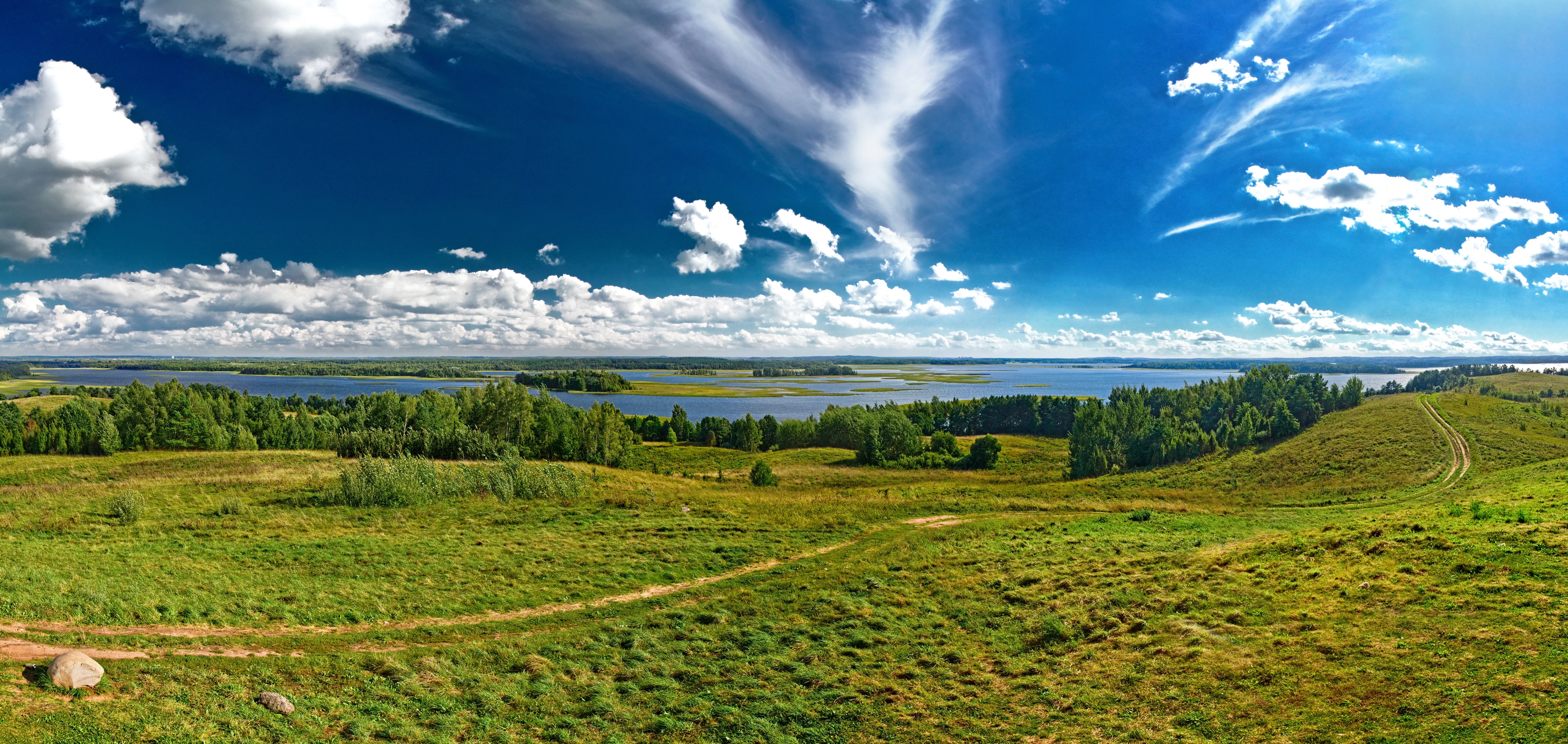
Panoramic landscape showing Strusta Lake, green meadows, scattered trees, and a blue sky with clouds
Panoramic view of Strusta Lake in Braslaw Lakes National Park, Belarus

Braslaw Lakes National Park history and protected-area timeline

Braslaw Lakes National Park was established as a protected area to conserve the unique glacial lake landscape of northern Belarus. The creation of the park reflected growing recognition of the ecological and scenic value of the lake chain and surrounding forests. The protected area was formally designated to provide formal conservation status to the lake district, ensuring the preservation of its natural character against development pressures and resource exploitation. The park's establishment also aimed to support sustainable use of the area's natural resources while protecting biodiversity.

Braslaw Lakes National Park landscape and geographic character

The landscape of Braslaw Lakes National Park is defined by its glacially formed lake chain, which creates a distinctive scenery of interconnected water bodies set within a forested and marshy terrain. The lakes vary in size and depth, with irregular shorelines that include peninsulas, islands, and sheltered bays. The surrounding land features mixed deciduous and coniferous forests, wet meadows, and peat bogs. The terrain is gently rolling, with elevations that add subtle topographic variation without dramatic relief. The combination of open water, forested slopes, and wetland areas creates a varied and visually appealing landscape typical of northern Belarus' lake districts.
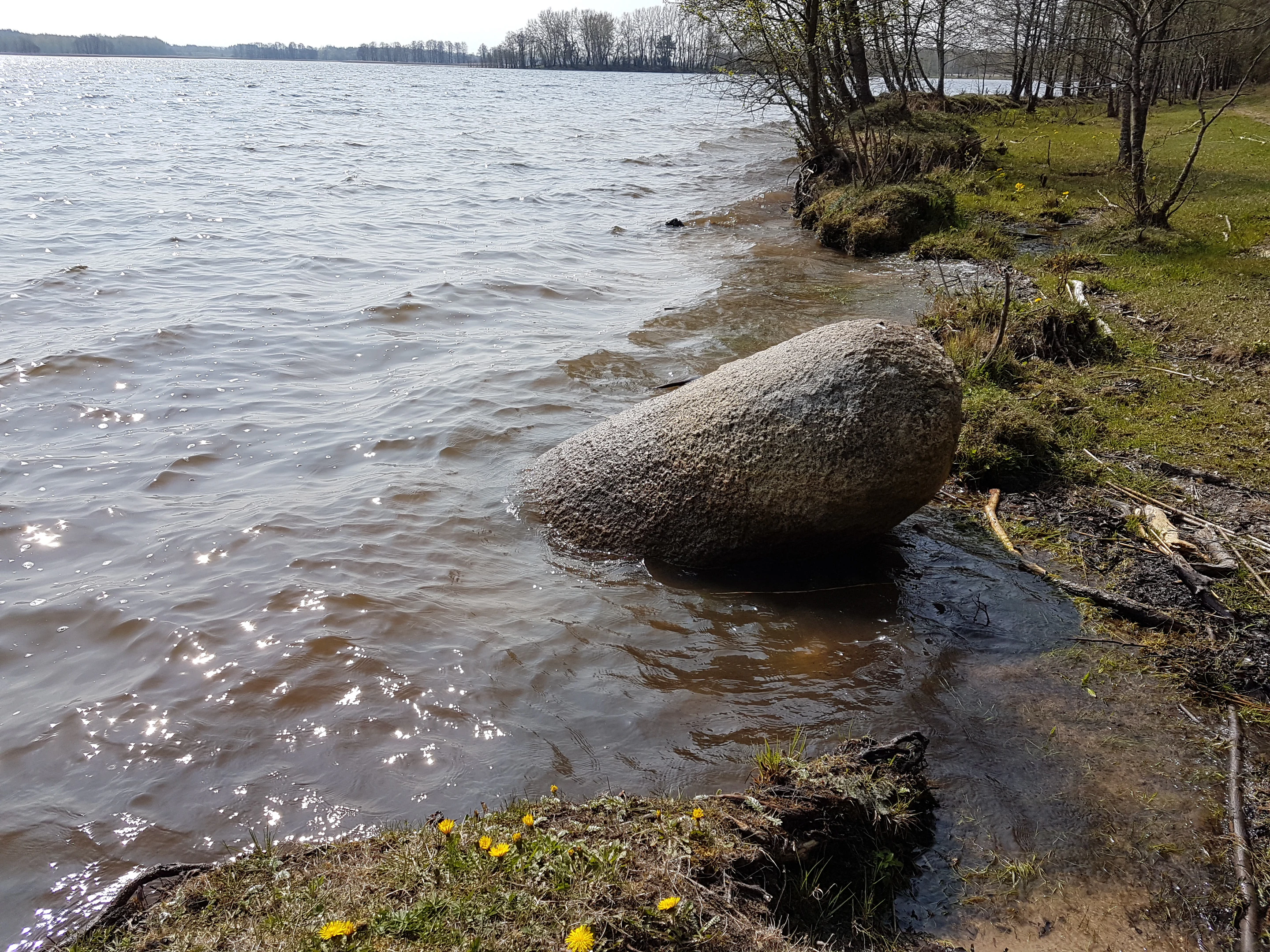
Large boulder partially submerged in a lake with gentle waves, grassy shore, and trees in the background
Lake Niespish shoreline with a large boulder at the water's edge in Belarus

Braslaw Lakes National Park ecosystems, habitats, and plant life

The ecological character of Braslaw Lakes centers on its aquatic and wetland habitats. The lake chain supports diverse freshwater ecosystems, with varying depths, substrates, and shore conditions creating conditions for different plant and animal communities. The surrounding wetlands and marshes provide important habitat for water-loving species, while the forested areas add additional ecological complexity. The park's position in northern Belarus places it within a temperate climate zone that influences the types of vegetation and wildlife present. The mixed forest surrounding the lakes includes species typical of the region, contributing to the overall biodiversity of the protected area.
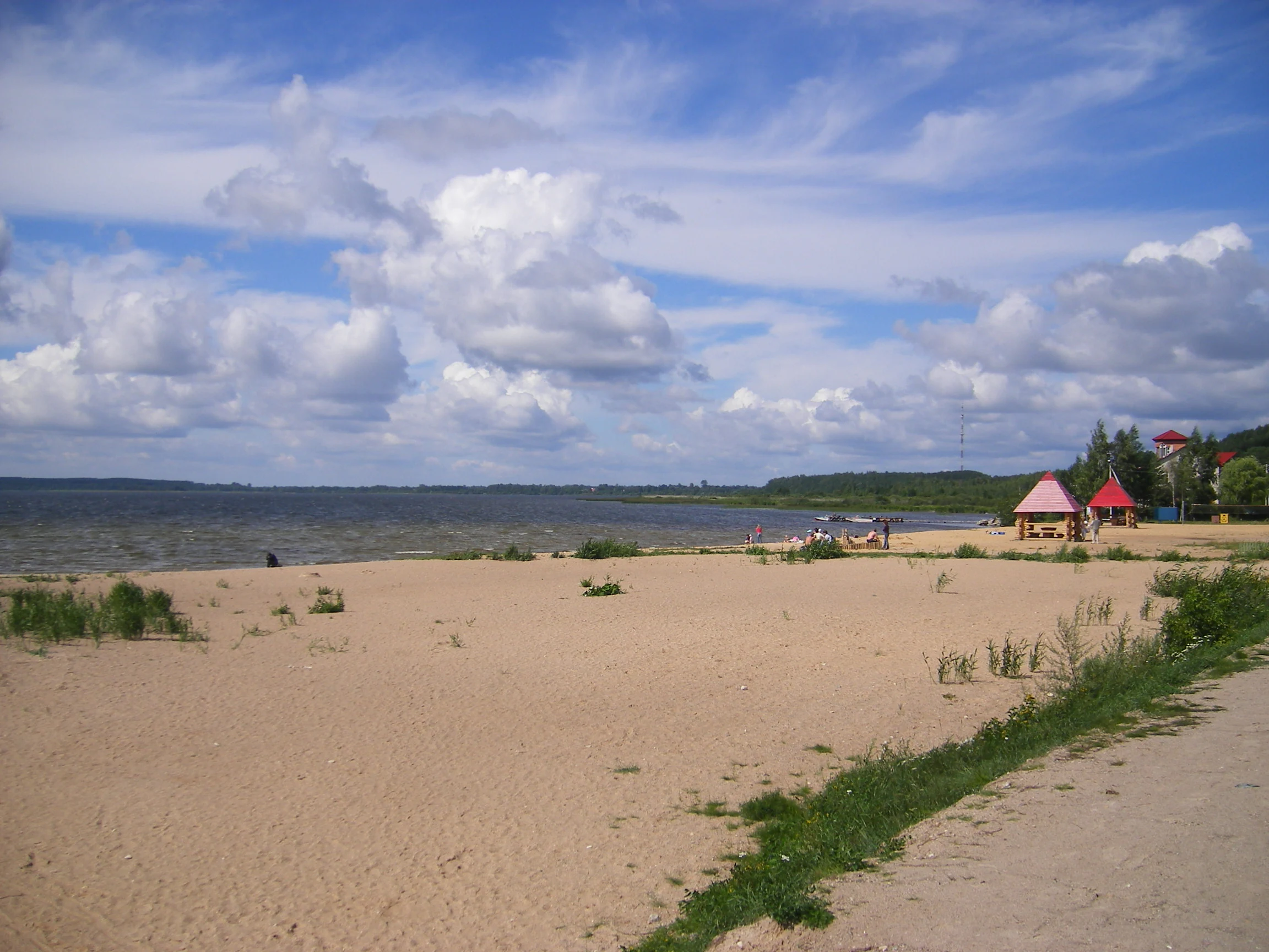
Sandy beach with grass patches and a dirt path leading to a lake shore. Small red-roofed structures are visible on the right side. The lake extends into the distance with a partly cloudy sky above.
Sandy beach shoreline with Drivyati Lake in the background, Belarus

Braslaw Lakes National Park wildlife and species highlights

The wildlife of Braslaw Lakes is associated with the park's diverse aquatic and forest habitats. The lakes support fish populations that provide food for birds and other predators. Waterfowl and marsh birds are particularly notable, with the wetland areas serving as feeding and nesting grounds. The surrounding forests provide habitat for various terrestrial species, including mammals and songbirds. The combination of water, marsh, and forest creates a habitat matrix that supports a range of species typical of Belarus' northern lake districts.
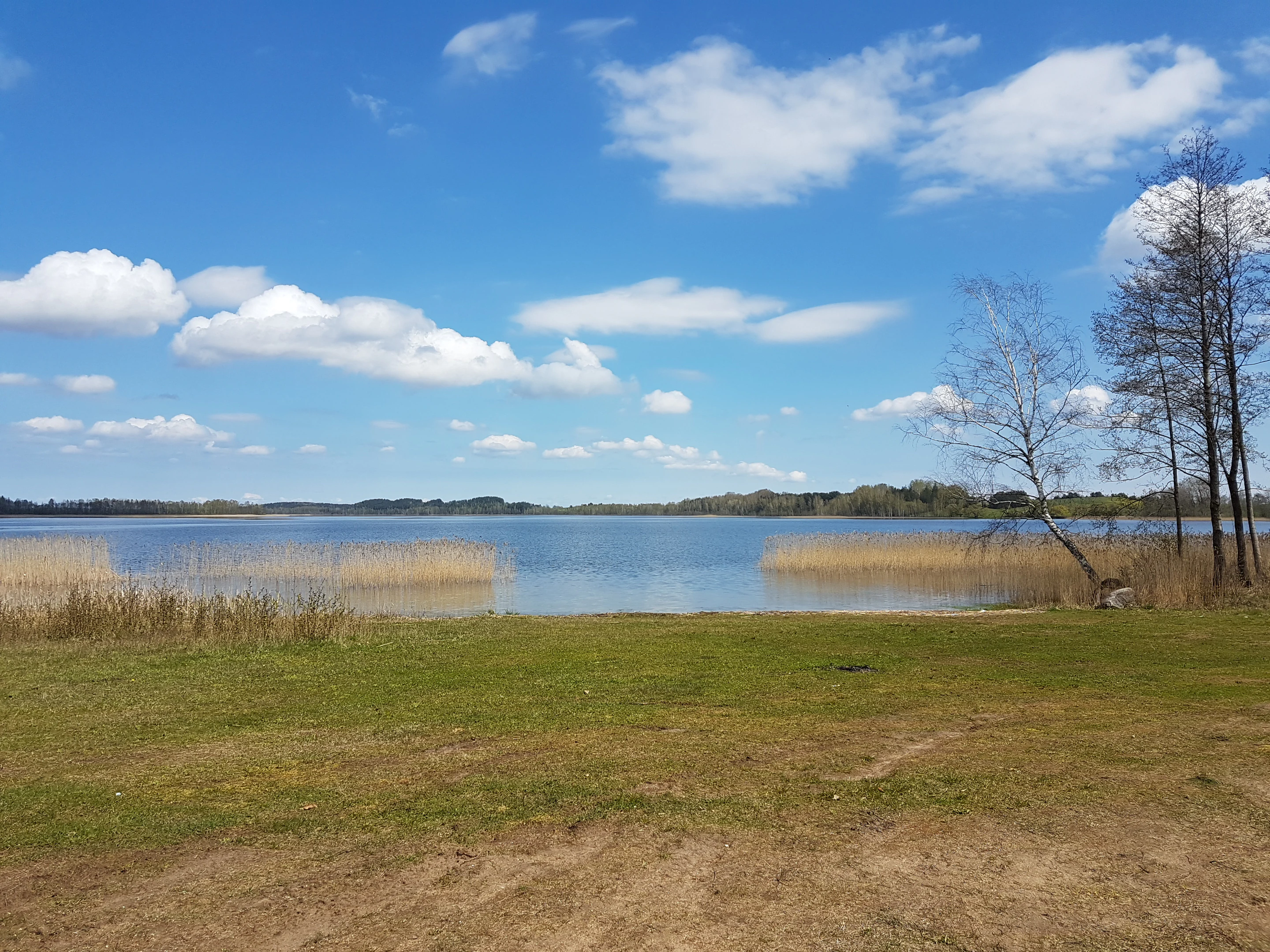
A wide view of Vojsa Lake with a grassy shore, reeds, and a clear blue sky with scattered clouds
Vojsa Lake in the Braslaw Lakes National Park on a clear day with grassy shore and reeds

Braslaw Lakes National Park conservation status and protection priorities

Braslaw Lakes National Park represents an important conservation designation for Belarus' northern lake landscape. The protected status helps preserve the lake chain, its associated wetlands, and the surrounding forests from development and intensive resource use. The park contributes to maintaining ecological connectivity in the region and protects habitats important for biodiversity. Conservation of this lacustrine system also provides benefits for water quality, flood regulation, and the broader ecological function of the landscape.

Braslaw Lakes National Park cultural meaning and human context

The Braslaw Lakes area has historical connections to the broader Vitebsk Region of northern Belarus. The town of Braslaw and surrounding settlements have long relationships with the lake landscape, with fishing and agriculture traditionally supporting local communities. The region's cultural history is tied to its natural setting, though the specific historical details of human interaction with the park area would require more detailed local sources.

Top sights and standout views in Braslaw Lakes National Park

The standout feature of Braslaw Lakes National Park is its chain of glacial lakes, a rare and scenic landscape in Belarus. The interconnected lakes create a distinctive visual environment that distinguishes the park from other protected areas in the country. The combination of open water, islands, forested shores, and wetlands offers a complex and varied natural setting. The park's ecological significance is tied to its wetland habitats and the biodiversity they support.

Best time to visit Braslaw Lakes National Park

The best time to visit Braslaw Lakes National Park is during the warmer months from late spring through early autumn, when the region's lakes and forests are most accessible and the weather allows for outdoor activities. Summer offers the warmest conditions for exploring the park's waterways and trails, while spring brings migratory birds to the wetland areas. Autumn provides fall colors in the surrounding forests. Winter access may be limited due to snow and ice conditions.
Monthly climate preview

Tracing thirty years of temperature variations and precipitation averages at the park elevation.

Historical Climate Normals and Weather by Month for Braslaw Lakes

Long-term records from 1991 through 2020 at the representative elevation show mean monthly temperatures ranging from -7.17 °C to 18.1 °C. Accessing the full seasonal breakdown reveals historical monthly averages for precipitation and temperature variation across the local landscape.
Annual mean6 °C
-7 °C18 °C
Jan-7°
Feb-6°
Mar-1°
Apr
May12°
Jun16°
Jul18°
Aug17°
Sep12°
Oct
Nov
Dec-5°
Warmest month
July

18.1 °C

Coolest month
January

-7.2 °C

Wettest month
July

3.2 mm/day

Driest month
March

1.5 mm/day

Park location guide

Geography guide, regional context, and park location map for Braslaw Lakes National Park

Braslaw Lakes National Park park geography, regions, and map view in Belarus

Understand where Braslaw Lakes National Park sits in Belarus through a broader geographic reading of the surrounding landscape, nearby location context, and its mapped position within the national park landscape.

How Braslaw Lakes National Park fits into Belarus

Belarus is a landlocked Eastern European country spanning 207,600 km² with a population of about 9.1 million. Formerly part of the Soviet Union, it declared independence in 1991 and is now a unitary semi-presidential republic. The nation shares borders with Russia, Ukraine, Poland, Lithuania, and Latvia, and is administratively divided into six regions.

Wider geography shaping Braslaw Lakes National Park in Belarus

Belarus is a landlocked country in Eastern Europe, bordered by Russia to the east and northeast, Ukraine to the south, Poland to the west, and Lithuania and Latvia to the northwest. The terrain consists largely of flatland and rolling hills with many rivers, lakes, and forests. The country spans 207,600 km² and is administratively divided into six regions.

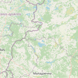
Map view of Braslaw Lakes National Park

Use this park location map to pinpoint Braslaw Lakes National Park in Belarus, understand its exact geographic position, and read its mapped placement within the surrounding landscape more clearly.

Pigeon | © OpenStreetMap contributors

Explore detailed imagery showcasing the park's unique terrain, diverse habitats, and characteristic Eastern European wetland environments.

Visual Atlas of Braslaw Lakes National Park: Glacial Lake Scenery and Protected Landscapes

Examine Braslaw Lakes photography to visually comprehend its distinct glacial lake chain, vast wetlands, and dense forested ecosystems. These curated images provide crucial insight into the park's specific terrain, key habitats, and the characteristic protected-area scenery of northern Belarus.

Panoramic landscape showing Strusta Lake, green meadows, scattered trees, and a blue sky with clouds

Wide landscape of Strusta Lake with green fields and forests under a partly cloudy sky

Large boulder partially submerged in a lake with gentle waves, grassy shore, and trees in the background

Sandy beach with grass patches and a dirt path leading to a lake shore. Small red-roofed structures are visible on the right side. The lake extends into the distance with a partly cloudy sky above.

A wide view of Vojsa Lake with a grassy shore, reeds, and a clear blue sky with scattered clouds

A lake with a wooden fishing platform, tall grass in the foreground, and a person fishing at a distance under a partly cloudy sky.

Park atlas

Trace surrounding protected areas, compare regional park geography, and explore connected conservation landscapes.

Discover Other National Parks and Protected Areas Near Braslaw Lakes

Explore other national parks and protected areas that share geographic features or are situated within the broader region surrounding Braslaw Lakes National Park. This continuation provides valuable atlas context, enabling comparison of diverse landscapes, conservation efforts, and regional ecological patterns across Eastern Europe.
Watercolor painting of a lake surrounded by trees with a sunset sky
National parkLithuania
About 59 km away#1 closest

Southwest

Aukštaitija National Park: Lithuania's Oldest National Park and Protected Landscape Exploration

Mapped geography and lake district atlas for this Baltic region park.

Delve into Aukštaitija National Park, Lithuania's pioneering national park and a key protected area in the Baltic region. This detailed atlas entry highlights its defining geography: an extensive mosaic of over 120 lakes interwoven with ancient pine forests across undulating highlands. Understand the park's protected landscape, its mapped boundaries, and its ecological significance within Eastern Europe's natural terrain.

Area
410.56 km²
Established
1974
IUCN
II
Relief
Upland
Watercolor illustration showing a lake, trees, and distant hills
National parkLatgale
About 64 km away#2 closest

North

Rāzna National Park: Protected Landscape and Regional Geography in Latgale

Explore the mapped terrain of Latvia's largest lake region.

Rāzna National Park, situated in the Latgale region, provides an essential focal point for understanding eastern Latvia's protected landscapes. This national park, recognized for its extensive glacial terrain and the significant Lake Rāzna, offers a distinct geographic profile. Users can explore its mapped boundaries, discover its role as a vital protected area, and understand its landscape context within the broader atlas of Latvia's natural heritage.

Area
596.14 km²
Established
2007
IUCN
II
Relief
Highland
Nature reserveŠvenčionys District Municipality
About 83 km away#3 closest

Southwest

Kiauneliškio gamtinis rezervatas: Ancient Forest Landscapes and Protected Terrain Mapping

Nature reserve geography in Švenčionys District Municipality

Kiauneliškio gamtinis rezervatas protects 283 hectares of moist, sandy pine woodland characterized by glacial ridges and historic old-growth specimens. This site acts as an ecological reference for the Labanoro forest landscape, offering clear insights into the undulating lowland topography and rare interior habitats of eastern Lithuania.

Area
2.83 km²
IUCN
Ia
Relief
Lowland
Climate
Temperate
Watercolor painting showing a lake with small forested islands and distant horizon.
National parkMinsk Region
About 86 km away#4 closest

South

Narachanski National Park: Belarus's Premier National Park and Lake District Atlas

Explore protected glacial terrain and diverse lake systems.

Narachanski National Park is the crown jewel of Belarus's lake district, a protected national park safeguarding a landscape defined by glacial origins and extensive freshwater systems. Centered around Lake Narach, the park's territory within Minsk Region showcases a varied terrain of moraine hills, depressions, and over 30 lakes. This atlas perspective highlights the park's unique geological features, extensive forests, and its role as a vital protected area for understanding regional geography.

Area
933 km²
Established
1999
IUCN
II
Relief
Lowland
Nature reserveŠvenčionys District Municipality
About 87 km away#5 closest

Southwest

Girutiškio gamtinis rezervatas Protected Area: Geographic Overview and Wetland Mapping

Labanoras Forest wetland complex in the Švenčionys District Municipality

Girutiškio gamtinis rezervatas is a strictly protected nature reserve occupying 1,400 hectares in eastern Lithuania. Defined by the Girutiškis and Beržalotas raised bogs, the area features a series of relict thermokarst lakes and dense pine forests. It remains a key site for boreal peatland conservation and hydrological study within the Baltic region, offering a rare glimpse into preserved wetland terrain.

Area
14 km²
IUCN
Ia
Biosphere reserveAnykščiai District Municipality
About 109 km away#6 closest

West

Šimonių Giria Biosphere Reserve in Anykščiai District Municipality, Lithuania

Protected forest massif and glacial landscape mapping

Šimonių giria stands as a prominent biosphere reserve in northern Lithuania, offering an expansive, pine dominated woodland defined by post glacial sands, extensive peat bogs, and a network of interior lakes. This structured overview details the park geographical features, from its role in the Natura 2000 network to its critical function as a biodiversity monitoring site within the Anykščiai District Municipality.

Area
232.61 km²
Established
2004
Relief
Lowland
Climate
Temperate
Watercolor painting of a lake with green forested islands and distant mountains under a pastel sky
National parkPskov Oblast
About 117 km away#7 closest

Northeast

Sebezhsky National Park: National Park within Pskov Oblast's Regional Geography

Mapped protected landscape and regional context

Sebezhsky National Park is a designated national park offering a distinct protected landscape within the Pskov Oblast of northwestern Russia. This page provides essential details for atlas exploration, focusing on the park's mapped boundaries, its role as a protected area, and its contribution to the regional geography of the Pskov Oblast. Users can understand its place within a broader mapping of Russia's natural territories and protected lands.

Area
500.21 km²
Established
1996
IUCN
II
Relief
Highland
Biosphere reserveLithuania
About 153 km away#8 closest

West

Taujėnų, Užulėnio miškų biosferos poligonas: Protected Forest Landscapes of Lithuania

Central Baltic lowland conservation territory

Spanning central Lithuania, this biosphere reserve preserves a vast mosaic of deciduous, coniferous, and mixed forest lands. The territory supports high-quality bird habitats through disciplined forestry practices and the protection of complex wetland and peatland systems, making it a reference site for lowland forest conservation.

Area
44.19 km²
Established
2004
Relief
Lowland
Climate
Temperate

Common questions about visiting, size, designation, and location context for Braslaw Lakes National Park

Braslaw Lakes National Park FAQs for park facts, access, geography, and protected area context

Find quick answers about Braslaw Lakes National Park, including protected-area facts, park geography, trail and visitor context, and how the park fits into its surrounding country and regional landscape.
MoriAtlas Explorer

Continue Your Protected Areas Search Across the Global Atlas

Deepen your exploration by continuing the structured search for national parks and protected areas worldwide. Utilize the comprehensive filtering capabilities to compare different conservation landscapes and refine your understanding of global park geography. Discover more about the distribution and characteristics of protected natural areas.

Global natural geography