Mori Atlas logo
National parkNarachanski National Park

Discover protected glacial landscapes, diverse lake systems, and unique terrain within this national park.

Narachanski National Park: Belarus's Premier Lake District National Park in Minsk Region

Narachanski National Park represents a significant protected landscape in northern Belarus, established to preserve the unique natural complexes of the Narach lake region. Encompassing over 97,000 hectares within the Minsk Region, the park is centered around Lake Narach, Belarus's largest lake. This atlas-focused exploration reveals a terrain characterized by dozens of glacial lakes, moraine hills, and extensive forest cover, offering a rich context for understanding Belarus's protected natural areas.

Lake DistrictGlacial LakesForest EcosystemsNorthern BelarusPine ForestsWetlands

Narachanski National Park

National park

Park overview

Structured park overview, official facts, and landscape profile for Narachanski National Park

Narachanski National Park park facts, protected area profile, and essential visitor context
Review the core facts for Narachanski National Park, including designation, size, terrain, visitor scale, habitats, and operating context in one park-focused overview.

About Narachanski National Park

Narachanski National Park occupies a distinctive position in Belarus's protected area network as the nation's premier lake-focused national park. The park was established in 1999 to conserve the unique natural complexes of the Narach region and to better utilize the recreational potential of the area's natural resources. The landscape is fundamentally shaped by glacial processes, featuring a complex topography of moraine hills, kettle depressions, esker ridges, and outwash plains that create a diverse array of habitats. The lake district includes more than 30 lakes of varying sizes, with Lake Narach being the largest and most significant. These lakes are interconnected hydrologically and support rich aquatic ecosystems. The surrounding forests, primarily pine, spruce, and birch, cover extensive areas and provide critical habitat for wildlife. The park's administrative center is located in the resort settlement of Narach, which has developed into the hub of Belarus's largest sanatorium and recreation zone. Beyond its natural significance, the park encompasses cultural heritage sites including historic churches, manor complexes, and traditional settlements that reflect the region's long human history. The park's 60% coverage of Myadel District makes it a defining feature of the local landscape and economy.

Quick facts and research context for Narachanski National Park

Narachanski National Park is located in northern Belarus within the Minsk Region, approximately 54.85°N 26.73°E. The park covers approximately 97,300 hectares and stretches 34 kilometers north-south and 59 kilometers east-west. It protects a landscape of over 30 lakes totaling more than 170 square kilometers, with the largest being Lake Narach. The park sits within a moraine and glacial landscape featuring small to medium hills, kames, and outwash plains. Approximately 68.7% of the park's territory consists of forests and water bodies. The park serves as the core of Belarus's largest resort area, containing 11 sanatoriums and wellness centers.

Park context

Deeper park guide and search-rich context for Narachanski National Park

Narachanski National Park history, landscape, wildlife, and travel context
Explore Narachanski National Park through its history, landscape character, ecosystems, wildlife, conservation priorities, cultural context, and seasonal travel timing in a structured park guide built for atlas discovery and search intent.

Why Narachanski National Park stands out

Narachanski National Park is best known for its exceptional lake district landscape, protecting the Narach group of lakes and surrounding glacial terrain. The park contains Belarus's largest and most scenic lake system, with Lake Narach at its center along with the Buldud, Vishnevo, Shvaktsi, and Svir lake groups. Its diverse forests support significant populations of rare bird species including the black stork, black-throated diver, gray crane, eagle owl, and osprey, all protected under Belarus's Red Book. The park also preserves unique geological features including esker ridges, the Dubovaya Gara peninsula, and coastal cliffs, along with mineral springs that have supported spa traditions since the 1940s.

Narachanski National Park history and protected-area timeline

Narachanski National Park's history as a recreational area extends back to the early 20th century when the scenic beauty of the Narach lakes attracted visitors seeking leisure and outdoor activities. Private villas, restaurants, a yacht club, and a docking area for sailing boats were built along the shores of Lake Narach, establishing the region as a premium resort destination. The area continued to develop as a recreation site through the mid-20th century. A pivotal moment came in 1946 when the first scientific expedition discovered mineral water sources and therapeutic mud deposits in the lakes of Kuzmichy, Shvaktsi, and Deyagili, providing the basis for establishing a climate and balneological resort. In the late 1950s, active construction of tourist bases and holiday homes began along the Narach shoreline. By 1963, the Sanatorium Narach had opened, followed by the Holiday Home Narach and the children's health camp Zubronya. During the 1960s and 1970s, the Narach region emerged as a major resort and wellness zone for the country. Narachanski National Park was officially created in 1999 with the goals of preserving landscapes, biological diversity, and the genetic resources of flora and fauna in the Narach region.

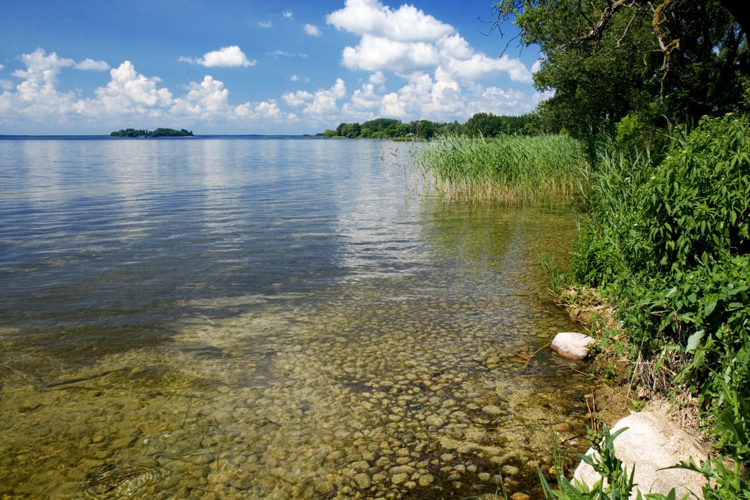
Narachanski National Park landscape and geographic character

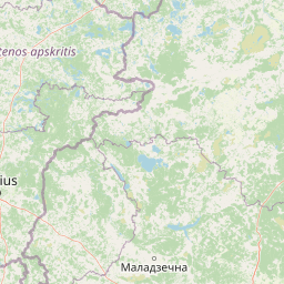
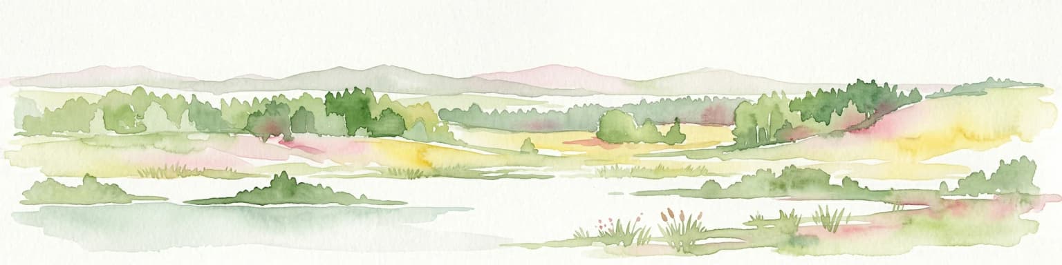
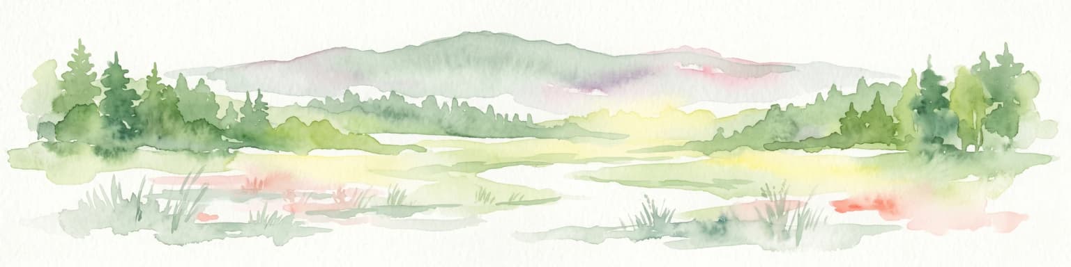
The landscape of Narachanski National Park is defined by its glacial origins and extensive lake systems. The terrain consists of small to medium moraine hills with depressions, large and medium hill-and-ridge moraine elevations with kames, and sloping glaciofluvial plains containing lakes, dunes, kames, depressions, and lowland marsh areas. This varied topography creates a visually distinctive landscape of rolling hills, open plains, and lake basins. The lake district represents one of Belarus's most important freshwater systems, with over 30 lakes covering more than 170 square kilometers. The largest lakes include Narach, Myadel, Vishnevo, and the Svir lake group. These lakes occupy glacial kettle depressions and are connected by streams and groundwater. The shorelines vary from gently sloping beaches to steeper coastal cliffs in some areas. The park also contains notable geological features including esker ridges such as Lukinskaya, Tyukshin, and Kacharginskaya, as well as the Dubovaya Gara peninsula on Lake Myadel and the Stsyapyanoŭski coastal cliff on Lake Narach. The area features more than 20 glacial erratics scattered across the landscape. Forest coverage is extensive, with pine, spruce, and birch forests dominating the terrestrial landscape.

Narachanski National Park ecosystems, habitats, and plant life

Narachanski National Park lies within the oak-pine forest vegetation subzone, a transition between more southerly deciduous forests and northern boreal ecosystems. The dominant forest types are pine, spruce, and birch forests that cover the majority of the terrestrial landscape. These forests provide critical habitat for diverse wildlife and contribute to the park's ecological character. The park's biodiversity is substantial, with approximately 900 species of higher vascular plants recorded within its boundaries. The aquatic environments support rich communities, with 32 fish species documented in the park's lakes, including commercially valuable species such as European eel, carp, pike, and sig (coregonid). The wetlands and marshes provide important habitat for waterbirds and contribute to water regulation. The park also contains unique botanical features, with rare plant species including dwarf birch, wild rosemary, cloudberry, common cattail, alpine gentian, and wild tulip recorded in the area. Some species are endemic to specific habitat types within the park, such as certain algae species found only in Lake Narach and its basin. The Charemashchyca forest-marsh area contains relic moss complexes with rare species including Gymnocolea inflata.

Narachanski National Park wildlife and species highlights

The wildlife of Narachanski National Park is diverse and includes several species of conservation significance. The mammal community comprises 49 species, including red deer, raccoon dog, European badger, marten, and otter. The bird fauna is particularly rich, with 179 nesting bird species documented in the park. Notable bird species include the bittern, osprey, and common crane, as well as rare species protected under Belarus's Red Book such as the black stork, black-throated diver, gray crane, and eagle owl. The avifauna includes both forest-dwelling species and waterbirds associated with the lake systems. The fish community includes 32 species, with common bream, silver bream, and crucian carp being among the most abundant. The park also supports populations of rare and commercially valuable fish species including brown trout, ide, spined loach, and dace. Lakes within the park are stocked with economically important species including European eel, carp, pike, and whitefish for commercial fishing. The overall vertebrate fauna totals 243 species across amphibians, reptiles, birds, and mammals.

Narachanski National Park conservation status and protection priorities

Narachanski National Park serves as a critical conservation area for Belarus's northern lake district ecosystems. The park protects representative samples of glacial lake landscapes, forest communities, and wetland habitats that would otherwise face development pressures. Several species within the park are protected under the Red Book of Belarus, including the European badger, black stork, black-throated diver, gray crane, eagle owl, and osprey among vertebrates, and rare plants such as dwarf birch, cloudberry, and wild tulip among flora. The park also preserves unique algal communities, with species such as Batrachospermum boryanum, Cladophora aegagropila, and Nostoc pruniforme found only in Lake Narach and protected as rare. The 1999 establishment of the national park institutionalized protection of the region's landscapes, biological diversity, and genetic resources. The park's management focuses on balancing conservation with sustainable recreation, as the area also serves as Belarus's primary resort zone. The comprehensive protection framework covers both terrestrial and aquatic ecosystems, from forests to lakes to marshes.

Narachanski National Park cultural meaning and human context

The Narach region has a rich human history that predates the establishment of the national park. The area's scenic lakes and natural beauty attracted visitors from the early 20th century, leading to the development of resort infrastructure including private villas, restaurants, and recreational facilities. The discovery of mineral waters and therapeutic mud in 1946 established the region as a significant balneological resort, a role that expanded through the Soviet period with the construction of sanatoriums and holiday facilities. The park contains architectural heritage sites including the Catholic Church of Our Lady of the Scapular in Myadel, St. Andrew's Church in Narach, and the Holy Ilia Orthodox Church in Narach. Additional sites include the Nicholas Catholic Church and wooden Orthodox church in Svir, an 18th-century Carmelite monastery in Zasvir, and 19th-century churches in Konstantinovo and Krivichy. The park also encompasses historic manor complexes with traditional parks in settlements including Narach, Svir, Konstantinovo, Kamarova, and Alsheva. These cultural elements are woven into the landscape and represent the human dimension of the Narach region.

Top sights and standout views in Narachanski National Park

Narachanski National Park stands out as Belarus's premier lake district protected area, protecting the nation's largest and most scenic lake system. The park's over 30 lakes, centered on Lake Narach, represent a glacial landscape of exceptional diversity. The area supports significant biodiversity with rare birds including black stork, black-throated diver, and eagle owl, and contains important populations of commercial fish species. The glacial terrain features distinctive esker ridges, the Dubovaya Gara peninsula, and coastal cliffs that add geological interest. The park serves as the foundation of Belarus's largest resort and wellness area, with 11 sanatoriums utilizing mineral springs discovered in the 1940s. Visitors can explore approximately 30 excursion routes including routes to the Blue Lakes and Charavki Peninsula. The combination of natural landscapes, biodiversity, geological features, and resort infrastructure makes Narachanski a distinctive destination within Belarus's protected areas.

Best time to visit Narachanski National Park

The optimal time to experience Narachanski National Park is during the summer months when warm weather allows full access to the lake-based activities and extensive trail network. The summer season, particularly June through August, offers the best conditions for boat excursions, swimming, and hiking the park's many routes. Autumn provides a different experience as foliage colors transform the forests, and the quieter season offers opportunities for wildlife observation. The winter months, while offering cross-country skiing opportunities, limit access to some areas as lakes freeze and some facilities operate seasonally. The shoulder seasons of spring and early summer are excellent for birdwatching as migratory species return to nesting grounds. The resort settlement of Narach operates year-round for those seeking wellness treatments at the sanatoriums, though peak visitor numbers occur during the traditional summer vacation period.

Park location guide

Geography guide, regional context, and park location map for Narachanski National Park

Narachanski National Park park geography, regions, and map view in Belarus
Understand where Narachanski National Park sits in Belarus through a broader geographic reading of the surrounding landscape, nearby location context, and its mapped position within the national park landscape.

How Narachanski National Park fits into Belarus

Belarus is a landlocked Eastern European country spanning 207,600 km² with a population of about 9.1 million. Formerly part of the Soviet Union, it declared independence in 1991 and is now a unitary semi-presidential republic. The nation shares borders with Russia, Ukraine, Poland, Lithuania, and Latvia, and is administratively divided into six regions.

Wider geography shaping Narachanski National Park in Belarus

Belarus is a landlocked country in Eastern Europe, bordered by Russia to the east and northeast, Ukraine to the south, Poland to the west, and Lithuania and Latvia to the northwest. The terrain consists largely of flatland and rolling hills with many rivers, lakes, and forests. The country spans 207,600 km² and is administratively divided into six regions.

Map view of Narachanski National Park

Use this park location map to pinpoint Narachanski National Park in Belarus, understand its exact geographic position, and read its mapped placement within the surrounding landscape more clearly.

Pigeon | © OpenStreetMap contributors

Location context for Narachanski National Park

Minsk Region
Park atlas

Trace the regional geography and compare protected landscapes surrounding Narachanski National Park, delving into Belarus's glacial lake districts.

Discover Other National Parks and Protected Areas Near Narachanski National Park in Belarus
Continue your exploration of Belarus's protected areas beyond Narachanski National Park, comparing glacial lake districts, extensive forest ecosystems, and moraine landscapes across the region. Map the diverse terrain and conservation efforts within the broader geographic context, understanding the interconnectedness of these valuable natural reserves.
National park

Aukštaitija National Park: Lithuania's Oldest National Park and Protected Landscape Exploration

Mapped geography and lake district atlas for this Baltic region park.

Delve into Aukštaitija National Park, Lithuania's pioneering national park and a key protected area in the Baltic region. This detailed atlas entry highlights its defining geography: an extensive mosaic of over 120 lakes interwoven with ancient pine forests across undulating highlands. Understand the park's protected landscape, its mapped boundaries, and its ecological significance within Eastern Europe's natural terrain.

Area
410.56 km²
Established
1974
IUCN
II
Relief
Upland
National park

Braslaw Lakes National Park: Protected Glacial Lake Landscape Atlas

Mapped boundaries and terrain of a key Belarusian protected area.

Braslaw Lakes National Park presents a fascinating protected landscape defined by its extensive glacial lake chain, lush forests, and vital wetland ecosystems. As a significant natural region in northern Belarus, it offers valuable insights into lacustrine environments and glacially formed terrain. This park serves as a prime example of protected land within the Vitebsk Region, ideal for exploring its mapped geography, understanding its ecological importance, and appreciating the unique character of Eastern Europe's lake districts through a structured atlas lens.

National park

Trakai National Historic Park: Medieval Heritage and Lake District Protected Landscape

Explore Lithuania's historic park and its mapped geographic context.

Trakai National Historic Park offers a rich tapestry of medieval history intertwined with a captivating lake district landscape. As a protected area in southeastern Lithuania, it preserves significant architectural monuments, including the iconic Trakai Castle, set against a backdrop of interconnected lakes, forests, and wetlands. MoriAtlas provides a structured overview of its geographic boundaries and regional setting, facilitating atlas-style exploration of this historically significant protected landscape.

Access
Moderate access
Scope
Mixed
Watercolor illustration showing a lake, trees, and distant hills
National parkLatgale

Rāzna National Park: Protected Landscape and Regional Geography in Latgale

Explore the mapped terrain of Latvia's largest lake region.

Rāzna National Park, situated in the Latgale region, provides an essential focal point for understanding eastern Latvia's protected landscapes. This national park, recognized for its extensive glacial terrain and the significant Lake Rāzna, offers a distinct geographic profile. Users can explore its mapped boundaries, discover its role as a vital protected area, and understand its landscape context within the broader atlas of Latvia's natural heritage.

Area
596.14 km²
Established
2007
IUCN
II
Relief
Highland
National park

Dzūkija National Park: Explore Lithuania's Largest Protected Forest and Inland Dune Landscapes

Mapped protected area geography and natural terrain of the Dainava region.

Delve into the protected landscape of Dzūkija National Park, Lithuania's expansive national park renowned for its vast primeval pine forests and extraordinary inland dune formations. This page provides a detailed atlas-style view of the park's mapped boundaries, diverse terrain, and significant natural features, offering insight into its protected territory and regional geographic importance. Examine the unique wetland systems and forest ecosystems that make this a crucial area for protected land discovery.

Area
584.53 km²
Established
1991
IUCN
II
Visitors
30K annual
Watercolor painting of a lake with green forested islands and distant mountains under a pastel sky
National parkPskov Oblast

Sebezhsky National Park: National Park within Pskov Oblast's Regional Geography

Mapped protected landscape and regional context

Sebezhsky National Park is a designated national park offering a distinct protected landscape within the Pskov Oblast of northwestern Russia. This page provides essential details for atlas exploration, focusing on the park's mapped boundaries, its role as a protected area, and its contribution to the regional geography of the Pskov Oblast. Users can understand its place within a broader mapping of Russia's natural territories and protected lands.

Area
500.21 km²
Established
1996
IUCN
II
Relief
Highland
Watercolor illustration showing lakes, green vegetation, and hills in the background
National parkPodlaskie Voivodeship

Wigry National Park: Protected Area Atlas of Poland's Glacial Lake District

Explore mapped landscapes and wetland ecosystems in Podlaskie Voivodeship

Delve into the geography of Wigry National Park, a national park situated in the Podlaskie Voivodeship of northeastern Poland. This protected area is defined by its glacial landscape, featuring 42 lakes including the expansive Lake Wigry, alongside critical wetland habitats and significant peat bogs. Discover the mapped boundaries and ecological importance of Wigry National Park, renowned as a prime location for beaver populations and a vital component of Poland's protected lands atlas.

Area
150.86 km²
Established
1989
IUCN
II
Visitors
110K annual
Watercolor illustration of a river flowing through a valley with hills and greenery
National park

Gauja National Park: Latvia's Largest National Park Atlas and Protected Landscape

Mapped terrain and diverse natural heritage in Vidzeme.

As Latvia's largest national park, Gauja offers a deep dive into a protected landscape defined by the ancient Gauja River valley and its spectacular Devonian sandstone cliffs. This page provides essential geographic context and atlas-style information, detailing the park's mapped boundaries, unique geological formations, and the rich tapestry of natural and cultural heritage that makes it a cornerstone of the region's protected lands. Explore the varied terrain, from river valleys to rolling uplands, all within a meticulously mapped conservation area.

Area
917.87 km²
Established
1973
IUCN
II
Relief
Mixed relief

Common questions about visiting, size, designation, and location context for Narachanski National Park

Narachanski National Park FAQs for park facts, access, geography, and protected area context
Find quick answers about Narachanski National Park, including protected-area facts, park geography, trail and visitor context, and how the park fits into its surrounding country and regional landscape.
MoriAtlas Explorer

Continue Your Protected Areas Search Across the Global Atlas

Deepen your exploration by continuing the structured search for national parks and protected areas worldwide. Utilize the comprehensive filtering capabilities to compare different conservation landscapes and refine your understanding of global park geography. Discover more about the distribution and characteristics of protected natural areas.

Global natural geography