
Trip Timing Basics
When to visit Aulavik National Park for your Arctic expedition
For those planning an expedition to Aulavik National Park, the window for a viable visit is remarkably narrow. Because this park is located on Banks Island in the high Arctic of Canada, it exists in a state of extreme climatic and logistical isolation for most of the year. The best time to visit is strictly limited to the brief summer season, which typically spans from late June through early August. Attempting to enter this remote polar desert outside of this window presents insurmountable challenges regarding temperature, darkness, and the absence of navigable conditions on the Thomsen River.
The necessity of the summer window
Arctic conditions dictate every aspect of travel planning here. During the summer months of June, July, and August, the region experiences continuous daylight, providing the light necessary for navigating the treeless tundra and conducting remote expeditions. This is also the period when the Thomsen River thaws sufficiently to allow for paddling, which is the primary mode of travel for most park expeditions. Outside of this period, the landscape transitions into a deep winter freeze. With average mean temperatures dropping well below freezing for the vast majority of the year, and average minimums during the coldest months plunging toward negative forty degrees Celsius, the environment becomes hostile to human activity. The daylight cycle is equally prohibitive, with zero hours of sun during the darkest parts of the year, making independent travel or safe camping essentially impossible.
Balancing seasonal trade-offs
The choice of exactly when to go within that short summer window involves a delicate balance between river conditions and the peak of the Arctic biological season. In late June, the thaw is still in progress, and the landscape is often transitioning from snowmelt, which can affect water levels and trail accessibility. By July and early August, the temperatures reach their annual peak, with average maximums rarely exceeding sixteen degrees Celsius. This is the optimal time to witness the wildlife of Banks Island, particularly the large herds of muskoxen. However, visitors must recognize that even at the height of summer, the weather remains volatile. The park is characterized by its identity as a polar desert, and regardless of the specific week chosen, the threat of high winds and sudden temperature drops is constant. Prospective visitors must view these summer weeks not as a standard vacation period, but as a narrow opportunity to access a fragile and isolated environment where the infrastructure is non-existent and self-sufficiency is a requirement for survival.
Visit Timing
Best Months to Experience Aulavik National Park
The Peak Wilderness Window: July
For most visitors, July represents the definitive window for accessing Aulavik. With daily average temperatures peaking near 5.6 degrees Celsius and maximums reaching into the mid-teens, it provides the most hospitable climate for extended outdoor activity. This is the only month where the Thomsen River is consistently ice-free enough to permit reliable paddling. The combination of 24-hour daylight and the warmest weather of the year allows for a flexible schedule, as hikers and paddlers do not face the constraint of waiting for daylight to conduct safety-critical navigation. The primary trade-off during this period is the risk of higher precipitation, which averages 1.49 mm per day. Visitors must also be prepared for active wildlife, as the peak of the summer season aligns with the migration and foraging patterns of muskoxen, which are most visible during this thaw.
Shoulder Considerations: Late June and Early August
The period flanking the peak of July offers distinct logistical trade-offs. Late June is characterized by the transition from winter to summer. While the sun remains above the horizon for 24 hours, the ground is often saturated from the initial snowmelt, and river navigation can be unpredictable depending on the speed of the ice breakup. It is a period of rapid environmental change, and visitors arriving too early in the month may find traditional travel routes restricted by lingering snow or slushy conditions.
Conversely, early August marks the beginning of the seasonal decline. While temperatures remain relatively high compared to the rest of the year, there is a noticeable shortening of the daily light cycle as the sun begins to set. By mid-August, the environmental window narrows rapidly as temperatures drop toward freezing and the risk of early autumn storms increases. Choosing this time requires a high degree of comfort with colder nights, as average daily minimums dip toward -4.4 degrees Celsius.
Comparative Overview of Visiting Priorities
Determining the right time to visit requires balancing specific expedition goals against the harsh Arctic environment:
- For Thomsen River paddling: Mid-July is the superior choice, as it ensures the highest probability of navigable water levels and reduced ice obstruction.
- For wildlife observation and photography: Mid-July through early August provides the best balance of warmth and daylight, maximizing the time available to track muskoxen across the tundra.
- For solitude and remote exploration: Late June or early August offers a quieter experience, though at the cost of higher exposure to wind and colder, more volatile weather patterns.
Each of these periods demands a rigorous approach to gear and safety, as the lack of infrastructure means that even in the height of the season, conditions remain entirely dictated by the Arctic climate.
Annual Climate Overview
Aulavik National Park Weather and Climate Trends by Month
Understanding the climate of Aulavik National Park requires shifting away from temperate expectations and focusing on the extreme, thin transition between a harsh polar winter and the brief, high-latitude summer. The park functions as a polar desert, receiving minimal precipitation, which means that the primary climate factors influencing a visitor are the temperature ranges, the relentless, constant daylight of early summer, and the transition toward autumnal cooling. These climate normals provide a baseline for planning but do not replace the necessity of monitoring live weather reports, as the inland tundra and coastal plateaus can experience sudden shifts that deviate from thirty-year averages.
The Shift from Winter to Midnight Sun
The most significant climatic event in the park is the rapid transition from the dark, frigid winter to the period of continuous daylight. From late June through July, the park experiences 24 hours of daylight. This shift is not just about visibility; it fundamentally alters the thermal environment. While average highs in June reach 12.78 degrees Celsius, the presence of the sun at all hours prevents the typical nocturnal temperature drops seen in other climates. By July, the average high peaks at 16.35 degrees Celsius, representing the warmest period of the year. However, visitors should note that even during these peak months, nighttime temperatures frequently dip toward the freezing point, with average minimums hovering near negative 1 degree Celsius in July. The lack of a true night means the landscape does not have the typical opportunity to radiate heat away, yet the persistence of the Arctic air mass keeps the environment consistently cool.
Patterns of Precipitation and Humidity
As a polar desert, Aulavik National Park exhibits very low annual precipitation, averaging roughly 300 millimeters per year. The monthly data indicates that precipitation is highest during the summer months, with August seeing the peak at 1.65 millimeters per day. This moisture often arrives as light rain or snow flurries, rather than heavy downpours. The relative humidity remains remarkably high throughout the year, frequently exceeding 90 percent, even during the cold winter months. During the summer, humidity levels hover around 86 to 90 percent. This high ambient moisture, combined with cool temperatures, creates a dampness that can make wind chill feel significantly more intense. Visitors should prioritize moisture-management in their gear, as the combination of high humidity and wind is a constant presence on the exposed tundra.
Wind Dynamics and Thermal Realities
Wind is a defining feature of the Arctic tundra. Throughout the year, wind speeds remain relatively consistent, typically oscillating between 4 and 5 meters per second. Because there are no trees or significant topographical barriers to break the flow of air across the vast, treeless plateaus of Banks Island, these winds are rarely obstructed. Even when temperature readings appear moderate in June or August, the wind can drastically reduce the felt temperature. The period from September through December marks the transition back into total darkness, where average temperatures plummet to reach lows of nearly negative 40 degrees Celsius in mid-winter. These winter months are characterized by extreme stability in their cold state, with negligible daylight and the highest levels of relative humidity, illustrating the unforgiving nature of the landscape outside of the narrow summer window.
Seasonal Conditions
Arctic Seasons and Weather Transitions in Aulavik National Park
Defining the Arctic Seasonal Cycle
Unlike temperate regions that operate on a standard four-season calendar, Aulavik National Park functions through a binary climate rhythm: a brief, intense summer thaw and a prolonged, extreme winter freeze. Because the park is situated within a polar desert, these shifts are governed not by rainfall patterns but by the presence or absence of solar radiation and its direct impact on ground stability and waterway navigability. The transition between these phases is abrupt, leaving very little room for traditional shoulder seasons.
The Summer Thaw and Hydrological Awakening
The summer phase, spanning late June through early August, represents the only period when the landscape transitions from a state of total cryogenic suspension to a dynamic, if fragile, ecosystem. This period is defined by continuous daylight, which provides the thermal energy necessary to melt winter snowpack and induce the spring freshet. Visitors should view this window as a brief transition from frozen terrain to a saturated, thaw-softened environment. As the Thomsen River ice breaks, the park moves into its most hospitable state, yet the landscape remains perpetually moist due to the active layer of tundra melting. This is not a dry season, despite the park's classification as a polar desert, because the permafrost prevents water from draining into the soil, creating a landscape of marshy depressions and flooded margins throughout the warmest months.
The Transition to Polar Night
By mid-August, the solar angle drops, marking the transition from summer warmth to the deep cold of autumn. This period is marked by a rapid contraction of daylight hours and a steady decline in temperatures that typically return to below-freezing averages by September. As the active layer of the tundra begins its seasonal refreeze, the mobility afforded by the landscape changes significantly. Surface water freezes and the soil loses the spongy quality characteristic of the July thaw. This transition is not merely a cooling of the air, but a fundamental change in the state of the terrain. Visitors who remain into late August often experience the first snow events, signaling the end of the window for overland travel and the start of the return to the long, dark winter.
The Persistent Winter Freeze
From October through May, the park enters a sustained period of deep winter that effectively closes the region to all but the most specialized, high-risk expeditions. During these months, the primary environmental factors are the total lack of daylight, the intensity of polar winds, and temperatures that frequently plummet below -30 degrees Celsius. The climate in this phase is defined by uniformity: the entire landscape is locked in a state of rigid ice and snow, with relative humidity levels near saturation despite the lack of liquid precipitation. The lack of solar input means that seasonal changes are minimal during this period, creating a static, high-stakes environment where the weather remains locked in a pattern of extreme cold and complete darkness until the return of the sun in late February and the subsequent, slow ramp-up toward the summer thaw.
Seasonal Experiences
What Visiting Aulavik National Park Is Like Throughout the Year
Visiting this remote Arctic landscape is defined by the rigid environmental constraints of the brief summer. Because the park lacks permanent infrastructure, traditional tourism activities like seasonal festivals or marked loop trails do not exist. Instead, the experiential value of a visit is entirely dependent on the narrow period when the Thomsen River becomes navigable and the ground thaw permits foot travel across the tundra.
Paddling the Thomsen River
For most travelers, the Thomsen River is the focal point of an Aulavik expedition. This waterway serves as the primary corridor for exploring the island’s interior. Navigability is strictly limited to the height of the summer thaw, typically spanning from late June through early August. In late June, early-season visitors may encounter lingering ice floes or water levels influenced by the initial melt, which can complicate river travel. By July, water levels generally stabilize, offering the most consistent conditions for multi-day paddling journeys. As August progresses, the decrease in solar radiation and lower temperatures can lead to faster changes in water conditions, making late-summer trips more sensitive to weather shifts. This river journey provides a unique perspective on the tundra, allowing travelers to move through the heart of the park while maintaining a base of movement that would be impossible to replicate on foot across the saturated landscape.
Tundra Exploration and Wildlife Observation
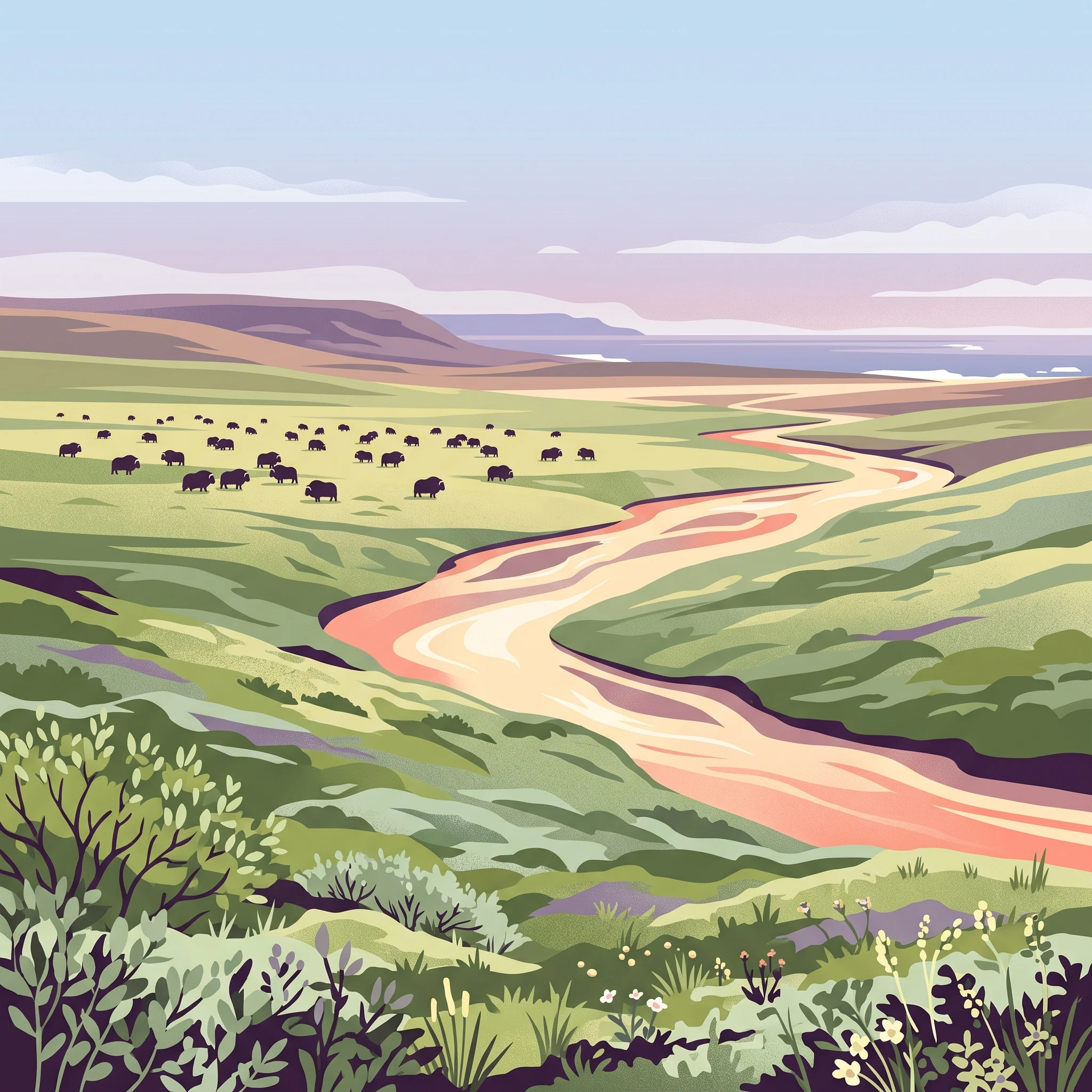
Away from the water, the experience is defined by the expansive, treeless Arctic tundra. Hiking here is a challenge of navigation, as there are no marked trails or established paths. Midsummer offers the greatest mobility, as the ground transitions from saturated, muddy conditions caused by snowmelt to a firmer, more stable surface. Travelers visiting during the height of the summer window benefit from continuous daylight, which provides maximum flexibility for choosing travel times and avoids the disorientation associated with typical dawn or dusk patterns. This period is the best window for encountering the resident muskoxen. These animals are often found grazing on the rolling plateaus, and the lack of foliage means they are visible across vast distances. While wildlife is present throughout the short summer, the ability to safely traverse the landscape to reach prime viewing areas is highly dependent on the ground conditions peaking in July.
Historical Connection at Mercy Bay
Beyond the natural environment, the park is known for its deep historical significance related to the search for the Franklin expedition. The area around Mercy Bay holds evidence of the mid-19th-century efforts to locate the missing explorers. Visiting these sites requires travel across exposed, rugged terrain, which is most feasible when temperatures are at their highest and the ground is not obscured by new snow. Because these locations are extremely isolated and offer no visitor facilities, the experience is largely about observation and historical reflection in a landscape that has remained largely unchanged for nearly two centuries. Access to these sites is entirely contingent on the same charter aircraft logistics that dictate the park's overall accessibility, meaning the historical experience is inseparable from the logistical realities of the early summer window.
Visitor Priorities
Best Timing to Visit Aulavik National Park Based on Travel Priorities
Balancing Warmer Temperatures and Paddling Stability
For travelers prioritizing the most comfortable physical conditions, July represents the primary window of opportunity. This month experiences the highest mean temperature of 5.6 degrees Celsius and the most significant daily maximums reaching 16.35 degrees Celsius. These conditions are vital for those planning multi-day river journeys on the Thomsen River, as the relative warmth facilitates the final clearance of ice and ensures that the water levels remain navigable. The compromise for this heat is the increased frequency of precipitation, with July recording the highest daily rainfall average of 1.49 mm. While this is not significant by temperate standards, in an Arctic environment where moisture directly impacts thermal comfort and gear performance, visitors must be prepared for damp, shifting conditions even during the warmest phase of the year.
Prioritizing Longer Daylight for Expedition Goals
Those whose primary goal is maximizing available light for navigation, wildlife observation, or archaeological site exploration will find the period from late June through early July highly effective. During this time, the region experiences 24-hour continuous daylight. This constant illumination allows for flexible scheduling, which is particularly beneficial when managing the unpredictability of Arctic terrain or waiting for specific wind conditions that are safer for travel. The main trade-off for this extended daylight is the persistence of late-season snow and the possibility of higher ground saturation as the landscape undergoes its initial thaw. Travelers who choose this window should anticipate slower movement across the tundra, as the ground can be soft and muddy, requiring greater effort for hiking away from the river banks.
Seeking Drier Conditions and Cooler Walking Weather
If your priority is minimizing precipitation and avoiding the peak of the thaw, early to mid-August offers a distinctively different profile. As the season progresses, the daily average maximum temperature begins to retreat toward 12.48 degrees Celsius, and the daylight hours begin to taper, though they remain substantial. This period is statistically the driest compared to the peak summer volatility of July. The cooler, clearer air can be more suitable for extensive inland walking away from the main river corridor, as the ground has had several weeks to drain. The primary compromise is the accelerating shift toward autumn; late August can introduce early frosts and significantly higher wind chill factors. Travelers choosing this time must have robust cold-weather gear, as the transition to the freezing polar winter can occur rapidly once the solar intensity drops.
Logistics and Access
Seasonal Access and Operational Planning for Aulavik National Park
Navigating Remote Arctic Access
Aulavik National Park is exceptionally isolated, and all travel into the park is dependent on chartered aviation. Because the park lacks internal roads, maintained trails, or traditional visitor facilities, independent movement is restricted by the need to fly into one of the four designated landing sites. Visitors must manage their own transport logistics from the start, as there is no public transit, shuttle service, or scheduled access route to the park boundaries.
Coordination with Aviation Charters
The most common gateway for Arctic expeditions is the community of Inuvik in the Northwest Territories. Inuvik is reachable by commercial flights or the Dempster Highway, serving as the necessary staging point for securing chartered aircraft. Chartering planes requires careful coordination, as the availability of suitable aircraft and pilots who are comfortable with landing on tundra or remote river-side sites varies by season. Prospective travelers must contact charter operators well in advance of their planned visit. Pilots retain final authority regarding whether current weather conditions, including visibility and wind speed, allow for a safe landing at specific park locations.
Regulatory Requirements and Permitting
Visitors should verify the latest permit requirements and registration processes directly with Parks Canada before committing to a departure date. As of current information, any group planning an excursion into this environment must ensure they are fully informed about local regulations and park visitor registration. Requirements for reporting itineraries and safety plans are standard for areas with no search and rescue infrastructure. Because operational rules for remote national parks can change, consult the official Parks Canada website or contact their regional offices for the most accurate details on mandatory registrations and current visitor conduct rules.
Understanding Operational Constraints
Do not assume that the brief summer climate window guarantees access. Even during the peak of July, when climate normals indicate the most favorable conditions, unexpected high winds or shifts in river ice can affect landing success. Aviation access is fundamentally tethered to the state of the terrain. Flights to remote landing sites are often contingent upon pilot assessment of ground saturation and local weather stability. Always build flexibility into your itinerary to account for potential delays caused by these environmental factors. Before beginning any travel, confirm that your intended landing site is currently permissible and that you have a clear understanding of the protocols for emergency communication, as the park is devoid of cell service and typical administrative oversight.
Safety and Preparation
Weather, Safety, and Seasonal Preparation for Aulavik National Park
Preparation for a trip to this Arctic wilderness requires an objective assessment of the environment. Unlike parks with managed trails or visitor facilities, the landscape here demands complete self-sufficiency. Because the climate is defined by a polar desert regime, you must prepare for conditions that are inherently volatile and capable of changing within hours. Regardless of when you travel during the summer window, the primary safety factor is your ability to manage exposure to temperature fluctuations, wind chill, and rapid shifts in ground saturation.
Managing Exposure and Temperature Flux
While July climate normals suggest mean temperatures around 5.6 degrees Celsius, these figures do not account for the real-feel impact of wind. High humidity and consistent air movement can cause body heat to dissipate quickly, even when ambient temperatures appear relatively mild. Layering is not merely a recommendation but a safety necessity for preventing hypothermia in a landscape that remains near freezing throughout the summer. Prepare for the possibility of temperatures dipping toward the freezing point, particularly during the transition periods of late June or mid-August. You should plan your clothing and shelter systems to handle cold-weather realities rather than relying on the warmest potential daily highs.
Terrain and Mobility Factors
Navigating the tundra requires constant attention to ground conditions. During the early part of the season in late June, the landscape is often characterized by significant snowmelt and saturated soil. This increases the difficulty of hiking and can make specific route planning more arduous. As the season progresses through July and into August, the ground dries, but you must remain aware of potential hazards related to unstable terrain or shifting riverbanks along the Thomsen River. Always verify current route reports and local guidance, as hydrological changes from year to year can alter the accessibility of landing sites and camping locations. There are no marked paths, so your ability to navigate independently and respond to the specific, immediate terrain is your most critical safety asset.
Importance of Current Conditions
Climate normals provide a baseline for understanding what to expect, but they do not serve as a weather forecast for your specific dates. Before finalising any packing lists or expedition plans, you must consult current weather forecasts and official safety alerts provided by Parks Canada. Access to this remote region is contingent on pilot discretion, and local weather patterns can render landing sites unusable regardless of the time of year. Because you are operating far from search and rescue support, your preparation must emphasize conservative decision-making, such as maintaining flexible itineraries that allow you to wait for stable conditions before attempting movement or river-based activities.
Trip Planning
How to Select the Ideal Time for Your Aulavik National Park Expedition
Selecting your travel window for this Arctic destination requires balancing the rigid environmental limits of a high-latitude polar desert against the specific requirements of your expedition. Because the window for safe, independent access is confined to the brief period when the Thomsen River is clear of ice and the tundra is passable, your decision should prioritize safety and realistic mission objectives over calendar availability. If your primary goal is river navigation, July offers the most consistent conditions for paddling as temperatures rise and water levels remain manageable. Travelers focused on extensive tundra hiking and terrestrial exploration often prefer the latter half of the season, when the ground is at its driest and the persistent threat of meltwater saturation subsides.
Deciding when to arrive also involves a trade-off between daylight and temperature. Early arrivals in late June benefit from the height of the continuous daylight cycle, which provides maximum operational flexibility for exploration. However, this period often retains the greatest risk of late-season snow and wet ground conditions. Conversely, August provides more stable, cooler conditions for land-based travel, though it marks the distinct transition back toward shorter days and the rapid approach of the winter freeze.
Your final choice hinges on your comfort with expedition-style independence. Since there are no permanent park facilities, marked trails, or local support services, your planning must reflect your group's ability to handle sudden weather shifts and navigate without infrastructure. If you prioritize the most moderate weather available, focus on the peak of July. If your priority is the unique experience of the Arctic's high-summer light, you must accept the trade-off of potentially colder, wetter conditions in late June.
Remember that climate normals provide only a historical baseline. They are not a substitute for real-time assessments, and they cannot predict the specific weather patterns you will encounter on the ground. Regardless of when you choose to go, your travel plans remain subject to the availability of chartered aircraft and the final safety assessment of pilots operating in this remote region. Always confirm your status with Parks Canada and monitor current conditions closely as your departure date approaches. The right time to visit is ultimately the period where your activity goals align with the most favorable stability in the park's fragile and unforgiving landscape.