

Streams
Park geography
Analyzing the protected terrain, elevation features, and regional landscape context
Comprehensive Geographic Profile and Mapped Boundaries of Barren Grounds Nature Reserve
The geography of Barren Grounds Nature Reserve in New South Wales encompasses 20.24 square kilometers of diverse upland terrain. This protected area includes prominent landscape features such as the Illawarra Escarpment, Noorinan Mountain, and various stream systems including Broughton Creek and Lamonds Creek.
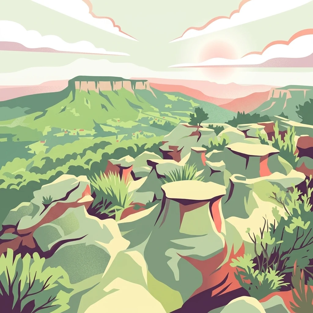
A sandstone heath plateau above the Illawarra escarpment, famed for eastern bristlebirds and cliff-edge views of the coast.
Barren Grounds Nature Reserve
Barren Grounds Nature Reserve is a protected nature park in the Southern Highlands region of New South Wales, Australia, perched on the plateau above the Illawarra escarpment between Budderoo National Park to the west and the coastal town of Kiama to the east. The reserve protects a mosaic of sandstone heath and eucalypt woodland that is ecologically significant far beyond its modest size, especially for the threatened eastern bristlebird and a suite of other birds tied to heath habitat on the edge of the escarpment. Although it covers only about 2,024 hectares, Barren Grounds forms the southern half of the Budderoo and Barren Grounds Important Bird Area, a landscape-level recognition of its importance for bird conservation in southeastern Australia. Visitors come for the wild, windswept heath scenery, for sweeping coastal lookouts from the escarpment edge, and for rock formations such as Drawing Room Rocks, a well known geological feature in the southern part of the reserve. The reserve offers a quieter, less developed alternative to the more visited national parks that neighbour it, with access from the north via Budderoo or from the south via a bush walk from the town of Berry. Its combination of heath birdlife, sandstone geology, and elevated coastal views gives it a distinctive identity within the broader NSW protected-area network.
- Location
- Australia
- Park type
- Nature reserve
- Established
- 1956
- Area
- 20.2 km²
Location overview
National park administration across Australia and New South Wales
Barren Grounds Nature Reserve Geographic Location and Regional Settings
Barren Grounds Nature Reserve is located within the country of Australia and the region of New South Wales. Regional administration records confirm standard protected status without transboundary or marine designations.
- Countries
- Australia
- Regions
- New South Wales
- Primary location
- New South Wales
- Geographic setting
- Inland
Boundary and coordinates
A 20.24 km² outline paired with extent measurements
Barren Grounds Nature Reserve mapped boundary and land area
The map can trace Barren Grounds Nature Reserve from stored geometry, clarifying its shape within the surrounding landscape. The database lists 20.24 km² entirely as land but no perimeter, and the polygon carries no legal-survey authority.
- Boundary area
- 20.7 km²
- Boundary perimeter
- 34.5 km
- Northernmost point
- 34.6664° S
- Southernmost point
- 34.7237° S
- Easternmost point
- 150.7699° E
- Westernmost point
- 150.6906° E
- Geographic centre
- 34.6936° S, 150.7229° E
- North–south span
- 6.4 km
- East–west span
- 7.3 km
Terrain and natural features
Explore upland terrain classifications and recorded natural features
Barren Grounds Nature Reserve Terrain and Named Natural Features
Recorded upland terrain classifications define the protected landscape alongside internal streams, peaks, and waterfalls. Individual feature cards present official names, types, measurements, and spatial relationships.
Selected named natural features
Viewpoints
Cooks Nose (West)
Streams
Redbank Gully
Valleys
Kangaroo Valley
Mountain ranges
Illawarra Escarpment
Viewpoints
Drawing Room Rock Lookout
Environmental setting
Temperate upland relief, heath habitats, and partial forest cover profiles
Barren Grounds Nature Reserve Environmental Classifications and Physical Settings
Stored classifications provide complementary ways to read physical settings across woodland, hill, and shrubland terrain. Recorded categories connect directly to relevant atlas destinations where available.
- Relief
- Upland
- Climate
- Temperate
- Water
- Minor water
- Forest cover
- Partial forest
Landscape features
Woodland · Hills
Habitat types
Heath · Shrubland
Park atlas
Compare nearby national parks and connected conservation areas across the Southern Highlands
Parks Near Barren Grounds Nature Reserve And Surrounding Protected Landscapes
Continue geographic discovery beyond Barren Grounds Nature Reserve by browsing other protected areas in the surrounding regional landscape. Examining adjacent reserves and nearby national parks reveals broader patterns in sandstone terrain, native heath habitats, and escarpment geography.
National parkNew South Wales
Park boundaries overlap#1 closest
West

Budderoo National Park: Protected Landscape Exploration in New South Wales
Mapping the protected area and its regional geographic context.
Gain a clear understanding of Budderoo National Park as a protected national park situated within New South Wales. This detail page focuses on its mapped geographic features and protected landscape characteristics, providing critical context for atlas-based discovery. Explore the park's position within the broader regional geography of Australia and appreciate its identity as a conservation landscape.
- Area
- 72.19 km²
- Established
- 1986
- IUCN
- II
- Climate
- Subtropical
Nature reserveNew South Wales
About 0.9 km away#2 closest
Southeast
Nameless Sylvan Reserve: A Protected Escarpment Rainforest in New South Wales
Geographic overview of this Illawarra nature reserve
Located in south-eastern New South Wales, Nameless Sylvan Reserve preserves a compact 54 hectare corridor of Illawarra Escarpment habitat. The landscape transitions from subtropical rainforest along Irwin Creek to cooler temperate rainforest on the higher slopes, representing a significant piece of the regional conservation mosaic near Berry.
- Area
- 0.54 km²
- Established
- 2007
- IUCN
- II
- Relief
- Mountain
National parkNew South Wales
7.6 km away#3 closest
South
Seven Mile Beach National Park: New South Wales National Park, Coastal Delta & Bird Habitat Exploration
Explore the mapped terrain and protected landscapes of this significant Australian coastal park.
Seven Mile Beach National Park offers a fascinating case study in coastal geography and protected area management, situated within New South Wales, Australia. The park's landscape is defined by the Shoalhaven River delta, showcasing a unique environment of tidal flats, islands, and a substantial sand barrier. This ecosystem supports significant populations of migratory waders and seabirds, making it a noteworthy site for ornithological interest and broader conservation studies. Understanding this park's atlas representation reveals its distinct littoral rainforest and its role within the regional protected land network.
- Area
- 8.981 km²
- Established
- 1971
- IUCN
- II
- Relief
- Lowland
Nature reserveNew South Wales
8 km away#4 closest
Southwest
Cambewarra Range Nature Reserve: Geographic Atlas and Protected Landscape Overview
Escarpment forests and plateau terrain in New South Wales
The Cambewarra Range Nature Reserve acts as a resilient ecological anchor within the Southern Highlands, safeguarding coachwood-dominated rainforests and diverse heath shrublands. As part of a larger network of protected lands, its steep terrain and rocky cliffs provide essential habitat for threatened species while managing regional drainage across the Sydney Basin geological landscape.
- Area
- 16.84 km²
- Established
- 2001
- Relief
- Highland
- Climate
- Temperate
National parkNew South Wales
11 km away#5 closest
Northwest
Macquarie Pass National Park: National Park Protected Landscape and Regional Geography
Mapped protected area boundaries and natural terrain context.
Macquarie Pass National Park is an important protected natural landscape situated in New South Wales. This page offers an atlas-focused view, detailing the park's precise geographic extent and its significance as a national park. Understanding its mapped boundaries and its position within the regional geography allows for a deeper appreciation of its protected status and the natural terrain it encompasses, serving as a key entry point for geographic discovery.
- Area
- 11 km²
- Established
- 1969
- IUCN
- II
- Relief
- Mountain

National parkNew South Wales
12 km away#6 closest
Southwest
Morton National Park: A Protected Landscape of Waterfalls and Dissected Plateaus in New South Wales
Explore its mapped boundaries and regional geographic context.
Morton National Park is a nationally recognized protected area within New South Wales, Australia, celebrated for its striking natural features and geographic significance. The park's landscape is characterized by a dramatic dissected plateau, giving rise to impressive waterfall systems such as Fitzroy Falls and Belmore Falls that cascade into deep gorges. As a key component of the Southern Highlands' natural heritage, Morton National Park provides a rich subject for atlas exploration, offering insights into regional terrain, protected land distribution, and the unique interplay of natural elements within this Australian national park.
- Area
- 1,997.45 km²
- Established
- 1967
- IUCN
- II
- Relief
- Mixed relief
Nature reserveNew South Wales
About 13 km away#7 closest
Northwest
Robertson Nature Reserve: Mapping a Rare Rainforest Remnant in the New South Wales Highlands
Protected warm temperate rainforest and escarpment geography
Robertson Nature Reserve serves as a vital conservation anchor in the New South Wales Southern Highlands. This reserve protects a dense fragment of warm temperate rainforest, characterized by its low canopy and rich basaltic soil composition. The area offers an opportunity to study the distinct ecology of the historic Yarrawa Brush and its adaptation to the high rainfall conditions along the Illawarra Escarpment.
- Area
- 0.053 km²
- Established
- 1979
- Relief
- Upland
- Climate
- Temperate
Nature reserveNew South Wales
About 16 km away#8 closest
West
Barrengarry Nature Reserve: A Protected Forest Mosaic in New South Wales, Australia
Illawarra hinterland geography and forest ecosystem mapping
Barrengarry Nature Reserve protects a 21-hectare mosaic of warm temperate rainforest and eucalyptus forest. Situated near Kangaroo Valley, the area demonstrates complex habitat transition and serves as a significant site for threatened species conservation within the broader New South Wales ecological landscape.
- Area
- 0.21 km²
- Established
- 2001
- IUCN
- Ia
- Scope
- Terrestrial
MoriAtlas Explorer
Continue Exploring the Geography of Barren Grounds Nature Reserve
Deepen your understanding of the Illawarra escarpment by mapping the protected heathlands and rugged sandstone features of Barren Grounds Nature Reserve. MoriAtlas provides detailed geographic insights into this essential New South Wales landscape and its surrounding conservation terrain.
Browse next
Global natural geography
Explore related park routes
Explore MoriAtlas Global ParksBrowse All MoriAtlas ParksGlobal Park Map DiscoveryMoriAtlas: Browse All CountriesBrowse All MoriAtlas ContinentsNational Park Environment AtlasGrand Canyon National Park AtlasYellowstone National Park AtlasYosemite National Park Atlas and GeographySerengeti National Park AtlasGalápagos National Park Protected LandscapeBanff National Park Geography and AtlasKruger National Park Atlas EntryUluṟu-Kata Tjuṯa National Park AtlasExplore Uluru-Kata Tjuta National Park GeographyPlitvice Lakes National Park AtlasFiordland National Park Protected LandscapeGreat Smoky Mountains National Park AtlasAfghanistan National Parks and Protected AreasAlbania National Parks and Protected AreasAlgeria National Parks and Protected AreasAmerican Samoa National Parks and Protected AreasAndorra National Parks and Protected AreasAngola National Parks and Protected AreasAntarctica National Parks and Protected AreasAntigua and Barbuda Park List