

Mori Atlas logo
Nature reserveBarren Grounds Nature Reserve

A vital protected sandstone landscape defining the geography of the New South Wales Southern Highlands

Barren Grounds Nature Reserve: Mapping the Heathland Plateaus of the Illawarra Escarpment

Barren Grounds Nature Reserve serves as a significant protected highland plateau in New South Wales, bridging the gap between coastal lowlands and the rugged terrain of the Illawarra escarpment. The reserve is defined by its extensive mosaic of weathered sandstone heath, eucalypt woodlands, and the distinct rock formations of the Drawing Room Rocks site. Through an atlas perspective, the reserve functions as a critical ecological link within the broader Important Bird Area, providing essential habitat across the dissected ridge lines of this elevated landscape.

sandstone heathIllawarra escarpmenteastern bristlebirdImportant Bird Areaheathlandeucalypt woodland
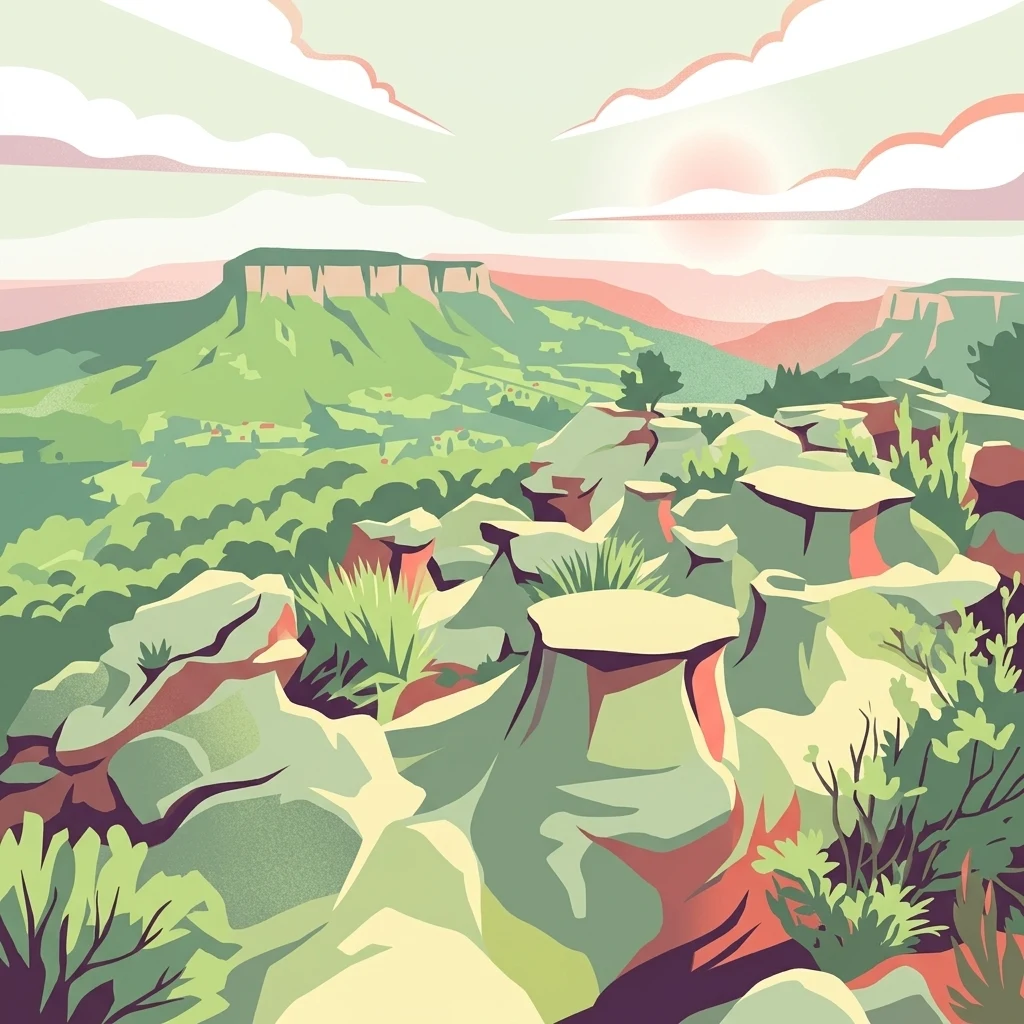
A colorful vector illustration showing green and red rocky formations in the foreground, with a large flat-topped mesa in the background under a pale pink sky.

Barren Grounds Nature Reserve

Nature reserve

Park overview

Structured park overview, official facts, and landscape profile for Barren Grounds Nature Reserve

Barren Grounds Nature Reserve park facts, protected area profile, and essential visitor context

Review the core facts for Barren Grounds Nature Reserve, including designation, size, terrain, visitor scale, habitats, and operating context in one park-focused overview.

About Barren Grounds Nature Reserve

Barren Grounds Nature Reserve protects a relatively small but ecologically rich slice of the sandstone plateau that runs along the top of the Illawarra escarpment in southeastern New South Wales. The reserve lies in the Southern Highlands region, between the more forested slopes of Budderoo National Park to the west and the drop of the escarpment toward the coastal plain and the Pacific Ocean to the east. Its eastern edge commands views out toward the coast, particularly around Kiama, while its southern side descends toward the Shoalhaven lowlands near Berry.

The defining character of the reserve is its heathland. Unlike the taller eucalypt forests common elsewhere on the escarpment, Barren Grounds is dominated by low, shrubby sandstone heath interspersed with patches of eucalypt woodland. This vegetation mosaic is the result of poor, sandy soils derived from Hawkesbury sandstone, combined with a windy, sometimes harsh plateau climate. The result is an open, park-like landscape that contrasts with the wet sclerophyll forests found in nearby Budderoo and gives the reserve its name.

The reserve has been protected since 1956 and today is managed by NSW National Parks and Wildlife Service under a nature park designation that reflects both its conservation significance and its relatively undeveloped visitor infrastructure. Although small, the reserve punches well above its size in ecological importance because it forms the southern anchor of the Budderoo and Barren Grounds Important Bird Area, covering more than 7,300 hectares across the two protected estates.

Quick facts and research context for Barren Grounds Nature Reserve

Barren Grounds Nature Reserve is a NSW state-managed nature park of roughly 2,024 hectares, located on the Illawarra escarpment in the Southern Highlands of New South Wales, Australia. Established in 1956 and protected under IUCN Category II, it lies east of Budderoo National Park and west of Kiama, and can also be reached from Berry in the Shoalhaven region to the south.

The reserve sits within sandstone country at the top of the escarpment, where heath and eucalypt woodland communities dominate. It is jointly recognised, together with Budderoo National Park, as an Important Bird Area for its population of endangered eastern bristlebirds, and it contains the geological feature known as Drawing Room Rocks on its southern side.

Protection and recognition

Explore terrestrial conservation records and designated management scope

Barren Grounds Nature Reserve Protection Status and Governance Data

Barren Grounds Nature Reserve holds a documented terrestrial conservation status within the global protected area network. Structured records outline the official designation history, management scope, and verified recognition sources for the terrain.

Protection details

Protection scope
Terrestrial
Transboundary protection
No
Park context

Deeper park guide and search-rich context for Barren Grounds Nature Reserve

Barren Grounds Nature Reserve history, landscape, wildlife, and travel context

Explore Barren Grounds Nature Reserve through its history, landscape character, ecosystems, wildlife, conservation priorities, cultural context, and seasonal travel timing in a structured park guide built for atlas discovery and search intent.

Why Barren Grounds Nature Reserve stands out

Barren Grounds is best known as one of the most important strongholds in New South Wales for the endangered eastern bristlebird, a ground-dwelling songbird that depends on dense, fire-managed heath along the Illawarra escarpment. Combined with the adjacent Budderoo National Park, the reserve forms a recognised Important Bird Area for this species and for other heath-associated birds such as pilotbirds and rockwarblers. The reserve is also recognised for the Drawing Room Rocks geological site, a cluster of weathered sandstone formations that draw visitors interested in the area's erosional landforms. Together, these ecological and geological qualities define the reserve's identity within the broader landscape of the Illawarra escarpment and Southern Highlands.
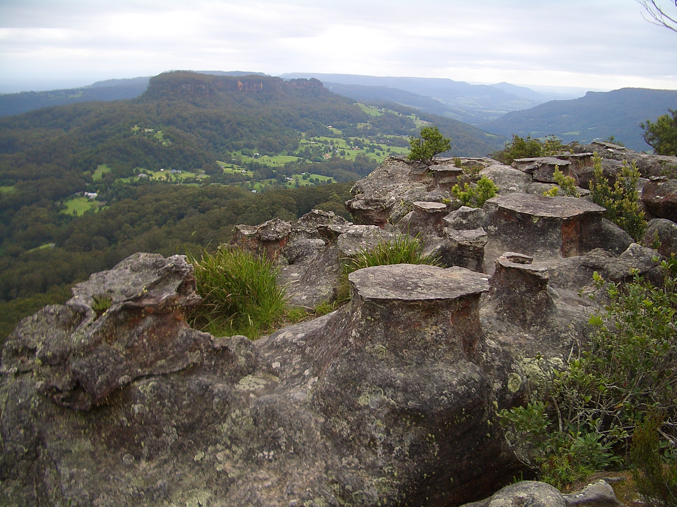
Weathered flat-topped rock formations with sparse shrubs and grasses in the foreground, overlooking a green valley with forested hills and a distant plateau under an overcast sky
Drawing Room Rocks, distinctive flat-topped sandstone formations overlooking a forested valley in Barren Grounds Nature Reserve, New South Wales

Barren Grounds Nature Reserve history and protected-area timeline

Barren Grounds Nature Reserve was formally established in 1956 as a protected area under the New South Wales conservation estate, making it one of the earlier post-war reserves on the Illawarra escarpment. Its protection followed growing recognition of the unique sandstone heath communities of the plateau and the birdlife they supported, at a time when bushland across the Sydney Basin and Illawarra region was increasingly being cleared for agriculture and rural development.

The reserve has been shaped over the following decades by ongoing ecological management, including fire regimes designed to maintain the mosaic of heath and woodland habitats that drive its biodiversity. The former Barren Grounds Bird Observatory, located within the park, played an important role in the study of heath birds, particularly the eastern bristlebird, and contributed to the scientific case that led to the later designation of the area, together with Budderoo National Park, as an Important Bird Area.

Barren Grounds Nature Reserve landscape and geographic character

Barren Grounds occupies the high, undulating plateau of the Illawarra escarpment, where Hawkesbury sandstone has weathered into a deeply dissected terrain of low ridges, shallow valleys, and exposed rock platforms. The soils are sandy and nutrient-poor, which limits tree growth and helps produce the open heathland character that distinguishes the reserve from taller forested parks nearby.

Along the eastern edge of the reserve, the land drops sharply into the escarpment, creating a series of cliff lines and lookouts that open out to sweeping views over the coastal lowlands and, on clear days, toward the Tasman Sea. One of the most recognisable features of the reserve is Drawing Room Rocks in the southern part, a set of weathered sandstone outcrops shaped by long-term erosion into distinctive rock formations.

Further south the terrain gradually descends toward the Berry area and the broader Shoalhaven landscape, while to the north the plateau continues into Budderoo National Park. This position, perched between forested slopes and the coast, gives Barren Grounds a strongly transitional landscape character.

Barren Grounds Nature Reserve ecosystems, habitats, and plant life

The natural environment of Barren Grounds is defined by the interface between sandstone heath and eucalypt woodland. Low, dense heath dominated by sclerophyllous shrubs forms the matrix of the landscape across much of the plateau, varied by taller woodland patches in sheltered pockets and around drainage lines. This mosaic is not incidental; it is a key driver of the reserve's biodiversity, providing different niches for reptiles, small mammals, and the suite of ground-dwelling and shrub-dependent birds for which the area is famous.

Heath communities like those at Barren Grounds are also ecologically dynamic, with fire playing an important natural role in shaping species composition and age structure. Episodic regeneration events following fire tend to reset sections of the heath, creating a patchwork of different growth stages across the plateau, which in turn supports different stages of the life cycles of many heath-specialist species. The reserve is a strong example of sandstone plateau ecology typical of the Illawarra and Sydney Basin region, but its birdlife gives it particular prominence on a state and national level.

Barren Grounds Nature Reserve wildlife and species highlights

The wildlife profile of Barren Grounds is dominated by birds, especially by species tied to heath and woodland margins on the escarpment. The reserve's most celebrated species is the endangered eastern bristlebird, a shy, ground-dwelling songbird whose strongholds in New South Wales are concentrated in the remnant heath along the Illawarra escarpment, including Barren Grounds and neighbouring Budderoo National Park.

Together with Budderoo, the reserve forms the Budderoo and Barren Grounds Important Bird Area, which holds significant numbers of eastern bristlebirds along with smaller populations of pilotbirds and rockwarblers. Pilotbirds are particularly associated with damp gullies and dense understorey, while rockwarblers favour rocky sandstone outcrops and shelter sites, both habitat types present within the reserve. Beyond birds, the mosaic of heath and woodland supports typical sandstone plateau fauna, including small reptiles, mammals, and insect communities shaped by the heath vegetation and sandstone geology.

Barren Grounds Nature Reserve conservation status and protection priorities

Barren Grounds Nature Reserve's conservation significance is disproportionate to its size. Although it covers roughly 2,024 hectares, it forms the southern anchor of the 7,334-hectare Budderoo and Barren Grounds Important Bird Area, an internationally recognised designation that reflects the area's importance for the conservation of heath-dependent birds in southeastern Australia. The reserve is among the most important refuges in New South Wales for the endangered eastern bristlebird.

Protection under the NSW state conservation estate, including its long-standing status as a nature reserve since 1956, helps shield the sandstone heath from the clearing and fragmentation that affected much of the surrounding plateau. Management of fire regimes, weeds, and feral animals, along with ongoing monitoring of key bird species, remains central to maintaining the habitat mosaic on which the reserve's biodiversity depends. The proximity of the Bush Heritage Australia-owned Nameless Sylvan Reserve further strengthens the conservation landscape around Barren Grounds.

Top sights and standout views in Barren Grounds Nature Reserve

Among the standout features of Barren Grounds Nature Reserve are the extensive sandstone heathlands on the plateau top, the coastal views from the escarpment edge, and the Drawing Room Rocks geological site in the southern part of the reserve. The heath mosaic drives both the visual character of the landscape and its exceptional bird diversity.

The reserve also holds a quieter kind of significance through its former Barren Grounds Bird Observatory, which contributed significantly to research on the eastern bristlebird and other heath species. Combined with its position adjoining Budderoo National Park and its proximity to the Bush Heritage Australia property at Nameless Sylvan Reserve, this gives Barren Grounds an outsised role in regional conservation despite its compact size.

Best time to visit Barren Grounds Nature Reserve

The reserve's open heath plateau and exposed escarpment edge mean weather conditions strongly shape the visitor experience. Spring and early summer tend to bring milder temperatures, active birdlife including plumed eastern bristlebirds, and a flowering display from heath shrubs, which is generally considered a rewarding period for both birdwatching and scenery. Autumn can offer stable, clear days with excellent visibility from the escarpment lookouts out toward the coast.

Winter at Barren Grounds can be cold and windy on the plateau, with shorter days, although the open heath and dramatic skies can be atmospheric for visitors prepared for the conditions. Summer brings warmer temperatures but also higher fire risk and the potential for total fire bans and access restrictions, so visitors should be aware of changing conditions. Because the reserve sits on an exposed plateau, layering of clothing and planning around weather is generally more important than at lower-elevation parks nearby.

Monthly climate preview

Long-term temperature ranges and monthly precipitation averages for New South Wales

Barren Grounds Nature Reserve Climate Normals and Annual Weather Patterns

Barren Grounds Nature Reserve records measured monthly temperature variations from a warm summer peak down to cooler winter lows alongside steady precipitation patterns. Analyzing the full twelve-month climate profile reveals comprehensive statistical context for regional temperature and precipitation trends.
Annual mean15 °C
9 °C21 °C
Jan21°
Feb21°
Mar19°
Apr16°
May13°
Jun10°
Jul
Aug10°
Sep13°
Oct15°
Nov18°
Dec20°
Warmest month
January

21.4 °C

Coolest month
July

9.2 °C

Wettest month
February

4.5 mm/day

Driest month
July

1.8 mm/day

Park location guide

Geography guide, regional context, and park location map for Barren Grounds Nature Reserve

Barren Grounds Nature Reserve park geography, regions, and map view in Australia

Understand where Barren Grounds Nature Reserve sits in Australia through a broader geographic reading of the surrounding landscape, nearby location context, and its mapped position within the national park landscape.

How Barren Grounds Nature Reserve fits into Australia

Australia is a constitutional monarchy and federal parliamentary democracy comprising six states and ten territories. With a population of nearly 28 million, it is one of the world's most urbanised countries, with most people concentrated on the eastern seaboard. The country has a high Human Development Index and is known for its cultural diversity, ancient Aboriginal heritage, and unique wildlife.

Wider geography shaping Barren Grounds Nature Reserve in Australia

Australia occupies the entire Australian continent, the island of Tasmania, and numerous smaller islands. It is the world's flattest and driest inhabited continent, featuring vast deserts in the interior (the Outback), tropical rainforests along the eastern coast, and a coastline bordering the Indian and Pacific Oceans.

Map view of Barren Grounds Nature Reserve

Use this park location map to pinpoint Barren Grounds Nature Reserve in Australia, understand its exact geographic position, and read its mapped placement within the surrounding landscape more clearly.

Pigeon | © OpenStreetMap contributors

Location context for Barren Grounds Nature Reserve

New South Wales
Natural feature types

Explore the Named Natural Features of Barren Grounds Nature Reserve

Continue geographic discovery by browsing the landforms and natural landmarks associated with Barren Grounds Nature Reserve. MoriAtlas organizes these sites to show how sandstone geology and coastal escarpment terrain define the physical landscape of this protected area in New South Wales.
Recorded earthquake history

Review Recorded Earthquake Activity Near Barren Grounds Nature Reserve

Access a chronological overview of seismic events associated by proximity with the Barren Grounds Nature Reserve landscape. This MoriAtlas catalogue provides event details such as magnitudes and epicentre distances for researchers and geography enthusiasts examining the Southern Highlands.

Barren Grounds Nature Reserve Earthquake History

Catalogued events

3 events

Strongest magnitude

Magnitude 4.6

Most recent event

Aug 18, 2007

This history includes earthquakes recorded inside the park or within 50 km of its borders

Visualizing sandstone heathlands, escarpment cliffs, and protected bird habitats

Barren Grounds Nature Reserve Photos and Landscape Scenery

Examinations of Barren Grounds Nature Reserve reveal sweeping plateau terrain, rocky geological formations, and coastal lookouts across New South Wales. High-resolution imagery documents the native heath mosaic, exposed sandstone platforms, and transitional eucalypt woodlands defining the regional protected landscape.

Weathered flat-topped rock formations with sparse shrubs and grasses in the foreground, overlooking a green valley with forested hills and a distant plateau under an overcast sky

Park atlas

Compare nearby national parks and connected conservation areas across the Southern Highlands

Parks Near Barren Grounds Nature Reserve And Surrounding Protected Landscapes

Continue geographic discovery beyond Barren Grounds Nature Reserve by browsing other protected areas in the surrounding regional landscape. Examining adjacent reserves and nearby national parks reveals broader patterns in sandstone terrain, native heath habitats, and escarpment geography.
National parkNew South Wales
Park boundaries overlap#1 closest

West

Budderoo National Park: Protected Landscape Exploration in New South Wales

Mapping the protected area and its regional geographic context.

Gain a clear understanding of Budderoo National Park as a protected national park situated within New South Wales. This detail page focuses on its mapped geographic features and protected landscape characteristics, providing critical context for atlas-based discovery. Explore the park's position within the broader regional geography of Australia and appreciate its identity as a conservation landscape.

Area
72.19 km²
Established
1986
IUCN
II
Climate
Subtropical
Nature reserveNew South Wales
About 0.9 km away#2 closest

Southeast

Nameless Sylvan Reserve: A Protected Escarpment Rainforest in New South Wales

Geographic overview of this Illawarra nature reserve

Located in south-eastern New South Wales, Nameless Sylvan Reserve preserves a compact 54 hectare corridor of Illawarra Escarpment habitat. The landscape transitions from subtropical rainforest along Irwin Creek to cooler temperate rainforest on the higher slopes, representing a significant piece of the regional conservation mosaic near Berry.

Area
0.54 km²
Established
2007
IUCN
II
Relief
Mountain
National parkNew South Wales
7.6 km away#3 closest

South

Seven Mile Beach National Park: New South Wales National Park, Coastal Delta & Bird Habitat Exploration

Explore the mapped terrain and protected landscapes of this significant Australian coastal park.

Seven Mile Beach National Park offers a fascinating case study in coastal geography and protected area management, situated within New South Wales, Australia. The park's landscape is defined by the Shoalhaven River delta, showcasing a unique environment of tidal flats, islands, and a substantial sand barrier. This ecosystem supports significant populations of migratory waders and seabirds, making it a noteworthy site for ornithological interest and broader conservation studies. Understanding this park's atlas representation reveals its distinct littoral rainforest and its role within the regional protected land network.

Area
8.981 km²
Established
1971
IUCN
II
Relief
Lowland
A soft watercolor illustration featuring sparse trees and low-lying scrubland against a hazy, distant horizon.
Nature reserveNew South Wales
8 km away#4 closest

Southwest

Cambewarra Range Nature Reserve: Geographic Atlas and Protected Landscape Overview

Escarpment forests and plateau terrain in New South Wales

The Cambewarra Range Nature Reserve acts as a resilient ecological anchor within the Southern Highlands, safeguarding coachwood-dominated rainforests and diverse heath shrublands. As part of a larger network of protected lands, its steep terrain and rocky cliffs provide essential habitat for threatened species while managing regional drainage across the Sydney Basin geological landscape.

Area
16.84 km²
Established
2001
Relief
Highland
Climate
Temperate
National parkNew South Wales
11 km away#5 closest

Northwest

Macquarie Pass National Park: National Park Protected Landscape and Regional Geography

Mapped protected area boundaries and natural terrain context.

Macquarie Pass National Park is an important protected natural landscape situated in New South Wales. This page offers an atlas-focused view, detailing the park's precise geographic extent and its significance as a national park. Understanding its mapped boundaries and its position within the regional geography allows for a deeper appreciation of its protected status and the natural terrain it encompasses, serving as a key entry point for geographic discovery.

Area
11 km²
Established
1969
IUCN
II
Relief
Mountain
Watercolor landscape illustration showing green fields, trees, hills, and pastel sky
National parkNew South Wales
12 km away#6 closest

Southwest

Morton National Park: A Protected Landscape of Waterfalls and Dissected Plateaus in New South Wales

Explore its mapped boundaries and regional geographic context.

Morton National Park is a nationally recognized protected area within New South Wales, Australia, celebrated for its striking natural features and geographic significance. The park's landscape is characterized by a dramatic dissected plateau, giving rise to impressive waterfall systems such as Fitzroy Falls and Belmore Falls that cascade into deep gorges. As a key component of the Southern Highlands' natural heritage, Morton National Park provides a rich subject for atlas exploration, offering insights into regional terrain, protected land distribution, and the unique interplay of natural elements within this Australian national park.

Area
1,997.45 km²
Established
1967
IUCN
II
Relief
Mixed relief
Nature reserveNew South Wales
About 13 km away#7 closest

Northwest

Robertson Nature Reserve: Mapping a Rare Rainforest Remnant in the New South Wales Highlands

Protected warm temperate rainforest and escarpment geography

Robertson Nature Reserve serves as a vital conservation anchor in the New South Wales Southern Highlands. This reserve protects a dense fragment of warm temperate rainforest, characterized by its low canopy and rich basaltic soil composition. The area offers an opportunity to study the distinct ecology of the historic Yarrawa Brush and its adaptation to the high rainfall conditions along the Illawarra Escarpment.

Area
0.053 km²
Established
1979
Relief
Upland
Climate
Temperate
Nature reserveNew South Wales
About 16 km away#8 closest

West

Barrengarry Nature Reserve: A Protected Forest Mosaic in New South Wales, Australia

Illawarra hinterland geography and forest ecosystem mapping

Barrengarry Nature Reserve protects a 21-hectare mosaic of warm temperate rainforest and eucalyptus forest. Situated near Kangaroo Valley, the area demonstrates complex habitat transition and serves as a significant site for threatened species conservation within the broader New South Wales ecological landscape.

Area
0.21 km²
Established
2001
IUCN
Ia
Scope
Terrestrial

Common questions about visiting, size, designation, and location context for Barren Grounds Nature Reserve

Barren Grounds Nature Reserve FAQs for park facts, access, geography, and protected area context

Find quick answers about Barren Grounds Nature Reserve, including protected-area facts, park geography, trail and visitor context, and how the park fits into its surrounding country and regional landscape.
MoriAtlas Explorer

Continue Your Protected Areas Search Across the Global Atlas

Deepen your exploration by continuing the structured search for national parks and protected areas worldwide. Utilize the comprehensive filtering capabilities to compare different conservation landscapes and refine your understanding of global park geography. Discover more about the distribution and characteristics of protected natural areas.

Global natural geography
