

Mori Atlas logo
Wildlife reserveBerenty Reserve

A study of semi-arid riverine ecosystems and endemic thicket geography in southern Madagascar

Berenty Reserve Wildlife Reserve: Mapping the Spiny Forest Landscapes of Anosy, Madagascar

Berenty Reserve stands as a pivotal protected area within the Anosy region, characterized by its distinctive southern spiny forest and riverine gallery terrain. This atlas entry provides a structural look at the reserve's unique ecology, detailing its semi-arid climate, thorny thicket vegetation, and its role as a core site for ecological research in Madagascar's southern borderlands.

lemursspiny forestsemi-arid ecosystemsprivate reserveprimatology researchendemic birdlife

Berenty Reserve

Wildlife reserve

Park overview

Structured park overview, official facts, and landscape profile for Berenty Reserve

Berenty Reserve park facts, protected area profile, and essential visitor context

Review the core facts for Berenty Reserve, including designation, size, terrain, visitor scale, habitats, and operating context in one park-focused overview.

About Berenty Reserve

Berenty Reserve is a compact, privately managed protected area in Madagascar's far south, set on the banks of the Mandrare River near Amboasary Sud. Although small in extent relative to many of the country's national parks, it has outsized importance for both conservation and tourism, largely because it combines endangered primate populations with a uniquely accessible walk-through reserve layout.

Ecologically, the reserve lies entirely within the Madagascar spiny thickets ecoregion, an ecosystem shaped by the long dry season of southern Madagascar and dominated by drought-adapted vegetation such as didierea, euphorbias, and baobabs. The open canopy and characteristic thorny understory create a landscape that looks starkly different from the humid eastern rainforests of the island, and which supports a correspondingly distinctive set of specialist species.

From a visitor and research standpoint, Berenty has earned its reputation as a flagship site for lemur observation. Ring-tailed lemurs, Verreaux's sifaka, and a hybrid red-fronted and collared brown lemur are all active during the day, while several nocturnal species, including white-footed sportive lemurs and mouse lemurs, broaden the reserve's wildlife appeal. Over more than three decades, the site has hosted continuous primatological research, undergraduate field courses, and journalists, helping to shape global understanding of Malagasy primate behavior and ecology.

Quick facts and research context for Berenty Reserve

Berenty Reserve lies in the Anosy region of southern Madagascar, near the town of Amboasary Sud and roughly two hours by road from the southeastern coastal city of Tôlagnaro. It is a privately managed protected reserve rather than a national park, and it sits within the Madagascar spiny thickets ecoregion, an environment defined by drought-adapted vegetation, thorny succulents, and an unusually open forest structure.

The reserve has been an active research site for more than three decades, beginning with the work of primatologist Alison Jolly, and it continues to host lemur-focused fieldwork today. Its combination of habituated lemur troops, easy walking trails, forest accommodation, and proximity to the southeast coast has made it Madagascar's most-visited nature reserve by visitor numbers.

Protection and recognition

Documented terrestrial protection scope, designation history, and governance framework

Berenty Reserve Protection Status and International Recognition Details

Berenty Reserve maintains a documented terrestrial protection scope and structured conservation framework within its regional landscape. Official records outline the baseline designation parameters and management history associated with this protected area.

Protection details

Protection scope
Terrestrial
Transboundary protection
No
Park context

Deeper park guide and search-rich context for Berenty Reserve

Berenty Reserve history, landscape, wildlife, and travel context

Explore Berenty Reserve through its history, landscape character, ecosystems, wildlife, conservation priorities, cultural context, and seasonal travel timing in a structured park guide built for atlas discovery and search intent.

Why Berenty Reserve stands out

Berenty Reserve is best known as one of the world's most reliable places to observe ring-tailed lemurs in the wild. The reserve's troops are well-habituated to humans, allowing close viewing of their daily behaviors, ground-crossing postures, and social interactions, along with the equally iconic Verreaux's sifakas, famous for their sideways dancing locomotion through the open forest. Equally important to Berenty's identity is its setting within the southern spiny forest, a striking ecosystem of cactus-like plants, thorny thickets, and deciduous baobab trees. This unusual landscape, combined with the reserve's long-running role in lemur research and education, gives Berenty a distinctive character that sets it apart from Madagascar's other major reserves and national parks.
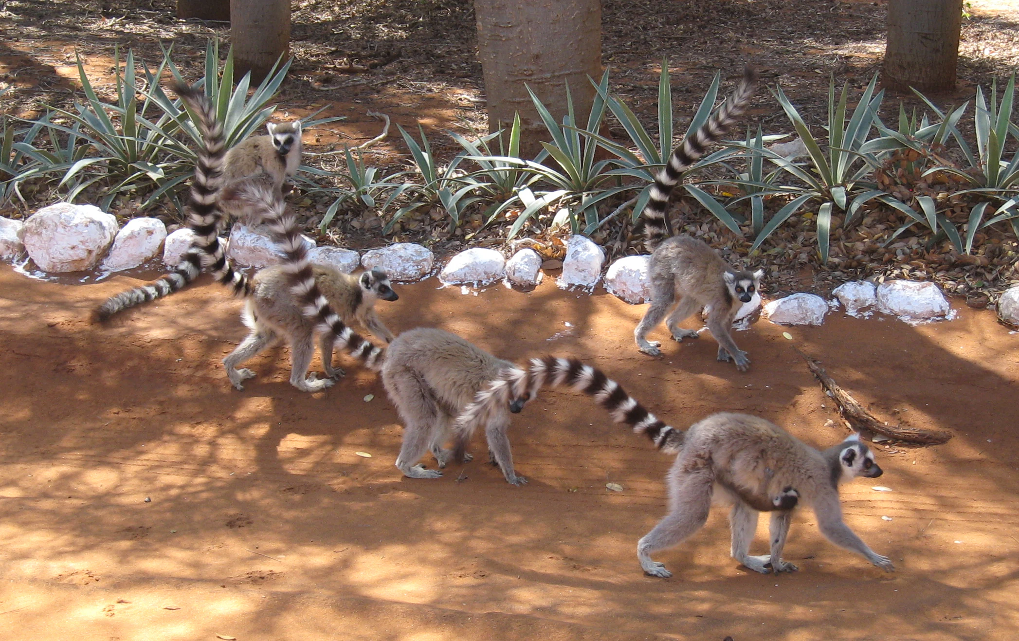
A group of ring-tailed lemurs with long black and white striped tails walking across a dirt path in a wooded area, with white rocks bordering the path.
A group of ring-tailed lemurs foraging in the forest floor at Berenty Reserve.

Berenty Reserve history and protected-area timeline

Berenty Reserve's modern identity is closely linked to the primatologist Alison Jolly, who began research at the site in the early 1960s and continued working there for decades, eventually establishing the reserve as one of the most important long-term lemur research sites in the world. Her initial fieldwork and her ongoing relationship with the site created the conditions for a steady stream of visiting scientists, students, and documentary teams, giving Berenty a continuous research presence spanning more than thirty years.

Alongside its academic history, Berenty gradually developed as a tourism destination. As its habituated lemur troops became more reliably viewable and accommodation was built within the forest, the reserve emerged as a favored stop for visitors arriving via the nearby southeastern coast and the regional hub of Tôlagnaro. Over time, it became the most-visited nature reserve in Madagascar, an unusual distinction for a privately managed site rather than a national park.

Today, Berenty continues to balance its roles as a working research site and a public reserve. Tourism income helps sustain protection of the surrounding forest, while researchers continue to use the reserve to monitor lemur social structure, troop dynamics, and forest regeneration in a controlled, well-studied environment.

Berenty Reserve landscape and geographic character

The landscape of Berenty Reserve is defined by the southern Madagascar spiny forest: a dry, thorny, semi-arid terrain that feels more savanna-like than typically imagined forest. Canopies are sparse and open, allowing bright sunlight to reach the ground and giving the reserve a slightly desert-like appearance during the long dry season.

The vegetation is dominated by drought-adapted plants with a strongly sculptural quality, including didierea, large caudex-forming euphorbias, and baobabs that drop their leaves during the dry months. Along the Mandrare River, the riverine gallery vegetation differs from the surrounding spiny thicket, adding a subtle palette change between the riverside and the inland forest blocks. Walking trails wind through both habitats, offering visitors a close-up view of the unusual plant architecture that makes southern Madagascar such a distinctive environment.

Terra firma rises gently above the river rather than dramatically, so the visual drama of Berenty comes less from topography and more from texture: the interplay of thorny branches, spindly cactus-like trunks, and unusual silhouettes against widely spaced canopies.

Berenty Reserve ecosystems, habitats, and plant life

Berenty protects a representative sample of the Madagascar spiny thickets ecoregion, an ecological zone that is both globally distinctive and ecologically fragile. The vegetation is shaped by prolonged drought, nutrient-poor soils, and a long evolutionary separation from mainland African flora, producing a community of plants found almost nowhere else on earth.

The reserve's forest mosaic includes older, taller stands of spiny thicket with more developed canopies, open regenerating areas, and the adjacent riparian forest along the Mandrare. This mix of habitat types supports very different microenvironments: open-canopy stretches favor more terrestrial lemur behavior, while denser patches provide critical refuge and feeding areas for smaller nocturnal primates and birds.

From a biodiversity perspective, the ecosystem is unusually rich in specialists. Despite harsh surface conditions, the spiny forest is an endemic-rich habitat with a high proportion of species that do not occur anywhere else, making even small reserves like Berenty disproportionately important for the survival of Madagascar's southern natural heritage.

Berenty Reserve wildlife and species highlights

The wildlife of Berenty Reserve is dominated by its lemur communities, which form the core of the reserve's identity. Ring-tailed lemurs are the most visible species, moving in recognizable troops through the open forest and even along the ground in their distinctive cross-armed posture. Verreaux's sifakas add another layer of behavioral appeal through their vertical clinging and leaping locomotion, which translates on the ground into an almost balletic sideways hop across the bare soil.

A hybrid population of red-fronted and collared brown lemurs, introduced to Berenty, provides additional diurnal viewing opportunities. After dark, the reserve hosts several nocturnal lemurs including the white-footed sportive lemur, the gray mouse lemur, and the reddish-gray mouse lemur, expanding the reserve's appeal as a long-window wildlife site.

Berenty is also valued for its endemic birdlife. Owls, couas, and other dry-forest specialists are regularly encountered along the trails, reinforcing the reserve's reputation as a productive introduction to the fauna of southern Madagascar. Although large mammals are sparse, the combination of primates and birds provides the kind of wildlife density and viewability that makes Berenty especially memorable for visitors.

Berenty Reserve conservation status and protection priorities

As a privately managed reserve embedded in a heavily cleared region of southern Madagascar, Berenty plays an outsize conservation role. The surrounding dry spiny forest is among the most threatened ecosystems on the island, with large swathes cleared for agriculture, charcoal, and grazing, leaving only scattered surviving forest fragments. Berenty is one of those surviving fragments, and its protected status helps anchor regional biodiversity.

The reserve's long-running scientific presence has contributed directly to conservation knowledge, supporting decades of primate behavior, ecology, and population monitoring that has informed broader lemur conservation strategies across Madagascar. The combination of an academic research tradition and steady visitor interest has created a financial case for ongoing protection, with tourism revenue helping to offset the costs of guarding and maintaining the forest.

Equally important is Berenty's role as a demonstration site: as one of the few southern reserves where visitors can reliably see wild lemurs, it has built public awareness of Madagascar's unique biodiversity, supporting the broader case for protecting the country's spiny forests.

Berenty Reserve cultural meaning and human context

Berenty is rooted in the southern Malagasy landscape rather than closely tied to a single ethnic tradition: the surrounding region is inhabited by Antandroy and Antanosy communities whose subsistence practices of small-scale agriculture and pastoralism are shaped by the same arid conditions and seasonal rivers that define the forest. The spiny forest and the Mandrare River have long been part of these communities' living environment.

The reserve itself reflects a more modern mode of land stewardship, in which private landowners, working scientists, and tourism operators together maintain a protected pocket of natural habitat within a heavily modified regional landscape. Its model of private conservation, decades-long research relationships, and on-site tourism infrastructure has itself become part of Berenty's cultural footprint within Madagascar's environmental history.

Top sights and standout views in Berenty Reserve

Berenty's standout quality is its extraordinary viewability of wild lemurs, especially the world-famous ring-tailed lemur troops that move freely among visitors and along the reserve's open dry-forest trails. Verreaux's sifakas provide a memorable counterpoint with their leaping and 'dancing' locomotion through the thorny canopy.

Beyond its primates, the reserve is a showcase for Madagascar's southern spiny forest, a striking ecosystem of didierea, euphorbias, and baobabs that is unlike any other major habitat on the island. The combination of forest-edge accommodation, a compact trail network, and access to nocturnal species makes Berenty unusually rich as a short but deeply immersive wildlife experience.

Best time to visit Berenty Reserve

In the dry season, roughly April through November, Berenty's spiny forest thins out and opens up, making primate viewing easier and more reliable. Cooler, dry months also bring clearer skies and more comfortable walking conditions along the reserve's trails.

The wet season, roughly December through March, brings dense foliage, higher humidity, and more challenging road access to the far south. Although some visitors find the lusher forest visually rewarding during this period, wildlife observation tends to be more difficult and equipment-intensive.
Monthly climate preview

Long-term monthly temperature and precipitation patterns recorded across the reserve

Berenty Reserve Climate Normals and Annual Temperature Rhythm

Representative coordinates document sustained monthly thermal shifts and varying precipitation rates across the landscape through the year. Analyzing the complete twelve-month climatology dataset reveals detailed multi-year temperature averages and precipitation trends for this protected region.
Annual mean23 °C
19 °C26 °C
Jan26°
Feb26°
Mar25°
Apr24°
May22°
Jun20°
Jul19°
Aug20°
Sep22°
Oct24°
Nov25°
Dec26°
Warmest month
January

26.3 °C

Coolest month
July

19.1 °C

Wettest month
February

7.6 mm/day

Driest month
September

1.4 mm/day

Park location guide

Geography guide, regional context, and park location map for Berenty Reserve

Berenty Reserve park geography, regions, and map view in Madagascar

Understand where Berenty Reserve sits in Madagascar through a broader geographic reading of the surrounding landscape, nearby location context, and its mapped position within the national park landscape.

How Berenty Reserve fits into Madagascar

Madagascar is an island nation in the Indian Ocean, positioned off the southeastern coast of Africa. As the world's fourth-largest island and second-largest island country, it stands out for its exceptional biodiversity, over 90% of its wildlife is endemic, making it one of 17 megadiverse countries. The population is approximately 32 million, with Antananarivo as both the capital and largest city.

Wider geography shaping Berenty Reserve in Madagascar

Madagascar lies in the Indian Ocean off the southeastern coast of Africa, separated from the mainland by the Mozambique Channel. The island is situated approximately 400 km from the African continent. As the world's fourth-largest island, it also includes numerous smaller peripheral islands.

Map view of Berenty Reserve

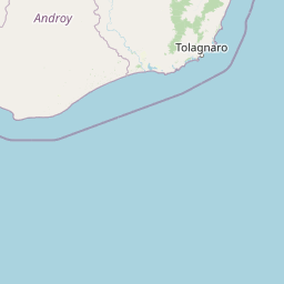
Use this park location map to pinpoint Berenty Reserve in Madagascar, understand its exact geographic position, and read its mapped placement within the surrounding landscape more clearly.

Pigeon | © OpenStreetMap contributors

Location context for Berenty Reserve

Anosy

Visual reference of southern Madagascar spiny forest habitats and terrain

Berenty Reserve Photos, Landscapes, and Protected Area Scenery

Visual documentation captures the distinctive spiny forest terrain, riverine gallery vegetation, and open canopies defining Berenty Reserve. Detailed photography provides clear insight into the drought-adapted plant architecture and wildlife habitats characterizing this southern ecosystem.

A group of ring-tailed lemurs with long black and white striped tails walking across a dirt path in a wooded area, with white rocks bordering the path.

Park atlas

Compare adjacent spiny forest reserves and regional conservation landscapes

Parks Near Berenty Reserve and Other Protected Areas in Southern Madagascar

Browsing parks near Berenty Reserve reveals related semi-arid ecosystems and unique thorn forests across southern Madagascar. Examining connected protected areas provides broader geographic context for regional wildlife habitats.
National parkMadagascar
About 60 km away#1 closest

Northeast

Andohahela National Park: Protected Landscape and Geographic Atlas Context in Madagascar

Explore the mapped terrain and regional park geography.

Understand Andohahela National Park as a distinct national park entity, focusing on its geographic setting and protected landscape characteristics within Madagascar. This detail page provides structured data on the park's mapped boundaries and its regional importance, offering insights for anyone exploring protected areas and natural terrain through a geographic lens. It is an essential resource for understanding the park's specific context in the broader atlas.

Area
760 km²
Established
1998
IUCN
II
Visitors
1.3K annual
Nature reserveMadagascar
About 70 km away#2 closest

East

Mandena Conservation Zone: Protected Littoral Forest and Wetland Geography in Madagascar

A critical nature reserve near the southeastern coastline

Mandena Conservation Zone protects over 200 hectares of rare littoral forest and coastal swamp in southeastern Madagascar. As one of the few remaining fragments of this unique coastal ecosystem, the reserve provides a critical habitat for endemic lemur populations and serves as an important site for understanding the regional geography of the Tolagnaro area.

Area
2.3 km²
Relief
Lowland
Climate
Tropical
Access
Access unknown
Nature reserveAnosy
About 78 km away#3 closest

Northeast

Tsitongambarika Nature Reserve: Geographic Profile and Protected Forest Landscape

Lowland humid evergreen forest in the Anosy region

Tsitongambarika represents one of the final remaining lowland humid evergreen forest tracts in southern Madagascar. The reserve encompasses an extensive massif of ridges and the isolated Mount Ivohibe, supporting complex drainage networks that sustain the coastal water supply of the Anosy region. This protected landscape is fundamental for preserving regional biodiversity, including endemic lemurs, palm species, and specialized forest bird habitats across the southeastern Madagascar terrain.

Area
585.97 km²
Established
2015
IUCN
VI
Relief
Mountain
Nature reserveMadagascar
About 90 km away#4 closest

East

Sainte Luce Reserve: Mapping Madagascar's Coastal Rainforest and Nature Reserve Boundaries

Coastal littoral forest, rare ebony enclaves, and mangrove ecosystems.

Located on the southeastern coast of Madagascar, Sainte Luce Reserve represents an intensive conservation area for littoral forest ecosystems. The reserve protects a unique linear landscape of Pandanus rainforests, white-sand ebony stands, and riverine mangroves, serving as a sanctuary for endangered palms and various endemic lemur species within its concentrated geographic footprint.

Area
0.4 km²
Established
2009
Visitors
50 annual
Relief
Lowland
Wildlife reserveAndroy
About 130 km away#5 closest

Southwest

Réserve spéciale du Cap Sainte-Marie: Wildlife Reserve and Protected Coastal Landscape in Androy

An essential arid-zone habitat at the southernmost edge of Madagascar

Réserve spéciale du Cap Sainte-Marie protects a fragile ecosystem of spiny thicket and coastal terrain. As a focal point for tortoise conservation in the Androy region, this reserve offers a window into the specialized reptile habitats and harsh environmental conditions that define the southern extremity of the Madagascar landscape.

Area
17.5 km²
Established
1962
IUCN
IV
Scope
Terrestrial
Marine protected areaAtsimo-Andrefana
About 150 km away#6 closest

Southwest

Nosy Ve-Androka National Park Marine Protected Area: Geographic and Atlas Discovery

Understand its marine landscape and regional geographic context.

Delve into Nosy Ve-Androka National Park, a critical marine protected area located in Madagascar's Atsimo-Andrefana region. This park offers a focused look at protected marine geography, allowing for detailed atlas exploration of its mapped boundaries and its role within the surrounding natural landscapes. Understand the specific geographic identity and conservation significance of this vital protected area through structured data.

Area
914.45 km²
Climate
Tropical
Access
Moderate access
Water
Water-dominated
Wildlife reserveMadagascar
About 172 km away#7 closest

North

Kalambatritra Special Reserve: Exploring the Geography of Southern Madagascar Protected Lands

Mapping a unique humid highland forest refuge

The Kalambatritra Special Reserve comprises a significant forested block in southern Madagascar, defined by ridges and valleys that maintain a humid microclimate. This protected area serves as a critical habitat for endemic wildlife, bridging the gap between eastern forest ecosystems and the drier terrain of the southern plateau, providing an essential study in island geography and conservation.

Area
282.55 km²
Established
1959
IUCN
IV
Scope
Terrestrial
National parkAtsimo-Atsinanana
About 178 km away#8 closest

North

Midongy du sud National Park: National Park in Atsimo-Atsinanana, Madagascar

Explore its protected landscape and mapped geography.

Midongy du sud National Park is a significant protected area located in the Atsimo-Atsinanana region of Madagascar. This entry provides detailed geographic context, focusing on the park's mapped boundaries and its identity as a national park. It supports atlas-based discovery by offering insights into the park's specific landscape and its regional setting within southeastern Madagascar, serving as a factual resource for understanding its protected status.

Area
1,922 km²
Established
1997
IUCN
II
Relief
Mountain

Common questions about visiting, size, designation, and location context for Berenty Reserve

Berenty Reserve FAQs for park facts, access, geography, and protected area context

Find quick answers about Berenty Reserve, including protected-area facts, park geography, trail and visitor context, and how the park fits into its surrounding country and regional landscape.
MoriAtlas Explorer

Continue Your Protected Areas Search Across the Global Atlas

Deepen your exploration by continuing the structured search for national parks and protected areas worldwide. Utilize the comprehensive filtering capabilities to compare different conservation landscapes and refine your understanding of global park geography. Discover more about the distribution and characteristics of protected natural areas.

Global natural geography