Mori Atlas logo
Wildlife reserveRéserve spéciale du Cap Sainte-Marie

Mapping the arid spiny thicket terrain and protected coastal boundaries of this crucial reptile refuge

Réserve spéciale du Cap Sainte-Marie: Geographic Analysis of a Southern Madagascar Wildlife Reserve

Located at the extreme southern extremity of Madagascar, Réserve spéciale du Cap Sainte-Marie preserves a harsh, wind-swept landscape of sandy soils and thorny thicket. This wildlife reserve serves as a critical habitat for threatened reptile populations, including the radiated tortoise and spider tortoise. The area features a minimalist coastal geography defined by exposed headlands and semi-arid terrain within the Androy region.

Madagascarsouthern Madagascarspiny thicketdry foresttortoise conservationradiated tortoise

Réserve spéciale du Cap Sainte-Marie

Wildlife reserve

Park overview

Structured park overview, official facts, and landscape profile for Réserve spéciale du Cap Sainte-Marie

Réserve spéciale du Cap Sainte-Marie park facts, protected area profile, and essential visitor context

Review the core facts for Réserve spéciale du Cap Sainte-Marie, including designation, size, terrain, visitor scale, habitats, and operating context in one park-focused overview.

About Réserve spéciale du Cap Sainte-Marie

The Réserve spéciale du Cap Sainte-Marie occupies a strategic place at the southernmost tip of Madagascar, the fourth largest island in the world and a globally significant biodiversity hotspot. The reserve hugs the Cape Sainte-Marie headland, the point where the island's landmass finally tapers into the southern Indian Ocean. Its position within the Androy region places it deep in the Mahafaly-Malagasy cultural zone, an area historically associated with extreme aridity, semi-nomadic pastoralism, and the famous spiny forests of the southwest.

Ecologically, the reserve lies within the dry spiny thicket biome, one of Madagascar's most distinctive yet most threatened vegetation types. The landscape here is defined by low canopies of didierea and euphorbia, scattered hardy shrubs, exposed sandy soils, and rocky outcrops close to the coast. There is no significant freshwater network within the reserve, and rainfall is low and erratic, factors that limit vegetation growth but also create the very conditions that have shaped the unique reptile fauna of the south.

The reserve's protected status since 1962 has made it a key refuge for tortoise species that have suffered dramatic declines from habitat loss and collection for the illegal pet trade in other parts of the island. Its remoteness, difficult access, and proximity to one of the poorest and least populated regions of Madagascar have combined to give the reserve an unusual degree of natural protection, while also making it a priority site for conservation organizations working on long-term tortoise survival and habitat preservation.

Quick facts and research context for Réserve spéciale du Cap Sainte-Marie

The Réserve spéciale du Cap Sainte-Marie lies at the southernmost point of Madagascar, near Cape Sainte-Marie in the Androy region. It is about 230 km west of Tôlanaro (Fort Dauphin) and roughly 63 km south of Tsihombe. Established in 1962 and managed as a special reserve under Madagascar's protected-area system, the area spans approximately 17.5 square kilometers and is classified under IUCN Category IV as a habitat and species management area.

Protection and recognition

Examine the terrestrial protected area designation and official conservation records

Réserve spéciale du Cap Sainte-Marie Protection Status and Mapped Geography

Terrestrial protection status for Réserve spéciale du Cap Sainte-Marie establishes formal conservation boundaries within the regional landscape. Documented designation records provide essential context for understanding the scope of this protected natural area.

Protection details

Protection scope
Terrestrial
WDPA ID
5041
Park context

Deeper park guide and search-rich context for Réserve spéciale du Cap Sainte-Marie

Réserve spéciale du Cap Sainte-Marie history, landscape, wildlife, and travel context

Explore Réserve spéciale du Cap Sainte-Marie through its history, landscape character, ecosystems, wildlife, conservation priorities, cultural context, and seasonal travel timing in a structured park guide built for atlas discovery and search intent.

Why Réserve spéciale du Cap Sainte-Marie stands out

The reserve is best known for its exceptionally dense population of radiated tortoises, one of the most famous and threatened reptile species of Madagascar, together with the spider tortoise, another highly endemic and vulnerable species of the south. Both species depend on the dry spiny thicket habitat that the reserve protects at the very tip of the island. Outside of tortoise conservation, the reserve is also recognized for its reptile fauna, including endemic sand lizards such as Chalarodon madagascariensis, as well as for the austere beauty of Madagascar's southernmost coastal landscape.
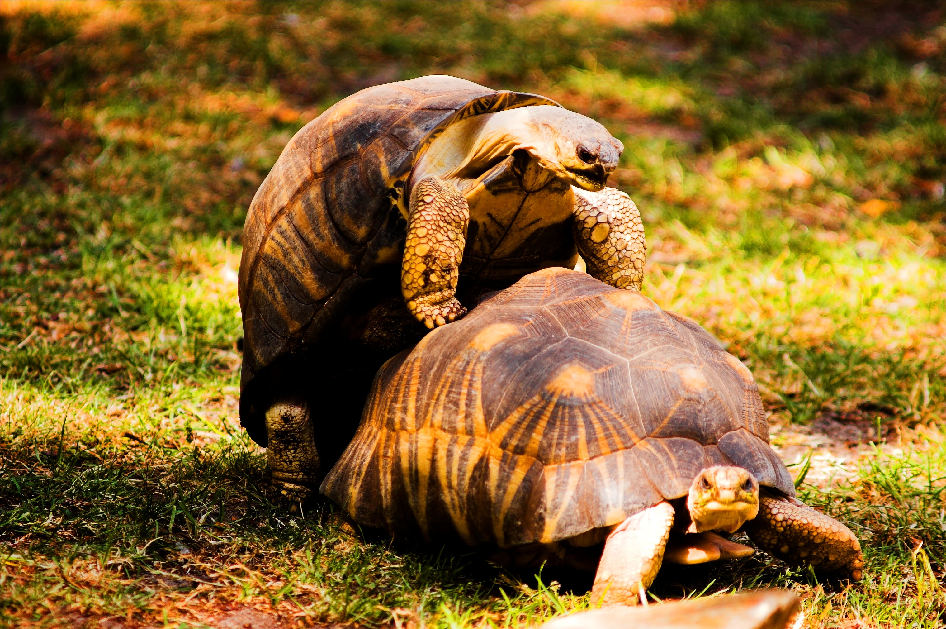
Two radiated tortoises in the grass, one mounting the other.
Radiated tortoises in Réserve spéciale du Cap Sainte-Marie.

Réserve spéciale du Cap Sainte-Marie history and protected-area timeline

The Réserve spéciale du Cap Sainte-Marie was established as a protected area in 1962, during the early decades of Madagascar's formal system of national parks and reserves. Its creation reflected a growing recognition of the unique ecological value of the island's southern dry zones, particularly for reptile species with very limited ranges.

Since its establishment, the reserve has served both as a permanent refuge for tortoise populations and as a reference area for herpetological research in Madagascar's arid south. Conservation attention has grown significantly over recent decades as the radiated tortoise and the spider tortoise have come under severe pressure from habitat conversion and illegal collection, increasing the strategic importance of well-protected sites such as Cap Sainte-Marie.

Réserve spéciale du Cap Sainte-Marie landscape and geographic character

The landscape of the Cap Sainte-Marie reserve is shaped by its coastal position at the very southern end of Madagascar. The terrain is low-lying, sandy, and rocky, with sparse vegetation that is well adapted to prolonged drought and strong winds. Thorny euphorbias, didierea bushes, and low shrubs form the dominant plant structure, creating the classic profile of Madagascar's spiny thicket biome.

The coastline near the reserve consists of exposed headlands, small cliffs, and sandy stretches formed where the land finally gives way to the sea. The interior of the reserve is marked by rolling, semi-arid country behind these coastal formations, with little surface water and a generally harsh, sun-bleached appearance. The result is a stark and minimalist scenery, visually quite distinct from the greener forests of eastern Madagascar.

Réserve spéciale du Cap Sainte-Marie ecosystems, habitats, and plant life

The reserve's ecological identity is defined by the dry spiny thicket that covers much of its area, one of Madagascar's most specialized and most fragile habitat types. This vegetation is dominated by thorny succulents, didierea, and xerophytic shrubs that survive in soil with low organic content and minimal rainfall. The ecosystem is highly adapted to drought, salt-laden coastal winds, and intense sun exposure.

Within this difficult environment, reptiles are by far the most conspicuous vertebrate group, and the reserve serves as a vital reservoir for species that are often rare or absent elsewhere in Madagascar. Mammalian and avian diversity is lower than in forested parts of the island, reflecting the limitations imposed by aridity and sparse cover.

Réserve spéciale du Cap Sainte-Marie wildlife and species highlights

The reserve is internationally recognized as one of the key sites for the conservation of the radiated tortoise, Astrochelys radiata, a strikingly patterned species whose survival in the wild has become increasingly threatened. It also supports populations of the spider tortoise, Pyxis arachnoides, another arid-zone specialist endemic to the south and southwest of Madagascar. Both species have benefited from the relative protection and remoteness of the Cap Sainte-Marie area, where densities of radiated tortoises have been reported at remarkably high levels.

Among other wildlife, the reserve hosts the sand lizard Chalarodon madagascariensis, which is endemic to this region of southern Madagascar. Mammal life includes the Madagascar fruit bat, also known as the Madagascar rousette, and the gray-brown mouse lemur, one of the smallest primates in the world. The Malagasy tree boa is also documented in the area. The wildlife profile of the reserve reflects the broader arid-zone fauna of southern Madagascar, where reptiles dominate and mammals are typically small, nocturnal, or tree-dependent.

Réserve spéciale du Cap Sainte-Marie conservation status and protection priorities

The conservation value of the Réserve spéciale du Cap Sainte-Marie is exceptionally high for its size. Although the area covers only a few square kilometers, it protects globally significant populations of threatened tortoise species, especially the radiated tortoise and the spider tortoise, both of which are considered among the most vulnerable reptiles in the world. The reserve's status as an IUCN Category IV area reflects its role as a habitat and species management zone specifically tailored to safeguard these reptiles and the fragile spiny thicket they inhabit.

In the wider context of Madagascar's biodiversity crisis, where habitat loss and the illegal pet trade have devastated tortoise populations across the south, Cap Sainte-Marie has become a priority site for conservation investment and management. Its combination of legal protection, remoteness, and high tortoise densities makes it both a refuge and a baseline site for monitoring the long-term fate of Madagascar's iconic dry-zone reptile fauna.

Réserve spéciale du Cap Sainte-Marie cultural meaning and human context

The Cap Sainte-Marie region lies deep within the traditional territory of the Antandroy and Mahafaly peoples, communities historically adapted to one of the harshest climates in Madagascar. Life in this part of the island has long centered on subsistence agriculture, zebu herding, and the harvesting of wild plants and animals from the spiny forests. The reserve's remote setting places it within a broader cultural landscape of southern Madagascar where ancestral practices, funerary traditions, and a strong connection to the arid land remain important expressions of regional identity.

Top sights and standout views in Réserve spéciale du Cap Sainte-Marie

The reserve's most distinctive quality is its role as one of the densest remaining wild refuges of the radiated tortoise, a species that has become a symbol of Madagascar's biodiversity heritage. Its location at the southern tip of the island also makes it a landmark for travelers and researchers interested in the southernmost extremity of Madagascar's natural world.

Best time to visit Réserve spéciale du Cap Sainte-Marie

The climate at the southern tip of Madagascar is hot and dry for much of the year, with a brief cooler and slightly wetter period during the southern winter. The cooler months are generally more comfortable for moving through the open terrain and for observing tortoises and reptiles, which remain active in milder conditions. The hot, dry season offers harsher light and temperatures but also brings reptiles out into the open, while coastal winds can intensify along the capes during transitional periods.
Monthly climate preview

Long-term temperature ranges and monthly precipitation recorded at the representative coordinate

Annual Climate Normals and Weather Patterns in Réserve spéciale du Cap Sainte-Marie

Temperature and precipitation measurements track a consistent annual cycle across the sampled coordinate within Réserve spéciale du Cap Sainte-Marie. Deeper analysis of monthly climate normals reveals full baseline trends across the entire twelve-month span.
Annual mean24 °C
21 °C27 °C
Jan27°
Feb27°
Mar26°
Apr25°
May23°
Jun22°
Jul21°
Aug21°
Sep22°
Oct24°
Nov25°
Dec26°
Warmest month
January

26.7 °C

Coolest month
July

20.8 °C

Wettest month
February

5.1 mm/day

Driest month
August

0.7 mm/day

Park location guide

Geography guide, regional context, and park location map for Réserve spéciale du Cap Sainte-Marie

Réserve spéciale du Cap Sainte-Marie park geography, regions, and map view in Madagascar

Understand where Réserve spéciale du Cap Sainte-Marie sits in Madagascar through a broader geographic reading of the surrounding landscape, nearby location context, and its mapped position within the national park landscape.

How Réserve spéciale du Cap Sainte-Marie fits into Madagascar

Madagascar is an island nation in the Indian Ocean, positioned off the southeastern coast of Africa. As the world's fourth-largest island and second-largest island country, it stands out for its exceptional biodiversity, over 90% of its wildlife is endemic, making it one of 17 megadiverse countries. The population is approximately 32 million, with Antananarivo as both the capital and largest city.

Wider geography shaping Réserve spéciale du Cap Sainte-Marie in Madagascar

Madagascar lies in the Indian Ocean off the southeastern coast of Africa, separated from the mainland by the Mozambique Channel. The island is situated approximately 400 km from the African continent. As the world's fourth-largest island, it also includes numerous smaller peripheral islands.

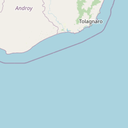
Map view of Réserve spéciale du Cap Sainte-Marie

Use this park location map to pinpoint Réserve spéciale du Cap Sainte-Marie in Madagascar, understand its exact geographic position, and read its mapped placement within the surrounding landscape more clearly.

Pigeon | © OpenStreetMap contributors

Location context for Réserve spéciale du Cap Sainte-Marie

Androy

Visualizing the dry spiny thicket habitats and southernmost coastal terrain of Madagascar

Réserve spéciale du Cap Sainte-Marie Photos and Landscape Scenery Gallery

Examine professional field photography documenting the harsh coastal terrain and arid spiny thicket habitats of Réserve spéciale du Cap Sainte-Marie. Visual reference collections reveal the austere beauty and remote character of Madagascar's southernmost protected wilderness.

Two radiated tortoises in the grass, one mounting the other.

Park atlas

Compare surrounding coastal reserves and arid spiny thicket landscapes across southern Madagascar

Parks Near Réserve spéciale du Cap Sainte-Marie and Regional Protected Areas

Browse protected areas and regional reserves connected to the austere coastal habitats of Réserve spéciale du Cap Sainte-Marie. Evaluating neighboring terrain reveals broader ecological patterns across the dry southern tip of Madagascar.
Marine protected areaAtsimo-Andrefana
About 20 km away#1 closest

Southwest

Nosy Ve-Androka National Park Marine Protected Area: Geographic and Atlas Discovery

Understand its marine landscape and regional geographic context.

Delve into Nosy Ve-Androka National Park, a critical marine protected area located in Madagascar's Atsimo-Andrefana region. This park offers a focused look at protected marine geography, allowing for detailed atlas exploration of its mapped boundaries and its role within the surrounding natural landscapes. Understand the specific geographic identity and conservation significance of this vital protected area through structured data.

Area
914.45 km²
Climate
Tropical
Access
Moderate access
Water
Water-dominated
National parkMadagascar
About 126 km away#2 closest

Northwest

Tsimanampetsotsa National Park: National Park Protected Landscape and Geographic Features

Mapping the protected area boundaries and landscape context.

Delve into the protected landscape identity of Tsimanampetsotsa National Park, a designated national park. This profile focuses on its geographic significance, providing a clear view of its mapped boundaries and the surrounding natural terrain. Understand its role as a protected area within the larger atlas for comprehensive geographic exploration.

Area
432 km²
Established
1927
Relief
Mixed relief
Climate
Arid
Wildlife reserveAnosy
About 130 km away#3 closest

Northeast

Berenty Reserve Wildlife Reserve in the Anosy Region of Southern Madagascar

Spiny forest ecology and riverine landscape mapping

Berenty Reserve offers a concentrated look at the semi-arid spiny forests of southern Madagascar. This wildlife reserve, located along the Mandrare River in the Anosy region, serves as a vital protected area for observing endemic species within a striking terrain of cactus-like plants, baobabs, and thorny thickets.

Relief
Lowland
Climate
Arid
Access
Moderate access
Scope
Terrestrial
National parkAtsimo-Andrefana
About 184 km away#4 closest

Northwest

Tsimanampetsotsa National Park: A Geographic Overview of the Mahafaly Plateau and Spiny Forest

Protected landscapes and wetland geography in Southwestern Madagascar.

Located in the Atsimo-Andrefana region, Tsimanampetsotsa National Park protects a rare convergence of limestone sinkholes, salt-tolerant lake ecosystems, and ancient spiny forest thickets. This atlas record details the park's structural boundaries and its critical role as a site for plant endemism and prehistoric subfossil preservation within the broader Madagascar geographic context.

Area
432 km²
Established
1927
IUCN
II
Relief
Upland
National parkMadagascar
About 189 km away#5 closest

Northeast

Andohahela National Park: Protected Landscape and Geographic Atlas Context in Madagascar

Explore the mapped terrain and regional park geography.

Understand Andohahela National Park as a distinct national park entity, focusing on its geographic setting and protected landscape characteristics within Madagascar. This detail page provides structured data on the park's mapped boundaries and its regional importance, offering insights for anyone exploring protected areas and natural terrain through a geographic lens. It is an essential resource for understanding the park's specific context in the broader atlas.

Area
760 km²
Established
1998
IUCN
II
Visitors
1.3K annual
Nature reserveMadagascar
About 196 km away#6 closest

East

Mandena Conservation Zone: Protected Littoral Forest and Wetland Geography in Madagascar

A critical nature reserve near the southeastern coastline

Mandena Conservation Zone protects over 200 hectares of rare littoral forest and coastal swamp in southeastern Madagascar. As one of the few remaining fragments of this unique coastal ecosystem, the reserve provides a critical habitat for endemic lemur populations and serves as an important site for understanding the regional geography of the Tolagnaro area.

Area
2.3 km²
Relief
Lowland
Climate
Tropical
Access
Access unknown
Nature reserveAnosy
About 209 km away#7 closest

Northeast

Tsitongambarika Nature Reserve: Geographic Profile and Protected Forest Landscape

Lowland humid evergreen forest in the Anosy region

Tsitongambarika represents one of the final remaining lowland humid evergreen forest tracts in southern Madagascar. The reserve encompasses an extensive massif of ridges and the isolated Mount Ivohibe, supporting complex drainage networks that sustain the coastal water supply of the Anosy region. This protected landscape is fundamental for preserving regional biodiversity, including endemic lemurs, palm species, and specialized forest bird habitats across the southeastern Madagascar terrain.

Area
585.97 km²
Established
2015
IUCN
VI
Relief
Mountain
Nature reserveMadagascar
About 219 km away#8 closest

Northeast

Sainte Luce Reserve: Mapping Madagascar's Coastal Rainforest and Nature Reserve Boundaries

Coastal littoral forest, rare ebony enclaves, and mangrove ecosystems.

Located on the southeastern coast of Madagascar, Sainte Luce Reserve represents an intensive conservation area for littoral forest ecosystems. The reserve protects a unique linear landscape of Pandanus rainforests, white-sand ebony stands, and riverine mangroves, serving as a sanctuary for endangered palms and various endemic lemur species within its concentrated geographic footprint.

Area
0.4 km²
Established
2009
Visitors
50 annual
Relief
Lowland

Common questions about visiting, size, designation, and location context for Réserve spéciale du Cap Sainte-Marie

Réserve spéciale du Cap Sainte-Marie FAQs for park facts, access, geography, and protected area context

Find quick answers about Réserve spéciale du Cap Sainte-Marie, including protected-area facts, park geography, trail and visitor context, and how the park fits into its surrounding country and regional landscape.
MoriAtlas Explorer

Continue Your Protected Areas Search Across the Global Atlas

Deepen your exploration by continuing the structured search for national parks and protected areas worldwide. Utilize the comprehensive filtering capabilities to compare different conservation landscapes and refine your understanding of global park geography. Discover more about the distribution and characteristics of protected natural areas.

Global natural geography