
Mori Atlas logo
Protected areaBrinkenweiher

A seventeenth-century artificial lake system preserved as a vital nature reserve in Rhineland-Palatinate

Brinkenweiher Protected Area: Mapping the Historic Wetland Landscapes of the Westerwald Region

(Naturschutzgebiet Brinkenweiher)

The Brinkenweiher is an integral component of the Westerwälder Seenplatte, a historic district of man-made fish ponds in Germany formed by the seventeenth-century damming of the Holzbach headwaters. This protected area showcases a transition between dense eastern forest cover, marshy northern shorelines, and open western meadows. Since its 1977 designation as a nature reserve, the site has evolved into a key wetland habitat owned by the NABU-Stiftung Nationales Naturerbe.

WesterwaldWesterwälder SeenplatteWaldweiherfreshwater lakenature reservemarshland
Digital vector-style illustration of a pond fed by a waterfall cascading from rocky cliffs, set against a backdrop of pine forests and a sunrise or sunset sky, with a small farm cart in a foreground field.

Brinkenweiher

Protected area

Park overview

Structured park overview, official facts, and landscape profile for Brinkenweiher

Brinkenweiher park facts, protected area profile, and essential visitor context

Review the core facts for Brinkenweiher, including designation, size, terrain, visitor scale, habitats, and operating context in one park-focused overview.

About Brinkenweiher

Brinkenweiher occupies a distinctive position within the Westerwälder Seenplatte, a chain of historic Weiher strung across the rolling Westerwald hills between the towns of Montabaur, Hachenburg and Dierdorf in eastern Rhineland-Palatinate. Although each lake in the district has its own character, the Brinkenweiher is notable for how clearly its surrounding landscape changes around its shoreline, a quality that gives the protected area both scenic appeal and strong ecological value.

The pond lies at roughly 406 meters above sea level, around 400 meters east of the settlement of Steinen. Its water surface of approximately twenty-one hectares makes it the third largest Weiher of the Seemplatte, after the Dreifelder Weiher and the Postweiher, and only a narrow dam crossed by a path separates it from the neighboring Postweiher to the south. The outlet of the Brinkenweiher feeds into the Holzbach, eventually joining the Wied river system in the northern Westerwald.

Today the pond's character is shaped by a sharp ecological transition between its edges. To the east rises a dense forest that comes right down to the water, providing shelter and dark, sheltered habitat along almost half the shore. To the north, the lake gives way to a marshy littoral zone that is one of the most ecologically valuable features of the protected area; here shallow water, reed beds and wet ground provide habitat for uncommon fauna, especially nesting birds. Moving west, the marshy shore gradually tapers and is replaced by open meadows belonging to the village of Steinen. The contrast between closed woodland, open wetland, and pastoral meadow within a single small lake basin is what makes the Brinkenweiher a coherent and easily understood nature reserve.

Quick facts and research context for Brinkenweiher

Brinkenweiher is a designated nature reserve within the Westerwaldkreis, in the Westerwald hill country of eastern Rhineland-Palatinate. It is part of the Westerwälder Seenplatte, a collection of historic fish ponds arranged west of the district capital Montabaur. The pond covers roughly twenty-one hectares and sits at about 406 meters above sea level. Since 1977 it has been protected as a Naturschutzgebiet, and since 2019 it has been held by the NABU-Stiftung Nationales Naturerbe together with the other Weiher of the Seenplatte. Its outflow feeds into the Holzbach, which ultimately reaches the Wied river.

Protection and recognition

Documented terrestrial conservation scope and recognition records

Brinkenweiher Protection Status and Official Designation History

Brinkenweiher features a documented terrestrial protection status established in 1977 with independent management parameters. Official designation history outlines the recorded conservation framework without imported international recognition sources.

Protection details

Protection scope
Terrestrial
Designated year
1977
Transboundary protection
No
Park context

Deeper park guide and search-rich context for Brinkenweiher

Brinkenweiher history, landscape, wildlife, and travel context

Explore Brinkenweiher through its history, landscape character, ecosystems, wildlife, conservation priorities, cultural context, and seasonal travel timing in a structured park guide built for atlas discovery and search intent.

Why Brinkenweiher stands out

Brinkenweiher is best known as a protected lowland-style Waldweiher with sharply contrasting shorelines: a dense wooded fringe on the eastern side, a marshy, bird-rich northern shore, and open meadows belonging to the village of Steinen on the western side. It is also recognized as one of the original seventeenth-century fish-pond lakes of the Westerwälder Seenplatte, designed by Count Friedrich III of Wied to dam the headwaters of the Holzbach.
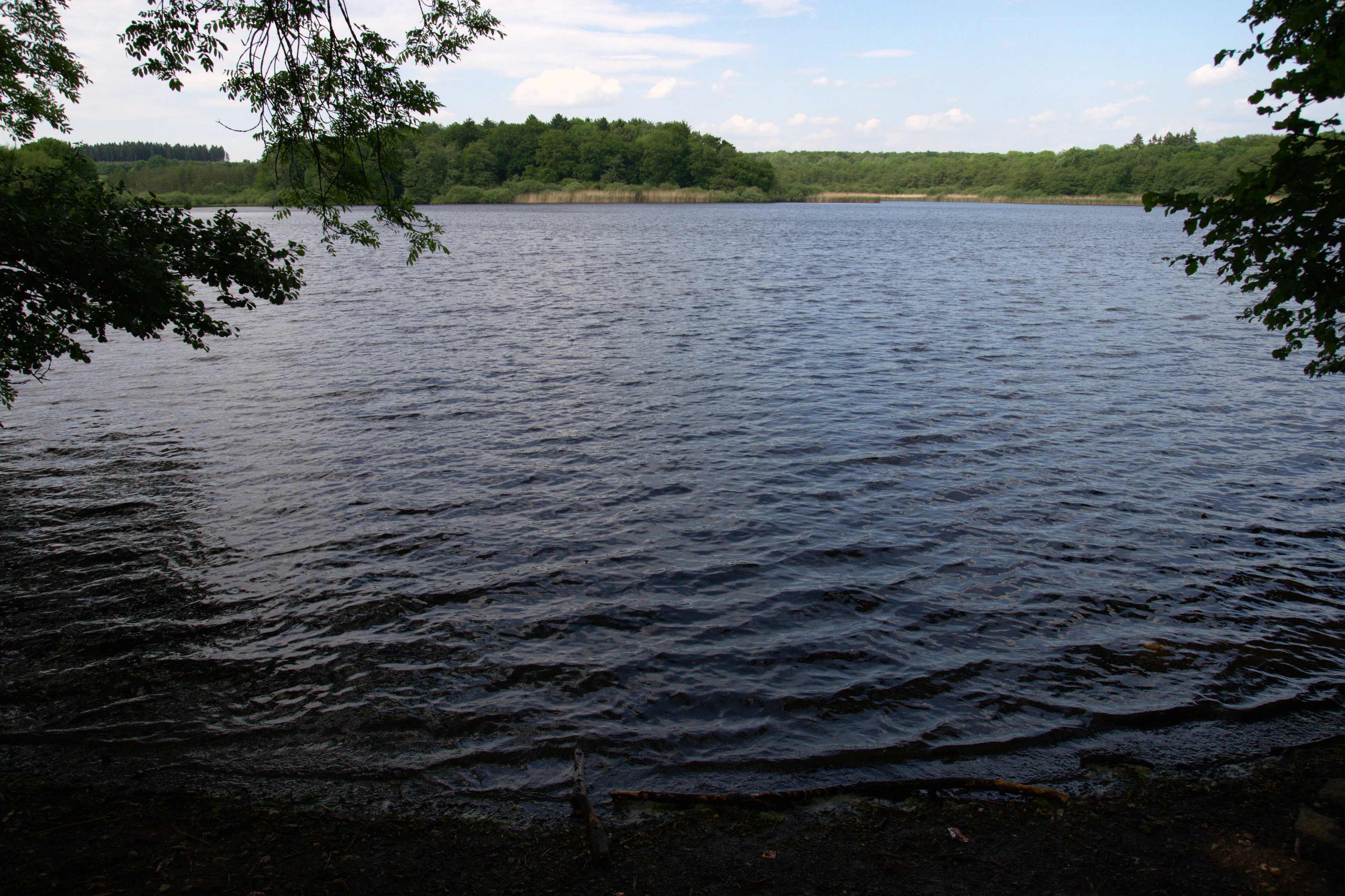
A wide view across a rippling lake surrounded by green forest under a partly cloudy sky.
A view across Brinkenweiher lake in the Westerwald region.

Brinkenweiher history and protected-area timeline

The Brinkenweiher has its origins in the mid seventeenth century, when Count Friedrich III of Wied had the small spring streams feeding the upper Holzbach dammed in order to create a fish pond. Around 1660 this artificial lake was established alongside other Weiher in what would later be called the Westerwälder Seenplatte, and for more than three hundred years the pond was managed primarily for Fischzucht, the cultivation of freshwater fish.

In 1977 the Weiher was officially declared a Naturschutzgebiet under German nature protection law, ending its role as a working fish pond and placing it under a new regime focused on ecological conservation. Since 2019 the Brinkenweiher, together with the other Weiher of the Seenplatte, has been in the ownership of the NABU-Stiftung Nationales Naturerbe, the conservation foundation of the German nature organization NABU. This transfer cemented the nature-reserve status of the lake and placed its long-term management in the hands of a dedicated national-heritage foundation.

Brinkenweiher landscape and geographic character

The Brinkenweiher sits in the gently undulating landscape of the Westerwald, a low-mountain region of forested ridges, meadows and shallow valleys in eastern Rhineland-Palatinate. Its surface lies at roughly 406 meters above sea level, slightly above the surrounding farmland, and its basin is entirely artificial, shaped by the early modern damming of the headwater brooks of the Holzbach rather than by glacial or tectonic processes.

Visually, the lake is defined by the changing character of its shoreline. The eastern shore is enclosed by a dense, mature forest whose trees come down to the water's edge, giving the lake a quiet, shadowed appearance from that side. The southern shore is the lowest and most artificial feature of the landscape: a narrow earthen dam, just wide enough to carry a footpath, separates the Brinkenweiher from the Postweiher, the next lake south in the Westerwälder Seenplatte.

Brinkenweiher ecosystems, habitats, and plant life

The nature reserve protects an unusually varied lake-margin ecosystem within a very small area. The pond itself is open freshwater, but its value lies in the gradients between open water, marsh, wet meadow and forest edge that surround it. Because the pond was historically used for fish cultivation, the present-day nature reserve combines relict cultural water bodies with a recovering natural shoreline community.

The eastern wooded strip and the northern marsh zone together define the ecological character of the protected area. The forest edge provides shade, leaf litter input, and terrestrial habitat for species that depend on woodland next to water, while the marshy northern shore offers the shallow, structured habitat that supports amphibian, invertebrate, and especially breeding bird populations. The transition from wet marsh to dry meadow on the western side adds additional habitat variety within walking distance.

Brinkenweiher wildlife and species highlights

Wildlife is the principal reason the Brinkenweiher earned nature reserve status sources support. The marshy northern shore is singled out as habitat for uncommon fauna, especially nesting birds, which use the reed fringe and shallow water for breeding and feeding. Songbirds, waterfowl, and other wetland species are characteristic of the reserve, while the surrounding forest supports typical Westerwald woodland birdlife and small mammals.

The combined presence of woodland to the east, marshland to the north, and meadow to the west means the small reserve supports a wide range of birdlife for its size. This mosaic of habitats is the reason the lake remains a focus of conservation interest even within a region, the Westerwald, that is otherwise dominated by managed forest and farmland.

Brinkenweiher conservation status and protection priorities

Brinkenweiher has been formally protected as a Naturschutzgebiet since 1977, one of a network of designated nature reserves within the Westerwaldkreis. Its protected status places it within the German system of strict nature reserves, in which the primary goal is the conservation of habitats and species rather than fisheries or other commercial uses. The end of fish-pond operations in 1977 was the decisive moment that allowed the shoreline habitat, especially the marshy northern fringe, to recover and diversify.

Since 2019 the long-term conservation of the lake has been secured through its ownership by the NABU-Stiftung Nationales Naturerbe, a national-heritage foundation associated with the German nature organization NABU. Holding the pond together with the other Weiher of the Westerwälder Seenplatte gives the foundation a coordinated role in protecting the entire lake district as a single ecological unit. The narrow dam separating the Brinkenweiher from the Postweiher also has conservation significance, as it maintains the hydrological link between adjacent ponds without turning them into a single uniform water body.

Brinkenweiher cultural meaning and human context

The Brinkenweiher is a surviving element of the early modern fish-pond culture of the Westerwald, a tradition in which the counts and later rulers of the region used the headwater brooks of the Wied river system to create artificial Weiher for fish production. Its foundation around 1660 by Count Friedrich III of Wied ties the lake directly to the noble estates and fisheries of the Wied dynasty and to the broader history of Waldweiher, forest ponds, in the German Mittelgebirge.

Its present-day role as a nature reserve reflects a broader shift in regional identity, from a working landscape of ponds, mills, and forestry to a landscape valued primarily for biodiversity and quiet recreation. Today the reserve is intertwined with the village of Steinen, whose meadows form part of the western shore, and with the wider Westerwälder Seenplatte, which has become a recognized regional destination for nature-oriented visitors.

Top sights and standout views in Brinkenweiher

The highlights of the Brinkenweiher are the contrast between the dense eastern forest and the open marshy northern shore, the historic seventeenth-century damming of the Holzbach headwaters that gave the lake its existence, and the protected status it has carried since 1977. Its ownership by the NABU-Stiftung Nationales Naturerbe since 2019 and its position within the larger Westerwälder Seenplatte make it a particularly coherent example of how a small artificial Weiher can become the center of a meaningful protected area.

Best time to visit Brinkenweiher

Because the Brinkenweiher is a low-elevation Westerwald lake at around 406 meters above sea level, its character shifts with the seasons in the typical rhythm of central German countryside. Spring and early summer are the most biologically active period: water levels stabilize, the marshy northern shore comes alive with breeding waterbirds and songbirds, and the contrast between woodland, marsh and meadow is at its sharpest. This is generally the most rewarding season for visitors interested in birdlife and wetland habitat.

Late summer and autumn bring quieter conditions, warmer water, and the colorful foliage of the surrounding Westerwald forest, which closes in visually over the eastern shore. Winter visits can be atmospheric, especially when frost lightly covers the meadows of Steinen and the lake surface acquires a quiet stillness, though access around wetland edges may be more difficult. The lake is most engaging for nature observation from spring through autumn; ice safety and exact access conditions are not part of the protected area's profile and should not be relied on.

Monthly climate preview

Measured annual temperature progression and monthly precipitation averages for Brinkenweiher

Brinkenweiher Climate Normals and Long-Term Weather by Month

Long-term NASA data records reveal the annual temperature and precipitation rhythm across representative coordinates at Brinkenweiher. Detailed monthly climate profiles track average temperature extremes and precipitation totals for deeper environmental analysis.
Annual mean9 °C
0 °C19 °C
Jan
Feb
Mar
Apr
May12°
Jun16°
Jul19°
Aug18°
Sep14°
Oct
Nov
Dec
Warmest month
July

18.5 °C

Coolest month
January

-0.4 °C

Wettest month
December

2.5 mm/day

Driest month
April

1.6 mm/day

Park location guide

Geography guide, regional context, and park location map for Brinkenweiher

Brinkenweiher park geography, regions, and map view in Germany

Understand where Brinkenweiher sits in Germany through a broader geographic reading of the surrounding landscape, nearby location context, and its mapped position within the national park landscape.

How Brinkenweiher fits into Germany

Germany is a federal republic in Western and Central Europe with a population of over 83 million across sixteen constituent states. It is Europe's largest economy by nominal GDP and a major global exporter and importer. The capital is Berlin, and the country borders Denmark, Poland, Czech Republic, Austria, Switzerland, France, Luxembourg, Belgium, and the Netherlands.

Wider geography shaping Brinkenweiher in Germany

Germany is located in Western and Central Europe, spanning 357,022 km². It borders Denmark to the north, Poland and the Czech Republic to the east, Austria and Switzerland to the south, and France, Luxembourg, Belgium, and the Netherlands to the west. The country has coastlines on the Baltic Sea and North Sea to the north, with the Alps located in the southern region.

Map view of Brinkenweiher

Use this park location map to pinpoint Brinkenweiher in Germany, understand its exact geographic position, and read its mapped placement within the surrounding landscape more clearly.

Pigeon | © OpenStreetMap contributors

Explore Brinkenweiher images highlighting forested shores and wetland habitats

Brinkenweiher Photos and Scenery: Visualizing the Protected Wetland Landscapes

Visual records capture the distinctive character of Brinkenweiher, revealing contrasting forested margins and marshy shorelines across the protected Westerwald lake district. Detailed photographic documentation helps visitors examine the terrain, water margins, and conservation landscape features more closely.

A wide view across a rippling lake surrounded by green forest under a partly cloudy sky.

A wide landscape view of Brinkenweiher lake with green grassy meadows in the foreground, grazing cattle to the left, and a metal water trough on wheels to the right, all set against a background of dense forest and a partly cloudy sky.

Park atlas

Discover connected wetland reserves and regional water bodies across the Westerwald

Explore Parks Near Brinkenweiher and Surrounding Protected Landscapes

Continue browsing protected areas near Brinkenweiher to examine adjacent woodland lakes and shared lowland habitats. Comparing these regional reserves reveals the wider ecological patterns shaping the Westerwälder Seenplatte lake district.
Nature reserveRheinland-Pfalz
About 1.7 km away#1 closest

Northeast

Westerwälder Seen: Nature Reserve Geography and Mapped Pond Landscape in Rhineland-Palatinate

Historic reservoir systems, wetland habitats, and upland plateau terrain

Westerwälder Seen is a sprawling nature reserve defined by its system of seven interconnected, man-made ponds and surrounding wetland fringes. Located in the heart of the Westerwald in Rhineland-Palatinate, this site serves as a prime example of historical land management evolving into a vital ecological refuge for waterbirds, amphibians, and diverse brook forest communities.

Area
2.28 km²
Established
1650
Relief
Upland
Climate
Temperate
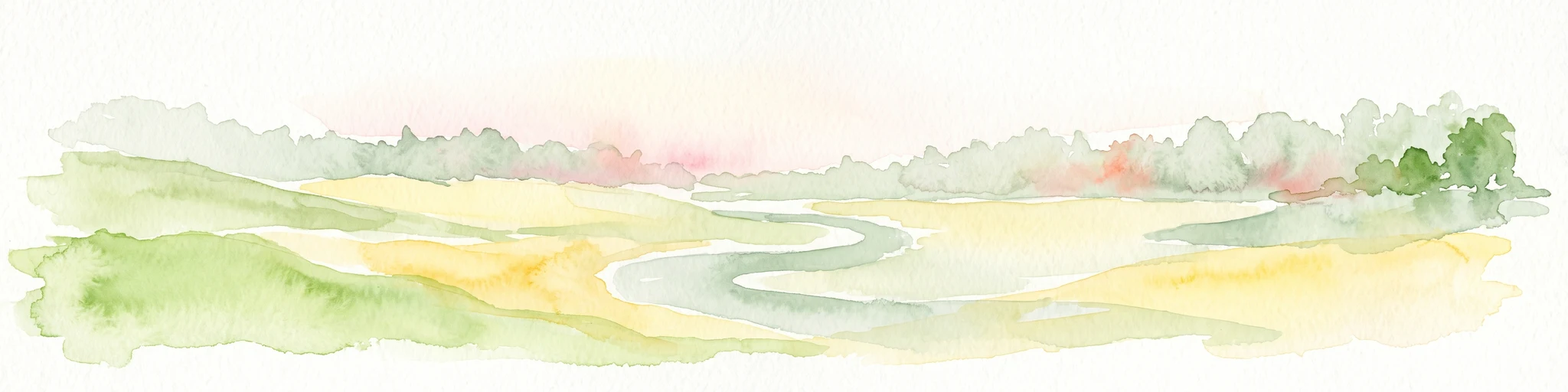
A soft watercolor painting of a wide, flat landscape with a winding stream and light green hills under a hazy sky.
Nature reserveRhineland-Palatinate
About 2.2 km away#2 closest

North

Dreifelder Weiher Nature Reserve and Westerwälder Seenplatte Protected Geography

A historic pond ecosystem in the northern Westerwald highlands

Spanning 123 hectares, Dreifelder Weiher serves as a vital nature reserve within the Rhenish Massif. Its shallow basin and seasonal drawdown cycles sustain a diverse landscape of reedbelts and marshes, reflecting the deep integration of German noble history and contemporary habitat protection.

Area
1.23 km²
Established
1668
Relief
Lowland
Climate
Temperate
Nature reserveWesterwaldkreis
About 3.7 km away#3 closest

East

Wölferlinger Weiher Nature Reserve: Geography and Protected Wetland Boundaries

Historic Westerwaldkreis pond and protected aquatic landscape

Wölferlinger Weiher represents a critical protected wetland within the Westerwaldkreis region of Germany. This detailed record highlights the pond's geographic role within the Westerwälder Seenplatte, covering its marshy fringes, shallow water zones, and surrounding moist meadows that define its protected area status.

Area
0.9 km²
Established
1979
Relief
Lowland
Climate
Temperate
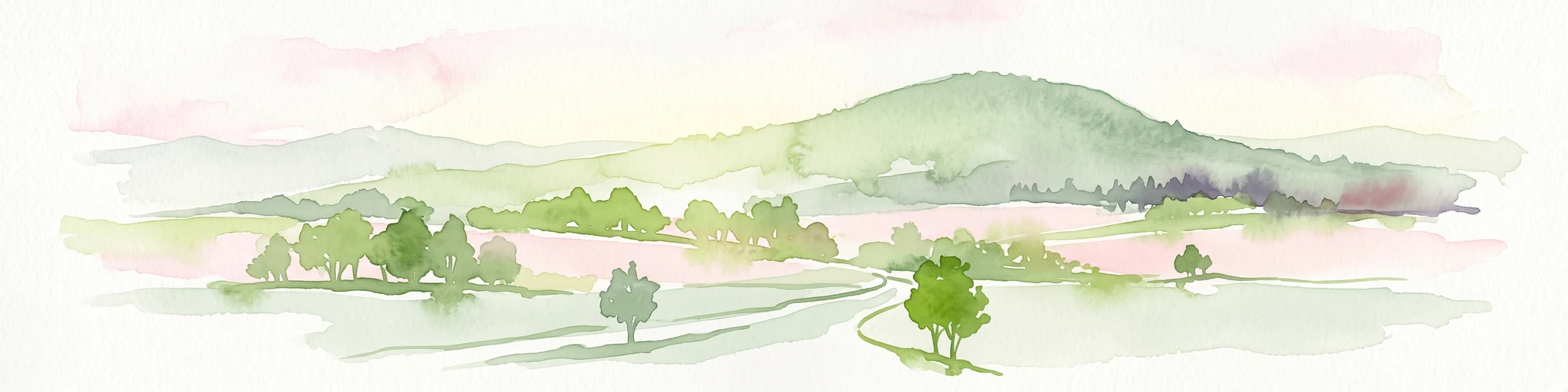
A soft, light watercolor painting of rolling green hills, scattered trees, and a winding path under a pale, warm sky.
Nature reserveWesterwaldkreis
About 9.2 km away#4 closest

South

Naturschutzgebiet Malberg: Geography and Protected Phonolite Landscapes in Westerwaldkreis

Geological exploration of a unique volcanic nature reserve

Naturschutzgebiet Malberg provides a focused look at a rare volcanic cupola in Germany. Centered on a 22-million-year-old phonolite summit, the reserve protects a complex environment of blockfields, craggy crevices, and natural rock caves that stand out as a sharp geographic anomaly amidst the gentle lowlands of the Montabaur Basin.

Area
0.96 km²
Established
1971
IUCN
IV
Relief
Mountain
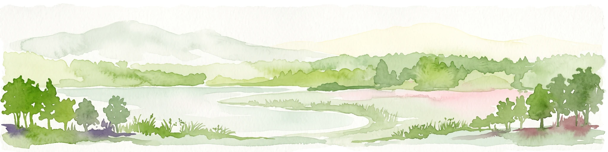
A horizontal watercolor painting depicting a soft, scenic landscape of a park with rolling hills, a central body of water, and surrounding trees.
Nature reserveWesterwaldkreis
About 14 km away#5 closest

Northeast

Bacher Lay Nature Reserve: Basalt Quarry Landscapes in Westerwaldkreis, Germany

Protected landscape with significant geological geotope features

Bacher Lay provides an informative look at a compact nature reserve formed within a former basalt quarry. Featuring the striking Pfaffenmal columnar basalt formation and a mosaic of river valley habitats, the site serves as a vital protected area in the Westerwaldkreis region for studying habitat succession and geological formations.

Area
0.447 km²
Established
1996
IUCN
IV
Relief
Upland
Watercolor illustration of a winding stream flowing through a lush green valley with rolling hills in the background.
Nature reserveRheinland-Pfalz
About 15 km away#6 closest

East

Holzbachdurchbruch: Basalt Gorge and Protected Nature Reserve in the Westerwald Highlands

Geological landscapes and protected stream valleys in Rheinland-Pfalz.

The Holzbachdurchbruch nature reserve is a focused, high-relief landscape defined by its classic breakthrough valley where the Holzbach cuts through resistant basalt bedrock. This protected area offers a look at the volcanic terrain and forest-stream mosaics that define the Westerwald, serving as a landmark site for understanding the regional geography and geological heritage of Germany.

Area
0.21 km²
Established
1961
IUCN
IV
Relief
Upland
Watercolor painting of a soft, hazy landscape featuring rolling green hills, distant mountains, and water in the foreground.
Nature reserveWesterwaldkreis
About 20 km away#7 closest

East

Breitenbachtalsperre Nature Reserve: Geography and Protected Habitat Mapping in Westerwaldkreis

Managed wetland and reservoir landscape in western Germany

Breitenbachtalsperre protects an important reservoir ecosystem, including shallow margins and wet meadows near Waigandshain. This nature reserve provides a focused look at habitat management in the Westerwald, where stream-fed waters sustain diverse plant societies and wildlife in a compact, protected basin.

Area
0.47 km²
Established
1988
IUCN
IV
Nature reserveRheinland-Pfalz
About 21 km away#8 closest

East

Wacholderheide bei Westernohe Nature Reserve Protected Area Atlas and Geographic Map Context

Juniper heathland mosaic in the German Westerwald region

Spanning 14 hectares, Wacholderheide bei Westernohe acts as a vital protected pocket of open heathland framed by dense spruce forests. The reserve supports a specialized community of arnica, common heather, and juniper, sustained by decades of consistent grazing and mechanical mowing that define its unique regional character.

Area
0.14 km²
Established
1967
IUCN
IV

Common questions about visiting, size, designation, and location context for Brinkenweiher

Brinkenweiher FAQs for park facts, access, geography, and protected area context

Find quick answers about Brinkenweiher, including protected-area facts, park geography, trail and visitor context, and how the park fits into its surrounding country and regional landscape.
MoriAtlas Explorer

Continue Your Protected Areas Search Across the Global Atlas

Deepen your exploration by continuing the structured search for national parks and protected areas worldwide. Utilize the comprehensive filtering capabilities to compare different conservation landscapes and refine your understanding of global park geography. Discover more about the distribution and characteristics of protected natural areas.

Global natural geography