
Mori Atlas logo
Nature reserveWesterwälder Seen

Mapping the ecological mosaic of historic reservoirs, sedge marshes, and brook forests across the plateau

Westerwälder Seen: A Protected Nature Reserve and Cultural Pond Landscape in Rhineland-Palatinate

Westerwälder Seen represents a distinctive protected landscape within the German state of Rhineland-Palatinate, where centuries of traditional fish farming have shaped a rare, shallow pond system on a gently undulating plateau. This nature reserve, composed of seven interconnected waterbodies, serves as a crucial habitat for migratory waterbirds and wetland species while preserving a unique cultural heritage. Through map-based analysis and spatial discovery, understand the physical links between these reservoirs, the surrounding woodland fringe, and the broader topographical context of the Westerwald region.

Westerwaldpond landscapeshallow waterreservoir pondsreedbedswet meadows
A flat-style digital illustration depicting a calm lake framed by pine trees in the foreground, with distant rock formations and clouds in the background.

Westerwälder Seen

Nature reserve

Park overview

Structured park overview, official facts, and landscape profile for Westerwälder Seen

Westerwälder Seen park facts, protected area profile, and essential visitor context

Review the core facts for Westerwälder Seen, including designation, size, terrain, visitor scale, habitats, and operating context in one park-focused overview.

About Westerwälder Seen

The Westerwälder Seen form one of the most distinctive pond landscapes in the German Mittelgebirge. Set on a broad upland plateau in the Oberwesterwald, the seven waterbodies are the product of deliberate human design layered onto a naturally undulating landscape, with small streams such as the Wied, the Holzbach, and the Saynbach supplying the ponds and connecting them through a network of channels and ditches. Although each pond is, strictly speaking, a reservoir, the Westerwälder Seen read as a region of ponds and shallow wetlands, with fringing reedbeds, sedge stands, wet meadows, and adjacent riparian woodlands forming a continuous ecological mosaic.

The group is best understood in three parts. Near Dreifelden and Steinebach lie the Dreifelder Weiher, the largest at around 123 hectares, along with the Haidenweiher and the Hofmannsweiher, all tied to the Wied river system. Around Freilingen and Steinen stretch the Brinkenweiher, Postweiher, and Hausweiher, fed by the Holzbach and forming the Freilingen group. A short distance to the east lies the much smaller Wölferlinger Weiher, fed by the Saynbach and now largely overgrown through natural silting.

What gives the site its broader importance is the way these ponds sit within a larger transitional landscape. The plateau acts as a hinge between the higher Westerwald and the lower Westerwald toward the Rhine, with the Hachenburger Wald rising to the north and the Sayn valley opening to the south. Streams entering the plateau have carved soft channels into the elevated surface, and the resulting low-energy environment has allowed organic-rich sediments and shallow margins to accumulate over centuries. These conditions, which originally supported large-scale fish farming, now sustain one of the more important wetland bird habitats in the region.

The Westerwälder Seen are integrated into the regional identity of the Westerwald as a place where water management, forestry, and protected nature coexist. They are used for walking, cycling, and camping, and they form the backbone of a local tourist route linking all seven ponds, yet their deeper value lies in the conservation role they now play at both regional and European scales.

Quick facts and research context for Westerwälder Seen

The Westerwälder Seen comprise seven shallow ponds located on a high plateau in the Westerwald range of Rhineland-Palatinate, Germany, roughly bounded by Hachenburg, Westerburg, Montabaur, and Dierdorf. The waterbodies sit at an elevation of about 400 to 420 meters, with surrounding elevations rising to 494 meters at the Hachenburger Forst and falling to around 340 meters in the Sayn valley. They were reshaped into their current form in the seventeenth century, building on monastic fishpond traditions from earlier centuries, and are now owned by the NABU National Natural Heritage Foundation.

A substantial portion of the area is designated both as a European Fauna-Flora-Habitat site and as a European Bird Protection Area, while parts of the ponds and their margins have been formally declared nature reserves. The pond landscape therefore carries overlapping layers of regional, national, and European protection status, and the area functions simultaneously as a working cultural landscape, a recreational destination, and a conservation site for waterbirds and woodland species.

Protection and recognition

Terrestrial conservation framework and documented designation records

Westerwälder Seen Protection Status and Official Designation History

Westerwälder Seen maintains a documented terrestrial protection status established in two thousand and nineteen. Conservation records track the official designation framework and management scope associated with this protected landscape.

Protection details

Protection scope
Terrestrial
Designated year
2019
Transboundary protection
No
Park context

Deeper park guide and search-rich context for Westerwälder Seen

Westerwälder Seen history, landscape, wildlife, and travel context

Explore Westerwälder Seen through its history, landscape character, ecosystems, wildlife, conservation priorities, cultural context, and seasonal travel timing in a structured park guide built for atlas discovery and search intent.

Why Westerwälder Seen stands out

The Westerwälder Seen are best known as a steppe-like mosaic of shallow, historically managed ponds surrounded by fringing reedbeds, sedge stands, wet meadows, and brook forests. Their ponds are small enough to read as intimate water features rather than large lakes, yet, taken together, they form a coherent landscape mosaic recognized at European level for birdlife and habitat diversity. The site is especially notable for the combination of centuries-old cultural shaping and present-day ecological significance. Man-made fishponds from monastic and noble estate management have been overtaken by natural processes of reed expansion, shallow mudflats, and woodland encroachment, creating habitat for diving ducks, grebes, rails, herons, waders, and birds of prey such as the osprey and black stork. This rare overlap of well-preserved cultural heritage and functioning bird habitat is what sets the Westerwälder Seen apart from more conventional reservoir landscapes in Germany.
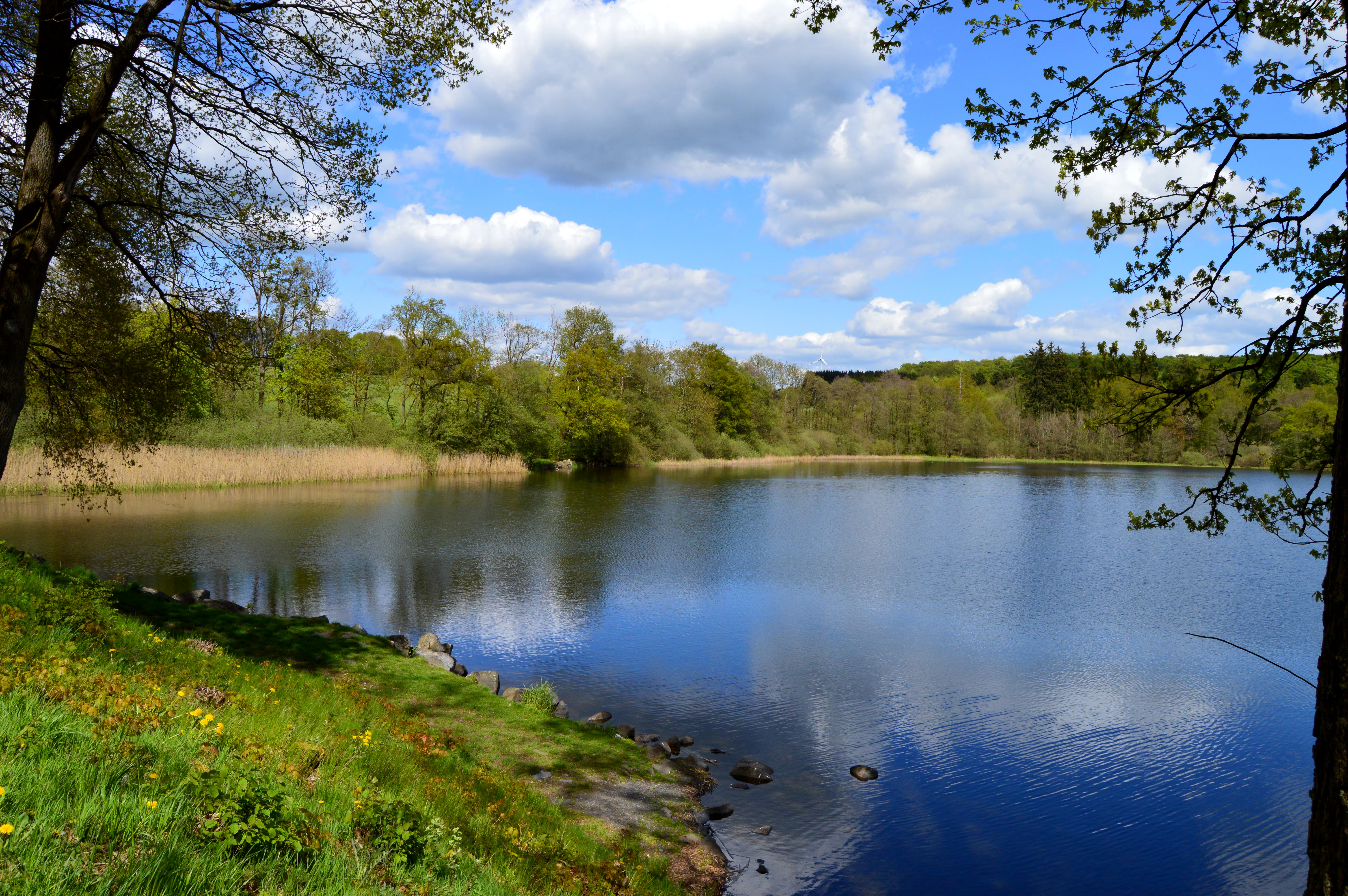
A wide view of a calm lake on a bright spring day with green grassy banks, trees in the foreground, and a blue sky with fluffy white clouds reflected in the water.
A peaceful spring day at the Dreifelder Weiher, one of the lakes in the Westerwälder Seen nature reserve.

Westerwälder Seen history and protected-area timeline

The Westerwälder Seen are not a natural lake district. All seven ponds are artificial, shaped by human hands over many centuries for fish cultivation. Monastic communities from regional monasteries were already running major fishpond operations in the area as early as the twelfth century, using the naturally damp terrain to establish large breeding ponds, including what would later grow into the Seeweiher, the historical core of the Dreifelder Weiher.

The ponds took on their present form in the seventeenth century. Around 1650, Count Friedrich of Wied, prince of the small Principality of Wied, enlarged existing ponds and ordered new ones dug, creating the system of seven large fishponds that still defines the landscape today. With a combined water surface of more than 1,000 Morgen, the ponds became a substantial regional fish operation, and the annual practice of lowering the water levels and harvesting fish each autumn turned into a widely known seasonal event across the Westerwald.

For roughly 350 years, the ponds remained in the ownership of the House of Wied through the Principality of Wied. In November 2019, the entire group of seven ponds and a total area of 228 hectares of shoreline woodland was sold to the NABU National Natural Heritage Foundation. Since then, the foundation, working with the state of Rhineland-Palatinate, has taken on long-term stewardship of the site, emphasizing both habitat protection and engagement of local residents and visitors in nature conservation.

Westerwälder Seen landscape and geographic character

The Westerwälder Seen lie on the Westerwälder Seenplatte, a gently rolling upland surface that forms the western edge of the Oberwesterwald. The plateau sits at roughly 400 to 420 meters in elevation and forms a clear natural boundary with the Herschbach-Dierdorf basin to the west, which marks the transition from the high Westerwald to the lower Westerwald toward the Rhine. To the north, the land rises into the wooded crests of the Hachenburger Wald, with elevation reaching about 494 meters at Glietzebeul in the Hachenburger Forst. To the south, the Sayn valley drops more steeply, falling to roughly 340 meters near Zürbach, where the young Sayn stream has cut a deep notch into the slope.

Seen as a whole, the landscape reads as a high plateau that lifts almost like a wall from the lower basins around it, with the ponds sitting in shallow basins on its upper surface. The Dreifelder, Haiden, and Hofmannsweiher occupy the western Dreifelden group, clustered near the Wied stream and set among open country associated with the Mertinger Heide. The Brinken, Post, and Hausweiher form the Freilingen group to the east, connected through channels along the Holzbach stream. The Wölferlinger Weiher lies a few kilometers further east near the village of Wölferlingen, where the Saynbach enters the lake, and it is the most heavily silted-up pond of the group.

The alignment of ponds follows the gentle surface contours rather than deep glacial or tectonic features. Surrounding the waterbodies are typical Mittelgebirge forests, patches of meadow, and lines of fringing woodland that follow the small streams, giving the landscape a layered rhythm of open water, reed and sedge margins, wet meadows, and mixed forests rising to the plateau edge.
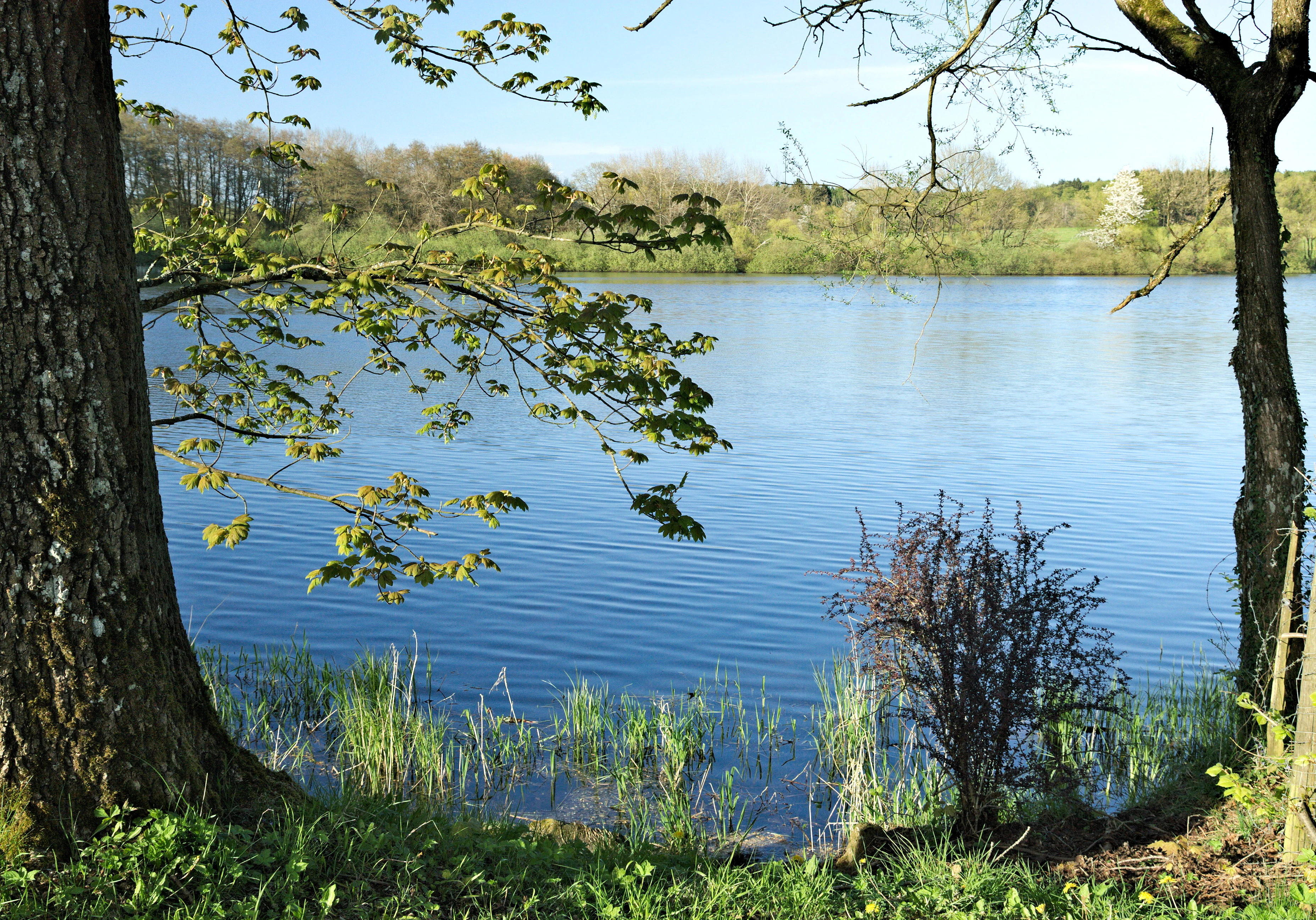
A serene view of a calm blue lake, framed by tree trunks and branches in the foreground, with a grassy bank and a wooded hillside visible across the water.
A peaceful view across the Hausweiher lake in the Westerwälder Seen area.

Westerwälder Seen ecosystems, habitats, and plant life

The Westerwälder Seenplatte is a low-energy, water-rich landscape whose ecological character has been defined by the deliberate impounding of small streams. The ponds themselves are shallow and partially silting, with extensive open-water areas, low shores, fringing reedbeds, sedge stands, and patches of wet woodland. Along the inflows, alder-dominated brook forests, scrub, and small meadows form ecotones that link the ponds to the wider plateau and to the slopes that frame it.

These habitat conditions support a rich wetland flora and fauna. The combination of open water, reedy margins, wet meadows, and warm sheltered woodland edges creates a diversified ecological mosaic despite the artificial origins of the lakes themselves. The ponds function less as reservoirs and more as a network of limnic habitats integrated into the surrounding terrestrial landscape, with vegetation responses closely tied to how water levels fluctuate through the seasons and across years.

The relative quietness, marginal character, and shallow profile of the ponds make them particularly useful for waterbirds and wetland birds, and their biotopes continue to evolve through natural processes of silting and reed encroachment. Over time, the very mechanisms that were once used to manage the ponds for fish have produced a habitat structure that supports birds, amphibians, and a broad wetland flora that would not exist in unmodified form on the Westerwald plateau today.
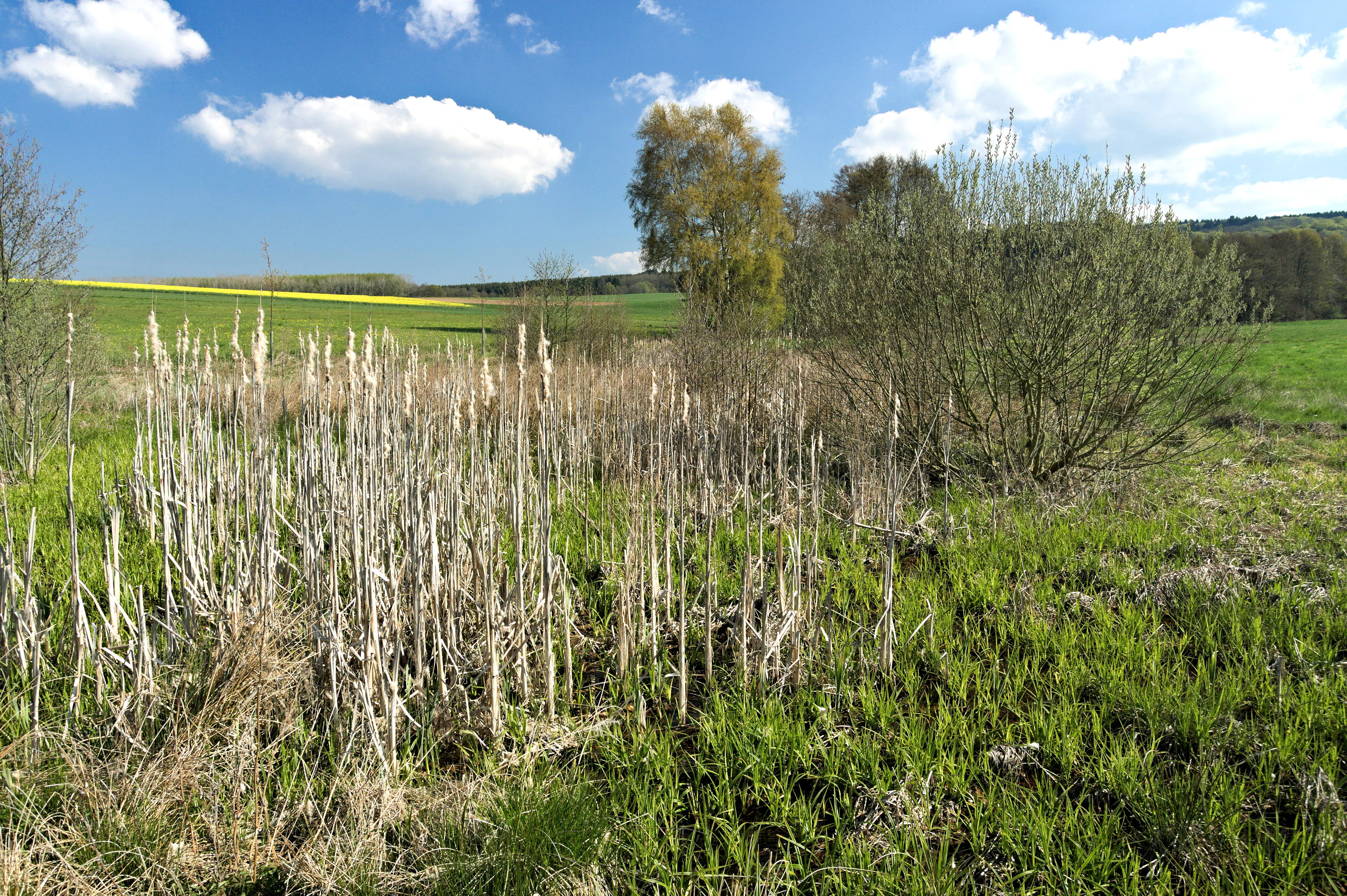
A wetland landscape under a blue sky with white clouds, showing a foreground of dry cattails and green grass, with trees and a yellow field in the background.
Wetland vegetation in the Westerwälder Seenplatte, featuring cattails and scrub.

Westerwälder Seen wildlife and species highlights

A large portion of the Westerwälder Seenplatte is designated as a European Bird Protection Area on top of its Fauna-Flora-Habitat status, reflecting the site's importance for both resident breeding birds and migratory species. The combination of open water, low shore, reedbed margins, and adjoining alder woods supports waterfowl, grebes, rails, and reedbed warblers, while the broader landscape of forest and meadow supports woodland raptors and ground-nesting waders.

Among the regularly recorded breeding species are little grebe and red-necked grebe, tufted duck and common pochard, water rail, and the Eurasian reed warbler in the reedbelts. The ponds and their surroundings also host black stork, osprey, and great egret, attracted by the rich food supply of the shallow waterbodies. When water levels are deliberately lowered, large muddy flats appear along the margins, providing temporary staging habitat for migratory waders such as dunlin, common snipe, and little ringed plover, while the surrounding woodlands hold sensitive breeding species including Tengmalm's owl, Eurasian woodcock, and European turtle dove.

Parts of the area have been formally declared nature reserves, including the Brinkenweiher, Haidenweiher, Wölferlinger Weiher, and the southern portions of the Dreifelder Weiher, which consolidates the conservation framework around key sections of the pond landscape.
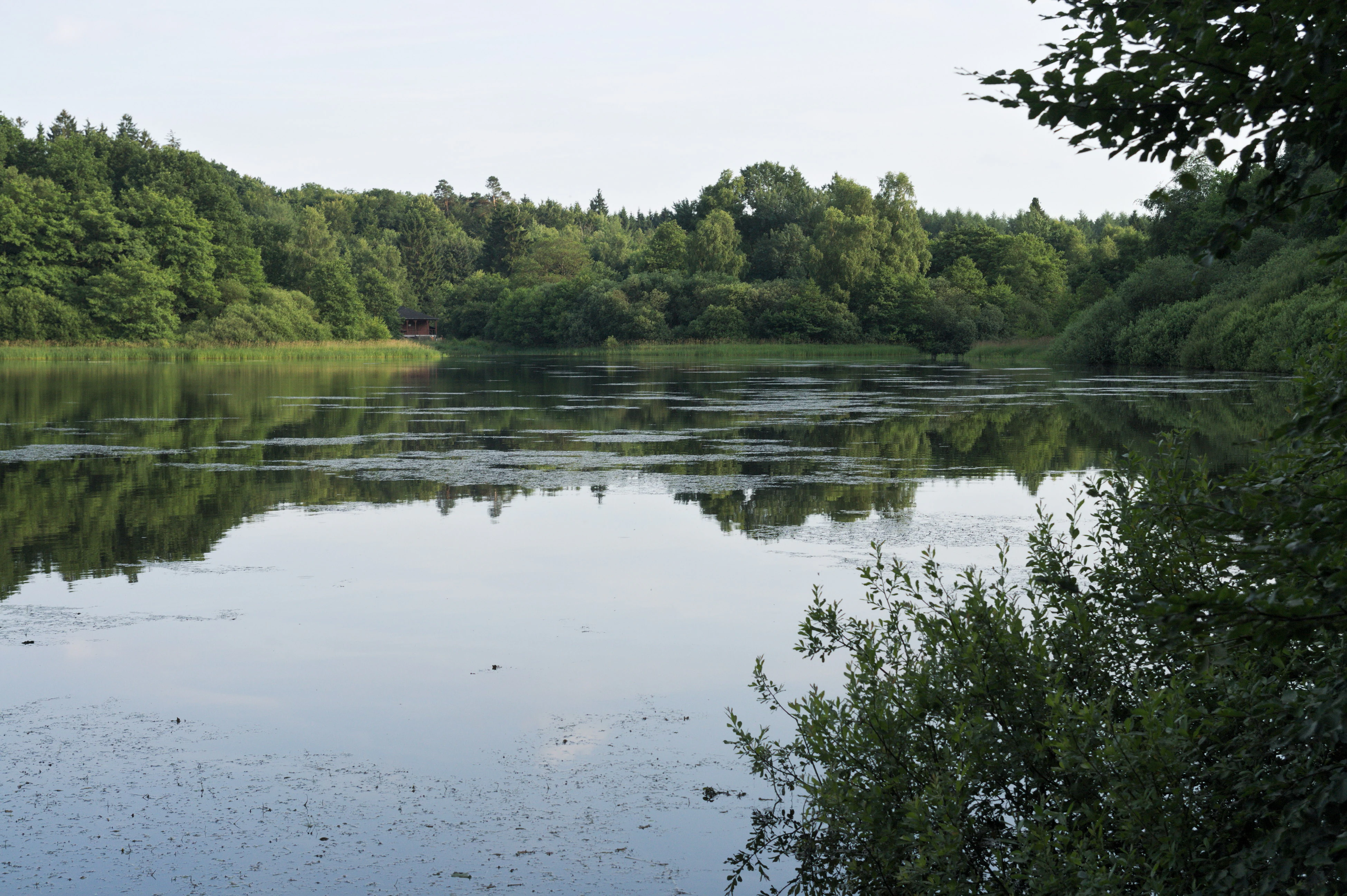
A calm, reflective lake surrounded by dense green forest foliage.
Hoffmannsweiher, one of the lakes within the Westerwälder Seen protected area.

Westerwälder Seen conservation status and protection priorities

The conservation significance of the Westerwälder Seen operates on multiple overlapping levels. The site carries European designations as both a Fauna-Flora-Habitat area and a European Bird Protection Area, accepted as part of the Natura 2000 network, while selected components of the pond system have been raised to the status of formal nature reserves under German law. In addition, the surrounding cultural landscape falls under landscape protection designations, especially along the Saynbach and in the low-lying wetlands.

The shift to long-term stewardship in 2019 was a defining moment for the site. With the purchase of the seven ponds and approximately 228 hectares of shoreline woodland, the NABU National Natural Heritage Foundation took responsibility for maintaining the ponds as a high-quality habitat for the plants and animals of the region. The foundation emphasizes not only the protection of the wetland complex but also the integration of local communities and visitors into the conservation effort, aiming to conserve the ponds as a working, living landscape rather than sealing them off from public engagement.

From a broader ecological perspective, the Westerwälder Seen matter because their combination of shallow water, fringing wetland vegetation, and adjoining forests provides habitat that is otherwise rare in the heavily forested Westerwald hills. Managing the ponds to retain open water, reed habitat, and periodic mudflat exposure, while keeping the broader plateau in forest and meadow, is now seen as the core conservation challenge for the coming decades.

Westerwälder Seen cultural meaning and human context

The cultural significance of the Westerwälder Seen is closely tied to centuries of fish farming in the Westerwald. As early as the twelfth century, monastic communities established large ponds in the marshy surroundings, drawn by the natural water-retaining character of the plateau and the demand for fish in religious dietary practice. The pond tradition expanded significantly in the seventeenth century under Count Friedrich of Wied, and for the following 350 years the ponds remained under the control of the House of Wied.

The annual practice of lowering water levels and harvesting fish in autumn became a regional ritual as much as a practical activity, shaping the rhythm of local life and contributing to the Westerwald's identity as a place where carefully managed water landscapes are part of everyday cultural heritage. Historic cultural elements such as the old milestone along the Kreisstraße 61 near the Wölferlinger Weiher still mark parts of the surrounding road network, and references to the pond landscape remain embedded in local place names, route names, and tourism imagery.
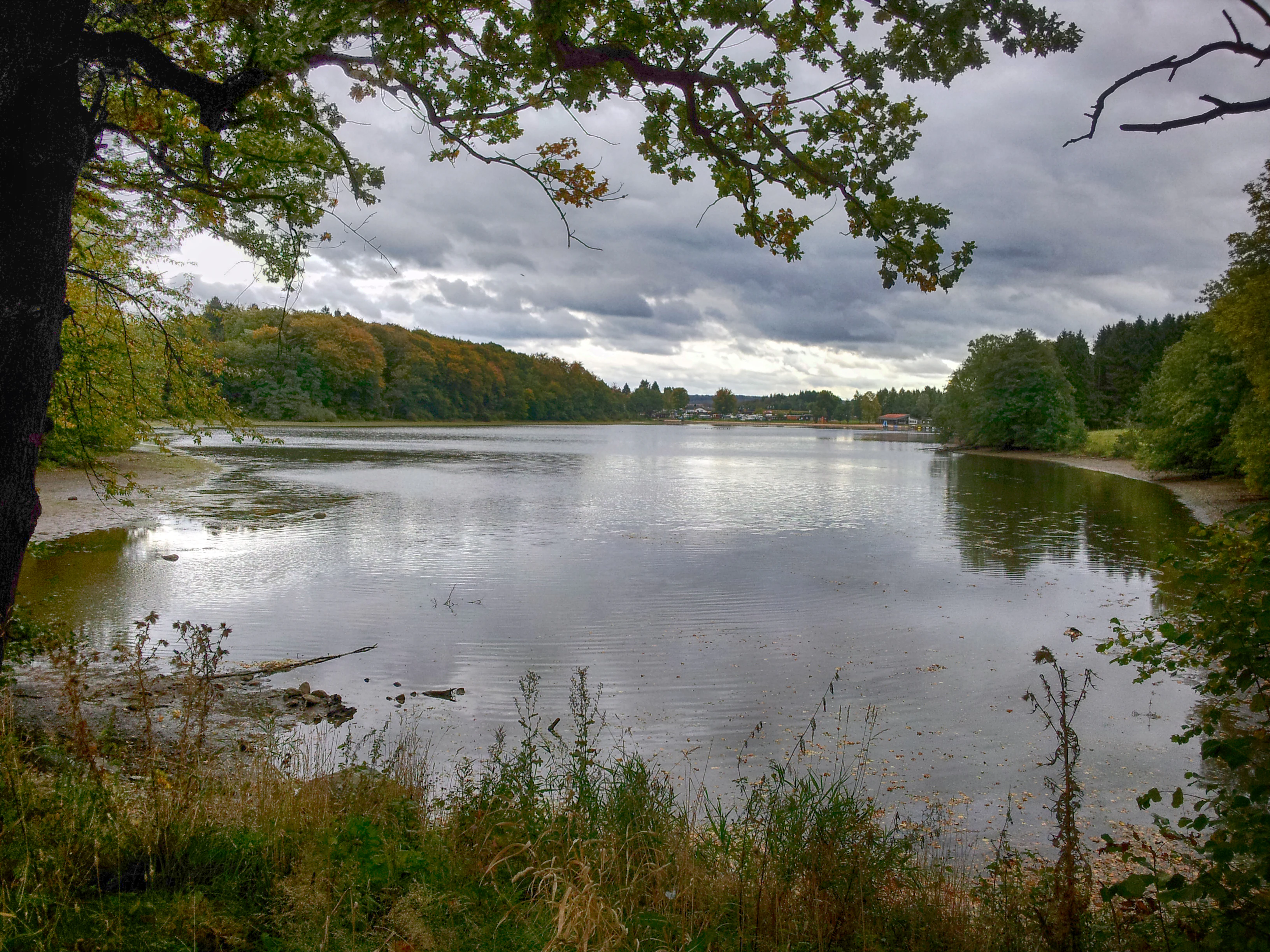
A wide view of a calm lake surrounded by trees under a cloudy sky, framed by branches in the foreground.
A view of the Postweiher, one of the lakes in the Westerwälder Seen nature reserve.

Top sights and standout views in Westerwälder Seen

The Westerwälder Seen stand out for their unusual combination of an entirely man-made pond landscape with a strong modern conservation profile. Seven interconnected ponds, several of them centuries old, sit within a protected European habitat network, and their shallow profiles, reed-fringed margins, and silt-influenced basins support breeding, wintering, and migrating waterbirds in a region better known for forests than for wetlands.

The area is also distinctive as one of the most visible examples of how a historic fish-farming landscape can become an ecological anchor. Long-standing cultural practices, including seasonal water draw-downs and ownership by a single regional house for three and a half centuries, have produced a habitat structure that today plays a recognized role in European nature protection, and this dual heritage, cultural and ecological, gives the Westerwälder Seen a unique place in the Westerwald and in Rhineland-Palatinate more broadly.
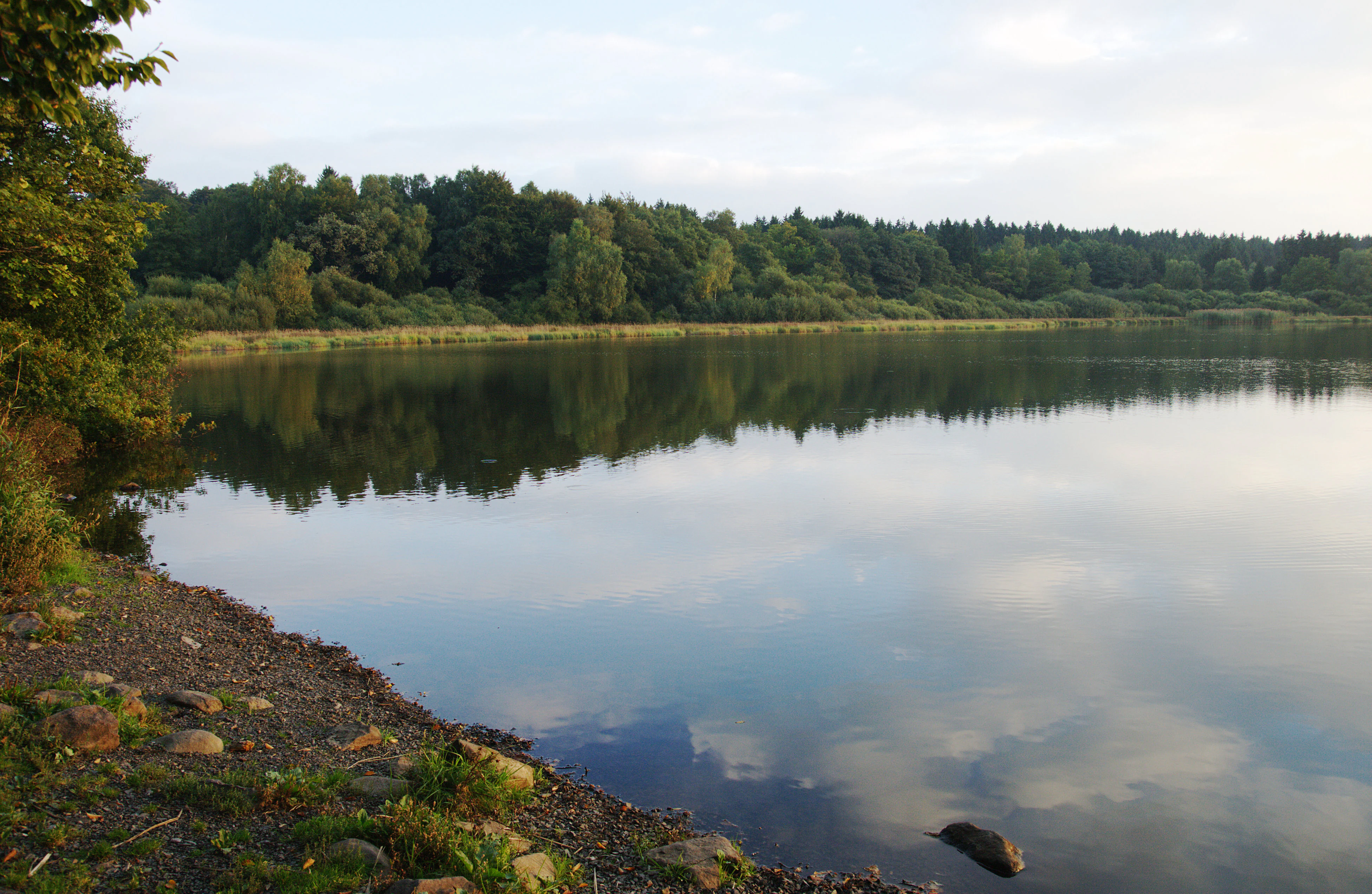
A calm, reflective lake with a forested shoreline in the background and a rocky, grassy bank in the foreground under a cloudy sky.
A serene view of the Haidenweiher, one of the seven artificial lakes in the Westerwälder Seen nature reserve.

Best time to visit Westerwälder Seen

The character of the Westerwälder Seen changes markedly with the seasons, and the choice of timing shapes the visitor experience. Spring and early summer bring high water levels, lush green reed margins, and active breeding activity among grebes, ducks, and reedbed warblers along the shorelines. The woodland edges of the ponds and the surrounding forests are rich in bird song during this period, and the light over the open water surfaces is often calm and reflective.

Late summer and autumn correspond with the traditional fish harvesting, when water levels are gradually reduced and large muddy flats appear along the margins, drawing migratory waders and varied waterbird flocks. The mix of cooling temperatures, autumn color in the surrounding forests, and visible water-level management gives these months a distinctive character. Winter brings quieter skies, lower visitor numbers, occasional frost on the margins, and the chance to see wintering waterfowl on the larger ponds, particularly on the Dreifelder Weiher.

Monthly climate preview

Long-term monthly temperature and precipitation averages for Rheinland-Pfalz

Westerwälder Seen Climate Normals and Annual Temperature Rhythm

Historical data records continuous monthly shifts in mean temperature and precipitation at a representative coordinate within Westerwälder Seen. Exploring the complete twelve-month profile provides a detailed breakdown of average temperature ranges and precipitation patterns across the year.
Annual mean9 °C
0 °C19 °C
Jan
Feb
Mar
Apr
May12°
Jun16°
Jul19°
Aug18°
Sep14°
Oct
Nov
Dec
Warmest month
July

18.5 °C

Coolest month
January

-0.4 °C

Wettest month
December

2.5 mm/day

Driest month
April

1.6 mm/day

Park location guide

Geography guide, regional context, and park location map for Westerwälder Seen

Westerwälder Seen park geography, regions, and map view in Germany

Understand where Westerwälder Seen sits in Germany through a broader geographic reading of the surrounding landscape, nearby location context, and its mapped position within the national park landscape.

How Westerwälder Seen fits into Germany

Germany is a federal republic in Western and Central Europe with a population of over 83 million across sixteen constituent states. It is Europe's largest economy by nominal GDP and a major global exporter and importer. The capital is Berlin, and the country borders Denmark, Poland, Czech Republic, Austria, Switzerland, France, Luxembourg, Belgium, and the Netherlands.

Wider geography shaping Westerwälder Seen in Germany

Germany is located in Western and Central Europe, spanning 357,022 km². It borders Denmark to the north, Poland and the Czech Republic to the east, Austria and Switzerland to the south, and France, Luxembourg, Belgium, and the Netherlands to the west. The country has coastlines on the Baltic Sea and North Sea to the north, with the Alps located in the southern region.

Map view of Westerwälder Seen

Use this park location map to pinpoint Westerwälder Seen in Germany, understand its exact geographic position, and read its mapped placement within the surrounding landscape more clearly.

Pigeon | © OpenStreetMap contributors

Location context for Westerwälder Seen

Rheinland-Pfalz

Visual reference for the shallow pond mosaic, reedbeds, and upland forest habitats of the Oberwesterwald plateau.

Westerwälder Seen Photos, Landscapes, and Protected-Area Scenery

Original field photography reveals the complex mosaic of shallow historical ponds, fringing reedbeds, and brook forests that define the Westerwälder Seen protected area. Examining these visual records helps observers understand the terrain, habitat structure, and ecological character of the upper plateau.

A wide view of a calm lake on a bright spring day with green grassy banks, trees in the foreground, and a blue sky with fluffy white clouds reflected in the water.

A small, slow-moving stream winds through a lush, green forest environment with large tree roots exposed on the bank and two ducks swimming in the water.

A serene view of a calm blue lake, framed by tree trunks and branches in the foreground, with a grassy bank and a wooded hillside visible across the water.

A wetland landscape under a blue sky with white clouds, showing a foreground of dry cattails and green grass, with trees and a yellow field in the background.

A calm, reflective lake surrounded by dense green forest foliage.

A wide view of a calm, reflective pond bordered by reeds and dense forest, with a golden meadow in the foreground.

A wide view of a calm lake surrounded by trees under a cloudy sky, framed by branches in the foreground.

A calm, reflective lake with a forested shoreline in the background and a rocky, grassy bank in the foreground under a cloudy sky.

A wide view of a calm lake surrounded by dense green forest under a partly cloudy sky, framed by overhanging tree branches in the foreground.

A meadow scene with a muddy foreground, surrounded by deciduous trees and green grass under an overcast sky.

Park atlas

Compare adjacent wetland habitats, plateau reserves, and regional conservation landscapes

Parks Near Westerwälder Seen And Protected Areas in the Surrounding Region

Browsing other parks near Westerwälder Seen reveals connected wetland habitats and plateau reserves across the surrounding region. Comparing these protected landscapes highlights regional terrain patterns and wetland conservation networks.
A soft watercolor painting of a wide, flat landscape with a winding stream and light green hills under a hazy sky.
Nature reserveRhineland-Palatinate
About 1.6 km away#1 closest

Northwest

Dreifelder Weiher Nature Reserve and Westerwälder Seenplatte Protected Geography

A historic pond ecosystem in the northern Westerwald highlands

Spanning 123 hectares, Dreifelder Weiher serves as a vital nature reserve within the Rhenish Massif. Its shallow basin and seasonal drawdown cycles sustain a diverse landscape of reedbelts and marshes, reflecting the deep integration of German noble history and contemporary habitat protection.

Area
1.23 km²
Established
1668
Relief
Lowland
Climate
Temperate
A horizontal watercolor painting showing a calm lake or pond with grassy banks, small trees, and soft hills in the background.
Protected areaGermany
About 1.7 km away#2 closest

Southwest

Brinkenweiher Protected Area and Westerwald Lake District Geography

Historic wetland habitat in Rhineland-Palatinate

Brinkenweiher serves as a significant example of a seventeenth-century Waldweiher, shaped by human engineering to dam the Holzbach headwaters. Today, the site functions as a protected nature reserve, offering a varied landscape of shadowed forest fringes, marshy wetlands, and open meadows that support a coherent wetland ecosystem within the broader Westerwälder Seenplatte.

Area
0.21 km²
Established
1660
Relief
Lowland
Scope
Terrestrial
Nature reserveWesterwaldkreis
About 2.6 km away#3 closest

Southeast

Wölferlinger Weiher Nature Reserve: Geography and Protected Wetland Boundaries

Historic Westerwaldkreis pond and protected aquatic landscape

Wölferlinger Weiher represents a critical protected wetland within the Westerwaldkreis region of Germany. This detailed record highlights the pond's geographic role within the Westerwälder Seenplatte, covering its marshy fringes, shallow water zones, and surrounding moist meadows that define its protected area status.

Area
0.9 km²
Established
1979
Relief
Lowland
Climate
Temperate
A soft, light watercolor painting of rolling green hills, scattered trees, and a winding path under a pale, warm sky.
Nature reserveWesterwaldkreis
About 10 km away#4 closest

South

Naturschutzgebiet Malberg: Geography and Protected Phonolite Landscapes in Westerwaldkreis

Geological exploration of a unique volcanic nature reserve

Naturschutzgebiet Malberg provides a focused look at a rare volcanic cupola in Germany. Centered on a 22-million-year-old phonolite summit, the reserve protects a complex environment of blockfields, craggy crevices, and natural rock caves that stand out as a sharp geographic anomaly amidst the gentle lowlands of the Montabaur Basin.

Area
0.96 km²
Established
1971
IUCN
IV
Relief
Mountain
A horizontal watercolor painting depicting a soft, scenic landscape of a park with rolling hills, a central body of water, and surrounding trees.
Nature reserveWesterwaldkreis
About 13 km away#5 closest

Northeast

Bacher Lay Nature Reserve: Basalt Quarry Landscapes in Westerwaldkreis, Germany

Protected landscape with significant geological geotope features

Bacher Lay provides an informative look at a compact nature reserve formed within a former basalt quarry. Featuring the striking Pfaffenmal columnar basalt formation and a mosaic of river valley habitats, the site serves as a vital protected area in the Westerwaldkreis region for studying habitat succession and geological formations.

Area
0.447 km²
Established
1996
IUCN
IV
Relief
Upland
Watercolor illustration of a winding stream flowing through a lush green valley with rolling hills in the background.
Nature reserveRheinland-Pfalz
About 13 km away#6 closest

East

Holzbachdurchbruch: Basalt Gorge and Protected Nature Reserve in the Westerwald Highlands

Geological landscapes and protected stream valleys in Rheinland-Pfalz.

The Holzbachdurchbruch nature reserve is a focused, high-relief landscape defined by its classic breakthrough valley where the Holzbach cuts through resistant basalt bedrock. This protected area offers a look at the volcanic terrain and forest-stream mosaics that define the Westerwald, serving as a landmark site for understanding the regional geography and geological heritage of Germany.

Area
0.21 km²
Established
1961
IUCN
IV
Relief
Upland
Watercolor painting of a soft, hazy landscape featuring rolling green hills, distant mountains, and water in the foreground.
Nature reserveWesterwaldkreis
About 19 km away#7 closest

East

Breitenbachtalsperre Nature Reserve: Geography and Protected Habitat Mapping in Westerwaldkreis

Managed wetland and reservoir landscape in western Germany

Breitenbachtalsperre protects an important reservoir ecosystem, including shallow margins and wet meadows near Waigandshain. This nature reserve provides a focused look at habitat management in the Westerwald, where stream-fed waters sustain diverse plant societies and wildlife in a compact, protected basin.

Area
0.47 km²
Established
1988
IUCN
IV
Nature reserveRheinland-Pfalz
About 20 km away#8 closest

East

Wacholderheide bei Westernohe Nature Reserve Protected Area Atlas and Geographic Map Context

Juniper heathland mosaic in the German Westerwald region

Spanning 14 hectares, Wacholderheide bei Westernohe acts as a vital protected pocket of open heathland framed by dense spruce forests. The reserve supports a specialized community of arnica, common heather, and juniper, sustained by decades of consistent grazing and mechanical mowing that define its unique regional character.

Area
0.14 km²
Established
1967
IUCN
IV

Common questions about visiting, size, designation, and location context for Westerwälder Seen

Westerwälder Seen FAQs for park facts, access, geography, and protected area context

Find quick answers about Westerwälder Seen, including protected-area facts, park geography, trail and visitor context, and how the park fits into its surrounding country and regional landscape.
MoriAtlas Explorer

Continue Your Protected Areas Search Across the Global Atlas

Deepen your exploration by continuing the structured search for national parks and protected areas worldwide. Utilize the comprehensive filtering capabilities to compare different conservation landscapes and refine your understanding of global park geography. Discover more about the distribution and characteristics of protected natural areas.

Global natural geography