
Mori Atlas logo
Natural monumentChambers Pillar

Examining the geological terrain, arid landscape context, and protected boundaries of this remote outback landmark

Chambers Pillar Historical Reserve: A Detailed Geographic Atlas of a Central Australian Natural Monument

(Chambers Pillar Historical Reserve)

Chambers Pillar stands as a prominent sandstone formation rising 50 meters above the flat, arid plains of the Northern Territory. This historical reserve serves as a vital anchor in the desert landscape, representing an intersection of deep geological time and cultural heritage. The surrounding terrain, characterized by weathered rock and sparse sandy environments, provides a distinct regional context for understanding this isolated natural monument within the wider Australian outback.

arid landscapedesert plainssandstone formationoutbackexploration historyaboriginal heritage
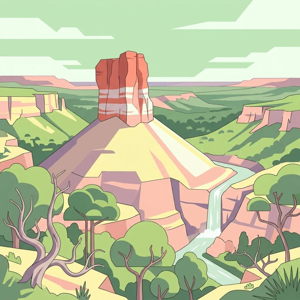
A stylized flat illustration of a tall sandstone pillar with horizontal bands, surrounded by green hills, sparse trees, and a small waterfall flowing into a stream.

Chambers Pillar

Natural monument

Park overview

Structured park overview, official facts, and landscape profile for Chambers Pillar

Chambers Pillar park facts, protected area profile, and essential visitor context

Review the core facts for Chambers Pillar, including designation, size, terrain, visitor scale, habitats, and operating context in one park-focused overview.

About Chambers Pillar

Chambers Pillar is a sandstone formation in Australia's Northern Territory, situated in a remote stretch of desert roughly 160 kilometers south of Alice Springs. Although small in overall footprint, the site carries a concentrated mix of geological, cultural, and historical significance, and is managed as the Chambers Pillar Historical Reserve. The reserve covers around 340 hectares of surrounding plain and sand dune country, framing the pillar as a lone vertical feature within an otherwise expansive horizontal landscape.

Geologically, the pillar is the remnant of a much larger sandstone body that has been reduced over time by wind and rain erosion. The rock itself dates back approximately 350 million years, making the formation a small but deeply old feature in the Australian interior. Its current shape, a free-standing column rising about 50 meters above the surrounding terrain, reflects millions of years of differential weathering acting on the local sandstone layers. The result is a landmark that visually interrupts the flat desert horizon and gives the surrounding plain an unexpected focal point.

Beyond its geological character, Chambers Pillar is notable for what has accumulated on and around it over the past two centuries. The site was first encountered by Europeans during one of the most important phases of Australian inland exploration. Today, the pillar is also recognized as a Site of Aboriginal Significance, embedded in the dreaming traditions of local Indigenous peoples. Together with the nearby Castle Rock formation, the pillar forms part of a paired cultural landscape that explains both landforms through ancestral transformation.

Practical access to Chambers Pillar reinforces its identity as an outback destination. The site is reached via unsealed roads that require preparation, four-wheel-drive vehicles, and an appetite for the slow, sandy travel typical of central Australia. For visitors who make the journey, the pillar offers not just a natural attraction but a layered cultural encounter with deep time, Aboriginal heritage, and the early history of European exploration in the Red Centre.

Quick facts and research context for Chambers Pillar

Chambers Pillar is a sandstone monolith in the Northern Territory of Australia, located approximately 160 kilometers south of Alice Springs and set within the Chambers Pillar Historical Reserve, a protected area of about 340 hectares. The pillar rises roughly 50 meters above the surrounding desert plain and is composed of sandstone estimated to be around 350 million years old, shaped by long-term wind and rain erosion.

The formation holds both European and Aboriginal historical significance. It was first recorded by the explorer John McDouall Stuart in 1860 and later became a marker along pioneer routes between Adelaide and Alice Springs before the railway era. At the same time, the site is a recognized Aboriginal place, embedded in local dreaming stories and tied to a tradition that explains the pillar and nearby Castle Rock as transformed ancestral beings.

Protection and recognition

Terrestrial protected area management scope and administrative records

Chambers Pillar Protection Status and Conservation Recognition Data

Chambers Pillar holds documented terrestrial protection status within a managed natural landscape. Official records outline the governing scope and administrative recognition parameters for this protected area.

Protection details

Protection scope
Terrestrial
Transboundary protection
No
Park context

Deeper park guide and search-rich context for Chambers Pillar

Chambers Pillar history, landscape, wildlife, and travel context

Explore Chambers Pillar through its history, landscape character, ecosystems, wildlife, conservation priorities, cultural context, and seasonal travel timing in a structured park guide built for atlas discovery and search intent.

Why Chambers Pillar stands out

Chambers Pillar is best known for two intersecting qualities: a dramatic isolated sandstone column rising abruptly from an otherwise flat desert plain, and a long history of human presence written into its soft rock. Many visitors are drawn to the visual contrast between the pillar and the surrounding sandy, sparsely vegetated outback, where the formation appears as a solitary vertical feature in a horizontal landscape. It is equally known for the cultural layers visible on the rock itself. Carved initials and graffiti, some dating back to the nineteenth century, mark the passage of early European explorers and travelers, while the broader site is also tied to Aboriginal dreaming traditions that explain the pillar as a transformed ancestral being. This combination of striking geology, exploration-era heritage, and Indigenous significance gives the pillar a multi-dimensional identity that sets it apart from purely scenic desert landmarks.
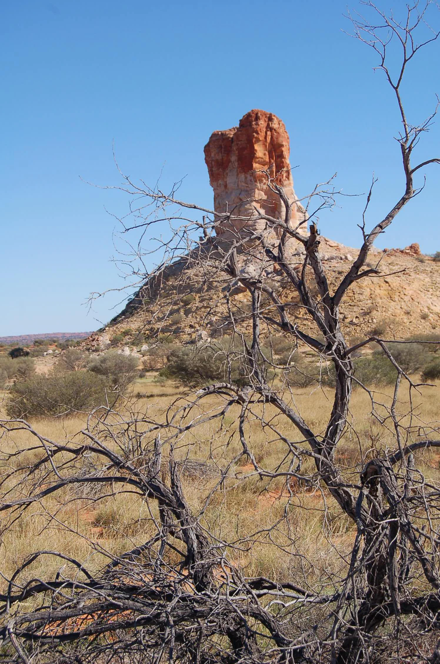
A large, weathered, reddish-orange sandstone pillar rises from a flat, dry, grassy plain, viewed behind a gnarled, leafless tree.
Chambers Pillar stands as a prominent sandstone formation in the Northern Territory desert.

Chambers Pillar history and protected-area timeline

Chambers Pillar entered the European historical record in April 1860, when the explorer John McDouall Stuart became the first non-Indigenous person known to have reached the site. Stuart named the formation after James Chambers, one of his South Australian sponsors who had supported the expedition. The pillar's original Aboriginal names, Idracowra and Etikaura, reflect a much longer history of human association with the landscape.

During the latter half of the nineteenth century, the pillar became an important waypoint for travelers crossing the Australian interior. Before the railways reached central Australia in the 1920s, the route from Adelaide north toward Alice Springs was long, slow, and demanding, and conspicuous landmarks such as Chambers Pillar served as vital orientation points for overland travel. Explorers and travelers carved their names into the soft sandstone at the base of the formation, and several of these early inscriptions remain visible today. Notably, the explorer Alfred Giles and John Ross, who led part of the second cross-continental expedition in 1870, left their marks on the rockface, with their initials still readable as 'J Ross' and 'AC 1870'.

The pillar's role as a travelers' landmark gradually declined as rail and road infrastructure improved across central Australia. Nonetheless, the inscriptions left by nineteenth-century visitors continued to accumulate, and in modern times many later visitors have also added their own graffiti to the soft sandstone, sometimes illegally. The combination of nineteenth-century exploration inscriptions and later additions has turned the base of the pillar into a visible, if contested, historical record of human movement through the Australian interior.

Alongside the European story, the pillar holds Aboriginal history that predates European contact by thousands of years. The site is registered as a Site of Aboriginal Significance and is woven into local dreaming traditions, which interpret the pillar, and nearby Castle Rock, as the transformed bodies of ancestral beings. This long Indigenous history sits alongside the European exploration heritage, giving the site a layered and continuous human story across very different cultural traditions.

Chambers Pillar landscape and geographic character

Chambers Pillar rises from a flat, arid plain that forms part of the broader desert landscape of the Northern Territory's Red Centre. The surrounding country is shaped by sand dunes, sparse vegetation, and weathered surfaces typical of central Australian outback terrain. Within this expansive setting, the pillar itself is the defining visual feature, an isolated column of sandstone that breaks the otherwise horizontal line of the desert horizon.

The pillar stands roughly 50 meters tall and is composed of sandstone estimated to be around 350 million years old. Its current form is the result of prolonged erosion by wind and rain, which has gradually stripped away surrounding rock and left a more resistant column behind. While the pillar is the most prominent formation, the landscape also includes nearby Castle Rock, a related sandstone feature about 500 meters to the north-east that complements the pillar as a paired geological landmark.

The terrain between these formations is characteristic of the surrounding region: rolling sandy hills, deep sand drifts, and stretches of exposed, weathered rock. Vegetation is sparse and adapted to the arid conditions, and the ground surface varies between hard plains and loose, deeply rutted sand. This combination of clear horizons, soft sandy ground, and isolated rock formations gives the landscape its strong sense of openness, and makes the pillar appear even more visually striking by contrast.
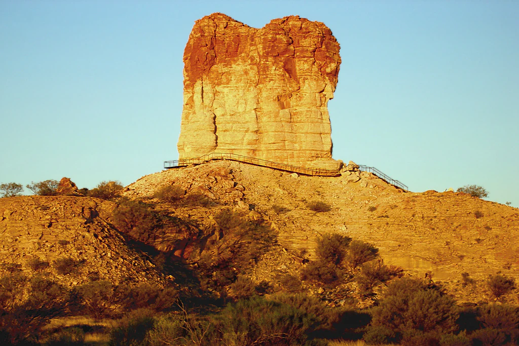
A large sandstone pillar rising from a rocky desert landscape at sunset, illuminated by warm orange light.
Chambers Pillar stands prominently above the desert plain at sunset.

Chambers Pillar ecosystems, habitats, and plant life

The natural environment surrounding Chambers Pillar is defined by arid conditions and the simple, hardy character typical of central Australian desert country. The landforms and soils support only sparse vegetation, with plants adapted to long dry periods, intense heat, and limited rainfall. Sand dunes and weathered sandy plains dominate large parts of the reserve, while rocky exposures and harder substrates support different, equally sparse plant communities.

The reserve's ecological character is shaped more by extremes of climate and substrate than by biological richness. Its protected status focuses on preserving the combined natural and cultural values of the area, including the geological formation itself, the surrounding arid landscape, and the traditional associations local Aboriginal communities have with the country. The overall ecological identity of the site is that of an enduring, sun-exposed desert terrain in which vegetation cover is low, seasonal change is pronounced, and water is scarce.

Because the reserve is small in scale relative to the wider desert region, its nature value lies less in rare or unusual species and more in the integrity of the landscape as a whole. The pillar and the surrounding plain together form an intact example of the kind of arid sandstone country that characterizes much of this part of the Northern Territory.

Chambers Pillar wildlife and species highlights

Wildlife at Chambers Pillar reflects the broader patterns of central Australian arid-zone ecology. The reserve is not known as a major wildlife destination, but the surrounding desert supports the typical species assemblages of the Red Centre, with animals adapted to heat, dryness, and sparse vegetation cover. Reptiles, small mammals, and hardy bird species are characteristic of the region, although detailed species lists are not part of the park's identity.

The site's significance from a wildlife perspective is tied more to its landscape context than to specific flagship species. The combination of open sandy plains, low shrub cover, and rocky sandstone exposures creates habitats used by animals typical of similar terrain across central Australia. Visitors traveling to the pillar commonly encounter signs of outback fauna in the surrounding countryside, including tracks and the presence of adapted birdlife.

Because the reserve is small and embedded within a larger arid landscape, the site's contribution to wildlife conservation is best understood as part of the broader regional ecosystem rather than as a standalone biodiversity hotspot. The pillar and its surrounds function as a piece of intact arid country within a wider network of desert habitats.

Chambers Pillar conservation status and protection priorities

Chambers Pillar is protected as part of the Chambers Pillar Historical Reserve, a designation that recognizes both the natural and cultural values of the site. The reserve's protected status is aimed at preserving an isolated sandstone formation, the surrounding arid landscape of about 340 hectares, and the cultural associations the site holds for both Aboriginal communities and historians of Australian exploration.

From a conservation perspective, the reserve matters less for biodiversity statistics than for the integrity of the landscape and the preservation of geological and cultural heritage. The pillar itself is a finite natural feature vulnerable to ongoing weathering, vandalism through graffiti, and visitor pressure, which is why its formal reserve status carries both environmental and heritage significance. Protecting the area helps ensure that this rare combination of geology and human history remains intact for future engagement and study.

The site's recognition as a Site of Aboriginal Significance also brings a cultural conservation dimension, ensuring that the dreaming stories and traditional associations tied to the pillar and Castle Rock are respected in how the reserve is managed and interpreted.

Chambers Pillar cultural meaning and human context

Chambers Pillar carries a dual cultural identity that is central to its meaning. For local Aboriginal communities, the pillar and nearby Castle Rock are part of a dreaming narrative in which ancestral beings were transformed into stone. According to tradition, the gecko ancestor Itirkawara was exiled for taking a wife from the wrong skin group, and when he and his wife stopped to rest in the sand dunes they turned into rock. Itirkawara became the pillar and his wife became Castle Rock, giving the two formations a paired cultural meaning that continues to shape how the landscape is understood.

For the broader Australian story, the pillar is also a key landmark from the era of European inland exploration and overland travel. Carved names and initials on the soft sandstone at the base of the pillar, including those of nineteenth-century explorers, mark the pillar as a tangible point of contact between Indigenous land, colonial exploration, and the later movement of settlers and travelers across central Australia.

Today, the layered cultural character of the site is recognized through its formal protections. As an Aboriginal site of significance and a historical reserve, Chambers Pillar is a place where Indigenous heritage, colonial exploration history, and contemporary Australian identity intersect within a single remote desert landscape.

Top sights and standout views in Chambers Pillar

A standout feature of Chambers Pillar is the visual contrast it creates within the surrounding plain: a 50-meter sandstone column rising abruptly from a flat, sandy desert landscape roughly 160 kilometers south of Alice Springs. Its age, around 350 million years, gives it a deep geological anchor that complements the harsh modern desert in which it stands.

Equally distinctive is the cultural layering visible on the rock itself. Nineteenth-century exploration inscriptions, continued Aboriginal dreaming associations, and long-standing identification as a protected historical reserve combine to make the site an unusually concentrated intersection of natural and human history in the Australian outback. Paired with nearby Castle Rock, the pillar forms both a geological duo and a cultural pair tied to a single ancestral story.

Best time to visit Chambers Pillar

Conditions at Chambers Pillar vary considerably with the seasons of central Australia, and travel planning is shaped more by climate and road conditions than by a single peak travel window. Cooler months, generally spanning the southern hemisphere autumn, winter, and early spring, tend to offer more comfortable temperatures for outdoor exploration and camping, with milder daytime conditions and cooler nights that suit travel in arid country.

Warmer months bring higher daytime temperatures typical of the Red Centre, which can make prolonged outdoor activity more demanding. Summer storms and seasonal rainfall can also change road conditions significantly in the surrounding dune country, affecting access along the unsealed tracks that lead to the reserve. As a result, travelers commonly approach the site during drier, cooler periods when sandy roads are more predictable and conditions at the campground are more comfortable. The quality of light at sunrise and sunset over the surrounding plain also makes these times of day particularly atmospheric for viewing the pillar.
Monthly climate preview

Long-term representative averages tracking annual temperature ranges and monthly precipitation cycles.

Chambers Pillar Climate Normals, Monthly Temperature and Precipitation Patterns

Chambers Pillar records measured long-term temperature swings and low precipitation rates across twelve distinct monthly intervals. Reviewing the complete monthly climate profile provides deeper analytical depth for regional temperature and precipitation patterns.
Annual mean23 °C
13 °C32 °C
Jan32°
Feb30°
Mar27°
Apr22°
May17°
Jun13°
Jul13°
Aug15°
Sep21°
Oct24°
Nov28°
Dec30°
Warmest month
January

31.6 °C

Coolest month
July

12.7 °C

Wettest month
February

1.3 mm/day

Driest month
August

0.1 mm/day

Park location guide

Geography guide, regional context, and park location map for Chambers Pillar

Chambers Pillar park geography, regions, and map view in Australia

Understand where Chambers Pillar sits in Australia through a broader geographic reading of the surrounding landscape, nearby location context, and its mapped position within the national park landscape.

How Chambers Pillar fits into Australia

Australia is a constitutional monarchy and federal parliamentary democracy comprising six states and ten territories. With a population of nearly 28 million, it is one of the world's most urbanised countries, with most people concentrated on the eastern seaboard. The country has a high Human Development Index and is known for its cultural diversity, ancient Aboriginal heritage, and unique wildlife.

Wider geography shaping Chambers Pillar in Australia

Australia occupies the entire Australian continent, the island of Tasmania, and numerous smaller islands. It is the world's flattest and driest inhabited continent, featuring vast deserts in the interior (the Outback), tropical rainforests along the eastern coast, and a coastline bordering the Indian and Pacific Oceans.

Map view of Chambers Pillar

Use this park location map to pinpoint Chambers Pillar in Australia, understand its exact geographic position, and read its mapped placement within the surrounding landscape more clearly.

Pigeon | © OpenStreetMap contributors

Location context for Chambers Pillar

Northern Territory

Explore detailed park photography showing sandstone formations and arid desert terrain.

Chambers Pillar Photos and Landscape Scenery: Visualizing the Red Centre

Photographic collections reveal the stark vertical presence of Chambers Pillar rising above flat arid plains in the Australian outback. Visual records capture weathered sandstone textures and surrounding desert landscapes to document remote protected environments.

A large, weathered, reddish-orange sandstone pillar rises from a flat, dry, grassy plain, viewed behind a gnarled, leafless tree.

A wide angle view of the sandstone rock formation Chambers Pillar rising above a desert landscape under a clear blue sky.

A large sandstone pillar rising from a rocky desert landscape at sunset, illuminated by warm orange light.

Park atlas

Compare surrounding desert landscapes, geological formations, and remote historical reserves

Other Parks and Protected Areas Near Chambers Pillar in the Australian Outback

Browse other national parks and protected areas sharing the rugged arid terrain and exploration history of Chambers Pillar. Comparing adjacent desert landscapes helps trace broader geological patterns across the remote Australian interior.
A horizontal watercolor painting showing stylized soft green, orange, and pale yellow hills under a white sky.
Nature reserveNorthern Territory
About 61 km away#1 closest

North

Rainbow Valley Conservation Reserve: Geological Atlas and Protected Landscape Mapping

Examining the arid-zone terrain of Northern Territory, Australia.

The Rainbow Valley Conservation Reserve is a significant protected landscape known for its 350-million-year-old banded sandstone bluffs and diverse arid-zone habitats. This overview provides a focused look at the park's geological structure, claypan terrain, and its status as a vital site for Aboriginal heritage, offering a clear understanding of its place within the broader Northern Territory geographic context.

Area
24.83 km²
Established
1990
IUCN
V
Visitors
6.8K annual
A pale, minimalist watercolor painting of an arid, desert-like landscape with sparse green shrubs and grasses against a soft pastel background.
Natural monumentNorthern Territory
About 75 km away#2 closest

Northwest

Henbury Meteorites Conservation Reserve: Geological and Cultural Impact Site Mapping

Northern Territory desert monument and crater field atlas

Henbury Meteorites Conservation Reserve preserves a series of striking impact craters in the heart of the Northern Territory desert. This protected area offers insights into the geological mechanics of meteorite falls and the enduring cultural significance of the site within central Australian history. Its compact crater field creates a distinct topography against the surrounding arid plains, making it a focal point for understanding terrestrial impact morphology.

Area
0.16 km²
Established
1964
IUCN
III
Relief
Lowland
Watercolor painting of a soft, abstract landscape with a line of trees against rolling hills and light, hazy colors.
Nature reserveNorthern Territory
About 95 km away#3 closest

North

Napwerte / Ewaninga Rock Carvings Conservation Reserve: Protected Desert Landscape Map

Cultural heritage and arid basin geography in the Northern Territory

Napwerte / Ewaninga Rock Carvings Conservation Reserve protects a unique desert site defined by its extensive collection of prehistoric Arrernte rock engravings. The landscape encompasses rocky outcrops, red sand dunes, and a seasonal claypan that captures rare rainfall, creating a significant intersection of archaeological history and arid-zone ecology in central Australia.

Area
0.06 km²
Established
1970
IUCN
V
Relief
Lowland
Watercolor painting of a landscape with green valleys, pink and yellow mountain peaks, and distant hills
National parkNorthern Territory
About 114 km away#4 closest

Northwest

Finke Gorge National Park: Explore Its Protected Landscape and Geographic Identity

Mapped boundaries and natural terrain within Northern Territory.

Finke Gorge National Park represents a significant protected area within the Northern Territory, Australia. This national park offers valuable insights into the region's geography, mapped landscapes, and natural terrain. Detailed information helps users understand the park's protected boundaries and its role in the broader context of Australian conservation lands, ideal for focused atlas exploration.

Area
452.85 km²
Established
1966
IUCN
V
Visitors
18K annual
Wildlife reserveNorthern Territory
About 117 km away#5 closest

North

Kuyunba Conservation Reserve: Wildlife Protected Landscape in Central Australia

Mapped geography and rocky habitat near Alice Springs

Kuyunba Conservation Reserve represents a focused approach to habitat protection in the Northern Territory. The terrain is defined by its rocky hills and boulder-filled escarpments, offering critical shelter for wildlife in an arid, drought-adapted desert region. This site provides a clear view of how targeted land management supports specialized ecological niches in inland Australia.

Area
6.29 km²
Established
1970
IUCN
V
Relief
Upland
National parkNorthern Territory
About 123 km away#6 closest

Northwest

Tjoritja / West MacDonnell National Park: National Park Atlas and Protected Landscape

Explore the dramatic MacDonnell Ranges terrain and geography.

Delve into the protected geography of Tjoritja / West MacDonnell National Park, a significant national park in Australia's Northern Territory. This landscape features striking mountain formations, deep gorges like Standley Chasm and Glen Helen, and is intrinsically linked to the famous Larapinta Trail and the Arrernte people's cultural heritage. Understanding its mapped boundaries and regional context provides essential insight into this iconic Central Australian protected area.

Area
2,568.61 km²
Established
1992
IUCN
II
Relief
Mountain
Nature reserveNorthern Territory
About 130 km away#7 closest

Northwest

Illamurta Springs Conservation Reserve: Geography and Protected Landscape Atlas

Desert-fringe oasis in the Northern Territory

Located in the arid heart of central Australia, Illamurta Springs Conservation Reserve anchors a rare permanent water source at the base of the James Range. This protected area offers deep insight into the region's geography, balancing an essential oasis habitat with significant cultural storylines and remnants of frontier history in the Northern Territory.

Area
1.29 km²
Established
1969
IUCN
V
Relief
Upland
Protected landscapeNorthern Territory
About 137 km away#8 closest

North

Corroboree Rock Conservation Reserve: Geological and Cultural Protected Area in Central Australia

Mapped protected landscape within the East MacDonnell Ranges

Corroboree Rock Conservation Reserve features a striking dolomite rock formation tied to ancient Precambrian salt lake sediments. Located east of Alice Springs, the reserve provides a protected glimpse into central Australian arid range geography and holds profound cultural importance for the Eastern Arrernte Traditional Owners within the surrounding pastoral landscape.

Area
0.07 km²
Established
1962
IUCN
V
Visitors
15K annual

Common questions about visiting, size, designation, and location context for Chambers Pillar

Chambers Pillar FAQs for park facts, access, geography, and protected area context

Find quick answers about Chambers Pillar, including protected-area facts, park geography, trail and visitor context, and how the park fits into its surrounding country and regional landscape.
MoriAtlas Explorer

Continue Your Protected Areas Search Across the Global Atlas

Deepen your exploration by continuing the structured search for national parks and protected areas worldwide. Utilize the comprehensive filtering capabilities to compare different conservation landscapes and refine your understanding of global park geography. Discover more about the distribution and characteristics of protected natural areas.

Global natural geography