
Mori Atlas logo
Nature reserveNapwerte / Ewaninga Rock Carvings Conservation Reserve

Examining the intersection of ancient Arrernte petroglyphs, seasonal claypans, and arid desert terrain.

Napwerte / Ewaninga Rock Carvings Conservation Reserve: A Protected Landscape in the Northern Territory

Located south of Alice Springs, Napwerte / Ewaninga Rock Carvings Conservation Reserve preserves a significant collection of around 1,000 ancient petroglyphs carved into sandstone outcrops. This protected landscape features a distinct layered geography, where low sand dunes surround a concave claypan that acts as an ephemeral wetland. The reserve provides a critical window into deep Aboriginal cultural history while showcasing the ecological transition of central Australian desert terrain.

rock artpetroglyphsAboriginal heritageArrerntesacred siteclaypan
A stylized, flat-design illustration depicting a natural stone arch bridging a river between high, layered canyon walls, framed by silhouetted coniferous trees in the foreground.

Napwerte / Ewaninga Rock Carvings Conservation Reserve

Nature reserve

Park overview

Structured park overview, official facts, and landscape profile for Napwerte / Ewaninga Rock Carvings Conservation Reserve

Napwerte / Ewaninga Rock Carvings Conservation Reserve park facts, protected area profile, and essential visitor context

Review the core facts for Napwerte / Ewaninga Rock Carvings Conservation Reserve, including designation, size, terrain, visitor scale, habitats, and operating context in one park-focused overview.

About Napwerte / Ewaninga Rock Carvings Conservation Reserve

Napwerte / Ewaninga Rock Carvings Conservation Reserve sits in the heart of central Australia, in the Northern Territory about 35 kilometres south of Alice Springs. The reserve covers only a small area, but within that footprint it preserves a remarkable convergence of arid-zone landforms, ecological function, and Aboriginal cultural heritage. Low red sand dunes surround sections of exposed rocky outcrop, while a shallow claypan near the centre of the reserve forms a slightly concave basin that holds water after even brief rainfall. After rain, this basin becomes a focal point of activity, drawing birds and animals from the surrounding landscape and illustrating how life in this dry region pulses around rare, temporary water sources.

The reserve was established in 1970 and gazetted as a conservation reserve on 20 November 1996 under IUCN Category V, recognising it as a protected landscape of cultural and natural significance. Its administrative identity changed again in 2014, when the name Napwerte, from the Arrernte word for the rock outcrop, was added through an official dual naming alongside the long-established English name Ewaninga. Today the reserve is jointly managed in recognition of the Arrernte people as its traditional owners, and an Indigenous land use agreement signed in 2005 formally transferred the land to Aboriginal ownership under the Aboriginal Land Rights Act 1976.

Culturally, the reserve is best understood as a sacred men's site of the Arrernte people, where prehistoric engravings still speak to thousands of years of continuous connection to country. The petroglyphs distributed across the southern and south-eastern outcrops include a mix of geometric motifs and occasional animal tracks, and researchers have placed many of them in the Panaramitee tradition that is also seen elsewhere in the central deserts and Tasmania. The heavy weathering of the engraved surfaces, which once would have stood out white against the red stone, has long since faded the carvings back into the rock, an indicator of their vast age. As both a cultural landscape and an ecological refuge, the reserve represents an unusually concentrated example of how natural setting and human heritage intertwine in the Australian arid zone.

Quick facts and research context for Napwerte / Ewaninga Rock Carvings Conservation Reserve

Napwerte / Ewaninga Rock Carvings Conservation Reserve is a small, culturally focused protected area in the Northern Territory of Australia, set in the arid landscape south of Alice Springs. Its combination of sand dunes, rock outcrops, and a shallow claypan creates an environment that is both visually distinctive and ecologically important when rainfall briefly fills the basin. The reserve's defining feature, however, is its extraordinary archaeological record: around 1,000 petroglyphs made by the Arrernte people and their ancestors, many of which may be tens of thousands of years old. Classified under IUCN Category V as a protected landscape, the reserve has been formally recognised since its gazetting in 1996 and granted as Aboriginal land in 2005.

Protection and recognition

Examine the terrestrial protection history and official conservation records for Napwerte / Ewaninga Rock Carvings Conservation Reserve.

Napwerte / Ewaninga Rock Carvings Conservation Reserve Protection Status and Designation Records

Napwerte / Ewaninga Rock Carvings Conservation Reserve maintains formal terrestrial protection established through regional designation records dating to 2014. Review structured management scope and international recognition status compiled for this protected area.

Protection details

Protection scope
Terrestrial
Designated year
2014
Transboundary protection
No
Park context

Deeper park guide and search-rich context for Napwerte / Ewaninga Rock Carvings Conservation Reserve

Napwerte / Ewaninga Rock Carvings Conservation Reserve history, landscape, wildlife, and travel context

Explore Napwerte / Ewaninga Rock Carvings Conservation Reserve through its history, landscape character, ecosystems, wildlife, conservation priorities, cultural context, and seasonal travel timing in a structured park guide built for atlas discovery and search intent.

Why Napwerte / Ewaninga Rock Carvings Conservation Reserve stands out

The reserve is best known for its exceptional collection of Aboriginal petroglyphs scattered across its rocky outcrops. Approximately 1,000 prehistoric engravings, ranging from geometric circles and lines to animal tracks, mark the sandstone surfaces in styles that compare with Panaramitee rock art found elsewhere in central Australia and Tasmania. The petroglyphs are estimated to be extremely ancient, with weathering patterns and motif comparisons suggesting ages up to roughly 30,000 to 40,000 years, making the site a major window into deep Aboriginal cultural history in the central desert. Beyond the carvings, the reserve is also recognised for the unusually intact claypan that anchors its landscape. This shallow basin collects water after light rainfall and draws a diverse array of bird and animal visitors, turning the otherwise dry dunes and outcrops into a seasonally active ecological pocket. Together, the petroglyphs, the claypan, and the spiritual importance of the site to the Arrernte traditional owners define the reserve's distinctive identity within Australia's protected area network.
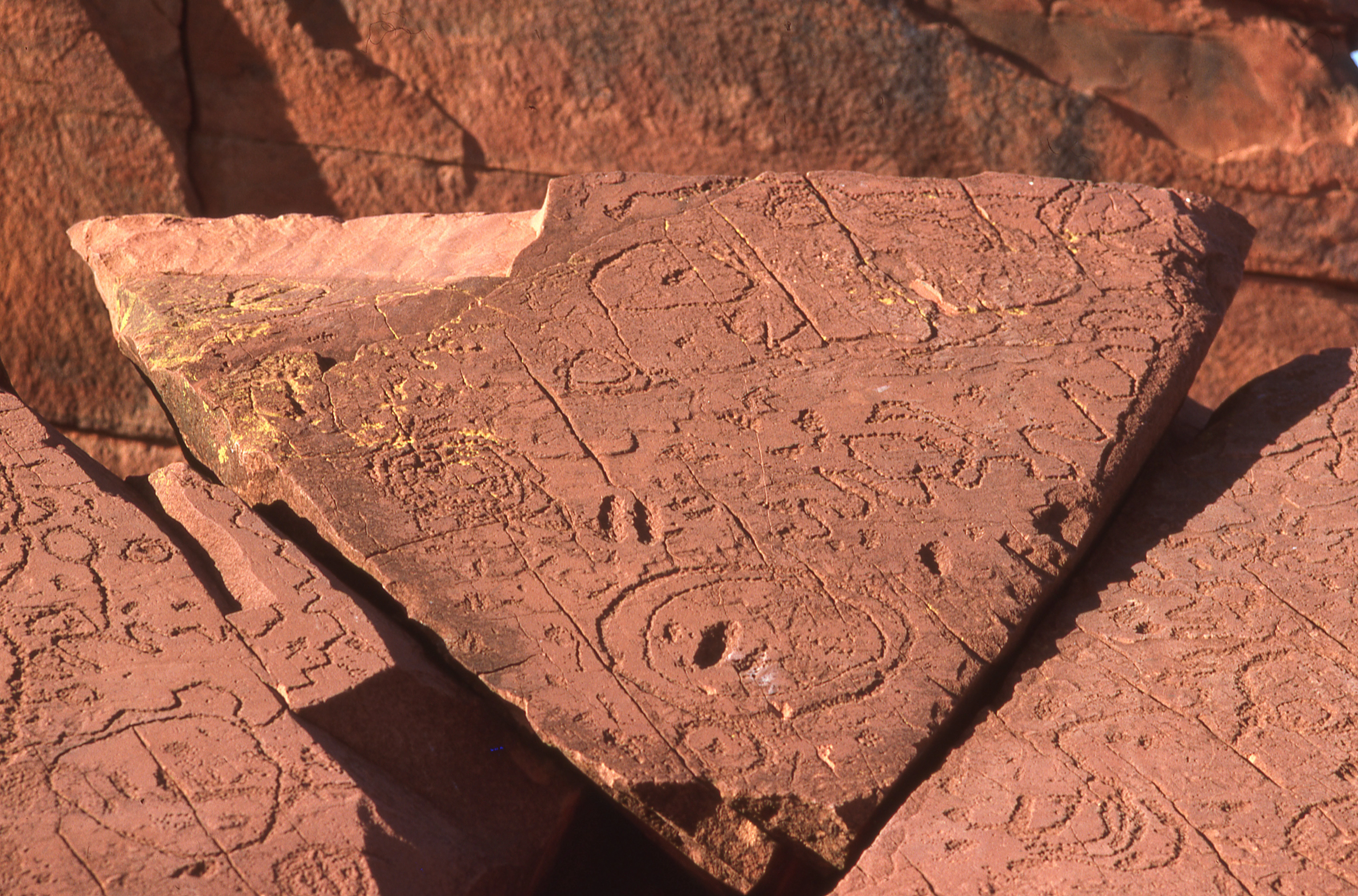
Close-up of red sandstone rock slabs covered in carved abstract circular and geometric patterns, located in a desert environment.
A detailed view of ancient Aboriginal rock carvings on a red sandstone surface at the Ewaninga Rock Carvings Conservation Reserve.

Napwerte / Ewaninga Rock Carvings Conservation Reserve history and protected-area timeline

The land encompassed by the reserve has a history shaped by tens of thousands of years of Arrernte presence. Aboriginal rock engravings on the rocky outcrops, including circles, lines, and animal tracks, are believed to be very ancient, with weathering and stylistic comparisons suggesting some may be up to 30,000 to 40,000 years old. Throughout this long span the site has remained a sacred place associated with the traditional cultural practices of the Arrernte men of the region, even as the surrounding country shifted through climatic and ecological changes.

The reserve's formal protection history began in 1970, when the area was first established as a managed site. It was then officially gazetted as a conservation reserve on 20 November 1996 under the Northern Territory's protected-area framework. In December 2004, the site's significance was highlighted beyond central Australia when laser-scanned three-dimensional images of the petroglyphs were included in the National Museum of Australia's exhibition Extremes: Survival in the Great Deserts of the Southern Hemisphere, bringing international attention to the carvings.

A turning point in the reserve's cultural governance came on 30 November 2005, when an Indigenous land use agreement was signed between the Central Land Council and the Northern Territory Government, granting the reserve as Aboriginal land under the Aboriginal Land Rights Act 1976. In 2014 the site was officially given its dual name Napwerte / Ewaninga Rock Carvings Conservation Reserve, formally recognising the Arrernte name for the rock outcrop alongside the existing English-language designation.

Napwerte / Ewaninga Rock Carvings Conservation Reserve landscape and geographic character

The reserve's landscape is a compact but characteristic slice of central Australian desert country. Gentle, low sand dunes form the broader setting, while isolated rocky outcrops rise through the sandy surface to expose the harder geology beneath. These outcrops are not only visually striking but are also the canvases on which the reserve's famous petroglyphs were carved, making the geology itself inseparable from the site's cultural identity.

At the centre of the reserve lies a shallow claypan shaped like a slightly concave surface of roughly 100 metres across. In the dry conditions typical of the region, the claypan often appears as a flat, pale basin set among red dunes and stone, but after even light rainfall it briefly fills with water and becomes the most active ecological feature of the landscape. The combination of dunes, rock, and claypan produces a layered terrain where microhabitats shift rapidly with the weather, and where the visible landforms reflect the long interplay between stone, sand, and occasional standing water in one of Australia's most arid regions.
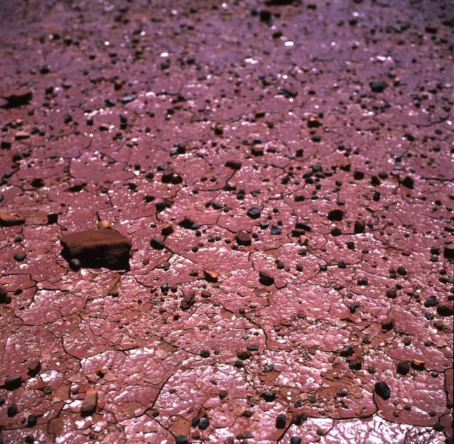
A close up, high angle view of a dry, cracked reddish-brown claypan ground surface scattered with small dark stones.
The cracked, arid surface of the claypan at Napwerte / Ewaninga Rock Carvings Conservation Reserve.

Napwerte / Ewaninga Rock Carvings Conservation Reserve ecosystems, habitats, and plant life

Ecologically, the reserve functions as a small but important refuge in an otherwise harsh arid environment. The defining feature is the claypan, which after rainfall collects and retains water, creating an ephemeral wetland in a landscape where surface water is otherwise rare. This brief appearance of moisture transforms the biological rhythm of the area, supporting an influx of birds, small mammals, and other wildlife drawn from the surrounding dunes and outcrops.

Beyond the claypan itself, the mix of sand dune and rocky outcrop supports the broader arid-zone ecology typical of central Australia. The exposed rock surfaces host lichens and other drought-adapted organisms adapted to intense sun and minimal moisture, while the sandy soils around the basin support sparse but hardy vegetation suited to long dry spells. Together, the reserve's habitats form a miniature ecological mosaic that pulses with seasonal activity whenever rain triggers the claypan to fill.

Napwerte / Ewaninga Rock Carvings Conservation Reserve wildlife and species highlights

Wildlife observation at the reserve is closely tied to the water-carrying behaviour of the claypan. After rain, the basin becomes a gathering point for many bird species and animals moving through the surrounding arid land, providing one of the few predictable wildlife encounters in the area. Although the reserve is small, its role as a transient watering point gives it an outsized ecological value for local fauna during and after wet periods.

The surrounding dunes and rocky outcrops host the typical central Australian fauna adapted to extreme aridity and temperature variation. Reptiles, small mammals, and drought-resilient bird species move through the landscape, often unseen during dry conditions but visible when rain softens the environment. Even when the claypan is dry, the reserve's combination of shaded rock crevices, sandy substrates, and sheltered basins supports the persistent presence of arid-zone wildlife throughout the year.

Napwerte / Ewaninga Rock Carvings Conservation Reserve conservation status and protection priorities

The primary conservation significance of the reserve lies in the protection of one of central Australia's most important collections of Aboriginal rock art. With around 1,000 petroglyphs preserved across its outcrops, the site safeguards a tangible and irreplaceable record of the Arrernte people's long cultural and spiritual connection to country. Protecting these engravings from damage, weathering, or unmonitored access is central to the reserve's purpose and is reinforced by its status as a sacred men's site whose access is governed by the traditional owners.

Beyond cultural protection, the reserve also conserves an ecologically distinctive combination of sand dunes, rocky outcrops, and a seasonal claypan. The claypan's function as an ephemeral wetland supports a localised pulse of biodiversity after rainfall, giving the reserve disproportionate ecological value relative to its size. Its gazetting as a conservation reserve in 1996, its classification under IUCN Category V as a protected landscape, and its formal transfer to Aboriginal ownership through an Indigenous land use agreement in 2005 together provide a layered protection framework that recognises both natural and cultural heritage values.

Napwerte / Ewaninga Rock Carvings Conservation Reserve cultural meaning and human context

The reserve lies within the traditional Country of the Arrernte people and is recognised as a sacred men's site. The name Napwerte, pronounced na-poor-ta, comes from the Arrernte language and refers to the rock outcrop itself, while Ewaninga is the established English-language name that has historically been used for the site. The official adoption of the dual name Napwerte / Ewaninga in 2014 reflects a broader movement to recognise Aboriginal place names alongside historical European-language designations in the Northern Territory.

The site's importance to the Arrernte community goes well beyond the archaeological value of the petroglyphs. The reserve is a living cultural landscape where traditional custodianship remains active, and access to the rock carvings is governed through the traditional owners. The granting of the reserve as Aboriginal land under the Aboriginal Land Rights Act 1976 formalised a recognition of Country that had long been acknowledged culturally, while the Indigenous land use agreement remains the principal governance framework for how the site is managed and visited. National-level recognition of the carvings through inclusions such as the National Museum of Australia's 2004 exhibition further extended awareness of this sacred place beyond central Australia.

Top sights and standout views in Napwerte / Ewaninga Rock Carvings Conservation Reserve

Within a remarkably small footprint, the reserve concentrates several elements that together make it one of the most distinctive protected areas in central Australia. Its roughly 1,000 Arrernte petroglyphs, many potentially tens of thousands of years old, form one of the most significant examples of central Australian rock art. The Panaramitee-style geometric motifs and occasional animal tracks have parallels with engravings found across central Australia and Tasmania, linking the site to a much wider ancient artistic tradition.

Equally distinctive is the claypan at the centre of the reserve, a shallow concave basin that gathers water after light rainfall and draws wildlife into an otherwise dry landscape. This seasonal wetland function, combined with the surrounding dunes and rocky outcrops used as carving surfaces, gives the reserve a layered identity in which geology, ecology, and Aboriginal cultural heritage are tightly interwoven. The formal arrangements for shared governance through the Indigenous land use agreement and the dual naming of the place make it a notable example of cultural recognition embedded within a protected-area framework.

Best time to visit Napwerte / Ewaninga Rock Carvings Conservation Reserve

The reserve's character shifts strongly with seasonal conditions. Periods following rainfall, even relatively light rainfall in the normally dry region, are when the claypan fills and wildlife activity around the basin is at its peak. At these times the reserve feels more alive, with birds and animals concentrated around the newly wet claypan, while the surrounding dunes and outcrops become cooler and more inviting to walk through.

During the drier parts of the year, the reserve offers a quieter, more austere experience, with the landscape dominated by red sand, exposed rock, and the pale claypan basin. The contrasts between light and shadow on the rocky outcrops are often more pronounced in brighter, cooler conditions, which can also improve visibility of the petroglyph surfaces. Cooler months of the year typically bring milder daytime temperatures, making exploration of the site more comfortable, while summer heat in central Australia can be intense and dry conditions tend to limit wildlife viewing around the basin.
Monthly climate preview

Long term annual temperature ranges and monthly precipitation patterns across representative terrain

Napwerte / Ewaninga Rock Carvings Conservation Reserve Climate and Temperature Normals

Representative coordinate records show significant annual temperature variation alongside consistently low daily precipitation throughout the year. Examining the full monthly climate profile reveals detailed thermal extremes and precipitation trends across all twelve periods.
Annual mean22 °C
13 °C30 °C
Jan30°
Feb29°
Mar26°
Apr22°
May16°
Jun13°
Jul13°
Aug15°
Sep21°
Oct24°
Nov27°
Dec29°
Warmest month
January

30.5 °C

Coolest month
July

12.5 °C

Wettest month
February

1.6 mm/day

Driest month
August

0.1 mm/day

Park location guide

Geography guide, regional context, and park location map for Napwerte / Ewaninga Rock Carvings Conservation Reserve

Napwerte / Ewaninga Rock Carvings Conservation Reserve park geography, regions, and map view in Australia

Understand where Napwerte / Ewaninga Rock Carvings Conservation Reserve sits in Australia through a broader geographic reading of the surrounding landscape, nearby location context, and its mapped position within the national park landscape.

How Napwerte / Ewaninga Rock Carvings Conservation Reserve fits into Australia

Australia is a constitutional monarchy and federal parliamentary democracy comprising six states and ten territories. With a population of nearly 28 million, it is one of the world's most urbanised countries, with most people concentrated on the eastern seaboard. The country has a high Human Development Index and is known for its cultural diversity, ancient Aboriginal heritage, and unique wildlife.

Wider geography shaping Napwerte / Ewaninga Rock Carvings Conservation Reserve in Australia

Australia occupies the entire Australian continent, the island of Tasmania, and numerous smaller islands. It is the world's flattest and driest inhabited continent, featuring vast deserts in the interior (the Outback), tropical rainforests along the eastern coast, and a coastline bordering the Indian and Pacific Oceans.

Map view of Napwerte / Ewaninga Rock Carvings Conservation Reserve

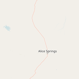
Use this park location map to pinpoint Napwerte / Ewaninga Rock Carvings Conservation Reserve in Australia, understand its exact geographic position, and read its mapped placement within the surrounding landscape more clearly.

Pigeon | © OpenStreetMap contributors

Location context for Napwerte / Ewaninga Rock Carvings Conservation Reserve

Northern Territory

Visualizing desert terrain, sandstone outcrops, and ancient petroglyph sites

Napwerte / Ewaninga Rock Carvings Conservation Reserve Photos and Landscapes

Photographs capture the arid desert environment, low sand dunes, and weathered sandstone outcrops that define the protected landscape. Visual documentation reveals the interplay between stone canvases and ephemeral wetland claypans across the reserve.

Close-up of red sandstone rock slabs covered in carved abstract circular and geometric patterns, located in a desert environment.

A close-up view of red sandstone rock formations and boulders under a clear deep blue sky in an arid Australian landscape.

A close up, high angle view of a dry, cracked reddish-brown claypan ground surface scattered with small dark stones.

Park atlas

Compare adjacent desert terrain and regional protected landscapes across central Australia

Parks Near Napwerte / Ewaninga Rock Carvings Conservation Reserve and Surrounding Protected Areas

Visitors exploring Napwerte / Ewaninga Rock Carvings Conservation Reserve can examine neighboring desert reserves and regional protected landscapes. Comparing nearby protected areas reveals wider patterns in arid terrain, ancient rock art sites, and ephemeral wetland habitats across the Northern Territory.
Wildlife reserveNorthern Territory
About 29 km away#1 closest

Northwest

Kuyunba Conservation Reserve: Wildlife Protected Landscape in Central Australia

Mapped geography and rocky habitat near Alice Springs

Kuyunba Conservation Reserve represents a focused approach to habitat protection in the Northern Territory. The terrain is defined by its rocky hills and boulder-filled escarpments, offering critical shelter for wildlife in an arid, drought-adapted desert region. This site provides a clear view of how targeted land management supports specialized ecological niches in inland Australia.

Area
6.29 km²
Established
1970
IUCN
V
Relief
Upland
National parkNorthern Territory
About 35 km away#2 closest

Northwest

Tjoritja / West MacDonnell National Park: National Park Atlas and Protected Landscape

Explore the dramatic MacDonnell Ranges terrain and geography.

Delve into the protected geography of Tjoritja / West MacDonnell National Park, a significant national park in Australia's Northern Territory. This landscape features striking mountain formations, deep gorges like Standley Chasm and Glen Helen, and is intrinsically linked to the famous Larapinta Trail and the Arrernte people's cultural heritage. Understanding its mapped boundaries and regional context provides essential insight into this iconic Central Australian protected area.

Area
2,568.61 km²
Established
1992
IUCN
II
Relief
Mountain
Protected landscapeNorthern Territory
About 46 km away#3 closest

Northeast

Corroboree Rock Conservation Reserve: Geological and Cultural Protected Area in Central Australia

Mapped protected landscape within the East MacDonnell Ranges

Corroboree Rock Conservation Reserve features a striking dolomite rock formation tied to ancient Precambrian salt lake sediments. Located east of Alice Springs, the reserve provides a protected glimpse into central Australian arid range geography and holds profound cultural importance for the Eastern Arrernte Traditional Owners within the surrounding pastoral landscape.

Area
0.07 km²
Established
1962
IUCN
V
Visitors
15K annual
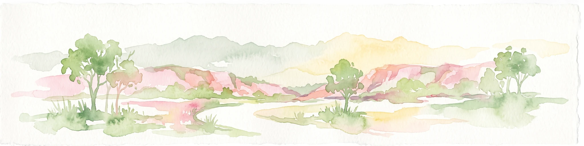
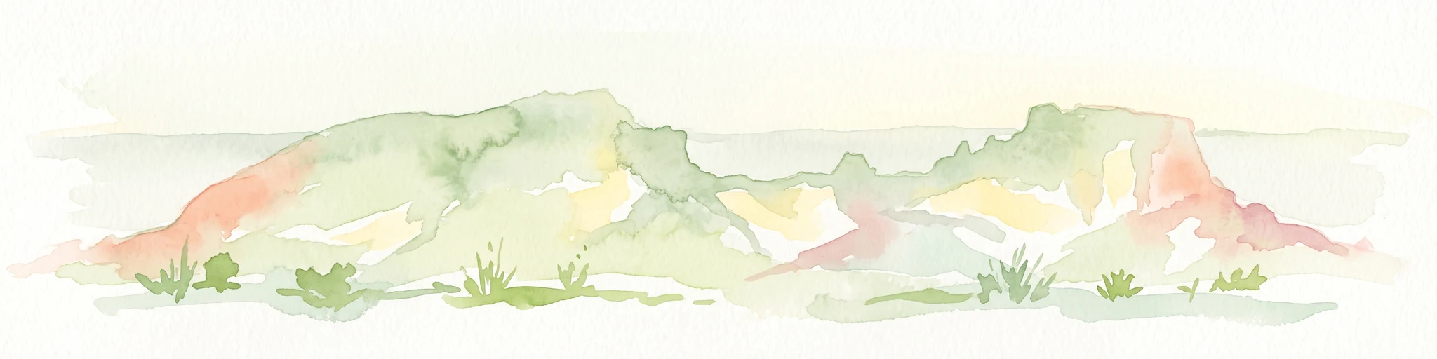
A horizontal watercolor painting showing stylized soft green, orange, and pale yellow hills under a white sky.
Nature reserveNorthern Territory
About 46 km away#4 closest

Southwest

Rainbow Valley Conservation Reserve: Geological Atlas and Protected Landscape Mapping

Examining the arid-zone terrain of Northern Territory, Australia.

The Rainbow Valley Conservation Reserve is a significant protected landscape known for its 350-million-year-old banded sandstone bluffs and diverse arid-zone habitats. This overview provides a focused look at the park's geological structure, claypan terrain, and its status as a vital site for Aboriginal heritage, offering a clear understanding of its place within the broader Northern Territory geographic context.

Area
24.83 km²
Established
1990
IUCN
V
Visitors
6.8K annual
A wide watercolor illustration showing a winding river or creek bed flanked by green trees, with pink and red rocky hills in the background under a pale sky.
Nature reserveNorthern Territory
About 67 km away#5 closest

Northeast

N'Dhala Gorge Nature Park: Mapped Geography and Protected Cultural Heritage

Nature reserve located in the eastern MacDonnell Ranges

This nature reserve protects a vital valley corridor in the Northern Territory where sandstone ridges and sandy terrain meet. The park serves as a repository for approximately 6,000 ancient petroglyphs and sustains specialized arid plant species. Use this resource to understand the park's structural boundaries and its place within the broader geography of Central Australia.

Area
5.01 km²
Established
1962
IUCN
V
Relief
Mountain
Protected landscapeNorthern Territory
About 71 km away#6 closest

Northeast

Trephina Gorge Nature Park: Mapped Geography and Protected Landscape Context

East MacDonnell Ranges, Northern Territory Australia

Trephina Gorge Nature Park represents a central feature of the arid MacDonnell Ranges, characterized by its deep gorge, white ghost gums against red rock, and expansive spinifex ridges. This record outlines the park boundaries, its role as a jointly managed conservation area, and its position within the broader geography of central Australia.

Established
1965
Relief
Mountain
Climate
Arid
Access
Access unknown
National parkAustralia
About 91 km away#7 closest

Northwest

West MacDonnell National Park: Australia's Outback Mountain Landscape and Protected Area

Explore mapped gorges, waterholes, and regional geography in the Red Centre.

West MacDonnell National Park serves as a key protected area within Australia's arid interior, delineating the dramatic western MacDonnell Ranges. This national park offers a unique opportunity to study its mapped landscape, characterized by ancient sandstone ridges, deep gorges, and permanent water sources that support endemic biodiversity. Its profound connection to Aboriginal cultural heritage and its status as a conservation reserve make it essential for understanding the geography and protected lands of central Australia's Red Centre.

Area
2,048 km²
Established
1992
IUCN
II
Relief
Mountain
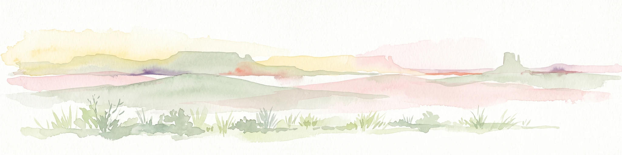
A soft watercolor painting of a desert landscape featuring rolling plains and a prominent, pillar-like rock formation on the horizon under a pale sky.
Natural monumentNorthern Territory
About 95 km away#8 closest

South

Chambers Pillar Historical Reserve: An Atlas of a Significant Northern Territory Sandstone Landmark

Geographic analysis of an iconic Australian outback desert monument

Chambers Pillar is a striking 50-meter sandstone column anchored in the arid plains of central Australia. This historical reserve serves as an essential subject for geological and regional mapping, offering a clear look at how isolated formations define the vast outback horizon. Explore the intersection of 350-million-year-old rock formations and the shifting desert sands that shape this protected cultural and natural site.

Area
3.4 km²
Relief
Lowland
Climate
Arid
Access
Remote access

Common questions about visiting, size, designation, and location context for Napwerte / Ewaninga Rock Carvings Conservation Reserve

Napwerte / Ewaninga Rock Carvings Conservation Reserve FAQs for park facts, access, geography, and protected area context

Find quick answers about Napwerte / Ewaninga Rock Carvings Conservation Reserve, including protected-area facts, park geography, trail and visitor context, and how the park fits into its surrounding country and regional landscape.
MoriAtlas Explorer

Continue Your Protected Areas Search Across the Global Atlas

Deepen your exploration by continuing the structured search for national parks and protected areas worldwide. Utilize the comprehensive filtering capabilities to compare different conservation landscapes and refine your understanding of global park geography. Discover more about the distribution and characteristics of protected natural areas.

Global natural geography