

Mori Atlas logo
Wildlife reserveConnells Lagoon Conservation Reserve

Analyzing the geographic boundaries, soil mosaics, and tropical grassland terrain of this Northern Territory reserve.

Connells Lagoon Conservation Reserve: A Protected Mitchell Grassland Landscape Map

Connells Lagoon Conservation Reserve protects a substantial expanse of the Barkly Tableland, serving as a critical reference point for intact Mitchell grassland systems in the Northern Territory. The landscape is characterized by expansive black soil cracking-clay plains and subtle drainage corridors that support unique bluebush communities. This protected area provides a rare, undisturbed look at the pre-pastoral conditions of Australian tropical grasslands, preserving the complex ecological patterns found across Wambaya country.

Mitchell grasslandBarkly Tablelandgrassland conservationblack soil plainsbluebush shrublandstrict nature reserve

Connells Lagoon Conservation Reserve

Wildlife reserve

Park overview

Structured park overview, official facts, and landscape profile for Connells Lagoon Conservation Reserve

Connells Lagoon Conservation Reserve park facts, protected area profile, and essential visitor context

Review the core facts for Connells Lagoon Conservation Reserve, including designation, size, terrain, visitor scale, habitats, and operating context in one park-focused overview.

About Connells Lagoon Conservation Reserve

Connells Lagoon Conservation Reserve is a large, remote protected area in the Northern Territory of Australia, situated on the Barkly Tableland between the towns of Tennant Creek and Elliott. Known also by its Aboriginal name Dalgajini, the reserve was created with a clear ecological mandate: to conserve Mitchell grassland communities in a setting where cattle grazing and frequent fires had already transformed much of the surrounding landscape. The area was gazetted in 1984 and formally established as a conservation reserve in 1994, and it remains one of the more significant strictly protected grassland reserves in northern Australia.

The setting of the reserve is defined by the broad, flat expanse of the Barkly Tableland. Black soil cracking-clay plains cover most of the area, sitting above flat beds of Middle Cambrian Camooweal dolomite, while higher ground shows gravelly red-earth soils. Tree cover is sparse and largely limited to narrow strips along the watercourses in the northern portion of the reserve, with bluebush occupying the wettest areas. The eponymous Connells Lagoon itself lies just outside the reserve's boundary fence, yet the broader landscape it characterises is precisely what the reserve exists to protect.

Ecologically, Connells Lagoon Conservation Reserve is anchored by Mitchell grass, one of the dominant perennial grass genera across the Barkly region and a foundation of the area's pastoral economy. Alongside the grasslands, the reserve contains subtle but important habitat variation, including seasonal wetlands, swales with bluebush, and lightly wooded drainage lines. This combination of habitats supports a community of birds, reptiles, and mammals typical of the Barkly's semi-arid tropical grasslands, including several species of conservation concern. The early 1982 surveys recorded 189 plant species, 53 bird species, 19 reptile species, and 9 mammal species, providing a baseline that continues to give the reserve scientific importance.

The reserve is also a culturally significant landscape. The traditional owners of the area are the Wambaya people, who identify the reserve as part of the broader Rumburriya semi-moiety country, referred to as Mangurinji. Dreamtime narratives relating to ancestral beings known as Mangaya are tied to features within and around the reserve, underscoring the deep connection between the Wambaya and this stretch of the Barkly Tableland. This Aboriginal heritage, expressed through the name Dalgajini and the continuing cultural ownership of the land, is part of the reserve's identity alongside its ecological role.

From a management perspective, Connells Lagoon Conservation Reserve is administered by the Parks and Wildlife Commission of the Northern Territory and is classified as an IUCN Category Ia strict nature reserve. The long-term exclusion of cattle and the suppression of uncontrolled fire have allowed the Mitchell grassland to remain largely intact, making the reserve a useful benchmark for understanding what Barkly Tableland grasslands look like without heavy pastoral pressure. Its listing in 2002 on the (now-defunct) Register of the National Estate further reflected its recognition as a place of national environmental significance.

Quick facts and research context for Connells Lagoon Conservation Reserve

Connells Lagoon Conservation Reserve covers roughly 259 square kilometres in the Northern Territory of Australia and is managed by the Parks and Wildlife Commission of the Northern Territory. It sits at the heart of the Barkly Tableland, within the semi-arid tropical grassland zone that defines much of the region's pastoral and ecological character. The reserve was formally established in 1994, although the land had been gazetted and fenced about a decade earlier, in 1984, to exclude cattle and uncontrolled fire. It is listed under IUCN Category Ia as a strict nature reserve, reflecting its emphasis on ecological preservation rather than public recreation.

The reserve is best understood as a Mitchell grassland stronghold, with associated habitats that include bluebush swales, scattered tree stands along watercourses, and black soil cracking-clay plains. A biological survey carried out in 1982 recorded 189 plant species, 53 bird species, 19 reptile species, and 9 mammal species within the area. Several bird species documented there are of conservation concern, giving the reserve additional significance as a refuge for declining grassland fauna of the Barkly region.

Protection and recognition

Documented terrestrial protection metrics, historical designation records, and conservation status overview.

Connells Lagoon Conservation Reserve Protection Status and Designation History

Connells Lagoon Conservation Reserve maintains established terrestrial protection status stemming from its 2002 designation year. Official conservation records outline the governing management framework, administrative scope, and recognized international standing for this protected area.

Protection details

Protection scope
Terrestrial
Designated year
2002
Transboundary protection
No
Park context

Deeper park guide and search-rich context for Connells Lagoon Conservation Reserve

Connells Lagoon Conservation Reserve history, landscape, wildlife, and travel context

Explore Connells Lagoon Conservation Reserve through its history, landscape character, ecosystems, wildlife, conservation priorities, cultural context, and seasonal travel timing in a structured park guide built for atlas discovery and search intent.

Why Connells Lagoon Conservation Reserve stands out

Connells Lagoon Conservation Reserve is best known for protecting a substantial expanse of Mitchell grassland on the Barkly Tableland, one of the great tropical grassland landscapes of northern Australia. The reserve safeguards a representative example of the black soil cracking-clay plains, scattered tree-lined watercourses, and bluebush communities that together define the ecological character of this part of the Northern Territory. The reserve has also become notable for its exclusion of cattle and uncontrolled fire since the mid-1980s, which has allowed the grassland to be maintained in a relatively undisturbed state. This makes it a valuable reference site for understanding the pre-pastoral condition of Barkly Tableland grasslands, and for monitoring rare grassland bird species that have declined elsewhere across the region. Its cultural importance to the Wambaya people, where the Aboriginal name Dalgajini is still used, adds another layer of identity to the reserve beyond its ecological role.

Connells Lagoon Conservation Reserve history and protected-area timeline

The history of Connells Lagoon Conservation Reserve is closely tied to the pastoral development of the Barkly Tableland. European pastoralists arrived in the area in the 1880s, and the landscape soon became part of an active cattle grazing landscape. The reserve site was used as a stock reserve along the Barkly stock route, a corridor through which large numbers of cattle were moved across the Northern Territory until the 1960s, when road transport replaced overlanding and the traffic along these traditional stock routes declined.

Recognition of the area's ecological value grew during the late twentieth century. A biological survey conducted in the area in 1982 documented the richness of its plant and animal communities, recording 189 plant species, 53 bird species, 19 reptile species and 9 mammal species. This survey helped build the case for protecting a representative sample of the Mitchell grassland landscape before further degradation could occur.

In 1984, the area was gazetted and fenced, an important turning point that excluded cattle and uncontrolled fire from the reserve. A decade later, in 1994, it was formally established as Connells Lagoon Conservation Reserve under the management of what is now the Parks and Wildlife Commission of the Northern Territory. In 2002, the reserve was listed on the Register of the National Estate, an independent recognition of its environmental and cultural significance, although that register has since been discontinued.

Parallel to this European land-use and conservation history is the much longer Indigenous history of the area. The Wambaya people are the traditional owners of the reserve and the surrounding country, identifying it as part of the broader Rumburriya semi-moiety area known as Mangurinji. The Aboriginal name Dalgajini continues to be used alongside the European name, and ancestral beings known as Mangaya are central to Wambaya Dreamtime narratives linked to features across the reserve.

Connells Lagoon Conservation Reserve landscape and geographic character

The landscape of Connells Lagoon Conservation Reserve is characteristic of the central Barkly Tableland: broad, flat, and visually understated, with subtle variation driving much of its ecological interest. The reserve sits on a vast plain dominated by black soil cracking-clay country, with the cracking clays underlain by flat beds of Middle Cambrian Camooweal dolomite. On slightly higher ground within the reserve, gravelly red-earth soils replace the dark cracking clays, producing a gentle mosaic of soil types across an otherwise level terrain.

Watercourses appear mainly in the northern sections of the reserve, and these corridors carry small stands of trees that stand out against the otherwise open grassland. Bluebush communities are found in the wettest areas, occupying depressions and drainage lines where moisture persists longest after rain. The lagoon from which the reserve takes its name lies just outside the boundary fence, but it shapes the identity of the place and reflects the broader hydrology of the Barkly landscape, in which seasonal inundation is a defining feature.

Overall, the impression is of a vast, quiet, semi-arid tropical grassland plain, broken only by shallow swales, scattered tree-lined channels, and the bright green flush that follows the wet season rains. The reserve's topographical subtlety belies its ecological importance, as these gentle variations in soil, drainage, and tree cover drive the distribution of Mitchell grass, bluebush, and the fauna that depend on them.

Connells Lagoon Conservation Reserve ecosystems, habitats, and plant life

The natural character of Connells Lagoon Conservation Reserve is shaped by the Mitchell grasslands that define much of the Barkly Tableland. Mitchell grass is the dominant perennial grass across the black soil cracking-clay plains, forming a relatively uniform but ecologically critical ground layer that supports the area's birds, reptiles, and small mammals. The reserve's long-term exclusion of cattle and uncontrolled fire has allowed these grasslands to persist in a near-natural state, making the area an important reference for understanding the structure and composition of pre-pastoral Barkly grasslands.

Around the margins of the grassland system, the reserve contains a suite of associated habitats. Bluebush occupies the wettest areas, forming distinct chenopod shrublands that contrast with the surrounding grass cover. The watercourses in the northern section support small stands of trees, providing vertical structure and shade that is otherwise scarce across the plain. These trees, combined with the swales and depressions where moisture persists, create habitat heterogeneity within what at first appears to be a uniform landscape.

The reserve's vegetation recorded in the 1982 biological survey included 189 plant species, an indication of the surprising botanical richness that the Mitchell grass plains and their associated habitats can support. The combination of cracking-clay soils, dolomite substrate, red-earth higher ground, and seasonal water availability produces a subtle but distinct ecological patchwork, with the reserve functioning as a stronghold for grassland communities that have declined elsewhere across the Barkly region due to grazing pressure and altered fire regimes.

Connells Lagoon Conservation Reserve wildlife and species highlights

The wildlife of Connells Lagoon Conservation Reserve reflects the broader fauna of the Barkly Tableland's Mitchell grassland systems. The 1982 biological survey recorded 53 bird species, 19 reptile species, and 9 mammal species within the area, providing an early and still valuable snapshot of the reserve's faunal diversity. The grassland environment, with its scattered tree-lined watercourses and seasonal swales, supports a community of birds and reptiles adapted to semi-arid tropical conditions.

Several bird species documented in the reserve are of conservation concern, giving the area particular significance for grassland bird conservation in northern Australia. Species of note include the flock bronzewing, the red-chested button-quail, the Australian bustard, and the pictorella mannikin. These species are typical of the Barkly's extensive native grasslands and have elsewhere declined under heavy grazing pressure, making Connells Lagoon an important refuge in the region.

Beyond the birdlife, the reserve provides habitat for a range of reptiles and small to medium-sized mammals typical of Barkly Tableland environments. While the mammalian fauna is relatively low in species richness compared with more wooded environments, the reptiles represent a substantial component of the reserve's fauna, exploiting the warm, sun-exposed cracking-clay plains. The combination of birds, reptiles, and mammals, maintaining natural patterns under cattle-free and fire-managed conditions, makes the reserve a useful benchmark for the wildlife that Mitchell grasslands can support when left relatively undisturbed.

Connells Lagoon Conservation Reserve conservation status and protection priorities

Conservation is the central purpose of Connells Lagoon Conservation Reserve. The reserve was established primarily to protect Mitchell grassland communities on the Barkly Tableland, one of the most ecologically significant tropical grassland systems in northern Australia. By removing cattle and controlling access for several decades, the reserve provides a rare example of these grasslands maintained in a condition close to their pre-pastoral state, against a regional background where heavy cattle grazing has altered much of the surrounding landscape.

The reserve is classified under IUCN Category Ia as a strict nature reserve, reflecting its emphasis on ecological preservation rather than visitor use. It is managed by the Parks and Wildlife Commission of the Northern Territory, with a focus on maintaining the integrity of Mitchell grass, bluebush, and tree-lined watercourse habitats, and on supporting the native fauna that depends on them. The presence of several threatened or declining grassland bird species, including the flock bronzewing, red-chested button-quail, Australian bustard, and pictorella mannikin, gives the reserve an additional conservation role as a refuge for fauna that has declined across other parts of the Barkly.

Recognition of the reserve's conservation importance came in 2002 with its listing on the Register of the National Estate, an acknowledgment of its environmental and cultural significance at a national level. While that register is no longer active, the listing reflects the standing of Connells Lagoon as a place of enduring ecological value, particularly as a baseline site for understanding and managing Barkly Tableland grasslands into the future.

Connells Lagoon Conservation Reserve cultural meaning and human context

The cultural dimension of Connells Lagoon Conservation Reserve centres on the Wambaya people, the traditional owners of the land on which the reserve sits. The Wambaya identify the reserve as part of the broader Rumburriya semi-moiety area, an extensive stretch of Barkly Tableland country they refer to as Mangurinji. The reserve is also known by the Aboriginal name Dalgajini, reflecting the continuing role of Wambaya language and place-naming in describing this landscape.

For the Wambaya, the reserve holds deep cultural and spiritual significance. Ancestral beings known as Mangaya are central to Wambaya Dreamtime narratives tied to features in and around the reserve. These ancestral beings are understood to have created several features of the landscape during the Dreamtime, embedding the area within a wider network of Wambaya storyplaces across the Barkly region.

European land use later brought pastoralists into the area from the 1880s onward, with the reserve site being used as a stock reserve along the Barkly stock route. The eventual gazetting and fencing of the reserve in 1984, and its formal establishment as a conservation reserve in 1994, mark the transition of the area into a formally protected landscape that nonetheless remains Wambaya country. The intersection of Wambaya cultural ownership and contemporary nature conservation is part of the reserve's ongoing identity.

Top sights and standout views in Connells Lagoon Conservation Reserve

Connells Lagoon Conservation Reserve is a large, quiet, strictly protected grassland reserve on the Barkly Tableland, anchoring a substantial area of Mitchell grass country in a near-natural condition.

Its combination of Mitchell grassland, bluebush swales, scattered tree-lined watercourses, and seasonal wetlands supports an array of birds, reptiles, and mammals typical of the Barkly, including several grassland bird species of conservation concern.

Best time to visit Connells Lagoon Conservation Reserve

The character of Connells Lagoon Conservation Reserve is shaped strongly by the tropical seasonal cycle that defines the Barkly Tableland. Following the wet season rains, which generally arrive in the warmer months, the Mitchell grasslands and associated swales can green up dramatically, producing fresh growth, denser ground cover, and more active bird and reptile life. This period often brings the most visible wildlife activity and the most lush appearance of the grassland plains.

In the cooler dry months, the reserve takes on a more muted, sun-bleached appearance, with grasses curing off and water becoming more restricted to the deeper watercourses. Wildlife tends to concentrate around the remaining water sources, and the reserve's open character makes these areas particularly important for bird observation. Because Connells Lagoon is a remote, strictly managed nature reserve with limited public infrastructure, the timing of a visit should also take into account the practical realities of reaching such an isolated part of the Northern Territory, with cooler dry-season conditions typically providing more reliable access to the region.
Monthly climate preview

Long-term monthly temperature and precipitation patterns across the reserve coordinate

Connells Lagoon Conservation Reserve Climate Normals and Annual Temperature Rhythm

Connells Lagoon Conservation Reserve records sustained high monthly maximum temperatures alongside measured seasonal variations in precipitation across the representative coordinate. Reviewing the comprehensive monthly climate normals and temperature averages provides deeper insight into the local environmental profile.
Annual mean26 °C
19 °C32 °C
Jan30°
Feb29°
Mar28°
Apr27°
May22°
Jun19°
Jul19°
Aug21°
Sep26°
Oct30°
Nov31°
Dec32°
Warmest month
December

31.6 °C

Coolest month
July

18.7 °C

Wettest month
February

4.2 mm/day

Driest month
August

0.1 mm/day

Park location guide

Geography guide, regional context, and park location map for Connells Lagoon Conservation Reserve

Connells Lagoon Conservation Reserve park geography, regions, and map view in Australia

Understand where Connells Lagoon Conservation Reserve sits in Australia through a broader geographic reading of the surrounding landscape, nearby location context, and its mapped position within the national park landscape.

How Connells Lagoon Conservation Reserve fits into Australia

Australia is a constitutional monarchy and federal parliamentary democracy comprising six states and ten territories. With a population of nearly 28 million, it is one of the world's most urbanised countries, with most people concentrated on the eastern seaboard. The country has a high Human Development Index and is known for its cultural diversity, ancient Aboriginal heritage, and unique wildlife.

Wider geography shaping Connells Lagoon Conservation Reserve in Australia

Australia occupies the entire Australian continent, the island of Tasmania, and numerous smaller islands. It is the world's flattest and driest inhabited continent, featuring vast deserts in the interior (the Outback), tropical rainforests along the eastern coast, and a coastline bordering the Indian and Pacific Oceans.

Map view of Connells Lagoon Conservation Reserve

Use this park location map to pinpoint Connells Lagoon Conservation Reserve in Australia, understand its exact geographic position, and read its mapped placement within the surrounding landscape more clearly.

Pigeon | © OpenStreetMap contributors

Location context for Connells Lagoon Conservation Reserve

Northern Territory
Park atlas

Compare adjacent grassland habitats, black soil plains, and northern Australian reserves.

Explore Parks Near Connells Lagoon Conservation Reserve and Regional Protected Landscapes

Discover protected areas near Connells Lagoon Conservation Reserve to compare regional grassland ecosystems and tropical savanna terrain. Expanding the geographic view reveals connected conservation landscapes and similar reserves across the Barkly Tableland.
National parkQueensland
About 206 km away#1 closest

East

Boodjamulla National Park: Queensland National Park Geography and Mapped Boundaries

Explore the protected landscape and regional context of Boodjamulla National Park.

Boodjamulla National Park represents a key protected area within the northeastern Australian state of Queensland, offering users a detailed look at its geographic identity and mapped conservation boundaries. This national park serves as a focal point for understanding the distribution of protected lands and the unique natural terrain it encompasses within its regional setting. Discover its atlas-relevant features and protected landscape context.

Area
2,820 km²
Established
1985
IUCN
II
Relief
Highland
National parkQueensland
About 214 km away#2 closest

Southeast

Camooweal Caves National Park: Protected National Park Geography and Map Context in Queensland

Explore mapped boundaries and regional landscape character.

Camooweal Caves National Park represents a distinct protected landscape within Queensland, Australia. This national park offers users a focused entry into exploring its specific geographic features and mapped boundaries. Delve into the unique regional context and understand the atlas-level significance of this protected natural area, providing a clear view of its natural terrain and conservation identity.

Area
138 km²
Established
1988
IUCN
II
Relief
Upland
National parkNorthern Territory
About 275 km away#3 closest

Southwest

Iytwelepenty / Davenport Range National Park: Protected National Park Landscape Atlas

Explore Northern Territory's mapped protected area and regional geography.

Iytwelepenty / Davenport Range National Park is a designated national park offering crucial insights into Australia's protected landscapes. This resource provides a detailed view of its geographic position within the Northern Territory, emphasizing its mapped boundaries and the surrounding regional context. Users seeking to understand the distribution and geographical characteristics of protected areas will find this park's atlas-style data invaluable for discovery.

Area
1,278.47 km²
Established
1993
IUCN
II
Relief
Mountain
National parkNorthern Territory
About 276 km away#4 closest

North

Limmen National Park: Explore Australia's Northern Territory National Park & Protected Landscape

Discover mapped geography and regional context for this protected area.

Limmen National Park stands as a distinct protected area within the Northern Territory, offering valuable insights for geographic exploration. This national park serves as a focal point for understanding the mapped landscape and the broader regional context of protected lands in Northern Australia. Its identity as a national park contributes significantly to the geographic narrative of the territory, making it a crucial point for atlas-based discovery.

Area
9,369.26 km²
Established
2012
IUCN
II
Relief
Upland
Wildlife reserveNorthern Territory
About 277 km away#5 closest

North

Pungalina-Seven Emu Sanctuary: Protected Wildlife Reserve and Regional Landscape Atlas

Coastal and upland wilderness in the Northern Territory

Uncover the geographic breadth of Pungalina-Seven Emu Sanctuary, an essential wildlife reserve in Australia. The landscape encompasses sandstone gorges, extensive freshwater wetlands, and tidal mudflats, providing a crucial conservation corridor along the Gulf of Carpentaria. This site offers deep insight into the intersection of Indigenous stewardship and professional land management across tropical savanna environments.

Area
3,072.12 km²
Established
2009
IUCN
II
Relief
Upland
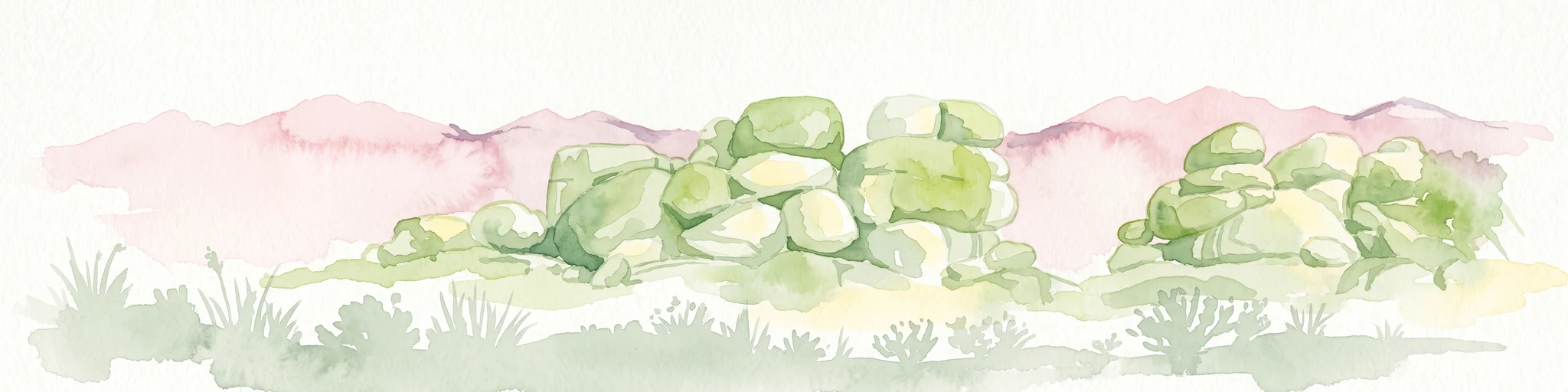
A watercolor painting of large, round granite boulders resting on a grassy plains landscape with a soft, faded pink background.
Nature reserveNorthern Territory
About 300 km away#6 closest

Southwest

Karlu Karlu / Devils Marbles Conservation Reserve: Mapped Desert Landscapes and Geological Sites

Protected granite formations in the Northern Territory

Investigate the distinctive boulder fields and arid geography of Karlu Karlu / Devils Marbles Conservation Reserve, a significant Indigenous Protected Area located in the heart of Australia. The site maps the intersection of ancient geological processes and enduring cultural narratives, providing clear boundary context for one of the most recognizable natural landmarks in the Barkly region.

Area
18.02 km²
Established
1961
IUCN
V
Visitors
137.5K annual
Protected areaNorthern Territory
About 347 km away#7 closest

West

Lake Woods Protected Area: Northern Territory Wetland Geography and Atlas Data

Ephemeral floodplain and waterbird habitat mapping

Lake Woods is a distinct freshwater system in the Northern Territory, defined by its cycle of flooding and recession. The basin hosts an important mosaic of coolibah woodland, river red gums, and lignum shrubland. As a recognized wetland for migratory and breeding waterbirds, the area offers a significant example of inland Australian floodplain geography and dynamic aquatic ecosystems.

Area
1,240 km²
Water
Water-dominated
Nature reserveNorthern Territory
About 355 km away#8 closest

Northwest

Bullwaddy Conservation Reserve: Protected Woodland Geography on the Northern Territory Sturt Plateau

Nature reserve boundary and landscape context

Bullwaddy Conservation Reserve represents an important protected woodland enclave on the Sturt Plateau. The terrain, defined by nutrient-poor lateritic soils, supports dense native thickets that stand out against the backdrop of the surrounding pastoral landscape. This nature reserve provides essential ecological integrity for local species and serves as a significant site for understanding the natural vegetation patterns of the Australian outback.

Area
115.3 km²
Established
2000
IUCN
Ia
Relief
Upland

Common questions about visiting, size, designation, and location context for Connells Lagoon Conservation Reserve

Connells Lagoon Conservation Reserve FAQs for park facts, access, geography, and protected area context

Find quick answers about Connells Lagoon Conservation Reserve, including protected-area facts, park geography, trail and visitor context, and how the park fits into its surrounding country and regional landscape.
MoriAtlas Explorer

Continue Your Protected Areas Search Across the Global Atlas

Deepen your exploration by continuing the structured search for national parks and protected areas worldwide. Utilize the comprehensive filtering capabilities to compare different conservation landscapes and refine your understanding of global park geography. Discover more about the distribution and characteristics of protected natural areas.

Global natural geography