Mori Atlas logo
Protected areaCoul Links

Examining the complex transition from active shoreline foredunes to stable coastal heathland geography

Coul Links Protected Area: An Atlas Analysis of Coastal Dune and Heathland Landscapes in Sutherland

Coul Links represents one of the most complete coastal dune systems in Scotland, illustrating a natural progression from shifting shoreline sands through sheltered dune slacks to older, inland coastal heathland. This protected area in Sutherland sits adjacent to the tidal inlets of Loch Fleet, creating a rich mosaic of freshwater lochans, juniper-scrub patches, and brackish shorelines. Understanding the terrain requires looking at the interconnected topographical layers of dunes, flats, and troughs that define this unique coastal environment.

coastal dunessand dunescoastal heathlandjuniper scrubdune slackslochans

Coul Links

Protected area

Park overview

Structured park overview, official facts, and landscape profile for Coul Links

Coul Links park facts, protected area profile, and essential visitor context

Review the core facts for Coul Links, including designation, size, terrain, visitor scale, habitats, and operating context in one park-focused overview.

About Coul Links

Coul Links occupies a stretch of the east Sutherland coastline bordering the sea and the tidal Loch Fleet. In the local landscape tradition of the Scots language, 'links' refers to coastal sand dunes, and Coul Links is one of the clearer and more intact representations of this kind of dune landscape in Scotland. Unlike many other coastal dune systems, Coul Links preserves a continuous gradient from the dynamic foredune at the shoreline, through the broader dune ridges, into older fixed dunes and ultimately into a distinctive zone of coastal heathland. This full transition allows the natural processes of dune formation, stabilization, and ecological succession to be observed in close proximity.

The site gained its conservation reputation through the richness and rarity of its flora and fauna. The wet slacks between the dune ridges hold specialized plant communities, while the older heath surfaces support juniper scrub and a mixture of heathland species. Coul Links also has an unusual ecological importance for invertebrates, particularly Fonseca's seed fly, a species whose known distribution is overwhelmingly concentrated on sand dunes along the east coast of Scotland. As a result, Coul Links is not only a scenic dune landscape but also a nationally and internationally important biological site.

Administratively and ecologically, Coul Links does not stand alone. It forms part of the Loch Fleet Site of Special Scientific Interest, contributing its dune habitats to the wider interest of that designation. It also falls within the Dornoch Firth and Loch Fleet Special Protection Area, which recognizes the area's significance for birds, and within the corresponding Ramsar site, which acknowledges it as a wetland of international importance. Despite these overlapping designations, Coul Links lies outside the formal boundary of the Loch Fleet national nature reserve, with the Scottish Wildlife Trust having managed the dunes under a separate agreement with the landowner for many years.

The site has also become known beyond the conservation community through a long-running debate over whether part of the dune system should be converted into a golf course. That debate brought national attention to the ecological value of Coul Links, raised questions about how Scotland weighs coastal development against internationally protected habitats, and ultimately led to the Scottish Government refusing planning permission for the proposal after a public inquiry.

Quick facts and research context for Coul Links

Coul Links is a sand dune system on the Sutherland coast of northeast Scotland, located between Golspie and Dornoch and adjacent to Loch Fleet. The site forms part of the Loch Fleet SSSI and lies within the Dornoch Firth and Loch Fleet Special Protection Area and Ramsar site, although it is outside the adjacent Loch Fleet national nature reserve. Coul Links is noted for displaying a complete natural transition from foredune to dune heathland, a feature described as unusual within Scotland, and it supports rare plants and invertebrates, including the endemic Fonseca's seed fly.

Protection and recognition

Examine the documented protection scope and international designation records

Coul Links Protection Status and Terrestrial Conservation Recognition

Terrestrial protection status and administrative conservation frameworks for Coul Links appear across verified records. Documented management parameters provide a clear baseline for evaluating official protected area designations.

Protection details

Protection scope
Terrestrial
Transboundary protection
No
Park context

Deeper park guide and search-rich context for Coul Links

Coul Links history, landscape, wildlife, and travel context

Explore Coul Links through its history, landscape character, ecosystems, wildlife, conservation priorities, cultural context, and seasonal travel timing in a structured park guide built for atlas discovery and search intent.

Why Coul Links stands out

Coul Links is best known for its unusually complete sequence of coastal sand dune habitats, from active foredune on the shoreline through the dune system to older coastal heathland inland. It is also recognized as a stronghold of Fonseca's seed fly, a rare invertebrate whose global range is largely restricted to the sand dunes of Scotland's east coast. The combination of botanically rich dune slacks, juniper-dominated heath patches, seasonal lochans, and its position beside Loch Fleet gives the site a distinctive ecological character within Scotland's coastal landscapes.
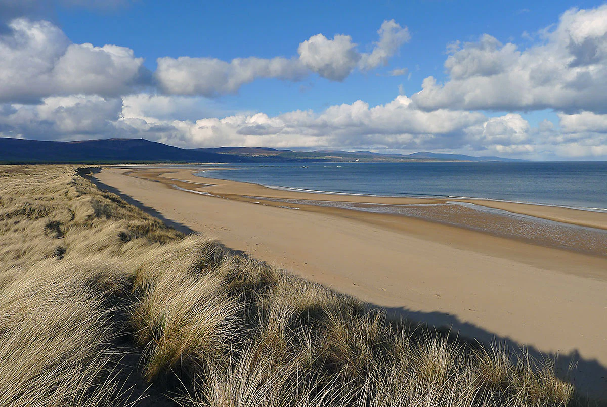
A wide coastal landscape view showing grass-covered sand dunes in the foreground leading to a long, sweeping sandy beach and calm blue water under a cloudy sky.
The expansive sand dunes and coastline stretching between Embo and Loch Fleet.

Coul Links history and protected-area timeline

Coul Links has a long-standing presence as a recognizable coastal dune landscape on the Sutherland coast, but its documented modern history is closely tied to conservation management and to the recent controversy surrounding development proposals for the site.

From 1985 until 2010, the Scottish Wildlife Trust managed Coul Links under an agreement with the landowner, overseeing the dune and heathland habitats in cooperation with other conservation agencies in the area. When that agreement expired it was not renewed, and the Scottish Wildlife Trust's direct role at the dunes ended, although the Trust has remained involved in the management of the adjacent Loch Fleet national nature reserve. Over time, Coul Links also became recognized through a succession of statutory conservation designations covering Loch Fleet and the surrounding coast, including the Site of Special Scientific Interest, the Special Protection Area, and the Ramsar designation.

In 2015, a proposal was put forward by a company led by the American developer Todd Warnock to construct a golf course on a portion of the dunes, an idea that would have involved disturbing around thirteen hectares of dune habitat. The proposal quickly became a focal point for national debate. Major conservation organizations, including the Scottish Wildlife Trust, Scottish Natural Heritage, RSPB Scotland, Plantlife Scotland, Ramblers Scotland, the National Trust for Scotland, and the International Otter Survival Fund, all objected on the grounds that a golf course would disrupt the natural dune processes, threaten protected flora and fauna, and undermine the site's international conservation commitments.

Highland Council approved the proposal on 20 June 2018, but the Scottish Government decided in August of that year to call in the decision for closer national scrutiny. In February 2019, the government announced that the matter would be decided through a formal public inquiry, and in February 2020 the government's Planning and Architecture Division formally refused permission for the development, effectively ending the proposal.

Coul Links landscape and geographic character

Coul Links is a classic example of a Scottish coastal links landscape, the term used in the Scots language for stretches of shoreline sand dune. The dunes form a continuous system along the Sutherland coast, beginning at the active beach where sand is still moved by wind and waves and grading inland through a series of dune ridges and flats. Behind the dunes, the landscape passes into older, more stable surfaces where the sandy ground has become colonized by heath vegetation, producing a distinctive coastal heathland that gives Coul Links much of its visual and ecological variety.

Within this continuous system, the topography is broken by dune slacks, the lower-lying troughs between dune ridges. Some of these slacks are damp or seasonally flooded, holding small lochans of fresh water that reflect the sky between the dunes and create sheltered microhabitats. The contrast between the open dune slopes with their marram-grass-dominated surfaces, the darker wet hollows, and the warmer-toned heath inland gives the site a strongly varied terrain despite its relatively narrow coastal extent.

The setting is shaped further by the proximity of Loch Fleet, a tidal inlet that joins the sea near the northern end of the dune system. The combination of open sandy beach, the dune ridges, the freshwater slacks, and the brackish shoreline of Loch Fleet produces a layered coastal scenery in which water, sand, and heathland are closely interwoven. Embo Sands flanks the southern side of the system, contributing to the long coastal sweep of dune and beach that defines this stretch of the Sutherland coast.
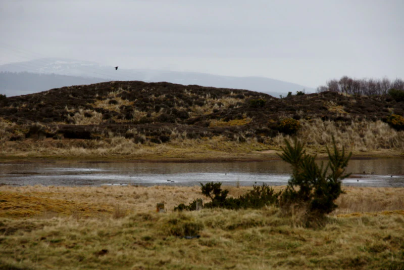
A small, calm lochan surrounded by low-lying, brownish grassy dunes and heathland under an overcast sky.
A small lochan nestled within the sand dunes at Coul Links, featuring coastal heathland and distant hills.

Coul Links ecosystems, habitats, and plant life

The ecological character of Coul Links is built around the gradient of dune habitats that runs from the shoreline inland. Closest to the sea, mobile foredunes represent the active part of the system, where wind and tide continue to shape the sand. Further inland, more stable dune ridges support denser plant cover, while the slack habitats in between are naturally wetter, sometimes seasonal, and host distinctive communities associated with damp sandy soils. Beyond the older fixed dunes, the landscape passes into coastal heathland where vegetation reflects the long history of the sand surface and the influence of nearby mineral-poor soils.

This variety of dune and heathland environments makes Coul Links unusually rich in botanical terms. The plant life includes several rare and locally significant species, and the wetter slacks provide conditions for plants that would not survive on the drier dune ridges. The juniper scrub on the older heath surface adds a structurally distinct element to the vegetation mosaic, breaking up the otherwise open dune and heath expanse with darker, denser patches of shrub.

Beyond plants, Coul Links is also notable for the rare invertebrate fauna associated with its dune soils and vegetation. The conditions created by the open sand, the slacks, and the surrounding heathland support species whose populations are tightly linked to this particular combination of habitats. As a result, the conservation value of Coul Links cannot be understood from its plants alone; the invertebrate communities in the dunes are an integral part of what makes the site distinctive within Scotland.

Coul Links wildlife and species highlights

Coul Links is primarily recognized for its dune and heathland plant communities and for its rare invertebrates, but the site's ecological importance also extends to birds, especially through its connection with Loch Fleet and the surrounding protected areas.

The dune system itself occasionally hosts nesting terns, which attempt to breed on the open sand. Local conservation management has long recognized that this nesting activity is vulnerable to human disturbance, especially from dog walking, horse riding, and unauthorized vehicle use on the dunes, all of which have been recorded as ongoing issues at the site. Beyond the nesting season, the broader mosaic of beach, dune, slack, and heath supports a varied bird community across the year.

The site's position beside Loch Fleet, which is recognized as a Special Protection Area and Ramsar site for its bird interest, further extends the wildlife significance of Coul Links. Waders and waterfowl such as oystercatchers are part of the regular fauna of the shoreline where the dunes meet the tidal inlet, and the Dornoch Firth and Loch Fleet designations reflect the regional importance of this stretch of coast for migratory and wintering birds. While Coul Links is not a national nature reserve itself, its contribution to the wider Loch Fleet ecosystem means that its wildlife interest is considered well beyond its small area alone.

Coul Links conservation status and protection priorities

Coul Links holds a layered set of conservation designations that reflect both its national and international importance. Formally, the dune system is part of the Loch Fleet Site of Special Scientific Interest, recognizing its geological, botanical, and ecological interest within the Scottish system of site protection. It also lies within the Dornoch Firth and Loch Fleet Special Protection Area, a designation under European conservation law that acknowledges the area's importance for bird species, and within the corresponding Dornoch Firth and Loch Fleet Ramsar site, which identifies it as a wetland of international significance under the Ramsar Convention.

Despite these overlapping designations, Coul Links lies outside the formal boundary of the Loch Fleet national nature reserve, which covers parts of the area managed to the south. From 1985 until 2010, the Scottish Wildlife Trust directly managed Coul Links through an agreement with the landowner, applying conservation management to maintain the dune habitats. Once that agreement expired, direct Trust management of the dunes ended, although the Trust continued involvement at the adjacent national nature reserve.

The conservation significance of Coul Links was put firmly into public focus by the proposal to build a golf course on part of the dune system. National and international conservation organizations argued that such a development would compromise the natural processes that shape the dunes, threaten rare plants and the endemic Fonseca's seed fly, and undermine the site's international legal commitments. After a planning inquiry, the Scottish Government ultimately refused permission in February 2020, reinforcing the widely held view that the dune system is too important ecologically to be converted to a managed golf landscape.

Coul Links cultural meaning and human context

Coul Links is embedded in the coastal landscape tradition of Sutherland, and the very use of the term 'links' itself reflects the Scots-language vocabulary for coastal sand dunes. The dune system has long been part of the working and recreational landscape of this stretch of coast, attested by the longstanding local activities of beach walking, dog walking, and horse riding along the dunes, some of which conservation bodies have identified as issues for sensitive habitats and nesting birds.

The site is also closely associated with the small coastal settlement of Embo, which sits just to the south of the dunes, and with the broader pattern of small communities along the Dornoch Firth shoreline. The economic life of the area has traditionally been linked to fishing, agriculture, and more recently tourism, and the proposal to develop a golf course at Coul Links was framed by its supporters in terms of potential economic benefit for these communities, while critics pointed to the limited and unevenly distributed nature of such benefits.

Top sights and standout views in Coul Links

Coul Links is one of the most complete examples of a Scottish coastal dune system, showing a full transition from active foredune through dune ridges into older coastal heathland. The site is botanically rich, hosting rare plants across its slacks, dunes, and juniper-bearing heath, and is internationally important for the endemic Fonseca's seed fly. Bordered by Loch Fleet and tied to the broader Dornoch Firth protected-area network, Coul Links combines a sense of an intact natural dune landscape with a complex conservation profile that has shaped its recent history.

Best time to visit Coul Links

Although Coul Links can be appreciated in any season, the character of the dune and heathland landscape shifts through the year. In late spring and summer, the dune vegetation is most active and the wildflowers of the slacks and older heath surfaces are at their most visible, which is also the period when nesting terns are most sensitive to disturbance and care is needed around their usual areas. The colder months bring quieter conditions and a sharper sense of the open coastal scenery, when the dune grasses dry to a paler tone, the slacks may hold frost or seasonal water, and fewer visitors are present on the beach and dune paths.
Monthly climate preview

Review monthly temperature ranges and precipitation averages recorded at representative coordinates.

Coul Links Climate Normals and Long Term Temperature Patterns

Long term climate data for Coul Links records average monthly temperatures alongside daily precipitation measurements from representative sampling points. Detailed month by month breakdowns provide deeper insight into annual meteorological rhythms across the protected landscape.
Annual mean8 °C
4 °C13 °C
Jan
Feb
Mar
Apr
May
Jun11°
Jul13°
Aug13°
Sep12°
Oct
Nov
Dec
Warmest month
August

13.4 °C

Coolest month
February

4.1 °C

Wettest month
October

3.9 mm/day

Driest month
April

2.4 mm/day

Park location guide

Geography guide, regional context, and park location map for Coul Links

Coul Links park geography, regions, and map view in United Kingdom

Understand where Coul Links sits in United Kingdom through a broader geographic reading of the surrounding landscape, nearby location context, and its mapped position within the national park landscape.

How Coul Links fits into United Kingdom

The United Kingdom is a parliamentary constitutional monarchy located in northwestern Europe, consisting of four constituent countries: England, Scotland, Wales, and Northern Ireland. As a major global power with over 69 million residents, it maintains significant international influence in politics, economics, and culture.

Wider geography shaping Coul Links in United Kingdom

The United Kingdom is an island nation located in northwestern Europe, surrounded by the Atlantic Ocean, North Sea, English Channel, Celtic Sea, and Irish Sea. It shares a land border with the Republic of Ireland to the west. The territory includes the island of Great Britain, the northeastern portion of Ireland, and most of the smaller British Isles islands.

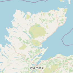
Map view of Coul Links

Use this park location map to pinpoint Coul Links in United Kingdom, understand its exact geographic position, and read its mapped placement within the surrounding landscape more clearly.

Pigeon | © OpenStreetMap contributors

Location context for Coul Links

ScotlandSutherland

Explore photographic records of coastal sand dunes, rare habitats, and terrain across northern Scotland.

Coul Links Photos and Coastal Scenery: Visualising Dune Landscapes

Visual documentation captures the complex transition from active foredune ridges to stable coastal heathland and seasonal freshwater lochans. Examining field imagery reveals the distinct topographical character and protected shoreline environments defining this northern Scottish ecosystem.

A wide coastal landscape view showing grass-covered sand dunes in the foreground leading to a long, sweeping sandy beach and calm blue water under a cloudy sky.

A large group of black and white oystercatcher birds in flight over a blue tidal waterway, with a sandy beach in the foreground and grassy dunes in the distance.

A small, calm lochan surrounded by low-lying, brownish grassy dunes and heathland under an overcast sky.

Park atlas

Compare surrounding coastal landscapes and regional nature reserves

Explore Protected Areas and Parks Near Coul Links

Discover related protected areas and coastal reserves situated near Coul Links across the Sutherland region. Evaluating these nearby locations helps connect individual dune habitats to broader regional conservation networks.
Nature reserveScotland
About 31 km away#1 closest

Northeast

East Caithness Cliffs Nature Reserve: Regional Geography and Coastal Protected Area Atlas

Coastal sandstone cliffs and maritime heath habitats in northern Scotland.

Examine the layered conservation architecture and physical geography of East Caithness Cliffs. This site serves as a prime example of protected northern coastal terrain, where sandstone formations and maritime heath support vast seabird populations across a mosaic of land and sea boundaries.

Area
116.96 km²
Established
1996
Relief
Upland
Climate
Temperate
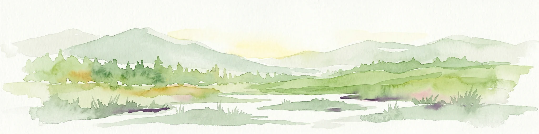
A watercolor painting showing a wide, sweeping landscape of green hills, a winding stream, and flat boggy terrain under a soft, light-colored sky.
Nature reserveScotland
About 56 km away#2 closest

North

Flow Country: Geography and Protected Landscape Analysis of Scotland's Blanket Bog

Northern Scotland's vast, waterlogged peatland ecosystem.

The Flow Country is defined by its extensive, open peatland terrain stretching across Caithness and Sutherland. This nature reserve serves as a critical geographic study area for understanding blanket bog formation, carbon storage, and the restoration of fragile wetland habitats in northern Europe.

Area
4,000 km²
Relief
Lowland
Scope
Terrestrial
Water
Water-dominated
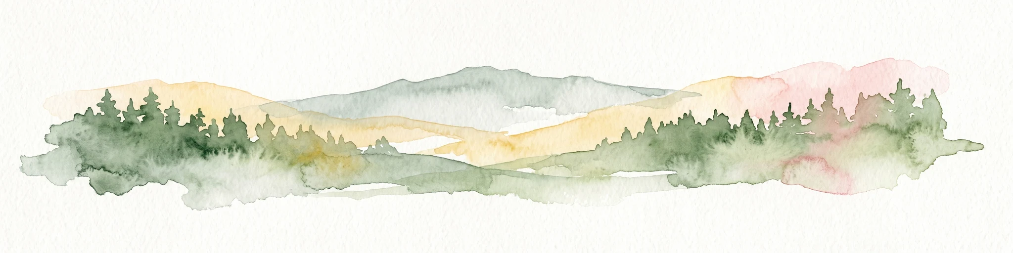
Watercolor painting depicting mountains, forested hills, and a river in a scenic landscape
National parkScotland
About 63 km away#3 closest

South

Cairngorms National Park: Explore Scotland's Largest Protected Mountain Landscape

Mapped boundaries and arctic-alpine geography.

As the United Kingdom's largest national park, Cairngorms National Park in Scotland presents a vast expanse of distinctive arctic-alpine terrain and ancient Caledonian forests. This protected landscape offers a unique opportunity to explore mapped geographic features, from its extensive mountain plateaus to its vital river systems. Discover the contours and context of this significant natural area within the broader atlas of Scotland's protected lands.

Area
4,528 km²
Established
2003
IUCN
V
Visitors
1.9M annual
A wide watercolor illustration showing a mountain range in the distance, a valley, and green forests on either side, with soft pastel colors.
Protected landscapeHighland
About 72 km away#4 closest

Northwest

North West Sutherland National Scenic Area: Mapping the Peaks and Coasts of Highland Scotland

Protected quartzite mountain landscapes and Atlantic coastal geography

This detailed overview of the North West Sutherland National Scenic Area maps the dramatic interplay between the white quartzite mountains of Foinaven and Arkle and the darker Lewisian gneiss that forms the underlying Highland landscape. The analysis provides deep insights into the region's knock and lochan topography, sea lochs, and the protected coastal habitats of Handa Island, anchoring the area within its broader Scottish geological context.

Area
266 km²
Established
1981
Relief
Mountain
Climate
Temperate
Protected landscapeHighland
About 78 km away#5 closest

West

Wester Ross National Scenic Area: Protected Highland Mountain and Coastal Landscape Atlas

Geographic mapping of the Northwest Highlands terrain

Wester Ross National Scenic Area spans vast stretches of the Northwest Highlands, characterized by towering Torridonian sandstone peaks and deeply carved sea lochs. This protected region integrates ancient Scots pine forests, glacial-carved glens, and complex coastal environments into one of the most recognizable geographic features of Scotland. The landscape serves as a vital record of geological heritage and high-latitude biodiversity within the Highland administrative region.

Area
1,634.58 km²
Established
1981
Visitors
70K annual
Relief
Mountain
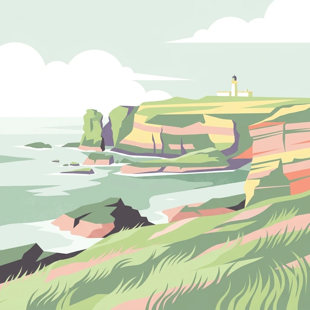
A minimalist, stylized vector illustration of coastal cliffs meeting the sea, with a lighthouse visible in the distance on top of the headland.
Marine protected areaHighland
About 84 km away#6 closest

Northeast

Noss Head Marine Protected Area: Highland Coastal and Benthic Geography

Exploring the rocky cliffs and offshore mussel habitats of Northern Scotland.

Noss Head is a notable marine protected area located on the Caithness coast of the Scottish Highlands. The site is defined by its rugged coastal cliffs and an expansive, nationally important horse mussel bed that occupies the seabed at depths between 35 and 45 metres. This area represents a core study in North Atlantic benthic ecology and dramatic maritime landforms.

Area
8 km²
Established
2014
IUCN
IV
Relief
Lowland
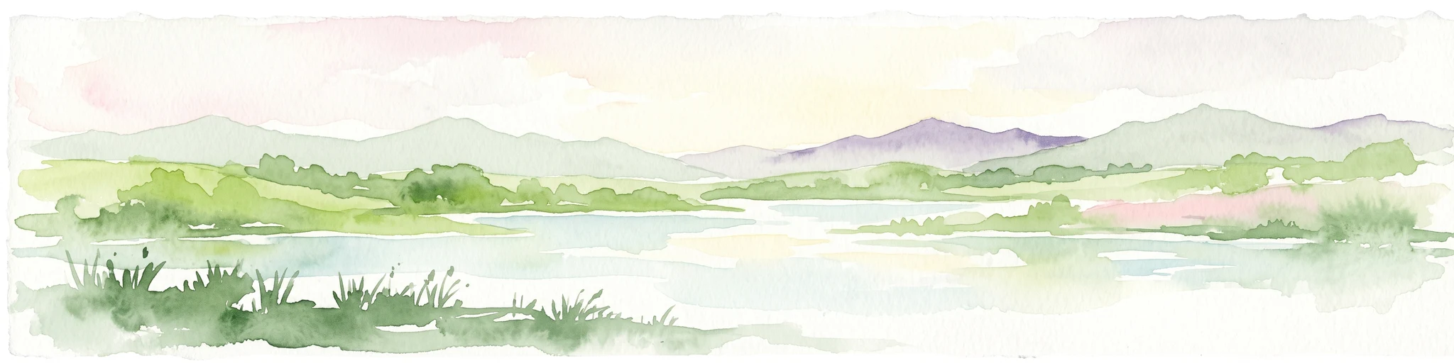
A soft, impressionistic watercolor painting of a Scottish loch surrounded by rolling green hills and distant mountain silhouettes.
Marine protected areaRoss and Cromarty
About 109 km away#7 closest

Southwest

Loch Carron Marine Protected Area: Coastal Geography and Protected Seabed Landscape Atlas

Exploring the tidal basins and underwater terrain of Ross and Cromarty.

Loch Carron stands as a landmark marine protected area defined by its dramatic underwater depth changes and robust tidal currents. This protected sea loch features the world's largest flame shell colony nestled beneath the cliffs at Strome Castle. The surrounding Highland geography of Ross and Cromarty creates a compressed, mountain-framed landscape that influences the rich ecological character of this essential coastal habitat.

Area
23 km²
Established
2019
Relief
Lowland
Climate
Temperate
Marine protected areaHighland
About 123 km away#8 closest

Southwest

Loch Alsh Nature Conservation Marine Protected Area: Geography and Protected Boundaries

A vital Highland marine landscape featuring rare underwater flame shell colonies.

Loch Alsh sits as a distinct marine boundary in the Northwest Highlands of Scotland. This protected area safeguards a vast seafloor ecosystem, most notably a massive flame shell colony that has transformed local understanding of marine biodiversity in the region. The loch landscape blends ancient metamorphic geology with the fjord-like waters separating Skye from the mainland, offering a unique perspective on protected coastal terrains.

Area
0.75 km²
Established
2014
Relief
Mountain
Climate
Temperate

Common questions about visiting, size, designation, and location context for Coul Links

Coul Links FAQs for park facts, access, geography, and protected area context

Find quick answers about Coul Links, including protected-area facts, park geography, trail and visitor context, and how the park fits into its surrounding country and regional landscape.
MoriAtlas Explorer

Continue Your Protected Areas Search Across the Global Atlas

Deepen your exploration by continuing the structured search for national parks and protected areas worldwide. Utilize the comprehensive filtering capabilities to compare different conservation landscapes and refine your understanding of global park geography. Discover more about the distribution and characteristics of protected natural areas.

Global natural geography