Mori Atlas logo
National parkCairngorms National Park

Discover the mapped boundaries and arctic-alpine terrain of Britain's largest national park.

Cairngorms National Park: A Premier Protected Landscape in Scotland's Geography

Cairngorms National Park, situated in northeast Scotland, stands as the United Kingdom's largest protected area, defined by its dramatic mountain plateaus and unique arctic-alpine environment. This national park encompasses vast tracts of ancient Caledonian forest and is home to Britain's most northerly mountain terrain. Its distinct geographic features, including extensive high ground and the sources of major rivers, offer a rich landscape for atlas-based exploration and understanding of regional protected areas within Scotland.

National ParkScotlandMountain LandscapeArctic-Alpine EnvironmentCaledonian ForestAncient Woodland
Stylized illustration showing mountains, cliffs, a waterfall, a bridge, and forested areas

Cairngorms National Park

National park

Park overview

Structured park overview, official facts, and landscape profile for Cairngorms National Park

Cairngorms National Park park facts, protected area profile, and essential visitor context
Review the core facts for Cairngorms National Park, including designation, size, terrain, visitor scale, habitats, and operating context in one park-focused overview.

About Cairngorms National Park

Cairngorms National Park occupies a remarkable position as the largest national park in the United Kingdom, protecting a landscape of outstanding natural importance and cultural significance. At its heart lie the Cairngorms, a spectacular mountain range whose appearance resembles the Hardangervidda National Park in Norway, featuring a large area of upland plateau above which domed summits rise. These summits, the eroded stumps of once much higher mountains, are crowned with tors—free-standing rock outcrops that stand prominently on the boulder-strewn landscape. The plateau edges feature steep granite cliffs that provide excellent opportunities for climbing and skiing. Unlike typical alpine landscapes, the Cairngorms lack the characteristic U-shaped valleys, instead presenting a more ancient terrain shaped by different geological processes over millions of years. The surrounding lower ground includes the straths and glens that contain the Caledonian forest, the rivers that support Atlantic salmon and other wildlife, and the wetlands such as the Insh Marshes, one of Scotland's largest areas of floodplain mire and fen vegetation. The park's cultural heritage reflects long human interaction with this landscape through agriculture, forestry and recreation, creating the semi-natural environment that distinguishes Scottish national parks from the strict wilderness protection found in other countries.

Quick facts and research context for Cairngorms National Park

Cairngorms National Park contains Scotland's highest mountains outside the Highlands, with a landscape characterized by expansive upland plateaus at around 1000-1200 metres above sea level, topped by domed summits reaching approximately 1300 metres. The Cairngorms represent an arctic-alpine mountain environment with tundra-like characteristics and long-lasting snow patches. Three major rivers—the Spey, Dee, and Don—rise within the park, with the Spey being Scotland's second longest river. The park holds more than half of the remaining Caledonian forest in Scotland, representing the largest single area of this ancient woodland habitat. It contains nine national nature reserves and supports significant populations of rare birds including ptarmigan, dotterel, snow bunting, golden eagle, and the only herd of semi-domesticated reindeer in the British Isles.

Park context

Deeper park guide and search-rich context for Cairngorms National Park

Cairngorms National Park history, landscape, wildlife, and travel context
Explore Cairngorms National Park through its history, landscape character, ecosystems, wildlife, conservation priorities, cultural context, and seasonal travel timing in a structured park guide built for atlas discovery and search intent.

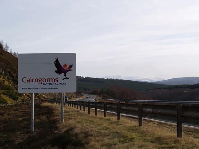
Why Cairngorms National Park stands out

The Cairngorms are renowned for their distinctive arctic-alpine landscape, one of the most northerly mountain environments in Britain with tundra-like characteristics and unique flora and fauna adapted to harsh conditions. The park protects the largest remaining tract of Caledonian pine forest in Scotland, a rare ancient woodland type with species including capercaillie, black grouse, Scottish crossbill, crested tit and parrot crossbill. The area is famous for its reindeer herd, the only one of its kind in the British Isles, introduced in 1952 and now numbering around 150 individuals. The mountains offer excellent conditions for skiing, rock climbing and ice climbing, with three of Scotland's five ski resorts located within the park. The region also contains the greatest concentration of Munros, mountains exceeding 3,000 feet, making it a premier destination for hillwalkers.

Aerial view of a forest with two distinct sections: one with yellow and brown foliage, the other with dense green coniferous trees
Aerial view of mixed forest with autumn foliage near River Muick

Cairngorms National Park history and protected-area timeline

The concept of designating parts of Scotland's wild landscapes as national parks emerged in the early twentieth century. In 1931, a commission headed by Christopher Addison proposed creating a national park in the Cairngorms, alongside proposals for parks in England and Wales. Following the Second World War, ten national parks were established in England and Wales, and a committee was formed to consider Scottish national parks. The 1945 report proposed national parks in five areas, including the Cairngorms, though the government designated these only as "National Park Direction Areas" without full national park status. These were replaced by National Scenic Areas in 1981. In 1990, the Countryside Commission for Scotland recommended that four areas—including the Cairngorms—should become national parks with independent planning boards. No action followed until the establishment of the Scottish Parliament in 1999, which passed the National Parks (Scotland) Act 2000 as one of its first pieces of legislation. The Cairngorms National Park was formally designated in 2003, followed by a successful campaign leading to expansion into Perth and Kinross in 2010, adding Blair Atholl and Spittal of Glenshee to the park. In 2015, a significant power line through the park was removed to enhance the landscape.

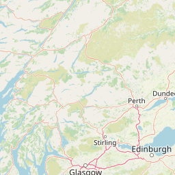
Cairngorms National Park landscape and geographic character

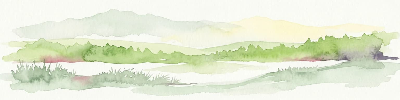
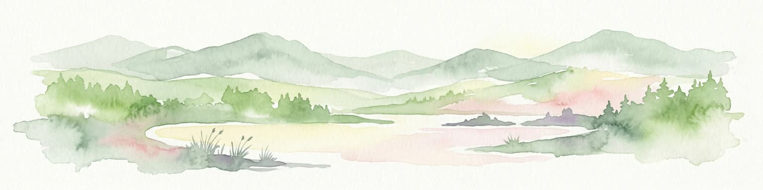
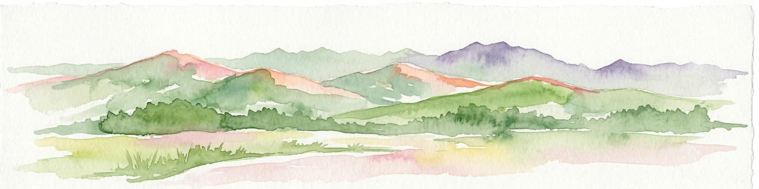
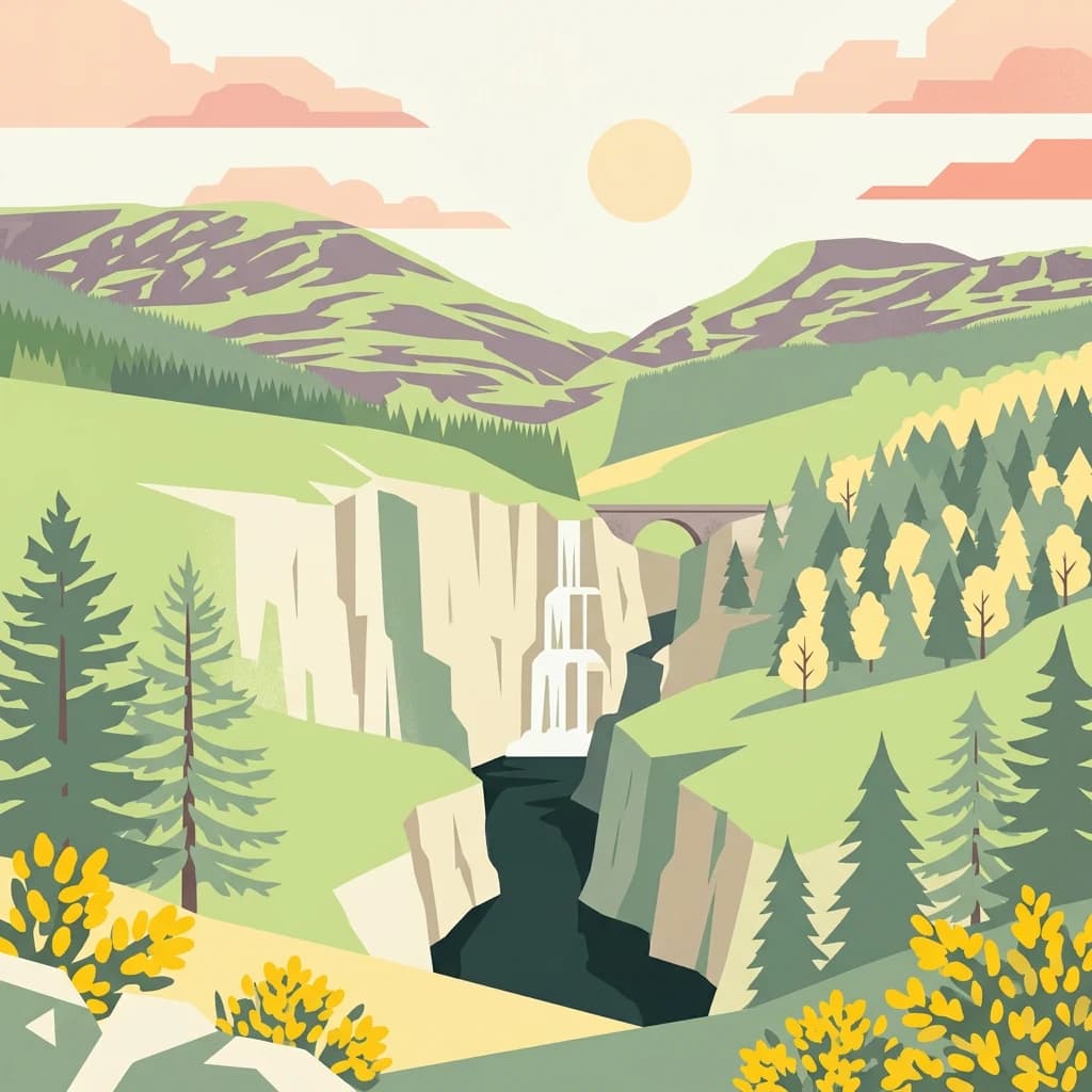
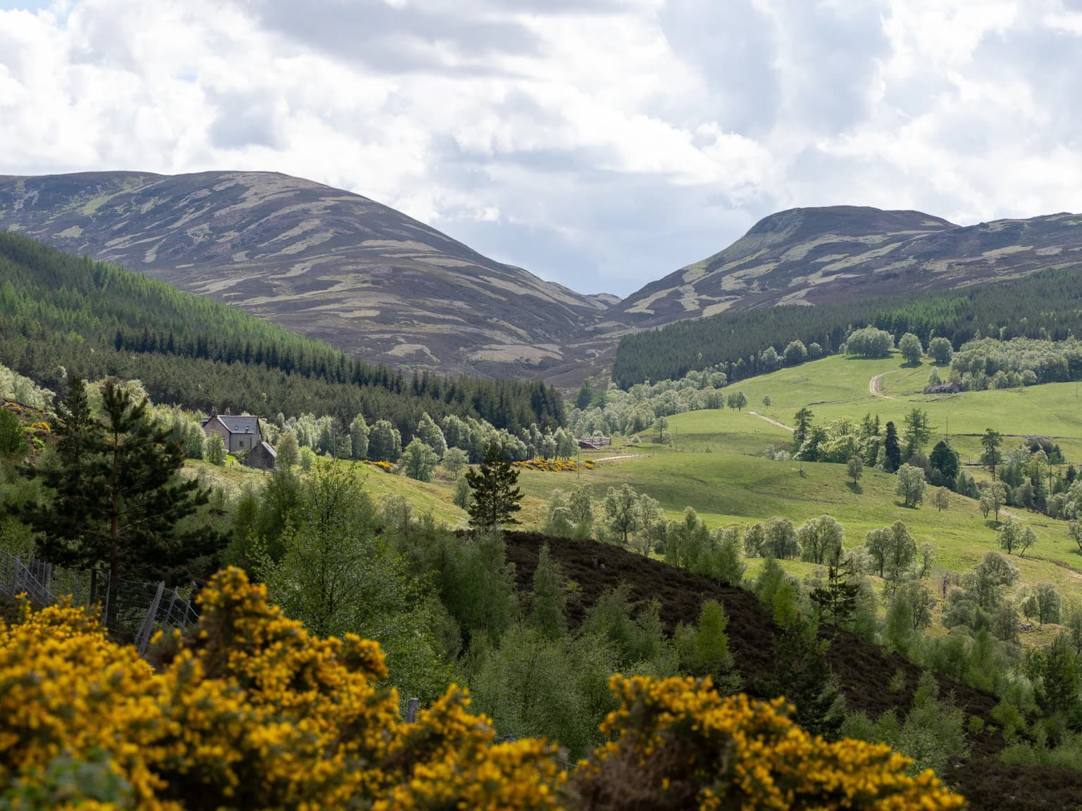
The Cairngorms present a distinctive mountainous landscape defined by extensive plateaus at elevations between 1000 and 1200 metres above sea level, making them the most extensive high ground in Scotland. Above these plateaus rise the domed summits of the individual mountains, reaching approximately 1300 metres. The summits are characterized by tors—prominent free-standing rock outcrops standing atop the boulder-strewn plateau surfaces. The plateau edges descend through steep granite cliffs in places, while the lower slopes give way to the glens and straths that form the broader park landscape. The Monadhliath mountains lie to the north of Strathspey, comprising a bleak, wide plateau rising to between 700 and 950 metres. Three major river systems—the Spey, Dee, and Don—all rise within the park boundaries, with the Spey originating in the Monadhliath and both the Dee and Don having their sources in the Cairngorms themselves. The landscape is punctuated by waterfalls such as the Linn of Dee, and includes extensive areas of peat and evidence of past landslips.

White Cairngorms National Park sign with bird logo, A9 road with guardrails, grassy hillside, and mountain range in background
Cairngorms National Park sign along A9 road with distant mountain range

Cairngorms National Park ecosystems, habitats, and plant life

The Cairngorms National Park protects a remarkable diversity of habitats, from arctic-alpine mountain terrain to ancient Caledonian pine forest and extensive wetlands. The Cairngorm mountains themselves provide a unique alpine semi-tundra moorland habitat, home to many rare plants, birds and animals adapted to the harsh conditions. The straths and glens feature the Caledonian forest, the ancient pine woodland that once covered much of the Scottish Highlands. The expanse of pinewood stretching from Glen Feshie to Abernethy Forest forms the largest single area of this habitat remaining in Scotland, with the park as a whole holding more than half of the surviving Caledonian forest. In upper Strathspey, the Insh Marshes represent one of the largest areas of floodplain mire and fen vegetation in Scotland. The River Dee is designated a Special Area of Conservation due to its importance for salmon, otters and freshwater pearl mussels. Within the park there are 19 Special Areas of Conservation, Special Protection Areas and 46 Sites of Special Scientific Interest, plus nine of Scotland's national nature reserves.

Wide view of snow-covered mountain pass with winding road through valley between hills
Snow-covered Drumochter Pass in Cairngorms National Park with winding road through valley

Cairngorms National Park wildlife and species highlights

The Cairngorms support a distinctive assemblage of wildlife, particularly notable for species associated with arctic-alpine and boreal forest habitats. The mountain plateaux are home to breeding ptarmigan, dotterel, snow bunting, golden eagle, ring ouzel and red grouse—the ptarmigan and dotterel being particularly characteristic of this environment. Mammal species include red deer and mountain hare, as well as the only herd of semi-domesticated reindeer in the British Isles, brought to the Cairngorms in 1952 by a Swedish herdsman and now stable at around 150 individuals. The Caledonian forests support bird species including capercaillie, black grouse, Scottish crossbill, parrot crossbill and crested tit. The Rivers Dee and Don support fish populations including Atlantic salmon, sea trout, brown trout, eels and lamprey. The Insh Marshes are important for breeding birds including osprey, wigeon, shoveler, goldeneye, redshank, snipe, curlew and lapwing, and receive winter visitors including greylag geese from Iceland and whooper swans.

Rolling hills and valleys in Cairngorms National Park with green fields, trees, and yellow gorse in the foreground under a partly cloudy sky
Lush green valleys and rolling hills in Cairngorms National Park with yellow flowering bushes in the foreground

Cairngorms National Park conservation status and protection priorities

The Cairngorms National Park is classified as an IUCN Category V protected landscape, reflecting its character as an area where people have interacted with the landscape for many centuries, resulting in a semi-natural environment rather than a strict wilderness. This classification acknowledges that thousands of years of human activity—including agriculture, historical deforestation, overgrazing by sheep and deer, and twentieth-century afforestation with introduced tree species—have shaped the current landscape. The park contains numerous areas with additional protection through other conservation designations, including nine national nature reserves, 19 Special Areas of Conservation, Special Protection Areas and 46 Sites of Special Scientific Interest. The entire length of the River Dee is a Special Area of Conservation. The park authority operates under a fourfold mandate to conserve and enhance natural and cultural heritage, promote sustainable use of natural resources, promote understanding and enjoyment, and promote sustainable economic and social development, with the Sandford Principle giving priority to conservation when aims conflict.

Cairngorms National Park cultural meaning and human context

The Cairngorms National Park reflects centuries of human interaction with the landscape. The communities within the park have shaped the land through agriculture, forestry and more recently tourism and recreation. The park contains historic settlements with cultural heritage, including the village of Carrbridge with its 1717 Packhorse Bridge built to enable funeral processions to reach Duthil Church. The area has connections to Scottish history and heritage, reflected in its use as a filming location for productions depicting Scottish life and history. The whisky industry is prominent, with six distilleries within the park—Dalwhinnie, The Glenlivet, Tomintoul, Royal Lochnagar, Balmenach and The Speyside—plus the Cairngorm Brewery. The park's communities, including those in Badenoch and Strathspey, Marr, Angus, Moray and Perth and Kinross, maintain cultural traditions tied to the landscape.

Top sights and standout views in Cairngorms National Park

Cairngorms National Park offers an exceptional combination of mountain landscape, ancient forest, and outdoor recreation within Scotland's largest protected area. The arctic-alpine environment of the Cairngorms provides Britain's most northerly mountain terrain with tundra-like characteristics, supporting species found nowhere else in the country. The Caledonian forest represents the last remnants of the pine woodland that once covered the Highlands, home to species including capercaillie and Scottish crossbill. The reindeer herd remains unique in the British Isles. Three ski resorts provide winter sports opportunities, while 55 Munros attract hillwalkers. The Speyside Way and Cateran Trail offer long-distance walking routes. The presence of six distilleries and a brewery within the park boundary links natural landscape to Scotland's whisky heritage.

Best time to visit Cairngorms National Park

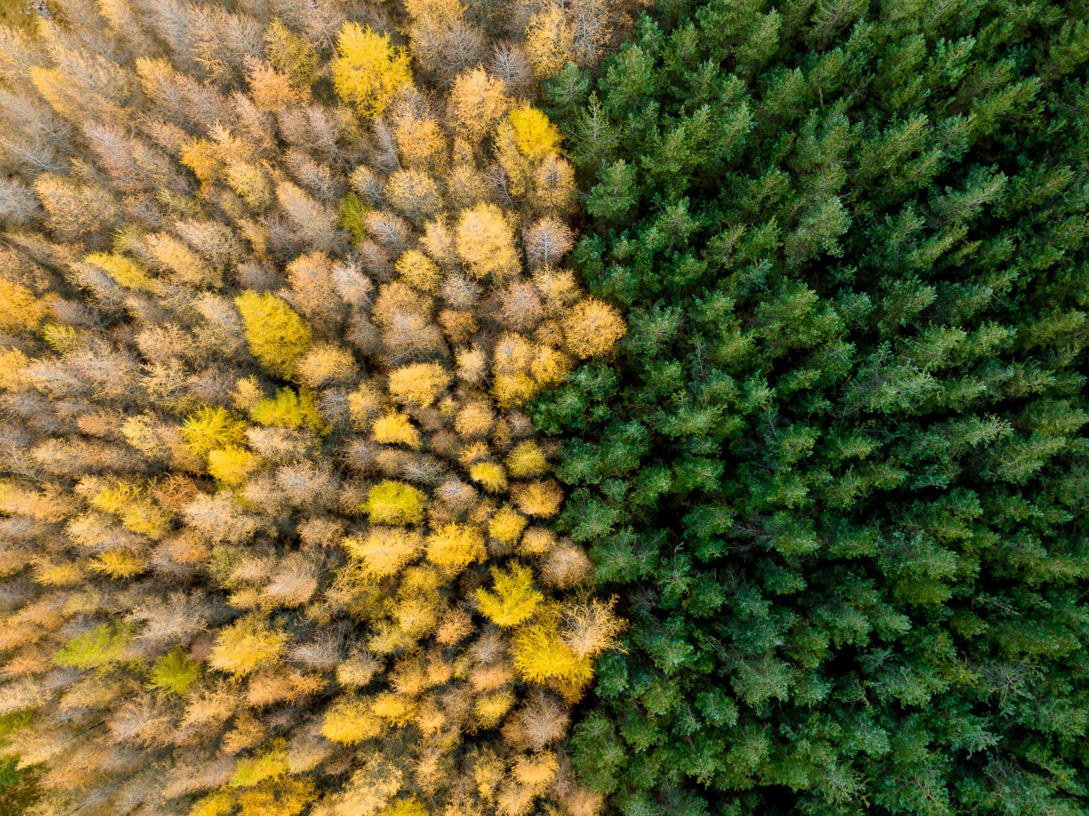
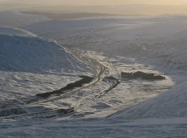
The Cairngorms National Park offers distinct experiences throughout the year, with each season revealing different aspects of its character. Summer brings the best conditions for walking, climbing and wildlife viewing, with longer days allowing extended exploration of the mountains and forests. The breeding bird season peaks in late spring and early summer, with ptarmigan, dotterel and dotterel visible on the plateaux. Autumn offers the opportunity to see the Caledonian forest in golden hues, with fewer visitors and potentially better wildlife viewing as animals become more active. Winter transforms the landscape, with snow covering the higher ground and the ski resorts operating—though conditions can be variable. The reindeer are present year-round and can be encountered in any season. The shoulder seasons of spring and autumn often provide the most reliable weather for hillwalking, while the summer months coincide with the peak visitor season.

Park location guide

Geography guide, regional context, and park location map for Cairngorms National Park

Cairngorms National Park park geography, regions, and map view in United Kingdom
Understand where Cairngorms National Park sits in United Kingdom through a broader geographic reading of the surrounding landscape, nearby location context, and its mapped position within the national park landscape.

How Cairngorms National Park fits into United Kingdom

The United Kingdom is a parliamentary constitutional monarchy located in northwestern Europe, consisting of four constituent countries: England, Scotland, Wales, and Northern Ireland. As a major global power with over 69 million residents, it maintains significant international influence in politics, economics, and culture.

Wider geography shaping Cairngorms National Park in United Kingdom

The United Kingdom is an island nation located in northwestern Europe, surrounded by the Atlantic Ocean, North Sea, English Channel, Celtic Sea, and Irish Sea. It shares a land border with the Republic of Ireland to the west. The territory includes the island of Great Britain, the northeastern portion of Ireland, and most of the smaller British Isles islands.

Map view of Cairngorms National Park

Use this park location map to pinpoint Cairngorms National Park in United Kingdom, understand its exact geographic position, and read its mapped placement within the surrounding landscape more clearly.

Pigeon | © OpenStreetMap contributors

Location context for Cairngorms National Park

AberdeenshireAngusHighlandMorayPerth and KinrossScotland

Explore the vast, protected landscapes of the Cairngorms, revealing its arctic-alpine character, ancient forests, and unique ecological zones.

Cairngorms National Park Photos: Discover Scotland's Arctic-Alpine Landscapes and Ancient Forests
Visually explore the diverse landscapes of Cairngorms National Park, from its vast arctic-alpine plateaus and towering Munros to its ancient Caledonian pine forests and winding glens. These detailed images provide essential context for comprehending the unique topography, ecological zones, and protected-area character of the United Kingdom's largest national park.

Aerial view of a forest with two distinct sections: one with yellow and brown foliage, the other with dense green coniferous trees

Rocky gorge with flowing river, moss-covered cliffs, and forested background

White Cairngorms National Park sign with bird logo, A9 road with guardrails, grassy hillside, and mountain range in background

Wide view of snow-covered mountain pass with winding road through valley between hills

Rolling hills and valleys in Cairngorms National Park with green fields, trees, and yellow gorse in the foreground under a partly cloudy sky

Wide landscape view of marshes and river with snow-capped mountains in the background

Park atlas

Trace the regional spread of protected landscapes and mountain environments across the Scottish Highlands.

Explore Other National Parks and Protected Areas Near Cairngorms National Park, Scotland
After exploring Cairngorms National Park, browse other national parks and protected areas across Scotland, comparing their unique mountain landscapes, ancient forests, and high plateaus. This broader geographic perspective offers essential context for atlas-style comparison of distinct conservation landscapes and diverse protected terrains throughout the region.
Watercolor illustration showing mountains, green forests, a loch, and a river in a landscape
National parkScotland

Loch Lomond and The Trossachs National Park: Scotland's National Park Atlas and Protected Landscape

Mapping Scotland's Highland Boundary Fault and diverse natural terrain.

As Scotland's first national park, Loch Lomond and The Trossachs National Park offers a prime example of a protected landscape shaped by significant geological features. This atlas entry highlights its strategic location along the Highland Boundary Fault, which delineates distinct highland and lowland terrains. Users can explore the park's extensive network of lochs, including Loch Lomond, its mountainous Munros, and its native woodland ecosystems, providing a rich geographic context for discovery.

Area
1,865 km²
Established
2002
IUCN
V
Visitors
2.9M annual
National parkNorthumberland

Northumberland National Park: England's Northernmost Protected Landscape and Dark Sky Wilderness

Explore its mapped boundaries, Roman heritage, and remote moorland terrain.

Northumberland National Park protects over 1,050 square kilometers of remote and stunning natural beauty in northern England, bordering Scotland. This page provides a structured overview of its protected landscape, focusing on its geographic context within the county of Northumberland, its designation as a National Park, and its renowned status as Europe's largest Dark Sky Park. Users can discover the park's characteristic moorland terrain, the archaeological significance of Hadrian's Wall, and the vast expanses of Kielder Forest, offering an atlas-level understanding of this unique frontier landscape.

Area
1,050 km²
Established
1956
IUCN
V
Relief
Highland
National parkCumbria

Lake District National Park: Protected Landscape Atlas and Geographic Exploration

Mapped mountain terrain and glacial valleys in Cumbria

Delve into the geography of Lake District National Park, a protected area renowned for its dramatic mountainous terrain, U-shaped glacial valleys, and stunning natural lakes. This atlas perspective highlights the park's unique landscape features, mapped boundaries, and its significance within Cumbria, offering a comprehensive view for geographic discovery.

Area
2,292 km²
Established
1951
IUCN
V
Relief
Mountain
National parkNorth Yorkshire

Yorkshire Dales National Park: A Protected Landscape in North Yorkshire

Explore mapped boundaries and distinctive limestone terrain.

Yorkshire Dales National Park offers a rich tapestry of mapped natural landscapes, characterized by its iconic limestone valleys, U-shaped glacial formations, and rolling heather-clad moorlands. Situated within North Yorkshire, this protected area showcases a unique karst geology, evident in features like Malham Cove and extensive cave systems. The park's traditional dry-stone walls and working farms contribute to a living cultural landscape, making it a prime destination for atlas-driven geographic discovery and understanding regional terrain.

Area
2,178 km²
Established
1954
IUCN
V
Relief
Mountain
Watercolor illustration showing rolling hills, green vegetation, and a pale sky
National parkNorth Yorkshire

North York Moors National Park: Explore its Protected Landscape and Geography

Discover mapped moorland, dales, and coastlines.

The North York Moors National Park is a vital protected landscape in North Yorkshire, celebrated for its extensive heather moorland and distinctive deeply incised dales. This page provides an atlas-style exploration of the park's geography, highlighting its unique terrain, mapped boundaries, and its integral role within the regional landscape context. Understand the diverse natural features that define this iconic national park, from the upland plateau to the dramatic Jurassic coast.

Area
1,430 km²
Established
1952
IUCN
V
Relief
Upland
National parkCounty Donegal

Glenveagh National Park: A Protected Landscape in the Heart of County Donegal

Mapped geography and natural terrain for Ireland's national park.

Delve into the geographic specifics of Glenveagh National Park, a protected area situated in County Donegal. This section provides detailed information on its mapped boundaries and regional landscape context. Understand how this national park fits within the natural geography of Ulster, offering a structured atlas view for detailed exploration of its unique terrain and protected status.

Area
169.58 km²
Established
1986
IUCN
II
Relief
Mixed relief
National parkUnited Kingdom

Peak District National Park: Explore Protected Landscape and Regional Geography

Mapped boundaries and natural terrain context for this UK national park.

Investigate the Peak District National Park, a cornerstone of the United Kingdom's protected natural areas. This MoriAtlas entry provides essential details on its geographic scope, mapped boundaries, and landscape characteristics. Engage with structured data to understand how this national park fits into the atlas of the United Kingdom, supporting detailed geographic and protected-area discovery for researchers and explorers.

Area
1,440 km²
Established
1951
IUCN
V
Watercolor illustration of a landscape with mountains, a lake, and trees
National parkCounty Wicklow

Wicklow Mountains National Park: Protected Landscape and Geographic Atlas Mapping

Explore County Wicklow's mapped natural terrain and park boundaries.

Understand the geographic scope and protected landscape identity of Wicklow Mountains National Park. This page offers detailed information on its mapped boundaries and its context within County Wicklow, providing a foundation for atlas-based discovery of Ireland's natural areas. Explore how this national park contributes to the region's mapped geography and conservation landscapes.

Area
205 km²
Established
1991
IUCN
II
Relief
Mountain

Common questions about visiting, size, designation, and location context for Cairngorms National Park

Cairngorms National Park FAQs for park facts, access, geography, and protected area context
Find quick answers about Cairngorms National Park, including protected-area facts, park geography, trail and visitor context, and how the park fits into its surrounding country and regional landscape.
MoriAtlas Explorer

Continue Your Protected Areas Search Across the Global Atlas

Deepen your exploration by continuing the structured search for national parks and protected areas worldwide. Utilize the comprehensive filtering capabilities to compare different conservation landscapes and refine your understanding of global park geography. Discover more about the distribution and characteristics of protected natural areas.

Global natural geography