

Mori Atlas logo
National parkGlenveagh National Park

Explore the mapped geography and natural terrain of this significant national park.

Glenveagh National Park: Ireland's Protected Landscape in County Donegal

(Páirc Náisiúnta Ghleann Bheatha)

Glenveagh National Park stands as a crucial protected area within County Donegal, Ireland, offering a unique glimpse into the region's natural landscapes. This page serves as a detailed atlas entry, focusing on the park's geographic setting, mapped boundaries, and its role within the broader context of Northern Ireland's protected lands. Users can explore the terrain and understand the specific landscape character that defines Glenveagh National Park.

mountain landscapelake settingred deergolden eagleshistoric castlewetland habitats
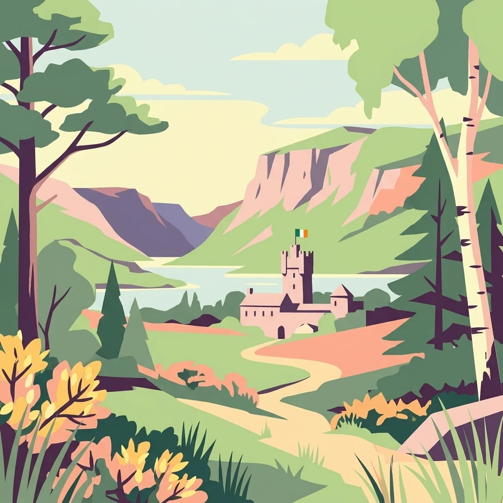
Stylized illustration of Glenveagh National Park featuring Glenveagh Castle, a winding path, lake, mountains, and trees

Glenveagh National Park

National park

Park overview

Structured park overview, official facts, and landscape profile for Glenveagh National Park

Glenveagh National Park park facts, protected area profile, and essential visitor context

Review the core facts for Glenveagh National Park, including designation, size, terrain, visitor scale, habitats, and operating context in one park-focused overview.

About Glenveagh National Park

Glenveagh National Park represents one of Ireland's most significant wilderness areas, protecting a substantial portion of the Derryveagh Mountains in the northwestern county of Donegal. The park's terrain is characterized by rugged mountain scenery, deep glacial valleys, and expansive tracts of bog and heath. Lough Veagh, the park's central lake, lies amid this dramatic setting, with Glenveagh Castle positioned prominently on its southern shore. The castle gardens, originally developed as part of the private estate, showcase a remarkable collection of exotic plants that thrive in the maritime climate of northwest Ireland, creating pockets of unexpected lushness against the more austere mountain backdrop. The park's establishment in 1985 and formal designation the following year came about through the bequest of the Glenveagh estate to the Irish state, with the property having passed through several hands in the decades prior. Today the park offers visitors opportunities to explore its landscapes through a network of trails, while its ecological significance continues through the protection of both common and rare species.

Quick facts and research context for Glenveagh National Park

Glenveagh National Park covers approximately 170 square kilometers in the heart of County Donegal, making it the second-largest of Ireland's national parks and the sole representative in Ulster province. The park is managed by the National Parks and Wildlife Service and was established in 1986 when the Glenveagh estate was bequeathed to the Irish state. The protected area centers around Lough Veagh, a scenic mountain lake, and incorporates the Derryveagh Mountains, a range of predominantly quartzite peaks. The historic Glenveagh Castle, built in the 19th century, sits on the lakeshore and forms a focal point within the park.

Protection and recognition

Verifying the terrestrial conservation status and administrative boundaries of Irish parklands.

Documenting the Official Protected Area Status of Glenveagh National Park

Geographic records document the official terrestrial protection status and conservation management scope assigned to Glenveagh National Park. Natural area analysts can evaluate regional Irish conservation frameworks alongside international data sets to track geographic protection metrics.

Protection details

Protection scope
Terrestrial
Transboundary protection
No
Park context

Deeper park guide and search-rich context for Glenveagh National Park

Glenveagh National Park history, landscape, wildlife, and travel context

Explore Glenveagh National Park through its history, landscape character, ecosystems, wildlife, conservation priorities, cultural context, and seasonal travel timing in a structured park guide built for atlas discovery and search intent.

Why Glenveagh National Park stands out

Glenveagh is particularly known for two remarkable wildlife populations: the largest herd of red deer in Ireland and the reintroduced golden eagles that have been present since 2000. The Derryveagh Mountains provide the backbone of the park's dramatic landscape, while Lough Veagh offers a central aquatic feature surrounded by Castle and woodland. The estate's Victorian-era gardens at Glenveagh Castle contain exotic plantings that contrast sharply with the surrounding wild mountain terrain. As Ireland's only national park in Ulster, the park serves as the primary protected area for this northern province.
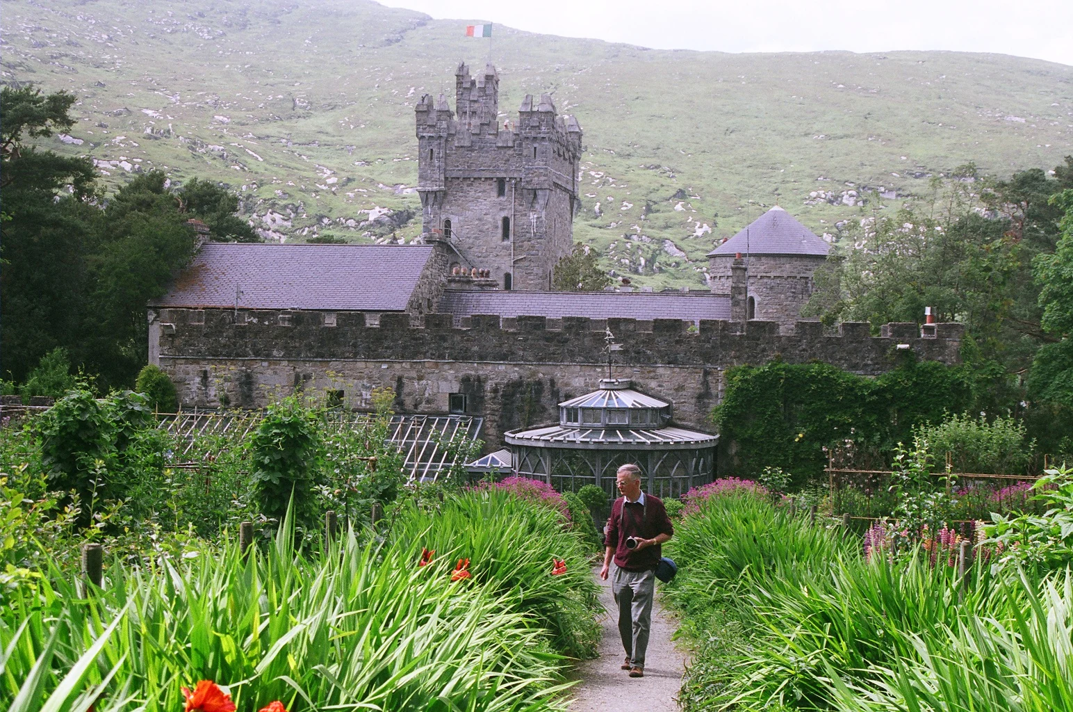
Stone castle with tower and surrounding garden pathway with a person walking
Glenveagh Castle pathway with gardens and castle in background

Glenveagh National Park history and protected-area timeline

The Glenveagh estate traces its origins to Captain John George Adair, an Anglo-Irish businessman who constructed Glenveagh Castle in the mid-19th century and assembled the surrounding lands into a shooting estate. Adair's tenure was marked by controversy, most notably his 1861 eviction of 44 families totaling 224 people from their blackhouses during a period of famine, an action that earned him the derisive nickname "Black Jack Adair." Following Adair's death, the estate passed to his widow Cornelia Adair and was subsequently acquired in 1929 by Arthur Kingsley Porter, an American scholar. In 1937 the property was purchased by Henry Plumer McIlhenny of Philadelphia, who developed the gardens to their present form. McIlhenny bequeathed the estate to the Irish state in the 1970s, though he continued to reside at the castle until 1982. The land was formally established as a national park in 1986, preserving this significant mountain landscape for public benefit and conservation.

Glenveagh National Park landscape and geographic character

The Derryveagh Mountains form the core of Glenveagh's dramatic topography, a range of quartzite peaks rising steeply from the valley floors to heights exceeding 600 meters. These mountains were shaped by glacial processes during the last Ice Age, leaving behind the characteristic U-shaped valleys, corries, and rock-strewn ridges visible throughout the park. Lough Veagh, a long narrow lake constrained by the valley walls, provides the park's central water feature and reflects the surrounding peaks in its still waters. The terrain alternates between exposed mountain ridges and sheltered valleys where woodland has established, while extensive areas of blanket bog and heath cover the flatter ground between the peaks. The landscape possesses a wild, remote character that distinguishes it from Ireland's more domesticated central lowlands.

Glenveagh National Park ecosystems, habitats, and plant life

Glenveagh protects a diversity of habitats ranging from montane heath and blanket bog on the mountain slopes to mixed woodland in the lower valleys and the aquatic environment of Lough Veagh. The park's position in northwest Ireland subjects it to a wet, Atlantic-influenced climate that supports lush vegetation and prevents the extensive drying that affects eastern areas. Native woodland, though limited in extent compared to historical coverage, occurs along watercourses and in sheltered glens, providing habitat for various woodland species. The open moorland and heath communities support characteristic bird species and a range of invertebrates adapted to these conditions. The lake itself supports populations of brown trout and other freshwater species.

Glenveagh National Park wildlife and species highlights

The red deer herd at Glenveagh represents Ireland's largest population of this native species, descended from animals that have occupied the Irish landscape since prehistoric times. These deer are most readily observed in the more open areas of the park, particularly during the autumn rut when stags can be heard bellowing across the valleys. The reintroduction of golden eagles in 2000 marked a significant conservation milestone, as these birds had been locally extinct in Ireland for decades. The eagles now breed within the park and have expanded their range, bringing a top predator back to the Irish mountain landscape. The birdlife of the park also includes species such as peregrine falcon, merlin, and red grouse, while the woodlands host various songbirds and the lake supports waterfowl.

Glenveagh National Park conservation status and protection priorities

Glenveagh National Park plays a crucial role in protecting Ireland's mountain ecosystems and the species they support. The park's designation under IUCN Category II ensures the maintenance of natural processes while allowing for public enjoyment and education. The golden eagle reintroduction program represents one of Ireland's most ambitious wildlife recovery projects, demonstrating the potential for restoring species that have been lost from the wild. The protection of the red deer population preserves genetic diversity within Ireland's only native deer species. The blanket bogs and heath communities within the park store significant quantities of carbon and represent habitats that have been extensively modified elsewhere in Ireland.

Glenveagh National Park cultural meaning and human context

The Glenveagh estate carries a complex historical legacy that includes both the development of an important Victorian garden and the controversial social history of 19th-century land ownership. The castle itself, though not ancient, has become an established feature of the Donegal landscape and serves as a visitor center and museum. The evicted communities whose ancestors were forced from the land during Adair's ownership represent a painful chapter in the region's history that forms part of the broader narrative of Irish rural life during the famine period. The Irish-language name Gleann Bheatha, meaning "glen of the birches," reflects the pre-estate identity of this landscape.

Top sights and standout views in Glenveagh National Park

The combination of wild mountain scenery, historic castle, significant wildlife populations, and the sense of remoteness makes Glenveagh distinctive among Ireland's national parks. The opportunity to observe red deer in their natural habitat and the chance to see golden eagles soaring over the Derryveagh Mountains offer wildlife experiences found nowhere else in Ireland. The castle gardens provide a contrast of cultivated exotic planting within the wild mountain setting, while Lough Veagh offers scenic value and recreational opportunity. As Ulster's sole national park, Glenveagh fills a critical geographic gap in Ireland's protected area network.

Best time to visit Glenveagh National Park

The park can be visited throughout the year, though each season offers a different character. Summer brings longer days and the warmest conditions for walking the mountain trails, with the heather in bloom transforming the moorland into purple moorland. Autumn offers the red deer rut, providing excellent opportunities to observe this iconic species, while the changing leaf colors in the castle gardens add visual interest. Winter can bring snow to the higher ground, creating dramatic mountain scenery, though conditions can be challenging. Spring sees the return of breeding birds and the fresh green growth characteristic of the Irish landscape. The wet climate means that waterproof clothing is advisable at any time of year.
Park guides

Targeted resources addressing essential visit timing questions across the Derryveagh Mountains

Glenveagh National Park Published Guides and Focused Terrain Answers

Focused reference resources help interpret the complex mountain terrain and changing weather patterns across County Donegal. Selected reading materials address optimal seasonal timing for exploring remote valleys and glacial lakes.
Monthly climate preview

Long term temperature and precipitation normals for County Donegal highland valleys

Glenveagh National Park Climate and Monthly Average Weather Patterns

Representative climatological records at ninety-five meters elevation show a mild maritime cycle where mean temperatures peak near fourteen degrees Celsius alongside persistent precipitation. Accessing the complete twelve-month profile reveals detailed historical trends for average minimums and daily rainfall rates across the seasonal spectrum of County Donegal.
Annual mean9 °C
5 °C14 °C
Jan
Feb
Mar
Apr
May10°
Jun12°
Jul14°
Aug14°
Sep13°
Oct10°
Nov
Dec
Warmest month
August

14.1 °C

Coolest month
February

5.3 °C

Wettest month
December

4.9 mm/day

Driest month
May

2.8 mm/day

Park location guide

Geography guide, regional context, and park location map for Glenveagh National Park

Glenveagh National Park park geography, regions, and map view in Ireland

Understand where Glenveagh National Park sits in Ireland through a broader geographic reading of the surrounding landscape, nearby location context, and its mapped position within the national park landscape.

How Glenveagh National Park fits into Ireland

Ireland is an island in the North Atlantic, geologically part of the British Isles. Politically, the island is split between the Republic of Ireland (a sovereign state and EU member) and Northern Ireland (part of the UK). The island has a population of approximately 7.2 million people and is known for its lush landscape, Celtic heritage, and literary culture.

Wider geography shaping Glenveagh National Park in Ireland

Ireland is an island in the North Atlantic Ocean, separated from Great Britain to the east by the North Channel, Irish Sea, and St George's Channel. The island forms part of the British Isles archipelago. The terrain consists of low-lying mountains surrounding a central plain, with the highest point being Carrauntoohil at 1,041 metres. The coastline stretches approximately 7,527 kilometres with numerous inlets and bays.

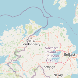
Map view of Glenveagh National Park

Use this park location map to pinpoint Glenveagh National Park in Ireland, understand its exact geographic position, and read its mapped placement within the surrounding landscape more clearly.

Pigeon | © OpenStreetMap contributors

Location context for Glenveagh National Park

County DonegalUlster

Visual Guide to Glenveagh's Derryveagh Mountains, Lough Veagh, and Protected Habitats

Glenveagh National Park Photos: Explore Ireland's Rugged Mountain Landscapes and Wildlife Scenery

Browse a visual atlas of Glenveagh National Park, revealing its dramatic Derryveagh Mountain terrain, serene Lough Veagh, and expansive blanket bog landscapes. The imagery offers clear insight into the park's unique protected-area character, showcasing its wild Irish beauty, diverse habitats, and the remote environment where red deer and golden eagles thrive.

Stone castle with tower and surrounding garden pathway with a person walking

A lake surrounded by green hills and trees under a clear blue sky.

Park atlas

Trace protected landscapes and regional park geography, comparing conservation areas within County Donegal and the wider Ulster province.

Explore Nearby Protected Areas and National Parks Beyond Glenveagh National Park

After exploring Glenveagh National Park, browse other national parks and protected areas located in or around County Donegal, offering a wider view of Ireland's protected landscapes. Compare adjacent mountain terrain, coastal regions, and various conservation landscapes to contextualize Glenveagh within the broader geographic and environmental tapestry of Ulster.
Protected landscapeCounty Fermanagh
About 53 km away#1 closest

South

Castle Archdale Protected Landscape in County Fermanagh: Geography and Map Overview

Lakeside woodland and historic terrain on Lower Lough Erne

Located on the shores of Lower Lough Erne, Castle Archdale represents a unique protected landscape in County Fermanagh. The area features a complex mosaic of sheltered inlets, mature woodland, and open parkland that characterises the Fermanagh lakelands. Beyond its physical terrain, the site is defined by its historical significance, from seventeenth century estate remnants to its role as a pivotal wartime flying boat base, providing a rich context for geographic and environmental exploration.

Relief
Lowland
Climate
Temperate
Access
Easy access
Scope
Terrestrial
Nature reserveCounty Londonderry
About 58 km away#2 closest

East

Roe Estuary Nature Reserve: Coastal Geography and Protected Estuarine Landscapes

Lough Foyle coastal terrain in County Londonderry

Explore the structured geography of Roe Estuary Nature Reserve, a primary coastal protected area in County Londonderry. This atlas entry details the reserve's intertidal mudflats, salt marshes, and riverine channels. Understand its unique position between the Binevenagh escarpment and the waters of Lough Foyle, highlighting its role as a vital corridor for migratory species and aquatic life within the Northern Ireland coastal landscape.

Relief
Lowland
Climate
Temperate
Access
Access unknown
Scope
Mixed
Nature reserveNorthern Ireland
79 km away#3 closest

East

Ballynahone Bog: Northern Ireland Lowland Raised Peatland and Wetland Geography

Intact active bog dome and protected wetland landscape

Examine the geography of Ballynahone Bog, one of the largest remaining lowland raised bogs in Northern Ireland. This protected landscape preserves an active peat-forming surface, intricate hummock and pool complexes, and marginal fen habitats, offering insight into the ecological history and hydrological patterns of the Lough Neagh lowland region.

Area
2.432 km²
Established
1995
Relief
Lowland
Climate
Temperate
Nature reserveCounty Fermanagh
About 92 km away#4 closest

South

Crom Estate Nature Reserve and Upper Lough Erne Geographic Landscape Overview

Riparian forest and island geography in County Fermanagh

Deeply connected to the shores of Upper Lough Erne, Crom Estate is a sprawling nature reserve defined by its ancient riparian woodlands and intricate maze of bays and islands. The terrain preserves a distinct mix of old-growth forest, open grassland, and historic castle ruins, providing a valuable case study in the regional geography of County Fermanagh and the conservation of water-influenced ecosystems.

Area
5.5 km²
Established
1987
Relief
Lowland
Climate
Temperate
Protected areaCounty Antrim
About 93 km away#5 closest

East

Benbane Head Protected Area: Geographic Profile and Regional Landscape Mapping

Coastal terrain and protected boundaries in County Antrim

Examine the geographic characteristics of Benbane Head, a significant protected area located in County Antrim. This profile highlights the site's physical boundaries and its place within the regional landscape, providing essential mapping context for understanding Northern Ireland's diverse natural terrain and conservation geography.

Area
0.052 km²
Established
1953
Relief
Lowland
Climate
Temperate
Nature reserveNorthern Ireland
About 94 km away#6 closest

East

Lough Beg Nature Reserve: Mapping the Wetlands and Floodplains of Northern Ireland

An essential protected landscape within the Lough Neagh basin.

Lough Beg provides a distinct geographic study of freshwater ecosystems and alluvial landscapes. As a designated nature reserve, it forms a crucial link in the Lower Bann catchment, characterized by its shallow waters and seasonal pasture flooding. The area serves as a primary hub for migratory bird species, while the historic Church Island offers a unique convergence of early Christian heritage and natural wetland terrain.

Relief
Lowland
Climate
Temperate
Access
Easy access
Scope
Terrestrial
Protected areaCounty Antrim
About 107 km away#7 closest

East

Slieveanorra Forest Protected Area: Geography, Maps, and Upland Landscape Context

A comprehensive look at the Antrim forest and glacial landscape.

Slieveanorra Forest serves as a prominent protected area within the County Antrim uplands. Featuring expansive conifer woodlands, the site includes rugged terrain, reservoir edges, and scenic summit views. Understand the geological and environmental composition of this working forest landscape through its mapped boundaries and regional context.

Relief
Upland
Water
Minor water
Nature reserveNorthern Ireland
About 114 km away#8 closest

Southeast

Oxford Island National Nature Reserve: Protected Wetland Landscapes of Northern Ireland

Lakeshore habitats and woodland geography at Lough Neagh

Oxford Island is a prominent nature reserve where terrestrial woodland meets the expansive waters of Lough Neagh. The site showcases a transition of reed beds and meadows that serve as vital ecological assets within the regional geography of Northern Ireland, offering a dense, accessible look at lowland wetland environments.

Area
1.14 km²
Relief
Lowland
Climate
Temperate
Access
Easy access

Common questions about visiting, size, designation, and location context for Glenveagh National Park

Glenveagh National Park FAQs for park facts, access, geography, and protected area context

Find quick answers about Glenveagh National Park, including protected-area facts, park geography, trail and visitor context, and how the park fits into its surrounding country and regional landscape.
MoriAtlas Explorer

Continue Your Protected Areas Search Across the Global Atlas

Deepen your exploration by continuing the structured search for national parks and protected areas worldwide. Utilize the comprehensive filtering capabilities to compare different conservation landscapes and refine your understanding of global park geography. Discover more about the distribution and characteristics of protected natural areas.

Global natural geography
