Mori Atlas logo
National parkLake District National Park

Mapped Mountain Terrain, Glacial Valleys, and Natural Lakes in Cumbria

Lake District National Park: Protected Landscape Atlas and Geographic Context

Discover the Lake District National Park, a premier protected landscape in Cumbria, England. This page details its distinct mountainous terrain, U-shaped glacial valleys, and iconic natural lakes, offering a unique atlas perspective on one of England's most significant protected areas. Explore the geographic contours and mapped boundaries that define this remarkable national park.

Mountain ParkGlacial LakesUpland LandscapeEnglish National ParkHistoric LandscapeLiterary Heritage

Lake District National Park

National park

Park overview

Structured park overview, official facts, and landscape profile for Lake District National Park

Lake District National Park park facts, protected area profile, and essential visitor context
Review the core facts for Lake District National Park, including designation, size, terrain, visitor scale, habitats, and operating context in one park-focused overview.

About Lake District National Park

Lake District National Park stands as England's premier mountain park, protecting a landscape of exceptional natural beauty and cultural resonance. The park's interior features a radial arrangement of steep valleys emanating from a high central plateau, with the principal lakes—Windermere, Ullswater, Coniston Water, and Derwentwater—occupying valleys carved by glacial ice during the last Ice Age. The surrounding fells (mountainous peaks) rise to elevations exceeding 900 meters, with Scafell Pike, Scafell, and Helvellyn forming the backbone of the park's lofty terrain. The landscape supports a mosaic of habitats ranging from oak woodlands on lower slopes to exposed alpine heath above the treeline. The human history of the Lake District stretches back to the Neolithic period, with field systems, stone circles, and medieval settlements scattered throughout the valleys. The region gained international literary fame through the Romantic movement of the late 18th and early 19th centuries, when poets William Wordsworth and Samuel Taylor Coleridge made the landscape a symbol of nature's sublime power. This poetic heritage, combined with the later conservation work of Beatrix Potter—who purchased farms in the area to preserve the traditional agricultural landscape—shaped the modern understanding of the Lake District as both a natural and cultural treasure. The park was designated in 1951 under the National Parks and Access to the Countryside Act of 1949, becoming England's second national park after the Peak District.

Quick facts and research context for Lake District National Park

Lake District National Park covers approximately 2,362 square kilometers of Cumbria in northwest England. The park contains the highest peaks in England, including Scafell Pike at 978 meters, and the deepest lakes, such as Wast Water at 79 meters. The region is defined by its distinctive combination of rugged mountains, pastoral valleys, and ribbon lakes formed by glacial activity. The park is home to around 40% of England's tallest mountains and contains major lake systems including Windermere, Ullswater, and Derwentwater.

Park context

Deeper park guide and search-rich context for Lake District National Park

Lake District National Park history, landscape, wildlife, and travel context
Explore Lake District National Park through its history, landscape character, ecosystems, wildlife, conservation priorities, cultural context, and seasonal travel timing in a structured park guide built for atlas discovery and search intent.

Why Lake District National Park stands out

Lake District National Park is renowned for its dramatic mountain-and-lake scenery, which represents the finest mountainous landscape in England. The park protects a compact alpine-type environment with steep-sided valleys radiating from a central highland core. It is particularly known for its sequence of glacial lakes, notably Windermere, the largest lake in England, and the distinctive pyramidal peak of Skiddaw. The area's cultural association with Romantic-era poetry and the conservation legacy of Beatrix Potter add layers of literary and heritage significance unique among British national parks.

Lake District National Park history and protected-area timeline

Lake District National Park was formally established on 9 May 1951, becoming the second national park in the United Kingdom and the largest national park in England. The designation came after decades of advocacy by conservationists who recognized the need to protect the landscape from unchecked industrial development, particularly from the锰 mining and slate quarrying that had scarred portions of the terrain. The creation of the national park was influenced by the 1931 report of the稀 Advisory Committee, which identified the Lake District as an area deserving national protection. The park's boundary was drawn to encompass the core of the mountainous and lakeside landscape while excluding some of the more developed valley floors and towns. Early management focused on preserving the natural landscape while allowing traditional farming practices to continue—a balance that remains central to the park's ethos. The formation of the Lake District Planning Board in 1974 brought unified planning authority to the area, consolidating what had previously been fragmented across multiple district councils. The park has since evolved its approach to encompass broader environmental stewardship, including habitat restoration, visitor management, and climate adaptation strategies.

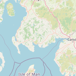
Lake District National Park landscape and geographic character

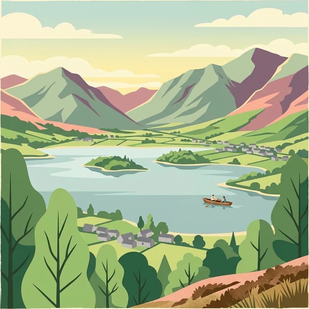
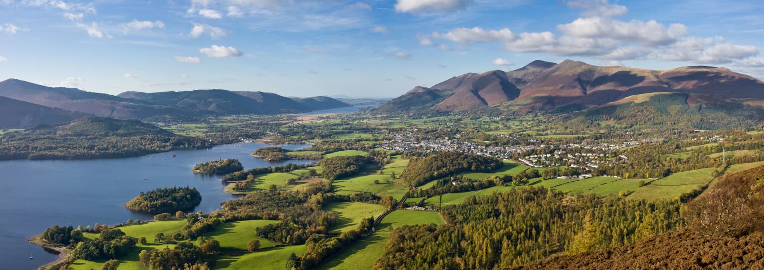
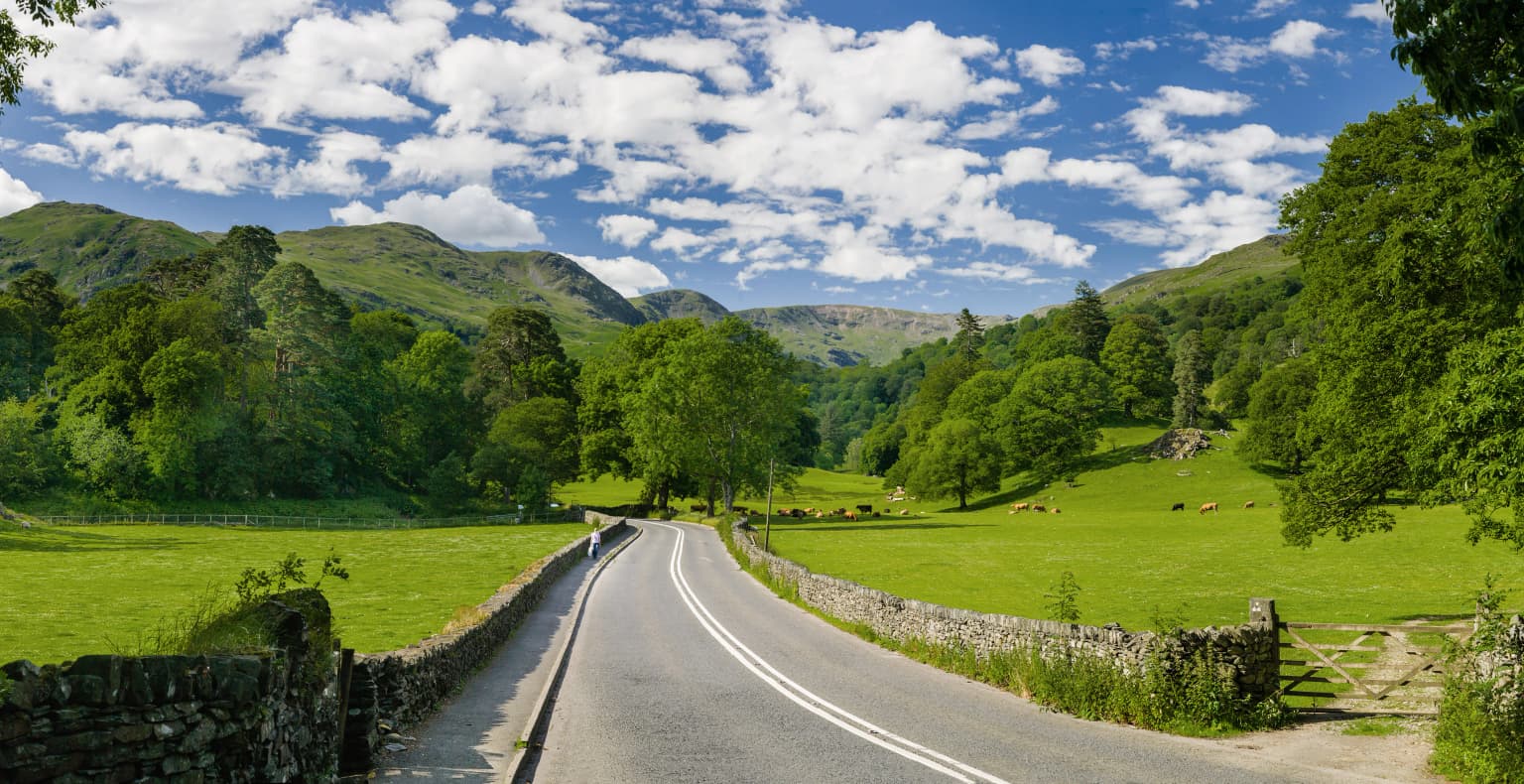
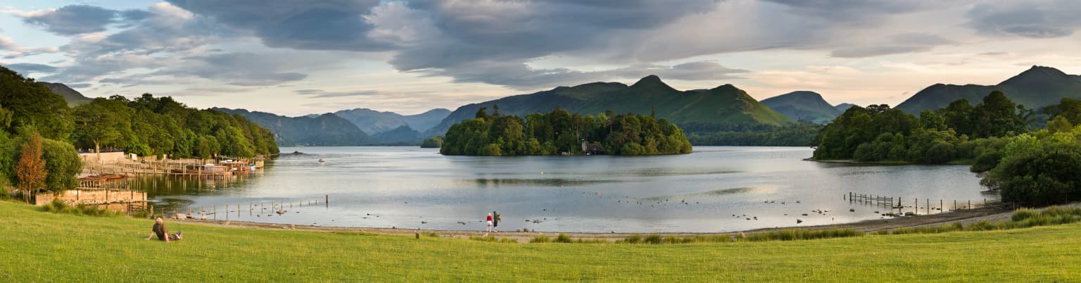
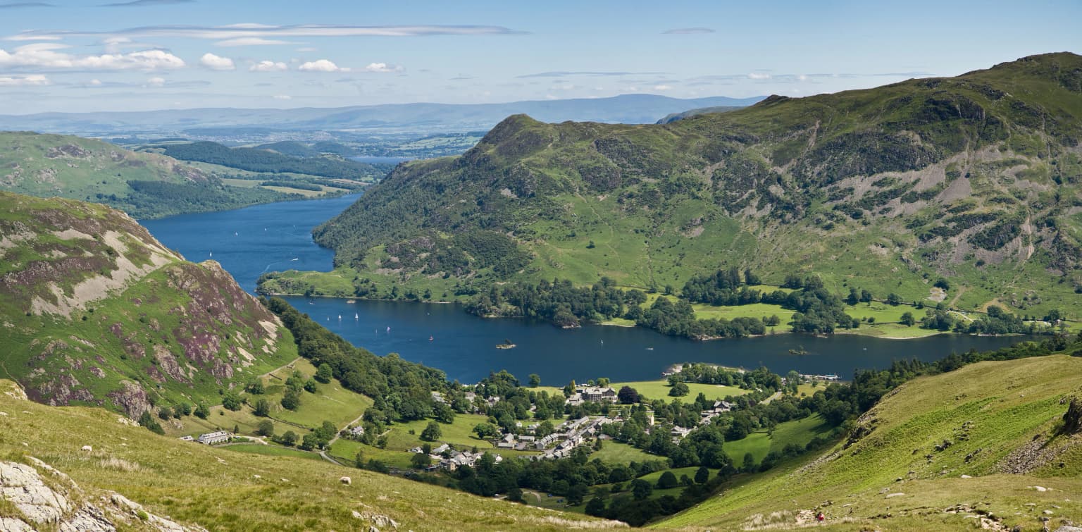
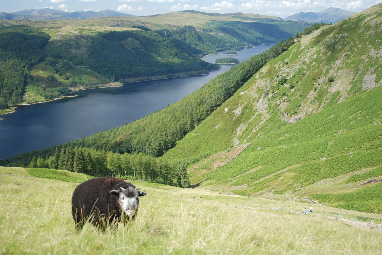
The Lake District's landscape is defined by its mountainous terrain sculpted by glacial processes during the Pleistocene epoch. The park's central core consists of a high plateau ringed by steep-sided valleys that descend to ribbon lakes occupying glacial troughs. The distinctive radial drainage pattern sees valleys flowing outward from the central heights toward the surrounding lowlands. The solid geology comprises primarily Borrowdale volcanic rocks and Skiddaw slate, with granite intrusions forming the highest peaks. The resulting topography features dramatic contrasts: smooth-sided domes like Skiddaw and Blencathra rise above the terrain alongside sharp arêtes such as Striding Edge on Helvellyn, while valley floors contain flat meadows bordered by cascading streams and cascading waterfalls. The lakes themselves represent the most iconic feature, with Windermere stretching over 16 kilometers as England's longest natural lake, while others such as Ullswater, Coniston Water, and Buttermere occupy narrower glacial valleys. Between the valleys, open moorland covers the higher ground, creating a landscape of stark beauty where Heather and grasses dominate during late summer.

Lake District National Park ecosystems, habitats, and plant life

The Lake District supports a diverse range of habitats that vary dramatically with elevation and exposure. The lower valleys feature broadleaved woodlands of oak, ash, and birch, with hazel and rowan forming understory layers. These ancient woodlands represent some of the most species-rich areas, supporting populations of red squirrels, woodland birds, and diverse invertebrate communities. As elevation increases, the tree line gives way to rough grassland and then to exposed moorland dominated byHeather, bilberry, and crowberry. The lake environments themselves support aquatic vegetation including pondweed species and water lilies, while the surrounding wetlands and reed beds provide crucial habitat for breeding birds. The park's highest ground features alpine-style vegetation adapted to harsh conditions, including mosses, lichens, and specialized flowering plants that survive in the exposed conditions above 800 meters. The diverse habitats support notable populations of golden eagles, peregrine falcons, and red deer, though some species have declined from historical populations due to historical persecution and habitat changes.

Lake District National Park wildlife and species highlights

The Lake District supports significant populations of mountain and woodland wildlife, though many species have experienced population fluctuations over recent decades. The park holds England's only breeding population of golden eagles, centered on the remote eastern fells, while peregrine falcons nest on the craggy cliff faces throughout the park. Red deer represent the largest wild mammals, with populations thriving on the open moorland and providing a natural prey base that supports occasional sightings of pine martens. The woodlands shelter populations of red squirrels, though the species has declined significantly due to squirrelpox carried by invasive grey squirrels. Birdlife includes raven, ring ouzel, and dunlin on the high ground, while the lakes and wetlands support populations of great crested grebes, goosanders, and whooper swans during winter. The smaller mammals include otter, which have recolonized many of the park's rivers and lakes following conservation efforts, as well as badger populations in the woodlands.

Lake District National Park conservation status and protection priorities

Lake District National Park represents a flagship area for British conservation, protecting landscapes that have been shaped by centuries of traditional land use while facing pressures from modern agriculture, tourism, and climate change. The park's designation as a national park provides statutory protection for its natural beauty, with planning controls restricting inappropriate development. Habitat conservation efforts focus on restoring the park's upland environments through heather burning management, controlled grazing to maintain moorland, and native woodland planting in valleys. Water quality in the lakes has improved significantly since the 1970s following reduced agricultural pollution and treatment of sewage inputs, supporting recovery of aquatic ecosystems. The park also participates in climate adaptation planning, recognizing that rising temperatures and changing precipitation patterns may shift species distributions and alter the character of the iconic landscapes. Ongoing conservation challenges include balancing visitor pressure on sensitive areas, managing invasive species, and maintaining the traditional farming patterns that help preserve the landscape's character.

Lake District National Park cultural meaning and human context

The Lake District's cultural identity is deeply intertwined with its landscapes of mountains and lakes, shaped by centuries of human presence and artistic interpretation. The region became a center of the Romantic movement in English literature during the late 18th century, with William Wordsworth's poems celebrating the area's natural beauty and establishing the Lake District as a symbol of nature's spiritual and aesthetic power. Samuel Taylor Coleridge, Robert Southey, and other writers contributed to this literary heritage, while the painter J.M.W. Turner captured the landscape's dramatic lighting in watercolors and oils. The Victorian era brought Beatrix Potter to the area, where she purchased farms and land to preserve the traditional agricultural landscape and farming communities; her homes at Hill Top and Near Sawrey remain preserved and open to visitors. Traditional Cumbrian agriculture—particularly sheep farming on the open fells and cattle grazing in the valleys—has shaped the landscape for centuries and remains integral to the park's character and economy.

Top sights and standout views in Lake District National Park

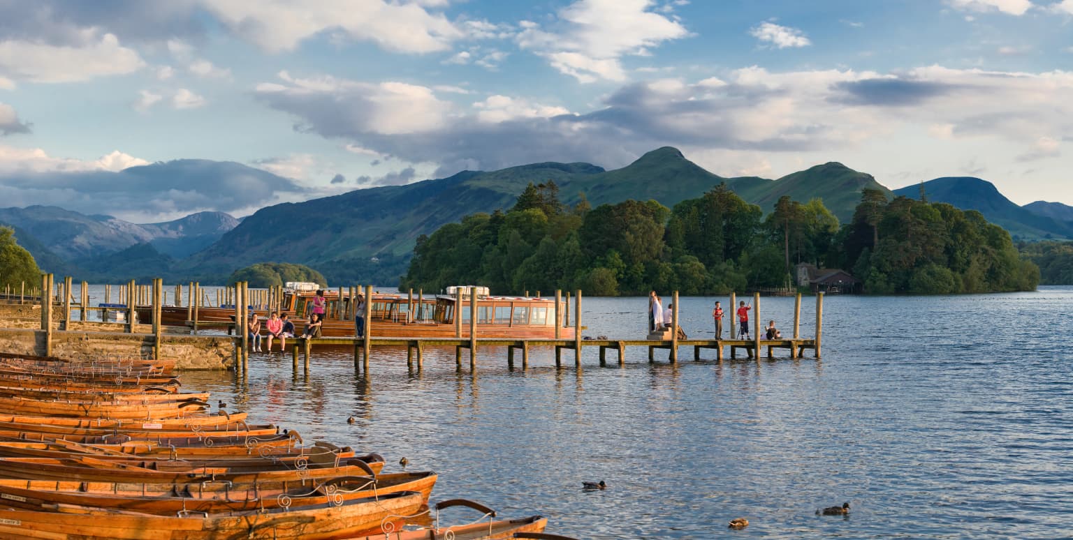
Lake District National Park offers exceptional mountain walking, with routes ranging from gentle lakeside strolls to challenging ascents of England's highest peaks. Windermere and the surrounding lakes provide opportunities for water-based activities, while the network of rights-of-way allows exploration of remote valleys and hidden tarns. The park's literary heritage can be explored through the homes of Wordsworth and Potter, while its geological significance is evident in exposures of volcanic rocks and glacial landforms. The contrast between the pastoral valley floors and the wild open fells creates a compact but extraordinarily varied landscape that rewards exploration throughout the year, whether under spring daffodils, summer heather bloom, autumn's golden colors, or winter's snow-dusted peaks.

Best time to visit Lake District National Park

The Lake District offers distinct experiences across the seasons, each bringing different aspects of the landscape into focus. Spring brings daffodil blooms in the valleys and returning birdlife to the fells, with longer days and manageable visitor numbers. Summer provides the warmest conditions for outdoor activities, though the park's popularity means crowded trails and busy lake shores during school holidays. Autumn transforms the landscape with golden beech and oak woodlands, misty mornings on the lakes, and fewer visitors after the school holiday peak. Winter offers the most dramatic scenery when snow caps the highest peaks, though conditions can be challenging with limited daylight and potential trail closures. The shoulder seasons of spring and autumn often provide the best balance of favorable weather and manageable visitor numbers for those seeking a more contemplative experience of the landscape.

Park location guide

Geography guide, regional context, and park location map for Lake District National Park

Lake District National Park park geography, regions, and map view in United Kingdom
Understand where Lake District National Park sits in United Kingdom through a broader geographic reading of the surrounding landscape, nearby location context, and its mapped position within the national park landscape.

How Lake District National Park fits into United Kingdom

The United Kingdom is a parliamentary constitutional monarchy located in northwestern Europe, consisting of four constituent countries: England, Scotland, Wales, and Northern Ireland. As a major global power with over 69 million residents, it maintains significant international influence in politics, economics, and culture.

Wider geography shaping Lake District National Park in United Kingdom

The United Kingdom is an island nation located in northwestern Europe, surrounded by the Atlantic Ocean, North Sea, English Channel, Celtic Sea, and Irish Sea. It shares a land border with the Republic of Ireland to the west. The territory includes the island of Great Britain, the northeastern portion of Ireland, and most of the smaller British Isles islands.

Map view of Lake District National Park

Use this park location map to pinpoint Lake District National Park in United Kingdom, understand its exact geographic position, and read its mapped placement within the surrounding landscape more clearly.

Pigeon | © OpenStreetMap contributors

Location context for Lake District National Park

Cumbria
Park atlas

Explore the Diverse Protected Landscapes and Regional Park Geography Surrounding England's Famed Lake District

Discover Other National Parks and Protected Areas Near Lake District National Park
Explore additional national parks and protected areas across the UK that share geographic context or landscape features with Lake District National Park. Compare the regional spread of these conservation landscapes, tracing mountain parks and historic protected sites to deepen your atlas-based understanding of the region.
National parkNorth Yorkshire

Yorkshire Dales National Park: A Protected Landscape in North Yorkshire

Explore mapped boundaries and distinctive limestone terrain.

Yorkshire Dales National Park offers a rich tapestry of mapped natural landscapes, characterized by its iconic limestone valleys, U-shaped glacial formations, and rolling heather-clad moorlands. Situated within North Yorkshire, this protected area showcases a unique karst geology, evident in features like Malham Cove and extensive cave systems. The park's traditional dry-stone walls and working farms contribute to a living cultural landscape, making it a prime destination for atlas-driven geographic discovery and understanding regional terrain.

Area
2,178 km²
Established
1954
IUCN
V
Relief
Mountain
National parkNorthumberland

Northumberland National Park: England's Northernmost Protected Landscape and Dark Sky Wilderness

Explore its mapped boundaries, Roman heritage, and remote moorland terrain.

Northumberland National Park protects over 1,050 square kilometers of remote and stunning natural beauty in northern England, bordering Scotland. This page provides a structured overview of its protected landscape, focusing on its geographic context within the county of Northumberland, its designation as a National Park, and its renowned status as Europe's largest Dark Sky Park. Users can discover the park's characteristic moorland terrain, the archaeological significance of Hadrian's Wall, and the vast expanses of Kielder Forest, offering an atlas-level understanding of this unique frontier landscape.

Area
1,050 km²
Established
1956
IUCN
V
Relief
Highland
Watercolor illustration showing rolling hills, green vegetation, and a pale sky
National parkNorth Yorkshire

North York Moors National Park: Explore its Protected Landscape and Geography

Discover mapped moorland, dales, and coastlines.

The North York Moors National Park is a vital protected landscape in North Yorkshire, celebrated for its extensive heather moorland and distinctive deeply incised dales. This page provides an atlas-style exploration of the park's geography, highlighting its unique terrain, mapped boundaries, and its integral role within the regional landscape context. Understand the diverse natural features that define this iconic national park, from the upland plateau to the dramatic Jurassic coast.

Area
1,430 km²
Established
1952
IUCN
V
Relief
Upland
National parkUnited Kingdom

Peak District National Park: Explore Protected Landscape and Regional Geography

Mapped boundaries and natural terrain context for this UK national park.

Investigate the Peak District National Park, a cornerstone of the United Kingdom's protected natural areas. This MoriAtlas entry provides essential details on its geographic scope, mapped boundaries, and landscape characteristics. Engage with structured data to understand how this national park fits into the atlas of the United Kingdom, supporting detailed geographic and protected-area discovery for researchers and explorers.

Area
1,440 km²
Established
1951
IUCN
V
Watercolor illustration showing mountains, green forests, a loch, and a river in a landscape
National parkScotland

Loch Lomond and The Trossachs National Park: Scotland's National Park Atlas and Protected Landscape

Mapping Scotland's Highland Boundary Fault and diverse natural terrain.

As Scotland's first national park, Loch Lomond and The Trossachs National Park offers a prime example of a protected landscape shaped by significant geological features. This atlas entry highlights its strategic location along the Highland Boundary Fault, which delineates distinct highland and lowland terrains. Users can explore the park's extensive network of lochs, including Loch Lomond, its mountainous Munros, and its native woodland ecosystems, providing a rich geographic context for discovery.

Area
1,865 km²
Established
2002
IUCN
V
Visitors
2.9M annual
Watercolor illustration of a landscape with mountains, a lake, and trees
National parkCounty Wicklow

Wicklow Mountains National Park: Protected Landscape and Geographic Atlas Mapping

Explore County Wicklow's mapped natural terrain and park boundaries.

Understand the geographic scope and protected landscape identity of Wicklow Mountains National Park. This page offers detailed information on its mapped boundaries and its context within County Wicklow, providing a foundation for atlas-based discovery of Ireland's natural areas. Explore how this national park contributes to the region's mapped geography and conservation landscapes.

Area
205 km²
Established
1991
IUCN
II
Relief
Mountain
Watercolor painting depicting mountains, forested hills, and a river in a scenic landscape
National parkScotland

Cairngorms National Park: Explore Scotland's Largest Protected Mountain Landscape

Mapped boundaries and arctic-alpine geography.

As the United Kingdom's largest national park, Cairngorms National Park in Scotland presents a vast expanse of distinctive arctic-alpine terrain and ancient Caledonian forests. This protected landscape offers a unique opportunity to explore mapped geographic features, from its extensive mountain plateaus to its vital river systems. Discover the contours and context of this significant natural area within the broader atlas of Scotland's protected lands.

Area
4,528 km²
Established
2003
IUCN
V
Visitors
1.9M annual
National parkWales

Brecon Beacons National Park: Explore Wales' Iconic Protected Mountain Landscape

Discover mapped terrain, park boundaries, and regional geography.

Brecon Beacons National Park, officially Bannau Brycheiniog, stands as a premier protected area within Wales, covering over 1,344 square kilometers of striking mountainous terrain. This national park is defined by its dramatic Old Red Sandstone ranges, including Pen y Fan, South Wales' highest peak, and features diverse landscapes from heather moorland to extensive river valleys. Its mapped boundaries encompass unique geological features, significant historical sites, and provide context for regional geographic exploration, making it a key destination for understanding protected lands in the UK.

Area
1,344 km²
Established
1957
IUCN
V
Visitors
4.4M annual

Common questions about visiting, size, designation, and location context for Lake District National Park

Lake District National Park FAQs for park facts, access, geography, and protected area context
Find quick answers about Lake District National Park, including protected-area facts, park geography, trail and visitor context, and how the park fits into its surrounding country and regional landscape.
MoriAtlas Explorer

Continue Your Protected Areas Search Across the Global Atlas

Deepen your exploration by continuing the structured search for national parks and protected areas worldwide. Utilize the comprehensive filtering capabilities to compare different conservation landscapes and refine your understanding of global park geography. Discover more about the distribution and characteristics of protected natural areas.

Global natural geography