Mori Atlas logo
National parkWicklow Mountains National Park

Discover the mapped boundaries and regional context of this Irish national park.

Wicklow Mountains National Park: Protected Landscape and Geographic Atlas Exploration

(Páirc Náisiúnta Sléibhte Chill Mhantáin)

Wicklow Mountains National Park represents a significant protected landscape within County Wicklow, Ireland. As a designated national park, it offers users a focused point for exploring mapped natural terrain, understanding protected area boundaries, and situating this key Irish landscape within its broader geographic region. This page serves as an atlas-centric entry point, enabling detailed study of the park's role in regional conservation and its place on the map.

National ParkUpland LandscapeBlanket BogMonastic HeritageGlendaloughMountain Peaks
Stylized illustration of a waterfall in a valley between green mountains, with a blue lake and evergreen trees in the foreground

Wicklow Mountains National Park

National park

Park overview

Structured park overview, official facts, and landscape profile for Wicklow Mountains National Park

Wicklow Mountains National Park park facts, protected area profile, and essential visitor context
Review the core facts for Wicklow Mountains National Park, including designation, size, terrain, visitor scale, habitats, and operating context in one park-focused overview.

About Wicklow Mountains National Park

Wicklow Mountains National Park occupies a commanding position in Ireland's eastern uplands, rising prominently behind Dublin and visible across the Irish Sea from Wales on clear days. The park's 205 square kilometres encompass a remarkable diversity of landscapes that tell a complex geological story spanning over 400 million years. The granite mass of the Wicklow Mountains was uplifted during the Caledonian mountain-building episode, then sculpted by successive glaciations into the rounded peaks, deep corries, and U-shaped valleys that define the area today. The park straddles the boundary between the Wicklow uplands and the lowland peripheries, creating an ecological transition zone where species from both environments overlap. Beyond its natural values, the park holds profound cultural significance as the setting for Glendalough, one of the great centers of early Christian Ireland. The monastic settlement founded by Saint Kevin in the 6th century became a renowned university of Celtic learning, its fame spreading across medieval Europe. Today, visitors can walk among the ruins of churches, the famous round tower, and high crosses clustered around the Upper and Lower Lakes, following in the footsteps of centuries of pilgrims and travelers.

Quick facts and research context for Wicklow Mountains National Park

Wicklow Mountains National Park spans approximately 205 square kilometres across County Wicklow with small extensions into South Dublin and Dún Laoghaire–Rathdown. The park was officially established in 1991 following decades of advocacy, with significant land acquisitions adding nearly 48 square kilometres in 2009 and 2016. The landscape features the classic rounded granite summits characteristic of the Wicklow Mountains, carved by glacial activity into U-shaped valleys and ribbon lakes. The park is managed by the National Parks and Wildlife Service under Ireland's Department of Arts, Heritage, Regional, Rural and Gaeltacht Affairs.

Park context

Deeper park guide and search-rich context for Wicklow Mountains National Park

Wicklow Mountains National Park history, landscape, wildlife, and travel context
Explore Wicklow Mountains National Park through its history, landscape character, ecosystems, wildlife, conservation priorities, cultural context, and seasonal travel timing in a structured park guide built for atlas discovery and search intent.

Why Wicklow Mountains National Park stands out

Wicklow Mountains National Park is best known for two exceptional features that define its character. First, it contains Glendalough, one of Ireland's most important Early Medieval monastic sites, founded by the hermit saint Kevin in the 6th century and preserving a remarkable collection of stone churches, round towers, and high crosses amid a stunning lake setting. Second, the park protects extensive tracts of intact blanket bog, a rare habitat in European terms, alongside some of the last remaining药用native oak woodlands in Ireland. This combination of deep cultural heritage and outstanding natural diversity makes Wicklow uniquely significant among Ireland's national parks.

Wide view of Upper Lake surrounded by green hills and forests under a cloudy sky
Upper Lake in Glendalough Valley, Wicklow Mountains National Park

Wicklow Mountains National Park history and protected-area timeline

The establishment of Wicklow Mountains National Park represented the culmination of decades of advocacy by conservationists and local communities who recognized the exceptional value of the Wicklow landscape. The formal proposal for a national park in the Wicklow Mountains had been under consideration for many years before political will coalesced around the idea. In 1988, Taoiseach Charles Haughey announced the creation of the park at Glendalough, a location symbolically chosen for its deep resonance in Irish cultural memory. The interpretative centre at Bolger's Cottage on the Miners' Road was financed in 1990, and the park officially opened in 1991 under the management of the National Parks and Wildlife Service. The park has since expanded significantly beyond its original boundaries. In May 2009, an addition of 28.33 square kilometres was announced, substantially increasing the protected area. A further major expansion occurred in 2016 when the state purchased 19.83 square kilometres from a private owner, a tract extending from Kippure down through Glenasmole Valley to the Bohernabreena Reservoir. These additions have been critical in connecting fragmented habitats and ensuring the ecological integrity of the broader mountain ecosystem.

Wicklow Mountains National Park landscape and geographic character

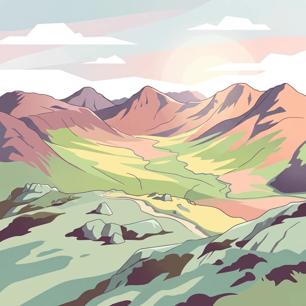
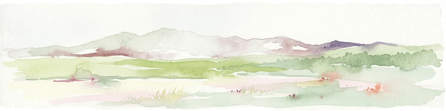
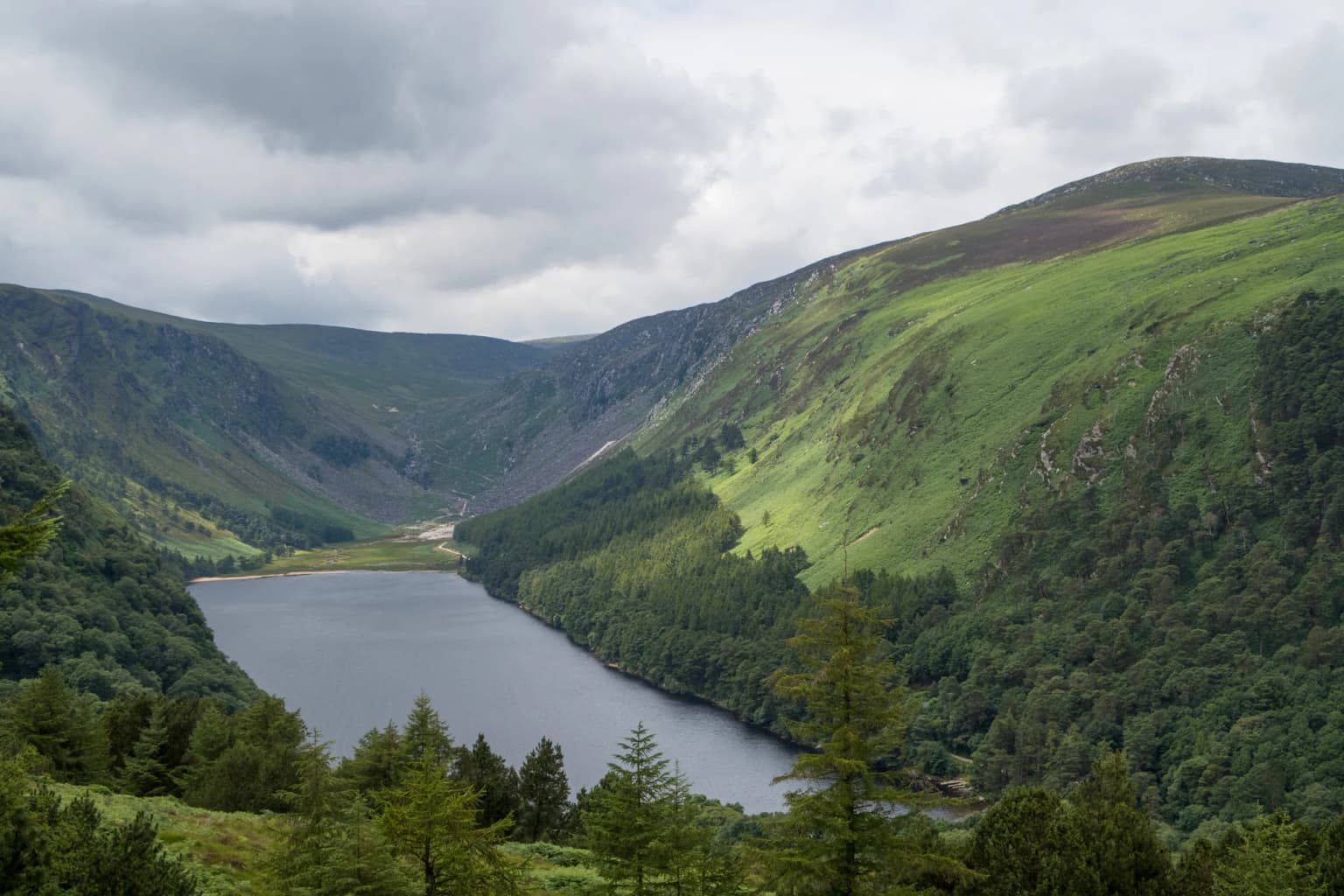
The Wicklow Mountains present a landscape of striking contrast and classical Irish beauty. The granite dome of the range rises from the surrounding lowlands in a series of rounded, heather-covered summits, the highest reaching approximately 925 metres above sea level. The mountains owe their character to the erosive power of Pleistocene glaciers, which carved deep valleys and left behind dramatic features such as the glacial lakes of Glendalough, the corries of the Upper Lake, and the smooth rock exposures known as greet. The park contains several distinctive landscape types: the open upland moors with their carpets of blanket bog and heath vegetation; the sheltered wooded valleys where ancient oak and birch woodland persists in the lee of the hills; the steep-sided river valleys descending from the mountain core; and the more level lowland fringes where wet grasslands and hedgerows predominate. The Military Road, designated R115, traverses the heart of the mountains, following a historic route through the Wicklow Gap to Laragh village, while the R756 provides another scenic route through the park. These roads offer travelers panoramic views across a landscape that has inspired artists, poets, and writers for centuries.

Wicklow Mountains National Park ecosystems, habitats, and plant life

The ecological diversity of Wicklow Mountains National Park is exceptional for its size, encompassing a remarkable range of habitats that support a rich tapestry of plant and animal life. The blanket bogs represent one of the most valuable habitats, these acid peat soils supporting a specialized flora including sphagnum mosses, cotton grasses, cross-leaved heath, and the distinctive bog asphodel. Where the peat has eroded or been cut away, exposed rock surfaces host communities of lichens and mosses adapted to harsh conditions. The woodlands of the park, though limited in extent compared to the open uplands, include some of Ireland's finest remaining areas of native oak woodland. These woods support a characteristic flora including bluebells, wood sorrel, wood anemones, and woodrush, forming a vivid display in spring. The coniferous plantations established in the mid-20th century have been progressively encroached by native species as they mature. Upland grasslands, heath communities, and the pockets of calcareous grassland add further botanical variety to the park's ecological repertoire.

Wicklow Mountains National Park wildlife and species highlights

The wildlife of Wicklow Mountains National Park reflects the park's position at the crossroads of different habitat types and its proximity to the sea. Among the mammals present, several species of bats exploit the variety of roosting opportunities in old buildings, trees, and underground sites, while otters, though rarely seen, maintain populations along the river systems and lake margins. The bird fauna is particularly significant, with nine species recorded that are considered threatened or of international importance. The hen harrier, a graceful bird of prey, nests on the open moors and hunts over the heath and grasslands, while the peregrine falcon nests on cliff faces and can be observed stooping at impressive speeds. The whooper swan winters on the lakes and wetlands, arriving from northern breeding grounds. Other notable species include the raven, the ring ouzel, and various species of thrushes and warblers that populate the woodland and scrub areas. The open moorland supports populations of the red grouse, a species increasingly scarce in Ireland, while the rivers and lakes support populations of brown trout and other freshwater fish.

Wicklow Mountains National Park conservation status and protection priorities

Wicklow Mountains National Park plays a vital role in nature conservation at both national and European levels. The blanket bog habitats, though widespread across Ireland's uplands, have been severely degraded by peat extraction, drainage, and overgrazing in many areas, making the protected example within the park particularly valuable. These peatlands store significant quantities of carbon and play an important role in water regulation, filtering runoff from the mountains and maintaining water quality in the rivers below. The native oak woodlands, though limited in extent, represent remnants of the forest that would once have covered much of the Irish lowlands, and their preservation is essential for the biodiversity they support. The park's designation as an IUCN Category II protected area reflects its dual role in conserving both natural values and cultural heritage, particularly the Glendalough monastic site. The National Parks and Wildlife Service manages the park with objectives focused on nature conservation, research and education, public safety, and maintaining positive relationships with surrounding communities.

Wicklow Mountains National Park cultural meaning and human context

The cultural landscape of Wicklow Mountains National Park extends far beyond the famous monastic ruins of Glendalough, though that site remains its most visited and celebrated element. The valley of Glendalough, meaning the valley of the two lakes, became one of the great centers of learning in early medieval Ireland following the establishment of a monastic community by Saint Kevin in the 6th century. Under subsequent abbots, Glendalough developed into a significant university, attracting students from across Ireland and continental Europe, its fame recorded in manuscripts and chronicles that survive today in fragments and references. The physical remains that survive include the Cathedral, St. Kevin's Church, the Reefert Church, the robust Round Tower standing over 30 metres tall, and several high crosses, all constructed in the local granite. The park also contains the remnants of mining villages, particularly lead and zinc mining operations that operated from the 19th century until the mid-20th century, their abandoned workings now providing interesting historical landmarks along the Miners' Road. The landscape has been inhabited since prehistoric times, with archaeological evidence of settlement, burial sites, and ritual activity scattered throughout the mountains.

Top sights and standout views in Wicklow Mountains National Park

Wicklow Mountains National Park offers visitors a combination of natural beauty, historical depth, and recreational opportunity that is unique among Ireland's protected areas. The monastic ruins of Glendalough, set among the Upper and Lower Lakes in a dramatic glacial valley, provide an extraordinarily powerful sense of place, the weathered stone structures evoking centuries of continuous pilgrimage and visitation. The network of walking trails, ranging from gentle lake-side strolls to demanding mountain scrambles, allows visitors to explore habitats ranging from moss-draped oak woodlands to open blanket bog. The views from the higher ground, particularly along the ridge route from Laragh to the peaks above Glendalough, encompass vast panoramas of the park's interior and, on clear days, extend to the Irish Sea and the mountains of Wales beyond. The accessibility of the park from Dublin, less than an hour's drive from the capital, makes it an exceptionally valuable green space for urban residents seeking wilderness without traveling far.

Best time to visit Wicklow Mountains National Park

Wicklow Mountains National Park can be enjoyed throughout the year, though each season offers a distinctly different experience. The summer months of June through August bring the longest days, the warmest temperatures, and the most reliable conditions for walking and mountain activities. The heath and bog vegetation is in full flower during this period, with the purple heather creating spectacular displays on the open hillsides. Spring, particularly May and early June, offers the woodland display for which the park is famous, with bluebells, wood anemones, and wood sorrel creating carpets of colour beneath the emerging leaf canopy. Autumn brings the turning of the birch and oak leaves to gold and copper, and the berries of the rowan or mountain ash add splashes of red to the hillsides. Winter, though offering shorter days and more challenging walking conditions, reveals the landscape in a different mood, with snow often capping the higher peaks while the valleys remain free of snow, and the absence of foliage opens views normally obscured in leafier seasons.

Park location guide

Geography guide, regional context, and park location map for Wicklow Mountains National Park

Wicklow Mountains National Park park geography, regions, and map view in Ireland
Understand where Wicklow Mountains National Park sits in Ireland through a broader geographic reading of the surrounding landscape, nearby location context, and its mapped position within the national park landscape.

How Wicklow Mountains National Park fits into Ireland

Ireland is an island in the North Atlantic, geologically part of the British Isles. Politically, the island is split between the Republic of Ireland (a sovereign state and EU member) and Northern Ireland (part of the UK). The island has a population of approximately 7.2 million people and is known for its lush landscape, Celtic heritage, and literary culture.

Wider geography shaping Wicklow Mountains National Park in Ireland

Ireland is an island in the North Atlantic Ocean, separated from Great Britain to the east by the North Channel, Irish Sea, and St George's Channel. The island forms part of the British Isles archipelago. The terrain consists of low-lying mountains surrounding a central plain, with the highest point being Carrauntoohil at 1,041 metres. The coastline stretches approximately 7,527 kilometres with numerous inlets and bays.

Map view of Wicklow Mountains National Park

Use this park location map to pinpoint Wicklow Mountains National Park in Ireland, understand its exact geographic position, and read its mapped placement within the surrounding landscape more clearly.

Pigeon | © OpenStreetMap contributors

Location context for Wicklow Mountains National Park

County Wicklow

Discover the visual identity of Wicklow Mountains National Park through imagery of its dramatic peaks, monastic sites, and rare blanket bogs.

Wicklow Mountains National Park Photos: Explore Ireland's Upland Landscapes and Glacial Valleys
Visually immerse yourself in Wicklow Mountains National Park, exploring its iconic glacial valleys, heather-covered peaks, and historic Glendalough monastic ruins. These park images provide essential insights into the diverse terrain, native woodlands, and distinctive blanket bog habitats that define this significant Irish protected area.

Wide view of Upper Lake surrounded by green hills and forests under a cloudy sky

Park atlas

Trace the regional spread of protected landscapes near Wicklow Mountains National Park, comparing Ireland's diverse conservation geography.

Discover Nearby National Parks and Protected Areas Beyond Wicklow Mountains National Park in Ireland
Browse other national parks and protected areas in Ireland, exploring how their distinct landscapes and conservation efforts compare to Wicklow Mountains National Park. This geographic atlas view helps you trace the spread of Ireland's diverse natural and cultural heritage, revealing connected ecosystems and unique regional features.
National parkPembrokeshire

Pembrokeshire Coast National Park: Mapped Coastal Boundaries and Protected Landscape Atlas

Explore unique seaside terrain and regional geography.

Delve into the Pembrokeshire Coast National Park, a premier protected landscape recognized for its extraordinary coastal formations and diverse natural terrain. This atlas entry details the park's distinct mapped boundaries, from its iconic limestone cliffs and sea stacks to its sheltered estuaries and inland Preseli Hills. Understand how this significant national park contributes to the protected area map of Pembrokeshire and offers unparalleled opportunities for geographic discovery along the Welsh coast.

Area
629 km²
Established
1952
IUCN
V
Relief
Mixed relief
National parkWales

Snowdonia National Park: Protected Landscape and Map Exploration in North Wales

Mountain terrain, glacial lakes, and regional geography.

Snowdonia National Park offers a profound exploration of mountainous protected landscapes in North Wales. This page details the park's mapped boundaries, revealing a terrain shaped by glaciation, featuring dramatic peaks like Snowdon, steep valleys, and pristine glacial lakes. Understand its geographic identity within the United Kingdom and how its protected status contributes to the regional landscape context, providing a unique focus for atlas-based discovery.

Area
2,142 km²
Established
1951
Relief
Mountain
Climate
Temperate
National parkCounty Clare

Burren National Park: National Park in County Clare, Ireland

Explore protected landscape and mapped geography.

Burren National Park is a designated national park located in County Clare, Ireland. This MoriAtlas page provides detailed insights into its protected landscape character, its unique karst terrain, and its specific geographic boundaries. Understand how this protected area fits within the broader context of County Clare's Atlantic coast geography, enabling structured atlas-style exploration of its natural significance.

Area
15 km²
Established
1991
IUCN
II
Relief
Mountain
National parkWales

Brecon Beacons National Park: Explore Wales' Iconic Protected Mountain Landscape

Discover mapped terrain, park boundaries, and regional geography.

Brecon Beacons National Park, officially Bannau Brycheiniog, stands as a premier protected area within Wales, covering over 1,344 square kilometers of striking mountainous terrain. This national park is defined by its dramatic Old Red Sandstone ranges, including Pen y Fan, South Wales' highest peak, and features diverse landscapes from heather moorland to extensive river valleys. Its mapped boundaries encompass unique geological features, significant historical sites, and provide context for regional geographic exploration, making it a key destination for understanding protected lands in the UK.

Area
1,344 km²
Established
1957
IUCN
V
Visitors
4.4M annual
National park

Killarney National Park: A Protected Landscape for Geographic Exploration

Explore mapped boundaries and regional atlas context.

Killarney National Park is a significant protected area in Ireland, recognized as a national park for its unique natural attributes. MoriAtlas provides detailed mapping and geographic data to explore this protected landscape. Users can engage with the park's specific terrain, understand its mapped perimeters, and gain insights into its regional geographic significance, enhancing their overall atlas exploration experience.

Area
102.89 km²
Established
1932
IUCN
II
Relief
Mountain
Stylized illustration of mountainous landscape with colorful terrain, valley, and winding path under a partly cloudy sky
National parkCounty Galway

Connemara National Park: A Mapped Protected Landscape in County Galway

Explore national park geography and protected terrain details.

Delve into Connemara National Park, a distinct national park located in the western region of County Galway, Ireland. This entry serves as a gateway to understanding its protected landscape, mapped boundaries, and its role within the broader geographic context of Connacht. Explore how this protected area contributes to the diverse natural terrain of Ireland, viewed through an atlas-driven discovery lens.

Area
20 km²
Established
1980
IUCN
II
Relief
Mountain
Watercolor illustration of a coastal landscape with green fields and distant mountains.
National parkCounty Kerry

Páirc Náisiúnta na Mara National Park: Protected Landscape Atlas for County Kerry

Explore mapped protected areas and regional geography.

This entry details Páirc Náisiúnta na Mara National Park, offering insights into its protected landscape character and geographic setting within County Kerry. As a significant protected area, it contributes to the atlas of Southwest Ireland, providing context for its natural terrain and mapped boundaries. Discover the park's unique identity and its position within the broader regional geography for structured exploration.

Area
280 km²
Established
2024
Relief
Mixed relief
Climate
Temperate
National parkCounty Mayo

Wild Nephin National Park: Ireland's Protected Landscape in County Mayo

National Park with regional geographic context.

Explore Wild Nephin National Park, a significant protected area situated in County Mayo, Ireland. This entry focuses on the park's mapped boundaries and its unique natural terrain, offering a clear geographic perspective. Understand how this national park contributes to the diverse landscapes of western Ireland and serves as a key point for atlas-based discovery of protected lands.

Area
150 km²
Established
1998
IUCN
II
Climate
Temperate

Common questions about visiting, size, designation, and location context for Wicklow Mountains National Park

Wicklow Mountains National Park FAQs for park facts, access, geography, and protected area context
Find quick answers about Wicklow Mountains National Park, including protected-area facts, park geography, trail and visitor context, and how the park fits into its surrounding country and regional landscape.
MoriAtlas Explorer

Continue Your Protected Areas Search Across the Global Atlas

Deepen your exploration by continuing the structured search for national parks and protected areas worldwide. Utilize the comprehensive filtering capabilities to compare different conservation landscapes and refine your understanding of global park geography. Discover more about the distribution and characteristics of protected natural areas.

Global natural geography