Mori Atlas logo
National parkBrecon Beacons National Park

Discover the distinctive sandstone mountain ranges, moorland terrain, and river valleys of this key Welsh national park.

Brecon Beacons National Park: Mapped Protected Landscape in the Heart of Wales

(Bannau Brycheiniog National Park)

Brecon Beacons National Park, a nationally protected area spanning over 1,344 square kilometers in South Wales, offers a profound geographic discovery experience. This park, officially known as Bannau Brycheiniog, is characterized by its dramatic Old Red Sandstone mountains, including Pen y Fan, the highest peak in South Wales. Its landscape mosaics of heath, grassland, and peat bogs, alongside notable waterfalls and cave systems, provide rich context for atlas exploration. Understanding Brecon Beacons National Park involves appreciating its unique terrain, mapped boundaries, and its significant place within the regional geography of Wales and the United Kingdom.

Upland landscapesMountain rangesDark Sky ReserveGeoparkOld Red SandstoneHeathland and moorland

Brecon Beacons National Park

National park

Park overview

Structured park overview, official facts, and landscape profile for Bannau Brycheiniog National Park

Bannau Brycheiniog National Park park facts, protected area profile, and essential visitor context
Review the core facts for Bannau Brycheiniog National Park, including designation, size, terrain, visitor scale, habitats, and operating context in one park-focused overview.

About Bannau Brycheiniog National Park

Bannau Brycheiniog National Park protects a mountainous landscape in the heart of South Wales that has been shaped by hundreds of millions of years of geological processes and millennia of human activity. The park's three mountain ranges—the Black Mountains, the Brecon Beacons and Fforest Fawr, and the Black Mountain—form a continuous highland massif of Old Red Sandstone that rises dramatically from the surrounding lowlands. This geological foundation has created the distinctive scenery of bold escarpments, rounded summits, and steep-sided valleys that defines the area. The park stretches from Llandeilo in the west to Hay-on-Wye in the northeast and Pontypool in the southeast, encompassing not only the high mountain ridges but also the river valleys, forests, and farmland that form the wider cultural landscape. Beyond its natural beauty, the park holds significant archaeological evidence of human occupation from the Neolithic period onwards, with Bronze Age burial cairns, Iron Age hillforts, Roman forts, and medieval castles scattered across the hillsides. The 2023 renaming to Bannau Brycheiniog—derived from the Welsh words for 'peaks' and the ancient kingdom of Brycheiniog—reflects a deliberate effort to centre Welsh language and heritage in the park's identity, though the English name 'Brecon Beacons' remains widely used by visitors and locals alike.

Quick facts and research context for Bannau Brycheiniog National Park

Bannau Brycheiniog National Park covers 1,344 square kilometres across parts of Powys, Monmouthshire, Carmarthenshire, Rhondda Cynon Taf, Merthyr Tydfil, Blaenau Gwent, and Torfaen. The park contains three major mountain ranges: the Black Mountains in the east, the Brecon Beacons and Fforest Fawr in the centre, and the Black Mountain in the west. The park was designated in 1957 as the third Welsh national park after Snowdonia and Pembrokeshire Coast, and receives approximately 4.4 million visitors annually. In 2013, the entire park achieved International Dark Sky Reserve status, making it one of the best places in the UK for stargazing.

Park context

Deeper park guide and search-rich context for Bannau Brycheiniog National Park

Bannau Brycheiniog National Park history, landscape, wildlife, and travel context
Explore Bannau Brycheiniog National Park through its history, landscape character, ecosystems, wildlife, conservation priorities, cultural context, and seasonal travel timing in a structured park guide built for atlas discovery and search intent.

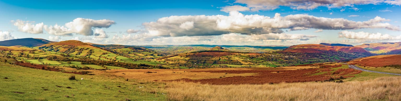
Why Bannau Brycheiniog National Park stands out

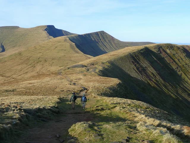
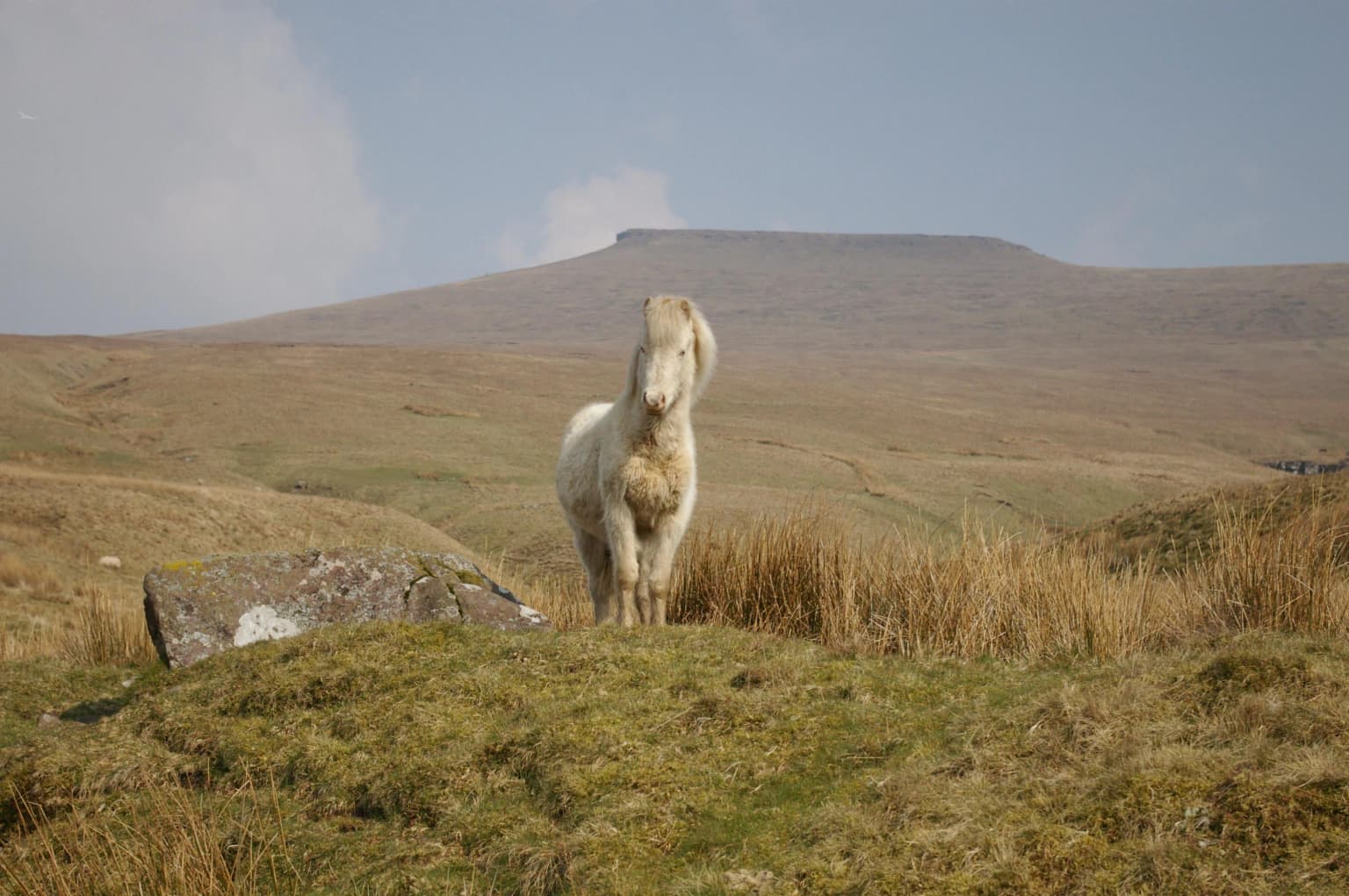
Bannau Brycheiniog is best known for its dramatic sandstone mountain scenery, with steep north-facing escarpments and long ridges defining the Brecon Beacons range. The park contains South Wales' highest mountain, Pen y Fan, along with a network of classic corries (cwms) carved by glacial action. Its Dark Sky Reserve status and Fforest Fawr Geopark designation make it significant for both astronomical and geological appreciation. The landscape is characterised by extensive heather moorland,不起瓦纳草原, and iconic Welsh mountain ponies grazing the open hills.

Bannau Brycheiniog National Park history and protected-area timeline

The human history of what is now Bannau Brycheiniog National Park stretches back to the Neolithic period, with the Bronze Age leaving the most visible legacy in the form of numerous burial cairns that crown the hills of the central and western park. Excavations on Fan Brycheiniog in 2002-2004 revealed a burial cist containing ashes dated to approximately 2000 BCE, accompanied by a wreath of meadowsweet. The Iron Age saw the construction of over twenty hillforts across the area, including the remarkable pair of forts atop y Garn Goch near Bethlehem—y Gaer Fawr and y Gaer Fach—which represent the largest Iron Age settlement complexes in South Wales and likely functioned as trading and political centres. Roman occupation began in 43 CE, with over 600 soldiers stationed in the region and Y Gaer near Brecon serving as their main base. Following the Norman Conquest, castles including Brecon Castle and Carreg Cennen Castle were erected throughout the area. The medieval period saw the development of droving routes across the mountains, with tracks used to drive cattle and geese to English markets, while returning drovers brought gorse seed that was sown to feed sheep. The Industrial Revolution brought quarrying of limestone, silica sand, and ironstone for transport to the furnaces of the South Wales Valleys. The national park was established in 1957, the third of Wales' three national parks, with a visitor centre opening in 1966 to help visitors understand and enjoy the area. In 2005, the western half gained Fforest Fawr Geopark status, and the entire park achieved International Dark Sky Reserve status in 2013.

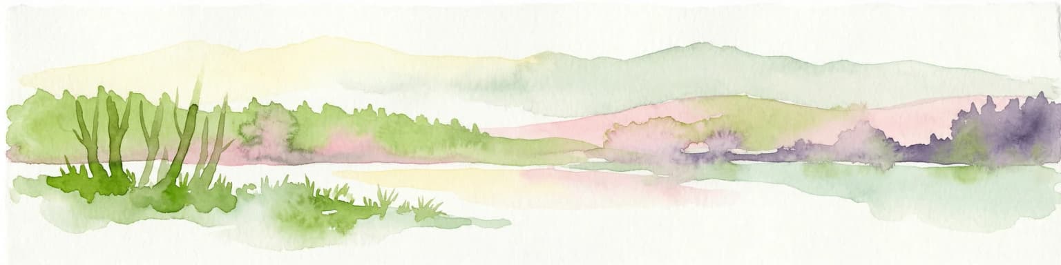
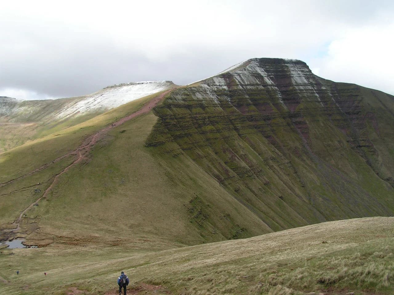
Bannau Brycheiniog National Park landscape and geographic character

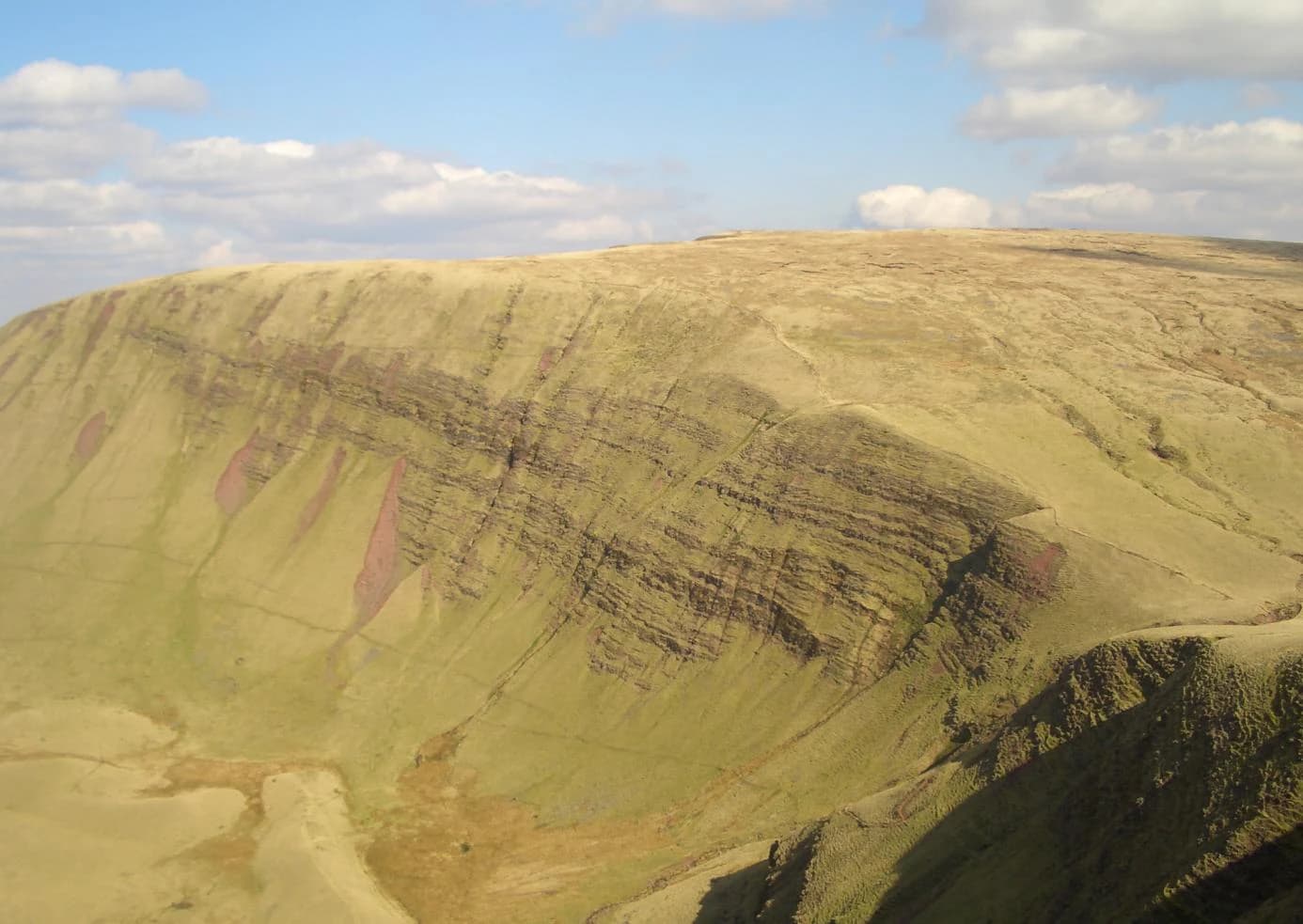
The landscape of Bannau Brycheiniog is defined by its three mountain ranges of Old Red Sandstone, each with distinctive character. The central Brecon Beacons comprise six main peaks forming a long ridge, with Corn Du (873m), Pen y Fan (886m), Cribyn (795m), Fan y Bîg (719m), Bwlch y Ddwyallt (754m), and Waun Rydd (769m) creating a dramatic skyline. These summits form a horseshoe shape around the head of the Taf Fechan valley, with four classic cirques—Cwm Sere, Cwm Cynwyn, Cwm Oergwm, and Cwm Cwareli—opening onto the northeastern slopes. The Black Mountains to the east are separated from the central Beacons by the Usk valley, with Waun Fach (811m) as their highest peak. To the west, the Black Mountain reaches 802.5m at Fan Brycheiniog. The park contains notable waterfalls including Henrhyd Falls at 27 metres and the Ystradfellte falls in the Fforest Fawr area, while the Ogof Ffynnon Ddu cave system represents one of Britain's deepest and longest cave networks on the southwestern edge of Fforest Fawr.

Bannau Brycheiniog National Park ecosystems, habitats, and plant life

The nature of Bannau Brycheiniog reflects the park's position in the upland zone of South Wales, where climate, geology, and human activity have combined to create a distinctive ecological character. Most of the park consists of open moorland dominated by heather and Molinia grasses, historically grazed by Welsh mountain ponies and Welsh mountain sheep. The underlying Old Red Sandstone geology, combined with high rainfall on the western slopes, has produced extensive peat bogs and wet heath communities. Scattered forestry plantations break the moorland in places, while the valleys support improved pastures and broadleaved woodlands. The park sits at the western edge of the range for many species, creating interesting biogeographical patterns. The Fforest Fawr Geopark designation highlights the area's exceptional geological heritage, with the Old Red Sandstone sequence spanning from the late Ordovician through the Silurian, Devonian, and Carboniferous periods, recording nearly 300 million years of Earth history.

Bannau Brycheiniog National Park wildlife and species highlights

The wildlife of Bannau Brycheiniog reflects the upland character of the park, with bird species being particularly notable. The park supports breeding populations of common ravens, red kites, peregrine falcons, northern wheatears, ring ouzels, and the rare merlin, which nests on the open moorland. The mix of heath, grassland, and rocky outcrops provides suitable habitat for these species, while the scattered woodlands in the valleys offer nesting opportunities for other birds. The park'smoorland is grazed by Welsh mountain ponies and Welsh mountain sheep, traditional breeds that have shaped the landscape through generations of pastoral use. The waterways, including the rivers Usk, Taff, and their tributaries, support populations of Atlantic salmon and brown trout, while the reservoirs such as Pontsticill (Taf Fechan) and Pentwyn provide additional aquatic habitats.

Bannau Brycheiniog National Park conservation status and protection priorities

Bannau Brycheiniog holds significant conservation value through its multiple designations and its role in protecting South Wales' mountain landscapes. The park's IUCN Category V status recognises it as a protected landscape where nature conservation is integrated with human land use and cultural heritage. The International Dark Sky Reserve designation since 2013 protects the nocturnal environment and astronomical heritage of the area, limiting light pollution and preserving views of the Milky Way from the open hills. The Fforest Fawr Geopark status, awarded in 2005, recognises the exceptional geological heritage of the western park, with educational programmes and sustainable tourism initiatives focused on the area's Earth science importance. The park authority works to balance conservation of the natural beauty, wildlife, and cultural heritage with visitor enjoyment and the economic wellbeing of local communities, managing a landscape that has been shaped by centuries of pastoral use while addressing contemporary challenges including climate change and habitat restoration.

Bannau Brycheiniog National Park cultural meaning and human context

The cultural context of Bannau Brycheiniog is deeply rooted in Welsh language and heritage, as reflected in the 2023 renaming from Brecon Beacons to Bannau Brycheiniog. The Welsh name derives from 'bannau' (peaks) and 'Brycheiniog', the name of an early medieval kingdom that covered the area. The landscape bears the imprint of centuries of Welsh history, from the Neolithic and Bronze Age communities who built burial cairns on the hills, through the Iron Age hillforts that represented centres of power, to the Roman, Norman, and later periods that saw castles and towns develop in the surrounding lowlands. The droving routes across the mountains represent a particularly Welsh tradition of seasonal movement of livestock to English markets, a practice that shaped both the landscape and the cultural identity of the region. The park encompasses communities ranging from small villages to the towns of Brecon and Hay-on-Wye, where the Welsh language remains part of daily life. The renaming to Bannau Brycheiniog represents a conscious effort to celebrate Welsh culture and identity, though the transition has generated debate about the balance between promoting Welsh language and maintaining accessibility for English-speaking visitors.

Top sights and standout views in Bannau Brycheiniog National Park

Bannau Brycheiniog offers remarkable highlights including the ascent of Pen y Fan, the highest peak in South Wales, with its sweeping views across the national park and beyond. The Four Bridges circuit through the Fforest Fawr area reveals some of Wales' most beautiful waterfalls, including Henrhyd Falls and the Ystradfellte cascade. The park's Dark Sky Reserve status makes it a premier destination for stargazing, with the Beacons providing pristine views of the night sky far from urban light pollution. The network of long-distance trails—including the Beacons Way at 159 kilometres and the Taff Trail for cyclists—allows visitors to explore the mountain ranges on foot. The Brecon Mountain Railway offers a heritage rail experience through the Taf Fechan valley, while the Dan yr Ogof show caves provide underground exploration. The Iron Age hillforts such as y Gaer Fawr and y Gaer Fach near Bethlehem represent some of the most significant prehistoric sites in South Wales.

Best time to visit Bannau Brycheiniog National Park

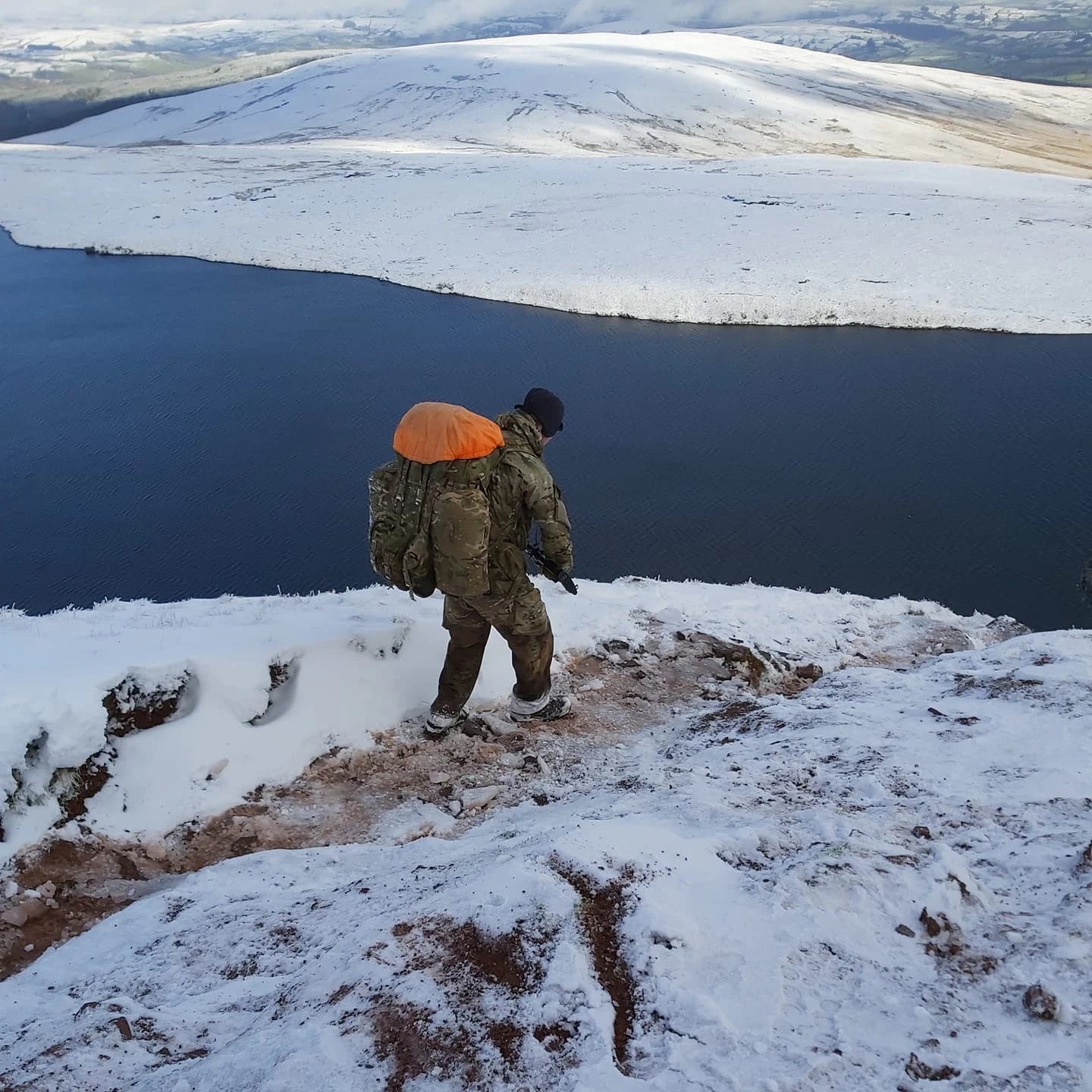
Bannau Brycheiniog can be visited year-round, with each season offering distinct experiences. Summer brings the warmest conditions for walking the open hills, with heather in bloom across the moorland in August creating a carpet of purple across the landscape. Autumn offers atmospheric conditions and the possibility of seeing red kites and ravens as the weather turns. Winter transforms the mountains with snow on the higher peaks, though conditions can be challenging and mountain safety becomes essential—it's during this season that the park's military training function becomes most visible as SAS selection candidates undertake the infamous Fan Dance on Pen y Fan. Spring sees the return of breeding birds to the moors and the lengthening days encouraging early season walks. The Dark Sky Reserve is most impressive in autumn and winter when the nights are longest and the Milky Way is most visible. For those seeking the quietest conditions, weekdays outside the main summer months offer more tranquil experiences on the trails.

Park location guide

Geography guide, regional context, and park location map for Bannau Brycheiniog National Park

Bannau Brycheiniog National Park park geography, regions, and map view in United Kingdom
Understand where Bannau Brycheiniog National Park sits in United Kingdom through a broader geographic reading of the surrounding landscape, nearby location context, and its mapped position within the national park landscape.

How Bannau Brycheiniog National Park fits into United Kingdom

The United Kingdom is a parliamentary constitutional monarchy located in northwestern Europe, consisting of four constituent countries: England, Scotland, Wales, and Northern Ireland. As a major global power with over 69 million residents, it maintains significant international influence in politics, economics, and culture.

Wider geography shaping Bannau Brycheiniog National Park in United Kingdom

The United Kingdom is an island nation located in northwestern Europe, surrounded by the Atlantic Ocean, North Sea, English Channel, Celtic Sea, and Irish Sea. It shares a land border with the Republic of Ireland to the west. The territory includes the island of Great Britain, the northeastern portion of Ireland, and most of the smaller British Isles islands.

Map view of Bannau Brycheiniog National Park

Use this park location map to pinpoint Bannau Brycheiniog National Park in United Kingdom, understand its exact geographic position, and read its mapped placement within the surrounding landscape more clearly.

Pigeon | © OpenStreetMap contributors

Location context for Bannau Brycheiniog National Park

MonmouthshirePowysWales
Park atlas

Browse surrounding protected landscapes, trace regional park geography, and compare diverse Welsh terrain.

Discover More National Parks and Protected Areas Near Brecon Beacons National Park
Continue your exploration from Brecon Beacons National Park by discovering a curated list of nearby national parks and other protected areas across Wales. This comparative view helps map their distinct mountain ranges, moorland, and coastal landscapes within a broader regional context, enhancing your geographic understanding.
National parkPembrokeshire

Pembrokeshire Coast National Park: Mapped Coastal Boundaries and Protected Landscape Atlas

Explore unique seaside terrain and regional geography.

Delve into the Pembrokeshire Coast National Park, a premier protected landscape recognized for its extraordinary coastal formations and diverse natural terrain. This atlas entry details the park's distinct mapped boundaries, from its iconic limestone cliffs and sea stacks to its sheltered estuaries and inland Preseli Hills. Understand how this significant national park contributes to the protected area map of Pembrokeshire and offers unparalleled opportunities for geographic discovery along the Welsh coast.

Area
629 km²
Established
1952
IUCN
V
Relief
Mixed relief
National parkWales

Snowdonia National Park: Protected Landscape and Map Exploration in North Wales

Mountain terrain, glacial lakes, and regional geography.

Snowdonia National Park offers a profound exploration of mountainous protected landscapes in North Wales. This page details the park's mapped boundaries, revealing a terrain shaped by glaciation, featuring dramatic peaks like Snowdon, steep valleys, and pristine glacial lakes. Understand its geographic identity within the United Kingdom and how its protected status contributes to the regional landscape context, providing a unique focus for atlas-based discovery.

Area
2,142 km²
Established
1951
Relief
Mountain
Climate
Temperate
Watercolor illustration of Dartmoor moorland landscape with rolling hills, grassy vegetation, a stream, and distant mountains.
National parkDevon

Dartmoor National Park: Granite Tors and Prehistoric Landscape in Devon

Mapped protected area with significant Bronze Age remains.

Dartmoor National Park represents a distinctive granite upland in Devon, England, characterized by its dramatic tors and expansive moorland. This protected landscape is globally significant for its dense concentration of prehistoric archaeological sites, including stone circles, standing stones, and ancient settlements. Exploring Dartmoor offers a unique insight into Britain's regional geography, mapped terrain, and enduring connection to ancient human history.

Area
954 km²
Established
1951
IUCN
V
Visitors
11M annual
Watercolor painting showing a landscape with green and purple vegetation, a body of water, and distant hills.
National parkEngland

New Forest National Park: Historic Protected Landscape and Regional Geography in England

Mapped heathland, ancient woodlands, and pastoral traditions.

Explore New Forest National Park, a nationally significant protected area in England renowned for its unique blend of ancient royal forest history, traditional pastoral practices, and biologically rich lowland habitats. This page provides an atlas-focused view of its mapped boundaries, distinctive terrain, and geographic context within England, highlighting its value as a living landscape shaped by centuries of common grazing rights and supporting rare wildlife.

Area
566 km²
Established
2005
IUCN
V
National parkUnited Kingdom

Peak District National Park: Explore Protected Landscape and Regional Geography

Mapped boundaries and natural terrain context for this UK national park.

Investigate the Peak District National Park, a cornerstone of the United Kingdom's protected natural areas. This MoriAtlas entry provides essential details on its geographic scope, mapped boundaries, and landscape characteristics. Engage with structured data to understand how this national park fits into the atlas of the United Kingdom, supporting detailed geographic and protected-area discovery for researchers and explorers.

Area
1,440 km²
Established
1951
IUCN
V
Watercolor illustration of a landscape with mountains, a lake, and trees
National parkCounty Wicklow

Wicklow Mountains National Park: Protected Landscape and Geographic Atlas Mapping

Explore County Wicklow's mapped natural terrain and park boundaries.

Understand the geographic scope and protected landscape identity of Wicklow Mountains National Park. This page offers detailed information on its mapped boundaries and its context within County Wicklow, providing a foundation for atlas-based discovery of Ireland's natural areas. Explore how this national park contributes to the region's mapped geography and conservation landscapes.

Area
205 km²
Established
1991
IUCN
II
Relief
Mountain
Watercolor illustration of a coastal landscape featuring green hills, white cliffs, and a body of water
National parkSouth East England

South Downs National Park: A Distinctive Chalk Landscape in South East England's Atlas

Iconic chalk downland, coastal cliffs, and mapped terrain.

South Downs National Park is a premier protected landscape in South East England, celebrated for its unique chalk downland terrain and dramatic coastal formations. This page provides detailed geographic context for the park, highlighting its rolling hills, dry valleys, and ancient woodlands. Discover the park's mapped boundaries and its significance within England's protected areas, offering a structured atlas view for landscape exploration.

Area
1,627 km²
Established
2010
IUCN
V
Visitors
18M annual
National parkNorth Yorkshire

Yorkshire Dales National Park: A Protected Landscape in North Yorkshire

Explore mapped boundaries and distinctive limestone terrain.

Yorkshire Dales National Park offers a rich tapestry of mapped natural landscapes, characterized by its iconic limestone valleys, U-shaped glacial formations, and rolling heather-clad moorlands. Situated within North Yorkshire, this protected area showcases a unique karst geology, evident in features like Malham Cove and extensive cave systems. The park's traditional dry-stone walls and working farms contribute to a living cultural landscape, making it a prime destination for atlas-driven geographic discovery and understanding regional terrain.

Area
2,178 km²
Established
1954
IUCN
V
Relief
Mountain

Common questions about visiting, size, designation, and location context for Bannau Brycheiniog National Park

Bannau Brycheiniog National Park FAQs for park facts, access, geography, and protected area context
Find quick answers about Bannau Brycheiniog National Park, including protected-area facts, park geography, trail and visitor context, and how the park fits into its surrounding country and regional landscape.
MoriAtlas Explorer

Continue Your Protected Areas Search Across the Global Atlas

Deepen your exploration by continuing the structured search for national parks and protected areas worldwide. Utilize the comprehensive filtering capabilities to compare different conservation landscapes and refine your understanding of global park geography. Discover more about the distribution and characteristics of protected natural areas.

Global natural geography