
Why South Downs National Park stands out
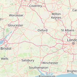
South Downs National Park is best known for its iconic chalk downland landscape, which is unique among Britain's national parks. The dramatic white chalk cliffs of the Seven Sisters and Beachy Head on the Sussex coast represent some of the most photographed coastal scenery in England. The park's rolling chalk escarpment, with its characteristic smooth contours and dry valleys, creates a landscape of exceptional beauty that has inspired artists, writers, and poets for centuries. The South Downs Way National Trail provides visitors with the opportunity to walk the entire length of the park along the chalk ridge, offering sweeping views across southern England. The western Weald provides a strongly contrasting landscape of ancient woodlands, heather-covered heath, and secluded valleys that add significant diversity to the park's character.
South Downs National Park history and protected-area timeline
The journey toward South Downs National Park spans nearly nine decades, beginning with early conservation movements in the 1920s. Public concern about increasing threats to the downland environment, particularly from speculative housing development following the example of Peacehaven on the eastern Sussex Downs, led to the formation of the Council for the Preservation of Rural England. In 1929, this organization submitted a memorandum to the Prime Minister urging the creation of national parks, including a park on part of the South Downs.
When John Dower was asked to report on how a system of national parks might be established in England and Wales, his 1945 report did not initially identify the South Downs for national park status, instead listing it among other amenity areas. However, Sir Arthur Hobhouse's 1947 Report of the National Parks Committee took a different view, including the South Downs among twelve areas recommended for national park designation. The South Downs was ultimately the last of these twelve original recommendations to be designated.
Extensive damage to the chalk downland from 1940 onwards through the conversion of grassland to arable farming, and the resulting decline in sheep grazing, undermined the case for early designation. By 1956, the National Parks Commission found that designation was no longer appropriate, as the value of the South Downs as a potential national park had been reduced by cultivation. Instead, the area was designated as two separate Areas of Outstanding Natural Beauty—the East Hampshire AONB in 1962 and the Sussex Downs AONB in 1966.
The modern push for national park status began in September 1999 when the government declared support for a South Downs National Park. Following a public inquiry between 2003 and 2005, and a second inquiry in 2008 after the western Weald issue was revisited, the Secretary of State announced on 31 March 2009 that the South Downs would become a national park. The designation order was signed on 12 November 2009, and the park came into full operation on 1 April 2011 when the South Downs National Park Authority assumed statutory responsibility.
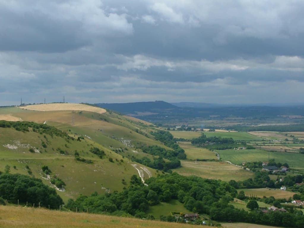
South Downs National Park landscape and geographic character
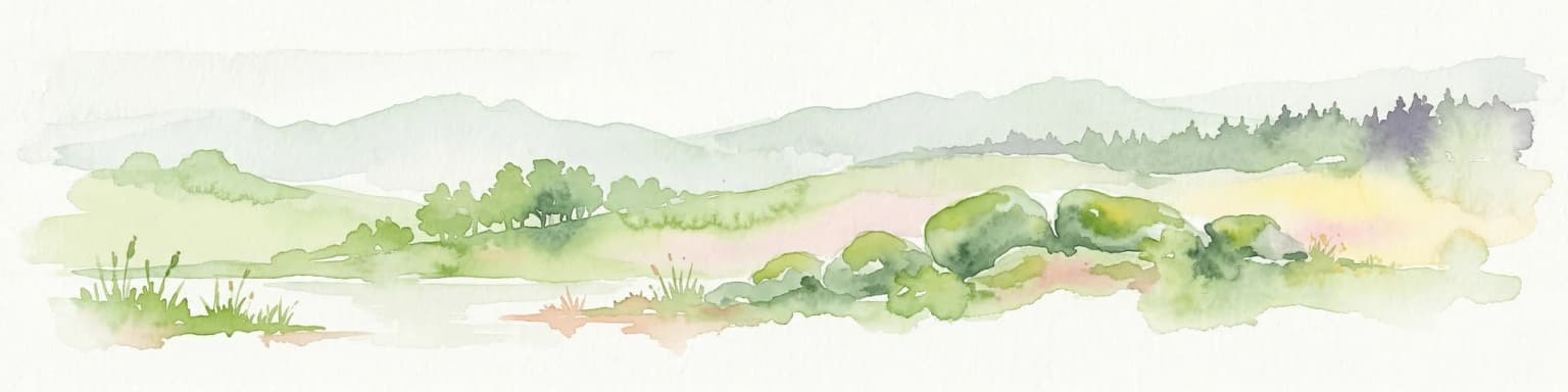
The South Downs National Park presents a landscape of exceptional variety and visual drama, defined primarily by its chalk geology. The most striking feature is the dramatic north-facing chalk escarpment that runs for over 100 kilometres through the park, rising sharply above the low-lying clay vales of the Weald. This classic cuesta landform creates a landscape of outstanding natural beauty, with the steep chalk faces, smooth rolling hilltops, and intervening dry valleys creating a distinctive silhouette visible across southern England.
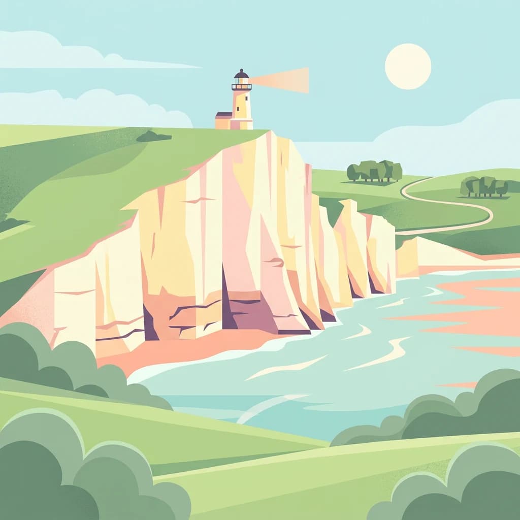
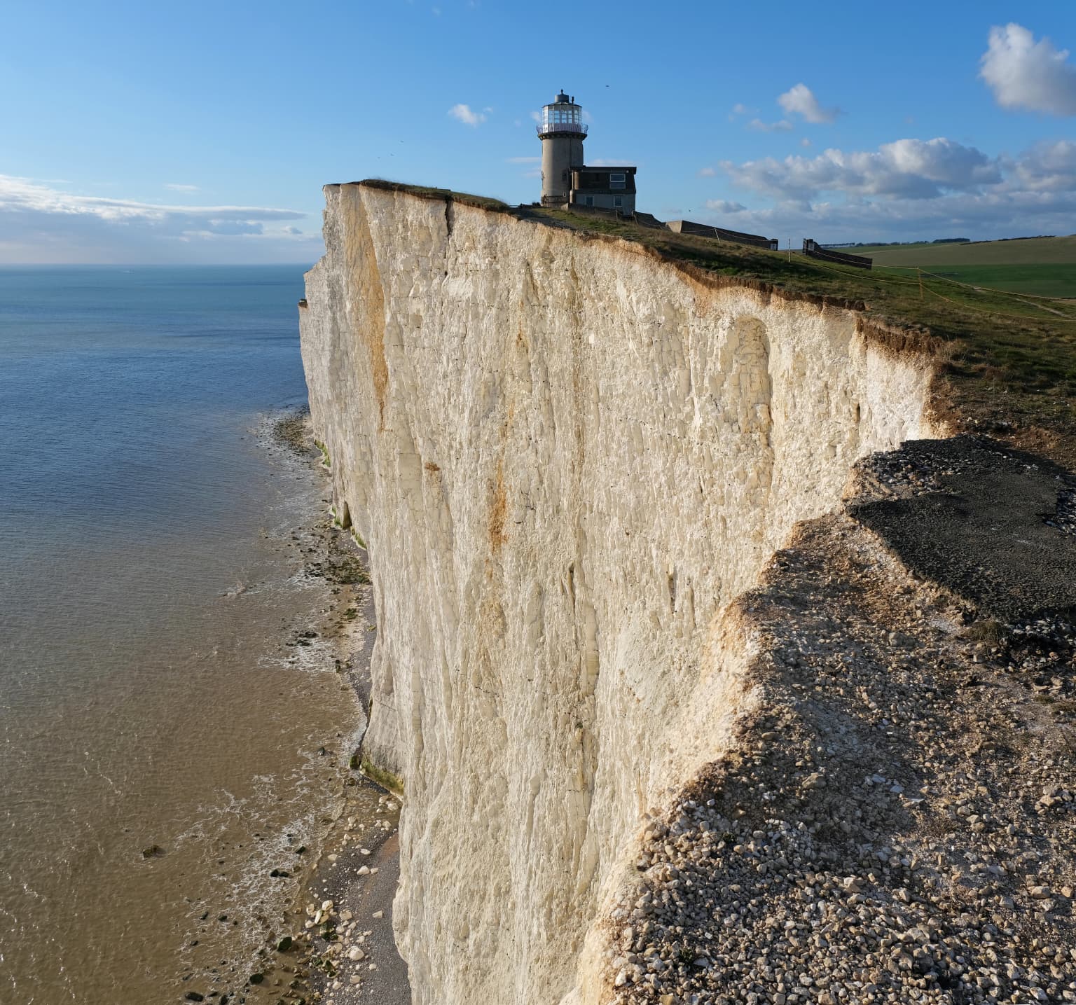
Along the Sussex coast, the chalk cliffs reach their most spectacular expression at Beachy Head, the highest chalk cliff in Britain at 162 metres, and at the Seven Sisters, where a series of chalk cliffs creates one of the most iconic coastal landscapes in England. These white cliffs, formed by wave action following the last ice age, appear brilliant against the blue waters of the English Channel. Behind the coast, the River Cuckmere has cut a dramatic gap through the downs to create the Cuckmere Haven, a sheltered valley where the river meets the sea.
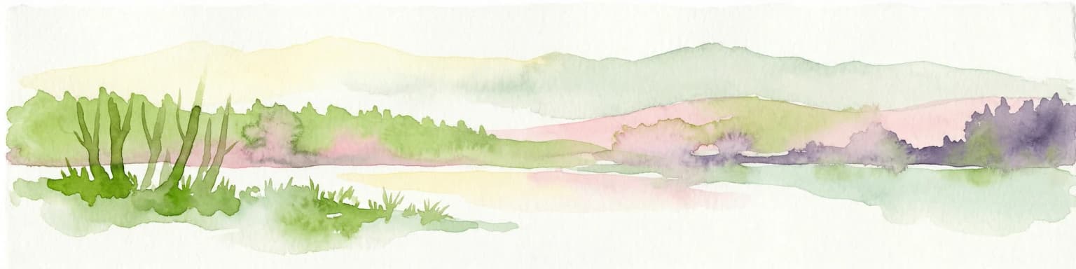
Inland, the characteristic dry valleys of the downs—such as the Devil's Dyke, one of the deepest dry valleys in Britain—provide evidence of the ancient drainage systems that once flowed across this chalk landscape. The smooth, rounded contours of the downland hills create an open, expansive landscape that has been shaped by centuries of grazing and human settlement. Scattered across the downs are ancient beech woodlands that cling to the steeper slopes, creating the characteristic pattern of woodland and open grassland that defines this landscape.
The western Weald presents a stark contrast to the open chalk downland. Here, older Wealden geology of resistant sandstones and softer clays has produced a landscape of densely wooded hills and secret valleys. The Greensand Ridge, with its heathlands, conifer plantations, and ancient woodlands, creates a markedly different character from the open downs. The highest point in the park, Blackdown at 280 metres, lies within this Wealden landscape rather than on the chalk downs.

South Downs National Park ecosystems, habitats, and plant life
The South Downs National Park supports a remarkable diversity of habitats, ranging from species-rich chalk grassland to ancient woodlands, heathlands, and river valleys. The chalk downland represents the park's most significant ecological asset, supporting some of the rarest grassland habitats in Britain. The thin, calcareous soils of the downs support a distinctive flora adapted to the free-draining, nutrient-poor conditions, including many rare and specialized plant species that are found nowhere else in the country.
The chalk grassland of the South Downs is characterized by a rich sward of fine grasses and herbs, including numerous species of orchids, such as the rare orchid species that depend on this habitat. The downland supports important populations of rare invertebrates, including several species of butterflies that are restricted to chalk grassland. The scrubby edges and hedgerows of the downs provide important habitat for birds and small mammals, creating a heterogeneous landscape that supports rich biodiversity.
The western Weald contributes significantly to the park's ecological diversity. The heathlands of the Greensand Ridge support specialist heathland species, while the ancient woodlands of the Weald contain some of the oldest trees in southern England. The river valleys that flow through the park—the Arun, Adur, Ouse, and Cuckmere—create wetland habitats that support additional biodiversity, including important populations of waterfowl and riparian species.
The park's network of Sites of Special Scientific Interest and Special Areas of Conservation reflects the ecological importance of these habitats. The designation of the park as an International Dark Sky Reserve in 2016 also recognizes the importance of the park's dark skies for nocturnal wildlife, highlighting the interconnectedness of above-ground and below-ground conservation values.
South Downs National Park wildlife and species highlights
The South Downs National Park supports a rich tapestry of wildlife, with populations of both common and rare species adapted to the park's diverse habitats. The chalk downland is home to populations of the iconic chalkhill blue butterfly, a species whose lifecycle is intimately tied to the horseshoe vetch that grows on the downs, and the dark green fritillary, which thrives in the flower-rich grassland. The scrub and woodland edges support populations of nightjar and Dartford warbler, birds that are characteristic of the heathland and gorse scrub habitats found in the park.
The ancient woodlands of the western Weald provide habitat for populations of dormice, a protected species that depends on the dense understory of hedgerows and woodland edges. The woodlands also support populations of deer, including fallow deer and roe deer that are widespread throughout the park. The park's hedgerows and field margins provide important habitat for brown hare, a species that has declined across much of lowland England but remains relatively common in the downs.
The birdlife of the park is diverse, with populations of raptors including buzzard, kestrel, and red kite soaring over the downs. The open grassland supports populations of skylark and meadow pipit, while the woodland provides habitat for species such as nuthatch, treecreeper, and various tit species. The river valleys attract waterfowl including kingfisher and heron, while the coastal cliffs at Beachy Head and the Seven Sisters provide nesting habitat for seabirds including kittiwake and fulmar.
The geological features of the park also support specialized wildlife. The chalk cliffs provide nesting sites for birds and shelter for invertebrates, while the numerous flint nodules in the chalk have created a substrate for specialized cave-dwelling creatures. The underground cave systems and fissures in the chalk support populations of bats, including several species that use the park for roosting and foraging.

South Downs National Park conservation status and protection priorities
The designation of South Downs National Park reflects the recognition that this landscape represents one of England's most significant conservation assets. The park's conservation value is underscored by its network of 86 Sites of Special Scientific Interest and 13 Special Areas of Conservation, designations that reflect the national and international importance of the park's habitats and species. The chalk downland in particular is recognized as a habitat of European importance, with the species-rich grasslands qualifying as a priority habitat under the EU Habitats Directive.
The conservation challenges facing the park are substantial. The chalk downland has suffered significant loss over the past century, with large areas converted to arable agriculture during and after the Second World War. The decline of sheep grazing, which traditionally maintained the downland, has led to scrub encroachment on many areas that were once open grassland. Conservation management within the park focuses on restoring and maintaining the chalk grassland through scrub clearance, grazing programmes, and habitat restoration projects.
The International Dark Sky Reserve designation achieved in 2016 reflects the park's commitment to protecting nocturnal environments and the wildlife that depends on dark skies. This designation requires the park authority to work with local communities and businesses to reduce artificial light pollution, implementing lighting strategies that preserve the darkness of the night sky while maintaining safety and functionality. The dark sky reserve represents a modern dimension of conservation that recognizes the importance of natural darkness as a natural resource to be protected.
The park also faces the challenge of balancing conservation with the needs of the 108,000 people who live within its boundaries. The South Downs National Park Authority must reconcile the statutory purposes of conserving the natural beauty, wildlife, and cultural heritage of the area while also promoting opportunities for public enjoyment and fostering the economic and social well-being of local communities. This balancing act requires careful management of development, visitor impact, and ecological restoration.
South Downs National Park cultural meaning and human context
The South Downs National Park is steeped in human history that spans millennia, from prehistoric times through the Roman period, the medieval era, and into the present day. The chalk downs have been inhabited and used by humans for thousands of years, with archaeological evidence of settlement, burial sites, and field systems scattered across the landscape. The flint nodules in the chalk were widely used for tool-making during the Stone Age, and the downs contain numerous archaeological sites that reveal the long history of human occupation.
The landscape has inspired artists, writers, and musicians for centuries. The Romantic painters of the 18th and 19th centuries were drawn to the dramatic light and sweeping views of the downs, while literary figures including Virginia Woolf, who lived near the Sussex coast, found inspiration in the unique quality of the landscape. The area has been celebrated in poetry, prose, and visual art as a symbol of English countryside at its most characteristic.
The hill figures carved into the chalk hillside—the Litlington White Horse and the Long Man of Wilmington—represent unique cultural features of the park, though their exact origins remain shrouded in mystery. These giant figures, created by cutting away turf to reveal the white chalk beneath, have become landmarks and symbols of the downs. The historic towns and villages within the park—including Arundel, Lewes, Midhurst, and Petersfield—contain important architectural heritage, with medieval churches, historic houses, and traditional villages that reflect centuries of continuous settlement.
Top sights and standout views in South Downs National Park
The South Downs offers exceptional variety within a relatively compact area, making it distinctive among Britain's national parks. The dramatic white chalk cliffs of the Seven Sisters and Beachy Head represent some of the most spectacular coastal scenery in England, while the sweeping views from the downs' ridgeline provide panoramic vistas across southern England to the Isle of Wight on clear days. The Devil's Dyke, one of the deepest dry valleys in Britain, offers dramatic topography and spectacular views. The park's ancient beech woodlands, particularly striking in autumn when the canopy turns golden, create some of England's most beautiful woodland scenery.
The South Downs Way, as the only National Trail lying wholly within a single national park, provides the definitive way to experience the park's landscapes, following the chalk ridge for its entire 160-kilometre length. The international Dark Sky Reserve status, achieved in 2016, makes the park one of the best places in England for stargazing, with dark skies that reveal the Milky Way and thousands of stars invisible from urban areas. The contrast between the open chalk downland and the wooded valleys of the western Weald adds significant variety, with visitors able to experience two very different landscapes within a single park.
Best time to visit South Downs National Park
The South Downs National Park can be enjoyed throughout the year, with each season bringing a different character to the landscape. Spring brings fresh green growth to the downs, with the emergence of spring flowers including bluebells in the woodlands and the first butterflies on the wing. The lambing season in spring adds to the pastoral character of the downs, with young lambs appearing on the grassland. Spring is also an excellent time for birdwatching, with summer visitors arriving and the woods full of song.
Summer offers the warmest weather and the longest days, ideal for walking the South Downs Way and exploring the park's extensive network of public rights of way. The chalk grassland reaches its peak in summer, with wildflowers creating a colourful display across the downs. The warm evenings make the dark skies particularly spectacular, and summer is a popular time for stargazing in the International Dark Sky Reserve. Autumn transforms the park's woodlands into a blaze of colour, with the beech trees turning rich gold and the hedgerows heavy with fruit. The autumn colours are particularly spectacular in the western Weald's ancient woodlands.
Winter brings a different character to the downs, with the bare trees offering clearer views across the landscape and the skeletal structure of the downs revealed. Winter walks can be rewarding, with fewer visitors on the paths and the opportunity to appreciate the fundamental shape of the landscape. The dark winter nights are actually the best time for stargazing, when the nights are longest and the skies are clearest. The park's facilities and accommodation are available throughout the year, though some rural villages have fewer services in the winter months.