Mori Atlas logo
National parkDartmoor

Discover the mapped boundaries and rich prehistoric archaeological geography of Dartmoor.

Dartmoor National Park: A Granite Upland Landscape in the Heart of Devon

(Dartmoor National Park)

Dartmoor National Park in Devon, England, offers a unique geographic perspective as Britain's largest granite upland. Covering 954 square kilometers, its landscape is defined by dramatic granite tors rising from expansive moorland and ancient peat bogs. This protected area is a significant site for understanding regional geography and prehistoric settlement patterns, with an extraordinary concentration of Neolithic and Bronze Age remains visible across its mapped terrain.

Upland landscapeGranite torsPrehistoric sitesBronze Age remainsBlanket bogOak woodland

Dartmoor

National park

Park overview

Structured park overview, official facts, and landscape profile for Dartmoor National Park

Dartmoor National Park park facts, protected area profile, and essential visitor context
Review the core facts for Dartmoor National Park, including designation, size, terrain, visitor scale, habitats, and operating context in one park-focused overview.

About Dartmoor National Park

Dartmoor National Park encompasses a dramatic landscape of granite uplands rising from the surrounding lowlands of Devon. The granite that forms the foundation of the moor was intruded as a pluton during the Carboniferous Period approximately 309 million years ago, creating the geological basis for the distinctive tors that define the skyline. The terrain is far more diverse than the popular image of open moorland suggests—roughly half the park consists of other habitats including valley wetlands, oak woodlands, and farmland. The moor takes its name from the River Dart, which originates as the East Dart and West Dart before converging at Dartmeet and flowing through Totnes to the sea at Dartmouth. Other significant rivers including the Teign, Taw, Tavy, Avon, and Lyd also have their catchments on the high ground, and several have been dammed to create reservoirs supplying drinking water. The climate on the high ground differs substantially from the surrounding lowlands, with more than 2,000mm of annual rainfall on the highest tors compared with less than 800mm in the rain shadow to the east, and frosts roughly five times more frequent than coastal areas. The park contains a resident community of approximately 33,000 people across villages including Ashburton, Buckfastleigh, Moretonhampstead, Princetown, and Chagford.

Quick facts and research context for Dartmoor National Park

Dartmoor occupies 954 km² of southern Devon's granite uplands, established as a national park in 1951 with IUCN Category V protected landscape status. The terrain features over 160 named tors, extensive peat bogs, river systems feeding reservoirs, and a mosaic of habitats including blanket bogs, upland heaths, and ancient sessile oak woodlands. The park receives approximately 11 million visitors annually and has a resident population of around 33,000 within its boundaries. Parts of the northern moor have been used as British Army firing ranges for over two centuries.

Park context

Deeper park guide and search-rich context for Dartmoor National Park

Dartmoor National Park history, landscape, wildlife, and travel context
Explore Dartmoor National Park through its history, landscape character, ecosystems, wildlife, conservation priorities, cultural context, and seasonal travel timing in a structured park guide built for atlas discovery and search intent.

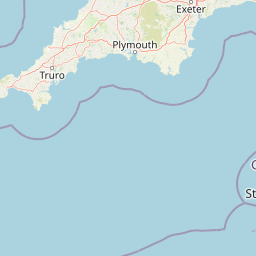
Why Dartmoor National Park stands out

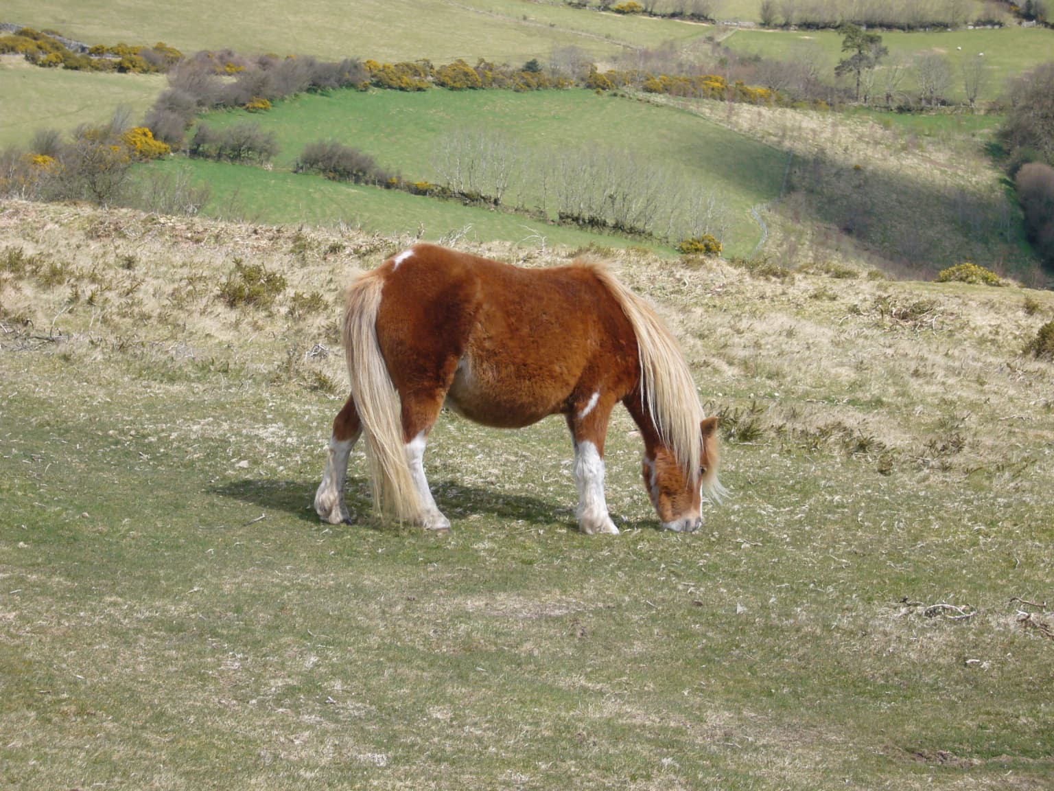
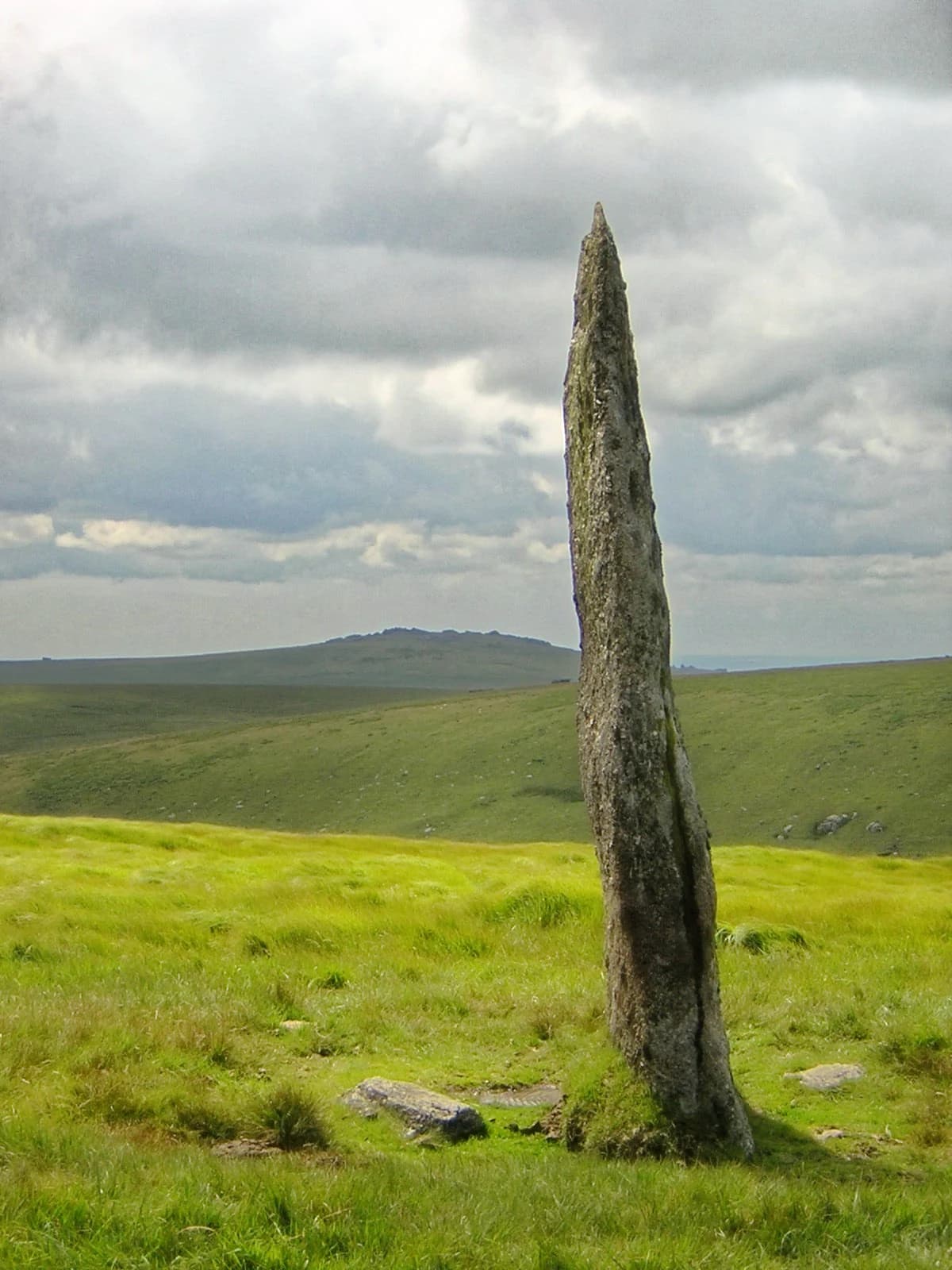
Dartmoor is best known for its iconic granite tors, rounded boulder-like rock formations capping hills, and the extensive prehistoric archaeological landscape that includes stone circles, standing stones, stone rows, Bronze Age settlements, and burial sites. The area holds the largest concentration of Bronze Age remains in the United Kingdom, with ancient field systems covering over 10,000 hectares. Wistman's Wood, an ancient sessile oak woodland, is another distinctive feature, while the moor is also famous for its wild ponies, literary connections to Sherlock Holmes, and the annual Ten Tors Challenge hiking event.

Overview image of Dartmoor National Park showing what the park is best known for
Visual overview of what makes Dartmoor National Park a notable national park destination.

Dartmoor National Park history and protected-area timeline

Dartmoor's human history spans millennia, with the majority of prehistoric remains dating from the late Neolithic and early Bronze Age periods. At that time, the climate was warmer than today and much of what is now moorland was forested. Early settlers cleared woodland using fire to create pasture and swidden farmland, gradually expanding the open upland landscape through repeated burning for grazing. These practices over centuries contributed to soil acidification and the development of peat bogs, ultimately transforming much of the high ground into the moorland character seen today. The climate deteriorated around 1000 BC, leading to abandonment of the high ground, which explains why many archaeological sites remained relatively undisturbed. The Bronze Age saw the largest population on the moor, evidenced by the extensive field systems divided by reaves covering over 10,000 hectares of the lower moors, along with numerous hut circles, stone circles, standing stones, stone rows, kistvaens, and cairns. The Upper Erme stone row at 3,300 metres is the longest in the world. After the climate worsened, the earliest surviving farms date to the 14th century as the Ancient Tenements, with some possibly earlier. The early medieval period saw settlement return to the moors, with the distinctive Dartmoor longhouse style still visible in some buildings today. Princetown grew around Dartmoor Prison, built for Napoleonic War prisoners and reputedly escape-proof due to both construction and location. The landscape bears the marks of tin mining and quarrying industries, while parts of the northern moor have been used for military training since the Napoleonic era.

Dartmoor National Park landscape and geographic character

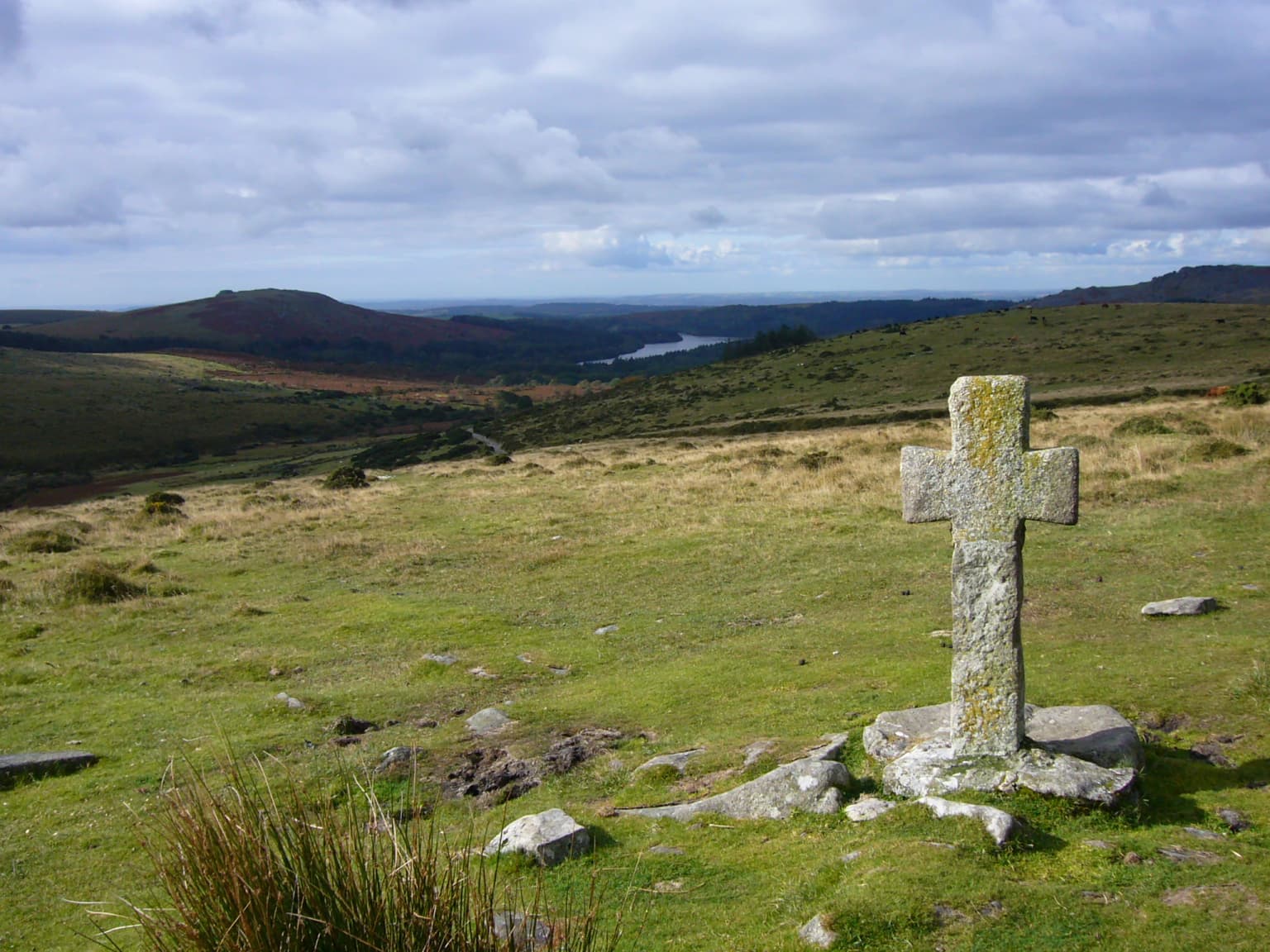
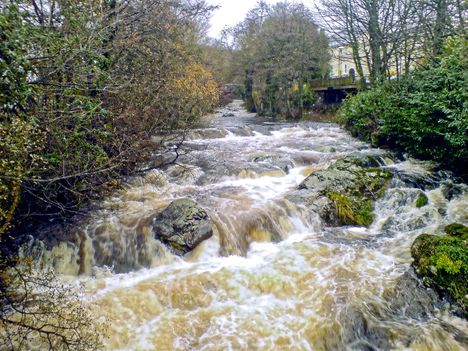
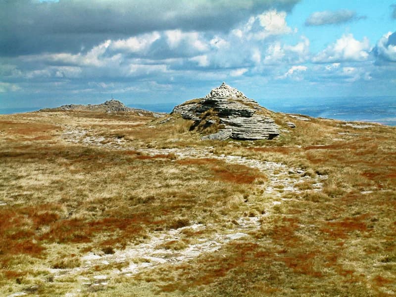
The physical landscape of Dartmoor is defined by its granite geology, which creates one of Britain's most distinctive upland environments. The granite outcrop covers approximately 625 km² at the surface, though much lies beneath peat deposits. The most characteristic features are the tors—hills crowned with exposed bedrock formations that in granite country typically appear as rounded boulder-like masses. More than 160 Dartmoor hills bear 'tor' in their name, though not all feature summit outcrops. The highest points are High Willhays and Yes Tor in the north, reaching 621m and 619m respectively, while Haytor at 457m is among the most famous and visited. The high ground forms the catchment for Devon's major rivers, including the Dart, Teign, Taw, Tavy, Avon, and Lyd. The rivers have traditionally powered moor industries including tin mining and quarrying, and several have been dammed for reservoirs. Extensive peat deposits covering much of the higher ground create conditions for bogs and mires, some with dangerous reputations—Fox Tor Mires reportedly inspired the fictional Grimpen Mire in The Hound of the Baskervilles. These 'quakers' or 'feather beds' can shift beneath feet due to sphagnum moss growth over water-filled hollows. The blanket bogs form where rainfall exceeds 2,000mm annually, featuring cotton-grass, sedges, bog asphodel, and sphagnum moss.

Stone clapper bridge spanning a river with green moorland and trees in the background
Clapper Bridge at Postbridge in Dartmoor National Park

Dartmoor National Park ecosystems, habitats, and plant life

Dartmoor's ecological significance is recognized through its designation as a Special Area of Conservation, with four primary habitats justifying this status: Northern Atlantic wet heaths with Erica tetralix, European dry heaths, blanket bogs, and old sessile oak woods with Ilex and Blechnum. The combination of high altitude, granite geology, strong winds, and acidic soils has limited intensive farming, preserving important ecosystems. While the iconic tors and moorland dominate popular images, these other habitats are equally vital for biodiversity. The ancient sessile oak woodlands, exemplified by Wistman's Wood, may be surviving fragments from the earliest Neolithic woodland clearances and support exceptional communities of epiphytic mosses, liverworts, and lichens—nearly 50 moss and liverwort species and 120 lichen types. The upland heaths feature heather, bell heather, and western gorse, while wetter areas support cross-leaved heath and purple moor grass. The bogs contain diverse sphagnum species, sundews, and bog asphodel. The southern damselfly, Atlantic salmon, and otter are among the qualifying species for the SAC designation.

A fast-flowing river with brown water flowing over rocks, surrounded by trees and vegetation on both banks, with buildings visible in the background
River Erme flowing through Dartmoor National Park with trees and buildings visible

Dartmoor National Park wildlife and species highlights

Dartmoor supports a rich diversity of wildlife, with several species of conservation importance. The bird population includes species that have declined elsewhere in Britain, such as skylark and common snipe, while the ring ouzel and cuckoo are rare nationally. Internationally important populations of meadow pipit and European stonechat breed on the moor. Woodland habitats support migrant species including pied flycatcher, wood warbler, and common redstart. Mammals include otters, hazel dormice, and nearly all of Britain's 16 bat species, with particular significance for the barbastelle, greater horseshoe bat, and lesser horseshoe bat. The upper river reaches provide spawning grounds for salmon and trout, while pools support palmate newts, frogs, and toads. The fairy shrimp inhabits temporary pools, with a very rare cave shrimp found in underground streams. The world's largest land slug, the ash black, occurs here, alongside common lizards and adders. The farmland in wet valleys supports important insect populations including the marsh fritillary butterfly, southern damselfly, and rare moths. The old oak woodlands harbor distinctive insects including the blue ground beetle and Heckford's pygmy moth, found nowhere else in the world.

Brown Dartmoor pony with white legs grazing on grassy moorland
Dartmoor pony grazing on moorland in Dartmoor National Park

Dartmoor National Park conservation status and protection priorities

Dartmoor's conservation significance is primarily expressed through its Special Area of Conservation status, which recognizes four European-listed habitat types of global importance and several protected species. The South West Peatland Project aims to restore approximately 300 hectares of Dartmoor's degraded peatland through collaboration with the National Park Authority, with the broader goal of making Dartmoor carbon negative by 2045. Peatland preservation sequesters carbon from the atmosphere while restoring ecological function. The park faces ongoing conservation challenges including pressures from china clay mining, though recent licence renouncements have reduced some concerns, and continued debate over military training impacts. The Dartmoor Preservation Association has long advocated for protection of the moorland landscape. Management balances public access rights—extensive under the Dartmoor Commons Act 1985—with ecological preservation and the ongoing traditional practice of commoning.

Dartmoor National Park cultural meaning and human context

Dartmoor's cultural landscape reflects millennia of human occupation and continues to support agricultural practices through commoning rights exercised by the Dartmoor Commoners' Council. The park is threaded with prehistoric routes marked by stone crosses, and sites such as Grimspound preserve Bronze Age settlement remains with notable examples of hut circles and L-shaped porches. The landscape has inspired numerous writers and artists, most famously Sir Arthur Conan Doyle for The Hound of the Baskervilles and The Adventure of Silver Blaze, while R.D. Blackmore, Eden Phillpotts, Beatrice Chase, and Agatha Christie also drew inspiration here. Princetown's Dartmoor Prison, built for Napoleonic prisoners of war, remains a prominent landmark. The moor features in contemporary popular culture through Harry Potter film locations and television productions including Sherlock. Traditional activities including letterboxing, a hobby originating on Dartmoor in the 19th century, and the annual Ten Tors Challenge continue to define the moor's cultural identity.

Stone cross standing on grassy moorland with distant hills and reservoir under cloudy sky
Ancient stone cross on Dartmoor moorland with Burrator Reservoir visible in the distance

Top sights and standout views in Dartmoor National Park

Dartmoor's standout features include the dramatic granite tors offering panoramic views, the world's longest prehistoric stone row at Upper Erme, and the ancient stunted oaks of Wistman's Wood. The archaeological richness is unparalleled, with Bronze Age settlements, stone circles, and burial sites scattered across the moor. Visitors can explore historic features such as the clapper bridge at Postbridge, the Warren House Inn reputedly having an eternal fire, and the Victorian-era Burrator Reservoir. The literary heritage connects the landscape to Sherlock Holmes, while outdoor activities range from walking and letterboxing to whitewater kayaking on the Dart and rock climbing on tors like Haytor. The wild Dartmoor pony remains an iconic symbol of the landscape.

River scene with boat, trees, and distant moorland hills in Dartmoor National Park
Victorian-era illustration of a river landscape with Dartmoor moorland in the background

Best time to visit Dartmoor National Park

Dartmoor can be visited year-round, though the experience varies significantly with seasons. Summer typically offers the most reliable weather for walking and outdoor activities, with long daylight hours allowing extended exploration of the tors and moorland. However, the high rainfall means weather can change rapidly even in summer. Spring and autumn often provide spectacular scenery as the heather blooms and the moorland colours shift, while winter can offer dramatic cloud inversions and snow-capped tors, though conditions underfoot can be challenging on the bogs. The climate on the high ground differs substantially from the surrounding lowlands—Princetown at 453 metres experiences mean minimum temperatures around 1°C in winter and only reaches 18°C on the warmest July days, with frost roughly five times more frequent than coastal areas. The wettest months are November and December, with over 2,000mm annual rainfall on the highest ground. For wildlife observation, spring brings breeding bird activity and amphibians spawning in pools, while summer reveals wildflower displays on the heaths.

Park location guide

Geography guide, regional context, and park location map for Dartmoor National Park

Dartmoor National Park park geography, regions, and map view in United Kingdom
Understand where Dartmoor National Park sits in United Kingdom through a broader geographic reading of the surrounding landscape, nearby location context, and its mapped position within the national park landscape.

How Dartmoor National Park fits into United Kingdom

The United Kingdom is a parliamentary constitutional monarchy located in northwestern Europe, consisting of four constituent countries: England, Scotland, Wales, and Northern Ireland. As a major global power with over 69 million residents, it maintains significant international influence in politics, economics, and culture.

Wider geography shaping Dartmoor National Park in United Kingdom

The United Kingdom is an island nation located in northwestern Europe, surrounded by the Atlantic Ocean, North Sea, English Channel, Celtic Sea, and Irish Sea. It shares a land border with the Republic of Ireland to the west. The territory includes the island of Great Britain, the northeastern portion of Ireland, and most of the smaller British Isles islands.

Map view of Dartmoor National Park

Use this park location map to pinpoint Dartmoor National Park in United Kingdom, understand its exact geographic position, and read its mapped placement within the surrounding landscape more clearly.

Pigeon | © OpenStreetMap contributors

Location context for Dartmoor National Park

Devon

Visualize Dartmoor's iconic granite tors, vast moorland, and ancient protected landscapes through detailed imagery.

Dartmoor National Park Photo Gallery: Visualizing Upland Landscapes and Ancient Terrain
Examine compelling imagery of Dartmoor to understand its unique granite upland landscape, characteristic tors, and expansive moorland habitats. These visual references provide deeper insight into the national park's prehistoric sites, ecological features, and overall protected area character.

Wide landscape of Dartmoor moorland with a stone path ascending to a granite tor under a partly cloudy sky.

Stone clapper bridge spanning a river with green moorland and trees in the background

A fast-flowing river with brown water flowing over rocks, surrounded by trees and vegetation on both banks, with buildings visible in the background

Brown Dartmoor pony with white legs grazing on grassy moorland

Tall weathered standing stone in a grassy moorland field with rolling hills under a cloudy sky

Stone cross standing on grassy moorland with distant hills and reservoir under cloudy sky

River scene with boat, trees, and distant moorland hills in Dartmoor National Park

Rocky tor formations on moorland under a partly cloudy sky with scattered vegetation

Moss-covered granite rocks and trees in a forested area

Wide panoramic view of snow-covered granite tors on Dartmoor moorland under a partly cloudy sky

Landscape view of Dartmoor National Park with river valley, granite tors, grassy moorland, and scattered boulders under a partly cloudy sky

Green and gray tents set up on a rocky grassy moorland with rolling hills and a cloudy sky

Night sky with purple and green aurora borealis, faint stars visible, dark landscape silhouette

Stone grave marker on grassy mound surrounded by stone walls, trees, and gravel path with a gate in the background

Wide expanse of brown moorland with scattered patches of standing water under a partly cloudy sky

Park atlas

Trace the regional spread of national parks and protected landscapes across Devon, comparing upland granite moors with coastal regions.

Compare Protected Areas Near Dartmoor: Discover More Parks Across Devon and Southwest England
Continue your protected area discovery beyond Dartmoor National Park by exploring other significant national parks and diverse protected landscapes throughout Devon and the broader South West England region. This geographic overview provides essential context for comparing varied terrain, from ancient granite uplands to coastal conservation zones, deepening your understanding of the region's unique natural heritage.
National parkWales

Brecon Beacons National Park: Explore Wales' Iconic Protected Mountain Landscape

Discover mapped terrain, park boundaries, and regional geography.

Brecon Beacons National Park, officially Bannau Brycheiniog, stands as a premier protected area within Wales, covering over 1,344 square kilometers of striking mountainous terrain. This national park is defined by its dramatic Old Red Sandstone ranges, including Pen y Fan, South Wales' highest peak, and features diverse landscapes from heather moorland to extensive river valleys. Its mapped boundaries encompass unique geological features, significant historical sites, and provide context for regional geographic exploration, making it a key destination for understanding protected lands in the UK.

Area
1,344 km²
Established
1957
IUCN
V
Visitors
4.4M annual
National parkPembrokeshire

Pembrokeshire Coast National Park: Mapped Coastal Boundaries and Protected Landscape Atlas

Explore unique seaside terrain and regional geography.

Delve into the Pembrokeshire Coast National Park, a premier protected landscape recognized for its extraordinary coastal formations and diverse natural terrain. This atlas entry details the park's distinct mapped boundaries, from its iconic limestone cliffs and sea stacks to its sheltered estuaries and inland Preseli Hills. Understand how this significant national park contributes to the protected area map of Pembrokeshire and offers unparalleled opportunities for geographic discovery along the Welsh coast.

Area
629 km²
Established
1952
IUCN
V
Relief
Mixed relief
Watercolor painting showing a landscape with green and purple vegetation, a body of water, and distant hills.
National parkEngland

New Forest National Park: Historic Protected Landscape and Regional Geography in England

Mapped heathland, ancient woodlands, and pastoral traditions.

Explore New Forest National Park, a nationally significant protected area in England renowned for its unique blend of ancient royal forest history, traditional pastoral practices, and biologically rich lowland habitats. This page provides an atlas-focused view of its mapped boundaries, distinctive terrain, and geographic context within England, highlighting its value as a living landscape shaped by centuries of common grazing rights and supporting rare wildlife.

Area
566 km²
Established
2005
IUCN
V
Watercolor illustration of a coastal landscape featuring green hills, white cliffs, and a body of water
National parkSouth East England

South Downs National Park: A Distinctive Chalk Landscape in South East England's Atlas

Iconic chalk downland, coastal cliffs, and mapped terrain.

South Downs National Park is a premier protected landscape in South East England, celebrated for its unique chalk downland terrain and dramatic coastal formations. This page provides detailed geographic context for the park, highlighting its rolling hills, dry valleys, and ancient woodlands. Discover the park's mapped boundaries and its significance within England's protected areas, offering a structured atlas view for landscape exploration.

Area
1,627 km²
Established
2010
IUCN
V
Visitors
18M annual
National parkWales

Snowdonia National Park: Protected Landscape and Map Exploration in North Wales

Mountain terrain, glacial lakes, and regional geography.

Snowdonia National Park offers a profound exploration of mountainous protected landscapes in North Wales. This page details the park's mapped boundaries, revealing a terrain shaped by glaciation, featuring dramatic peaks like Snowdon, steep valleys, and pristine glacial lakes. Understand its geographic identity within the United Kingdom and how its protected status contributes to the regional landscape context, providing a unique focus for atlas-based discovery.

Area
2,142 km²
Established
1951
Relief
Mountain
Climate
Temperate
Watercolor illustration of a landscape with mountains, a lake, and trees
National parkCounty Wicklow

Wicklow Mountains National Park: Protected Landscape and Geographic Atlas Mapping

Explore County Wicklow's mapped natural terrain and park boundaries.

Understand the geographic scope and protected landscape identity of Wicklow Mountains National Park. This page offers detailed information on its mapped boundaries and its context within County Wicklow, providing a foundation for atlas-based discovery of Ireland's natural areas. Explore how this national park contributes to the region's mapped geography and conservation landscapes.

Area
205 km²
Established
1991
IUCN
II
Relief
Mountain
National parkUnited Kingdom

Peak District National Park: Explore Protected Landscape and Regional Geography

Mapped boundaries and natural terrain context for this UK national park.

Investigate the Peak District National Park, a cornerstone of the United Kingdom's protected natural areas. This MoriAtlas entry provides essential details on its geographic scope, mapped boundaries, and landscape characteristics. Engage with structured data to understand how this national park fits into the atlas of the United Kingdom, supporting detailed geographic and protected-area discovery for researchers and explorers.

Area
1,440 km²
Established
1951
IUCN
V
National park

Killarney National Park: A Protected Landscape for Geographic Exploration

Explore mapped boundaries and regional atlas context.

Killarney National Park is a significant protected area in Ireland, recognized as a national park for its unique natural attributes. MoriAtlas provides detailed mapping and geographic data to explore this protected landscape. Users can engage with the park's specific terrain, understand its mapped perimeters, and gain insights into its regional geographic significance, enhancing their overall atlas exploration experience.

Area
102.89 km²
Established
1932
IUCN
II
Relief
Mountain

Common questions about visiting, size, designation, and location context for Dartmoor National Park

Dartmoor National Park FAQs for park facts, access, geography, and protected area context
Find quick answers about Dartmoor National Park, including protected-area facts, park geography, trail and visitor context, and how the park fits into its surrounding country and regional landscape.
MoriAtlas Explorer

Continue Your Protected Areas Search Across the Global Atlas

Deepen your exploration by continuing the structured search for national parks and protected areas worldwide. Utilize the comprehensive filtering capabilities to compare different conservation landscapes and refine your understanding of global park geography. Discover more about the distribution and characteristics of protected natural areas.

Global natural geography