Mori Atlas logo
National parkConnemara National Park

Discover the mapped terrain and protected landscape context of this Western Ireland national park.

Connemara National Park: A Protected National Park in County Galway, Ireland

Connemara National Park stands as a significant protected national park within the diverse geography of County Galway, Ireland. This page offers an atlas-focused exploration of its protected boundaries and landscape context, situating it within the western region of the island. Understand the geographic significance of Connemara National Park as part of the larger mapped terrain of Connacht and Ireland.

Atlantic coastBlanket bogMountain landscapeArchaeological sitesBirdwatchingNative ponies
Stylized illustration of mountainous landscape with colorful terrain, valley, and winding path under a partly cloudy sky

Connemara National Park

National park

Park overview

Structured park overview, official facts, and landscape profile for Connemara National Park

Connemara National Park park facts, protected area profile, and essential visitor context
Review the core facts for Connemara National Park, including designation, size, terrain, visitor scale, habitats, and operating context in one park-focused overview.

About Connemara National Park

Connemara National Park occupies a striking position on Ireland's Wild Atlantic Way, protecting a landscape that exemplifies the rugged beauty of western Ireland. The park's terrain spans from low-lying blanket bogs at 25 metres above sea level to the peaks of the Twelve Bens mountain range, with Benbaun rising to 729 metres. This elevation range, combined with the park's coastal Atlantic exposure, creates diverse microclimates and habitats within a relatively compact area. The mountains rise dramatically from the surrounding bogland, their steep-sided peaks and cols forming a distinctive silhouette against the often-changing sky. The park's blanket bogs represent a specialized ecosystem developed over thousands of years in Ireland's mild, wet climate, where decomposing sphagnum moss and other vegetation have built up layers of peat that now support a unique community of specialized plants. The historical dimension of the park adds layers of cultural significance, with evidence of human habitation spanning millennia including megalithic court tombs that predate the pyramids and a 19th-century graveyard reflecting more recent community use of the landscape.

Quick facts and research context for Connemara National Park

Connemara National Park lies in County Galway on Ireland's west coast, near the village of Letterfrack. The park covers 2,000 hectares and features terrain ranging from sea level at 25 metres to 729 metres at Benbaun peak. Established in 1980, it is managed by the National Parks and Wildlife Service and encompasses the Twelve Bens mountain range. The landscape includes western blanket bog, heathland, grasslands, and woodlands, with remnants of human habitation including a 19th-century graveyard and 4,000-year-old megalithic court tombs. The land was historically part of the Kylemore Abbey estate.

Park context

Deeper park guide and search-rich context for Connemara National Park

Connemara National Park history, landscape, wildlife, and travel context
Explore Connemara National Park through its history, landscape character, ecosystems, wildlife, conservation priorities, cultural context, and seasonal travel timing in a structured park guide built for atlas discovery and search intent.

Why Connemara National Park stands out

Connemara National Park is best known for its iconic Atlantic bog landscapes and the dramatic Twelve Bens mountain range. The park protects one of Europe's finest remaining blanket bog systems, a rare and ecologically significant habitat shaped by Ireland's maritime climate. The purple moorgrass-dominated bogs create a distinctive purple-hued landscape across the hillsides. The park is also notable for its herd of Connemara ponies, the largest mammals now roaming the park after the reintroduction of red deer. The area's archaeological heritage, including megalithic court tombs dating back 4,000 years, adds historical depth to the natural landscape.

Three hikers standing on a rocky hilltop with green vegetation, overlooking a valley surrounded by mountain ranges under a partly cloudy sky
Hikers on a rocky outcrop overlooking the Twelve Bens mountain range in Connemara National Park

Connemara National Park history and protected-area timeline

Connemara National Park was founded and officially opened to the public in 1980, becoming one of the later additions to Ireland's national park system. The land that now comprises the park was historically part of the extensive Kylemore Abbey estate, a connection that shaped the human history of the area. Within the park boundaries, visitors can still encounter remnants of this long human presence, including a 19th-century graveyard that reflects the communities who lived and worked on the land in relatively recent centuries. Of particular significance are the megalithic court tombs scattered throughout the park, ancient burial structures dating back approximately 4,000 years to the Bronze Age, making them among the oldest human-made structures in Ireland. These prehistoric monuments indicate that this landscape held significance for ancient peoples, possibly as a ceremonial or burial landscape. The establishment of the park in 1980 reflected growing recognition in Ireland of the need to protect remaining natural landscapes and cultural heritage, with the park later coming under the management of the National Parks and Wildlife Service.

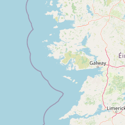
Connemara National Park landscape and geographic character

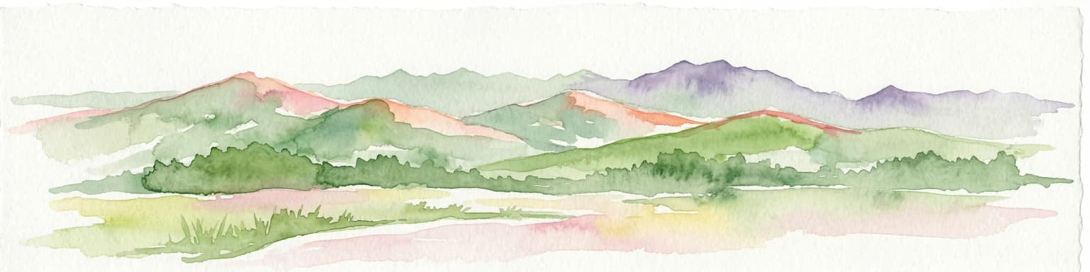
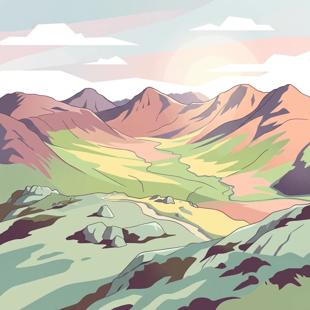
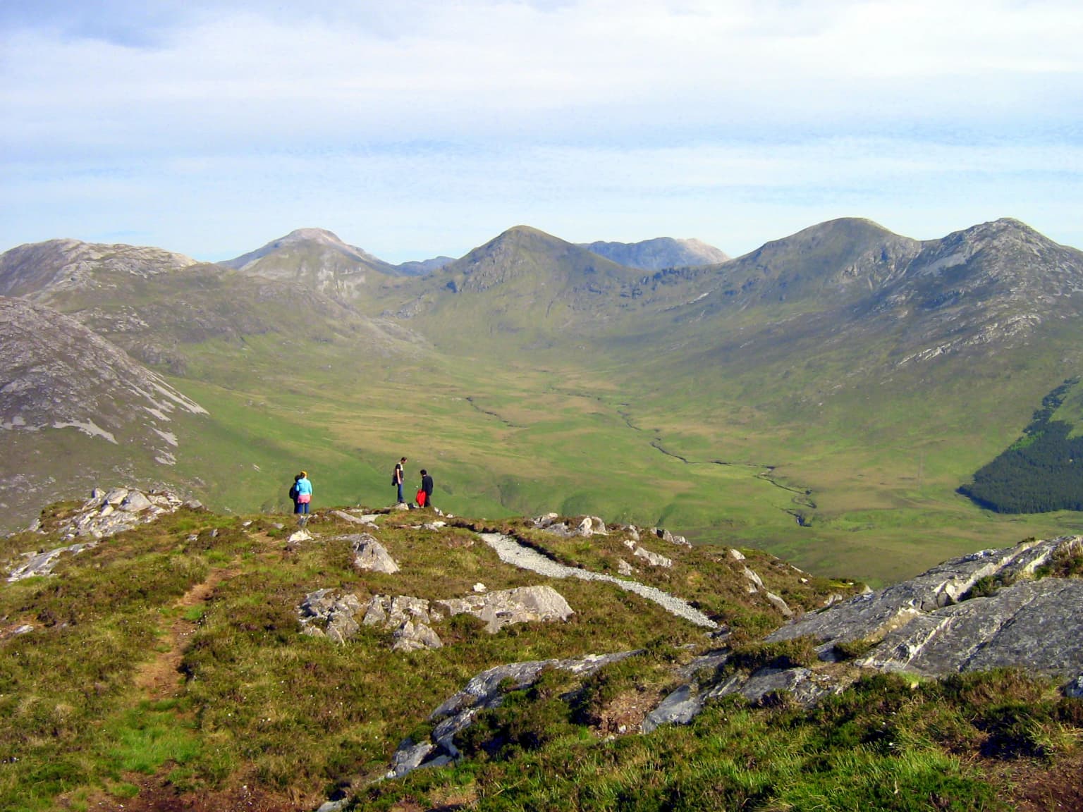
The landscape of Connemara National Park presents a dramatic interplay between mountain and bog, creating one of Ireland's most visually distinctive protected areas. The Twelve Bens, also known as the Bens or the Twelve Pins, form a horseshoe-shaped mountain range that dominates the park's eastern side, with sharp quartzite peaks rising abruptly from the surrounding terrain. The highest peak, Benbaun, reaches 729 metres and provides challenging hiking routes for experienced climbers, while lower peaks offer more accessible routes with spectacular views. Between and below the mountains lies an extensive system of blanket bogs, flat or gently undulating expanses of peat that can appear almost lunar in their barren beauty. The bogs are punctuated by small lakes, streams, and areas of heathland where heather and other shrubs provide color variation. Grasslands occur in areas where drainage is better, supporting grazing that helps maintain the open character of the landscape. Small woodlands of native and introduced species dot the lower slopes, providing shelter and creating contrasting patches of green amid the purples and browns of the boglands.

Connemara National Park ecosystems, habitats, and plant life

The ecological character of Connemara National Park is defined by its extensive blanket bog and heathland systems, which represent some of the finest examples of these habitats in Europe. The blanket bogs develop in Ireland's wet Atlantic climate where heavy rainfall and mild temperatures prevent complete decomposition of plant material, leading to the accumulation of peat over thousands of years. The park's boglands exist in two main forms: wet low-lying bogs and the more extensive mountain blanket bog existing in the drier atmosphere at higher elevations. Purple moorgrass dominates large areas, creating the park's characteristic purplish-brown color palette, particularly striking in late summer when the grasses flower. The bogs support a specialized flora adapted to nutrient-poor conditions, including several carnivorous species that derive nutrients from insects. Sundew and butterworts trap prey in their sticky leaves, an adaptation that compensates for the缺乏 of nutrients in the acidic peat soil. The park also supports populations of bog cotton, bog asphodel, lousewort, milkwort, orchids, and the fragrant bog myrtle, along with a rich assemblage of lichens and mosses that carpet damp surfaces.

Connemara National Park wildlife and species highlights

Connemara National Park supports a diverse bird community that exploits the various habitats within the park, from the open bogs and heaths to the mountain slopes and woodlands. Songbirds such as meadow pipits, skylarks, European stonechats, common chaffinches, European robins, and Eurasian wrens are commonly encountered throughout the park, their calls forming the backdrop to any visit. Birds of prey patrol the skies and rocky outcrops, with common kestrels and Eurasian sparrowhawks being regular sightings, while merlins and peregrine falcons appear less frequently, particularly during migration periods. The bogs and wetlands attract important wading bird species including woodcock and common snipe, while the winter months bring an influx of migrants from colder regions. During autumn and winter, flocks of redwings, fieldfares, and common starlings arrive to spend the colder months in the relatively mild Irish climate. The park's mammal community, while more elusive than its birdlife, includes several species adapted to the Irish countryside. Red deer, once native to the area but extirpated approximately 150 years ago, have been successfully reintroduced to the park and now roam the mountains and valleys. The Connemara pony, a distinctive breed native to this region, represents the largest mammals in the park. Other mammals present include badgers, foxes, pine martens, otters, hares, stoats, pygmy shrews, and various bat species, with field mice being common in woodland areas.

Connemara National Park conservation status and protection priorities

Connemara National Park plays a significant role in protecting some of Ireland's most threatened and characteristic habitats. The blanket bog within the park represents one of the last substantial intact systems of this habitat type in Europe, as extensive draining and peat extraction have destroyed most of Ireland's original bogs. Blanket bogs are now recognized as internationally important ecosystems, serving as carbon stores and supporting specialized species found nowhere else. The park's designation as an IUCN Category II protected area reflects its dual value in protecting both natural landscapes and cultural heritage, including the archaeological sites that preserve traces of human presence over millennia. The reintroduction of red deer represents an important conservation success, restoring a native species that had been lost from the region and helping to maintain natural ecological processes. The park's management by the National Parks and Wildlife Service ensures ongoing protection and restoration work, including habitat management that maintains the open character of the boglands and ensures conditions for the specialized species they support.

Connemara National Park cultural meaning and human context

The landscape of Connemara National Park carries the imprint of human activity spanning thousands of years, with the megalithic court tombs scattered throughout the park bearing witness to its significance in prehistoric times. These ancient burial chambers, dating to approximately 2000 BCE, represent the ceremonial landscape of early farming communities who chose this dramatic mountain and bog environment for their dead. The 19th-century graveyard within the park reflects the more recent presence of communities tied to the Kylemore Abbey estate, which owned much of the land before the park's establishment. Connemara itself has a distinctive cultural identity, with the Irish language remaining strong in the region and the Connemara pony breed representing a unique equine heritage developed in this harsh landscape over centuries. The park's landscape has been shaped not only by natural processes but by generations of human use, including grazing that helped maintain the open bog and heathland habitats that now define much of its character.

Top sights and standout views in Connemara National Park

The Twelve Bens mountain range provides the park's most dramatic scenery, with jagged quartzite peaks creating a world-class backdrop for hikers and photographers. The views from Diamond Hill, one of the more accessible peaks, encompass the full sweep of the park's landscapes from bog to mountain to the distant Atlantic coastline. The blanket bogs, particularly striking in late summer when the purple moorgrass flowers, represent a rare habitat protected within the park's boundaries. The archaeological sites, including the 4,000-year-old court tombs, offer a tangible connection to the prehistoric past and the human history of this landscape. The Connemara ponies wandering the park provide a living connection to the region's cultural heritage, while the recent return of red deer restores another element of the area's natural heritage.

Best time to visit Connemara National Park

The park can be visited year-round, though each season offers a different experience of the landscape. Summer brings the purple moorgrass into flower, creating the park's most famous color display across the bogs, though this is also the busiest period for visitors. The long daylight hours of Irish summer allow for extended hiking, though weather can change rapidly as Atlantic weather systems move across the region. Autumn brings migrating birds and often clearer skies, with the turning of the heather to rust color adding warmth to the hillsides. Winter exposes the bare structure of the landscape, with snow occasionally dusting the peaks while the bogs take on a quieter, more atmospheric quality. Spring awakens the bog with new growth and brings breeding bird activity, though conditions can be wet and muddy underfoot. The park's exposed Atlantic location means that weather is unpredictable year-round, and visitors should be prepared for rapid changes regardless of the season.

Park location guide

Geography guide, regional context, and park location map for Connemara National Park

Connemara National Park park geography, regions, and map view in Ireland
Understand where Connemara National Park sits in Ireland through a broader geographic reading of the surrounding landscape, nearby location context, and its mapped position within the national park landscape.

How Connemara National Park fits into Ireland

Ireland is an island in the North Atlantic, geologically part of the British Isles. Politically, the island is split between the Republic of Ireland (a sovereign state and EU member) and Northern Ireland (part of the UK). The island has a population of approximately 7.2 million people and is known for its lush landscape, Celtic heritage, and literary culture.

Wider geography shaping Connemara National Park in Ireland

Ireland is an island in the North Atlantic Ocean, separated from Great Britain to the east by the North Channel, Irish Sea, and St George's Channel. The island forms part of the British Isles archipelago. The terrain consists of low-lying mountains surrounding a central plain, with the highest point being Carrauntoohil at 1,041 metres. The coastline stretches approximately 7,527 kilometres with numerous inlets and bays.

Map view of Connemara National Park

Use this park location map to pinpoint Connemara National Park in Ireland, understand its exact geographic position, and read its mapped placement within the surrounding landscape more clearly.

Pigeon | © OpenStreetMap contributors

Location context for Connemara National Park

County Galway

Explore the Diverse Terrain, Habitat Zones, and Dramatic Protected-Area Views of Connemara National Park

Connemara National Park Photos: Visualizing Ireland's Wild Atlantic Bog Landscapes and Mountain Scenery
Browse a curated collection of images showcasing the distinctive natural landscapes of Connemara National Park, from its iconic Twelve Bens mountain range to expansive blanket bogs and Atlantic coastal features. These visual references help clarify the park's unique protected-area character, illustrating its ecological value and the rugged beauty defining this western Irish environment.

Three hikers standing on a rocky hilltop with green vegetation, overlooking a valley surrounded by mountain ranges under a partly cloudy sky

Park atlas

Expand your view of Ireland's protected landscapes; trace mountain ranges, blanket bogs, and coastal geography surrounding Connemara.

Other National Parks and Protected Areas Near Connemara National Park in County Galway
After exploring Connemara National Park, you can browse nearby national parks and protected areas, mapping their unique Atlantic bog systems, mountain terrain, and coastal features. This extended view offers valuable geographic context, facilitating comparison of diverse conservation landscapes and regional park geography within County Galway and wider western Ireland.
Watercolor illustration of a coastal landscape with green fields and distant mountains.
National parkCounty Kerry

Páirc Náisiúnta na Mara National Park: Protected Landscape Atlas for County Kerry

Explore mapped protected areas and regional geography.

This entry details Páirc Náisiúnta na Mara National Park, offering insights into its protected landscape character and geographic setting within County Kerry. As a significant protected area, it contributes to the atlas of Southwest Ireland, providing context for its natural terrain and mapped boundaries. Discover the park's unique identity and its position within the broader regional geography for structured exploration.

Area
280 km²
Established
2024
Relief
Mixed relief
Climate
Temperate
National parkCounty Mayo

Wild Nephin National Park: Ireland's Protected Landscape in County Mayo

National Park with regional geographic context.

Explore Wild Nephin National Park, a significant protected area situated in County Mayo, Ireland. This entry focuses on the park's mapped boundaries and its unique natural terrain, offering a clear geographic perspective. Understand how this national park contributes to the diverse landscapes of western Ireland and serves as a key point for atlas-based discovery of protected lands.

Area
150 km²
Established
1998
IUCN
II
Climate
Temperate
National parkCounty Clare

Burren National Park: National Park in County Clare, Ireland

Explore protected landscape and mapped geography.

Burren National Park is a designated national park located in County Clare, Ireland. This MoriAtlas page provides detailed insights into its protected landscape character, its unique karst terrain, and its specific geographic boundaries. Understand how this protected area fits within the broader context of County Clare's Atlantic coast geography, enabling structured atlas-style exploration of its natural significance.

Area
15 km²
Established
1991
IUCN
II
Relief
Mountain
National park

Killarney National Park: A Protected Landscape for Geographic Exploration

Explore mapped boundaries and regional atlas context.

Killarney National Park is a significant protected area in Ireland, recognized as a national park for its unique natural attributes. MoriAtlas provides detailed mapping and geographic data to explore this protected landscape. Users can engage with the park's specific terrain, understand its mapped perimeters, and gain insights into its regional geographic significance, enhancing their overall atlas exploration experience.

Area
102.89 km²
Established
1932
IUCN
II
Relief
Mountain
National parkCounty Donegal

Glenveagh National Park: A Protected Landscape in the Heart of County Donegal

Mapped geography and natural terrain for Ireland's national park.

Delve into the geographic specifics of Glenveagh National Park, a protected area situated in County Donegal. This section provides detailed information on its mapped boundaries and regional landscape context. Understand how this national park fits within the natural geography of Ulster, offering a structured atlas view for detailed exploration of its unique terrain and protected status.

Area
169.58 km²
Established
1986
IUCN
II
Relief
Mixed relief
Watercolor illustration of a landscape with mountains, a lake, and trees
National parkCounty Wicklow

Wicklow Mountains National Park: Protected Landscape and Geographic Atlas Mapping

Explore County Wicklow's mapped natural terrain and park boundaries.

Understand the geographic scope and protected landscape identity of Wicklow Mountains National Park. This page offers detailed information on its mapped boundaries and its context within County Wicklow, providing a foundation for atlas-based discovery of Ireland's natural areas. Explore how this national park contributes to the region's mapped geography and conservation landscapes.

Area
205 km²
Established
1991
IUCN
II
Relief
Mountain
National parkPembrokeshire

Pembrokeshire Coast National Park: Mapped Coastal Boundaries and Protected Landscape Atlas

Explore unique seaside terrain and regional geography.

Delve into the Pembrokeshire Coast National Park, a premier protected landscape recognized for its extraordinary coastal formations and diverse natural terrain. This atlas entry details the park's distinct mapped boundaries, from its iconic limestone cliffs and sea stacks to its sheltered estuaries and inland Preseli Hills. Understand how this significant national park contributes to the protected area map of Pembrokeshire and offers unparalleled opportunities for geographic discovery along the Welsh coast.

Area
629 km²
Established
1952
IUCN
V
Relief
Mixed relief
National parkWales

Snowdonia National Park: Protected Landscape and Map Exploration in North Wales

Mountain terrain, glacial lakes, and regional geography.

Snowdonia National Park offers a profound exploration of mountainous protected landscapes in North Wales. This page details the park's mapped boundaries, revealing a terrain shaped by glaciation, featuring dramatic peaks like Snowdon, steep valleys, and pristine glacial lakes. Understand its geographic identity within the United Kingdom and how its protected status contributes to the regional landscape context, providing a unique focus for atlas-based discovery.

Area
2,142 km²
Established
1951
Relief
Mountain
Climate
Temperate

Common questions about visiting, size, designation, and location context for Connemara National Park

Connemara National Park FAQs for park facts, access, geography, and protected area context
Find quick answers about Connemara National Park, including protected-area facts, park geography, trail and visitor context, and how the park fits into its surrounding country and regional landscape.
MoriAtlas Explorer

Continue Your Protected Areas Search Across the Global Atlas

Deepen your exploration by continuing the structured search for national parks and protected areas worldwide. Utilize the comprehensive filtering capabilities to compare different conservation landscapes and refine your understanding of global park geography. Discover more about the distribution and characteristics of protected natural areas.

Global natural geography