Mori Atlas logo
Marine protected areaCromer Shoal Chalk Beds

A dynamic marine landscape of hard chalk ridges and sediment plains in the southern North Sea.

Cromer Shoal Chalk Beds: Mapping the Largest Subtidal Chalk Reef Ecosystem in North Norfolk

(Cromer Shoal Chalk Beds Marine Conservation Zone)

The Cromer Shoal Chalk Beds represent a significant marine protected area extending along the North Norfolk coastline from Weybourne to Happisburgh. This extensive chalk reef complex forms a unique mosaic of hard bedrock exposures and shifting sediment, supporting over 700 marine species within the southern North Sea. The underwater topography provides a rare look at the geologic connection between the regional terrestrial chalk cliffs and the submerged seabed environments of eastern England.

marine conservation zonechalk reefmarine wildlifeunderwater geologyNorth Norfolk coastsouthern North Sea

Cromer Shoal Chalk Beds

Marine protected area

Park overview

Structured park overview, official facts, and landscape profile for Cromer Shoal Chalk Beds

Cromer Shoal Chalk Beds park facts, protected area profile, and essential visitor context

Review the core facts for Cromer Shoal Chalk Beds, including designation, size, terrain, visitor scale, habitats, and operating context in one park-focused overview.

About Cromer Shoal Chalk Beds

The Cromer Shoal Chalk Beds represent one of the most significant marine geological features in northwestern Europe. They are a chalk reef lying off the North Norfolk coast, in the southern North Sea, where the underlying chalk geology of the region rises close enough to the seabed surface to form hard, reef-like substrates rather than the soft sediments that dominate much of the surrounding sea floor. This hard chalk environment creates conditions for marine life that are uncommon in the generally sediment-covered waters of the southern North Sea.

Designated as a Marine Conservation Zone in January 2016, the protected area covers around 320 square kilometres of seabed, running from west of Weybourne to Happisburgh and extending from about 200 metres offshore out to roughly 10 kilometres into the North Sea. Despite the name "Cromer Shoal Chalk Beds", the most dramatic features of the reef are found further along the coast towards Sheringham, where the chalk exposures are most conspicuous.

The wider chalk geology of the area is also visible on land. Along parts of the Norfolk coast, veneers of sand and sediment shift with tides and storms, periodically revealing the chalk beneath. At West Runton, this chalk is famously exposed at the shore, forming rock pools that offer a glimpse of the same geological substrate that supports the marine life further out to sea. This connection between the on-shore chalk of Norfolk and the offshore reef underscores how the Cromer Shoal Chalk Beds are part of a much larger chalk landscape extending beneath the southern North Sea.

Ecologically, the reef is exceptionally rich. More than 700 marine species have been recorded in association with the chalk beds, including fish, invertebrates, and sponges adapted to life on hard chalk. Among the most notable inhabitants is Hymedesmia sp. 'Parpal Dumplin', a purple sponge unique to the area, first identified there in 2011. The combination of unusual substrate, high species diversity, and a long stretch of protected seabed makes the Cromer Shoal Chalk Beds an important reference site for understanding chalk-dominated marine habitats in Europe.

Quick facts and research context for Cromer Shoal Chalk Beds

The Cromer Shoal Chalk Beds are a chalk reef located off the North Norfolk coast of England and are believed to be the largest chalk reef in Europe. In January 2016, an area of about 321 square kilometres was designated as a Marine Conservation Zone, beginning around 200 metres from the shoreline and extending out into the North Sea.

The protected zone stretches roughly 30 kilometres along the coast and reaches about 10 kilometres offshore, from west of Weybourne in the west to Happisburgh in the east. The underlying chalk geology is connected to a much larger chalk bedrock surface beneath the southern North Sea, parts of which are exposed as the seabed shifts over time. The beds are ecologically significant for their species richness, with over 700 marine species recorded in association with the reef.

Protection and recognition

Documented marine protection scope, designation year, and official recognition records

Cromer Shoal Chalk Beds Protection Status and Designation History

Cromer Shoal Chalk Beds maintains a documented marine protection status established in the year 2016. Official records outline the conservation scope and designation history for this protected area.

Protection details

Protection scope
Marine
Designated year
2016
Transboundary protection
No
Park context

Deeper park guide and search-rich context for Cromer Shoal Chalk Beds

Cromer Shoal Chalk Beds history, landscape, wildlife, and travel context

Explore Cromer Shoal Chalk Beds through its history, landscape character, ecosystems, wildlife, conservation priorities, cultural context, and seasonal travel timing in a structured park guide built for atlas discovery and search intent.

Why Cromer Shoal Chalk Beds stands out

The Cromer Shoal Chalk Beds are best known for being the largest chalk reef in Europe and for harbouring more than 700 marine species on a relatively unusual hard chalk substrate in the North Sea. The site is also associated with notable discoveries of previously unknown sponge species, including Hymedesmia sp. 'Parpal Dumplin', first identified there in 2011, which remains unique to the area. The reef's scale and ecological richness, set against the backdrop of an otherwise sediment-dominated stretch of the southern North Sea, give it a distinctive place in British marine conservation. Its proximity to the Norfolk coastline, where chalk is also visible on shore as rock pools at West Runton, adds further interest for visitors and researchers exploring the broader chalk geology of the region.

Cromer Shoal Chalk Beds history and protected-area timeline

The Cromer Shoal Chalk Beds came to wider public and scientific attention through investigations into the marine habitats off North Norfolk, where divers and researchers documented unusually rich communities on a hard chalk substrate in an area otherwise known for its shifting sands. Recognition of the ecological value of the chalk reef led to its formal designation as a Marine Conservation Zone in January 2016, protecting an area of roughly 320 square kilometres off the Norfolk coast.

The designation process involved consultation with local communities, particularly coastal communities concerned about the potential implications of conservation status for sea defence and coastal management. As a result, the protected boundary was placed roughly 200 metres offshore rather than extending to the high tide mark. This compromise reflected the social and economic importance of the North Norfolk shoreline, while still securing the main chalk reef features further out to sea.

The chalk beds themselves are part of a far older geological story. The chalk substrate under the southern North Sea was laid down during the Cretaceous period, and its exposure today is the product of long-term sea-level change, erosion, and the constant movement of sediments across the seabed. The seabed continues to shift, alternately burying and revealing the chalk, which means that the visible extent of the reef is itself part of an ongoing natural process rather than a fixed feature.

Cromer Shoal Chalk Beds landscape and geographic character

The landscape context of the Cromer Shoal Chalk Beds is defined by a hidden geological foundation of chalk that underlies much of the southern North Sea. Rather than a single fixed reef structure, the chalk surfaces as patches and ridges where the overlying sands and sediments thin or move, producing a dynamic mosaic of hard chalk exposures amid soft sediment plains. This shifting character is central to the site's identity.

Onshore, the same chalk geology shapes the North Norfolk coast. The exposure of chalk at West Runton, where it forms prominent rock pools on the foreshore, provides a striking terrestrial counterpart to the offshore reef. Headlands and clifftops along the coast, along with the contrast between eroding chalk and the wide sandy beaches of the area, frame the views out to sea towards the chalk beds.

Below the surface, the seabed topography includes areas where the chalk forms pronounced features visible to divers and detectable through surveys. Although the entire zone runs from west of Weybourne to Happisburgh, the most dramatic chalk features are clustered closer to the Sheringham stretch of coast, where the seabed character of the region is most clearly expressed.

Cromer Shoal Chalk Beds ecosystems, habitats, and plant life

The Cromer Shoal Chalk Beds are ecologically distinctive because they provide a hard chalk substrate in a part of the North Sea that is otherwise dominated by sand, gravel, and finer sediments. Hard substrates are relatively scarce in this region, and wherever chalk is exposed it supports a different kind of marine community from the surrounding soft-bottom habitats, often with greater structural complexity and biodiversity.

The reefs and chalk exposures create complex three-dimensional surfaces, ranging from low-relief sheets of chalk to more rugose reef-like features. These surfaces host a wide range of encrusting and associated species, including sponges, bryozoans, and other invertebrates that depend on stable attachment points, as well as fish and mobile fauna that use the reef structure for shelter and feeding.

Ecologically, the chalk beds sit within a broader marine environment shaped by tides, storms, and the seasonal movement of sediments. The interplay between the stable chalk and the shifting sand veneer means that habitat conditions vary across the site, supporting a mosaic of communities rather than a single uniform ecosystem. The result is a marine habitat that combines geological rarity with ecological richness, helping to explain why the area warranted formal protection.

Cromer Shoal Chalk Beds wildlife and species highlights

The wildlife of the Cromer Shoal Chalk Beds is shaped by the presence of hard chalk substrates in an otherwise sediment-dominated marine environment. More than 700 marine species have been recorded in association with the reef, spanning a wide range of invertebrates and fish that depend on the chalk's hard surface for attachment, shelter, and foraging.

Sponges are among the most notable inhabitants. In particular, Hymedesmia sp. 'Parpal Dumplin', a purple sponge unique to the area, was first identified on the chalk beds in 2011 and has not been recorded elsewhere. This kind of localised endemism, where a species is known only from a single site, is unusual in marine environments and signals the ecological individuality of the chalk reef habitat.

Beyond sponges, the reef supports diverse invertebrate communities typical of chalk and limestone marine environments, as well as fish populations that use the reef structure for feeding and shelter. The mix of sessile filter feeders, mobile invertebrates, and fish contributes to the high species count and reinforces the site's importance for marine biodiversity in the southern North Sea.

Cromer Shoal Chalk Beds conservation status and protection priorities

The Cromer Shoal Chalk Beds have been at the centre of marine conservation efforts in the southern North Sea since January 2016, when the area was designated as a Marine Conservation Zone covering roughly 320 square kilometres. The designation reflects both the site's geological significance, as the largest known chalk reef in Europe, and its ecological importance, with more than 700 marine species recorded.

Marine Conservation Zone status provides formal recognition and protection for the seabed habitats and species within the boundary, helping to safeguard the reef against activities that could damage its ecological character. The protected area extends from about 200 metres offshore out to around 10 kilometres into the North Sea, running between Weybourne and Happisburgh along the North Norfolk coast.

The conservation effort was shaped by engagement with local communities. Concerns about coastal management, including the possibility that conservation status might restrict sea defence work, resulted in the boundary being set 200 metres from the shoreline rather than extending to the high tide mark. In practice, MCZ designation does not preclude coastal defence activity, but the dialogue around the boundary illustrates how marine protection in this part of Norfolk has been negotiated alongside the needs of a heavily used coastline.

Cromer Shoal Chalk Beds cultural meaning and human context

The chalk reef sits within a coastal region shaped by long-standing human interaction with the sea. The North Norfolk coast is characterised by fishing communities, tourism towns such as Cromer and Sheringham, and ongoing coastal management efforts to address erosion and flooding. The Cromer Shoal Chalk Beds designation reflects a balancing of these interests with marine conservation priorities.

Onshore, the same chalk substrate that forms the reef is visible to the public at locations like West Runton, where exposed chalk forms rock pools on the foreshore. This visible geology connects the offshore marine protected area with a publicly accessible counterpart on land, offering residents and visitors an opportunity to engage with the same geological fabric that defines the seabed further out.

The cultural context is also one of place-based identity, tied to the distinctive chalk cliffs, fossil-rich shoreline, and tourism economy of the North Norfolk coast. The Marine Conservation Zone forms part of how the region defines itself environmentally, alongside its existing heritage of geological and ecological interest.

Top sights and standout views in Cromer Shoal Chalk Beds

The defining qualities of the Cromer Shoal Chalk Beds are their scale, their geological distinctiveness, and their ecological richness. As the largest chalk reef in Europe, the site stands out within the southern North Sea, where chalk seabed geology is generally buried beneath shifting sediments and only revealed in pockets. The variety of life on the reef, with more than 700 marine species recorded, is unusually high for a marine habitat of this kind and includes species such as the locally unique sponge Hymedesmia sp. 'Parpal Dumplin'.

The setting along the North Norfolk coast, with onshore chalk exposures such as those at West Runton, gives the site a continuity with the wider chalk landscape of the region. The protected site's reach from around Weybourne to Happisburgh and its offshore extent of roughly 10 kilometres underline how large a marine area has been brought under conservation management, despite the compromises made during the boundary-setting process.

Best time to visit Cromer Shoal Chalk Beds

The Cromer Shoal Chalk Beds are best appreciated in conditions that suit exploring the North Norfolk coast generally. Calm seas and good visibility tend to favour boat-based or diving experiences offshore, while low spring tides offer the best opportunity to see the chalk geology on the shore, particularly at West Runton where rock pools form in the exposed chalk.

Summer months typically bring calmer conditions and longer days, making coastal exploration and beach activities more comfortable, while spring and autumn can offer quieter conditions and softer light along the coastline. Winter, while often more exposed, can be the season in which storms shift offshore sediments, sometimes leaving chalk features more visibly exposed along the foreshore. For divers and researchers, planning visits around forecasts of settled weather and clear water tends to yield the most rewarding encounters with the reef environment.
Monthly climate preview

Long-term representative monthly averages and temperature ranges for Norfolk

Cromer Shoal Chalk Beds Climate Normals, Annual Temperature and Precipitation Rhythm

Representative coordinate measurements outline annual temperature variation from 4.89 °C to 16.7 °C alongside steady daily precipitation normals across twelve recorded months. Examining the complete monthly climate dataset provides structured baseline data for analyzing long-term environmental patterns.
Annual mean10 °C
5 °C17 °C
Jan
Feb
Mar
Apr
May11°
Jun14°
Jul16°
Aug17°
Sep15°
Oct12°
Nov
Dec
Warmest month
August

16.7 °C

Coolest month
February

4.9 °C

Wettest month
October

2.5 mm/day

Driest month
April

1.5 mm/day

Park location guide

Geography guide, regional context, and park location map for Cromer Shoal Chalk Beds

Cromer Shoal Chalk Beds park geography, regions, and map view in United Kingdom

Understand where Cromer Shoal Chalk Beds sits in United Kingdom through a broader geographic reading of the surrounding landscape, nearby location context, and its mapped position within the national park landscape.

How Cromer Shoal Chalk Beds fits into United Kingdom

The United Kingdom is a parliamentary constitutional monarchy located in northwestern Europe, consisting of four constituent countries: England, Scotland, Wales, and Northern Ireland. As a major global power with over 69 million residents, it maintains significant international influence in politics, economics, and culture.

Wider geography shaping Cromer Shoal Chalk Beds in United Kingdom

The United Kingdom is an island nation located in northwestern Europe, surrounded by the Atlantic Ocean, North Sea, English Channel, Celtic Sea, and Irish Sea. It shares a land border with the Republic of Ireland to the west. The territory includes the island of Great Britain, the northeastern portion of Ireland, and most of the smaller British Isles islands.

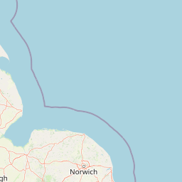
Map view of Cromer Shoal Chalk Beds

Use this park location map to pinpoint Cromer Shoal Chalk Beds in United Kingdom, understand its exact geographic position, and read its mapped placement within the surrounding landscape more clearly.

Pigeon | © OpenStreetMap contributors

Location context for Cromer Shoal Chalk Beds

Norfolk
Park atlas

Compare nearby marine conservation zones and coastal protected areas across the region.

Explore Other Parks Near Cromer Shoal Chalk Beds and Related Protected Landscapes

Browsing other protected areas near Cromer Shoal Chalk Beds reveals connected marine and coastal habitats across the wider regional geography. Examining adjacent reserves provides deeper context for chalk geology and regional biodiversity conservation.
Watercolor painting showing grassy wetlands and distant hills with a sunset sky
National parkUnited Kingdom
About 18 km away#1 closest

Southeast

The Broads National Park: Wetland Landscape, Rivers, and Regional Geography Atlas

Explore mapped waterways and protected reedbed ecosystems.

The Broads National Park offers a singular protected wetland landscape with over 200 kilometers of navigable waterways across its numerous shallow lakes, or 'broads.' Shaped by medieval peat excavations and natural processes, this area presents a unique geography of reedbeds and grazing marshes, punctuated by historic windmills. Discover the mapped extent of this protected landscape, its river systems, and its vital role in regional geography through structured atlas data.

Area
303 km²
Established
1989
IUCN
V
Relief
Lowland
Nature reserveSuffolk
About 98 km away#2 closest

South

Martlesham Wilds Nature Reserve: Suffolk Wetland and Protected Landscape Geography

Examining the ecological corridor along the River Deben estuary

Martlesham Wilds represents a significant lowland rewilding effort in eastern England. The 117 hectare reserve, managed by the Suffolk Wildlife Trust, creates a vital connection between ancient woodlands, tidal marshes, and freshwater wetland scrapes. Explore the geographic layout and protected boundaries of this developing sanctuary on the Deben Estuary.

Area
1.17 km²
Established
2023
Relief
Lowland
Climate
Temperate
Nature reserveEssex
About 125 km away#3 closest

South

Colne Estuary Nature Reserve: Geography and Protected Landscapes of the Essex Coast

Coastal wetlands, saltmarsh zones, and geological formations

Colne Estuary represents a massive tidal landscape in Essex characterized by the interaction between fluvial and marine systems. Covering over 2,900 hectares, this site protects diverse habitats including intertidal mudflats, active saltmarshes, and transitional zones that support wintering waterbirds. The area remains a key reference for studying coastal accretion and Quaternary geology in the East of England.

Area
29.152 km²
Established
1989
Relief
Lowland
Climate
Temperate
A soft watercolor illustration showing rolling green hills and wetlands against a light, pale sky.
Nature reserveEssex
About 128 km away#4 closest

South

Abberton Reservoir: Mapped Landscape and Protected Area Context in Essex, England

Freshwater reservoir, wetland, and historic site

Abberton Reservoir stands as a landmark of regional geography in Essex. This entry maps the site's transition from an engineered water-supply facility to a mosaic of reedbeds, marshes, and open water, providing essential habitat for migratory wildfowl and wintering bird populations.

Area
7 km²
Established
1939
Relief
Lowland
Climate
Temperate
Marine protected areaEssex
About 140 km away#5 closest

South

Blackwater, Crouch, Roach and Colne Estuaries Marine Conservation Zone Geography and Map

A comprehensive look at England's largest inshore marine protected area.

Covering 284 square kilometers of the Essex coast, this marine conservation zone integrates four tidal estuaries and North Sea coastal frontage into a single protected system. Recognized for its unique native oyster beds and vast intertidal mudflats, the area provides essential habitat for waterfowl. Explore the mapped terrain and overlapping conservation boundaries that define this vital estuarine landscape.

Area
284 km²
Relief
Lowland
Climate
Temperate
Scope
Marine
Nature reserveNorthamptonshire
About 159 km away#6 closest

Southwest

Summer Leys Nature Reserve: Geographic Context and Mapped Wetland Boundaries in Northamptonshire

Wetland ecosystems and industrial land reclamation in the Upper Nene Valley

Summer Leys is an important nature reserve and protected wetland complex in Northamptonshire. Defined by its history as a gravel extraction site, the landscape now features open lagoons, reed-fringed pools, and vital grassland habitats. This site provides a critical study in how former industrial terrain is repurposed for ecological conservation and avian biodiversity within the regional landscape of the English East Midlands.

Area
0.5 km²
Relief
Lowland
Climate
Temperate
Access
Easy access
National parkUnited Kingdom
About 194 km away#7 closest

West

Peak District National Park: Explore Protected Landscape and Regional Geography

Mapped boundaries and natural terrain context for this UK national park.

Investigate the Peak District National Park, a cornerstone of the United Kingdom's protected natural areas. This MoriAtlas entry provides essential details on its geographic scope, mapped boundaries, and landscape characteristics. Engage with structured data to understand how this national park fits into the atlas of the United Kingdom, supporting detailed geographic and protected-area discovery for researchers and explorers.

Area
1,440 km²
Established
1951
IUCN
V
Visitors
13M annual
Nature reserveSurrey
About 210 km away#8 closest

Southwest

Wraysbury Reservoir: An Engineered Nature Reserve and Vital Wetland Habitat in Surrey

Examining infrastructure, ecology, and sonar testing geography.

Wraysbury Reservoir stands as a unique example of late-twentieth-century industrial landscape design, serving as both a primary London water resource and a protected Ramsar wetland. Its earthen embankments enclose a specialized environment where sonar research and ecological conservation coexist within the wider context of the Thames Valley. This record details the site's boundaries, its function as a wintering bird refuge, and its specialized role in UK marine testing.

Area
2.05 km²
Established
1970
Relief
Lowland
Climate
Temperate

Common questions about visiting, size, designation, and location context for Cromer Shoal Chalk Beds

Cromer Shoal Chalk Beds FAQs for park facts, access, geography, and protected area context

Find quick answers about Cromer Shoal Chalk Beds, including protected-area facts, park geography, trail and visitor context, and how the park fits into its surrounding country and regional landscape.
MoriAtlas Explorer

Continue Your Protected Areas Search Across the Global Atlas

Deepen your exploration by continuing the structured search for national parks and protected areas worldwide. Utilize the comprehensive filtering capabilities to compare different conservation landscapes and refine your understanding of global park geography. Discover more about the distribution and characteristics of protected natural areas.

Global natural geography