Mori Atlas logo
Protected areaCuenca Alimentadora del Distrito Nacional de Riego 026 Bajo Río San Juan

A vital watershed landscape spanning the northern Sierra Madre Oriental mountain range

Cuenca Alimentadora del Distrito Nacional de Riego 026 Bajo Rio San Juan Protected Area Geography

The Cuenca Alimentadora del Distrito Nacional de Riego 026 Bajo Rio San Juan serves as a primary headwaters protection zone within the Sierra Madre Oriental. This sprawling protected landscape connects diverse terrain, from dry lowland scrublands to high elevation pine and oak forests, playing a central role in water security for the broader Coahuila region.

watershedpine-oak forestmountain reserveheadwaters protectionSierra Madre Orientalsustainable use

Cuenca Alimentadora del Distrito Nacional de Riego 026 Bajo Río San Juan

Protected area

Park overview

Structured park overview, official facts, and landscape profile for Cuenca Alimentadora del Distrito Nacional de Riego 026 Bajo Río San Juan

Cuenca Alimentadora del Distrito Nacional de Riego 026 Bajo Río San Juan park facts, protected area profile, and essential visitor context

Review the core facts for Cuenca Alimentadora del Distrito Nacional de Riego 026 Bajo Río San Juan, including designation, size, terrain, visitor scale, habitats, and operating context in one park-focused overview.

About Cuenca Alimentadora del Distrito Nacional de Riego 026 Bajo Río San Juan

The Cuenca Alimentadora del Distrito Nacional de Riego 026 Bajo Río San Juan occupies a strategic position in the geography of northeastern Mexico. Its roughly two million hectare extent spans the rugged terrain of the northern Sierra Madre Oriental, the mountain range that forms the spine between the high plateau of central Mexico and the lower Gulf Coast plain. By design, the reserve functions both as a watershed protection area, guaranteeing the quality and continuity of river flow, and as a broader natural resources protection area that conserves the surrounding ecosystems.

The protected area is anchored to a network of neighboring reserves and conservation lands. To the north it meets Cumbres de Monterrey National Park, one of Mexico's most visited mountain parks. To the west lies the Serranía de Zapalinamé ecological reserve, a rugged limestone range that is home to a wide range of endemic species. On its southeastern flank the reserve touches the Cerro el Potosí ecological reserve, a high-elevation massif that harbors some of the most important conifer forests in the region. Together these protected areas form a continuous belt of conservation land that maintains ecological connectivity across much of the northern Sierra Madre Oriental, allowing wildlife populations and ecological processes to move more freely between highland habitats.

Hydrologically, the reserve is defined by the San Juan River basin. The river rises in these mountains and travels a long course eastward, ultimately joining the Rio Grande. Water captured here is essential for the Monterrey Metropolitan Area, Mexico's second largest urban concentration, as well as for irrigated agriculture in the lower Rio Grande valley downstream. The protected area's role in maintaining forest cover, reducing erosion, and regulating streamflow makes it one of the most strategically important watershed reserves in northern Mexico.

Quick facts and research context for Cuenca Alimentadora del Distrito Nacional de Riego 026 Bajo Río San Juan

The Bajo Río San Juan reserve is a natural resources protection area located in northeastern Mexico across parts of Coahuila and Nuevo León. It lies in the northern Sierra Madre Oriental, between the major cities of Monterrey and Saltillo, and covers an extensive watershed in the upper San Juan River basin. Administered by Mexico's National Commission of Natural Protected Areas (CONANP), it carries an IUCN Category VI designation recognizing sustainable use of natural resources alongside protection.

Protection and recognition

Terrestrial protected area established in 2002 with documented management scope.

Protection Status and Designation History for Cuenca Alimentadora del Distrito Nacional de Riego 026 Bajo Río San Juan

Terrestrial protection status for Cuenca Alimentadora del Distrito Nacional de Riego 026 Bajo Río San Juan is recorded alongside a 2002 designation year. Official records aggregate the baseline management scope and international recognition data for this protected landscape.

Protection details

Protection scope
Terrestrial
Designated year
2002
Transboundary protection
No
Park context

Deeper park guide and search-rich context for Cuenca Alimentadora del Distrito Nacional de Riego 026 Bajo Río San Juan

Cuenca Alimentadora del Distrito Nacional de Riego 026 Bajo Río San Juan history, landscape, wildlife, and travel context

Explore Cuenca Alimentadora del Distrito Nacional de Riego 026 Bajo Río San Juan through its history, landscape character, ecosystems, wildlife, conservation priorities, cultural context, and seasonal travel timing in a structured park guide built for atlas discovery and search intent.

Why Cuenca Alimentadora del Distrito Nacional de Riego 026 Bajo Río San Juan stands out

The reserve is best known as the headwaters protection zone for the San Juan River, one of the most important freshwater sources feeding the Monterrey metropolitan area and extending downstream into the agricultural lands of the lower Rio Grande valley. It is also recognized for its extensive pine and oak forests of the Sierra Madre Oriental and for the rare conifer stands, including oyamel fir and Mexican Douglas-fir, that survive in its higher elevations.

Cuenca Alimentadora del Distrito Nacional de Riego 026 Bajo Río San Juan history and protected-area timeline

The area around the upper San Juan River basin was first given formal protection in 1949, when it was designated as a protected forest area and watershed. This early designation reflected longstanding concerns about water supply for the growing cities and agricultural lands of northeastern Mexico, and about the long-term health of the forests that feed the region's rivers.

In 2002 the area was reclassified as a natural resources protection area, a designation that broadened its conservation mandate beyond strict forest protection to include the sustainable use of natural resources within the watershed. Administration of the reserve falls to Mexico's National Commission of Natural Protected Areas, known as CONANP, which oversees the country's federal network of natural protected areas. The redesignation aligned the reserve with Mexico's modern system of protected area categories and confirmed its continuing importance for both ecological conservation and regional water security.

Cuenca Alimentadora del Distrito Nacional de Riego 026 Bajo Río San Juan landscape and geographic character

The landscape of the Bajo Río San Juan reserve is shaped by the northern end of the Sierra Madre Oriental, a mountain system whose folded ridges and valleys give the protected area a strongly three-dimensional character. Terrain rises from warmer, drier basins at lower elevations to cool, forested summits at the higher reaches, producing a broad gradient of microclimates within the reserve's boundaries.

The overarching scenery mixes pine-covered ridges, deep river-cut valleys, and open highland plateaus. Limestone and other sedimentary formations typical of the Sierra Madre Oriental create steep escarpments and sheltered canyons. To the southeast the landscape climbs toward Cerro el Potosí, one of the highest peaks in the region, and to the west the reserve abuts the dramatic ridges of the Serranía de Zapalinamé. At lower elevations the mountains give way to rolling terrain more characteristic of the semi-arid north, with scrublands, agricultural clearings, and isolated hills leading out toward the plains further downstream.

Cuenca Alimentadora del Distrito Nacional de Riego 026 Bajo Río San Juan ecosystems, habitats, and plant life

Ecologically, the reserve belongs to the transition zone between the temperate forests of the Sierra Madre Oriental and the arid lands that dominate northern Mexico. At higher elevations the natural vegetation is dominated by pine and oak, forming dense forests on the most sheltered slopes and open woodlands on drier, rockier sites. Within these forests, particularly in the cooler, moister microhabitats, grow groves of oyamel fir, a high-elevation conifer of restricted distribution, along with Mexican Douglas-fir, known locally as ayarín.

At lower elevations the climate becomes warmer and drier, and the vegetation shifts to communities adapted to those conditions. Chaparral covers some slopes, while submontane matorral and desert matorral, including both microphyll and rosetophyll forms, occupy much of the drier terrain. Areas disturbed by past land use now carry secondary scrubland, and the reserve also includes patches of agriculture, particularly in valley bottoms where soil and water permit cultivation. This gradient from pine-oak forest down through matorral and into agricultural land creates a habitat mosaic that supports a broad range of species.

Cuenca Alimentadora del Distrito Nacional de Riego 026 Bajo Río San Juan wildlife and species highlights

Source content for wildlife is limited; the reserve's pine-oak forests, oak woodlands, and adjacent matorral shrublands are characteristic habitat for the small mammals, deer, and resident and migratory bird communities typical of the Sierra Madre Oriental. The reserve's role as part of the larger network of protected areas in the region likely supports wider-ranging species, but specific faunal details are not well documented in the available sources.

Cuenca Alimentadora del Distrito Nacional de Riego 026 Bajo Río San Juan conservation status and protection priorities

The Bajo Río San Juan reserve is one of the most strategically important conservation areas in northeastern Mexico because of its dual role as a watershed and a biodiversity refuge. By protecting the forested headwaters of the San Juan River, the reserve safeguards a freshwater resource that serves major urban and agricultural users downstream, including the Monterrey Metropolitan Area and farming communities in the lower Rio Grande valley. Healthy forest cover in the upper catchment reduces erosion, moderates floods, and helps regulate the seasonal flow of the river.

Beyond water, the reserve contributes to conservation through its IUCN Category VI status, which recognizes the area as a protected landscape where sustainable use of natural resources is permitted alongside conservation objectives. This acknowledges that local communities continue to use the land, while still protecting the ecological functions that make the watershed viable. Connectivity with neighboring protected areas, including Cumbres de Monterrey National Park, the Serranía de Zapalinamé reserve, and the Cerro el Potosí reserve, further extends the conservation value of the Bajo Río San Juan area, allowing ecological processes to operate at a landscape scale rather than within a single isolated reserve.

Top sights and standout views in Cuenca Alimentadora del Distrito Nacional de Riego 026 Bajo Río San Juan

The reserve's defining quality is its function as the forested headwaters of the San Juan River, supplying major urban and agricultural users downstream, combined with its position in the northern Sierra Madre Oriental between Monterrey and Saltillo. Its scale, its network of neighboring reserves, and its rare high-elevation conifer groves, including oyamel fir and Mexican Douglas-fir, distinguish it from many other watershed protection areas in Mexico.

Best time to visit Cuenca Alimentadora del Distrito Nacional de Riego 026 Bajo Río San Juan

Specific seasonal information is not well supported by the available sources. As a watershed and forest reserve that spans a significant altitudinal gradient, the Bajo Río San Juan area experiences a temperate mountain climate at higher elevations and warmer, drier conditions lower down. Cooler months typically offer more comfortable conditions for exploring the higher pine-oak forests, while warmer months emphasize the dryland vegetation and clearer skies of the lower matorral zones, but operational visitor details are not provided in the source content.

Monthly climate preview

Long term representative coordinates reveal monthly temperature swings and precipitation patterns across the protected terrain.

Annual Temperature and Precipitation Normals for Cuenca Alimentadora del Distrito Nacional de Riego 026 Bajo Río San Juan

Historical climatology records outline the measured long term temperature range and monthly precipitation distribution across representative coordinates within Cuenca Alimentadora del Distrito Nacional de Riego 026 Bajo Río San Juan. Detailed twelve month profiles provide deeper context for evaluating annual climate normals and regional meteorological variations.
Annual mean17 °C
11 °C23 °C
Jan11°
Feb13°
Mar16°
Apr19°
May22°
Jun23°
Jul22°
Aug22°
Sep20°
Oct17°
Nov14°
Dec11°
Warmest month
June

22.5 °C

Coolest month
January

10.8 °C

Wettest month
September

3.7 mm/day

Driest month
December

0.4 mm/day

Park location guide

Geography guide, regional context, and park location map for Cuenca Alimentadora del Distrito Nacional de Riego 026 Bajo Río San Juan

Cuenca Alimentadora del Distrito Nacional de Riego 026 Bajo Río San Juan park geography, regions, and map view in Mexico

Understand where Cuenca Alimentadora del Distrito Nacional de Riego 026 Bajo Río San Juan sits in Mexico through a broader geographic reading of the surrounding landscape, nearby location context, and its mapped position within the national park landscape.

How Cuenca Alimentadora del Distrito Nacional de Riego 026 Bajo Río San Juan fits into Mexico

Mexico, officially the United Mexican States, is a country in North America spanning the Sierra Madre mountain ranges, coastal plains, and tropical regions. It borders the United States to the north, Guatemala and Belize to the southeast, and has coastlines along the Pacific Ocean, Gulf of Mexico, and Caribbean Sea. With a population exceeding 130 million, Mexico is home to one of the world's most significant concentrations of Indigenous languages alongside Spanish.

Wider geography shaping Cuenca Alimentadora del Distrito Nacional de Riego 026 Bajo Río San Juan in Mexico

Mexico occupies a land area of 1,972,550 km2, making it the thirteenth-largest country in the world. The terrain is highly diverse, featuring the Sierra Madre Occidental and Sierra Madre Oriental mountain ranges, the Mexican Plateau, coastal lowlands along the Pacific and Gulf/Caribbean margins, and the Yucatan Peninsula. The country spans multiple climate zones from desert in the north to tropical rainforest in the south.

Map view of Cuenca Alimentadora del Distrito Nacional de Riego 026 Bajo Río San Juan

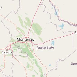
Use this park location map to pinpoint Cuenca Alimentadora del Distrito Nacional de Riego 026 Bajo Río San Juan in Mexico, understand its exact geographic position, and read its mapped placement within the surrounding landscape more clearly.

Pigeon | © OpenStreetMap contributors

Location context for Cuenca Alimentadora del Distrito Nacional de Riego 026 Bajo Río San Juan

CoahuilaNuevo León
Park atlas

Compare adjacent protected areas and surrounding mountain landscapes across the region

Parks Near Cuenca Alimentadora del Distrito Nacional de Riego 026 Bajo Río San Juan

Browse other protected areas and mountain reserves located near Cuenca Alimentadora del Distrito Nacional de Riego 026 Bajo Río San Juan. Comparing adjacent reserves helps trace regional watershed connections and protected-landscape patterns.
National parkMexico
About 18 km away#1 closest

East

Cumbres de Monterrey National Park: National Park Protected Landscape Discovery

Explore Mexico's Mapped Terrain and Regional Geography

Understand Cumbres de Monterrey National Park as a distinct protected landscape within Mexico. This page provides detailed atlas-oriented information focused on its geographic boundaries, mapped terrain, and its role in regional conservation. It serves as a valuable entry point for exploring the park's natural context and understanding its place in the national geography.

Area
1,773.96 km²
Established
1939
IUCN
II
Relief
Mountain
Watercolor illustration of layered mountain ranges with purple peaks fading into a green and yellow foreground.
Natural monumentNuevo León
About 36 km away#2 closest

Northeast

Cerro de la Silla: Protected Natural Monument Geography and Regional Map Context

A rugged mountain landscape in Nuevo León, Mexico

Cerro de la Silla is defined by its unmistakable saddle-shaped silhouette and its status as a vital protected area within the urban matrix of Monterrey. The mountain features complex folded limestone geology and a diverse habitat mosaic that transition from arid scrubland to forested peaks. Use this atlas resource to understand its topographical boundaries, summit formations, and regional environmental significance within the Sierra Madre Oriental fold belt.

Area
60 km²
Established
1991
Relief
Mountain
Climate
Subtropical
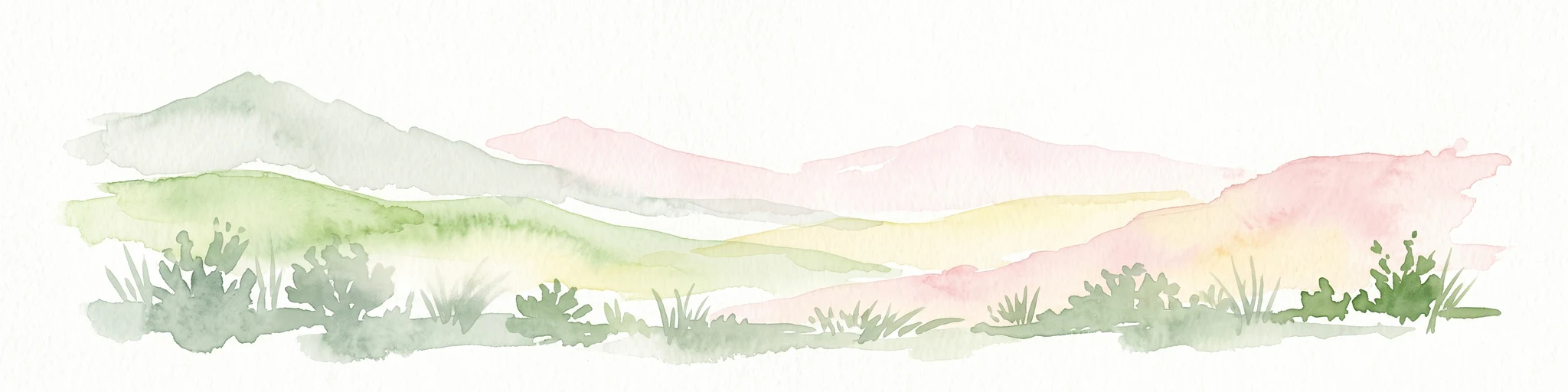
Watercolor painting of a mountain range featuring gentle slopes and low-lying shrubs against a white background.
Protected areaCoahuila
About 46 km away#3 closest

West

Serranía de Zapalinamé: Protected Mountain Geography and Watershed in Coahuila

Ecological transition zone within the Sierra Madre Oriental

The Serranía de Zapalinamé forms a dramatic mountain corridor rising over Saltillo, Coahuila. This state natural reserve protects a vital watershed and biodiversity hotspot where Chihuahuan Desert scrub meets pine and oak montane forests. Its steep canyons and high ridges offer a significant case study in regional landscape conservation and natural water security.

Area
253.74 km²
Established
1996
Relief
Mountain
Climate
Arid
Protected areaNuevo León
About 117 km away#4 closest

Northeast

Sierra de Picachos Protected Area: Geographic Boundaries and Regional Landscapes

Mountain geography in northern Nuevo León

Sierra de Picachos represents a vital conservation zone spanning north of Monterrey. The landscape is defined by its dramatic elevation changes, moving from desert-like plains to cool coniferous slopes. This atlas entry focuses on the physical boundaries, ecological zones, and the rugged, peak-studded terrain that distinguish the range from the surrounding Sierra Madre Oriental.

Area
1,405 km²
Established
2000
Relief
Mountain
Climate
Subtropical
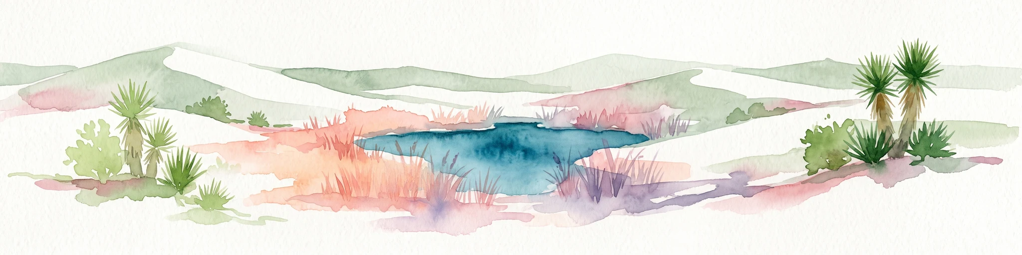
Watercolor painting of a desert landscape with white gypsum dunes, a central turquoise blue pool, and yucca plants.
Wildlife reserveCoahuila
About 232 km away#5 closest

Northwest

Área de Protección de Flora y Fauna Cuatrociénegas: Protected Landscape and Atlas Map

Desert wetlands and gypsum dune geography in Coahuila, Mexico

This wildlife reserve in Coahuila represents a globally significant desert wetland complex. Featuring hundreds of spring-fed pozas and the second-largest gypsum dune field in the Americas, the reserve offers a unique look at isolated ecosystems and specialized biodiversity within the Chihuahuan Desert.

Area
843.47 km²
Established
1994
Relief
Lowland
Climate
Arid
Protected areaCoahuila
About 283 km away#6 closest

North

Cuenca Alimentadora del Distrito Nacional de Riego 004 Don Martín Protected Area Geography

A vast watershed and mountain corridor in central Coahuila

This expansive protected area in northern Mexico functions as the primary catchment for the Don Martín irrigation district. The terrain ranges from dry shrubland and grasslands in the Coahuila interior to the rugged, forested heights of the Sierra Madre Oriental. It remains a key case study in river conservation and the complex interplay between arid ecosystems and mountainous watershed systems.

Area
15,193.8 km²
Established
1949
IUCN
VI
Relief
Mountain
Wildlife reserveTamaulipas
About 289 km away#7 closest

East

Laguna Madre Wildlife Reserve: Geography and Protected Coastal Landscapes of Tamaulipas

Mapping the hypersaline lagoons and barrier island chains of Mexico

Laguna Madre represents a singular coastal ecosystem characterized by its extreme salinity, expansive seagrass meadows, and sheltered barrier island configuration. As a vital protected wetland, the area serves as a primary migratory flyway and habitat for diverse shorebirds and sea turtles, revealing a distinct arid coastal landscape along the Tamaulipas shore.

Area
5,728.08 km²
Established
2005
IUCN
VI
Relief
Lowland
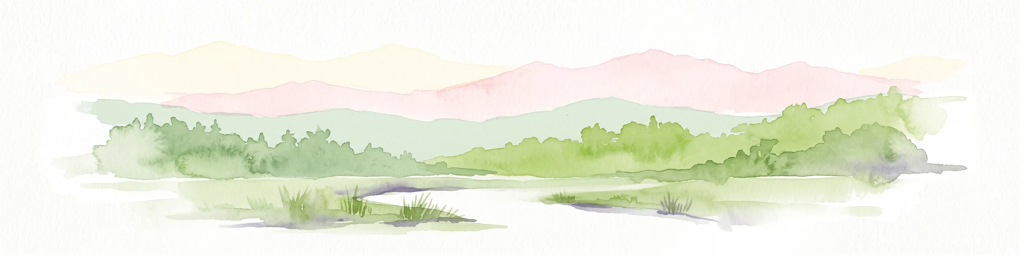
Watercolor illustration showing a river flowing through green forest with pink mountains in the background on a white background
Protected areaTamaulipas
About 317 km away#8 closest

Southeast

Sierra de Tamaulipas Protected Area: Geography, Karst Terrain, and Sky Island Ecosystems

Mapping the natural features of a remote Mexican mountain massif.

The Sierra de Tamaulipas offers a unique study in vertical geography and isolated ecosystems. Rising dramatically above the plains of Tamaulipas, this protected area features a complex mosaic of tropical deciduous forests and pine-oak summits. The range also hosts notable karst features, including the world's deepest water-filled sinkhole, El Zacatón, set within a landscape of immense historical and biological value.

Area
3,339 km²
Established
2016
Relief
Mountain
Climate
Subtropical

Common questions about visiting, size, designation, and location context for Cuenca Alimentadora del Distrito Nacional de Riego 026 Bajo Río San Juan

Cuenca Alimentadora del Distrito Nacional de Riego 026 Bajo Río San Juan FAQs for park facts, access, geography, and protected area context

Find quick answers about Cuenca Alimentadora del Distrito Nacional de Riego 026 Bajo Río San Juan, including protected-area facts, park geography, trail and visitor context, and how the park fits into its surrounding country and regional landscape.
MoriAtlas Explorer

Continue Your Protected Areas Search Across the Global Atlas

Deepen your exploration by continuing the structured search for national parks and protected areas worldwide. Utilize the comprehensive filtering capabilities to compare different conservation landscapes and refine your understanding of global park geography. Discover more about the distribution and characteristics of protected natural areas.

Global natural geography