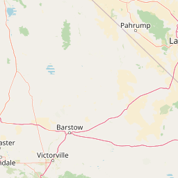
Natural springs
Big Dodd Spring
1,197 m

Analyzing the terrain, elevation extremes, and regional landscape context
Examine the detailed geographic layout of Death Valley National Park, spanning over 13,848 square kilometers across California and Nevada. This profile maps the diverse physical terrain, ranging from extreme desert depressions at 86 meters below sea level to mountain peaks reaching 3,368 meters, providing a structured overview of the area's natural boundaries and features.
Related tags
The hottest, driest, and lowest national park in the United States
Death Valley National Park is a vast protected area that straddles the California-Nevada border east of the Sierra Nevada, making it the largest national park in the contiguous United States. The park encompasses a dramatic landscape of salt-flats, sand dunes, badlands, deep canyons, and mountain ranges, protecting the northwest corner of the Mojave Desert and its diverse desert environment. At its lowest point, Badwater Basin sits 282 feet below sea level, making it the lowest point in North America and the second-lowest depression in the Western Hemisphere. More than 93 percent of the park is designated as wilderness area, preserving one of the most ecologically significant desert landscapes in North America.
Regional placement across California and Nevada boundaries
Geographic extent and coordinate span covering over 13,848 square kilometers
Vertical range data and mapped natural landforms
Natural springs
1,197 m
Natural springs
Streams
Natural springs
Peaks
1,743 m
Viewpoints
Arid climate profiles, sparse forest cover, and diverse desert landforms
Mountains · Valleys · Canyon · Forest · Wetland · Lakes · Rivers · Dunes · Volcano · Desert · Hills
Desert habitat · Dune habitat · Wetland · Shrubland · Montane forest · Riverine habitat · Lacustrine habitat
Explore Regional Geography, Diverse Landscapes, and Adjacent Protected Zones

Northwest

High altitude wilderness and volcanic terrain in Eastern California
Spanning from the arid Owens Valley floor to the 14,000 foot crest of the Sierra Nevada, Inyo National Forest remains a cornerstone of the American West. This protected landscape contains the Ancient Bristlecone Pine Forest, Mount Whitney, and the Mono Inyo volcanic chain, providing a dense geographic record of glacial, tectonic, and ecological diversity across a vast managed corridor.

North
A vast network of Nevada mountain ranges and alpine wilderness
Humboldt, Toiyabe National Forest serves as a defining public land entity across Nevada and eastern California. As the largest national forest in the contiguous United States, it preserves a striking collection of isolated mountain ranges, including the Ruby Mountains and the rugged Jarbidge wilderness, within a broader basin-and-range landscape. Examine the boundaries and terrain that characterize this complex, high-desert ecosystem.
East
A rugged mountain anchor in the southern Nevada desert
Rising sharply from the desert floor, Spring Mountains National Recreation Area features dramatic elevation shifts across 316,000 acres of forested canyons and rocky ridges. This protected landscape preserves vital mountain habitat and diverse terrain, ranging from pinyon-juniper woodlands to high-alpine environments near Mount Charleston, serving as a distinct natural contrast to the Mojave surroundings.

West
California wilderness area with glacial basins and granite peaks
John Muir Wilderness represents one of the largest protected high-elevation areas in the contiguous United States. Spanning the Sierra Nevada crest, its granite terrain is sculpted by Pleistocene glaciation into sharp arêtes, deep canyons, and hundreds of alpine lakes. This wilderness serves as a vital geographic anchor for mountain ecosystems, offering an extensive look at the high-country landscape of eastern California.
West
Mapped park boundaries and regional natural context.
Kings Canyon National Park stands as a key protected national park within California, offering a specific focus for geographic understanding and atlas-based exploration. This page details the park's mapped boundaries and its integration into the broader regional geography of California. For users interested in the distribution of protected lands and the mapping of natural landscapes, Kings Canyon National Park provides a crucial point of study within the comprehensive park atlas.
West
Explore mapped boundaries and the terrain of this California protected area.
Gain a structured understanding of Sequoia National Park as a protected landscape, focusing on its mapped geographic boundaries and its context within California. This entry provides foundational data for exploring the park's natural terrain and its role in a broader atlas of conservation lands, ideal for users seeking detailed geographic information.
West
A study of fault block terrain and desert mountain ecosystems.
The Inyo Mountains Wilderness serves as a dramatic ecological bridge between the Owens Valley and Saline Valley. This expansive protected area offers a look into late Proterozoic to Cambrian geology and distinct vertical plant zonation. Mapping the range reveals a network of canyons, ridges, and slopes that sustain endemic biodiversity and ancient bristlecone pine stands within the Great Basin periphery.
East
High-altitude wilderness and ancient forest landscapes in southern Nevada
Spanning the crest of the Spring Mountains, Mount Charleston Wilderness stands as a protected natural landmark in Nevada. This area offers an atlas-focused view of subalpine ridges, ancient bristlecone pine forests, and steep fault-block terrain that contrast significantly with the arid Mojave Desert basins located below.
Delve deeper into the geographic context of Death Valley National Park by examining its specific protected boundaries and the surrounding California landscape. This structured approach to park discovery reveals critical details about the unique desert terrain and its atlas significance. Understand the park's protected-area identity more fully through detailed map-driven insights.