Mori Atlas logo
Park earthquake history

Review documented seismic events associated with this lowland waterway landscape in the Wesermarsch region

Historical Earthquake Records for Dornebbe, Braker Sieltief und Colmarer Tief in Lower Saxony

Explore a curated catalogue of recorded earthquakes associated with the geographic vicinity of the Dornebbe, Braker Sieltief und Colmarer Tief protected landscape. This dataset provides a factual overview of historical seismic activity by referencing epicentre distances to the waterway network. Each record includes event timing, magnitude, and depth data to support geographic context for the Wesermarsch marshland region.

Related tags

landscape protection arealowland waterwayscoastal marshlandriparian habitatreedbeds

A small tidal lowland landscape protection area along the waterways west of Brake on the Wesermarsch.

Dornebbe, Braker Sieltief und Colmarer Tief

Dornebbe, Braker Sieltief und Colmarer Tief is a small protected landscape area in the Wesermarsch district of Lower Saxony, in northwestern Germany. Covering about 33 hectares, it lies west of the town of Brake an der Unterweser, within the municipality of Brake and the neighboring municipality of Ovelgönne. The area has been officially protected since 22 December 2018, and its authority lies with the Wesermarsch district as the responsible lower nature conservation authority. The landscape protection area focuses on a network of slow-flowing lowland waterways at the edge of the tidal Weser region. It includes the lower course of the Dornebbe stream, a short section of a tributary ditch, the Braker Sieltief, and a stretch of the Colmarer Tief. A narrow, five-meter-wide strip of bank habitat on both sides of the waterways is included in the protection, supporting reedbeds, tall herbaceous shoreline vegetation, and scattered waterside shrubs. Ecologically, the area is most valued as a habitat for freshwater mussels, fish, and bats. Together with its underlying FFH designation, it forms part of the broader Natura 2000 network in the Wesermarsch, helping to link aquatic and riparian habitats in one of Germany's characteristic coastal marshland landscapes.

Location
Germany
Park type
Protected landscape
Established
2018
Area
0.3 km²
Dornebbe, Braker Sieltief und Colmarer Tief Atlas

Inspect Dornebbe, Braker Sieltief und Colmarer Tief event evidence

Search earthquakes near Dornebbe, Braker Sieltief und Colmarer Tief

The catalogue for Dornebbe, Braker Sieltief und Colmarer Tief links earthquakes by epicentres and distance, not asserted occurrence inside the site. Dates, magnitudes, depths, places, distance measurements, and source links support historical comparison without assigning cause, declaring current hazard, or projecting future earthquakes.

Sort by
Magnitude
Location

This page describes catalogued earthquakes associated with the park by epicentre location and distance. It does not establish causation, assess current danger, or predict future earthquakes.

No earthquake records match the current filters

Park atlas

Go beyond Dornebbe, Braker Sieltief und Colmarer Tief earthquake history

Browse other parks after Dornebbe, Braker Sieltief und Colmarer Tief

From the Dornebbe, Braker Sieltief und Colmarer Tief earthquake catalogue, the atlas offers a separate route into other protected destinations. The selection does not claim shared site character, designation, earthquake evidence, geology, proximity, seismic relevance, hazards, risk, or equivalent records.
Nature reserveLower Saxony
About 6.5 km away#1 closest

Northeast

Strohauser Vorländer und Plate Nature Reserve: Geography and Protected Area Atlas

Tidal wetlands and freshwater habitats in Lower Saxony

The Strohauser Vorländer und Plate nature reserve protects a expansive tidal floodplain characterized by its river island geography, slow-moving side arms, and seasonal inundation patterns. As a focal point for meadow-bird monitoring, this site offers a clear view into the ecological dynamics of the Lower Weser river landscape, showcasing a rare combination of summer-dike-protected meadows and open freshwater tidal flats.

Area
11.52 km²
Established
2007
IUCN
IV
Watercolor painting showing coastal wetlands with mudflats, salt marshes, and distant hills under a soft light
National parkLower Saxony
7.4 km away#2 closest

Northwest

Lower Saxon Wadden Sea National Park: Protected Coastal Landscape & Geography Atlas

Explore mapped boundaries, intertidal zones, and Lower Saxony's natural terrain.

Delve into the Lower Saxon Wadden Sea National Park, a significant national park situated in Lower Saxony, Germany. This page serves as your atlas entry point for understanding its protected landscape, characterized by vast mudflats, salt marshes, and a crucial role as a migratory bird corridor. Discover the geographic context of this UNESCO World Heritage site and its unique intertidal ecosystem through structured map data and detailed landscape information.

Area
345.8 km²
Established
1986
IUCN
II
Relief
Lowland
Nature reserveLandkreis Cuxhaven
About 11 km away#3 closest

Northeast

Teichfledermausgewässer Nature Reserve: Mapped Geography of the Lower Weser Lowland Waters

Protected riverine habitats and lowland water mosaic in Germany

Teichfledermausgewässer functions as a vital nature reserve within the Landkreis Cuxhaven region. This protected landscape encompasses a rich mosaic of oxbow stretches, lowland rivers, and former clay extraction pits that support rare wildlife. Through its integrated water bodies, the reserve forms a continuous conservation corridor that preserves the ecological integrity of the Lower Weser estuary and its unique floodplain ecosystems.

Area
6.33 km²
Established
2018
Nature reserveLower Saxony
About 12 km away#4 closest

East

Südliches Hagener Königsmoor Nature Reserve: A Protected Peatland in Lower Saxony

Ecological mosaic of bog woodland and historical peat cuttings

Südliches Hagener Königsmoor is a protected nature reserve in Hagen im Bremischen, Lower Saxony. The terrain features a distinct mosaic of raised bog vegetation, drainage channels, and water-filled peat cuttings that anchor a rare remnant of the original lowland moor landscape against modern agricultural surroundings.

Area
0.85 km²
Established
1981
IUCN
IV
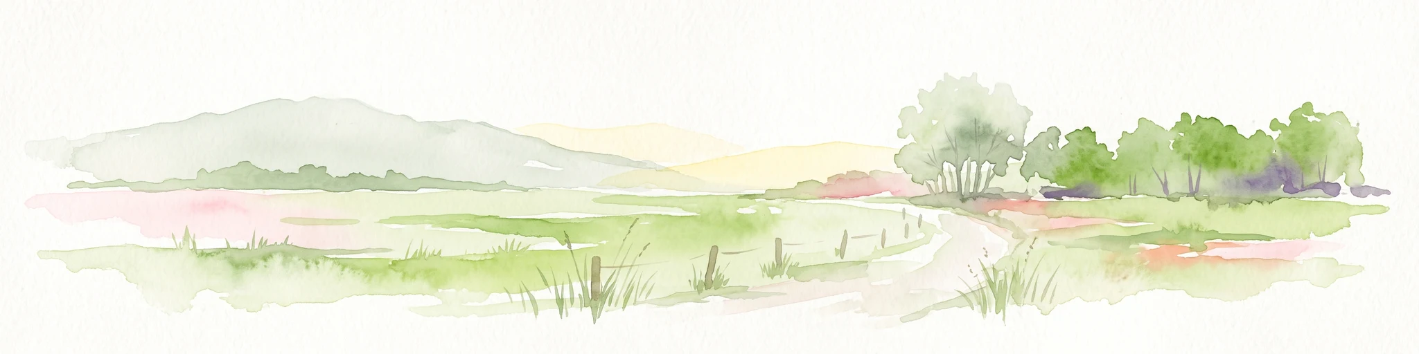
A soft, light-toned watercolor painting of a wetland landscape featuring green fields, a small path, a line of trees, and a distant low hill.
Nature reserveBremen
15 km away#5 closest

North

Luneplate Nature Reserve: A Detailed Geographic Atlas of Bremen's Coastal Wetland Landscapes

Protected estuarine habitats and tidal geography in the Weser river basin

Luneplate Nature Reserve offers a rich study of coastal wetland geography. Spanning the interface between the Weser river and the North Sea, the reserve features extensive mudflats, saltmarshes, and reedbeds. This protected landscape serves as an essential migratory hub, providing habitat for diverse waterbird populations within the maritime environment of Bremerhaven.

Area
14.38 km²
Established
2015
IUCN
IV
A horizontal watercolor painting depicting a soft-focus landscape with a pond in the foreground, pink and green heath vegetation, and distant tree lines under a pale sky.
Nature reserveBremen
About 16 km away#6 closest

Southeast

Eispohl, Sandwehen und Heideweiher: Protected Landscape and Geest Geography

Nature reserve featuring historic dunes and heath pond networks

This nature reserve in Bremen protects a remnant of the Rekumer Geest, featuring a complex of inland dunes, wet heath, and small heath ponds. Through its combination of extensively grazed grasslands and mixed forests, the area serves as a vital habitat corridor, maintaining the traditional Geest landscape patterns that once dominated the region between Bremen and the lower Weser.

Area
0.036 km²
Established
1988
Relief
Lowland
Climate
Temperate
Nature reserveBremen
About 19 km away#7 closest

Southeast

Hammersbecker Wiesen: Protected Nature Reserve and Meadow Landscape in Bremen

Ecological mosaic of wet meadows and stream valley terrain

Hammersbecker Wiesen encompasses 25.8 hectares of ecologically significant wet grassland and hedgerow habitats in Bremen. This nature reserve provides an essential refuge for diverse plant species and local amphibians within an urban-adjacent setting, illustrating the preserved character of traditional northern German meadow systems.

Area
0.258 km²
Established
1986
A soft watercolor painting featuring a reflective water surface, grassy marshland in the foreground, a tree line in the midground, and rolling, misty hills in the background.
Nature reserveBremen
About 23 km away#8 closest

Northeast

Düllhamm Nature Reserve: Protected Lowland Mosaic in Bremerhaven

Mapping the transitional forest and marshland terrain of Bremen.

Covering a small footprint, Düllhamm remains a vital nature reserve representing the lowland ecosystems of northern Germany. The area maps a unique gradient of dry oak-birch woodland shifting into wet meadows, boggy heath, and reed-covered marshes. This protected landscape offers a concentrated look at regional ecological patterns within the urbanized landscape of the Bremerhaven district.

Area
0.043 km²
Established
1984
Relief
Lowland
Climate
Temperate
MoriAtlas Explorer

Explore the Geography of Dornebbe, Braker Sieltief und Colmarer Tief

Trace the course of these protected lowland waterways and examine their role in the coastal marshland ecosystem of Niedersachsen. MoriAtlas provides a clear view of the protected boundaries, bank habitats, and riparian connections that define this unique landscape feature in northwestern Germany.