
Mori Atlas logo
National parkLower Saxon Wadden Sea National Park

Explore the unique intertidal ecosystem, mapped park boundaries, and regional geography.

Lower Saxon Wadden Sea National Park: A Mapped Protected Landscape in Lower Saxony

(Nationalpark Niedersächsisches Wattenmeer)

As Germany's largest national park, the Lower Saxon Wadden Sea National Park protects a dynamic coastal environment along the North Sea. This UNESCO World Heritage site in Lower Saxony features extensive mudflats, salt marshes, and a chain of barrier islands, creating a vital intertidal ecosystem. MoriAtlas provides detailed geographic context and map-based exploration tools to understand the park's expansive protected landscape and its ecological significance.

Coastal LandscapeMudflatsSalt MarshesMigratory BirdsUNESCO World Heritage SiteNorth Sea Islands
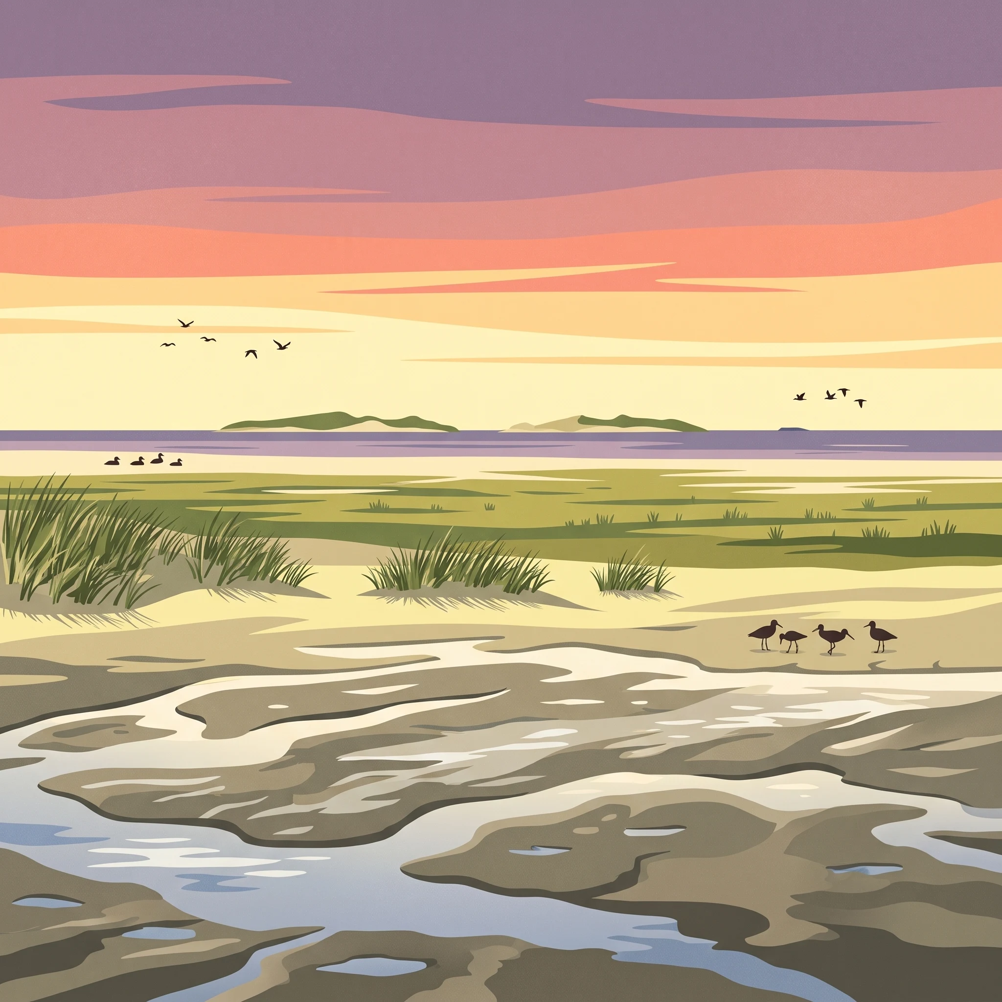
A stylized illustration showing a coastal landscape with a tall rock formation featuring a waterfall, grassy foreground, trees, and a sunset over the sea with pink and orange skies.

Lower Saxon Wadden Sea National Park

National park

Park overview

Structured park overview, official facts, and landscape profile for Lower Saxon Wadden Sea National Park

Lower Saxon Wadden Sea National Park park facts, protected area profile, and essential visitor context

Review the core facts for Lower Saxon Wadden Sea National Park, including designation, size, terrain, visitor scale, habitats, and operating context in one park-focused overview.

About Lower Saxon Wadden Sea National Park

Lower Saxon Wadden Sea National Park represents one of the most important coastal protected areas in Europe, encompassing a landscape of international ecological significance that has drawn recognition from UNESCO, the European Union, and international conservation bodies. The park stretches across a vast stretch of the German North Sea coast, incorporating the chain of East Frisian Islands that parallel the mainland, the seemingly endless mudflats that emerge at low tide, and the green salt marshes that fringe the islands and mainland coastline. This is a landscape shaped fundamentally by water—by the twice-daily tides that cover and uncover vast areas of seabed, by the longshore currents that reshape sandbanks, and by the fierce winds that build dunes along exposed shores. The ecological productivity of the Wadden Sea rivals that of tropical rainforests, a fact that underscores how this seemingly flat and featureless landscape actually teems with life. Diatoms, snails, worms, mussels, and shrimp form the base of a food web that supports enormous populations of migratory birds and marine mammals. The park is not merely a nature preserve but a living landscape where traditional human uses—fishing, seafaring, and island settlement—continue alongside conservation imperatives. The 2009 UNESCO World Heritage designation recognized that the Wadden Sea transcends national boundaries and represents a natural phenomenon of global significance.

Quick facts and research context for Lower Saxon Wadden Sea National Park

Located in Lower Saxony, Germany, the park protects a coastal strip of the North Sea characterized by extremely flat terrain where the seabed descends only centimeters per kilometer. Twice-daily tides deposit sand, clay, and silt across the mudflats, while wind-formed dunes anchor sections of the island coastline. The park is part of a transboundary World Heritage Site spanning Germany, the Netherlands, and Denmark. It was designated a Ramsar Wetland in 1976 and recognized as a UNESCO biosphere reserve in 1992. The national park headquarters are located in Wilhelmshaven.

Protection and recognition

Tracing ecological protection frameworks and European designations for the German coastal reserve

Lower Saxon Wadden Sea National Park Protection Status and Designation Details

Environmental records detail the official protection status and mixed conservation management scope of Lower Saxon Wadden Sea National Park. Analyzing international alignments like the Natura 2000 network registration helps park researchers track verified ecological safeguards across European borders.

International recognition

Protection details

Protection scope
Mixed
Transboundary protection
No
Park context

Deeper park guide and search-rich context for Lower Saxon Wadden Sea National Park

Lower Saxon Wadden Sea National Park history, landscape, wildlife, and travel context

Explore Lower Saxon Wadden Sea National Park through its history, landscape character, ecosystems, wildlife, conservation priorities, cultural context, and seasonal travel timing in a structured park guide built for atlas discovery and search intent.

Why Lower Saxon Wadden Sea National Park stands out

The park is renowned for its extraordinary intertidal ecosystem, the Wadden Sea, which supports over 10,000 animal and plant species, with up to 4,000 species specifically adapted to this rich habitat. The mudflats are famous for the lugworm, a keystone species that creates the U-shaped burrows characteristic of sandy substrates. The islands serve as critical breeding and molting grounds for hundreds of thousands of birds, including the common shelduck and common eider. The salt marshes provide nesting habitat for the distinctive pied avocet and various tern species. Seals regularly haul out on sandbanks within the park, and the dunes are stabilized by European beachgrass, creating the iconic coastal vegetation pattern.
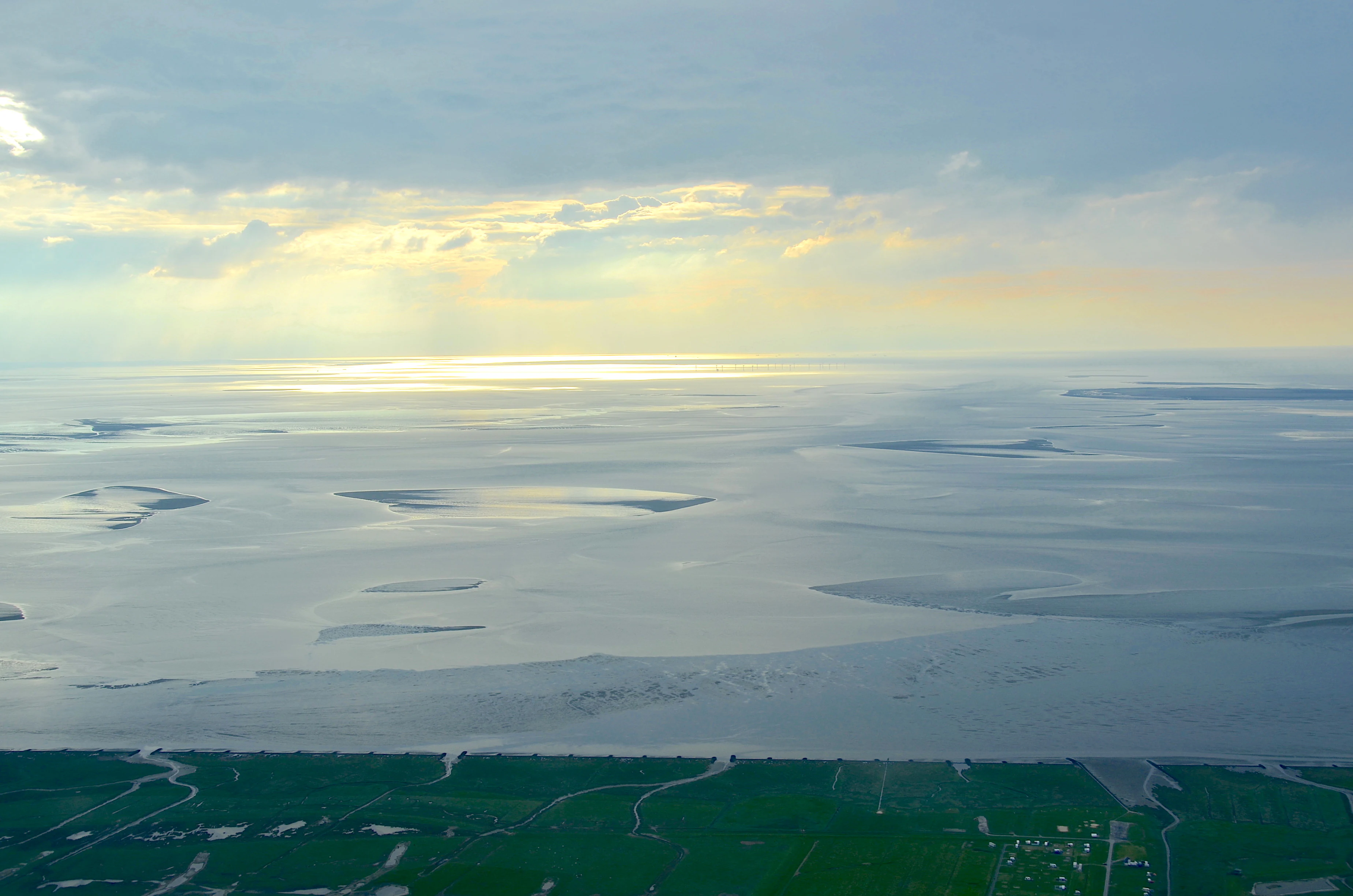
Aerial view showing extensive sandbanks and tidal flats in the Lower Saxon Wadden Sea National Park with coastal vegetation in the foreground
Aerial view of sandbanks and tidal flats in the Lower Saxon Wadden Sea National Park

Lower Saxon Wadden Sea National Park history and protected-area timeline

The protection of the Lower Saxon Wadden Sea has roots in international wetland conservation efforts beginning with the Ramsar Convention of 1971, which designated the Dollart Bay and surrounding areas as wetlands of international importance. In 1979, conservationists Hans-Joachim Augst and Holger Wesemüller developed a zoning model based on the ecological importance of different Wadden Sea areas, providing a foundation for systematic protection. The 1982 Lower Saxon regional development programme established a state planning objective for a national park covering the East Frisian Islands and coast, and formal planning began in 1983. The cabinet approved the park in early 1984, and the national park regulation came into force on January 1, 1986. Under the UNESCO Man and the Biosphere programme, the entire park was recognized as a biosphere reserve in 1992. The legal framework evolved from a 1986 regulation to a 1999 state law, with significant amendments in 2001 that removed some areas for tourism while adding marine areas before the islands of Borkum and Baltrum. In 2010, the park was expanded by approximately 670 square kilometers, primarily in the Cuxhaven and Elbe-Weser mouth area, bringing the total area to nearly 350 square kilometers. The park achieved UNESCO World Heritage status in June 2009 as part of a transnational designation with the Dutch and Schleswig-Holstein Wadden Sea.

Lower Saxon Wadden Sea National Park landscape and geographic character

The landscape of Lower Saxon Wadden Sea National Park is defined by the dynamic interaction between the North Sea and the low-lying coastal land of Lower Saxony. The German North Sea coast is extraordinarily flat, with the seabed descending only a few centimeters per kilometer—a gradient so gentle that tidal movements expose vast areas of mudflat twice daily. These mudflats, or Watt, consist of sand, clay, and silt deposited by tidal currents, creating a textured terrain of remarkable ecological complexity. Along the coast, wind has sculpted dunes from fine sand grains exposed at low tide, and these dunes now stabilize sections of the island and mainland coastline. The East Frisian Islands—Borkum, Baltrum, Langeoog, Juist, Norderney, Spiekeroog, Wangerooge, and several smaller islets—form a chain that partially buffers the mainland from North Sea storms. Between the islands and the mainland lie expansive salt marshes, their characteristic green-gray vegetation tolerating the saline conditions created by occasional flooding. The park also encompasses estuarine environments where rivers like the Ems meet the North Sea, creating brackish water habitats of particular ecological importance.
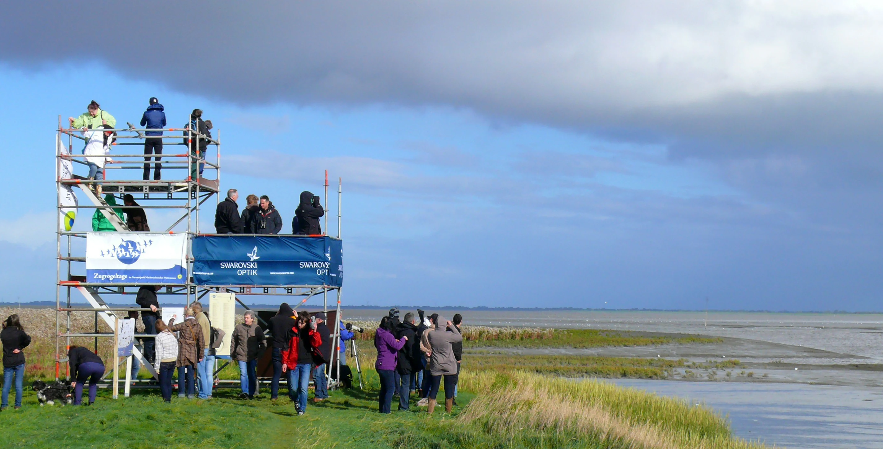
Multi-level observation tower with people on platforms overlooking a coastal marsh and body of water under a partly cloudy sky
People observing migratory birds from an observation tower at Varel harbor on the Jade Bight

Lower Saxon Wadden Sea National Park ecosystems, habitats, and plant life

The Wadden Sea represents an ecosystem of extraordinary biological productivity, often described as the second most productive ecosystem on Earth after tropical rainforests. This productivity stems from the constant flow of nutrients through the tidal system, where twice-daily flooding brings fresh supplies of organic material to the mudflats. The park protects a range of intertidal and coastal habitats including mudflats, salt marshes, beaches, dunes, and estuaries. The mudflat substrate supports a specialized community of organisms adapted to the constantly shifting conditions—diatoms that form the base of the food web, snails grazing on the surface, lugworms burrowing in U-shaped tubes, mussels forming beds in suitable substrates, and shrimp navigating the constantly changing water levels. The salt marshes bloom with sea holly and sea lavender in summer, while European beachgrass anchors the dunes with its extensive root system. Up to 4,000 species are specifically adapted to the Wadden Sea habitat, making this one of the most ecologically specialized regions in Europe.
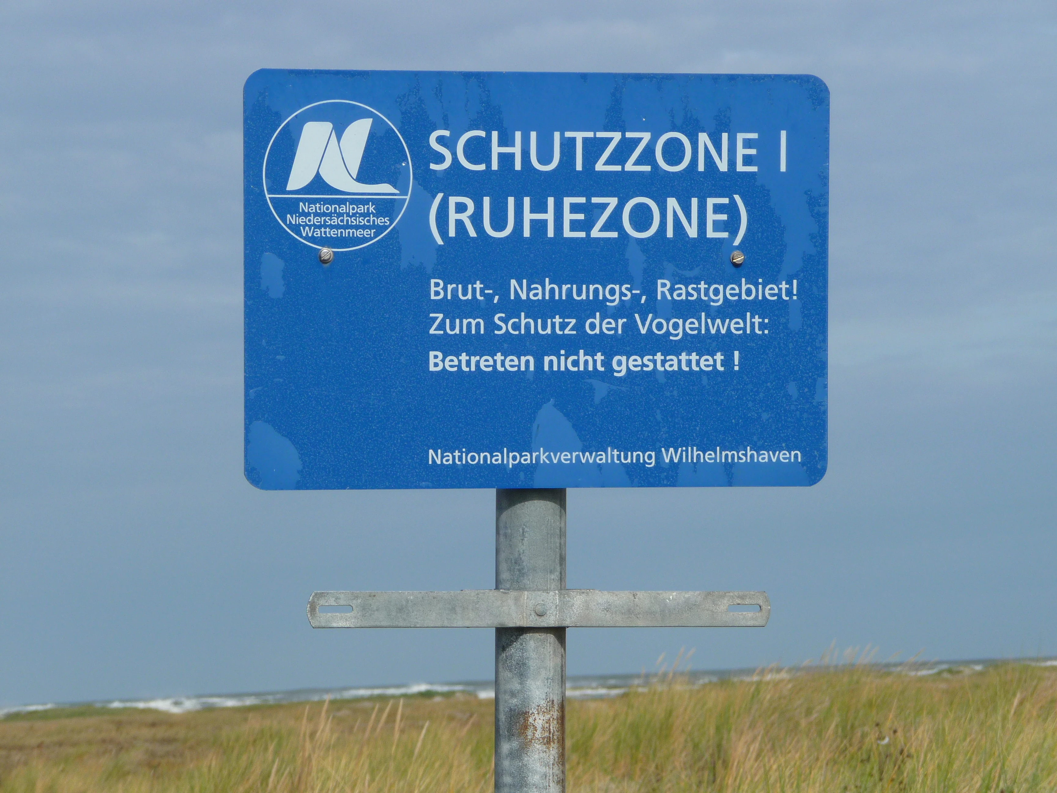
Blue sign with white text reading 'SCHUTZZONE I (RUHEZONE)', German instructions for bird protection, and 'Nationalparkverwaltung Wilhelmshaven' at bottom, mounted on metal pole with grassy field and sky in background
Blue sign marking a quiet zone in Lower Saxon Wadden Sea National Park with German text and park administration details

Lower Saxon Wadden Sea National Park wildlife and species highlights

The wildlife of Lower Saxon Wadden Sea National Park is characterized by extraordinary bird populations that use the area as breeding grounds, molting areas, and critical migratory stopovers. The common shelduck is particularly associated with the Wadden Sea—hundreds of thousands of these distinctive ducks feed on the mudflats, and the northwestern European population of approximately 180,000 birds spends its molting season from July to September in the Wadden Sea. Similarly, about 200,000 common eider ducks use the area for molting, and roughly 1,000 pairs breed on the islands, particularly Amrum. The entire Wadden Sea system hosts 10 to 12 million waders, geese, ducks, and gulls during migration, making it one of the most important bird migration corridors in Europe. The salt marshes provide breeding habitat for the pied avocet and various tern species, while seals—the common seal specifically—may be observed hauled out on sandbanks. The marine environment supports numerous fish species including those listed for protection under the EU Habitats Directive.
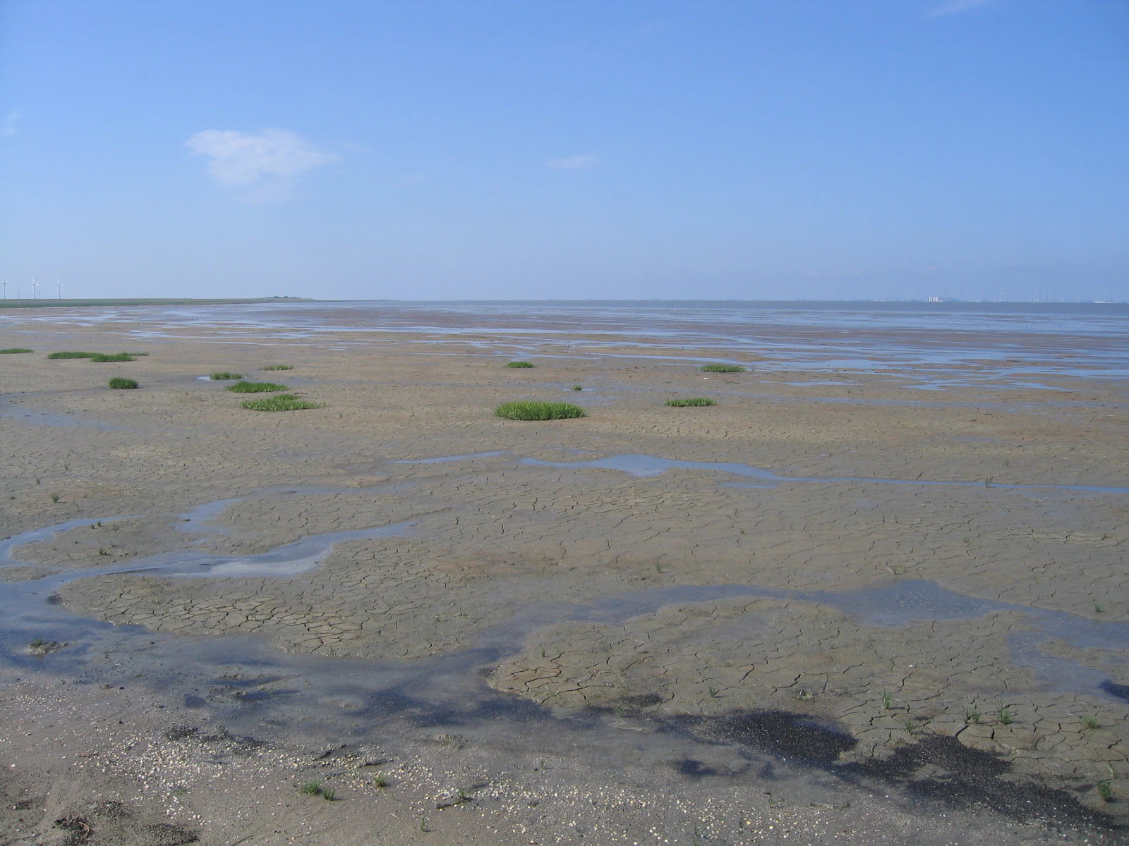
Wide expanse of tidal flats with shallow pools of water, patches of green vegetation, and clear blue sky.
View of the Wadden Sea mudflats from the Leyhörn peninsula showing tidal channels and sparse vegetation.

Lower Saxon Wadden Sea National Park conservation status and protection priorities

The park holds multiple layers of international protection reflecting its ecological significance. As a UNESCO World Heritage Site since 2009, it is recognized as having outstanding universal value requiring preservation for future generations. The Ramsar designation since 1976 acknowledges its importance as a wetland of international significance. As a European Union Natura 2000 site, the park is part of a network of protected areas designated under both the Birds Directive and the Habitats Directive—all zones are designated as bird reserves, while Zones I and II are Special Areas of Conservation. The park is managed as a biosphere reserve under UNESCO's Man and the Biosphere programme. However, conservation challenges persist, including commercial fishing within park boundaries, the spread of invasive Pacific oysters, significant bycatch in shrimp fisheries, marine litter, eutrophication from nutrient inputs, disturbance from kitesurfing in designated spots, and ongoing pressures from wind farm development near park boundaries.

Lower Saxon Wadden Sea National Park cultural meaning and human context

The East Frisian Islands within the park have a long human history of settlement and use. The inhabited islands—Borkum, Juist, Norderney, Baltrum, Langeoog, Spiekeroog, and Wangerooge—support communities whose identity is deeply intertwined with the sea and the shifting coastal landscape. Traditional activities like fishing and seafaring have shaped both the economy and the culture of these islands over centuries. The settlements and their associated infrastructure are excluded from national park protection, reflecting the reality that human habitation and nature conservation must coexist in this landscape. The relationship between island communities and the Wadden Sea is one of both dependence and respect—a recognition that the same forces that create the extraordinary ecology also shape the lives of those who call these islands home. The park also sits within a broader cultural region of Lower Saxony with strong connections to maritime history, trade, and the historical importance of ports like Wilhelmshaven.
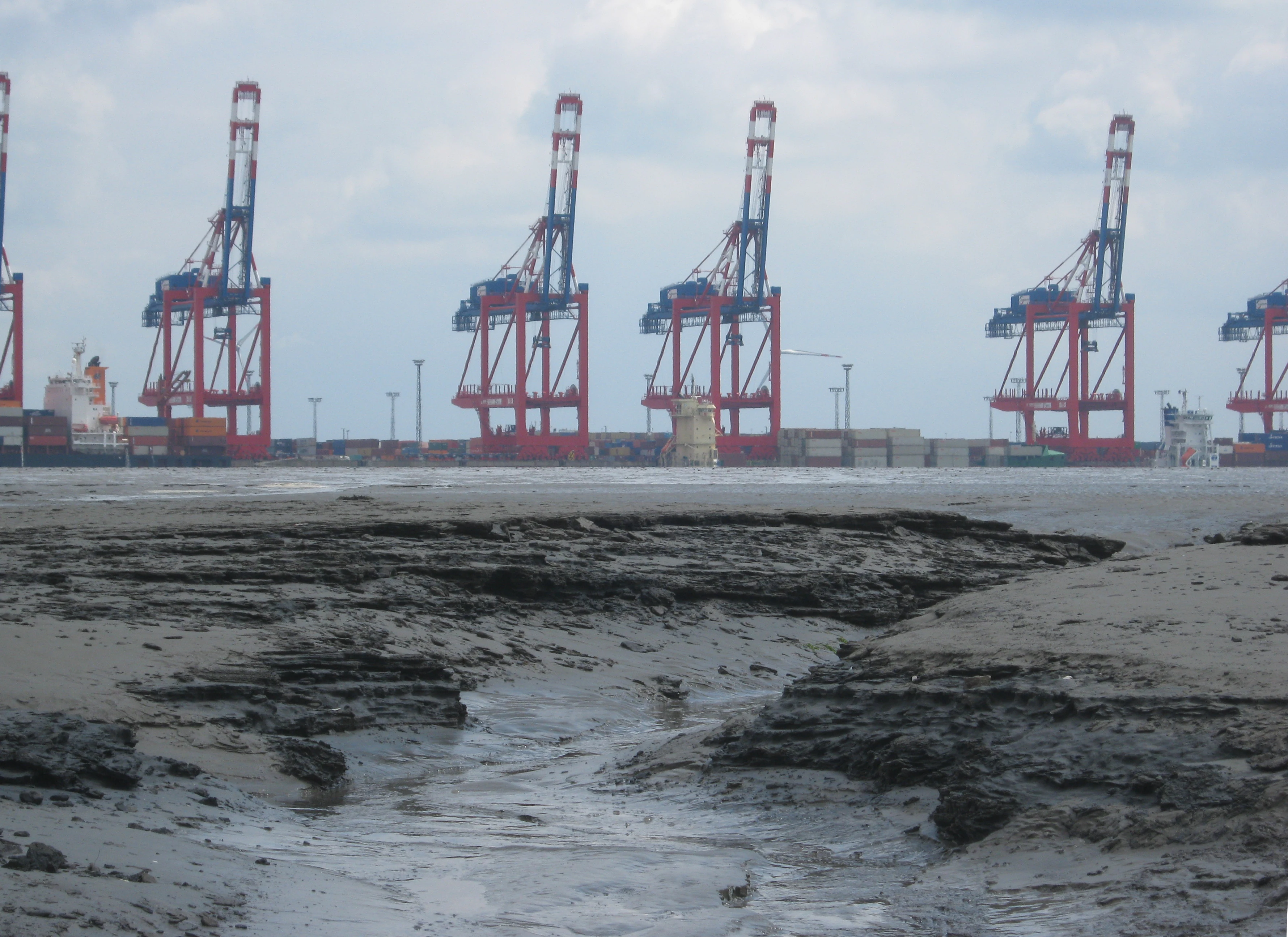
Tidal flat with mudflats in the foreground and industrial port cranes in the background under an overcast sky
Tidal flats with port cranes visible in the background

Top sights and standout views in Lower Saxon Wadden Sea National Park

The Lower Saxon Wadden Sea offers visitors access to one of Europe's last great coastal wildernesses, where the drama of the tidal cycle reveals and conceals vast mudflats twice daily. Guided mudflat walks provide safe opportunities to explore this unique environment and observe the specialized creatures that inhabit the sediments. The East Frisian Islands themselves—some inhabited with traditional tourism infrastructure, others preserved as strict wilderness reserves—offer diverse experiences from developed beach holidays to intimate encounters with nature. The birdlife is exceptional, with spring and autumn migration bringing millions of waders, ducks, and geese to the area. The seal populations are accessible and visible, often hauling out on sandbanks visible from shore or during boat excursions. The 2009 World Heritage designation elevated international recognition of this landscape, while the long tradition of Ramsar protection underscores its significance as a wetland of global importance.

Best time to visit Lower Saxon Wadden Sea National Park

The Wadden Sea can be explored throughout the year, though each season offers distinct experiences tied to the rhythms of bird migration and tidal patterns. Spring brings massive waves of migrating waders and waterfowl heading to northern breeding grounds, with the salt marshes coming alive with breeding activity. Summer offers the warmest conditions for beach activities on the islands and the fullest flowering of salt marsh vegetation, though this is also the peak tourist season. Autumn migration sees enormous concentrations of birds building fat reserves before their southward journey, and the molting season brings large flocks of shelduck and eider. Winter, while less conventionally appealing for beach activities, offers a stark beauty and the opportunity to witness the landscape in its most austere mood, with fewer visitors and a different quality of light across the mudflats. Tidal timing matters regardless of season—visitors should plan activities around the low-tide windows when mudflat exploration is possible.

Park guides

Targeted answers for planning visits to intertidal mudflats and coastal islands

Lower Saxon Wadden Sea National Park Focused Guide Preview

Selected published guides provide structured answers regarding optimal timing for exploring intertidal mudflats and coastal islands. Review specific timing considerations for experiencing seasonal weather patterns across the North Sea coastline.
Monthly climate preview

Long-term meteorological normals tracking coastal temperature ranges and daily precipitation trends

Average Temperature and Weather by Month in Lower Saxon Wadden Sea National Park

Decades of observations at a low-lying representative coordinate reveal an annual temperature cycle peaking near eighteen degrees Celsius alongside consistent year-round precipitation. Accessing the complete monthly climate dataset details the seasonal minimums and monthly precipitation variations across the coastal terrain.
Annual mean10 °C
2 °C18 °C
Jan
Feb
Mar
Apr
May12°
Jun15°
Jul18°
Aug18°
Sep15°
Oct11°
Nov
Dec
Warmest month
August

18 °C

Coolest month
January

2.3 °C

Wettest month
December

2.7 mm/day

Driest month
April

1.4 mm/day

Park location guide

Geography guide, regional context, and park location map for Lower Saxon Wadden Sea National Park

Lower Saxon Wadden Sea National Park park geography, regions, and map view in Germany

Understand where Lower Saxon Wadden Sea National Park sits in Germany through a broader geographic reading of the surrounding landscape, nearby location context, and its mapped position within the national park landscape.

How Lower Saxon Wadden Sea National Park fits into Germany

Germany is a federal republic in Western and Central Europe with a population of over 83 million across sixteen constituent states. It is Europe's largest economy by nominal GDP and a major global exporter and importer. The capital is Berlin, and the country borders Denmark, Poland, Czech Republic, Austria, Switzerland, France, Luxembourg, Belgium, and the Netherlands.

Wider geography shaping Lower Saxon Wadden Sea National Park in Germany

Germany is located in Western and Central Europe, spanning 357,022 km². It borders Denmark to the north, Poland and the Czech Republic to the east, Austria and Switzerland to the south, and France, Luxembourg, Belgium, and the Netherlands to the west. The country has coastlines on the Baltic Sea and North Sea to the north, with the Alps located in the southern region.

Map view of Lower Saxon Wadden Sea National Park

Use this park location map to pinpoint Lower Saxon Wadden Sea National Park in Germany, understand its exact geographic position, and read its mapped placement within the surrounding landscape more clearly.

Pigeon | © OpenStreetMap contributors

Location context for Lower Saxon Wadden Sea National Park

Lower Saxony
Natural feature types

Browse the Natural Features Atlas of Lower Saxon Wadden Sea National Park

Examine the geographic diversity of Lower Saxon Wadden Sea National Park through our curated list of named natural features. Use this structured atlas to trace the boundaries of coastal marshes, mudflats, and island chains throughout this unique North Sea ecosystem.
Recorded earthquake history

Explore the Historical Earthquake Record for Lower Saxon Wadden Sea National Park

Consult the historical catalogue of seismic activity associated with Lower Saxon Wadden Sea National Park. MoriAtlas provides a clear, data-driven view of recorded epicentres and event magnitudes to support your geographic exploration of this unique coastal landscape.

Lower Saxon Wadden Sea National Park Earthquake History

Catalogued events

8 events

Strongest magnitude

Magnitude 3.8

Most recent event

Nov 14, 2025

This history includes earthquakes recorded inside the park or within 50 km of its borders

Explore detailed imagery of the UNESCO World Heritage Wadden Sea, showcasing its unique mudflats, salt marshes, and East Frisian Islands' diverse scenery.

Lower Saxon Wadden Sea National Park Photos: A Visual Guide to Coastal Landscapes and Protected Habitats

Browse a curated collection of imagery that captures the distinctive landscapes of Lower Saxon Wadden Sea National Park, including its vast intertidal mudflats, dynamic salt marshes, and iconic East Frisian Islands. These photographs provide essential visual context for understanding Germany's significant coastal environment, revealing its rich biodiversity and the protected intertidal ecosystem along the North Sea.

Aerial view showing extensive sandbanks and tidal flats in the Lower Saxon Wadden Sea National Park with coastal vegetation in the foreground

Blue sign with white owl symbol and 'Nationalpark' text, mounted above a white sign reading 'Ruhezone' with prohibited activity symbols, set against sandy dunes and grassy background

Multi-level observation tower with people on platforms overlooking a coastal marsh and body of water under a partly cloudy sky

Blue sign with white text reading 'SCHUTZZONE I (RUHEZONE)', German instructions for bird protection, and 'Nationalparkverwaltung Wilhelmshaven' at bottom, mounted on metal pole with grassy field and sky in background

Wide expanse of tidal flats with shallow pools of water, patches of green vegetation, and clear blue sky.

Sunset over the Wadden Sea with tidal flats and a gradient sky from orange to blue

Tidal flat with mudflats in the foreground and industrial port cranes in the background under an overcast sky

Park atlas

Discover adjacent protected areas, mapping regional park geography and coastal landscapes surrounding Lower Saxon Wadden Sea.

Explore Other National Parks and Protected Areas Near Lower Saxon Wadden Sea

Explore national parks and protected areas near Lower Saxon Wadden Sea National Park, discovering other significant coastal landscapes, wetlands, and island ecosystems across the region. Comparing these adjacent protected areas provides valuable insights into regional conservation efforts, diverse intertidal habitats, and the broader North Sea geography.
Watercolor painting of a landscape with a winding river, green hills, and scattered vegetation under a pale sky
National parkHamburg
Park boundaries overlap#1 closest

East

Hamburg Wadden Sea National Park: North Sea Tidal Landscape and Protected Area

Explore the mapped geography of this unique coastal national park.

Hamburg Wadden Sea National Park, a vital part of the UNESCO-listed Wadden Sea, showcases a unique dynamic landscape of intertidal mudflats, sandbars, and dune islands. This protected national park provides critical habitat for numerous bird species and marine mammals, offering an unparalleled opportunity to study tidal ecosystem dynamics and coastal geography through detailed mapping and atlas exploration.

Area
137.5 km²
Established
1990
IUCN
II
Relief
Lowland
A soft, light-toned watercolor painting of a wetland landscape featuring green fields, a small path, a line of trees, and a distant low hill.
Nature reserveBremen
1.5 km away#2 closest

East

Luneplate Nature Reserve: A Detailed Geographic Atlas of Bremen's Coastal Wetland Landscapes

Protected estuarine habitats and tidal geography in the Weser river basin

Luneplate Nature Reserve offers a rich study of coastal wetland geography. Spanning the interface between the Weser river and the North Sea, the reserve features extensive mudflats, saltmarshes, and reedbeds. This protected landscape serves as an essential migratory hub, providing habitat for diverse waterbird populations within the maritime environment of Bremerhaven.

Area
14.38 km²
Established
2015
IUCN
IV
Watercolor illustration of a landscape with green hills, a body of water, and grassy foregrounds
National parkSchleswig-Holstein
2.5 km away#3 closest

Northeast

Schleswig-Holstein Wadden Sea National Park: Germany's Largest Protected Tidal Landscape

Explore the mapped geography of this vital North Sea national park.

Schleswig-Holstein Wadden Sea National Park is a monumental protected area, recognized globally as a UNESCO World Heritage Site for its extraordinary tidal wetland ecosystem. This page offers detailed insights into its geographic scope, from the North Frisian Islands to the Elbe estuary, highlighting the dynamic interplay of mudflats, salt marshes, and coastal terrain. Discover the park's critical role as a migratory bird flyway and marine nursery, providing rich data for geographic and atlas exploration of this unique North Sea protected landscape.

Area
4,410 km²
Established
1985
IUCN
II
Visitors
1.7M annual
A horizontal watercolor illustration showing a coastal landscape with soft pink and green hues, featuring small trees, marshy terrain, and a gentle horizon line.
Nature reserveLower Saxony
About 3.3 km away#4 closest

East

Cuxhavener Küstenheiden Nature Reserve: Geography and Coastal Heathland Atlas

Protected heath mosaic on the North Sea coast of Lower Saxony

Cuxhavener Küstenheiden stands as a landmark protected area along the German coast, showcasing an expansive mosaic of dry sand heaths, wet heathlands, and coastal dunes. This nature reserve acts as a vital bridge between the inland sandy terrain and the tidal Wadden Sea, providing a sustained habitat managed for ecological integrity through large-scale grazing.

Area
8.92 km²
Established
1983
IUCN
IV
Relief
Lowland
Nature reserveLower Saxony
3.6 km away#5 closest

East

Voslapper Groden-Süd Nature Reserve: Protected Wetland Map and Geographic Landscape

Coastal habitat mapping in Lower Saxony, Germany

Voslapper Groden-Süd represents a unique nature reserve on the North Sea coast of Lower Saxony, characterized by reclaimed land that has naturally evolved into a network of reedbeds and ponds. The site provides a critical avian refuge, set within a striking contrast of tidal geography and industrial surroundings, offering a valuable study in coastal conservation and land-use transition.

Area
3.88 km²
Established
2006
IUCN
IV
Relief
Lowland
A soft watercolor painting featuring a reflective water surface, grassy marshland in the foreground, a tree line in the midground, and rolling, misty hills in the background.
Nature reserveBremen
About 6.1 km away#6 closest

East

Düllhamm Nature Reserve: Protected Lowland Mosaic in Bremerhaven

Mapping the transitional forest and marshland terrain of Bremen.

Covering a small footprint, Düllhamm remains a vital nature reserve representing the lowland ecosystems of northern Germany. The area maps a unique gradient of dry oak-birch woodland shifting into wet meadows, boggy heath, and reed-covered marshes. This protected landscape offers a concentrated look at regional ecological patterns within the urbanized landscape of the Bremerhaven district.

Area
0.043 km²
Established
1984
Relief
Lowland
Climate
Temperate
Protected landscapeNiedersachsen
7.4 km away#7 closest

Southeast

Dornebbe, Braker Sieltief und Colmarer Tief: Mapped Protected Landscape in Niedersachsen

Geographic atlas of tidal lowland waterways and coastal habitats

Dornebbe, Braker Sieltief und Colmarer Tief comprises a chain of slow-flowing streams and bank habitats essential to the coastal marshland geography of Niedersachsen. The area provides a structured look at multi-layered habitat protection, featuring dense reedbeds and aquatic corridors vital for regional biodiversity in the German tidal zone.

Area
0.33 km²
Established
2018
Nature reserveLower Saxony
About 11 km away#8 closest

East

Wanhödener Moor Nature Reserve: Mapping Bog Ecology in Lower Saxony, Germany

Protected raised bog and coastal wetland landscapes

Located in the district of Cuxhaven, Wanhödener Moor represents a crucial fragment of original raised bog terrain in the North German Plain. This protected nature reserve provides insight into the historic human impact on peatlands and current conservation efforts to maintain wetland ecology and bog woodland transitions across the North Sea coastal region.

Area
0.39 km²
Established
1986
IUCN
IV
Relief
Lowland

Common questions about visiting, size, designation, and location context for Lower Saxon Wadden Sea National Park

Lower Saxon Wadden Sea National Park FAQs for park facts, access, geography, and protected area context

Find quick answers about Lower Saxon Wadden Sea National Park, including protected-area facts, park geography, trail and visitor context, and how the park fits into its surrounding country and regional landscape.
MoriAtlas Explorer

Continue Your Protected Areas Search Across the Global Atlas

Deepen your exploration by continuing the structured search for national parks and protected areas worldwide. Utilize the comprehensive filtering capabilities to compare different conservation landscapes and refine your understanding of global park geography. Discover more about the distribution and characteristics of protected natural areas.

Global natural geography