
Mori Atlas logo
Nature reserveVoslapper Groden-Süd

Exploring the mapped boundaries, tidal hydrology, and wetland mosaics of a North Sea coastal reserve

Voslapper Groden-Süd Nature Reserve and Protected Coastal Wetland Geography in Lower Saxony

(Naturschutzgebiet Voslapper Groden-Süd)

Voslapper Groden-Süd serves as a significant nature reserve on the North Sea coast of Lower Saxony, Germany, spanning 388 hectares of reclaimed land adjacent to Wilhelmshaven. This protected area features a distinct mosaic of flooded reedbeds, shallow ponds, and successional wetland vegetation. By tracing its geographic boundaries alongside major industrial infrastructure like the JadeWeserPort, one can understand the ecological importance of this site as a primary breeding, passage, and wintering location for protected bird species.

coastal wetlandreedbedsbird reserveNorth Sea coastLower SaxonyWertland
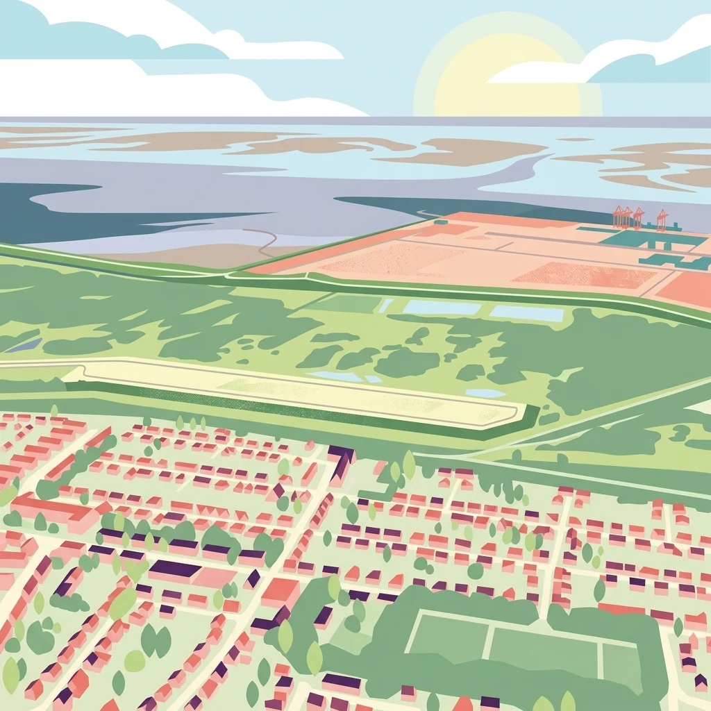
An aerial illustration showing a suburban housing grid in the foreground transitioning into green fields and finally the tidal mudflats and water of the Wadden Sea coast.

Voslapper Groden-Süd

Nature reserve

Park overview

Structured park overview, official facts, and landscape profile for Voslapper Groden-Süd

Voslapper Groden-Süd park facts, protected area profile, and essential visitor context

Review the core facts for Voslapper Groden-Süd, including designation, size, terrain, visitor scale, habitats, and operating context in one park-focused overview.

About Voslapper Groden-Süd

Voslapper Groden-Süd is a nature reserve on the German North Sea coast that illustrates how coastal landscapes shaped by industrial planning can evolve into ecologically valuable wetland habitats. Located in the northwestern part of Wilhelmshaven, the reserve sits on land that was deliberately reclaimed from the sea in the early 1970s for industrial development. When significant portions of the Groden were never built on, decades of natural colonization created a complex network of reedbeds, shallow ponds, scrub, and grassland that proved highly attractive to waterbirds and reed-dwelling passerines.

Today the protected area covers 388 hectares and forms the southern section of the larger Voslapper Groden landscape. It borders the Voslapp residential district to the west, lies south of the Wilhelmshaven refinery road, and faces the Inner Jade and the JadeWeserPort container terminal to the east. The juxtaposition of heavy port and refinery infrastructure with a thriving wetland reserve gives the site a distinctive character and makes it a notable case study in modern European coastal conservation.

The reserve is internationally framed within the EU Birds Directive framework, designated as the Bird Protection Area V61, and nationally protected under Lower Saxon ordinance. Its combination of tidal influence, low elevation, and the long process of ecological succession has produced a habitat mosaic that supports sensitive breeding birds and large numbers of migrants and wintering waterbirds, making it one of the highlights of Lower Saxony's coastal nature conservation network.

Quick facts and research context for Voslapper Groden-Süd

Voslapper Groden-Süd is a 388-hectare nature reserve in the city of Wilhelmshaven, Lower Saxony, in northwestern Germany. It lies north of the city center, east of the Voslapp district, and close to the JadeWeserPort and the Inner Jade. Officially protected since 1 June 2006 and identified as NSG WE 246, it is classified under IUCN Category IV (Habitat/Species Management Area). The reserve rests on reclaimed land at elevations between roughly minus 2 and plus 2 meters, and is administered by the city of Wilhelmshaven under the supervision of the Lower Saxony water and nature management authority (NLWKN).

Protection and recognition

Documented terrestrial protection scope and Natura 2000 designation data

Voslapper Groden-Süd Protection Status and International Recognition

Voslapper Groden-Süd maintains a recorded terrestrial protection scope supported by official Natura 2000 designation data. Structured records outline the international recognition framework and management context associated with this protected area.

International recognition

Protection details

Protection scope
Terrestrial
WDPA ID
378375
Park context

Deeper park guide and search-rich context for Voslapper Groden-Süd

Voslapper Groden-Süd history, landscape, wildlife, and travel context

Explore Voslapper Groden-Süd through its history, landscape character, ecosystems, wildlife, conservation priorities, cultural context, and seasonal travel timing in a structured park guide built for atlas discovery and search intent.

Why Voslapper Groden-Süd stands out

Voslapper Groden-Süd is best known for its extensive flooded reedbeds and shallow wetland mosaics, which provide critical habitat for several protected bird species of European conservation concern. Notable species regularly associated with the site include Eurasian bittern, spotted crake, bluethroat, Savi's warbler, sedge warbler, and water rail. The reserve has regional importance for ornithology in Lower Saxony, functioning simultaneously as a breeding ground, a migratory stopover, and a wintering area. Its ecological significance was formally recognized when the area was designated both as an EU Birds Directive site and a national nature reserve in 2006.
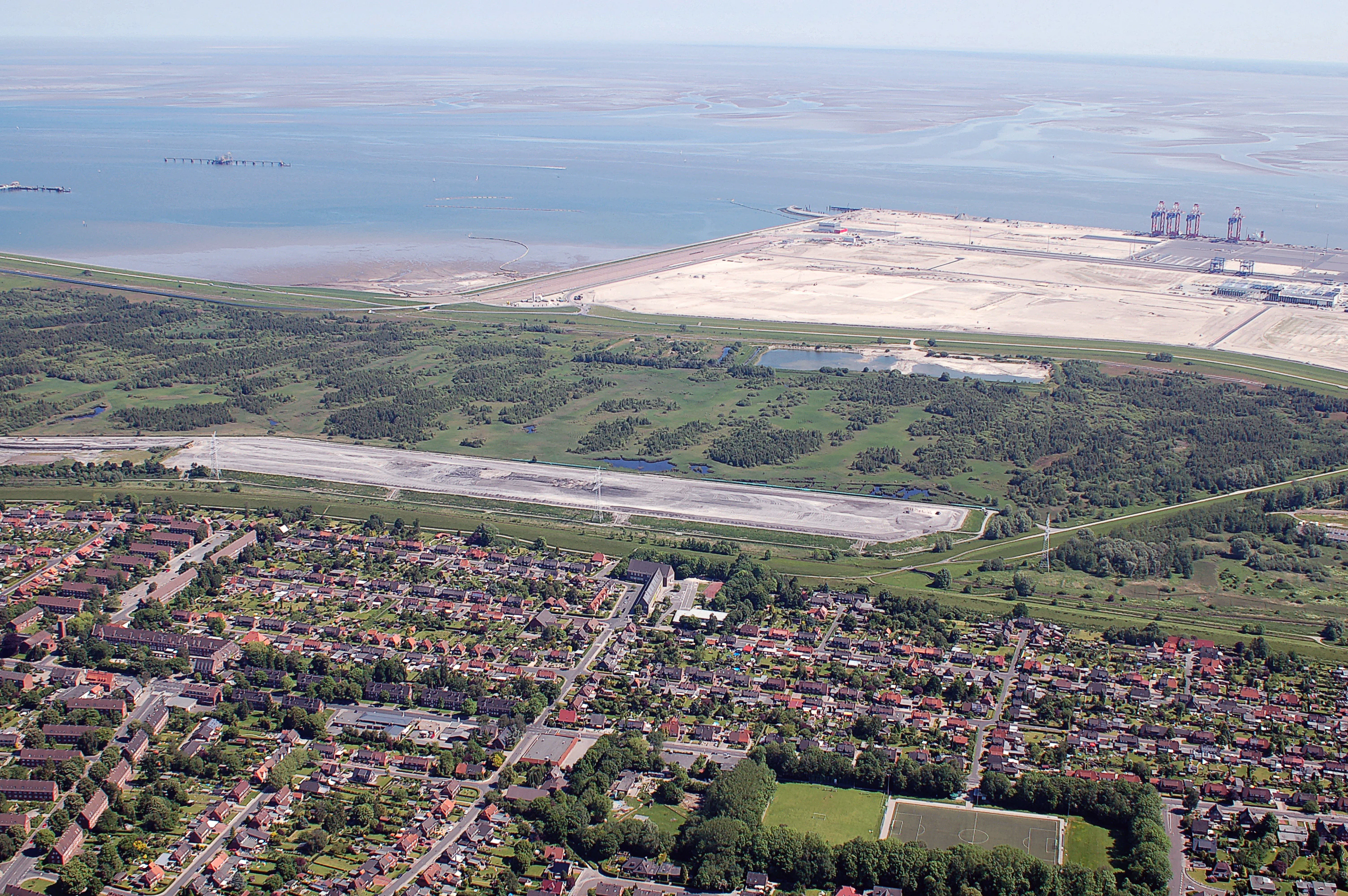
An aerial photograph showing the green, vegetated Voslapper Groden-Süd nature reserve situated between a residential district in the foreground and the North Sea coastline with large industrial facilities in the background.
Aerial view of Voslapper Groden-Süd nature reserve, adjacent to the North Sea coast and industrial infrastructure.

Voslapper Groden-Süd history and protected-area timeline

The Voslapper Groden was created between April 1971 and December 1974 through extensive land reclamation and sand infill, producing around 13.2 square kilometers of new coastal land east of Wilhelmshaven. The land was explicitly intended to attract industrial users. In September 1976 the Mobil Oil refinery began operations, followed in June 1981 by the ICI PVC plant. Additional areas continued to be used as sand deposition sites until 1979.

Planned follow-up developments, including a liquefied natural gas terminal, were never realized. As a result, large sections of the Voslapper Groden remained unused for decades. Over time these leftover plots underwent natural ecological succession, gradually developing into a mosaic of reedbeds, ponds, scrub, and rough vegetation that proved unusually favorable for protected bird species.

Parallel to this unplanned ecological development, the European Union introduced the Birds Directive, requiring member states to formally designate key areas for bird conservation. The then-undeveloped portion of the Groden was accordingly reported as the EU Bird Protection Area V61, and on 24 May 2006 a Lower Saxon ordinance formally established the southern section of the Groden as the national nature reserve Voslapper Groden-Süd. Bird Protection Area V61 was the forerunner of what would later become the EU-Vogelschutzgebiet V61 designation. The protection decision was therefore based not on the original industrial planning but on the actual ecological state and ornithological importance that had developed by 2006 and 2007.

Voslapper Groden-Süd landscape and geographic character

The landscape of Voslapper Groden-Süd is shaped by its position on the southern edge of the Inner Jade, a tidal inlet of the North Sea. The terrain is exceptionally flat, lying between roughly minus 2 meters and plus 2 meters above sea level, which means that much of the reserve is regularly influenced by groundwater levels and tidal hydrology. Reclamation embankments form the outer boundary of the Groden, separating the reserve from neighboring industrial zones.

Within this flat setting the surface is broken up by shallow freshwater ponds, flooded reed channels, sections of tall reedbed, scrubby transitional vegetation, and open pioneer habitats that recolonized the leftover reclamation land. The result is a fragmented coastal wetland mosaic rather than a single uniform habitat. To the west, the Voslapp district forms a clear urban edge, while to the south the protected area borders the Wilhelmshaven refinery road. To the east rises the broad industrial profile of the JadeWeserPort container terminal, and beyond it the open waters of the Inner Jade stretch toward the North Sea.

Voslapper Groden-Süd ecosystems, habitats, and plant life

Ecologically, Voslapper Groden-Süd falls within the broader family of North Sea coastal wetlands, but its character has been strongly shaped by artificial land creation and the absence of active management for many years. The unfilled reclamation plots gradually developed into a valuable patchwork of habitat types, with extensive areas of reedbed, shallow open water, damp grassland, scrub, and spontaneous woodland regeneration.

The combination of large flooded reedbeds and open shallow water is the defining ecological feature of the reserve. Hydrological conditions fluctuate with the seasons and with groundwater, meaning that the area regularly shifts between deeper flooded sections, shallowly inundated reed stands, and drier transitional zones. This dynamic hydrology supports a diverse community of wetland plants and creates structurally varied habitats for wildlife. Because the Groden lies at the interface between freshwater conditions inland and the brackish influence of the Jade nearby, the reserve also functions as an ecological transition zone typical of the southern North Sea coast.

Voslapper Groden-Süd wildlife and species highlights

Voslapper Groden-Süd is primarily recognized for its birdlife, which reflects the wetland character of the reserve. The site regularly hosts significant populations of several protected and ecologically sensitive species that depend on extensive reedbeds and shallow water. Among the characteristic species associated with the reserve are Eurasian bittern, spotted crake, water rail, bluethroat, Savi's warbler, and sedge warbler.

Beyond these flagship species, the combination of open water, reed margins, scrub, and rough vegetation supports a wider community of breeding, migrating, and wintering waterbirds and reed-dwelling passerines. The reserve is used seasonally as a breeding site for reedbed specialists, as a stopover area for migratory species moving along the North Sea coast, and as winter habitat for waterbirds that exploit the unfrozen shallow waters and reed fringes. Its proximity to the Jade also provides links to intertidal mudflat and estuarine feeding areas, extending the effective habitat range for many of the species recorded here.

Voslapper Groden-Süd conservation status and protection priorities

From a conservation perspective, Voslapper Groden-Süd is significant because it documents how unplanned land can acquire high ecological value and how a post-industrial landscape can be formally integrated into European nature protection networks. The reserve is the southern section of the larger Voslapper Groden complex and complements the separately protected Voslapper Groden-Nord, together forming a coordinated set of conservation areas for the western fringe of Wilhelmshaven.

The site is anchored in the EU Birds Directive framework as Bird Protection Area V61, an important designation within the broader Natura 2000 network, and is also protected at the national level through its Lower Saxony nature reserve status. Under IUCN categorization it falls under Category IV, Habitat/Species Management Area, indicating an active management approach focused on maintaining specific habitats and species rather than full wilderness protection.

Its conservation importance is heightened by its setting. Surrounded by refineries, container terminals, residential districts, and major transport corridors, the reserve provides a critical refuge for wetland-associated bird species in a region dominated by heavy industry and shipping. The protected status, combined with management oversight by the city of Wilhelmshaven and the Lower Saxony water and nature management authority (NLWKN), gives the site a formal role in maintaining biodiversity within one of the most industrialized stretches of the German North Sea coast.

Voslapper Groden-Süd cultural meaning and human context

The cultural context of Voslapper Groden-Süd is closely tied to the modern industrial identity of Wilhelmshaven rather than to ancient or traditional land use. The Groden itself only came into existence in the 1970s as part of a deliberate program to expand the city's industrial base, originally intended to host refineries, chemical plants, and energy terminals.

Because much of the planned expansion was never carried out, the reserve today represents an unintentional chapter in the city's development: the industrial vision faded, and the landscape that emerged instead became a piece of regional natural heritage. This makes the site a meaningful example of how the cultural and economic history of a North Sea port city directly shapes the geography of its protected natural areas, even where the protected habitat itself was never the original goal.

Top sights and standout views in Voslapper Groden-Süd

Voslapper Groden-Süd stands out as one of the most important bird reserves along the Lower Saxony North Sea coast, with 388 hectares of reedbeds, ponds, and successional wetland set against a striking industrial backdrop. Its combination of formal EU Birds Directive protection and national nature reserve status reflects a recognition of the reserve's importance for breeding, migrating, and wintering birds, while its location beside the JadeWeserPort and the Wilhelmshaven refinery gives it a distinctive profile among European coastal protected areas.

Best time to visit Voslapper Groden-Süd

The reserve offers different experiences across the seasons. Spring and early summer are the most rewarding periods for visitors interested in breeding birds, when reedbed species such as bittern, Savi's warbler, sedge warbler, and bluethroat are active in the vegetation and most vocal. Late summer and early autumn bring visible migration, with the shallow ponds and open water attracting waterbirds moving along the North Sea coast. Winter can also be of interest, as the milder conditions around the Jade and the unfrozen shallow waters of the Groden can support wintering waterfowl and reed-dwelling species. As with all active nature reserves, visitors should keep to public paths and observe disturbance-sensitive birds from a respectful distance.


Monthly climate preview

Long-term representative coordinate measurements for monthly temperature and precipitation rhythms

Voslapper Groden-Süd Climate Normals and Annual Temperature Patterns

Representative coordinate measurements reveal long-term monthly temperature ranges and steady precipitation averages for Voslapper Groden-Süd. Analyzing the complete twelve-month record provides a structured view of annual climate patterns across the protected landscape.
Annual mean9 °C
2 °C18 °C
Jan
Feb
Mar
Apr
May12°
Jun15°
Jul18°
Aug18°
Sep15°
Oct10°
Nov
Dec
Warmest month
August

17.9 °C

Coolest month
January

1.8 °C

Wettest month
December

2.5 mm/day

Driest month
April

1.3 mm/day

Park location guide

Geography guide, regional context, and park location map for Voslapper Groden-Süd

Voslapper Groden-Süd park geography, regions, and map view in Germany

Understand where Voslapper Groden-Süd sits in Germany through a broader geographic reading of the surrounding landscape, nearby location context, and its mapped position within the national park landscape.

How Voslapper Groden-Süd fits into Germany

Germany is a federal republic in Western and Central Europe with a population of over 83 million across sixteen constituent states. It is Europe's largest economy by nominal GDP and a major global exporter and importer. The capital is Berlin, and the country borders Denmark, Poland, Czech Republic, Austria, Switzerland, France, Luxembourg, Belgium, and the Netherlands.

Wider geography shaping Voslapper Groden-Süd in Germany

Germany is located in Western and Central Europe, spanning 357,022 km². It borders Denmark to the north, Poland and the Czech Republic to the east, Austria and Switzerland to the south, and France, Luxembourg, Belgium, and the Netherlands to the west. The country has coastlines on the Baltic Sea and North Sea to the north, with the Alps located in the southern region.

Map view of Voslapper Groden-Süd

Use this park location map to pinpoint Voslapper Groden-Süd in Germany, understand its exact geographic position, and read its mapped placement within the surrounding landscape more clearly.

Pigeon | © OpenStreetMap contributors

Location context for Voslapper Groden-Süd

Lower Saxony

Visualizing coastal wetland habitats and protected bird reserve terrain

Voslapper Groden-Süd Photos and Landscape Scenery

Visual documentation captures the flat coastal terrain, shallow ponds, and extensive reedbeds that define the reserve. Examining these protected area views reveals the unique environmental character of the coastal wetland mosaic.

An aerial photograph showing the green, vegetated Voslapper Groden-Süd nature reserve situated between a residential district in the foreground and the North Sea coastline with large industrial facilities in the background.

Park atlas

Compare nearby regional reserves and connected coastal wetland habitats across Lower Saxony

Explore Parks Near Voslapper Groden-Süd and Adjacent Coastal Protected Areas

Browsing other protected areas near Voslapper Groden-Süd reveals broader ecological patterns across the Lower Saxony coast. Examining adjacent wetland reserves provides valuable geographic context for understanding regional bird habitats and coastal terrain.
Watercolor painting showing coastal wetlands with mudflats, salt marshes, and distant hills under a soft light
National parkLower Saxony
3.6 km away#1 closest

West

Lower Saxon Wadden Sea National Park: Protected Coastal Landscape & Geography Atlas

Explore mapped boundaries, intertidal zones, and Lower Saxony's natural terrain.

Delve into the Lower Saxon Wadden Sea National Park, a significant national park situated in Lower Saxony, Germany. This page serves as your atlas entry point for understanding its protected landscape, characterized by vast mudflats, salt marshes, and a crucial role as a migratory bird corridor. Discover the geographic context of this UNESCO World Heritage site and its unique intertidal ecosystem through structured map data and detailed landscape information.

Area
345.8 km²
Established
1986
IUCN
II
Relief
Lowland
A soft, light-toned watercolor painting of a wetland landscape featuring green fields, a small path, a line of trees, and a distant low hill.
Nature reserveBremen
27 km away#2 closest

East

Luneplate Nature Reserve: A Detailed Geographic Atlas of Bremen's Coastal Wetland Landscapes

Protected estuarine habitats and tidal geography in the Weser river basin

Luneplate Nature Reserve offers a rich study of coastal wetland geography. Spanning the interface between the Weser river and the North Sea, the reserve features extensive mudflats, saltmarshes, and reedbeds. This protected landscape serves as an essential migratory hub, providing habitat for diverse waterbird populations within the maritime environment of Bremerhaven.

Area
14.38 km²
Established
2015
IUCN
IV
Protected landscapeNiedersachsen
30 km away#3 closest

Southeast

Dornebbe, Braker Sieltief und Colmarer Tief: Mapped Protected Landscape in Niedersachsen

Geographic atlas of tidal lowland waterways and coastal habitats

Dornebbe, Braker Sieltief und Colmarer Tief comprises a chain of slow-flowing streams and bank habitats essential to the coastal marshland geography of Niedersachsen. The area provides a structured look at multi-layered habitat protection, featuring dense reedbeds and aquatic corridors vital for regional biodiversity in the German tidal zone.

Area
0.33 km²
Established
2018
Nature reserveLower Saxony
About 31 km away#4 closest

Southeast

Strohauser Vorländer und Plate Nature Reserve: Geography and Protected Area Atlas

Tidal wetlands and freshwater habitats in Lower Saxony

The Strohauser Vorländer und Plate nature reserve protects a expansive tidal floodplain characterized by its river island geography, slow-moving side arms, and seasonal inundation patterns. As a focal point for meadow-bird monitoring, this site offers a clear view into the ecological dynamics of the Lower Weser river landscape, showcasing a rare combination of summer-dike-protected meadows and open freshwater tidal flats.

Area
11.52 km²
Established
2007
IUCN
IV
A soft watercolor painting featuring a reflective water surface, grassy marshland in the foreground, a tree line in the midground, and rolling, misty hills in the background.
Nature reserveBremen
About 35 km away#5 closest

East

Düllhamm Nature Reserve: Protected Lowland Mosaic in Bremerhaven

Mapping the transitional forest and marshland terrain of Bremen.

Covering a small footprint, Düllhamm remains a vital nature reserve representing the lowland ecosystems of northern Germany. The area maps a unique gradient of dry oak-birch woodland shifting into wet meadows, boggy heath, and reed-covered marshes. This protected landscape offers a concentrated look at regional ecological patterns within the urbanized landscape of the Bremerhaven district.

Area
0.043 km²
Established
1984
Relief
Lowland
Climate
Temperate
Nature reserveLandkreis Cuxhaven
About 35 km away#6 closest

Southeast

Teichfledermausgewässer Nature Reserve: Mapped Geography of the Lower Weser Lowland Waters

Protected riverine habitats and lowland water mosaic in Germany

Teichfledermausgewässer functions as a vital nature reserve within the Landkreis Cuxhaven region. This protected landscape encompasses a rich mosaic of oxbow stretches, lowland rivers, and former clay extraction pits that support rare wildlife. Through its integrated water bodies, the reserve forms a continuous conservation corridor that preserves the ecological integrity of the Lower Weser estuary and its unique floodplain ecosystems.

Area
6.33 km²
Established
2018
Watercolor painting of a landscape with a winding river, green hills, and scattered vegetation under a pale sky
National parkHamburg
38 km away#7 closest

Northeast

Hamburg Wadden Sea National Park: North Sea Tidal Landscape and Protected Area

Explore the mapped geography of this unique coastal national park.

Hamburg Wadden Sea National Park, a vital part of the UNESCO-listed Wadden Sea, showcases a unique dynamic landscape of intertidal mudflats, sandbars, and dune islands. This protected national park provides critical habitat for numerous bird species and marine mammals, offering an unparalleled opportunity to study tidal ecosystem dynamics and coastal geography through detailed mapping and atlas exploration.

Area
137.5 km²
Established
1990
IUCN
II
Relief
Lowland
Watercolor painting of a green and pink landscape featuring a forest line with tall grasses in the foreground and soft hills in the background.
Protected landscapeNiedersachsen
41 km away#8 closest

South

Elmendorfer Holz: Protected Landscape and Forest Ecology in Niedersachsen, Germany

Mapping lowland forest habitats and regional protected boundaries

Elmendorfer Holz is a significant protected area and forest reserve situated north of the Zwischenahner Meer. It is defined by its near-natural oak and hornbeam canopy and dense layering of conservation status. The forest serves as a vital ecological anchor within the broader agricultural mosaic of the Ammerland district, providing a clear reference for northwestern German lowland woodland characteristics.

Area
0.285 km²
Established
2007

Common questions about visiting, size, designation, and location context for Voslapper Groden-Süd

Voslapper Groden-Süd FAQs for park facts, access, geography, and protected area context

Find quick answers about Voslapper Groden-Süd, including protected-area facts, park geography, trail and visitor context, and how the park fits into its surrounding country and regional landscape.
MoriAtlas Explorer

Continue Your Protected Areas Search Across the Global Atlas

Deepen your exploration by continuing the structured search for national parks and protected areas worldwide. Utilize the comprehensive filtering capabilities to compare different conservation landscapes and refine your understanding of global park geography. Discover more about the distribution and characteristics of protected natural areas.

Global natural geography