Mori Atlas logo
National parkSchleswig-Holstein Wadden Sea National Park

Discover the vast extent of Germany's largest national park along the North Sea coast.

Schleswig-Holstein Wadden Sea National Park: A Mapped Protected Landscape and Tidal Ecosystem

(Nationalpark Schleswig-Holsteinisches Wattenmeer)

Schleswig-Holstein Wadden Sea National Park represents a crucial protected landscape situated along Germany's North Sea coast, stretching from the Danish border to the Elbe estuary. This UNESCO World Heritage Site is defined by its dynamic tidal ecosystem, encompassing extensive mudflats, salt marshes, and islands that create a unique geographic context. As a vital component of the Wadden Sea, it serves as a critical stopover for migratory birds and a habitat for marine life, offering unparalleled opportunities for atlas-based exploration of its vast, tide-influenced terrain and protected boundaries.

national parktidal wetlandmudflatsNorth Sea coastUNESCO World Heritage Sitesalt marshes
Illustration showing coastal landscape with tidal flats, cliffs, and sunset over the Wadden Sea

Schleswig-Holstein Wadden Sea National Park

National park

Park overview

Structured park overview, official facts, and landscape profile for Schleswig-Holstein Wadden Sea National Park

Schleswig-Holstein Wadden Sea National Park park facts, protected area profile, and essential visitor context
Review the core facts for Schleswig-Holstein Wadden Sea National Park, including designation, size, terrain, visitor scale, habitats, and operating context in one park-focused overview.

About Schleswig-Holstein Wadden Sea National Park

Schleswig-Holstein Wadden Sea National Park protects the German portion of the Wadden Sea, the world's largest connected system of tidal mudflats spanning the coasts of Denmark, Germany, and the Netherlands. The park extends from the Danish-German maritime border in the north to the Elbe estuary in the south, a distance of roughly 200 kilometers along the coast. Within this vast area, the park encompasses not only the mudflats themselves but also the North Frisian Islands—which include Sylt, Amrum, Föhr, and others—as well as the tiny Hallig islands that represent some of the lowest-lying inhabited land in Europe. The landscape is extraordinarily flat, with the North Sea coast descending only a few centimeters per kilometer, creating an environment where the twice-daily tides dramatically reshape the seafloor. The tidal range varies from less than two meters in the northern part near the Danish border to over three meters in the southern Dithmarschen region, influencing everything from sediment deposition to the types of habitats that can develop. The park's boundary extends to the twelve-mile territorial limit in the north but reaches only about three miles offshore in the southern section, while on the landward side it runs 150 meters offshore from the coast, deliberately excluding the sea dikes and their immediate forelands, which remain outside the protected zone. This configuration means that inhabited areas—including the five German North Frisian Islands and the larger Halligen—are also excluded from the park, creating a complex mosaic where human communities live surrounded by but not within the protected area. The park is administered from Tönning and employs approximately 85 staff with an annual budget of about seven million euros, operating as part of the state's integrated coastal defence and nature conservation agency.

Quick facts and research context for Schleswig-Holstein Wadden Sea National Park

Schleswig-Holstein Wadden Sea National Park covers 441,500 hectares along the German North Sea coast, making it Germany's largest national park. The protected area encompasses the North Frisian Islands, the Hallig islands, extensive mudflats, salt marshes, and shallow marine waters. Established in 1985 through the National Park Act and expanded in 1999, the park is part of a trilateral Wadden Sea protection regime involving Germany, Denmark, and the Netherlands. It holds multiple international designations including UNESCO World Heritage status, Ramsar Wetland status, and BIOSPHERE reserve recognition. The park supports approximately 700 plant species and 2,500 animal species, with about 10% being endemic to the Wadden Sea. The administration is based in Tönning, and the park is integrated into the Agency for Coastal Defence, National Park and Marine Conservation of Schleswig-Holstein.

Park context

Deeper park guide and search-rich context for Schleswig-Holstein Wadden Sea National Park

Schleswig-Holstein Wadden Sea National Park history, landscape, wildlife, and travel context
Explore Schleswig-Holstein Wadden Sea National Park through its history, landscape character, ecosystems, wildlife, conservation priorities, cultural context, and seasonal travel timing in a structured park guide built for atlas discovery and search intent.

Why Schleswig-Holstein Wadden Sea National Park stands out

Schleswig-Holstein Wadden Sea National Park is best known for its extraordinary tidal ecosystem, which represents one of the largest connected mudflat systems in the world. The park is famous for hosting the world's largest mass moult gathering of common shelduck, with over 80% of the northwest-European population concentrating around the protected island of Trischen each July through September. It is also renowned for its significant harbour porpoise population, which prompted the designation of Europe's first whale sanctuary in 1999. The park contains particularly extensive eelgrass beds covering approximately 6,000 hectares in the northern section, providing critical habitat for marine organisms and serving as an important food source for barnacle geese. The North Frisian Halligen, a handful of tiny undyked islands rising just above the sea, represent one of the most distinctive landscapes in the Wadden Sea and embody the region's fragile relationship with the North Sea.

Arctic tern with outstretched wings flying against a clear blue sky
Arctic tern in flight against a clear blue sky

Schleswig-Holstein Wadden Sea National Park history and protected-area timeline

The protection of the Wadden Sea in Schleswig-Holstein has roots dating back to the 1920s, when the first conservation areas were established at Sylt-Nord and the Morsum cliff on the island of Sylt—these remain the oldest nature reserves in Schleswig-Holstein, dating from 1923. Throughout the following decades, additional conservation areas were created, primarily focused on protecting bird species and their habitats. By the 1960s, scientific thinking had shifted toward protecting entire ecosystems rather than individual species, and the first proposals emerged to protect the entire Wadden Sea. The concept of a national park was first suggested by local hunting associations in 1972, two years after Germany's second national park was established in the Bavarian Forest, but initial legislative attempts in 1973 and 1974 faced strong local resistance and were withdrawn. The movement toward formal protection gained momentum through international cooperation, with the first trilateral intergovernmental conference on Wadden Sea protection held in 1978 and a joint declaration signed in The Hague in 1982. Ultimately, the Schleswig-Holstein state parliament passed the National Park Act in July 1985, creating a 272,000-hectare protected area that came into force on October 1, 1985—making it the third national park in Germany after the Bavarian Forest and Berchtesgaden. The establishment was controversial, with local fishing and farming communities protesting what they perceived as government overreach and a threat to their traditional livelihoods and freedom. The park was significantly expanded in 1999 following an eight-hundred-page ecosystem synthesis report that summarized seven years of scientific monitoring. This expansion generated new protests, including a demonstration by 143 shrimp fishermen who sailed their boats through the Kiel Canal to the state parliament, and incidents where locals threw eggs at the responsible minister. Despite the controversies, the expansion added substantial new areas to the park and introduced additional protections, including the whale sanctuary for harbour porpoises. The park achieved international recognition as a UNESCO World Heritage Site in 2009, together with the Dutch and Lower Saxon Wadden Sea areas.

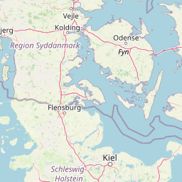
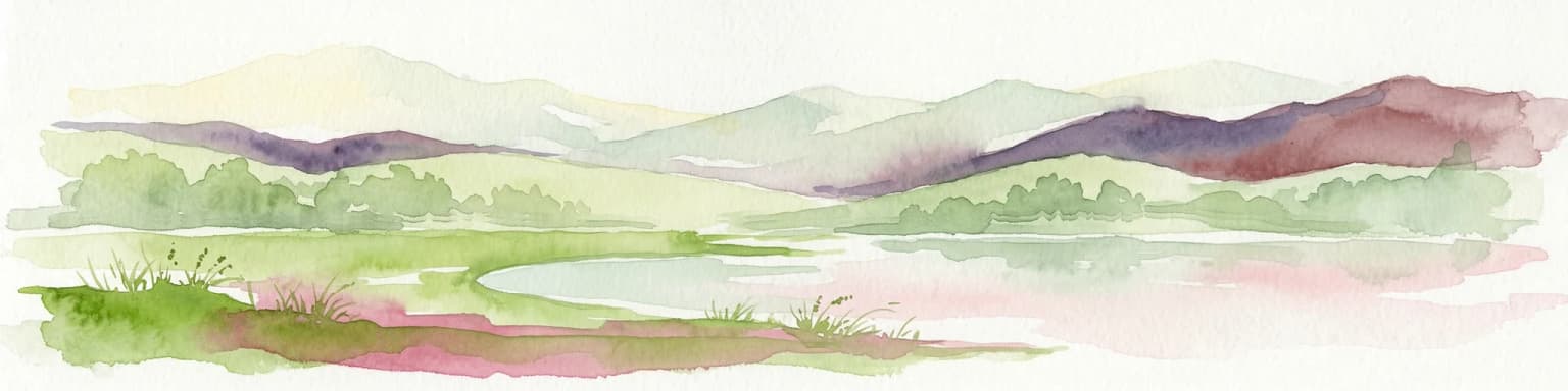
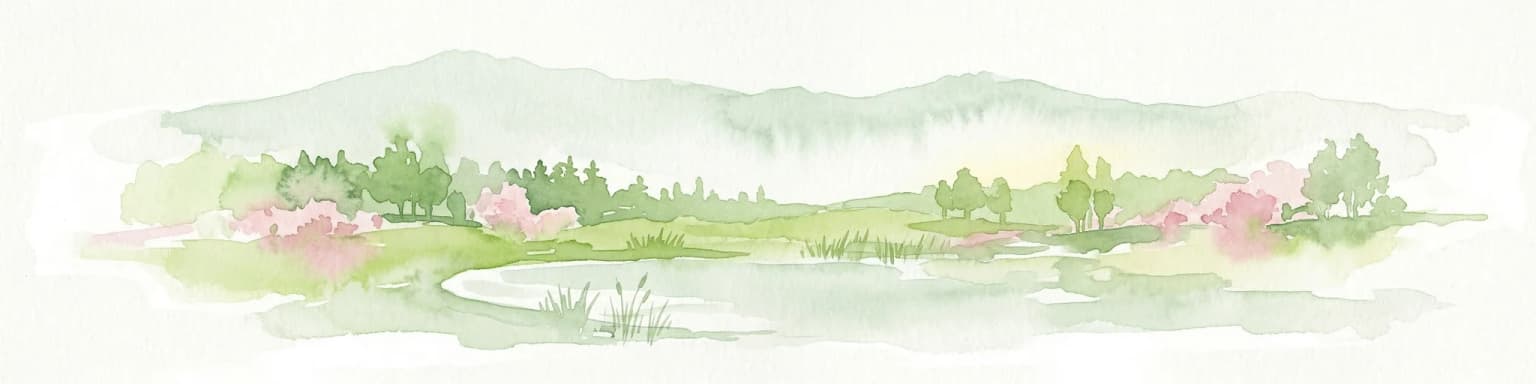
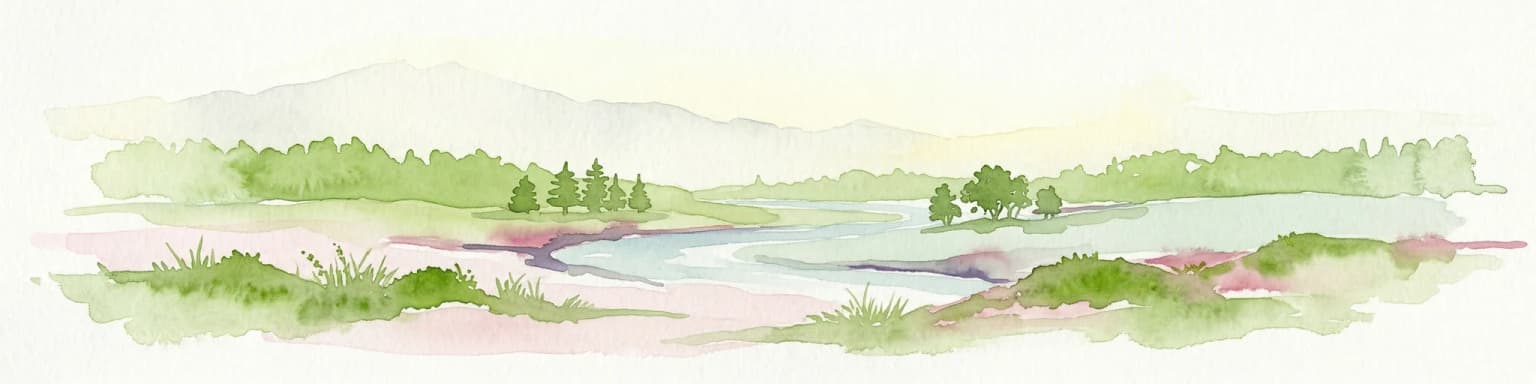
Schleswig-Holstein Wadden Sea National Park landscape and geographic character

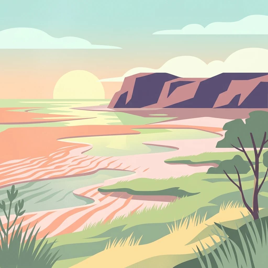
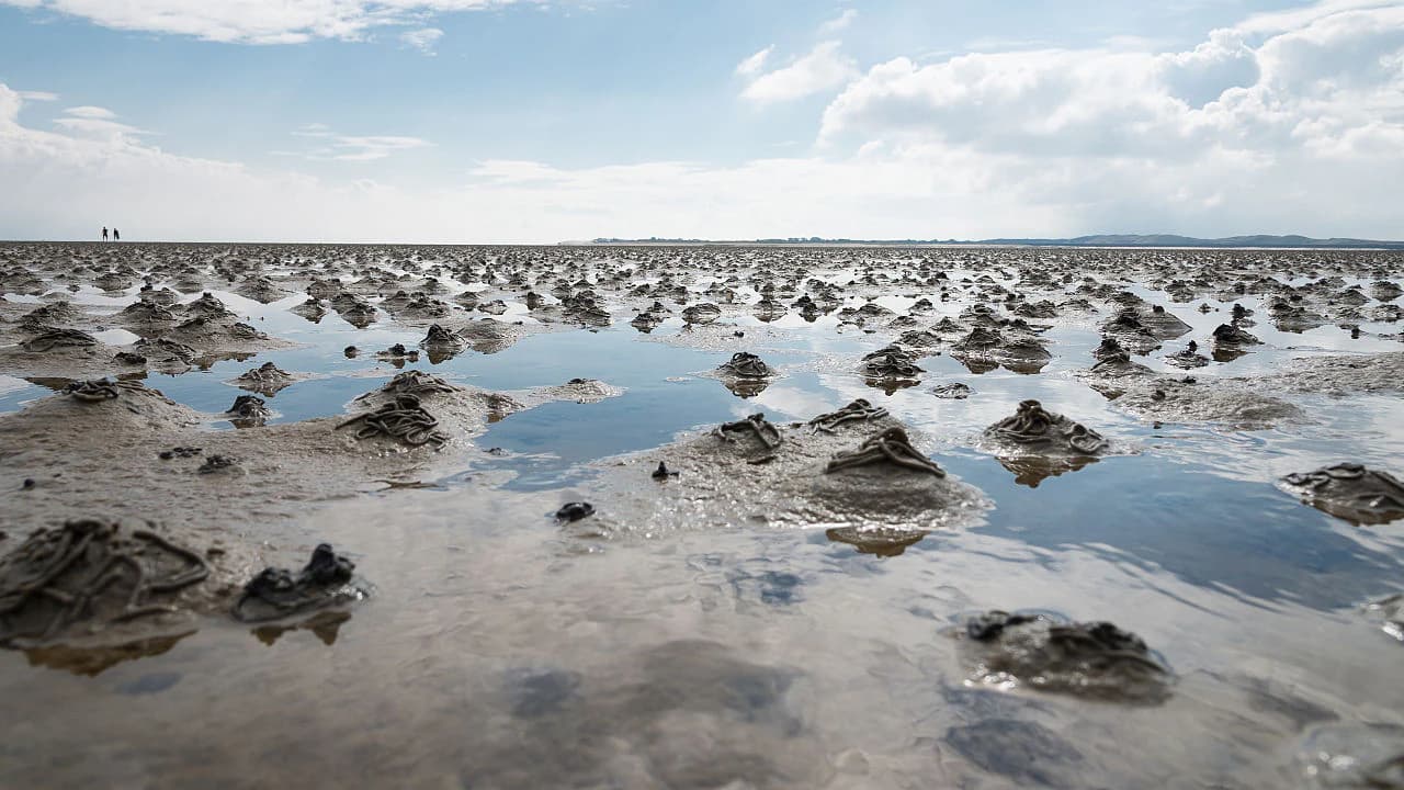
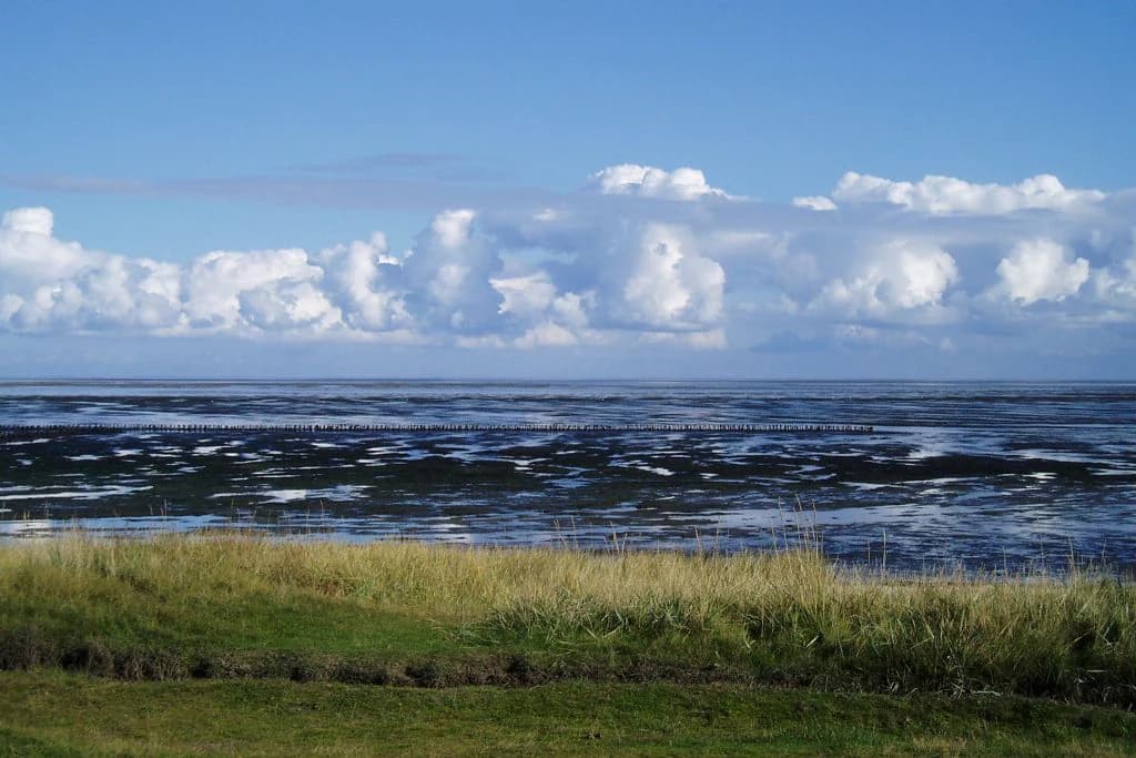
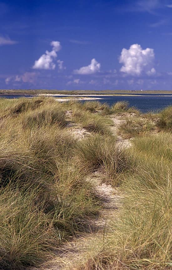
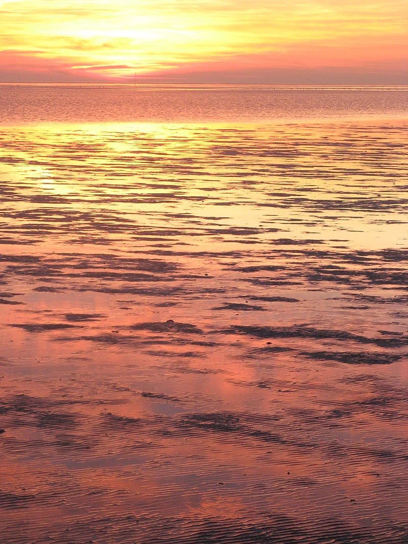
The landscape of Schleswig-Holstein Wadden Sea National Park is defined by the endless interplay between sea and land created by the twice-daily tides. The North Sea coast here is extraordinarily flat, with the ocean floor descending only a few centimeters per kilometer, creating an environment where even modest tidal changes dramatically alter the extent of exposed seabed. The park can be divided into two main geographic regions: the North Frisian Wadden Sea in the north, characterized by its chain of barrier islands and the tiny Hallig islands, and the Dithmarschen Wadden Sea in the south, which lacks significant islands but contains important sandbanks. In the North Frisian area, the mudflats reach up to 40 kilometers in width and are protected from the open sea by the barrier islands and Halligen. These islands formed primarily from mainland areas that became separated over centuries as a result of catastrophic storm floods, and they still retain geest cliffs from the ice ages—the highest elevations in an otherwise flat landscape. The Halligen are particularly distinctive, consisting of small mounds of land that rise just a few meters above sea level, lacking the protective dikes that defend the more developed islands and mainland. South of the Eiderstedt peninsula, the Dithmarschen region features a tidal range exceeding three meters, which has largely prevented the formation of islands, though sandbanks including Trischen do emerge from the sea. Several large river estuaries—including those of the Elbe and Eider—bring freshwater influence to the southern Wadden Sea, creating lower and more variable salinity than in the north. The land areas within the park consist almost entirely of salt marshes covering over 10,000 hectares, with smaller areas of sandbars and dunes. These salt marshes, which formed largely behind breakwaters or on the lee sides of islands, represent the transition zone between open sea and the diked mainland. The park experiences an Atlantic climate characterized by cool summers with average July temperatures around 14.5°C and mild winters with January averages of approximately 1.8°C, with strong westerly winds being a persistent feature.

A wide view of muddy tidal flats with small pools of water reflecting the sky
Mudflat landscape of the Schleswig-Holstein Wadden Sea National Park with tidal pools and mud mounds

Schleswig-Holstein Wadden Sea National Park ecosystems, habitats, and plant life

The Wadden Sea represents one of the most productive and ecologically significant coastal ecosystems in Europe, supporting a remarkable diversity of habitats within a relatively small area. The park's nature is characterized by three primary zones: the permanently underwater sublittoral zone covering over two-thirds of the area, the intertidal mudflats that alternate between exposure and flooding (the eulittoral zone comprising about 30% of the park), and the supralittoral zone of salt marshes and dunes that are flooded only during extreme high tides or storm events. The salt marshes represent the most distinctive terrestrial habitat, forming a complex zonation of plant communities that correlates with flooding frequency and salinity. The lower marsh zone, flooded most frequently, is dominated by glasswort and saltmarsh grass, while the upper marsh supports a more diverse community including sea aster, sea-blite, sea-purslane, and the distinctive red fescue grass that gives this zone its name. Eelgrass represents the only flowering plant capable of growing permanently underwater in the Wadden Sea, forming extensive meadows covering approximately 6,000 hectares in the northern part of the park—a remarkable concentration compared to just 705 hectares in Lower Saxony and 130 hectares in the Netherlands. These eelgrass beds provide critical habitat for marine organisms and serve as an important food source for wintering barnacle geese. The park supports approximately 700 plant species and 2,500 animal species, with about 10% being endemic to the Wadden Sea—a remarkable concentration of biodiversity for a seemingly uniform landscape.

Grassy coastal field leading to tidal flats with water and clouds in the background
Coastal view of the Schleswig-Holstein Wadden Sea National Park showing grassy foreground, tidal flats, and cloudy sky

Schleswig-Holstein Wadden Sea National Park wildlife and species highlights

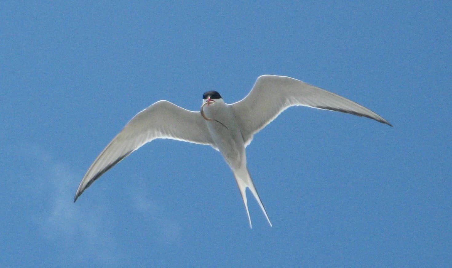
The wildlife of Schleswig-Holstein Wadden Sea National Park is exceptionally rich, with the tidal wetlands serving as a critical nursery ground for marine species and a major staging area for migratory birds. Marine mammals form a prominent part of the park's wildlife, with harbour porpoises being particularly abundant—the 1999 establishment of a 124,000-hectare whale sanctuary along the western coast of Sylt marked Europe's first protected area specifically for small cetaceans. Harbour seals rest and breed on sandbanks throughout the park, with approximately 13,000 individuals counted in 2017 in the Schleswig-Holstein portion, though population suffered significant losses during disease outbreaks in 1988 and 2002. Grey seals, though present in smaller numbers (approximately 140 individuals), maintain significant resting colonies on sandbanks near Amrum. The birdlife is perhaps most spectacular, with the Wadden Sea hosting over ten million migratory birds during spring and autumn passage—making it the most important bird area in Europe. The most famous wildlife phenomenon is the mass moult gathering of common shelduck, during which over 80% of the northwest-European population of approximately 180,000 birds congregates around the protected island of Trischen between July and September, a phenomenon unique in the world. Similarly, around 200,000 eider ducks use the area for moult, and large concentrations of barnacle geese (over 60,000) and brent geese (about 84,000) winter on the islands and Halligen. The mudflats support a rich invertebrate fauna including the lugworm (perhaps the most famous animal of the Wadden Sea), common cockles, blue mussels, shore crabs, brown shrimp, and numerous barnacles. Several fish species use the area as spawning grounds, particularly flatfish such as plaice.

Grassy dunes with a sandy path leading to the sea under a blue sky with clouds
Grassy dunes leading to the sea in the Schleswig-Holstein Wadden Sea National Park

Schleswig-Holstein Wadden Sea National Park conservation status and protection priorities

Schleswig-Holstein Wadden Sea National Park holds multiple international conservation designations that reflect its outstanding universal value. As part of the transboundary Wadden Sea World Heritage Site inscribed in 2009, the park is recognized for its relatively undisturbed intertidal ecosystem and unique biodiversity—a designation that extends to the Dutch and Lower Saxon portions and was later joined by the Hamburg Wadden Sea (2011) and the Danish National Park Vadehavet (2014). The park has been a Ramsar Wetland of International Importance since 1991, acknowledging its significance as a habitat for waterbirds and marine wetlands. Since 1990, the park and the five Hallig islands have been recognized as a UNESCO Biosphere Reserve. Within the European Union's Natura 2000 network, the park is designated as a Special Area of Conservation under the Habitats Directive and a Special Protection Area under the Birds Directive. The park is divided into two protection zones with different levels of protection: Zone 1 covers approximately 162,000 hectares and constitutes the core protected area with restrictions on public access, while Zone 2 serves as a buffer zone allowing sustainable use including fishing and recreational activities. A zero-use zone of 12,500 hectares was established south of the Hindenburgdamm as a reference area, though its effectiveness has been questioned by scientists. Despite these protections, the Wadden Sea faces ongoing challenges including the impacts of bottom trawling on food resources for birds, the spread of the invasive Pacific oyster, and the effects of climate change on tidal patterns and species distributions.

Schleswig-Holstein Wadden Sea National Park cultural meaning and human context

The Wadden Sea landscape has been shaped by centuries of human interaction, with coastal communities developing alongside and often in conflict with the dynamic tidal environment. The Hallig islands represent perhaps the most culturally distinctive feature—these tiny, low-lying islands lack the protective dikes found elsewhere, and their inhabitants have historically lived in constant awareness of the threat of storm surges. Today only about five people live permanently within the park boundaries, on the islands of Süderoog, Trischen, and Südfall, though approximately 290,000 people live in the 70 communities bordering the park. The Frisian cultural identity runs strong in the region, particularly in North Frisia, and local communities have historically valued their autonomy and traditional ways of life—a sentiment that fueled significant protests against the national park establishment in 1985 and the expansion in 1999. The traditional livelihoods of shrimp fishing, sheep grazing on salt marshes, and mussel cultivation remain important, though they increasingly operate within the framework of park regulations and sustainability agreements. The relationship between the local population and the Wadden Sea is captured in the Frisian concept of the Hallig—where people and landscape exist in a delicate balance shaped by the rhythms of tide and weather. The park administration has worked to increase local acceptance through numerous cooperative agreements and platforms that involve communities in management decisions, and surveys now show approximately 85% local support for the park's continuation.

Group of people standing on a reflective mudflat under clear blue sky with visible reflections in wet sand.
Group of visitors participating in a guided mudflat excursion in the Schleswig-Holstein Wadden Sea National Park.

Top sights and standout views in Schleswig-Holstein Wadden Sea National Park

The most spectacular highlight of Schleswig-Holstein Wadden Sea National Park is the mass moult gathering of common shelduck around Trischen island, where over 80% of the northwest-European population concentrates during July through September in what is believed to be a globally unique phenomenon. The harbour porpoise sanctuary along the western coast of Sylt represents another landmark achievement, being Europe's first protected area specifically designated for small cetaceans. The North Frisian Hallig islands—with their distinctive church steeples rising from seemingly impossible distances above sea level—offer one of the most iconic landscapes of the Wadden Sea and embody the region's historical struggle between human settlement and marine forces. The extensive eelgrass beds in the northern part of the park, covering approximately 6,000 hectares, represent a remarkable concentration that supports a whole community of marine organisms and provides critical foraging habitat for wintering barnacle geese. The annual migration of millions of birds through the Wadden Sea, including huge flocks of barnacle geese, brent geese, and eider ducks, creates one of Europe's most impressive wildlife spectacles. The Multimar Wattforum visitor center in Tönning, receiving approximately 200,000 visitors annually, provides comprehensive interpretation of the park's natural values and World Heritage status.

Sunset over calm tidal waters with orange and yellow sky reflections
Sunset over the Wadden Sea with vibrant orange and yellow hues reflecting on calm waters

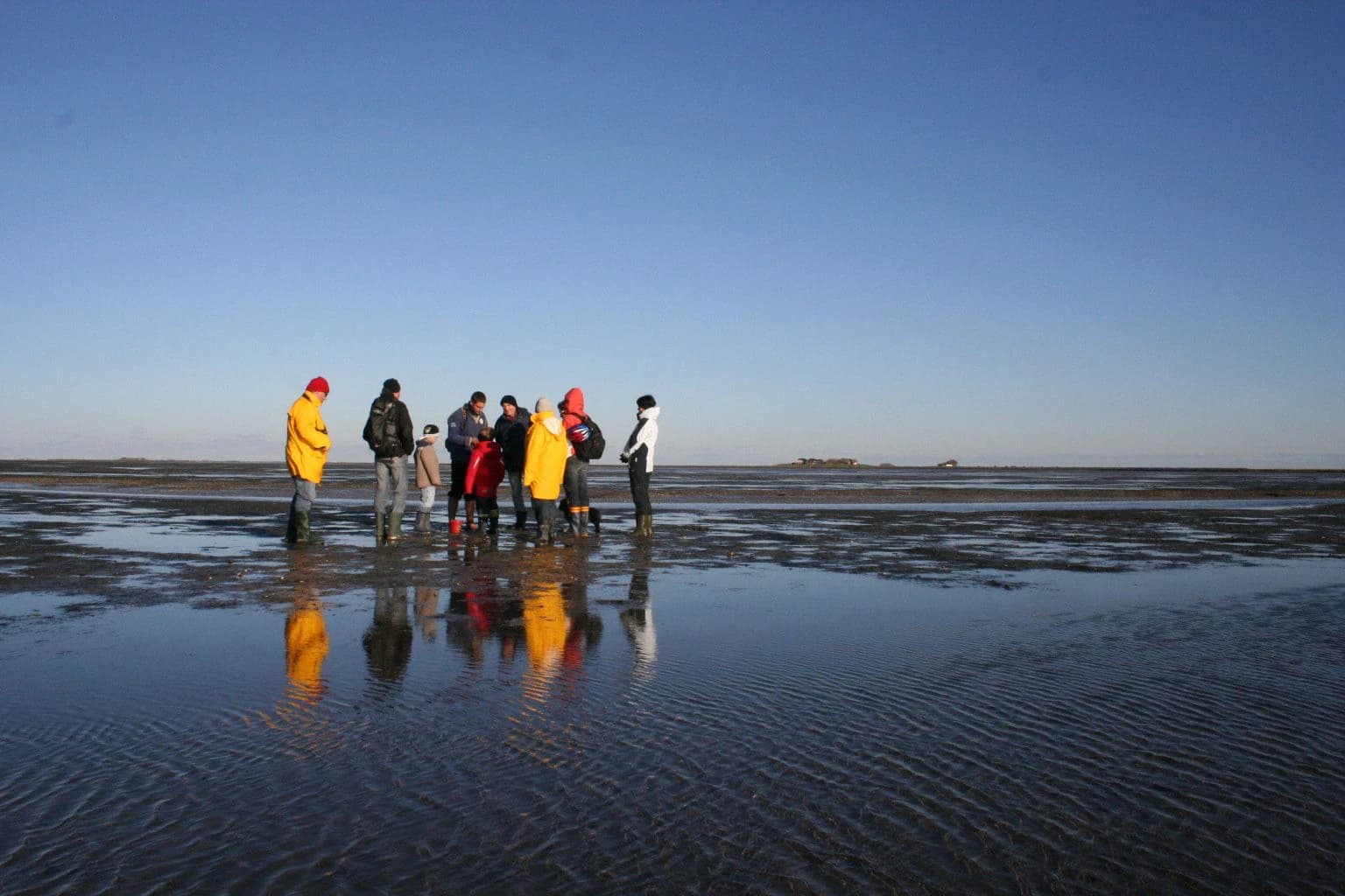
Best time to visit Schleswig-Holstein Wadden Sea National Park

The Wadden Sea offers distinct experiences throughout the year, each season revealing different aspects of this dynamic ecosystem. Spring and autumn represent the most spectacular times for birdwatching, when millions of migratory birds use the mudflats as a crucial refueling station along their journeys between breeding and wintering grounds—late April through May and September through October offer the best opportunities to witness these mass movements. The summer months of July through September host the extraordinary mass moult gathering of common shelduck, when over 80% of the northwest-European population concentrates around Trischen island, creating a unique wildlife spectacle found nowhere else in the world. However, summer also brings the largest crowds of visitors, with mudflat hiking tours being particularly popular. The winter months, while quieter, offer a different character—with fewer tourists but also shorter daylight hours limiting the time available for exploration. The experience of the Wadden Sea is fundamentally shaped by the tidal cycle, regardless of season, and visitors should plan activities around the times of low tide when mudflat hiking is possible. The cool, maritime climate means that even summer temperatures are moderate, and visitors should be prepared for changeable weather with strong winds possible in any season.

Park location guide

Geography guide, regional context, and park location map for Schleswig-Holstein Wadden Sea National Park

Schleswig-Holstein Wadden Sea National Park park geography, regions, and map view in Germany
Understand where Schleswig-Holstein Wadden Sea National Park sits in Germany through a broader geographic reading of the surrounding landscape, nearby location context, and its mapped position within the national park landscape.

How Schleswig-Holstein Wadden Sea National Park fits into Germany

Germany is a federal republic in Western and Central Europe with a population of over 83 million across sixteen constituent states. It is Europe's largest economy by nominal GDP and a major global exporter and importer. The capital is Berlin, and the country borders Denmark, Poland, Czech Republic, Austria, Switzerland, France, Luxembourg, Belgium, and the Netherlands.

Wider geography shaping Schleswig-Holstein Wadden Sea National Park in Germany

Germany is located in Western and Central Europe, spanning 357,022 km². It borders Denmark to the north, Poland and the Czech Republic to the east, Austria and Switzerland to the south, and France, Luxembourg, Belgium, and the Netherlands to the west. The country has coastlines on the Baltic Sea and North Sea to the north, with the Alps located in the southern region.

Map view of Schleswig-Holstein Wadden Sea National Park

Use this park location map to pinpoint Schleswig-Holstein Wadden Sea National Park in Germany, understand its exact geographic position, and read its mapped placement within the surrounding landscape more clearly.

Pigeon | © OpenStreetMap contributors

Location context for Schleswig-Holstein Wadden Sea National Park

Schleswig-Holstein

Explore the Wadden Sea's dynamic tidal ecosystems, salt marsh terrain, and coastal protected area character through immersive imagery.

Schleswig-Holstein Wadden Sea National Park Photos: Explore Tidal Mudflats, Salt Marshes, and North Sea Coastal Scenery
Explore the distinctive landscapes of Schleswig-Holstein Wadden Sea National Park through its rich visual representation. Gain insight into the expansive tidal mudflats, vital salt marshes, and unique coastal habitats that define this UNESCO World Heritage Site, deepening your understanding of its protected environment and dynamic terrain.

Arctic tern with outstretched wings flying against a clear blue sky

Sunset over the Wadden Sea with pink and orange sky reflections on the water's surface showing mudflat patterns

A wide view of muddy tidal flats with small pools of water reflecting the sky

Grassy coastal field leading to tidal flats with water and clouds in the background

Grassy dunes with a sandy path leading to the sea under a blue sky with clouds

Aerial view of coastal landscape with visible mudflats, sandbanks, and waterways

Group of people standing on a reflective mudflat under clear blue sky with visible reflections in wet sand.

Sunset over calm tidal waters with orange and yellow sky reflections

Five seals resting on a sandy beach with shallow water in the background

Ferry boat exiting lock structure at Eider Barrage with calm water and blue sky

Aerial view of barnacle geese flying over salt marshes with a distant horizon line under a partly cloudy sky

Common seals lying on a sandy beach near the shoreline

Black and white bird with bright orange beak standing among rocks and grass

A landscape view of salt marshes with patches of green and yellow vegetation, a narrow path, and the sea in the background under a cloudy sky.

Mudflats with numerous small mounds and shallow water patches under a partly cloudy sky

Wooden signboard displaying park information for Nationalpark Wattenmeer, blue directional sign, wooden fence, grassy field, and coastal water in background.

Park atlas

Compare tidal wetland ecosystems and explore the broader geography of protected areas across the North Sea region.

Explore Related National Parks and Protected Areas Beyond Schleswig-Holstein Wadden Sea National Park
Continue your atlas exploration by browsing other national parks and protected areas geographically connected to Schleswig-Holstein Wadden Sea National Park, encompassing similar tidal mudflats, salt marshes, and unique coastal ecosystems. This regional view allows for rich comparison of diverse conservation landscapes and supports deeper understanding of the North Sea's significant protected areas.
National parkHamburg

Hamburg Wadden Sea National Park: North Sea Tidal Landscape and Protected Area

Explore the mapped geography of this unique coastal national park.

Hamburg Wadden Sea National Park, a vital part of the UNESCO-listed Wadden Sea, showcases a unique dynamic landscape of intertidal mudflats, sandbars, and dune islands. This protected national park provides critical habitat for numerous bird species and marine mammals, offering an unparalleled opportunity to study tidal ecosystem dynamics and coastal geography through detailed mapping and atlas exploration.

Area
137.5 km²
Established
1990
IUCN
II
National park

Wadden Sea National Park: Denmark's Premier Tidal Wetland and Migratory Bird Sanctuary

Mapped boundaries and unique protected landscape exploration.

Wadden Sea National Park is a vast national park encompassing the Danish portion of the Wadden Sea, a globally significant tidal wetland. Recognized for its critical role in bird migration, hosting millions of birds annually, it features a distinctive landscape of tidal flats, salt marshes, coastal dunes, and barrier islands. This protected area offers a unique lens through which to explore dynamic coastal geography, intertidal ecosystems, and the conservation of a World Heritage Site.

Area
1,466 km²
Established
2010
Relief
Lowland
Climate
Temperate
National parkLower Saxony

Lower Saxon Wadden Sea National Park: Protected Coastal Landscape & Geography Atlas

Explore mapped boundaries, intertidal zones, and Lower Saxony's natural terrain.

Delve into the Lower Saxon Wadden Sea National Park, a significant national park situated in Lower Saxony, Germany. This page serves as your atlas entry point for understanding its protected landscape, characterized by vast mudflats, salt marshes, and a crucial role as a migratory bird corridor. Discover the geographic context of this UNESCO World Heritage site and its unique intertidal ecosystem through structured map data and detailed landscape information.

Area
345.8 km²
Established
1986
IUCN
II
Relief
Lowland
Watercolor illustration of rolling hills, a winding river, and distant mountains under a pale sky
National parkFriesland

Schiermonnikoog National Park: Protected Landscape and Geographic Atlas

Explore its unique dune systems, salt marshes, and Wadden Sea context.

Schiermonnikoog National Park in Friesland is a testament to actively evolving coastal geography, showcasing dynamic dune formations, extensive salt marshes, and diverse natural habitats. As a protected landscape within the UNESCO Wadden Sea, it offers a unique focus for understanding regional protected areas and the intricate interplay of wind, water, and sediment shaping the North Sea coastline. Discover the park's ecological significance and its mapped terrain through MoriAtlas's structured geographic exploration.

Area
54 km²
Established
1989
IUCN
II
Relief
Lowland
Watercolor painting of a lake surrounded by green fields and distant mountains.
National park

Lauwersmeer National Park: Mapped Wetland Landscape and Migratory Bird Atlas

Explore protected Dutch Wadden Sea geography and terrain.

Discover Lauwersmeer National Park, a protected wetland in the Netherlands shaped by its post-enclosure transformation. This national park offers a unique glimpse into evolving ecosystems, serving as a vital corridor for migratory birds and showcasing a distinctive flat, open landscape with extensive water and reed environments. Its position within the Wadden Sea UNESCO World Heritage Site highlights its broader ecological importance. Explore the mapped geography, land-use patterns, and characteristic terrain of this dynamic protected area, known for its natural darkness and diverse avian populations.

Area
60 km²
Established
2003
IUCN
II
Relief
Lowland
National parkDrenthe

Drentsche Aa National Park: Preserved Cultural Landscape & River Valley Geography

Explore Drenthe's unique protected lands and mapped terrain.

Drentsche Aa National Park stands as a testament to a landscape preserved from the mid-19th century, offering a rare glimpse into traditional Dutch rural life. Situated in the province of Drenthe, this protected area features one of the last relatively untouched river systems in the Netherlands, characterized by meandering brooks, ancient hedgerows, and distinctive esdorp villages. The park's geography is influenced by the Saalien ice age Hondsrug ridge, creating a unique terrain of heathlands, sand dunes, and rolling landscapes ideal for atlas-based discovery.

Area
100 km²
Established
2002
IUCN
II
Relief
Lowland
Watercolor illustration showing rolling hills, a lake, pink flowering trees, and distant mountains
National park

Mols Bjerge National Park: Protected Landscape and Geographic Atlas

Explore Denmark's second national park, a mosaic of glacial terrain and coast.

Mols Bjerge National Park offers a unique exploration of Denmark's glacial past through its mapped protected landscape. This 180 square kilometre national park on the Djursland peninsula is characterized by the prominent Mols Hills, rising to 137 metres, and diverse coastal environments along the Kattegat. The park preserves a rich mosaic of heath, woodlands, pastures, bogs, meadows, and coastal habitats, alongside significant prehistoric human heritage. Understanding Mols Bjerge National Park's protected boundaries and its place within the regional geography is key to appreciating its atlas value.

Area
180 km²
Established
2009
IUCN
II
Relief
Upland
Watercolor illustration of a landscape with green fields, trees, a body of water, and distant hills under a light sky
National parkDrenthe

Drents-Friese Wold National Park: Protected Landscape and Geographic Exploration in Drenthe

Explore unique heathlands, drift-sands, and regional natural geography.

This entry details Drents-Friese Wold National Park, a crucial protected landscape in the Drenthe province. Understand its mapped boundaries, distinctive heath and drift-sand terrain, and its significance as a natural area. Discover the park's regional geographic setting and its role in the broader Dutch landscape atlas, providing context for its unique ecological and historical character.

Area
61 km²
Established
2000
IUCN
II
Relief
Lowland

Common questions about visiting, size, designation, and location context for Schleswig-Holstein Wadden Sea National Park

Schleswig-Holstein Wadden Sea National Park FAQs for park facts, access, geography, and protected area context
Find quick answers about Schleswig-Holstein Wadden Sea National Park, including protected-area facts, park geography, trail and visitor context, and how the park fits into its surrounding country and regional landscape.
MoriAtlas Explorer

Continue Your Protected Areas Search Across the Global Atlas

Deepen your exploration by continuing the structured search for national parks and protected areas worldwide. Utilize the comprehensive filtering capabilities to compare different conservation landscapes and refine your understanding of global park geography. Discover more about the distribution and characteristics of protected natural areas.

Global natural geography