Mori Atlas logo
National parkDrents-Friese Wold National Park

Discover unique heathlands, drift-sands, and ancient landscapes across this Dutch National Park.

Drents-Friese Wold National Park: Mapped Protected Landscape and Geographic Context in Drenthe

(Nationaal Park Drents-Friese Wold)

Drents-Friese Wold National Park represents a significant protected area within the Drenthe region of the Netherlands, spanning over 60 square kilometers of diverse natural terrain. This page provides a gateway to understanding the park's mapped boundaries, its expansive heathlands, and striking drift-sand formations like the 'Kale duinen'. Explore the geographic context of this vital national park and its historical landscape, shaped by centuries of human interaction and natural processes.

HeathlandNational ParkDrentheFrieslandForestDrift-sand
Illustration of a winding river flowing through a canyon with steep cliffs, surrounded by pine trees and heathland under a setting sun

Drents-Friese Wold National Park

National park

Park overview

Structured park overview, official facts, and landscape profile for Drents-Friese Wold National Park

Drents-Friese Wold National Park park facts, protected area profile, and essential visitor context
Review the core facts for Drents-Friese Wold National Park, including designation, size, terrain, visitor scale, habitats, and operating context in one park-focused overview.

About Drents-Friese Wold National Park

Drents-Friese Wold National Park occupies a distinctive place among Dutch protected areas as one of the largest continuous nature reserves in the Netherlands. The park straddles the border between Friesland and Drenthe provinces, encompassing a landscape that has been shaped by both natural processes and centuries of human activity. The heathlands and drift-sands that define much of the park's character are not purely natural formations but rather cultural landscapes created through the esdorp settlement system, where farmers from surrounding villages used the land for sheep grazing and harvested peat and topsoil for their agricultural practices. In the 19th century, the state initiated extensive forestry programs, planting species such as oak, pine, Douglas fir, and Japanese larch across large areas. Today, these planted forests still cover significant portions of the park, creating a mosaic of semi-natural woodland, heath, and open sand habitats. The park is bisected by the Vledder Aa, a stream of particular ecological significance as the only river in the Netherlands with its entire upper course situated in a natural environment. Several visitor centers operate within the park, including facilities at Appelscha, Hoogersmilde, and Diever, providing information and educational resources about the park's natural and cultural heritage.

Quick facts and research context for Drents-Friese Wold National Park

Drents-Friese Wold National Park covers over 61 km² of protected land on the Friesland-Drenthe border in the northern Netherlands. The park was established in 2000 and is managed by multiple organizations including Staatsbosbeheer, Natuurmonumenten, Het Drentse Landschap, and the Maatschappij van Weldadigheid. The landscape features a combination of planted coniferous and deciduous forests, heathlands, and the notable drift-sand areas such as Aekingerzand and Doldersummerveld. The Vledder Aa river runs through the park and is unique in the Netherlands as the only river with a completely natural upper course.

Park context

Deeper park guide and search-rich context for Drents-Friese Wold National Park

Drents-Friese Wold National Park history, landscape, wildlife, and travel context
Explore Drents-Friese Wold National Park through its history, landscape character, ecosystems, wildlife, conservation priorities, cultural context, and seasonal travel timing in a structured park guide built for atlas discovery and search intent.

Why Drents-Friese Wold National Park stands out

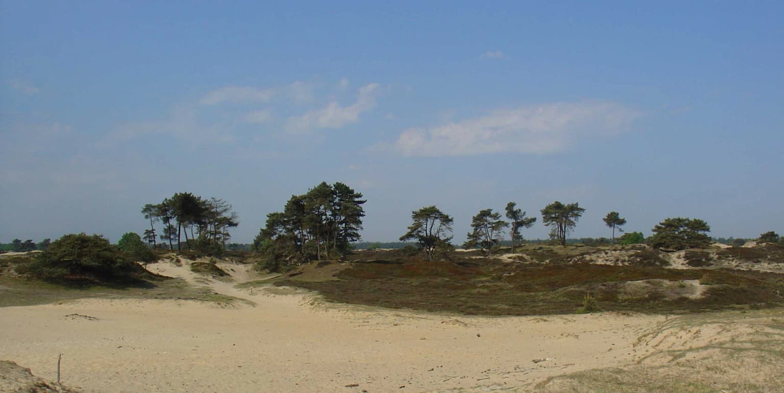
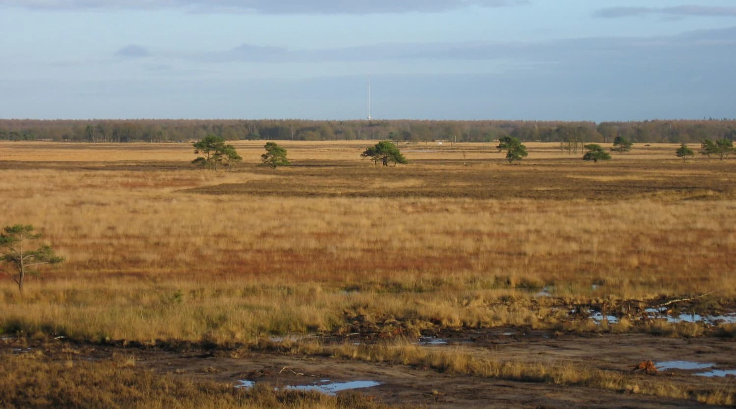
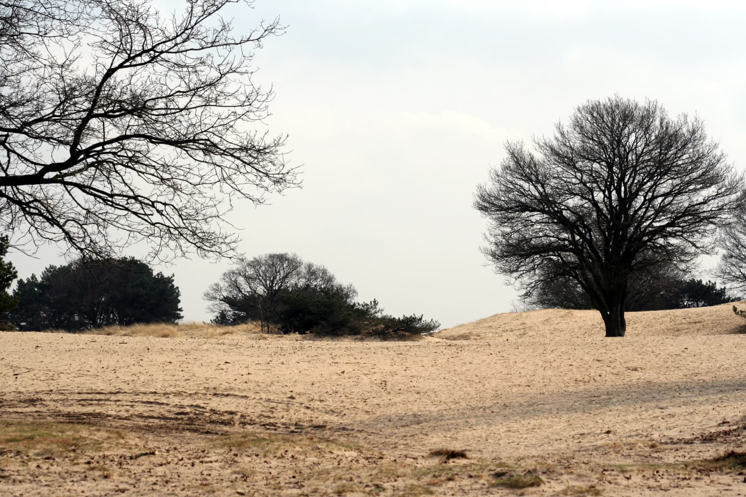
Drents-Friese Wold is best known for its extensive heathlands and drift-sand formations, which are rare in the Dutch context. The Aekingerzand area near Appelscha, locally known as the 'Kale duinen' or Bare Dunes, represents one of the most distinctive drift-sand landscapes in the country. The park is also notable for its ancient esdorp cultural landscape, where centuries of sheep grazing and plaggen soil removal created the characteristic heath and sand environments. The area contains several important archaeological sites including a hunebed (megalithic tomb) near Diever and numerous burial mounds from the Neolithic and Iron Age periods.

Brown Scottish cattle with long fur grazing in a wet grassland field with other cattle in the background
Scottish cattle grazing in wet grasslands within Drents-Friese Wold National Park

Drents-Friese Wold National Park history and protected-area timeline

Human presence in the Drents-Friese Wold area dates back to the Stone Age, with numerous archaeological remains providing evidence of early habitation. The landscape bears the marks of the esdorp culture that characterized much of the sandy soils region of the Netherlands, where farmers from clustered villages used outlying lands for seasonal grazing. The continuous removal of minerals through centuries of grazing and the harvesting of plaggen soil for the potstal (pot-stall) cultivation system gradually depleted the land, transforming former grasslands into heathlands and, in some areas, creating the drift-sand formations that remain today. In the 19th century, following the invention of artificial fertilizer, the government began systematic reforestation programs on the previously degraded 'woeste gronden' (waste lands). Native species like oak and Scots pine were planted alongside exotic species including Douglas fir, American oak, and Japanese larch. The park was formally established in 2000 as a national park, recognizing both the ecological value and cultural significance of the area. A significant event in the park's recent history was the wildfire that burned approximately 75 hectares of heathland on the Doldersummerveld in August 2018, near the village of Wateren on the Drenthe-Friesland border.

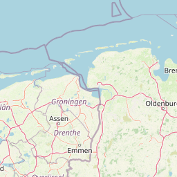
Drents-Friese Wold National Park landscape and geographic character

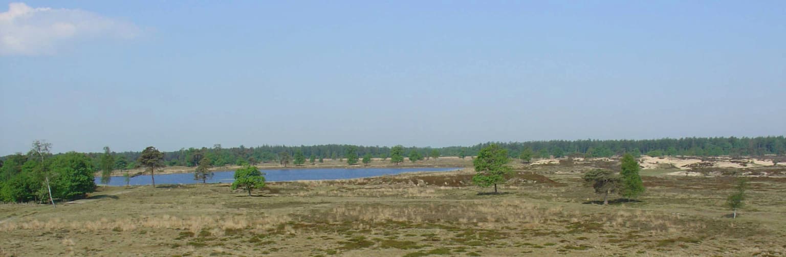
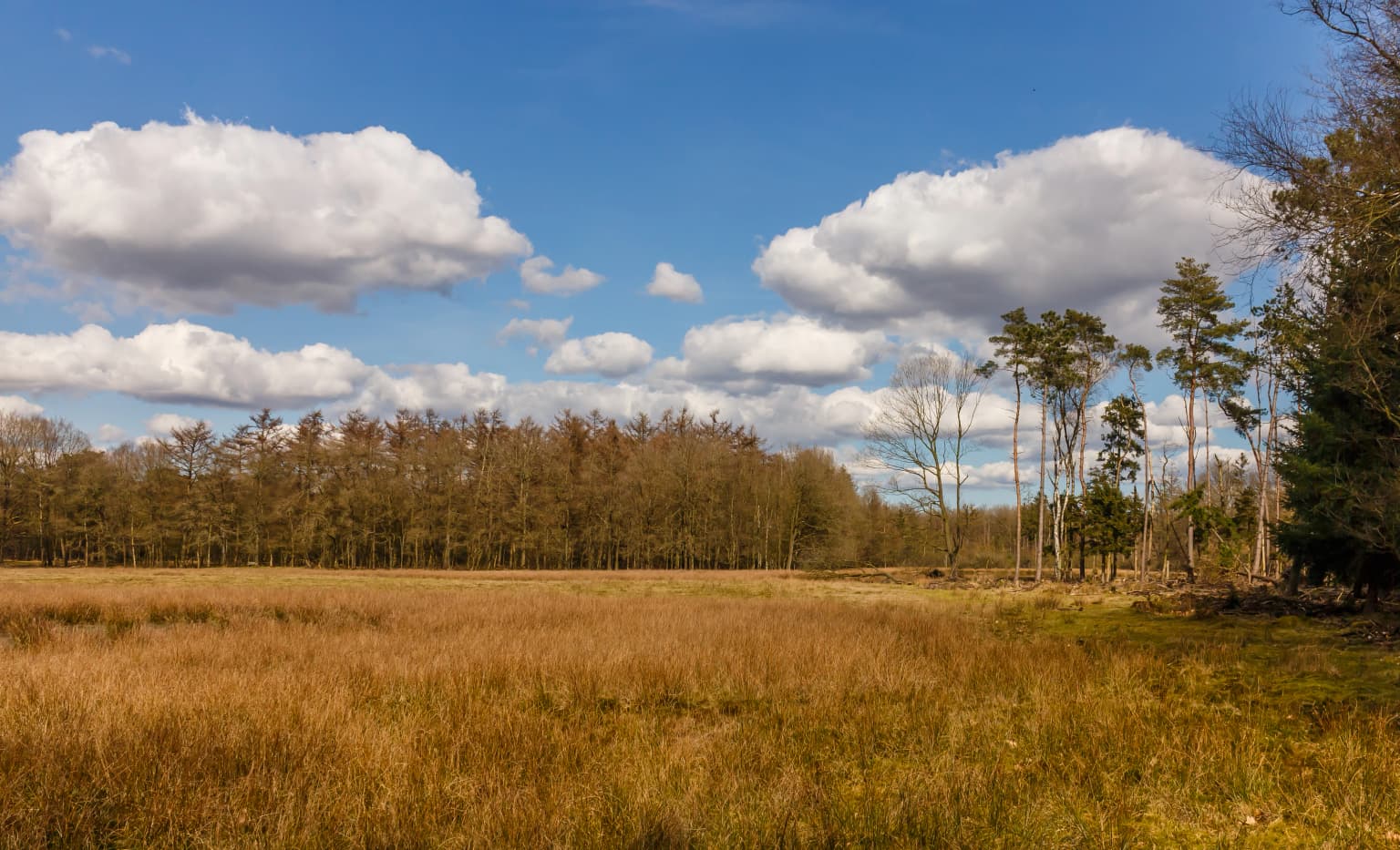
The physical landscape of Drents-Friese Wold presents a characteristic Dutch heathland environment with notable drift-sand areas. The terrain is largely flat to gently undulating, typical of the northern Dutch plains. The Aekingerzand near Appelscha represents the most prominent drift-sand area, known locally as the 'Kale duinen' for its almost bare appearance. Similar drift-sand formations occur at Doldersummerveld, Berkenheuvel, and Wapserveld. The park contains several distinct areas including the heathlands of the Doldersummerveld in the center, the forested zones in the north and east around Hoogersmilde, Diever, and Appelscha, and the more open heath areas near Diever. The Vledder Aa river traverses the park, representing one of the few remaining natural streams in the Netherlands. The landscape also includes small dune-like formations created by wind action on the exposed sand surfaces.

Sandy landscape with low vegetation and scattered trees under a clear blue sky
Drifting sand dunes with scattered trees in Drents-Friese Wold National Park

Drents-Friese Wold National Park ecosystems, habitats, and plant life

The ecological character of Drents-Friese Wold is defined by its mosaic of heathland, drift-sand, and coniferous and deciduous forest habitats. The heathlands support specialized plant communities adapted to acidic, nutrient-poor sandy soils. The drift-sand areas create open habitats with pioneer vegetation suited to the constantly shifting substrate. The planted forests, while not original old-growth, have developed into important semi-natural woodland habitats over the past century and a half. The park is recognized as an Important Bird Area in partnership with the adjacent Leggelderveld, designated by BirdLife International for populations of tree pipit, red-backed shrike, honey buzzard, and black woodpecker. The diversity of habitats supports a range of plant species including bell gentian, lavender heather, wolf's claw, and sundew, all characteristic of heathland environments.

Wide landscape view of a lake surrounded by sandy and grassy terrain with scattered trees under a clear blue sky
Boundary pool in Aekingerzand, a sanddrift area within Drents-Friese Wold National Park

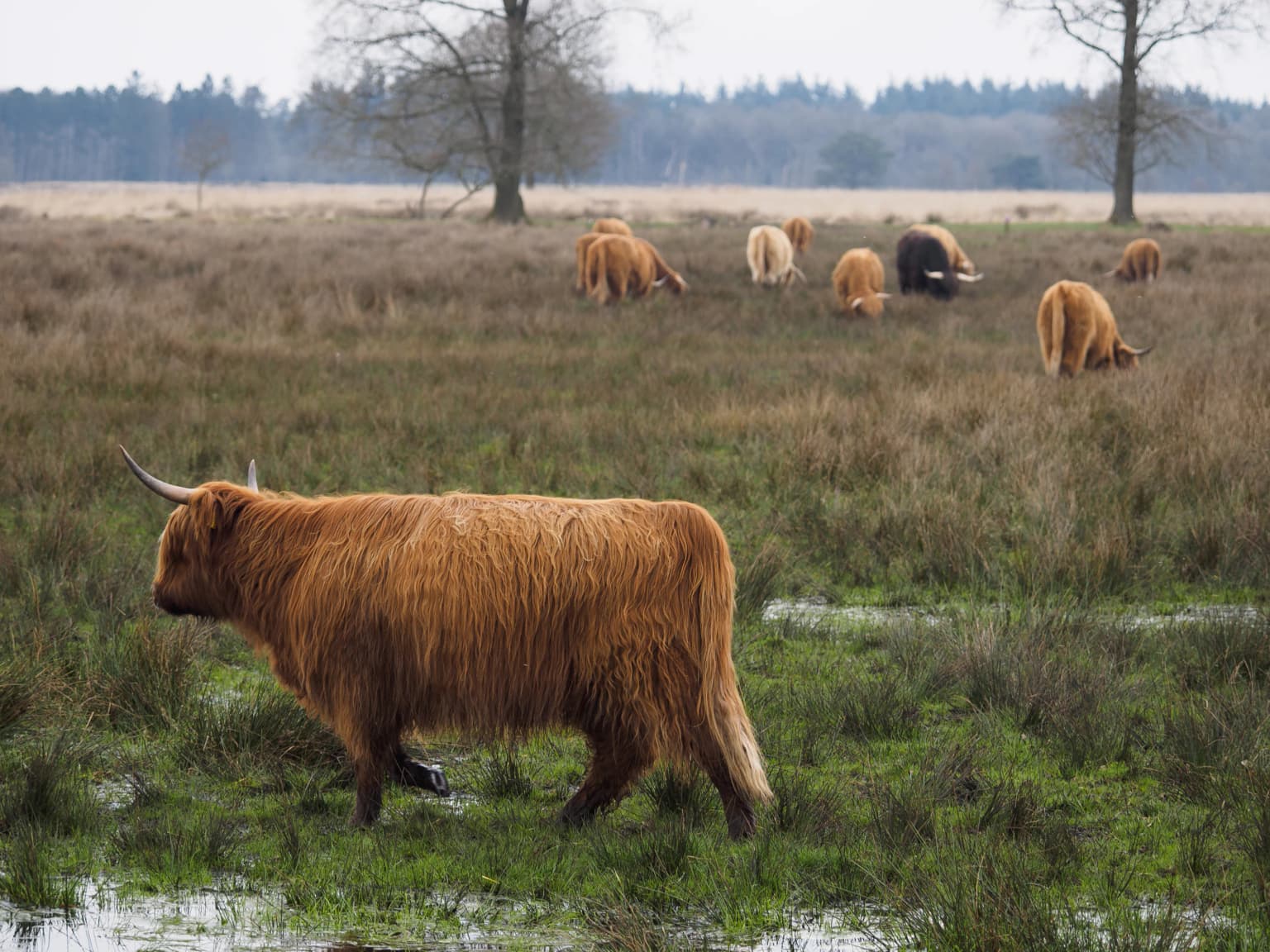
Drents-Friese Wold National Park wildlife and species highlights

Drents-Friese Wold supports a diverse fauna reflecting its varied habitats of heath, forest, and open sand. The park is home to several mammal species including the European pine marten, red fox, roe deer, and stone marten. The wolf, though not resident, has been spotted in the area in recent years, reflecting the broader recovery of this species in the Netherlands. Reptile and amphibian populations include the viviparous lizard, smooth snake, adder, grass snake, and the great crested newt, a species of European conservation concern. Birdlife is particularly noteworthy, with the park supporting populations of common raven, various woodpecker species including the black woodpecker, hawk, buzzard, and honey buzzard. The reptile and amphibian communities are well-represented with species like the hazelworm (slowworm), great crested newt, and viviparous lizard inhabiting the heath and forest edges.

Open grassy field transitioning into a forested area under a blue sky with scattered clouds
A landscape view of the Dieverzand forest edge within Drents-Friese Wold National Park, showing open grassland transitioning into a forested area under a partly cloudy sky

Drents-Friese Wold National Park conservation status and protection priorities

Drents-Friese Wold holds significant conservation value as one of the largest contiguous natural areas in the Netherlands and as a representative example of the esdorp cultural landscape. The park is designated under IUCN Category II as a national park and forms part of the Natura 2000 network of protected European sites. Its status as an Important Bird Area highlights the park's international significance for bird conservation. The management approach involves multiple organizations coordinating conservation efforts across the park's varied habitats. Restoration work on the Vledder Aa and its tributary the Tilgrup has improved water quality and restored natural hydrological processes. The ongoing challenge of maintaining the heathland habitat, which requires active management to prevent succession to forest, reflects the cultural origin of this landscape and the need for continued human intervention to preserve its ecological character.

Drents-Friese Wold National Park cultural meaning and human context

The cultural heritage of Drents-Friese Wold is deeply intertwined with the esdorp settlement pattern that shaped much of the sandy soils region of the Netherlands. The area contains significant archaeological evidence of human occupation spanning from the Neolithic period through to modern times. Near Diever, a hunebed (megalithic tomb) marks the eastern edge of the park, while burial mounds from the Neolithic and Iron Age periods are found near Doldersum and elsewhere in the park. The cultural landscape reflects centuries of traditional land use through sheep grazing and the plaggen system of soil removal. More recent history is represented by an underground hideout from World War II located approximately three kilometers from Diever, evidence of the area's role during the German occupation. The villages surrounding the park, including Appelscha, Diever, Hoogersmilde, and Vledder, maintain strong connections to the protected area.

Golden-brown grassland with scattered trees and small water patches under a partly cloudy sky
Open heathland at Doldersummerveld with scattered trees and water patches in Drents-Friese Wold National Park

Top sights and standout views in Drents-Friese Wold National Park

The Drents-Friese Wold offers several standout features that distinguish it within the Dutch national park system. The drift-sand area of Aekingerzand near Appelscha presents one of the most visually striking heathland landscapes in the Netherlands, with its almost desert-like appearance locally called the 'Kale duinen'. The park's extensive network of cycle paths makes it particularly popular for cycling recreation, while the visitor center at Appelscha provides an introduction to the park's natural and cultural values. The presence of the Vledder Aa, the only Dutch river with a completely natural upper course, adds hydrological significance. Archaeological features including the hunebed near Diever and burial mounds provide tangible connections to prehistoric and historic periods, while the 2018 wildfire on Doldersummerveld demonstrates the ongoing ecological dynamics of this heathland system.

Sandy area with scattered trees under an overcast sky
Sandy terrain with sparse trees in the Aekingerzand area of Drents-Friese Wold National Park

Best time to visit Drents-Friese Wold National Park

The park can be visited throughout the year, with each season offering distinct experiences. Spring and early summer bring the heathlands into bloom, with purple heather covering large areas typically from July through September. The breeding bird season in spring offers opportunities to observe forest and heathland species. Autumn provides atmospheric conditions in the forests and offers different wildlife viewing possibilities. Winter can be particularly scenic when snow covers the heathlands and forests, though some facilities may have reduced hours. The extensive network of paved cycle paths makes the park accessible for cycling in most weather conditions, while the various visitor centers provide information regardless of season.

Park location guide

Geography guide, regional context, and park location map for Drents-Friese Wold National Park

Drents-Friese Wold National Park park geography, regions, and map view in Netherlands
Understand where Drents-Friese Wold National Park sits in Netherlands through a broader geographic reading of the surrounding landscape, nearby location context, and its mapped position within the national park landscape.

How Drents-Friese Wold National Park fits into Netherlands

The Netherlands is a low-lying coastal country in Northwestern Europe, famous for its extensive dike and canal systems that reclaim land from the sea. It consists of twelve provinces and is known for tulips, windmills, and cycling culture. The country is a founding member of the European Union with Amsterdam as its capital and The Hague as the seat of government.

Wider geography shaping Drents-Friese Wold National Park in Netherlands

The Netherlands is located in Northwestern Europe along the North Sea coastline to the north and west. It borders Germany to the east and Belgium to the south. The country is notably flat, with a significant portion of its territory lying below sea level, protected by dikes and dune systems. It consists of twelve provinces and also includes overseas municipalities in the Caribbean.

Map view of Drents-Friese Wold National Park

Use this park location map to pinpoint Drents-Friese Wold National Park in Netherlands, understand its exact geographic position, and read its mapped placement within the surrounding landscape more clearly.

Pigeon | © OpenStreetMap contributors

Location context for Drents-Friese Wold National Park

DrentheFriesland

Explore the striking visual character of its diverse heathlands, ancient forests, and rare drift-sand landscapes within this protected Dutch region.

Drents-Friese Wold National Park: Discover Landscapes, Habitats, and Visual Scenery
Visually explore Drents-Friese Wold National Park, showcasing its expansive heathlands, unique Aekingerzand drift-sand areas, and ancient forests. The imagery provides essential geographic context, revealing the diverse terrain, specific habitats, and protected-area scenery of this significant Dutch landscape.

Brown Scottish cattle with long fur grazing in a wet grassland field with other cattle in the background

Sand dunes, heathland vegetation, scattered trees, and blue sky in Drents-Friese Wold National Park.

Sandy landscape with low vegetation and scattered trees under a clear blue sky

Wide landscape view of a lake surrounded by sandy and grassy terrain with scattered trees under a clear blue sky

Open grassy field transitioning into a forested area under a blue sky with scattered clouds

Wooden observation tower with staircase and viewing platform surrounded by forest

Golden-brown grassland with scattered trees and small water patches under a partly cloudy sky

Sandy area with scattered trees under an overcast sky

Park atlas

Discover the diverse protected landscapes of Drenthe and Friesland, mapping similar heathlands and forests beyond this Dutch national park.

Explore Other Protected Areas and National Parks Near Drents-Friese Wold National Park, Netherlands
Discover other national parks and protected areas geographically linked to Drents-Friese Wold National Park, extending your exploration of the distinct heathland and forest landscapes in Drenthe and Friesland. Trace regional conservation efforts and compare varied drift-sand formations, gaining a wider atlas perspective on protected geography across the northern Netherlands.
National parkDrenthe

Dwingelderveld National Park: Drenthe's Vast Wet Heathland and Unique Pingo Lakes

Explore a protected landscape of heath, bogs, and ancient geography.

Dwingelderveld National Park represents a significant protected landscape in the Drenthe region of the Netherlands, celebrated as the largest wet heathland in Western Europe. This 37-square-kilometer area provides exceptional opportunities for atlas exploration, revealing a terrain composed of sandy ridges interspersed with waterlogged depressions. The park's defining features include more than forty natural pools, known as vennen, many of which are geologically important pingo-ruins. Discover the rich archaeological heritage, including ancient Celtic fields and burial mounds, all situated within this unique natural setting. MoriAtlas offers a structured view of Dwingelderveld National Park's distinct geography and protected ecological value.

Area
37 km²
Established
1991
IUCN
II
Relief
Lowland
Watercolor painting of a wetland scene with a winding river, grassy areas, and distant hills
National parkOverijssel

Weerribben-Wieden National Park: A Premier Lowland Peat Bog National Park in Overijssel

Explore mapped protected wetlands and unique hydrological landscapes.

Weerribben-Wieden National Park stands as a remarkable example of a large-scale lowland peat bog ecosystem, recognized as the most extensive and well-preserved in Northwestern Europe. Located in the Overijssel province, this protected area showcases a complex mosaic of interconnected waterways, expansive reed beds, and marshy woodlands. Our platform provides structured geographic context, enabling detailed map-based discovery of the park's unique terrain and ecological significance as a vital conservation landscape.

Area
105 km²
Established
1992
IUCN
II
Relief
Lowland
National parkDrenthe

Drentsche Aa National Park: Preserved Cultural Landscape & River Valley Geography

Explore Drenthe's unique protected lands and mapped terrain.

Drentsche Aa National Park stands as a testament to a landscape preserved from the mid-19th century, offering a rare glimpse into traditional Dutch rural life. Situated in the province of Drenthe, this protected area features one of the last relatively untouched river systems in the Netherlands, characterized by meandering brooks, ancient hedgerows, and distinctive esdorp villages. The park's geography is influenced by the Saalien ice age Hondsrug ridge, creating a unique terrain of heathlands, sand dunes, and rolling landscapes ideal for atlas-based discovery.

Area
100 km²
Established
2002
IUCN
II
Relief
Lowland
National parkFriesland

De Alde Feanen National Park: Explore Friesland's Historic Peat Bog Landscape

Protected wetland terrain and abundant birdlife in the Netherlands.

Delve into the intricate mapped geography of De Alde Feanen National Park, a national park renowned for its exceptional lowland peat bog ecosystem. This protected area in Friesland showcases a unique terrain comprising shallow lakes, reed beds, and historic peat extraction pools, offering significant ecological and cultural value. The park's landscape provides vital habitats and serves as a testament to the region's long history of human engagement with wetland environments, making it a key destination for atlas-driven geographic discovery.

Area
25 km²
Established
2006
IUCN
II
Relief
Lowland
Watercolor painting of a lake surrounded by green fields and distant mountains.
National park

Lauwersmeer National Park: Mapped Wetland Landscape and Migratory Bird Atlas

Explore protected Dutch Wadden Sea geography and terrain.

Discover Lauwersmeer National Park, a protected wetland in the Netherlands shaped by its post-enclosure transformation. This national park offers a unique glimpse into evolving ecosystems, serving as a vital corridor for migratory birds and showcasing a distinctive flat, open landscape with extensive water and reed environments. Its position within the Wadden Sea UNESCO World Heritage Site highlights its broader ecological importance. Explore the mapped geography, land-use patterns, and characteristic terrain of this dynamic protected area, known for its natural darkness and diverse avian populations.

Area
60 km²
Established
2003
IUCN
II
Relief
Lowland
Watercolor painting showing green hills, a lake, and distant mountains under a light sky
National parkOverijssel

Sallandse Heuvelrug National Park: Overijssel's Glacial Ridge Protected Landscape

Explore its heathland geography and mapped park boundaries.

Sallandse Heuvelrug National Park represents a significant protected landscape within Overijssel, Netherlands, notable for its distinctive glacial ridges and extensive heathland ecosystems. As one of the country's most important conservation areas, it offers a unique opportunity to study the mapped topography and the geography of Dutch heathlands. Discover the protected area's contours and its place within the broader regional atlas context, appreciating its geological formations and ecological importance.

Area
35 km²
Established
2004
IUCN
II
Watercolor illustration of rolling hills, a winding river, and distant mountains under a pale sky
National parkFriesland

Schiermonnikoog National Park: Protected Landscape and Geographic Atlas

Explore its unique dune systems, salt marshes, and Wadden Sea context.

Schiermonnikoog National Park in Friesland is a testament to actively evolving coastal geography, showcasing dynamic dune formations, extensive salt marshes, and diverse natural habitats. As a protected landscape within the UNESCO Wadden Sea, it offers a unique focus for understanding regional protected areas and the intricate interplay of wind, water, and sediment shaping the North Sea coastline. Discover the park's ecological significance and its mapped terrain through MoriAtlas's structured geographic exploration.

Area
54 km²
Established
1989
IUCN
II
Relief
Lowland
National parkFlevoland

Nieuw Land National Park: Mapped Wetland Landscape on Flevoland's Reclaimed Land

Protected area geography and ecological discovery in the Netherlands

Nieuw Land National Park offers a distinctive protected landscape forged on land recently reclaimed from the sea in the Dutch province of Flevoland. This national park is characterized by its vast expanse of wetlands, artificial islands like the Marker Wadden, and critical importance for migratory bird populations. Delve into the park's geographic context and mapped features to understand its unique conservation value and role within the wider European atlas of protected areas.

Area
289 km²
Established
2018
IUCN
II
Relief
Lowland

Common questions about visiting, size, designation, and location context for Drents-Friese Wold National Park

Drents-Friese Wold National Park FAQs for park facts, access, geography, and protected area context
Find quick answers about Drents-Friese Wold National Park, including protected-area facts, park geography, trail and visitor context, and how the park fits into its surrounding country and regional landscape.
MoriAtlas Explorer

Continue Your Protected Areas Search Across the Global Atlas

Deepen your exploration by continuing the structured search for national parks and protected areas worldwide. Utilize the comprehensive filtering capabilities to compare different conservation landscapes and refine your understanding of global park geography. Discover more about the distribution and characteristics of protected natural areas.

Global natural geography