
Mori Atlas logo
National parkSallandse Heuvelrug National Park

Discover the unique geography and protected contours of the Netherlands' significant heathland preserve.

Sallandse Heuvelrug National Park: Glacial Ridge Heathland Landscape in Overijssel

(Nationaal Park Sallandse Heuvelrug)

Sallandse Heuvelrug National Park stands as a vital protected area in Overijssel, Netherlands, distinguished by its prominent glacial ridges. This national park preserves a rare and significant heathland landscape, offering a unique geographic context within the predominantly flat Dutch terrain. Explore the mapped boundaries and the distinctive natural features of Sallandse Heuvelrug National Park, understanding its role as a crucial conservation area and a significant component of the regional atlas.

HeathlandGlacial ridgesNational parkNatura 2000OverijsselEastern Netherlands
Stylized illustration of a mountainous landscape with a waterfall, river, and forest under a pastel sky

Sallandse Heuvelrug National Park

National park

Park overview

Structured park overview, official facts, and landscape profile for Sallandse Heuvelrug National Park

Sallandse Heuvelrug National Park park facts, protected area profile, and essential visitor context

Review the core facts for Sallandse Heuvelrug National Park, including designation, size, terrain, visitor scale, habitats, and operating context in one park-focused overview.

About Sallandse Heuvelrug National Park

Sallandse Heuvelrug National Park protects a distinctive ridge of glacial hills in the otherwise flat Dutch province of Overijssel. The landscape represents one of the most significant geological and ecological features in this region of the Netherlands, with the heuvelrug (heathland ridge) serving as both a visual landmark visible from considerable distance and an ecological island of heathland habitat in an agricultural landscape. The geological foundation dates to the Saalien glaciation approximately 150,000 years ago, when advancing ice sheets pushed up massive amounts of sand, gravel, and clay that had previously been deposited by rivers, creating the characteristic hill formations. Subsequent wind-borne sediment deposits during the Weichselien glaciation further shaped the terrain, while meltwater erosion created distinctive dry valleys such as the Wolfslenk and Diepe Hel. The park's ecological character has been shaped by human activity over centuries. During the Middle Ages, increasing population pressure led to forest clearance, and intensive grazing by sheep and goats combined with the removal of soil layers for use as fertilizer transformed the woodland into the heathland that defines the area today. By the beginning of the twentieth century, the Dutch state initiated forestry programmes to prevent erosion and produce timber, leading to extensive pine plantation across much of the ridge. Contemporary management has shifted toward restoring and expanding open heathland, particularly for the conservation of the black grouse, which represents a species of particular conservation concern in the Netherlands.

Quick facts and research context for Sallandse Heuvelrug National Park

Sallandse Heuvelrug National Park is located in Overijssel, a province in the eastern Netherlands. The park was officially designated as a national park in 2004, though the area had been a nature reserve for decades prior. The ridge is a geological formation created during the second-last glaciation, making it one of the older landscape features in the Dutch lowlands. The park lies entirely south of the N35 road between Zwolle and Almelo, encompassing several named hills including Haarlerberg, Holterberg, Noetselerberg, and the Koningsbelt. The area is notable for supporting the last remaining population of black grouse in the Netherlands, a species that has become extinct in most other Dutch heathland areas.

Protection and recognition

Analyzing the official terrestrial conservation boundaries and designation framework established in 2004

Sallandse Heuvelrug National Park Protection Status and Designation History

Official datasets record Sallandse Heuvelrug National Park as a terrestrial protected area formally established in 2004. Comparing documented designation data and management scope provides critical context for studying regional reserve networks across the Netherlands.

Protection details

Protection scope
Terrestrial
Designated year
2004
Transboundary protection
No
Park context

Deeper park guide and search-rich context for Sallandse Heuvelrug National Park

Sallandse Heuvelrug National Park history, landscape, wildlife, and travel context

Explore Sallandse Heuvelrug National Park through its history, landscape character, ecosystems, wildlife, conservation priorities, cultural context, and seasonal travel timing in a structured park guide built for atlas discovery and search intent.

Why Sallandse Heuvelrug National Park stands out

Sallandse Heuvelrug is best known for its extensive heathlands and its status as the final stronghold of the black grouse in the Netherlands. The park preserves one of the country's most important remaining populations of this species, which has disappeared from virtually all other Dutch heathland areas. The heathlands, which developed historically through centuries of sheep and goat grazing combined with soil removal for fertilizer, create a distinctive purple-flowering landscape in late summer. The park also contains the Holten Canadian War Cemetery, one of the largest military cemeteries in the Netherlands with 1,393 graves of Canadian soldiers from World War II, adding historical significance to the natural landscape.
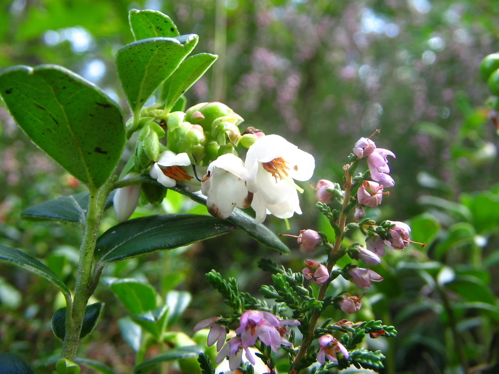
Close-up of Vaccinium vitis-idaea plant with white and pink flowers and green leaves
Lingonberry plant with white and pink flowers in Sallandse Heuvelrug National Park

Sallandse Heuvelrug National Park history and protected-area timeline

The history of Sallandse Heuvelrug reflects the broader transformation of Dutch heathlands from productive cultural landscapes to nature reserves. The geological history dates to approximately 150,000 years ago during the Saalien glaciation, when ice sheets advanced across what is now the Netherlands and pushed up river deposits into the high ridges that form the current landscape. Following the last glaciation, forests developed naturally across the area, but human activity from the Middle Ages onwards dramatically altered this. Population growth led to widespread forest clearance, and the combination of grazing pressure and soil removal for agricultural purposes transformed forested areas into heathland. This process continued for centuries, creating the extensive heather-covered landscapes that now characterize the park. In the early twentieth century, as the ecological degradation of the heathlands became apparent and the Dutch government sought to address erosion while producing timber, extensive pine forests were planted across the area. The formal designation of the national park in 2004 marked a new chapter in the area's management, prioritizing ecological restoration and nature conservation over timber production. The park also contains significant historical heritage related to World War II, including the Holten Canadian War Cemetery and the site of the Twilhaar labour camp, where Jewish forced labourers were held before transport to Westerbork and subsequently to Auschwitz.

Sallandse Heuvelrug National Park landscape and geographic character

The landscape of Sallandse Heuvelrug National Park is defined by a series of elongated glacial ridges running roughly north to south between Hellendoorn and Holten. These ridges, known as stuwwallen, were created when ice sheets during the Saalien glaciation pushed up pre-existing river deposits of sand, gravel, and clay into large mounds that now form the distinctive hills of the area. The highest point, the Grote Koningsbelt, reaches 75 metres above sea level, providing panoramic views across the surrounding Dutch lowlands. Between and around the ridges lie dry valleys, created during the Weichselien glaciation when permafrost conditions and meltwater erosion carved channels that now stand as landscape features even though they no longer carry surface water. The present-day landscape reflects centuries of human modification: areas of open heathland alternate with coniferous plantations established in the late nineteenth and early twentieth centuries. More recently, active management has involved removing some pine forest to restore open heathland habitat, particularly in areas important for black grouse conservation. The heathlands are characterized by their purple heather blooms in late summer and the presence of scattered birch and oak that have established in some areas, creating a mosaic of open and wooded habitat.
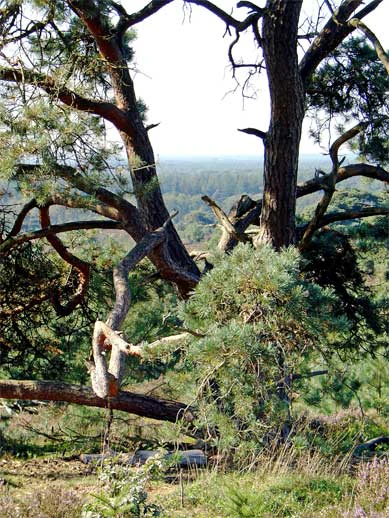
Twisted tree trunk with dense foliage, forested hillside with distant horizon
Forest scene in Sallandse Heuvelrug National Park featuring twisted tree trunks and lush greenery

Sallandse Heuvelrug National Park ecosystems, habitats, and plant life

The nature of Sallandse Heuvelrug is characterized by extensive heathland habitats that have become increasingly rare across the Netherlands. The heathlands support a distinctive flora adapted to acidic, nutrient-poor sandy soils, with lingonberry and cranberry among the characteristic plant species found in the area. The pine forests, while originally planted for timber production, have developed into important woodland habitats supporting different species assemblages. Some areas have seen the natural establishment of deciduous trees including birch, oak, and beech, creating diverse woodland structure. The park is designated as part of the Natura 2000 network, reflecting its European-level importance for conservation. However, the park faces significant ecological challenges, including hydrological issues with the area being too dry, small and fragmented habitats, recreational disturbance pressure, and nitrogen deposition that has made soils overly acidic and nutrient-rich. These factors have led to concerns about the ecological quality of the site and the ability to achieve conservation objectives for key species.
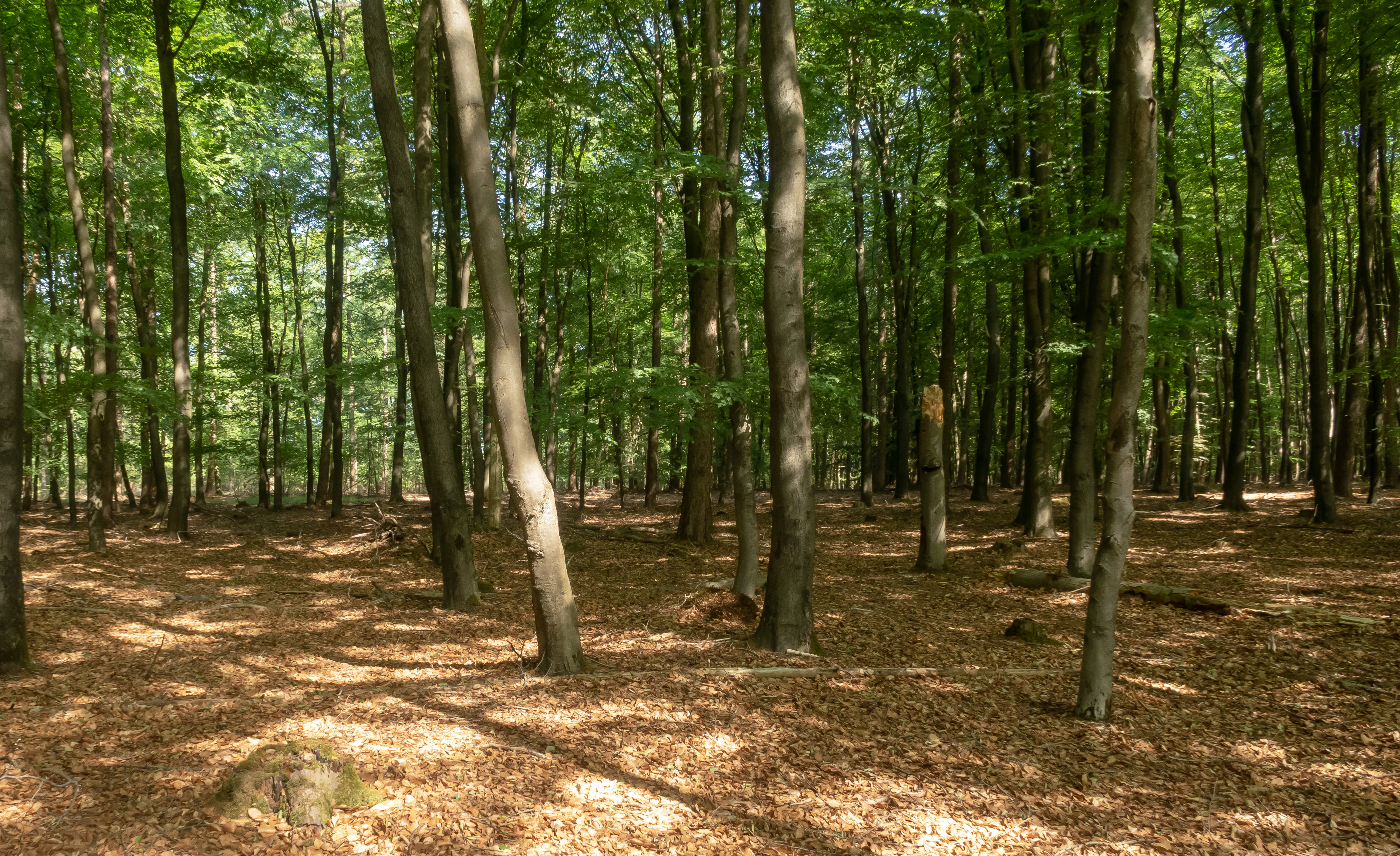
Tall trees with green foliage and sunlit forest floor covered in brown leaves
Trees within Sallandse Heuvelrug National Park

Sallandse Heuvelrug National Park wildlife and species highlights

Sallandse Heuvelrug is notable for its wildlife, particularly the presence of species that have become rare or extinct elsewhere in the Netherlands. The park holds the last remaining population of black grouse in the country, a species that represents a conservation priority and for which specific management measures have been implemented, including the closure of areas during the breeding season and the expansion of open heathland at the expense of forest. The European nightjar is another notable bird species present in the area. The reptile community includes the viviparous lizard and sand lizard, while damp areas support amphibians including the brown frog, great crested newt, and smooth newt. Among mammals, roe deer, fox, and badger are present, along with mustelids including stone marten, polecat, weasel, and ermine. In 2018, a radio-collared wolf briefly passed through the area, representing a rare visitation from a species that is recolonising parts of the Netherlands. Nearly eighty bird species breed in the area, including whinchat and raven. The open heathlands also support the relatively common slowworm.
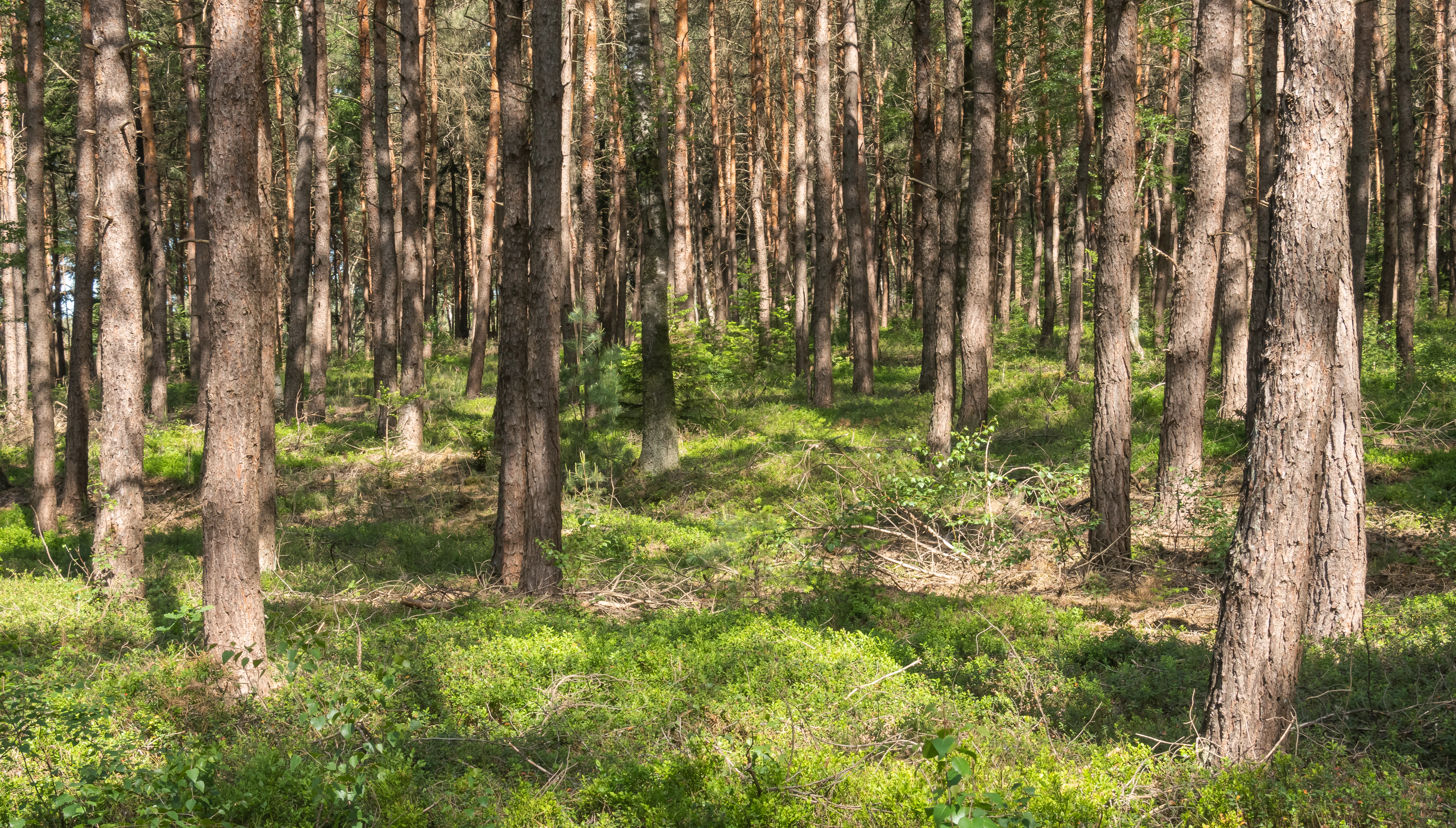
Tall pine trees in a dense forest with green undergrowth and sunlight filtering through the canopy
Sun-dappled pine forest in Sallandse Heuvelrug National Park

Sallandse Heuvelrug National Park conservation status and protection priorities

The conservation significance of Sallandse Heuvelrug derives primarily from its role as the last refuge for the black grouse in the Netherlands, a species that has been lost from virtually all other Dutch heathland areas. The park is designated as a Natura 2000 site, recognizing its importance at the European level for heathland ecosystems and the species they support. However, the conservation status of the area has given rise to significant concern. A 2023 assessment by the Provincial Ecological Authority identified multiple threats to the park's ecological quality: the area is regularly too dry due to hydrological issues, existing habitats are too small and too fragmented, recreational disturbance is excessive, and nitrogen deposition has degraded soil conditions to the point where they are too acidic and nutrient-rich for optimal heathland function. The assessment recommended urgent action on hydrology and nitrogen deposition to prevent further deterioration and to give hope of achieving Natura 2000 conservation targets. Management measures include grazing by Scottish Highland cattle to maintain open heathland, night-time road closures to reduce disturbance to breeding black grouse, and programmes to combat the natural succession of heathland to grass and woodland.

Sallandse Heuvelrug National Park cultural meaning and human context

Sallandse Heuvelrug contains significant cultural and historical heritage beyond its ecological value. The Holten Canadian War Cemetery, located on the Holterberg, is one of the largest military cemeteries in the Netherlands, containing 1,393 graves of Canadian soldiers who died during the final stages of World War II. The cemetery is maintained by the Commonwealth War Graves Commission and remains accessible to the public. On the Nijverdalsche Berg, the Twilhaar area contains the remains of historical settlement and a traditional sheep pen, along with a memorial to the labour camp of the same name. In 1942, Jewish forced labourers were transported from this camp to Westerbork and subsequently almost all were murdered at Auschwitz. The landscape also bears traces of more recent military history, including a reconstructed V1 launch ramp near Nijverdal. The area has a long tradition of agricultural use through sheep and goat grazing, which created and maintained the heathland habitats that now define the park's character.
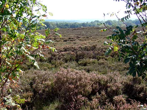
Landscape view of heathland with purple heather, scattered trees, and distant horizon
Heathland landscape within Sallandse Heuvelrug National Park

Top sights and standout views in Sallandse Heuvelrug National Park

Sallandse Heuvelrug National Park offers a distinctive Dutch heathland experience centred on the last remaining population of black grouse in the Netherlands. The rolling glacial ridges provide the most pronounced topography in this region of the country, with the Koningsbelt offering elevated views across the surrounding lowlands. The purple heather blooms in late summer create a visually striking landscape, while the mixture of open heathland, pine forest, and dry valleys provides diverse habitats within a relatively compact area. The Holten Canadian War Cemetery adds historical weight to a visit, while the visitor centre near Nijverdal includes a public observatory and interactive exhibitions about the park's geology and history. The park is crossed by long-distance hiking trails including the Pieterpad and Marskramerpad, making it popular for outdoor recreation while also serving as an important conservation area.
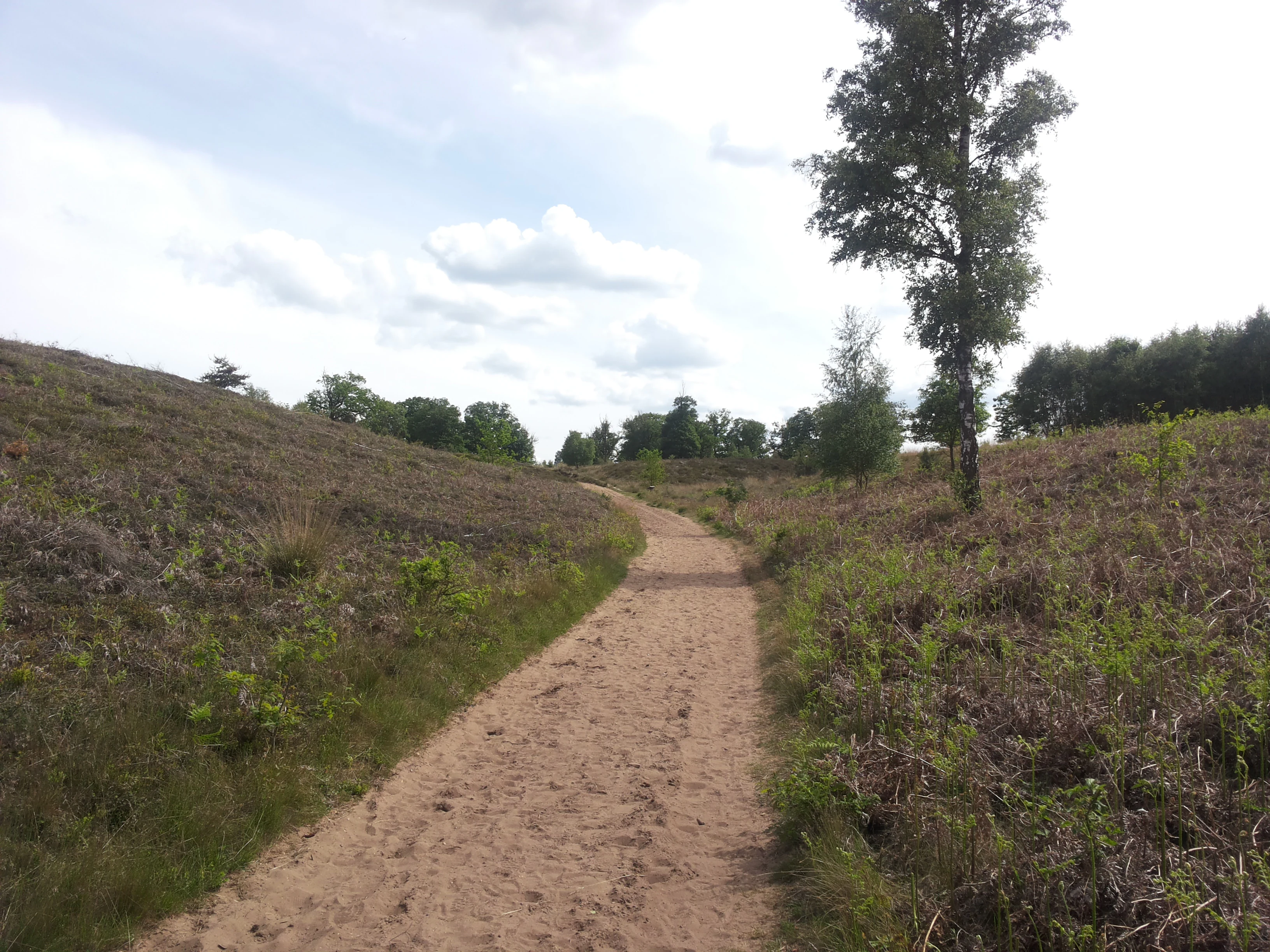
A dirt trail winding through heathland vegetation with a single tree on the right and scattered trees in the distance under a partly cloudy sky
Dirt trail winding through heathland vegetation in Sallandse Heuvelrug National Park

Best time to visit Sallandse Heuvelrug National Park

The best time to visit Sallandse Heuvelrug depends on what visitors hope to experience. Late summer, particularly August and early September, offers the peak flowering of the heather, when the heathlands display their characteristic purple coloration. This is also when the black grouse are most visible during their late-summer display period. Spring brings bird activity and the emergence of heathland flowers, while autumn can offer atmospheric conditions across the open moorland. Winter visits provide the opportunity to experience the landscape in its starkest form, though the park's facilities may have reduced hours. For those interested in wildlife, the breeding season (spring and early summer) offers the best opportunities to see birdlife, though some areas are closed during this period to minimize disturbance to sensitive species.

Park guides

Targeted visitor planning and seasonal landscape timing resources

Sallandse Heuvelrug National Park Published Guides and Focused Answers

Selected published guides provide structured answers regarding optimal timing for observing heathland blooms and navigating glacial ridge trails. These resources help visitors evaluate seasonal conditions across the protected landscape before planning trail excursions.
Monthly climate preview

Analyzing average temperature and monthly precipitation averages in Overijssel

Sallandse Heuvelrug National Park Climate Normals and Monthly Weather Patterns

Long term records for Sallandse Heuvelrug National Park show a temperate climate rhythm where monthly mean temperatures range from near freezing up to eighteen degrees Celsius. Examining the complete twelve month profile provides precise maximum and minimum temperature bands alongside daily precipitation averages for the Overijssel reserve.
Annual mean10 °C
2 °C18 °C
Jan
Feb
Mar
Apr
May13°
Jun16°
Jul18°
Aug18°
Sep15°
Oct10°
Nov
Dec
Warmest month
July

18 °C

Coolest month
January

2 °C

Wettest month
December

2.5 mm/day

Driest month
April

1.4 mm/day

Park location guide

Geography guide, regional context, and park location map for Sallandse Heuvelrug National Park

Sallandse Heuvelrug National Park park geography, regions, and map view in Netherlands

Understand where Sallandse Heuvelrug National Park sits in Netherlands through a broader geographic reading of the surrounding landscape, nearby location context, and its mapped position within the national park landscape.

How Sallandse Heuvelrug National Park fits into Netherlands

The Netherlands is a low-lying coastal country in Northwestern Europe, famous for its extensive dike and canal systems that reclaim land from the sea. It consists of twelve provinces and is known for tulips, windmills, and cycling culture. The country is a founding member of the European Union with Amsterdam as its capital and The Hague as the seat of government.

Wider geography shaping Sallandse Heuvelrug National Park in Netherlands

The Netherlands is located in Northwestern Europe along the North Sea coastline to the north and west. It borders Germany to the east and Belgium to the south. The country is notably flat, with a significant portion of its territory lying below sea level, protected by dikes and dune systems. It consists of twelve provinces and also includes overseas municipalities in the Caribbean.

Map view of Sallandse Heuvelrug National Park

Use this park location map to pinpoint Sallandse Heuvelrug National Park in Netherlands, understand its exact geographic position, and read its mapped placement within the surrounding landscape more clearly.

Pigeon | © OpenStreetMap contributors

Location context for Sallandse Heuvelrug National Park

Overijssel

Visually understand the unique Dutch heathland character and glacial topography, tracing the park's key habitats and protected-area environment.

Explore Sallandse Heuvelrug National Park Photos: Discover Heathland Landscapes, Glacial Ridges, and Protected Area Scenery

Browse compelling Sallandse Heuvelrug National Park photos to grasp the unique visual identity of its extensive heathlands, rolling glacial ridges, and diverse protected landscapes. These detailed images offer crucial insights into the park's conservation value, revealing the distinctive terrain and habitats of this important Dutch national park.

Close-up of Vaccinium vitis-idaea plant with white and pink flowers and green leaves

Thatched-roof wooden building surrounded by trees and grass in a national park setting

Twisted tree trunk with dense foliage, forested hillside with distant horizon

Tall trees with green foliage and sunlit forest floor covered in brown leaves

Tall pine trees in a dense forest with green undergrowth and sunlight filtering through the canopy

A tall pine tree with sprawling branches stands amid purple heather and green shrubs under a clear blue sky.

Landscape view of heathland with purple heather, scattered trees, and distant horizon

A dirt trail winding through heathland vegetation with a single tree on the right and scattered trees in the distance under a partly cloudy sky

Heathland landscape with scattered shrubs and dense forest in the background

A dirt trail surrounded by green shrubs and trees with sunlight filtering through the foliage

Park atlas

Trace the regional geography of protected areas, comparing the heathland, forest, and moraine landscapes surrounding Sallandse Heuvelrug.

Explore Nearby National Parks and Protected Areas Beyond Sallandse Heuvelrug National Park

Browse national parks and protected areas geographically near Sallandse Heuvelrug National Park, extending your exploration across the distinctive heathland and glacial ridge landscapes of the Eastern Netherlands. Compare these conservation areas to understand regional variations, trace connected ecological contexts, and identify other notable protected landscapes within Dutch geography.
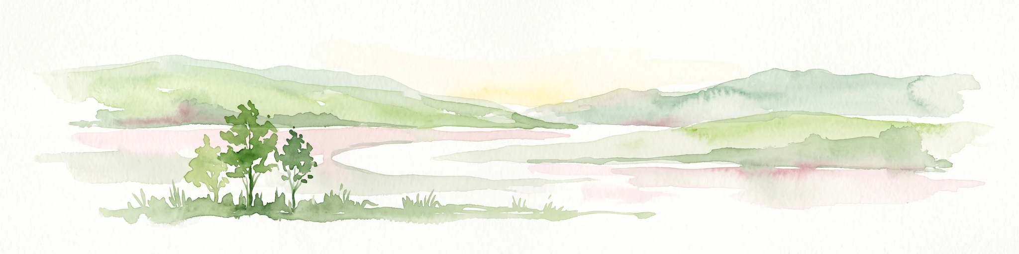
A minimalist watercolor illustration depicting green rolling hills, a cluster of trees in the foreground, and a body of water under a pale sky.
Nature reserveOverijssel
2.8 km away#1 closest

Northwest

Boetelerveld Nature Reserve: Landscape Geography and Protected Habitat Mapping

A critical wet heathland remnant in the Overijssel region.

Situated in the Salland region of Overijssel, Boetelerveld represents a dense convergence of heath, conifer forest, and small peat-influenced pools. The reserve is notable for its role as a protected area within the Natura 2000 network, offering insight into the restoration of sandy soil ecosystems and the preservation of rare, moisture-dependent flora and fauna in the eastern Netherlands.

Area
1.7 km²
Relief
Lowland
Climate
Temperate
Access
Easy access
Nature reserveOverijssel
2.9 km away#2 closest

Northeast

Wierdense Veld Nature Reserve: Geographic Overview and Protected Landscape Mapping

Raised bog and heathland restoration in Overijssel

Wierdense Veld represents a complex protected area in the Overijssel province, defined by its efforts to sustain raised bog remnants alongside a working water catchment. The landscape is a vital study of Dutch sandy soil ecology, featuring a delicate balance of sphagnum mosses, heath transitions, and essential water management practices that maintain regional biodiversity.

Area
4.2 km²
Established
1968
Relief
Lowland
Climate
Temperate
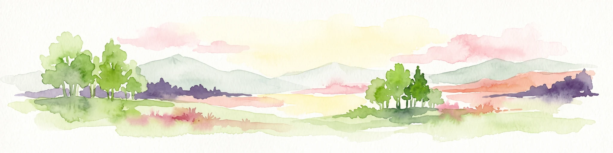
Watercolor painting of a wide landscape with clusters of trees, green meadows, and soft, distant hills under a pastel sky.
Nature reserveOverijssel
About 3.5 km away#3 closest

Southeast

Borkeld Nature Reserve: Overijssel Protected Landscape and Geographic Atlas

Heathland, juniper shrubland, and prehistoric archaeological terrain

Discover the geographic character of the Borkeld nature reserve in Overijssel. This protected area stands out for its large juniper shrubland, unique clay pit habitats, and deep archaeological history preserved within a gently rolling landscape of forest and heath.

Area
6 km²
Relief
Upland
Climate
Temperate
Access
Easy access
Nature reserveOverijssel
17 km away#4 closest

Northeast

Engbertsdijksvenen Nature Reserve: Mapping Dutch Raised Bog and Peatland Landscapes

Protected high moor geography in the Overijssel region

Engbertsdijksvenen is a significant nature reserve in the eastern Netherlands, renowned for its extensive living raised bog and diverse peatland habitats. The site showcases a rare mosaic of open water, heathland, and bog forest, serving as a landmark for ecological restoration and wetland geography in the province of Overijssel.

Area
10 km²
Relief
Upland
Climate
Temperate
Access
Easy access
Nature reserveGelderland
20 km away#5 closest

South

Stelkampsveld Protected Nature Reserve and Restored Achterhoek Kampenlandschap in Gelderland

Tracing the mapped boundaries of historic heath and fen ecosystems

Stelkampsveld acts as an ecologically distinctive protected area in the eastern Netherlands. Covering 102 hectares, the terrain showcases a recovered mosaic of hedgerows, small enclosed fields, and re-established wetlands. The site is recognized for its botanical diversity, including rare orchid and moss species within the broader Natura 2000 network of Gelderland.

Area
1.02 km²
Established
2013
Relief
Lowland
Climate
Temperate
Protected areaNetherlands
23 km away#6 closest

Southwest

Veluwe: A Comprehensive Geographic Atlas of the Central Netherlands Protected Area

Glacial moraines, heathlands, and inland sand systems

Investigate the Veluwe, a premier protected area in the Gelderland province characterized by its historic push moraines and extensive ecological zones. The region encompasses significant sand drift complexes, dense woodlands, and vital spring-fed streams, offering a clear view of the diverse natural terrain found throughout the central Netherlands.

Area
1,000 km²
Relief
Upland
Climate
Temperate
Access
Easy access
Nature reserveGelderland
25 km away#7 closest

Southwest

Landgoederen Brummen Nature Reserve: Protected Landscape and Geographic Atlas Entry

Ecological transition zone in the Gelderland province

Landgoederen Brummen showcases a rare geological intersection in the Netherlands where Veluwe sand ridges meet IJssel river clays. This protected area features a unique concentration of seepage-fed pools, blue grasslands, and alluvial alder forests, demonstrating how centuries of estate management coexist with preserved wild habitat remnants.

Area
6.77 km²
Established
2013
Relief
Lowland
Climate
Temperate
Protected areaOverijssel
26 km away#8 closest

Northeast

Springendal & Dal van de Mosbeek Protected Area: Mapped Geography and Terrain Overview

Glacial push-moraine landscapes in the Overijssel province

The Springendal & Dal van de Mosbeek protected area stands out for its concentrated geological diversity, where boulder-clay layers trigger consistent groundwater seepage. This natural process maintains rare ash-elm spring forests and calcareous mires within a twelve square kilometer expanse. The area preserves a classic Twente cultural pattern of small meadows and hedgerows, creating a protected sanctuary for specialized invertebrates and woodland wildlife.

Area
12.25 km²
Established
2013
Relief
Upland
Scope
Terrestrial

Common questions about visiting, size, designation, and location context for Sallandse Heuvelrug National Park

Sallandse Heuvelrug National Park FAQs for park facts, access, geography, and protected area context

Find quick answers about Sallandse Heuvelrug National Park, including protected-area facts, park geography, trail and visitor context, and how the park fits into its surrounding country and regional landscape.
MoriAtlas Explorer

Continue Your Protected Areas Search Across the Global Atlas

Deepen your exploration by continuing the structured search for national parks and protected areas worldwide. Utilize the comprehensive filtering capabilities to compare different conservation landscapes and refine your understanding of global park geography. Discover more about the distribution and characteristics of protected natural areas.

Global natural geography