Mori Atlas logo
National parkNieuw Land National Park

Discover the geography and ecological significance of this unique national park on reclaimed land.

Nieuw Land National Park: A Mapped Protected Wetland Landscape in Flevoland

(Nationaal Park Nieuw Land)

Nieuw Land National Park, established in 2018, represents a pioneering Dutch national park situated on land reclaimed from the sea in Flevoland. Spanning 289 square kilometers, over 75% of this protected area comprises lakes and wetlands, making it a vital ecological hub. This page serves as your gateway to understanding its distinctive landscape, mapped boundaries, and significant role in Western European wetland conservation and migratory bird habitats.

wetlandslakebirdwatchingmigratory birdsreclaimed landNatura 2000

Nieuw Land National Park

National park

Park overview

Structured park overview, official facts, and landscape profile for Nieuw Land National Park

Nieuw Land National Park park facts, protected area profile, and essential visitor context
Review the core facts for Nieuw Land National Park, including designation, size, terrain, visitor scale, habitats, and operating context in one park-focused overview.

About Nieuw Land National Park

Nieuw Land National Park stands as a remarkable example of modern conservation planning in the Netherlands, bringing together multiple nature reserves and water bodies under a unified national park designation. The park's territory spans the artificial landscape of the Flevopolder, where intensive agricultural land has been progressively transformed into a network of protected wetlands and shallow waters. The creation of Marker Wadden, a chain of artificial islands constructed from dredged sediment, has been particularly significant in transforming the formerly eutrophic Markermeer into a thriving ecosystem with improved water clarity and enhanced biodiversity. The park is accessible to visitors through a network of dikes, viewing points, and recreational routes, with the Oostvaardersdijk, Houtribdijk, and Knardijk serving as the main access corridors. These elevated roads function as "belvedères" offering panoramic views across the marshland and lake systems. The park's masterplan envisions continued expansion of natural habitats and improved connectivity between the four core nature areas, with the long-term ambition of creating a truly resilient and self-sustaining ecosystem capable of supporting diverse flora and fauna while accommodating visitor access.

Quick facts and research context for Nieuw Land National Park

Nieuw Land National Park is located in Flevoland, the newest province of the Netherlands, situated between the cities of Almere and Lelystad. The park encompasses roughly half of Lake Markermeer along with adjacent wetland areas including the Oostvaardersplassen and Lepelaarplassen. As the first "National Park new style" in the Netherlands, it was designed according to a masterplan that will guide its development through 2040, with the goal of creating a more connected and ecologically robust landscape. The park is managed collaboratively by three Dutch nature organizations: Flevo-landschap, Staatsbosbeheer, and Natuurmonumenten.

Park context

Deeper park guide and search-rich context for Nieuw Land National Park

Nieuw Land National Park history, landscape, wildlife, and travel context
Explore Nieuw Land National Park through its history, landscape character, ecosystems, wildlife, conservation priorities, cultural context, and seasonal travel timing in a structured park guide built for atlas discovery and search intent.

Why Nieuw Land National Park stands out

Nieuw Land National Park is best known for its extensive wetlands and its role as a critical habitat for migratory birds traversing the East Atlantic Flyway. The Oostvaardersplassen, one of the park's core reserves, is celebrated for its pioneering approach to large-scale ecological restoration and its populations of large herbivores. The Marker Wadden, an artificial archipelago created within the park, represents an innovative engineering project that has significantly improved water quality and biodiversity in the Markermeer while creating new breeding habitat for colonial nesting birds. The park's location on the former seabed of the Zuiderzee gives it a unique character as one of the few national parks in the world established on artificially reclaimed land.

Nieuw Land National Park history and protected-area timeline

The establishment of Nieuw Land National Park in 2018 marked the culmination of a broader initiative by the Dutch national government to renew and expand the country's network of national parks. The "National Park new style" concept introduced in 2015 set four key criteria for new protected areas: they must be large and ecologically coherent, contain cores of valuable nature with landscape or cultural-historical value, be attractive and iconic for both domestic and international visitors, and possess a distinct identity recognized by local communities and organizations. Nieuw Land was the first park to meet these new standards. Prior to its designation, several component areas, including the Oostvaardersplassen and portions of the Markermeer, were already protected under the European Natura 2000 framework. The Marker Wadden project, which began in 2016, represented a major ecological engineering undertaking that substantially increased the ecological value of the area prior to the park's formal creation. In 2019, the Dutch government and conservation organizations committed 470 million euros over twenty years to support the park's continued development and the improvement of connections between its various components.

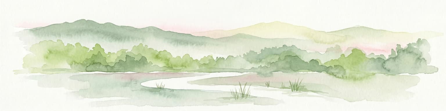
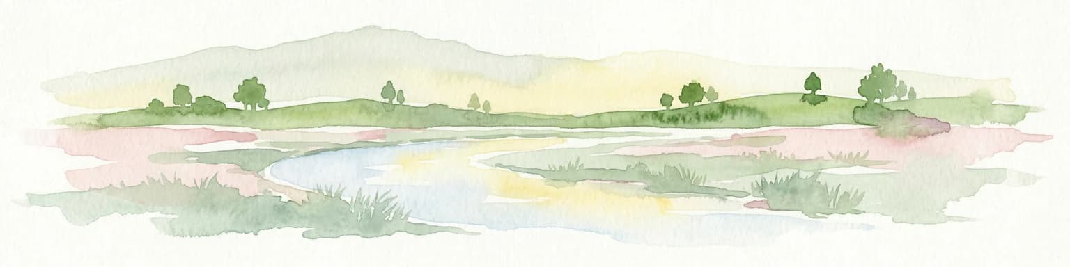
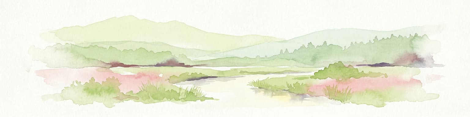
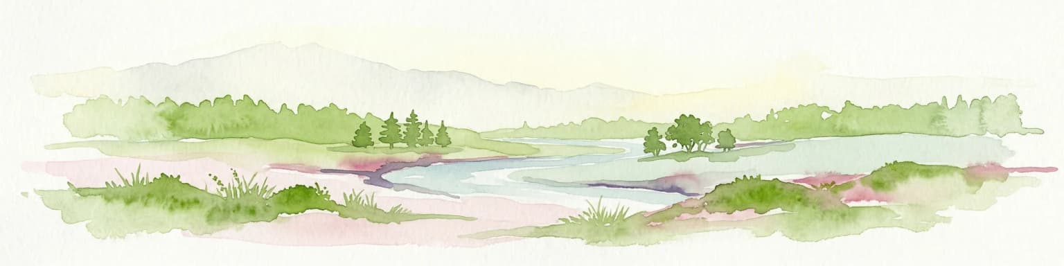
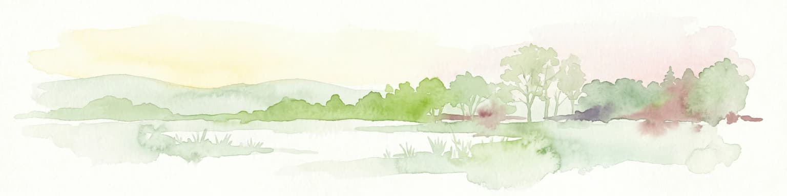
Nieuw Land National Park landscape and geographic character

The landscape of Nieuw Land National Park is defined by its position on the flat, low-lying terrain of the reclaimed Flevopolder. The terrain is almost entirely flat, with elevation determined by subtle variations in the artificial drainage patterns and the presence of constructed water bodies. The park encompasses extensive shallow waters, reed beds, marshy grasslands, and open lake areas. The most visually prominent landscape features are the artificial islands of Marker Wadden, which rise slightly above the water surface and support emergent vegetation communities. The surrounding dikes and elevated roads provide the only significant topographical variation, offering sweeping views across the horizontal planes of water and wetland. The former seabed upon which the park sits gives the landscape a distinctive character, with soils that retain memories of the marine environment that existed before the polders were created. The horizontal scale of the landscape is punctuated by dead trees in the Oostvaardersplassen, a striking feature resulting from the challenging windy climate on the former seabed.

Nieuw Land National Park ecosystems, habitats, and plant life

The ecological character of Nieuw Land National Park centers on wetland habitats that support internationally significant populations of waterbirds and migratory species. The shallow waters of Lake Markermeer, combined with the reed beds of the Oostvaardersplassen and Lepelaarplassen, create a complex mosaic of aquatic and emergent vegetation communities. The creation of Marker Wadden has been particularly impactful for the region's ecology, establishing extensive beds of submerged aquatic vegetation and providing crucial nesting islands for colonial waterbirds. The masterplan for the park envisions the creation of additional islands, tidal channels, wet grasslands, and waterways to further enhance ecological connectivity. This approach is designed to allow birds to forage in some areas while using other areas for resting or breeding, creating a functional ecological network within the park boundaries. The wetland system's importance is underscored by its designation as part of the Natura 2000 network, which provides European-level protection for its significant bird populations and habitat types.

Nieuw Land National Park wildlife and species highlights

Nieuw Land National Park supports diverse wildlife communities, with particular importance attached to its waterbird populations. The wetlands serve as critical staging and wintering areas for migratory birds traveling the East Atlantic Flyway, with numerous species using the park as a stopover during their seasonal movements. The Oostvaardersplassen is known for its populations of large herbivores, including Heck cattle, konik horses, and red deer, which play a crucial role in maintaining the open landscape through grazing pressure. The Marker Wadden islands have become important breeding sites for terns, gulls, and cormorants, while the surrounding waters support populations of fish that form the base of the aquatic food web. The wetlands provide habitat for rare species associated with marsh and reed bed environments, contributing to the park's significance as a biodiversity hotspot in the densely populated Netherlands.

Nieuw Land National Park conservation status and protection priorities

The conservation significance of Nieuw Land National Park derives from its role in protecting one of the largest remaining wetland complexes in the Netherlands and its contribution to international bird conservation. The park's inclusion in the Natura 2000 network provides European-level legal protection for its qualifying habitats and species, while the national park designation adds an additional layer of protection and management oversight. The Marker Wadden project exemplifies innovative conservation approaches, demonstrating how engineered habitat creation can restore degraded ecosystems and improve water quality across a large lake system. The substantial financial commitment of 470 million euros over twenty years reflects the national importance placed on the park's continued development as a flagship conservation area. The masterplan's vision for creating a more connected and ecologically robust landscape through habitat expansion and improved wildlife corridors positions the park as a model for large-scale ecological restoration in lowland Europe.

Nieuw Land National Park cultural meaning and human context

Nieuw Land National Park is situated in Flevoland, the youngest Dutch province, created through the massive engineering undertaking of reclaiming the Zuiderzee from the sea during the twentieth century. The landscape bears the imprint of this artificial creation, with the park representing an effort to transform intensive agricultural land back toward natural wetland ecosystems. The name "Nieuw Land" directly references this history, as the polder was historically known as "new land" when it emerged from the sea. The park sits within a cultural landscape shaped by Dutch water management traditions, with the surrounding infrastructure of dikes, drainage systems, and elevated roads reflecting centuries of human intervention in the water environment. While the park itself does not contain significant historic structures or cultural heritage sites, its creation reflects contemporary Dutch values regarding nature conservation, landscape restoration, and the balance between human development and environmental protection.

Top sights and standout views in Nieuw Land National Park

Nieuw Land National Park represents a new generation of protected areas in the Netherlands, combining wetland conservation with innovative habitat restoration and visitor access. The Marker Wadden artificial archipelago stands as a remarkable engineering achievement that has transformed the ecological quality of the Markermeer. The Oostvaardersplassen offers visitors the opportunity to experience a wetland landscape shaped by large herbivores in a manner reminiscent of historic European wildwoods. The park's accessibility via bicycle, canoe, and foot trails, combined with its proximity to major urban centers, makes it an important recreation area for the densely populated Randstad region. The vision for the park's development through 2040 aims to create one of Europe's most significant wetland conservation areas.

Best time to visit Nieuw Land National Park

The best time to visit Nieuw Land National Park depends on the experience sought, with each season offering distinct qualities. Spring brings the arrival of migratory birds and the breeding season, when the wetlands become alive with bird activity and the reed beds echo with calling birds. Autumn offers excellent opportunities for observing migratory birds as they stage before their southward journey, while the relatively mild Dutch climate allows for meaningful visits throughout the year. The winter months, though quieter, provide a different character to the landscape, with bare trees and open waters offering expansive views across the wetland. Summer brings the highest visitor numbers and the fullest vegetation, though the park's extensive size means that quiet corners can still be found.

Park location guide

Geography guide, regional context, and park location map for Nieuw Land National Park

Nieuw Land National Park park geography, regions, and map view in Netherlands
Understand where Nieuw Land National Park sits in Netherlands through a broader geographic reading of the surrounding landscape, nearby location context, and its mapped position within the national park landscape.

How Nieuw Land National Park fits into Netherlands

The Netherlands is a low-lying coastal country in Northwestern Europe, famous for its extensive dike and canal systems that reclaim land from the sea. It consists of twelve provinces and is known for tulips, windmills, and cycling culture. The country is a founding member of the European Union with Amsterdam as its capital and The Hague as the seat of government.

Wider geography shaping Nieuw Land National Park in Netherlands

The Netherlands is located in Northwestern Europe along the North Sea coastline to the north and west. It borders Germany to the east and Belgium to the south. The country is notably flat, with a significant portion of its territory lying below sea level, protected by dikes and dune systems. It consists of twelve provinces and also includes overseas municipalities in the Caribbean.

Map view of Nieuw Land National Park

Use this park location map to pinpoint Nieuw Land National Park in Netherlands, understand its exact geographic position, and read its mapped placement within the surrounding landscape more clearly.

Pigeon | © OpenStreetMap contributors

Location context for Nieuw Land National Park

Flevoland
Park atlas

Compare the distinctive wetland ecosystems and reclaimed land features of surrounding Dutch protected areas.

Discover National Parks and Protected Areas Near Nieuw Land National Park, Flevoland
Explore other national parks and protected areas across the Netherlands after examining Nieuw Land National Park's distinctive reclaimed wetlands and bird habitats. Compare regional conservation landscapes, trace the geographic spread of protected marshlands, and understand broader efforts to preserve Dutch low-lying terrain.
Watercolor painting of a wetland scene with a winding river, grassy areas, and distant hills
National parkOverijssel

Weerribben-Wieden National Park: A Premier Lowland Peat Bog National Park in Overijssel

Explore mapped protected wetlands and unique hydrological landscapes.

Weerribben-Wieden National Park stands as a remarkable example of a large-scale lowland peat bog ecosystem, recognized as the most extensive and well-preserved in Northwestern Europe. Located in the Overijssel province, this protected area showcases a complex mosaic of interconnected waterways, expansive reed beds, and marshy woodlands. Our platform provides structured geographic context, enabling detailed map-based discovery of the park's unique terrain and ecological significance as a vital conservation landscape.

Area
105 km²
Established
1992
IUCN
II
Relief
Lowland
Watercolor depiction of rolling coastal dunes, blue waterways, green vegetation, and distant hills under a light sky
National parkNorth Holland

Zuid-Kennemerland National Park: Coastal Dune Protected Landscape in North Holland

Explore its unique mapped terrain and protected area geography.

Zuid-Kennemerland National Park showcases a remarkable coastal dune ecosystem situated in the North Holland province. This national park entry provides detailed insight into its protected landscape, from calcium-rich dune soils supporting rare flora to ancient woodlands and extensive walking trails. Users can explore the park's mapped boundaries, understand its geographic setting within the Netherlands, and appreciate its significance as a conservation area. Discover the natural terrain and ecological richness that characterize this important Dutch protected land.

Area
38 km²
Established
1995
IUCN
II
Visitors
1.8M annual
Watercolor landscape showing green hills, forests, and a small stream with grassy patches
National parkUtrecht Province

Utrechtse Heuvelrug National Park: Mapped Protected Landscape and Geographic Atlas

Discover Utrecht Province's glacial ridge and diverse natural terrain.

Utrechtse Heuvelrug National Park is a significant protected natural area located in Utrecht Province, renowned for its unique glacial ridge topography. This entry provides detailed information about its mapped boundaries, diverse landscapes including heathlands and forests, and its importance as an ecological corridor within the Netherlands. Explore the park's distinct geography and its role in regional conservation through our structured atlas view.

Area
100 km²
Established
2003
IUCN
II
Visitors
1M annual
Watercolor painting of rolling hills, green trees, and a winding path
National parkGelderland

De Hoge Veluwe National Park: Mapped Protected Landscape & Geographic Atlas Context

Explore Gelderland's unique heathland, sand dune, and woodland terrain.

De Hoge Veluwe National Park represents a distinctive protected area within the Gelderland region of the Netherlands. Its landscape is characterized by a unique mosaic of heathlands, sand dunes, and woodlands, shaped by ice age processes and historical land use. This page offers an atlas-focused exploration of its geographic setting, mapped boundaries, and the specific terrain that defines this significant natural and cultural heritage site.

Area
55 km²
Established
1935
IUCN
II
Visitors
629.4K annual
Watercolor illustration of a park landscape with a winding stream, grassy fields, and distant hills
National parkGelderland

Veluwezoom National Park: Protected Landscape Atlas and Gelderland Geography

Explore oldest Dutch national park, heathlands, and glacial terrain.

Veluwezoom National Park is the Netherlands' inaugural national park, located in Gelderland. This page provides an atlas-driven exploration of its protected landscape, characterized by rolling heathlands, ancient forests, and dramatic glacial push moraines. Users can discover the park's geographical features, mapped boundaries, and its significance as a conserved natural area within the Veluwe region.

Area
50 km²
Established
1930
IUCN
II
National parkFriesland

De Alde Feanen National Park: Explore Friesland's Historic Peat Bog Landscape

Protected wetland terrain and abundant birdlife in the Netherlands.

Delve into the intricate mapped geography of De Alde Feanen National Park, a national park renowned for its exceptional lowland peat bog ecosystem. This protected area in Friesland showcases a unique terrain comprising shallow lakes, reed beds, and historic peat extraction pools, offering significant ecological and cultural value. The park's landscape provides vital habitats and serves as a testament to the region's long history of human engagement with wetland environments, making it a key destination for atlas-driven geographic discovery.

Area
25 km²
Established
2006
IUCN
II
Relief
Lowland
Watercolor illustration of a landscape with green fields, trees, a body of water, and distant hills under a light sky
National parkDrenthe

Drents-Friese Wold National Park: Protected Landscape and Geographic Exploration in Drenthe

Explore unique heathlands, drift-sands, and regional natural geography.

This entry details Drents-Friese Wold National Park, a crucial protected landscape in the Drenthe province. Understand its mapped boundaries, distinctive heath and drift-sand terrain, and its significance as a natural area. Discover the park's regional geographic setting and its role in the broader Dutch landscape atlas, providing context for its unique ecological and historical character.

Area
61 km²
Established
2000
IUCN
II
Relief
Lowland
National parkDrenthe

Dwingelderveld National Park: Drenthe's Vast Wet Heathland and Unique Pingo Lakes

Explore a protected landscape of heath, bogs, and ancient geography.

Dwingelderveld National Park represents a significant protected landscape in the Drenthe region of the Netherlands, celebrated as the largest wet heathland in Western Europe. This 37-square-kilometer area provides exceptional opportunities for atlas exploration, revealing a terrain composed of sandy ridges interspersed with waterlogged depressions. The park's defining features include more than forty natural pools, known as vennen, many of which are geologically important pingo-ruins. Discover the rich archaeological heritage, including ancient Celtic fields and burial mounds, all situated within this unique natural setting. MoriAtlas offers a structured view of Dwingelderveld National Park's distinct geography and protected ecological value.

Area
37 km²
Established
1991
IUCN
II
Relief
Lowland

Common questions about visiting, size, designation, and location context for Nieuw Land National Park

Nieuw Land National Park FAQs for park facts, access, geography, and protected area context
Find quick answers about Nieuw Land National Park, including protected-area facts, park geography, trail and visitor context, and how the park fits into its surrounding country and regional landscape.
MoriAtlas Explorer

Continue Your Protected Areas Search Across the Global Atlas

Deepen your exploration by continuing the structured search for national parks and protected areas worldwide. Utilize the comprehensive filtering capabilities to compare different conservation landscapes and refine your understanding of global park geography. Discover more about the distribution and characteristics of protected natural areas.

Global natural geography