Mori Atlas logo
National parkDe Alde Feanen National Park

Discover Friesland's unique lowland peat bog ecosystem and its rich birdlife.

De Alde Feanen National Park: A Mapped Protected Wetland Landscape in Friesland

(Nationaal Park De Alde Feanen)

De Alde Feanen National Park, situated in the Dutch province of Friesland, offers an unparalleled exploration of a rare lowland peat bog landscape. This designated national park features a distinctive terrain of shallow lakes, marshlands, quaking bogs, and historical peat extraction pools, representing a significant portion of western Europe's remaining peat wetland. As a key protected area, it provides critical habitats for diverse bird species and showcases a landscape shaped by centuries of human interaction, all within the broader geographic context of Friesland.

wetlandslowland peat bogbirdwatchingNatura 2000Ramsar siteFriesland

De Alde Feanen National Park

National park

Park overview

Structured park overview, official facts, and landscape profile for De Alde Feanen National Park

De Alde Feanen National Park park facts, protected area profile, and essential visitor context
Review the core facts for De Alde Feanen National Park, including designation, size, terrain, visitor scale, habitats, and operating context in one park-focused overview.

About De Alde Feanen National Park

De Alde Feanen National Park occupies a special place in Dutch conservation as the twentieth and, as of 2012, final national park to be established in the Netherlands. The park protects one of the most significant lowland peat bog ecosystems in western Europe, a landscape that has been shaped by both natural processes and centuries of human activity. The area lies within the geographic region known as Frieslands Lage Midden, a broad band of peat soils running across the province from Dokkum to Stavoren. This low-lying wetland area developed over approximately 6,000 years as peat accumulated in the area adjacent to the higher Drents Plateau. The landscape that visitors see today is the product of a complex history involving natural peat formation, medieval and early modern peat extraction, and subsequent nature conservation efforts beginning in the early twentieth century. The park is administratively located within the municipalities of Leeuwarden, Smallingerland, and Tytsjerksteradiel, with the village of Earnewâld serving as the main access point and location of visitor facilities including the De Reidplûm visitors center.

Quick facts and research context for De Alde Feanen National Park

De Alde Feanen spans approximately 25 square kilometers of protected lowland in Friesland, making it the largest contiguous natural area on the Friesland mainland. The landscape formed through centuries of peat extraction, creating a distinctive pattern of narrow peat pits (petgaten) separated by remnant peat ridges (legakkers). The area supports more than 500 plant species and over 180 bird species, with more than 100 species breeding within the park boundaries. The white stork serves as an iconic species, with specially installed nesting poles supporting successful breeding populations. The park is recognized as an Important Bird Area by BirdLife International and functions as a critical staging area for migratory waterfowl during winter months.

Park context

Deeper park guide and search-rich context for De Alde Feanen National Park

De Alde Feanen National Park history, landscape, wildlife, and travel context
Explore De Alde Feanen National Park through its history, landscape character, ecosystems, wildlife, conservation priorities, cultural context, and seasonal travel timing in a structured park guide built for atlas discovery and search intent.

Why De Alde Feanen National Park stands out

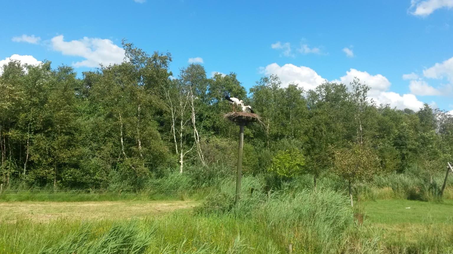
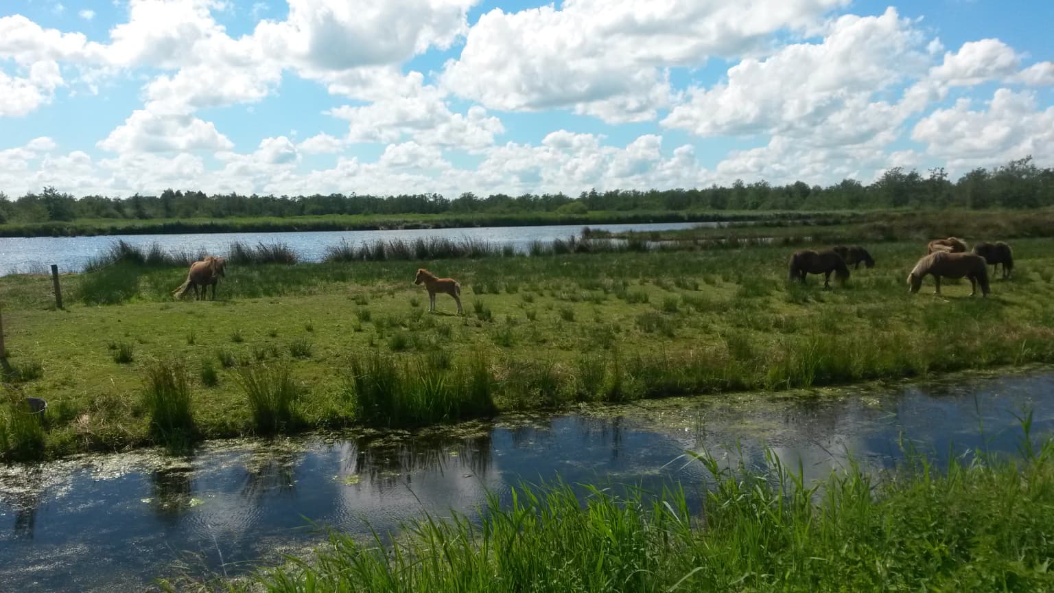
De Alde Feanen is best known for its exceptional lowland peat bog ecosystem, one of the last remaining examples of this habitat type in the Netherlands. The park's distinctive landscape of interconnected lakes, marshlands, quaking bogs (trilvenen), and traditional peat extraction pools creates a unique ecological character. The area is famous for its birdlife, particularly the white stork which has become a symbol of the park, with dedicated nesting platforms throughout the area. The park also features small herds of Shetland ponies that graze in certain areas, adding to the traditional countryside character. Historic windmills, including the 18th-century De Ikkers spinnenkopmolen, punctuate the wetland horizon and reflect the area's cultural history.

De Alde Feanen National Park history and protected-area timeline

The history of De Alde Feanen reflects the broader story of wetland exploitation and conservation in the Netherlands. Peat extraction in the Friese venen began on a small scale as early as the twelfth century but became a significant industrial activity during the sixteenth century when canals were dug to transport peat to the cities of Holland. In the area around Earnewoude, peat extraction peaked during the eighteenth and nineteenth centuries using the bagger method, which created the characteristic elongated peat pits (petgaten) separated by narrow strips of remaining peatland (legakkers). When peat extraction ended around 1900, the abandoned extraction areas became the basis for the modern landscape. The name De Alde Feanen, meaning "the old peat excavations," dates from this period. Conservation history began in 1923 when Vereniging Natuurmonumenten purchased the first three hectares at Rengersmiede. It Fryske Gea, the Friesland nature conservation organization founded in 1930, acquired Het Prinsehôf in 1934 (134 hectares) and subsequently expanded its holdings to approximately 2,500 hectares by 2001. The national park designation process began in the late 1990s following a societal debate about recreational development proposals near Earnewâld. After four years of preparation, the Minister of Nature designated the area as a national park on April 26, 2006.

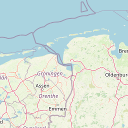
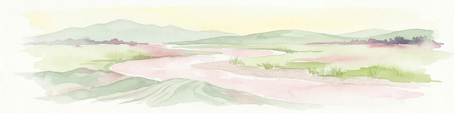
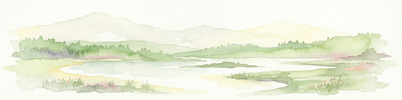
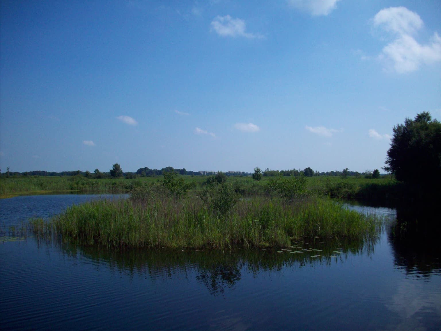
De Alde Feanen National Park landscape and geographic character

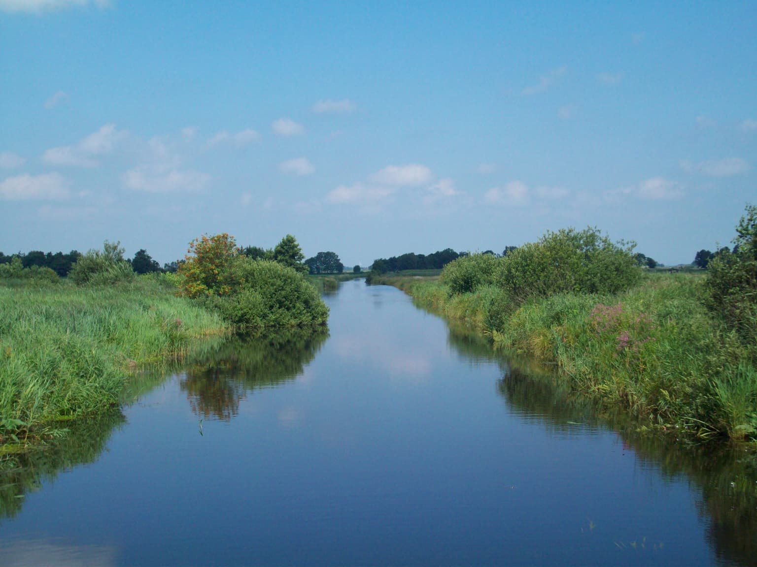
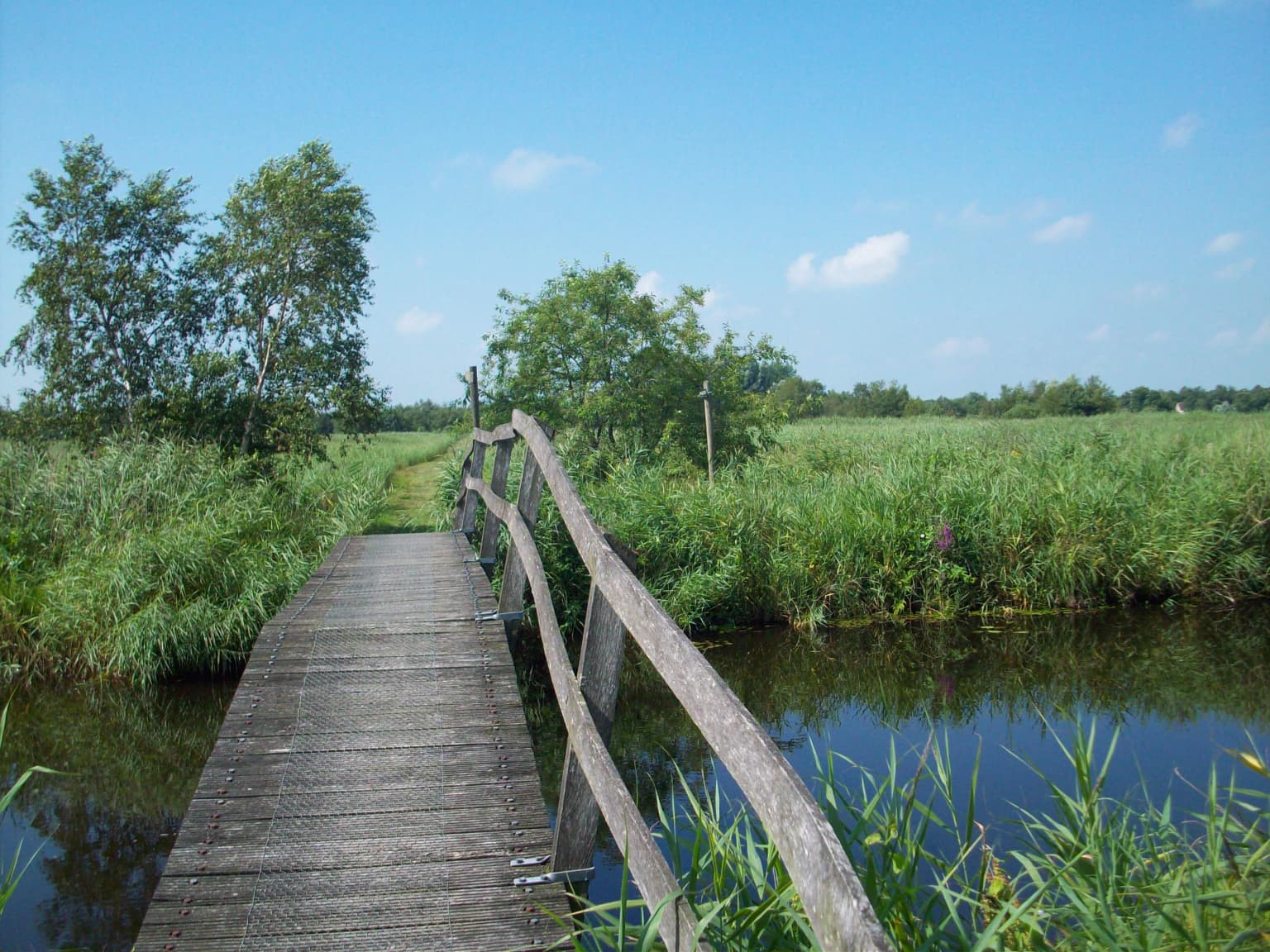
The physical landscape of De Alde Feanen is defined by its position in the lowest part of Friesland, a region of low-lying peat wetlands that contrasts with the higher ground of the Drents Plateau to the east. The park consists of an intricate pattern of shallow lakes, marshy areas, peat extraction pools (petgaten), quaking bogs (trilvenen), reed beds, and patches of woodland. The petgaten, created during centuries of peat extraction, are typically about 1.5 meters deep and separated by narrow strips of unreclaimed peatland. Some of these pools have merged over time due to wave erosion of the intervening legakkers, forming larger lakes such as the Princenhof area. The landscape is remarkably flat, with subtle variations in elevation determined by the pattern of extraction and natural peat subsidence. Wooden boardwalks and paths allow visitors to traverse areas of quaking bog where the ground literally moves with each step, a unique experience unique to this type of wetland. The horizon is punctuated by several historic windmills, including the eighteenth-century De Ikkers, which served historically as drainage devices for the surrounding farmland.

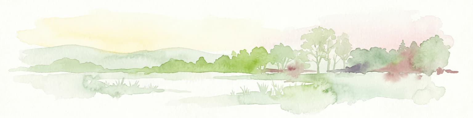
De Alde Feanen National Park ecosystems, habitats, and plant life

The ecological character of De Alde Feanen is defined by its lowland peat bog environment, a habitat type that has become increasingly rare across western Europe. The park contains a complete succession of wetland vegetation types, from open water through various stages of infilling to marsh and finally to fen woodland, a process known as verlanding or natural succession. The quaking bogs (trilvenen) represent a particularly distinctive habitat where a floating mat of vegetation covers waterlogged peat, creating a surface that moves underfoot. The blue grass meadows (blauwgraslanden) support specialized vegetation including blue sedge and yellow sedge, marsh violet, and knapweed. The relict peatlands contain rare heath vegetation with species including cross-leaved heath, bell heather, and hare's-tail cottongrass. More than 500 species of higher plants have been recorded in the park, including numerous species of sedge and orchid. The water system supports aquatic vegetation including water strawberry, and the wet woodlands contain species such as wild bogmyrtle. Six species of amphibians have been recorded, and the area supports diverse freshwater fish populations.

De Alde Feanen National Park wildlife and species highlights

De Alde Feanen supports an exceptional diversity of wildlife, particularly birds, making it one of the most significant wetland areas in the Netherlands. More than 180 bird species have been recorded, of which more than 100 breed within the park. The white stork is the most visible and iconic species, with tall wooden poles installed throughout the park to provide nesting sites. The bearded tit (baardmannetje) serves as the park's emblem. The area supports important populations of species listed under the EU Birds Directive, including bittern, purple heron, marsh harrier, corncrake, little crake, ruff, black tern, and common tern. A breeding colony of cormorants in the Princenhof area once contained up to 900 nests. The park is particularly important as a migratory staging area, with tens of thousands of waders passing through in spring, including ruff, black-tailed godwit, and curlew. Winter populations include large numbers of geese and ducks, with sometimes 25,000-35,000 wigeon present. The mammal population includes at least 35 species, with seven bat species recorded. The otter, which disappeared from the area in the 1980s, was reintroduced in 2011 with six individuals released. Four mammal species appear on Dutch Red Lists: pine marten, European water vole, European pygmy shrew, and northern bat.

De Alde Feanen National Park conservation status and protection priorities

De Alde Feanen holds multiple protective designations reflecting its ecological significance at both national and international levels. As a national park, it receives the highest level of protection under Dutch law. The area has been part of the Natura 2000 network since late 2006, with the provincial government responsible for developing and implementing management plans. The park was designated as a Ramsar Wetland in 1992, recognizing its importance as an international habitat for waterbirds. BirdLife International has identified the park as an Important Bird Area due to its significance for populations of species including barnacle goose, pink-footed goose, white stork, and sedge warbler. The conservation management challenges have included addressing historical water and soil pollution from surrounding agricultural areas, which led to the exclusion of外来 water in the 1990s, removal of contaminated sediment, creation of new peat pits, and restoration of former polders. The management plan, updated every ten years, guides conservation activities focused on maintaining and enhancing the wetland habitat, supporting breeding bird populations, and managing visitor access.

De Alde Feanen National Park cultural meaning and human context

The cultural landscape of De Alde Feanen reflects centuries of human interaction with the wetland environment. The area lies within the traditional Friesland landscape region known as the Lage Midden, historically characterized by peat extraction and seasonal grassland use. The village of Earnewâld sits on a slight elevation in the peatland and has been a permanent settlement since the thirteenth century. The historic windmills, including De Ikkers from the eighteenth century and the Princehofmolen near Earnewâld, represent the traditional drainage infrastructure that made agriculture possible in this low-lying landscape. The stork breeding station at It Eibertshiem reflects the cultural significance of this species in Dutch tradition. The presence of Shetland ponies, some in paddocks accessible to visitors, maintains the traditional pastoral character of the agricultural areas within and adjacent to the park. The Frisian language names used throughout the area, including park and place names, reflect the bilingual character of Friesland.

Top sights and standout views in De Alde Feanen National Park

De Alde Feanen offers a distinctive Dutch wetland experience characterized by its historic peat extraction landscape, exceptional birdlife, and traditional cultural features. The park provides some of the best opportunities in the Netherlands to observe white storks in a natural setting, with dedicated nesting platforms and viewing opportunities near Earnewâld. The quaking bog areas offer a unique walking experience where the ground moves beneath your feet. The historic windmills provide iconic landscape features and reflect the area's drainage history. The bird observation opportunities are outstanding, with the park serving as both a breeding ground for marsh birds and a critical staging area for migratory waterfowl. The visitor center at De Reidplûm provides orientation and educational resources, while the network of walking, cycling, and canoe routes allows exploration of this intimate wetland landscape.

Best time to visit De Alde Feanen National Park

The park can be enjoyed throughout the year, with different seasons offering distinct experiences. Spring brings large numbers of migratory waders passing through, with tens of thousands of ruff, black-tailed godwit, and curlew staging in the wetlands during March and April. This is also the prime season for observing white storks on their nests and the breeding activity of marsh birds. Summer offers the opportunity to see young storks and ponies, with the vegetation at its most lush. Autumn provides good conditions for birdwatching as winter visitors begin to arrive, particularly geese and ducks. Winter, though quieter, offers a different character with frozen waterways and large flocks of waterfowl, though some routes may have limited access. The visitor center at Earnewâld is open year-round and provides current information on conditions and wildlife viewing opportunities.

Park location guide

Geography guide, regional context, and park location map for De Alde Feanen National Park

De Alde Feanen National Park park geography, regions, and map view in Netherlands
Understand where De Alde Feanen National Park sits in Netherlands through a broader geographic reading of the surrounding landscape, nearby location context, and its mapped position within the national park landscape.

How De Alde Feanen National Park fits into Netherlands

The Netherlands is a low-lying coastal country in Northwestern Europe, famous for its extensive dike and canal systems that reclaim land from the sea. It consists of twelve provinces and is known for tulips, windmills, and cycling culture. The country is a founding member of the European Union with Amsterdam as its capital and The Hague as the seat of government.

Wider geography shaping De Alde Feanen National Park in Netherlands

The Netherlands is located in Northwestern Europe along the North Sea coastline to the north and west. It borders Germany to the east and Belgium to the south. The country is notably flat, with a significant portion of its territory lying below sea level, protected by dikes and dune systems. It consists of twelve provinces and also includes overseas municipalities in the Caribbean.

Map view of De Alde Feanen National Park

Use this park location map to pinpoint De Alde Feanen National Park in Netherlands, understand its exact geographic position, and read its mapped placement within the surrounding landscape more clearly.

Pigeon | © OpenStreetMap contributors

Location context for De Alde Feanen National Park

Friesland
Park atlas

Compare diverse protected landscapes and mapped conservation efforts across the Frisian wetlands and adjacent regions.

Explore Other National Parks and Protected Areas Near De Alde Feanen in Friesland
After exploring De Alde Feanen National Park, discover other national parks and protected areas situated across the low-lying wetlands of Friesland and the broader northern Netherlands. Compare diverse conservation landscapes, map regional protected zones, and trace the geographic distribution of significant natural habitats around this distinct peat bog environment.
Watercolor painting of a lake surrounded by green fields and distant mountains.
National park

Lauwersmeer National Park: Mapped Wetland Landscape and Migratory Bird Atlas

Explore protected Dutch Wadden Sea geography and terrain.

Discover Lauwersmeer National Park, a protected wetland in the Netherlands shaped by its post-enclosure transformation. This national park offers a unique glimpse into evolving ecosystems, serving as a vital corridor for migratory birds and showcasing a distinctive flat, open landscape with extensive water and reed environments. Its position within the Wadden Sea UNESCO World Heritage Site highlights its broader ecological importance. Explore the mapped geography, land-use patterns, and characteristic terrain of this dynamic protected area, known for its natural darkness and diverse avian populations.

Area
60 km²
Established
2003
IUCN
II
Relief
Lowland
Watercolor illustration of a landscape with green fields, trees, a body of water, and distant hills under a light sky
National parkDrenthe

Drents-Friese Wold National Park: Protected Landscape and Geographic Exploration in Drenthe

Explore unique heathlands, drift-sands, and regional natural geography.

This entry details Drents-Friese Wold National Park, a crucial protected landscape in the Drenthe province. Understand its mapped boundaries, distinctive heath and drift-sand terrain, and its significance as a natural area. Discover the park's regional geographic setting and its role in the broader Dutch landscape atlas, providing context for its unique ecological and historical character.

Area
61 km²
Established
2000
IUCN
II
Relief
Lowland
Watercolor painting of a wetland scene with a winding river, grassy areas, and distant hills
National parkOverijssel

Weerribben-Wieden National Park: A Premier Lowland Peat Bog National Park in Overijssel

Explore mapped protected wetlands and unique hydrological landscapes.

Weerribben-Wieden National Park stands as a remarkable example of a large-scale lowland peat bog ecosystem, recognized as the most extensive and well-preserved in Northwestern Europe. Located in the Overijssel province, this protected area showcases a complex mosaic of interconnected waterways, expansive reed beds, and marshy woodlands. Our platform provides structured geographic context, enabling detailed map-based discovery of the park's unique terrain and ecological significance as a vital conservation landscape.

Area
105 km²
Established
1992
IUCN
II
Relief
Lowland
Watercolor illustration of rolling hills, a winding river, and distant mountains under a pale sky
National parkFriesland

Schiermonnikoog National Park: Protected Landscape and Geographic Atlas

Explore its unique dune systems, salt marshes, and Wadden Sea context.

Schiermonnikoog National Park in Friesland is a testament to actively evolving coastal geography, showcasing dynamic dune formations, extensive salt marshes, and diverse natural habitats. As a protected landscape within the UNESCO Wadden Sea, it offers a unique focus for understanding regional protected areas and the intricate interplay of wind, water, and sediment shaping the North Sea coastline. Discover the park's ecological significance and its mapped terrain through MoriAtlas's structured geographic exploration.

Area
54 km²
Established
1989
IUCN
II
Relief
Lowland
National parkDrenthe

Dwingelderveld National Park: Drenthe's Vast Wet Heathland and Unique Pingo Lakes

Explore a protected landscape of heath, bogs, and ancient geography.

Dwingelderveld National Park represents a significant protected landscape in the Drenthe region of the Netherlands, celebrated as the largest wet heathland in Western Europe. This 37-square-kilometer area provides exceptional opportunities for atlas exploration, revealing a terrain composed of sandy ridges interspersed with waterlogged depressions. The park's defining features include more than forty natural pools, known as vennen, many of which are geologically important pingo-ruins. Discover the rich archaeological heritage, including ancient Celtic fields and burial mounds, all situated within this unique natural setting. MoriAtlas offers a structured view of Dwingelderveld National Park's distinct geography and protected ecological value.

Area
37 km²
Established
1991
IUCN
II
Relief
Lowland
National parkDrenthe

Drentsche Aa National Park: Preserved Cultural Landscape & River Valley Geography

Explore Drenthe's unique protected lands and mapped terrain.

Drentsche Aa National Park stands as a testament to a landscape preserved from the mid-19th century, offering a rare glimpse into traditional Dutch rural life. Situated in the province of Drenthe, this protected area features one of the last relatively untouched river systems in the Netherlands, characterized by meandering brooks, ancient hedgerows, and distinctive esdorp villages. The park's geography is influenced by the Saalien ice age Hondsrug ridge, creating a unique terrain of heathlands, sand dunes, and rolling landscapes ideal for atlas-based discovery.

Area
100 km²
Established
2002
IUCN
II
Relief
Lowland
National parkFlevoland

Nieuw Land National Park: Mapped Wetland Landscape on Flevoland's Reclaimed Land

Protected area geography and ecological discovery in the Netherlands

Nieuw Land National Park offers a distinctive protected landscape forged on land recently reclaimed from the sea in the Dutch province of Flevoland. This national park is characterized by its vast expanse of wetlands, artificial islands like the Marker Wadden, and critical importance for migratory bird populations. Delve into the park's geographic context and mapped features to understand its unique conservation value and role within the wider European atlas of protected areas.

Area
289 km²
Established
2018
IUCN
II
Relief
Lowland
National parkNorth Holland

Duinen van Texel National Park: Protected Coastal Dune and Wetland Atlas

Explore the mapped geography and protected landscape of North Holland.

The Duinen van Texel National Park offers a rich exploration of protected coastal dunes and dynamic wetland environments on Texel Island. This atlas-focused page details the park's unique landscape features, including active dune formation at De Hors and the tidal Slufter valley. Understanding its geographic context within North Holland provides a crucial aspect of its protected area status and ecological significance for regional mapped terrain.

Area
43 km²
Established
2002
IUCN
II
Visitors
265K annual

Common questions about visiting, size, designation, and location context for De Alde Feanen National Park

De Alde Feanen National Park FAQs for park facts, access, geography, and protected area context
Find quick answers about De Alde Feanen National Park, including protected-area facts, park geography, trail and visitor context, and how the park fits into its surrounding country and regional landscape.
MoriAtlas Explorer

Continue Your Protected Areas Search Across the Global Atlas

Deepen your exploration by continuing the structured search for national parks and protected areas worldwide. Utilize the comprehensive filtering capabilities to compare different conservation landscapes and refine your understanding of global park geography. Discover more about the distribution and characteristics of protected natural areas.

Global natural geography