Mori Atlas logo
National parkWeerribben-Wieden National Park

Mapped protected wetlands and unique hydrological systems within the Dutch province of Overijssel.

Weerribben-Wieden National Park: Northwestern Europe's Largest Lowland Peat Bog in Overijssel

(Nationaal Park Weerribben-Wieden)

Weerribben-Wieden National Park represents a globally significant protected landscape, holding the distinction of being the largest and most intact lowland peat bog in Northwestern Europe. Situated within the Overijssel province of the Netherlands, this national park offers a unique window into a dynamic wetland ecosystem shaped by centuries of human interaction with the land, primarily through peat extraction and reed harvesting. Our atlas-driven approach allows for detailed exploration of its intricate network of waterways, reed beds, lakes, and marsh forests, providing unparalleled geographic context for this vital conservation area.

wetlandslowland peat bognature reservesbirdwatchingfreshwater ecosystemsprotected area
Stylized illustration of a mountainous landscape with a waterfall, river, coniferous and deciduous forests, and rocky hills under a pastel sky

Weerribben-Wieden National Park

National park

Park overview

Structured park overview, official facts, and landscape profile for Weerribben-Wieden National Park

Weerribben-Wieden National Park park facts, protected area profile, and essential visitor context
Review the core facts for Weerribben-Wieden National Park, including designation, size, terrain, visitor scale, habitats, and operating context in one park-focused overview.

About Weerribben-Wieden National Park

Weerribben-Wieden National Park represents one of the Netherlands' most significant wetland conservation areas, protecting a landscape that has been shaped by human activity and natural processes over more than seven centuries. The park's two component areas, De Weerribben and De Wieden, together form the largest contiguous area of lowland peat bog in Northwestern Europe. This ecosystem developed through the historical practice of peat extraction, which created the characteristic pattern of narrow peat ridges (ribben) separated by water-filled extraction channels (weren). The park's hydrological system depends on careful water management, including more than three hundred small windmills that pump water into the area rather than out, a unique arrangement in Dutch water management. The landscape supports remarkable ecological diversity, with different stages of succession from open water bodies through reed beds, quaking bogs, and carr woodland creating a constantly evolving mosaic of habitats. This dynamic character requires ongoing active management, including winter reed harvesting, annual meadow mowing, and regular dredging of waterways to maintain the ecological variety that makes the park so valuable.

Quick facts and research context for Weerribben-Wieden National Park

Weerribben-Wieden National Park lies in the Kop van Overijssel region of the Netherlands, roughly 15 kilometers southeast of the town of Steenwijk. The park is managed cooperatively by Natuurmonumenten and Staatsbosbeheer, two of the Netherlands' largest nature conservation organizations. The area received Ramsar designation as a wetland of international importance in 1976, and the European Diploma for Nature Management was awarded in 1996, extended to the entire park area in 2009. The park forms part of the Dutch ecological main structure, serving as a crucial hub in the national network of protected areas and green corridors connecting wildlife populations across the country.

Park context

Deeper park guide and search-rich context for Weerribben-Wieden National Park

Weerribben-Wieden National Park history, landscape, wildlife, and travel context
Explore Weerribben-Wieden National Park through its history, landscape character, ecosystems, wildlife, conservation priorities, cultural context, and seasonal travel timing in a structured park guide built for atlas discovery and search intent.

Why Weerribben-Wieden National Park stands out

The park is most notable for its exceptional lowland peat bog ecosystem, the largest and most intact in Northwestern Europe. The Weerribben-Wieden represents a rare example of a functional low-moor fen system where natural succession from open water through reed beds to carr woodland remains observable across the landscape. The area is renowned for its populations of purple heron, black tern, and bittern, along with the return of the European otter following reintroduction in 2002. The rare large copper butterfly (Lycaena dispar batava), whose western European populations now persist primarily in Dutch marshes, finds its last strongholds here. The park also preserves traditional reed harvesting practices that have shaped the landscape for centuries.

A water pump, tractor, and windmill situated by a waterway in a grassy wetland under a partly cloudy sky.
Water pump structure and tractor in the wetlands of Weerribben-Wieden National Park.

Weerribben-Wieden National Park history and protected-area timeline

The history of Weerribben-Wieden is deeply intertwined with the extraction of peat, which began in the Kop van Overijssel around 1300 when flagellants settled in Giethoorn and discovered that dried peat made excellent fuel. Large-scale commercial peat production started around 1600, with turf transported by ship to markets in Holland via the Zuiderzee. The extraction method involved digging trenches (weren) and leaving strips of peat (ribben) to dry. The catastrophic storms of 1776 and 1825 breached the narrow peat ridges, flooding large areas and creating the lakes known as Beulakerwijde and Belterwijde. Following these disasters, stricter regulations on ridge width allowed the distinctive landscape of De Weerribben to develop north of the Steenwijkerdiep, where peat extraction began later in 1700. By the late 18th century, peat production employed over 15% of the regional workforce, reaching 80% in some villages. Peat extraction gradually declined through the 20th century, ending entirely by 1955. Simultaneously, reed harvesting for thatching became important from the 20th century onward, with about 1,000 hectares still producing thatching reed today. Nature conservation began acquiring land in the 1930s, with Natuurmonumenten purchasing properties around De Wieden starting in 1934, while Staatsbosbeheer began acquiring reed lands in De Weerribben in 1956.

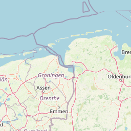
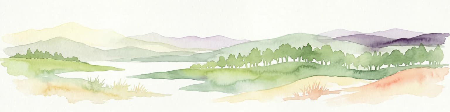
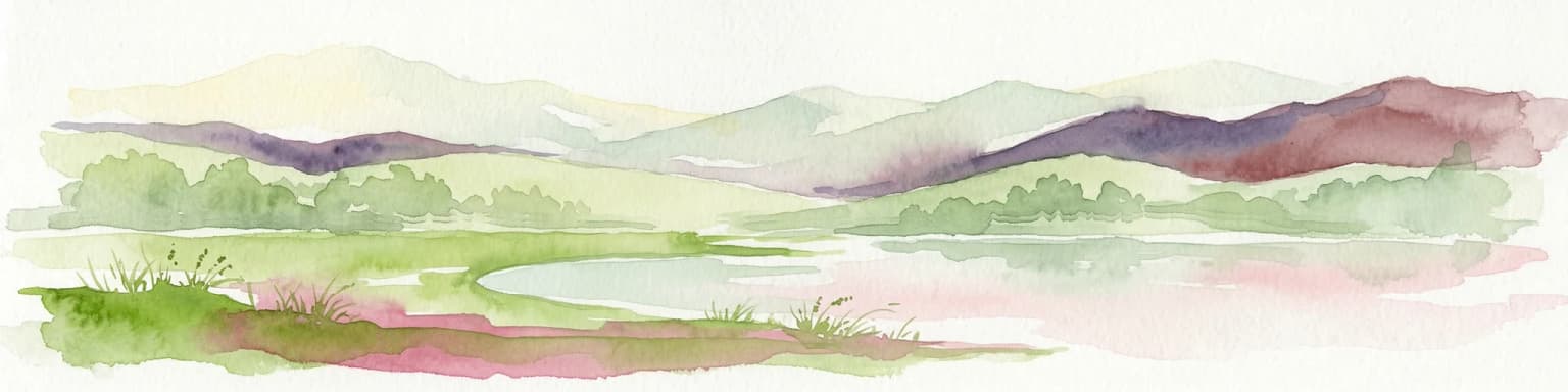
Weerribben-Wieden National Park landscape and geographic character

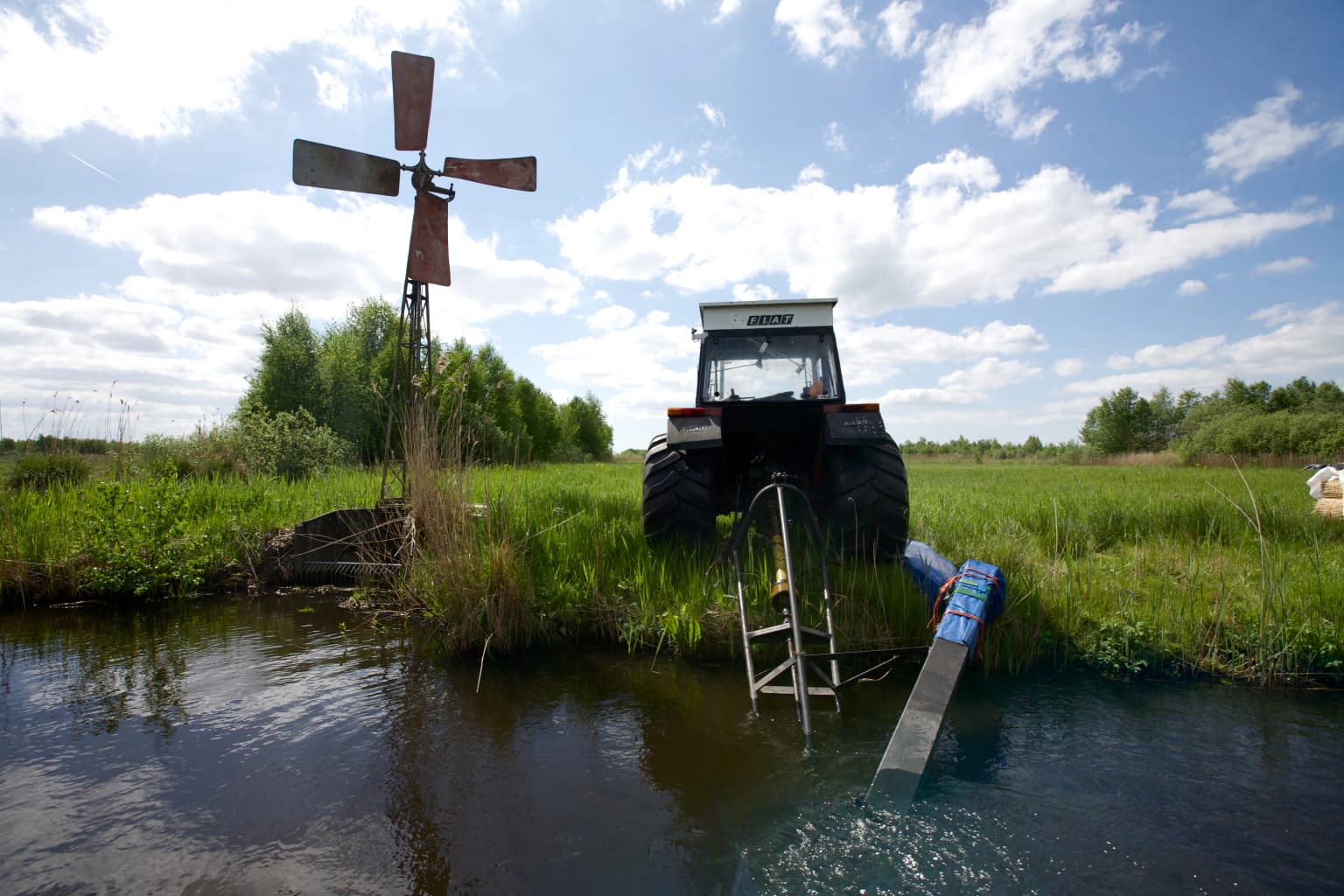
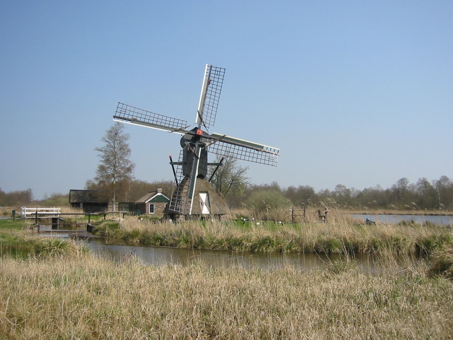
The physical landscape of Weerribben-Wieden consists of an intricate network of lakes, canals, ditches, reed beds, and marshy woodlands that form the largest lowland peat bog in Northwestern Europe. The terrain is almost entirely flat, with elevation differences rarely exceeding a few meters. The park contains numerous shallow lakes formed from flooded peat extraction areas, connected by a dense system of navigable waterways originally created for peat transport. The peat substrate, which can reach depths of several meters, sits atop clay deposits and has been accumulating since the last Ice Age. The water table is maintained at or just below the surface throughout much of the park, creating the waterlogged conditions essential for peat formation and the maintenance of wetland habitats. Traditional windmills, including the distinctive tjasker mills unique to this region, dot the landscape and form part of the water management system. The park also includes areas of higher ground where historic peat extraction was less intensive, providing habitat diversity within the overall wetland matrix.

Floating dock with green boats, grassy shore, and thatched-roof buildings on calm water
Boat dock with green boats at Weerribben-Wieden National Park

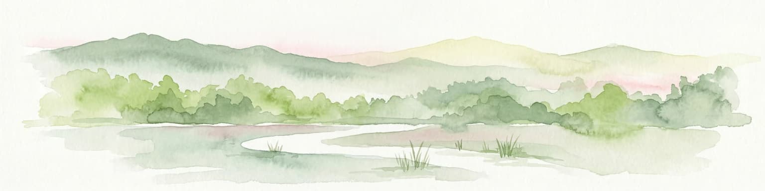
Weerribben-Wieden National Park ecosystems, habitats, and plant life

The ecological character of Weerribben-Wieden is defined by the lowland peat bog ecosystem, a habitat type that has become extremely rare in Europe due to drainage and agricultural conversion. The park's vegetation includes extensive reed beds (Phragmites australis), floating water vegetation dominated by water soldier (Stratiotes aloides) and yellow water-lily, and developing carr woodland where willow and alder dominate successional areas. The different stages of paludification and terrestrial succession create exceptional habitat heterogeneity, supporting species characteristic of each successional stage. Quaking bogs (trilvenen) form where vegetation floats on water-saturated peat, creating unstable ground that trembles when walked upon. The botanical value is closely linked to the historical human influence through peat extraction, which maintained the open wetland character and created the complex habitat mosaic that persists today. The park's position within the Dutch ecological main structure makes it important for connecting wetland populations across the country.

Two people paddling canoes on a calm waterway surrounded by dense green forest.
Two people canoeing on a calm waterway in Weerribben-Wieden National Park.

Weerribben-Wieden National Park wildlife and species highlights

The wildlife of Weerribben-Wieden reflects the exceptional value of the lowland peat bog ecosystem. The avifauna is particularly diverse and significant, with the park supporting important populations of purple heron (approximately 70 breeding pairs), bittern, black tern, grebe species, marsh harriers (both hen and Montagu's), and long-eared owl. The area serves as breeding habitat for species including shoveler, snipe, whimbrel, common snipe, black-headed gull, and black tern, while also functioning as critical staging and wintering habitat for migratory waterbirds. The European otter, which was locally extinct by the late 1980s, was successfully reintroduced in 2002 and has since dispersed throughout the park and into other Dutch wetlands. Fish species include northern pike and common carp, important prey for otters and diving birds. The invertebrate fauna includes the rare large copper butterfly (Lycaena dispar batava), whose remaining European populations are now concentrated in Dutch fens, along with numerous dragonfly species including the green hawker (Aeshna viridis).

A wooden windmill with four blades stands near a body of water in a grassy field. The sky is clear and blue with some trees in the background.
Traditional Dutch windmill in Weerribben-Wieden National Park

Weerribben-Wieden National Park conservation status and protection priorities

Weerribben-Wieden holds significant conservation recognition at both European and international levels. The park received Ramsar Convention designation in 1976 as a wetland of international importance, particularly for waterbird habitat. The European Diploma for Nature Management was awarded in 1996 and extended to cover the entire park area following the 2009 expansion. The entire park is also designated as a Natura 2000 site under the EU Birds and Habitats Directives. The conservation challenges facing the area include maintaining the dynamic wetland character through active management, as without intervention the entire area would succeed to carr woodland and lose the open water and reed bed habitats essential for many species. Major restoration projects have been undertaken through the European LIFE programme, including the

Best time to visit Weerribben-Wieden National Park

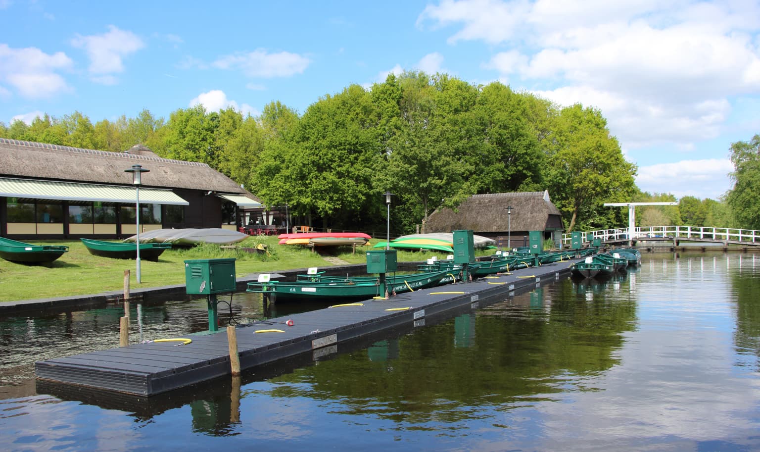
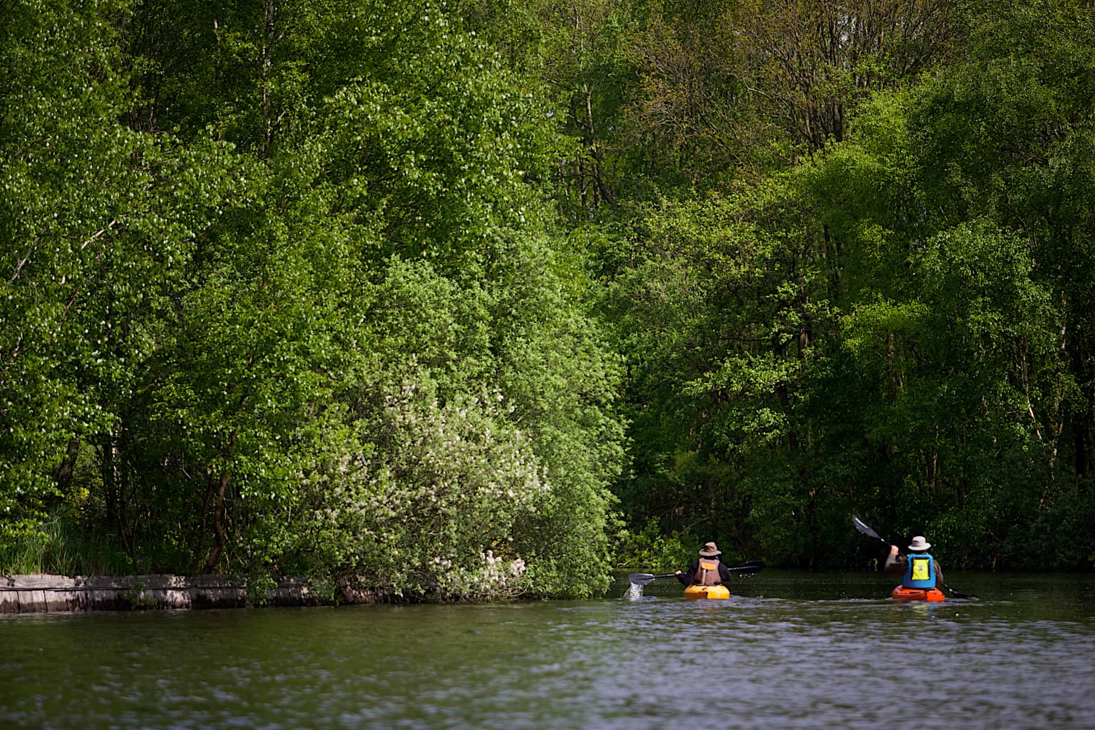
Weerribben-Wieden can be enjoyed throughout the year, though each season offers a distinctly different experience of the park. Spring brings the breeding season for many waterbirds, with purple herons, bitterns, and black terns becoming active and visible among the reed beds. The emergence of dragonflies and the first butterflies add invertebrate interest to early visits. Summer offers the fullest vegetation development, with extensive reed beds providing cover for nesting birds and creating the classic wetland atmosphere. Autumn is traditionally the time for reed harvesting, when the golden-colored cut reeds are gathered, and the water table is lowered allowing access to areas normally submerged. Winter reveals the skeletal structure of the landscape, with bare trees and the intricate pattern of waterways more visible, while birds congregating on remaining open water provide excellent viewing opportunities. The park's waterways remain accessible year-round for boat-based exploration, though summer weekends can be busy with visitors exploring by canoe.

Park location guide

Geography guide, regional context, and park location map for Weerribben-Wieden National Park

Weerribben-Wieden National Park park geography, regions, and map view in Netherlands
Understand where Weerribben-Wieden National Park sits in Netherlands through a broader geographic reading of the surrounding landscape, nearby location context, and its mapped position within the national park landscape.

How Weerribben-Wieden National Park fits into Netherlands

The Netherlands is a low-lying coastal country in Northwestern Europe, famous for its extensive dike and canal systems that reclaim land from the sea. It consists of twelve provinces and is known for tulips, windmills, and cycling culture. The country is a founding member of the European Union with Amsterdam as its capital and The Hague as the seat of government.

Wider geography shaping Weerribben-Wieden National Park in Netherlands

The Netherlands is located in Northwestern Europe along the North Sea coastline to the north and west. It borders Germany to the east and Belgium to the south. The country is notably flat, with a significant portion of its territory lying below sea level, protected by dikes and dune systems. It consists of twelve provinces and also includes overseas municipalities in the Caribbean.

Map view of Weerribben-Wieden National Park

Use this park location map to pinpoint Weerribben-Wieden National Park in Netherlands, understand its exact geographic position, and read its mapped placement within the surrounding landscape more clearly.

Pigeon | © OpenStreetMap contributors

Location context for Weerribben-Wieden National Park

Overijssel

Visual reference for the intricate waterways, reed beds, and unique low-moor fen habitats characterizing this protected Dutch wetland.

Weerribben-Wieden National Park Photos: Explore the Dutch Wetland Landscapes and Lowland Peat Bog Scenery
Discover the distinct landscapes and intricate habitats of Weerribben-Wieden National Park through detailed imagery. These photos offer visual insights into the lowland peat bog ecosystem, extensive reed beds, winding waterways, and marsh forests that define this significant Dutch protected area, aiding a deeper geographic understanding of its unique environment.

A water pump, tractor, and windmill situated by a waterway in a grassy wetland under a partly cloudy sky.

Aerial view of patchwork fields with varying shades of green and brown, some water patches visible, and distinct boundaries between agricultural plots.

Floating dock with green boats, grassy shore, and thatched-roof buildings on calm water

Two people paddling canoes on a calm waterway surrounded by dense green forest.

A wooden windmill with four blades stands near a body of water in a grassy field. The sky is clear and blue with some trees in the background.

Calm waterway reflecting clouds with tall grasses and trees on both sides under a partly cloudy sky

Park atlas

Explore surrounding wetlands, unique lowland peat bogs, and connected conservation landscapes of the Netherlands.

Discover More National Parks and Protected Areas Near Weerribben-Wieden
Continue your exploration from Weerribben-Wieden National Park by browsing other protected areas, mapping their geographic spread, and comparing wetland ecosystems across the region. Delve into the diverse national park geography of the Netherlands, understanding regional conservation efforts and distinct lowland fen systems in a wider atlas context.
National parkDrenthe

Dwingelderveld National Park: Drenthe's Vast Wet Heathland and Unique Pingo Lakes

Explore a protected landscape of heath, bogs, and ancient geography.

Dwingelderveld National Park represents a significant protected landscape in the Drenthe region of the Netherlands, celebrated as the largest wet heathland in Western Europe. This 37-square-kilometer area provides exceptional opportunities for atlas exploration, revealing a terrain composed of sandy ridges interspersed with waterlogged depressions. The park's defining features include more than forty natural pools, known as vennen, many of which are geologically important pingo-ruins. Discover the rich archaeological heritage, including ancient Celtic fields and burial mounds, all situated within this unique natural setting. MoriAtlas offers a structured view of Dwingelderveld National Park's distinct geography and protected ecological value.

Area
37 km²
Established
1991
IUCN
II
Relief
Lowland
Watercolor illustration of a landscape with green fields, trees, a body of water, and distant hills under a light sky
National parkDrenthe

Drents-Friese Wold National Park: Protected Landscape and Geographic Exploration in Drenthe

Explore unique heathlands, drift-sands, and regional natural geography.

This entry details Drents-Friese Wold National Park, a crucial protected landscape in the Drenthe province. Understand its mapped boundaries, distinctive heath and drift-sand terrain, and its significance as a natural area. Discover the park's regional geographic setting and its role in the broader Dutch landscape atlas, providing context for its unique ecological and historical character.

Area
61 km²
Established
2000
IUCN
II
Relief
Lowland
National parkFriesland

De Alde Feanen National Park: Explore Friesland's Historic Peat Bog Landscape

Protected wetland terrain and abundant birdlife in the Netherlands.

Delve into the intricate mapped geography of De Alde Feanen National Park, a national park renowned for its exceptional lowland peat bog ecosystem. This protected area in Friesland showcases a unique terrain comprising shallow lakes, reed beds, and historic peat extraction pools, offering significant ecological and cultural value. The park's landscape provides vital habitats and serves as a testament to the region's long history of human engagement with wetland environments, making it a key destination for atlas-driven geographic discovery.

Area
25 km²
Established
2006
IUCN
II
Relief
Lowland
National parkFlevoland

Nieuw Land National Park: Mapped Wetland Landscape on Flevoland's Reclaimed Land

Protected area geography and ecological discovery in the Netherlands

Nieuw Land National Park offers a distinctive protected landscape forged on land recently reclaimed from the sea in the Dutch province of Flevoland. This national park is characterized by its vast expanse of wetlands, artificial islands like the Marker Wadden, and critical importance for migratory bird populations. Delve into the park's geographic context and mapped features to understand its unique conservation value and role within the wider European atlas of protected areas.

Area
289 km²
Established
2018
IUCN
II
Relief
Lowland
Watercolor painting showing green hills, a lake, and distant mountains under a light sky
National parkOverijssel

Sallandse Heuvelrug National Park: Overijssel's Glacial Ridge Protected Landscape

Explore its heathland geography and mapped park boundaries.

Sallandse Heuvelrug National Park represents a significant protected landscape within Overijssel, Netherlands, notable for its distinctive glacial ridges and extensive heathland ecosystems. As one of the country's most important conservation areas, it offers a unique opportunity to study the mapped topography and the geography of Dutch heathlands. Discover the protected area's contours and its place within the broader regional atlas context, appreciating its geological formations and ecological importance.

Area
35 km²
Established
2004
IUCN
II
National parkDrenthe

Drentsche Aa National Park: Preserved Cultural Landscape & River Valley Geography

Explore Drenthe's unique protected lands and mapped terrain.

Drentsche Aa National Park stands as a testament to a landscape preserved from the mid-19th century, offering a rare glimpse into traditional Dutch rural life. Situated in the province of Drenthe, this protected area features one of the last relatively untouched river systems in the Netherlands, characterized by meandering brooks, ancient hedgerows, and distinctive esdorp villages. The park's geography is influenced by the Saalien ice age Hondsrug ridge, creating a unique terrain of heathlands, sand dunes, and rolling landscapes ideal for atlas-based discovery.

Area
100 km²
Established
2002
IUCN
II
Relief
Lowland
Watercolor painting of a lake surrounded by green fields and distant mountains.
National park

Lauwersmeer National Park: Mapped Wetland Landscape and Migratory Bird Atlas

Explore protected Dutch Wadden Sea geography and terrain.

Discover Lauwersmeer National Park, a protected wetland in the Netherlands shaped by its post-enclosure transformation. This national park offers a unique glimpse into evolving ecosystems, serving as a vital corridor for migratory birds and showcasing a distinctive flat, open landscape with extensive water and reed environments. Its position within the Wadden Sea UNESCO World Heritage Site highlights its broader ecological importance. Explore the mapped geography, land-use patterns, and characteristic terrain of this dynamic protected area, known for its natural darkness and diverse avian populations.

Area
60 km²
Established
2003
IUCN
II
Relief
Lowland
Watercolor painting of rolling hills, green trees, and a winding path
National parkGelderland

De Hoge Veluwe National Park: Mapped Protected Landscape & Geographic Atlas Context

Explore Gelderland's unique heathland, sand dune, and woodland terrain.

De Hoge Veluwe National Park represents a distinctive protected area within the Gelderland region of the Netherlands. Its landscape is characterized by a unique mosaic of heathlands, sand dunes, and woodlands, shaped by ice age processes and historical land use. This page offers an atlas-focused exploration of its geographic setting, mapped boundaries, and the specific terrain that defines this significant natural and cultural heritage site.

Area
55 km²
Established
1935
IUCN
II
Visitors
629.4K annual

Common questions about visiting, size, designation, and location context for Weerribben-Wieden National Park

Weerribben-Wieden National Park FAQs for park facts, access, geography, and protected area context
Find quick answers about Weerribben-Wieden National Park, including protected-area facts, park geography, trail and visitor context, and how the park fits into its surrounding country and regional landscape.
MoriAtlas Explorer

Continue Your Protected Areas Search Across the Global Atlas

Deepen your exploration by continuing the structured search for national parks and protected areas worldwide. Utilize the comprehensive filtering capabilities to compare different conservation landscapes and refine your understanding of global park geography. Discover more about the distribution and characteristics of protected natural areas.

Global natural geography