
Mori Atlas logo
Nature reserveDürr-Ellenbachtal von Wald-Michelbach

Discover the unique meadow valley geography, alder forest habitats, and cultural trail history

Dürr-Ellenbachtal von Wald-Michelbach: Mapped Protected Landscape and Nature Reserve in Hessen

Dürr-Ellenbachtal von Wald-Michelbach is a vital nature reserve and FFH site located in the heart of the Odenwald mountains within Hessen. The protected area encompasses a narrow, north to south oriented valley characterized by its meandering brook, traditional open meadows, and bordering alder gallery forests. This site preserves rare botanical diversity, including nutrient-poor grassland habitats, while also retaining a unique historical connection to early forest education in Germany.

nature reserveOdenwaldmeadow valleybrook habitatnear-natural streamalder gallery forest
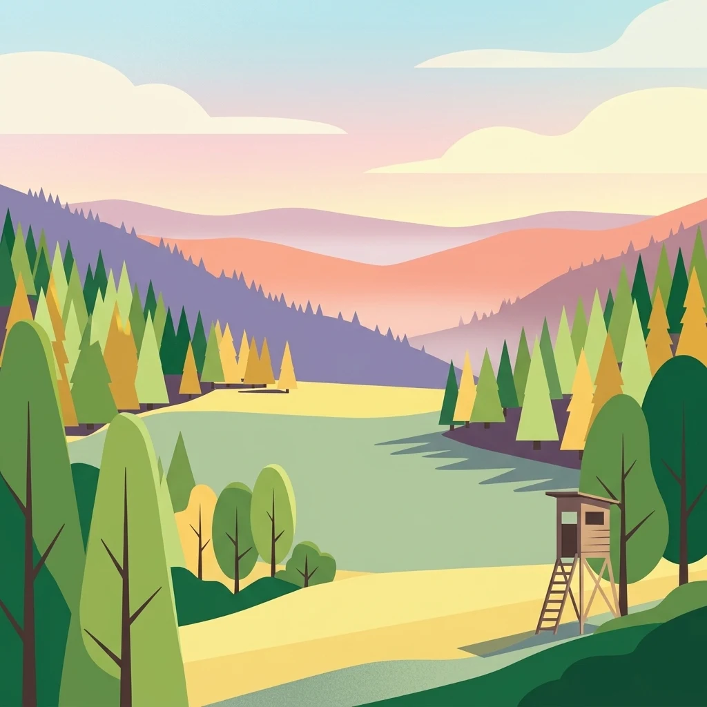
A flat-style digital illustration of a valley with a central meadow, surrounding evergreen and deciduous forests, rolling hills in the distance, and a wooden hunting observation stand in the foreground.

Dürr-Ellenbachtal von Wald-Michelbach

Nature reserve

Park overview

Structured park overview, official facts, and landscape profile for Dürr-Ellenbachtal von Wald-Michelbach

Dürr-Ellenbachtal von Wald-Michelbach park facts, protected area profile, and essential visitor context

Review the core facts for Dürr-Ellenbachtal von Wald-Michelbach, including designation, size, terrain, visitor scale, habitats, and operating context in one park-focused overview.

About Dürr-Ellenbachtal von Wald-Michelbach

The Dürr-Ellenbachtal von Wald-Michelbach is a slender protected valley in the heart of the Odenwald, a low mountain range spanning parts of Hesse, Bavaria, and Baden-Württemberg. Lying in the eastern reaches of the Wald-Michelbach municipality in the Bergstraße district, the reserve follows the south-flowing course of the Dürr-Ellenbach from its twin source brooks on the southern slopes of the Kleine Meisenberg (528 m) down to the boundary with Ober-Schönmattenwag; the brook then continues another kilometre to join the larger Ulfenbach.

The valley is enclosed between two wooded ridges: to the west stand the Meisenberg (538 m), Bocksberg (481 m), Metzgersrod (480 m), and Lannertskopf (472 m), while to the east lie the Zigeunerdelle (497 m), Taubenberg (482 m), Fichtelberg (492 m), Kohlwald (476 m), and Geiersberg (485 m). Together these forested flanks form the characteristic 'closed' feel of the valley, in which the meadows and brook below seem sheltered and distinct from the surrounding woodland.

Although the area is small, roughly 54 hectares, its ecological profile is unusually rich for such a compact valley. The combination of near-natural, meandering brook watercourse, wet and dry grassland patches, and alder gallery forest creates layered habitats that support demanding brook species, meadow wildflowers, butterflies, and birds of prey. Because of this density and integrity, the valley has been recognized both nationally, through its 1990 nature reserve designation, and at the European level, through its inclusion in the Natura 2000 network in 2018.

Beyond its natural values, the valley also holds a strong cultural and educational identity. The remains of a historic forestry house mark the site of the former settlement Dürr-Ellenbach, whose population emigrated in the mid-1800s during a period of severe hardship in the Odenwald. In the 1950s the educator and conservation pioneer Rupprecht Bayer installed one of Germany's first forest educational trails here, a tradition preserved through original wooden sign panels and a commemorative stone that remains on site today.

Quick facts and research context for Dürr-Ellenbachtal von Wald-Michelbach

Dürr-Ellenbachtal von Wald-Michelbach is a Hessian nature reserve (Naturschutzgebiet) under IUCN Category IV, Habitat/Species Management Area. It is located in the Odenwald within the Bergstraße district and was officially designated on 26 November 1990.

The protected area covers roughly 54 hectares and coincides with the FFH site DE6419305 'NSG Dürr-Ellenbachtal bei Wald-Michelbach', integrated into the Natura 2000 network. It is catalogued in the World Database on Protected Areas under WDPA-ID 162826. Elevations of the surrounding ridges lie in the high 400s and low 500s metres, with the valley running between the Meisenberg and the Zigeunerdelle–Geiersberg ridge lines.

Protection and recognition

Documented terrestrial protection history, management scope, and recognition data

Dürr-Ellenbachtal von Wald-Michelbach Protection Status and Designation Records

Terrestrial protection records for Dürr-Ellenbachtal von Wald-Michelbach outline the official designation history established in 2018 under database reference 162826. Verified framework details organize the documented conservation status and management scope for rigorous geographic research.

Protection details

Protection scope
Terrestrial
Designated year
2018
Transboundary protection
No
WDPA ID
162826
Park context

Deeper park guide and search-rich context for Dürr-Ellenbachtal von Wald-Michelbach

Dürr-Ellenbachtal von Wald-Michelbach history, landscape, wildlife, and travel context

Explore Dürr-Ellenbachtal von Wald-Michelbach through its history, landscape character, ecosystems, wildlife, conservation priorities, cultural context, and seasonal travel timing in a structured park guide built for atlas discovery and search intent.

Why Dürr-Ellenbachtal von Wald-Michelbach stands out

The reserve is best known for its species-rich, flower-filled meadows and its near-natural brook habitat, exemplified by clear, meandering stretches of the Dürr-Ellenbach bordered by alder forest. It is also notable as the home of one of the earliest forest educational trails in Germany, established by the educator and conservation pioneer Rupprecht Bayer in the mid-1950s and still partly preserved in its original form.
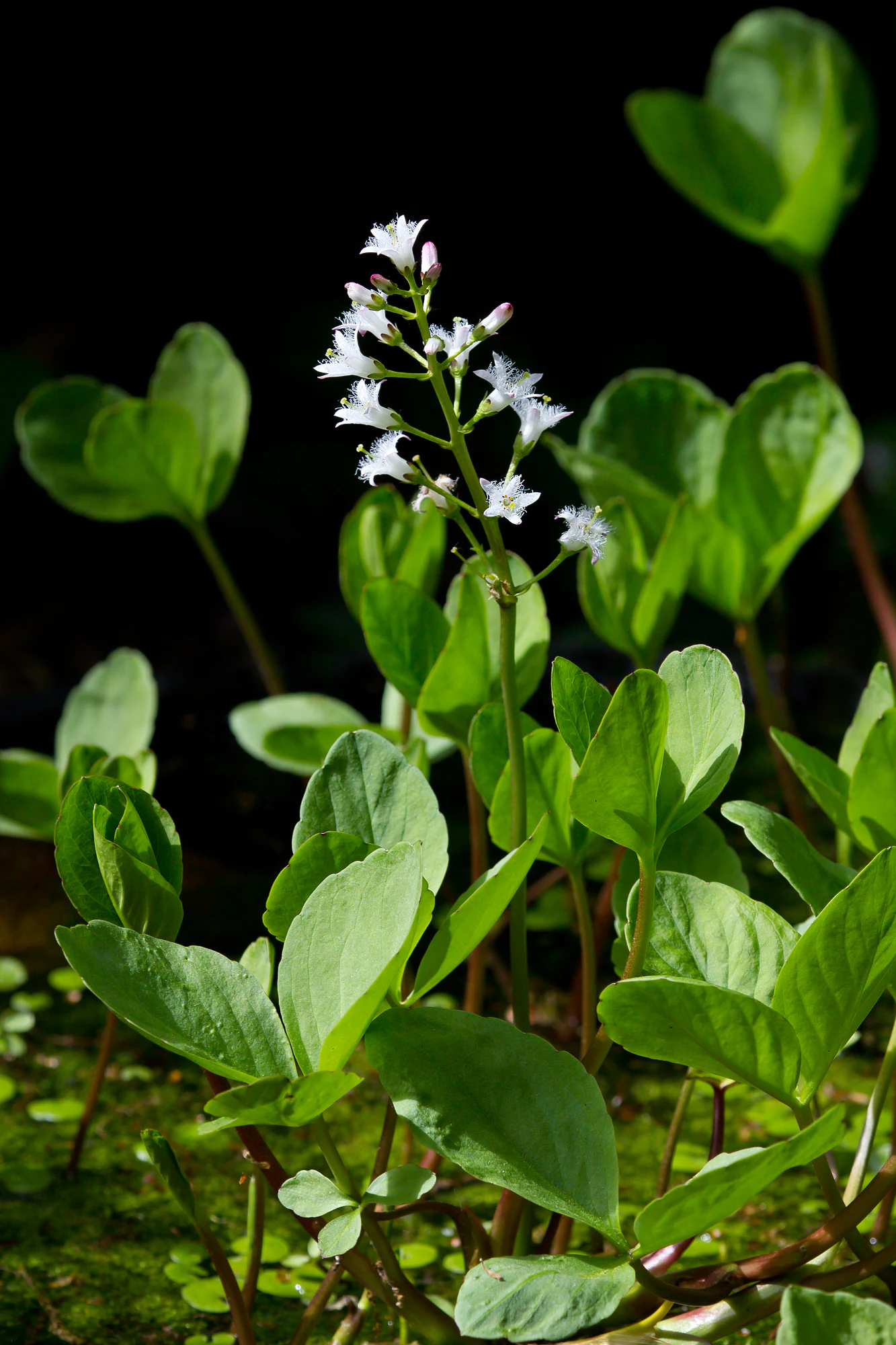
A close-up vertical shot of a bogbean plant showing white, fringed flowers on a stalk rising above its green leaves, set against a dark background.
Bogbean (Menyanthes trifoliata) flowering in the wetland habitat of Dürr-Ellenbachtal.

Dürr-Ellenbachtal von Wald-Michelbach history and protected-area timeline

The valley's recorded human history begins with the small rural settlement of Dürr-Ellenbach, located near the confluence of the two source brooks. This hamlet once covered the northern portion of what is today the protected area. By the mid-19th century, life in the Odenwald had become so difficult that almost the entire population of Dürr-Ellenbach chose to emigrate, primarily to America, and the settlement was abandoned. A protected forestry house is the main surviving physical trace of that earlier community.

In modern times, the valley's ecological significance gradually drew conservation interest. On 26 November 1990, the area was formally designated as the Hessian nature reserve 'Dürr-Ellenbachtal von Wald-Michelbach', securing formal protection for its meadows, brook, and associated forests.

European-level recognition came nearly three decades later, in 2018, when the reserve was admitted to the Natura 2000 network as the FFH site 'NSG Dürr-Ellenbachtal bei Wald-Michelbach', in acknowledgment of the high quality of its near-natural stream habitats and the diversity of its grassland flora.

A parallel cultural milestone occurred in the mid-1950s, when Rupprecht Bayer, a pioneer of nature education, developed one of Germany's first forest educational trails along the brook. Inaugurated in 1957, the trail used illustrated wooden panels to communicate the importance of the forest; some of the original panels have survived, and a memorial stone on site honours the trail's founder.

Dürr-Ellenbachtal von Wald-Michelbach landscape and geographic character

The Dürr-Ellenbachtal is a textbook example of a narrow, elongated Odenwald valley, oriented broadly north to south and pressed between two parallel forested ridges. The floor of the valley is a long strip of open grassland, while the immediately flanking slopes are cloaked in mixed forest that climbs to modest peaks in the high 400s and low 500s metres.

Across the valley floor, the Dürr-Ellenbach traces tight meandering bends through a corridor of green meadows set against a backdrop of alder strips and scattered hedgerows. The gentle, undulating meadow surface is visually softened by wet hollows and the dark green of the alder stands following the stream, while the steep, wooded flanks rise sharply on either side, giving the valley a distinctly enclosed atmosphere.

The broader Odenwald terrain surrounding the reserve lends the area a quiet, deeply rural mountain character. Small villages such as Aschbach, Affolterbach, and Olfen are tucked into neighbouring valleys and ridges, and the overall impression is of a remote, sheltered landscape in which the cultural and ecological history of the region remains visibly embedded in the terrain.
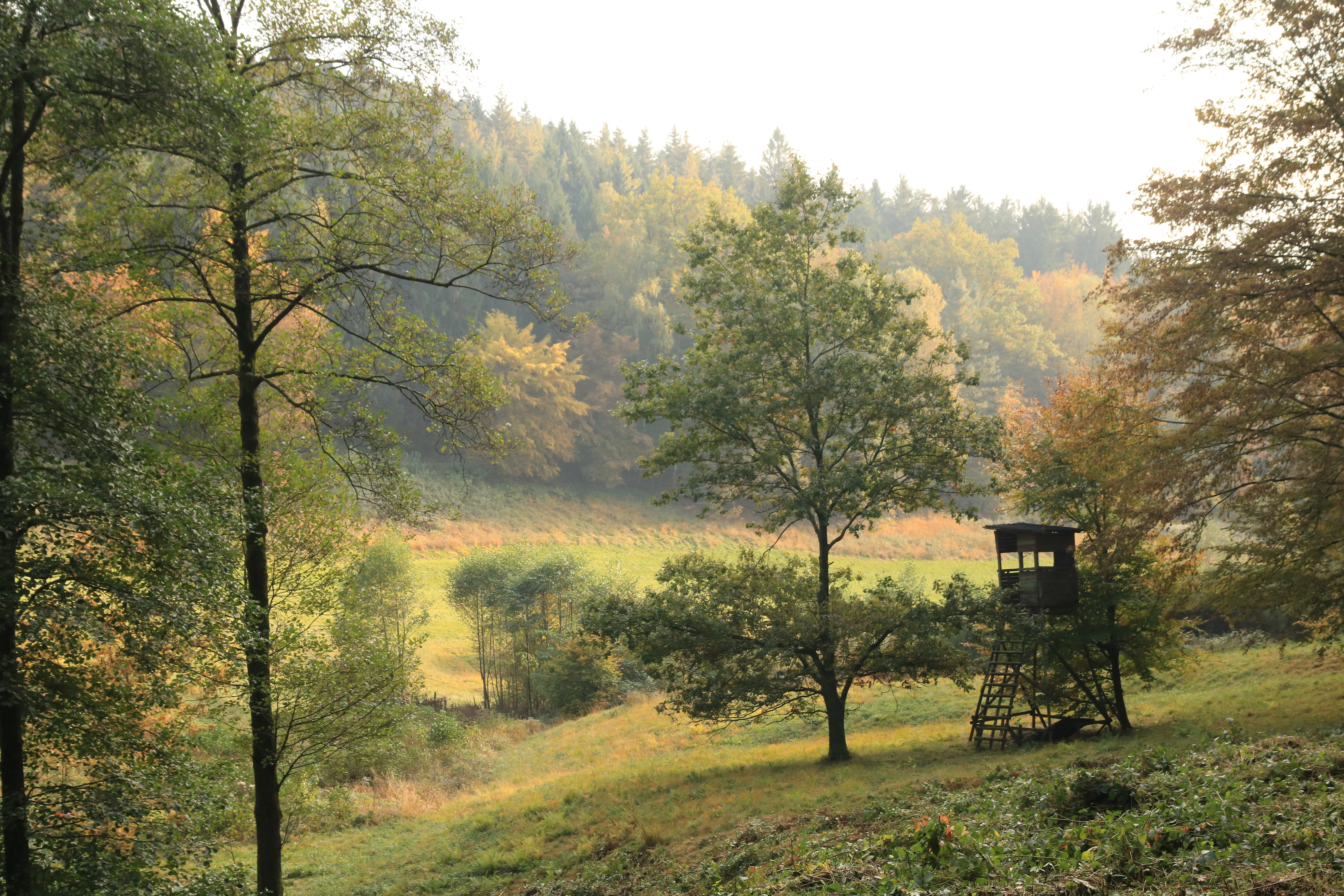
A wooden deer stand or hunting platform overlooks a grassy meadow surrounded by dense, autumn-tinted forest in the Odenwald region.
A wooden hunting high seat stands at the edge of a meadow in the Dürr-Ellenbachtal nature reserve.

Dürr-Ellenbachtal von Wald-Michelbach ecosystems, habitats, and plant life

Ecologically, the valley is a mosaic of near-natural freshwater habitat, wet and dry grassland, hedgerow networks, and gallery forest. The Dürr-Ellenbach flows in clear, oxygen-rich water, and its banks are lined with alder (Alnus), forming a continuous green corridor that stabilizes the banks and shades the water.

The open ground is dominated by species-rich, low-nutrient meadows, often described as 'Magerwiesen' (nutrient-poor meadows), which are visible evidence of a long history of grazing and traditional hay-making. Cutting these meadows and managing them without intensive fertilization is what allows the rich mixture of wildflowers to persist. Hedgerows preserved along the edges of former arable plots further break up the landscape and provide shelter, transition zones between forest and meadow, and habitat for insects and small mammals.

Where the meadows meet the brook and where the flush zones along the stream provide standing or slow-moving water, marshy vegetation develops. Plants such as marsh marigold (Cumpfdotterblume), yellow flag iris (Sumpf-Schwertlilie), and bogbean (Fieberklee) are associated with these wetter pockets, while orchids such as the broad-leaved marsh orchid (Breitblättriges Knabenkraut) and the early purple orchid (Männliches Knabenkraut) appear in the drier meadow stretches. Together, these vegetation patterns form a layered habitat complex that is unusually rich for such a small area.
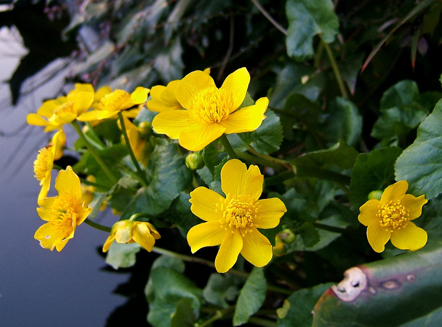
A close-up view of bright yellow marsh marigold flowers with green leaves growing at the edge of a dark stream.
Marsh marigolds, Caltha palustris, blooming near a stream in the Dürr-Ellenbachtal nature reserve.

Dürr-Ellenbachtal von Wald-Michelbach wildlife and species highlights

The clear, cool waters of the Dürr-Ellenbach support sensitive brook fauna: brown trout (Bachforelle) inhabit the upstream gravel beds, while fire salamanders (Feuersalamander) are characteristic of damp, shaded stretches, and larvae of the golden-ringed dragonfly (Zweigestreifte Quelljungfer) develop in the slower margins of the stream.

The meadows and hedgerows support a notable butterfly fauna. Species such as the sooty copper (Brauner Feuerfalter), painted lady (Distelfalter), and silver-washed fritillary (Kaisermantel) are recorded from the open flower-rich habitat, where they depend on the diversity of nectar sources and host plants sustained by traditional meadow management.

Birdlife in and around the reserve includes birds of prey and ecologically demanding woodland species. The red kite (Rotmilan) is associated with the broader Odenwald forest landscape, while the Eurasian pygmy owl (Sperlingskauz), one of Europe's smallest owls, is a notable presence in mature mixed and coniferous forest stands nearby. Together these species reflect the dual identity of the protected area: a small but ecologically complete valley combining aquatic, meadow, and forest habitats.

Dürr-Ellenbachtal von Wald-Michelbach conservation status and protection priorities

Protection of the Dürr-Ellenbachtal is significant because it locks in a system of traditional land use, near-natural hydrology, and habitat diversity that is no longer common in the surrounding Odenwald. By safeguarding the continued management of species-poor meadows and the integrity of the brook corridor, the reserve preserves ecological processes that sustain both rare plants and demanding freshwater species.

The 1990 designation as a Hessian nature reserve (NSG) placed the area under binding national-level protection, restricting damaging interventions and giving management authorities the tools to maintain open meadows and prevent vegetation overgrowth. Inclusion in the European Natura 2000 network, as the FFH site DE6419305, added an EU-level layer of protection specifically aimed at the habitat types of the Habitats Directive: near-natural brooks, nutrient-poor meadows, and alder gallery forests.

A key conservation challenge, both here and across the wider Odenwald, is the legacy of land-use change. The flower-rich meadows depend on continued mowing or grazing; without active management they would gradually be colonized by shrubs and forest, losing both their flora and the species that depend on it. By keeping meadow management active, preserving hedgerows, and protecting the stream from hydrological and pollution impacts, the reserve functions as a small but high-quality refuge within the broader Odenwald ecosystem.

Dürr-Ellenbachtal von Wald-Michelbach cultural meaning and human context

The cultural landscape of the valley is shaped by two strongly contrasting eras: the vanished rural settlement of Dürr-Ellenbach and the modern conservation-minded identity of the valley as a place of education and protection. The mid-19th-century emigration of nearly the entire population of Dürr-Ellenbach is one of many such stories from a period when hardship in the Odenwald drove large-scale migration to America; it gives the valley a deeply human-historical dimension that visitors encounter in the surviving forestry house.

The other defining cultural element is the forest educational trail developed in the 1950s by Rupprecht Bayer. As one of Germany's first 'Waldlehrpfade', the trail represents an early experiment in outdoor environmental education, using hand-painted wooden panels to explain forest ecology to the general public. Inaugurated in 1957, the trail and its surviving original signage, together with the commemorative stone, document the emergence of the modern German conservation movement at the local level.

Top sights and standout views in Dürr-Ellenbachtal von Wald-Michelbach

The valley's chief distinction lies in the combination of three qualities rarely found together at this scale: ecologically intact, meandering Odenwald brook habitat; species-rich traditional meadows bordered by hedgerows and alder forest; and an early forest educational trail whose original wooden signwork is still partly preserved.

On a single walk, visitors can move from open, flower-filled meadow through wet flushes rich in orchids and marsh plants to shaded streamside alder stands, all within a narrow, sheltered valley framed by wooded ridges of the central Odenwald.

Best time to visit Dürr-Ellenbachtal von Wald-Michelbach

Late spring and early summer are typically the strongest period for visiting the valley: the meadows reach their richest flowering display, and the combination of warm days and still-high water levels creates good conditions for seeing dragonflies, butterflies, and active amphibians along the brook.

Late summer and early autumn can also be rewarding, particularly for those interested in meadow butterflies and the warmer, humming insect fauna of the drier meadow sections. Cooler months offer quieter, more contemplative visits but reduce the visibility of the valley's characteristic flora and most of its distinctive insect life. Because this is a small, low-elevation valley, winter conditions generally remain accessible, though seasonal road and trail conditions in the surrounding Odenwald should always be considered.

Monthly climate preview

Long-term representative temperature and precipitation patterns across the year

Dürr-Ellenbachtal von Wald-Michelbach Climate Normals and Annual Weather Rhythm

Representative coordinate records show average monthly temperatures ranging from near freezing to warm summer maximums alongside steady precipitation rates. Reviewing the complete twelve-month climatology data provides a comprehensive baseline for regional meteorological comparison.
Annual mean10 °C
0 °C20 °C
Jan
Feb
Mar
Apr
May14°
Jun18°
Jul20°
Aug20°
Sep15°
Oct10°
Nov
Dec
Warmest month
July

20.3 °C

Coolest month
January

0.1 °C

Wettest month
July

2.4 mm/day

Driest month
April

1.5 mm/day

Park location guide

Geography guide, regional context, and park location map for Dürr-Ellenbachtal von Wald-Michelbach

Dürr-Ellenbachtal von Wald-Michelbach park geography, regions, and map view in Germany

Understand where Dürr-Ellenbachtal von Wald-Michelbach sits in Germany through a broader geographic reading of the surrounding landscape, nearby location context, and its mapped position within the national park landscape.

How Dürr-Ellenbachtal von Wald-Michelbach fits into Germany

Germany is a federal republic in Western and Central Europe with a population of over 83 million across sixteen constituent states. It is Europe's largest economy by nominal GDP and a major global exporter and importer. The capital is Berlin, and the country borders Denmark, Poland, Czech Republic, Austria, Switzerland, France, Luxembourg, Belgium, and the Netherlands.

Wider geography shaping Dürr-Ellenbachtal von Wald-Michelbach in Germany

Germany is located in Western and Central Europe, spanning 357,022 km². It borders Denmark to the north, Poland and the Czech Republic to the east, Austria and Switzerland to the south, and France, Luxembourg, Belgium, and the Netherlands to the west. The country has coastlines on the Baltic Sea and North Sea to the north, with the Alps located in the southern region.

Map view of Dürr-Ellenbachtal von Wald-Michelbach

Use this park location map to pinpoint Dürr-Ellenbachtal von Wald-Michelbach in Germany, understand its exact geographic position, and read its mapped placement within the surrounding landscape more clearly.

Pigeon | © OpenStreetMap contributors

Location context for Dürr-Ellenbachtal von Wald-Michelbach

Hessen

Visual exploration of protected valley terrain, meadows, and brook habitats

Dürr-Ellenbachtal von Wald-Michelbach Landscape Photos and Scenery

Visual records capture the narrow grassland valley, meandering brook corridors, and alder forests that define Dürr-Ellenbachtal von Wald-Michelbach. Photographic documentation reveals the sheltered topography, species-rich meadows, and rural Odenwald mountain character of the protected area.

A close-up vertical shot of a bogbean plant showing white, fringed flowers on a stalk rising above its green leaves, set against a dark background.

A red kite flying against a clear blue sky, showing its reddish brown plumage and characteristic forked tail.

A wooden deer stand or hunting platform overlooks a grassy meadow surrounded by dense, autumn-tinted forest in the Odenwald region.

A close-up view of bright yellow marsh marigold flowers with green leaves growing at the edge of a dark stream.

Park atlas

Compare surrounding Odenwald valley terrain and adjacent conservation landscapes.

Parks Near Dürr-Ellenbachtal von Wald-Michelbach and Related Protected Areas

Browsing other protected areas near Dürr-Ellenbachtal von Wald-Michelbach reveals the diverse meadow valleys and forested mountain ridges defining the central Odenwald region. Expanding the geographic comparison highlights regional conservation networks and similar natural reserves across adjacent mountain terrain.
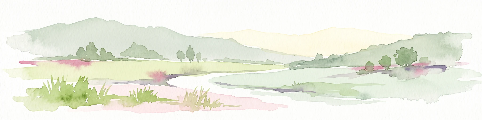
A wide watercolor painting showing rolling green hills and trees with pale pink and yellow hues across a valley landscape.
Nature reserveHessen
About 5.1 km away#1 closest

North

Rotes Wasser von Olfen Nature Reserve: Protected Wetland and Odenwald Geography

A unique bog and iron-rich stream landscape in Hessen, Germany.

Rotes Wasser von Olfen preserves a rare, small-scale mosaic of transitional bog and wet meadow vegetation within the Odenwald range. This protected site features reddish, iron-rich seepage waters and provides essential habitat for specialized flora and dragonfly populations amidst a surrounding forested mountain landscape.

Area
0.121 km²
Established
1980
IUCN
IV
Relief
Upland
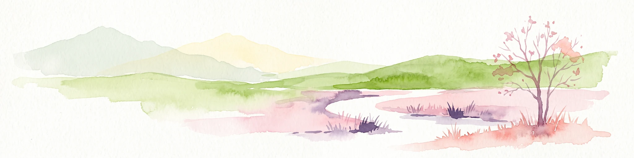
A watercolor painting depicting a soft-focus, light-colored landscape of rolling green hills, clustered trees, and a gentle stream valley.
Nature reserveHessen
About 5.3 km away#2 closest

Southwest

Eiterbachtal von Wald-Michelbach Nature Reserve in the Central Odenwald Uplands

A protected stream-valley landscape in the Bergstraße district of Hessen

Eiterbachtal von Wald-Michelbach protects a near-natural stream environment characterized by its meandering course, alder-ash gallery forests, and diverse tall-herb meadow communities. This nature reserve provides essential habitat in the southern Odenwald, showcasing the interplay between hydrological stream processes and sandstone forest edges within the Hessen region.

Area
0.473 km²
Established
1983
IUCN
IV
Relief
Upland
A soft, horizontal watercolor painting depicting a meandering stream flowing through green meadows and rolling hills under a pale sky.
Nature reserveHesse
About 5.8 km away#3 closest

Southeast

Finkenbachtal bei Finkenbach Nature Reserve: Mapped Brook Valleys of the Odenwald

Protected stream corridor and floodplain meadows in southern Hesse

Finkenbachtal bei Finkenbach preserves a compact, ecologically intact valley system characterized by meandering sandstone brook morphology and traditional floodplain meadow management. This protected area serves as a significant link in the regional Odenwald stream network, illustrating the intersection of low mountain forest and valley floor vegetation dynamics.

Area
0.276 km²
Established
1981
Relief
Upland
Climate
Temperate
Nature reserveHesse
About 7 km away#4 closest

West

In der Striet bei Vöckelsbach Nature Reserve: Regional Geography and Mapped Protected Landscapes

A compact forest and wetland mosaic in the Odenwald of southern Hesse

The nature reserve In der Striet bei Vöckelsbach is an essential protected area covering four and a half hectares of valley floor. It provides a dense habitat gradient from reeded spring zones through alder forests to mixed deciduous slopes. This record details the park landscape, stream systems, and its integration into the larger Geo Naturpark Bergstraße Odenwald and Natura 2000 protected areas.

Area
0.048 km²
Established
1988
Watercolor painting of a gentle, rolling green landscape with sparse trees and distant hills on a white background.
Nature reserveHesse
About 7 km away#5 closest

East

Jakobsgrund bei Gammelsbach Nature Reserve: Geographic Atlas and Park Boundary Mapping

Protected sandstone valley landscapes in southern Hesse

This nature reserve in the Odenwald hills provides a concentrated example of traditional valley land use. The area features a sharp contrast between dry south-facing slopes and damp, stream-carved lowlands, creating a botanical hotspot within the regional geography of Hesse, Germany.

Area
0.095 km²
Established
1996
IUCN
IV
Relief
Upland
A horizontal watercolor illustration of a soft, rolling landscape with a central winding path or stream, green meadows, distant hills, and foreground trees and flowers.
Nature reserveHesse
About 8.1 km away#6 closest

North

Gras-Ellenbacher Wiesen Nature Reserve: Protected Valley Basin Geography and Map Overview

Wet meadows and seepage habitats within the Odenwald hills

Situated in a gentle hollow near the Dachsberg and Kirchberg ridges, Gras-Ellenbacher Wiesen represents an essential Hessian nature reserve. This overview highlights the interplay between the Ulfenbach stream, drainage infrastructure, and traditional meadow management that defines this distinct sandstone upland protected landscape.

Area
0.241 km²
Established
1981
IUCN
IV
Relief
Upland
A wide watercolor illustration showing a river curving through a grassy valley with trees and hills in the background.
Nature reserveHessen
About 9.5 km away#7 closest

Northwest

In der Erbach bei Mörlenbach Nature Reserve: Protected Odenwald Stream Valley

Regional geography and habitat mapping in southern Hessen

The In der Erbach bei Mörlenbach nature reserve preserves a well-defined side-valley ecosystem within the broader Odenwald landscape. Its protected boundaries encompass a moisture-rich corridor featuring wet meadows, reedbeds, and forest edges that exemplify the traditional cultural geography of the Weschnitz river basin in southern Germany.

Area
0.197 km²
Established
1997
IUCN
IV
Relief
Upland
A horizontal watercolor painting showing rolling green hills, a winding stream in the foreground, and a single tree on the right.
Protected landscapeRhein-Neckar-Kreis
About 11 km away#8 closest

Southwest

Odenwald Protected Landscape: Geography and Regional Mapping in Rhein-Neckar-Kreis

Exploring the characteristic Odenwald mountain terrain and valley systems

This protected landscape encompasses over 6,000 hectares of diverse topography in northern Baden-Württemberg. The terrain features a classic Odenwald relief, defined by narrow V-shaped valley notches, riparian woodlands, and structural mosaics of forest and meadow. Gain insight into the geographic and ecological character of these protected stream catchments and ridgelines.

Area
60.775 km²
Established
1996
IUCN
V

Common questions about visiting, size, designation, and location context for Dürr-Ellenbachtal von Wald-Michelbach

Dürr-Ellenbachtal von Wald-Michelbach FAQs for park facts, access, geography, and protected area context

Find quick answers about Dürr-Ellenbachtal von Wald-Michelbach, including protected-area facts, park geography, trail and visitor context, and how the park fits into its surrounding country and regional landscape.
MoriAtlas Explorer

Continue Your Protected Areas Search Across the Global Atlas

Deepen your exploration by continuing the structured search for national parks and protected areas worldwide. Utilize the comprehensive filtering capabilities to compare different conservation landscapes and refine your understanding of global park geography. Discover more about the distribution and characteristics of protected natural areas.

Global natural geography