
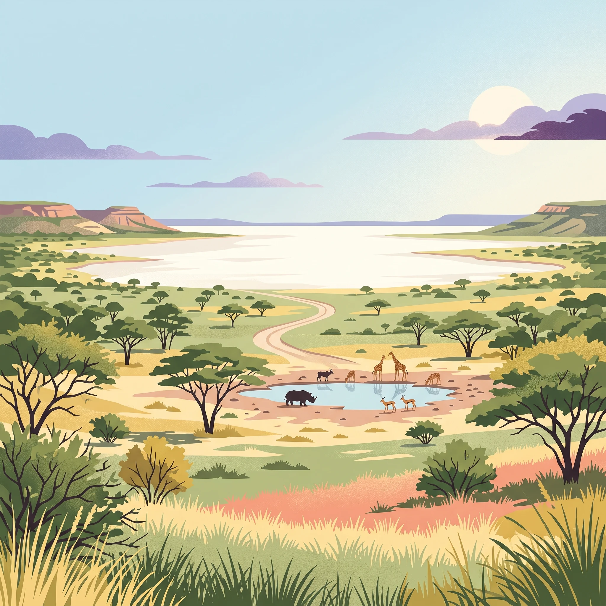
Trip Timing Orientation
When to Visit Etosha National Park: The Essential Timing Overview
Deciding when to visit Etosha National Park requires balancing the reliability of wildlife sightings against the trade-offs of temperature, landscape character, and atmospheric conditions. The most effective time to experience the park depends entirely on whether your priority is the high-density animal concentration associated with the arid season or the lush, avian-rich environment that emerges when the rains arrive. There is no single universal window for a visit, as the park operates on a distinct cycle where the availability of surface water dictates both animal behavior and the resulting quality of your safari experience.
The Contrast of Wildlife Visibility
Your best time to visit often correlates with the dry season, which spans from May through October. During these months, the scarcity of natural water sources drives animals to congregate around the park's permanent and artificial waterholes. This behavioral shift ensures that visitors can observe significant concentrations of wildlife, including the park's critical black rhinoceros populations, with high consistency. Because the landscape remains sparse and dry, vegetation provides little cover, which further improves visibility. This window is favored by travelers who view frequent, predictable sightings as the primary objective of their safari.
The Impact of Rainfall and Heat
In contrast, the summer rainy season from November through April offers a fundamentally different experience. While daytime temperatures frequently climb above 35 degrees Celsius, the rains bring a dramatic transformation to the landscape, turning the savanna vibrant green. During this period, wildlife tends to disperse widely across the park, making specific sightings more challenging to predict. However, this season is preferred by those interested in the park's birdlife and the prospect of seeing newborn animals. When significant rainfall occurs, the Etosha pan may hold water, attracting large flocks of flamingos and pelicans, creating a scenic contrast against the surrounding plains that is rarely seen in the colder, drier months.
Navigating Environmental Trade-offs
Understanding the physical environment is essential for timing your trip. The park experiences extreme diurnal temperature swings, particularly during the cooler months of June and July, when nighttime temperatures can drop toward freezing. Conversely, the summer months bring high humidity and intense heat, which can influence how long you spend on safari drives. Daylight hours also shift throughout the year, with the longer days of December offering more potential time for wildlife viewing, while the shorter winter days require a more compact and focused approach to exploring the dolomite hills and open plains. Because the park environment responds dynamically to annual precipitation patterns, travelers should interpret these seasonal cycles as shifting contexts for their visit rather than static rules.
Seasonal Planning
Best Months to Visit Etosha National Park for Wildlife and Scenery
Peak Wildlife Viewing: The Dry Winter Months
For most travellers, the period between May and October represents the ideal window for visiting this sanctuary. During these months, the scarcity of surface water forces wildlife to congregate predictably at perennial and artificial waterholes. This creates the highest probability of seeing significant mammal populations, including elephants, lions, and the park's characteristic black rhinoceros, within a single game drive.
From a climate perspective, this dry season is defined by clear, sunny skies and minimal humidity. Visitors should prepare for significant temperature swings: while days are generally warm and pleasant, nights and early mornings in June and July can drop significantly, sometimes approaching freezing temperatures. The combination of thinner vegetation and the reliance on central waterholes makes this the preferred period for those prioritizing high-density wildlife observation and dramatic safari photography, as the stark landscape highlights animals against the backdrop of the expansive salt pan.
The Green Season: Birding and Landscape Transformation
Travellers interested in different natural rhythms may find the rainy season, spanning November to April, more rewarding despite the trade-offs in wildlife predictability. As the summer rains arrive, the savanna transforms from a dusty, arid landscape into a vibrant green environment. This period is the primary window for bird enthusiasts, as migratory species arrive in large numbers. If rainfall is sufficient, the pan may fill with water, attracting flamingos and pelicans, which provides a visual experience entirely distinct from the dry season.
During these months, wildlife is generally more dispersed because water and grazing are widely available away from the traditional, man-made waterholes. While this makes finding larger game more challenging, it also aligns with calving season for many species. Travellers choosing this time must contend with higher humidity and daytime heat, with maximum temperatures frequently exceeding 35 degrees Celsius. Visitors should expect short but intense thunderstorms, which can occasionally make gravel roads muddy or difficult to traverse. This season is best suited for those who value biodiversity, avian life, and lush scenery over the high-density, predictable game sightings characteristic of the winter months.
Annual Climate Trends
Monthly Temperature, Rainfall, and Climate Patterns in Etosha National Park
Understanding the Annual Climate Rhythm
Etosha National Park experiences a hot, semi-arid climate characterized by significant diurnal temperature swings and a stark division between moisture-heavy periods and arid intervals. Because the park occupies a vast, relatively flat expanse at an elevation of over 1,100 meters, environmental conditions can feel amplified. Visitors should note that the following climate patterns are derived from long-term meteorological normals and reflect historical trends rather than precise local forecasts for any specific year.
Thermal Extremes and Daily Fluctuations
One of the most defining characteristics of the park's climate is the intensity of its heat during the day coupled with cooling temperatures at night. Maximum daily temperatures often climb toward 38 or 39 degrees Celsius during the peak of the hot season in October and November. These values represent averages, meaning midday temperatures frequently reach levels that demand careful hydration and protection from direct exposure. Conversely, the overnight lows provide a necessary thermal reset. During the coldest months, particularly June and July, nighttime temperatures can drop toward 5 degrees Celsius. The difference between a high of 30 degrees during the day and a chilling start to a morning game drive requires thoughtful packing and the ability to layer clothing appropriately.
Rainfall Patterns and Humidity Shifts
Precipitation in this region is concentrated and highly variable. The climate record shows a distinct shift when moving from the dry months, which span from May through September, to the buildup of moisture in December and January. While the dry months record near-zero precipitation, the summer months bring rain that typically manifests as short, intense convective thunderstorms. These events provide enough moisture to sustain the savanna vegetation and intermittently fill parts of the salt pan, yet they do not represent long, drawn-out rainy seasons. Humidity levels mirror this cycle, staying notably low in the arid months,often dropping below 25 percent in August and September,before climbing toward 50 percent during the peak of the wet season. This humidity shift makes the summer heat feel more taxing to visitors, even if the absolute temperature values remain comparable to the drier, hotter months of late spring.
Wind, Light, and Landscape Exposure
The park's geography, particularly the exposed expanse of the salt pan and surrounding plains, means that wind and sunlight play a consistent role in the visitor experience. Wind speeds are relatively consistent throughout the year but tend to peak in the transition months of September and October, reaching averages over 4 m/s. This air movement, combined with the reflective surface of the salt pan, can increase the drying effect on the skin and lips. Daylight hours also follow a predictable cycle, ranging from approximately 11 hours in the winter months of June to over 13 hours during the height of summer in December and January. While longer days offer more time for movement, the intensity of the sun during the summer solstice period is a significant factor for any outdoor activity during the middle of the day. These long-term averages provide a reliable framework for understanding the park's rhythm, but travelers should always consult the latest regional weather alerts before and during their trip to account for the unpredictable nature of local weather events.
Seasonal Weather Cycles
Understanding Climate Transitions and Seasonal Patterns in Etosha
Defining the Annual Climate Rhythm
Etosha does not follow a traditional four-season calendar. Instead, its environmental character is defined by a binary transition between a long, arid cooling phase and a shorter, moisture-dependent growth phase. Recognizing this duality is essential for planning, as the park landscape undergoes a near-total transformation regarding ground cover, water availability, and atmospheric clarity.
The Dry Winter Phase: May through October
The dry phase is the dominant annual period, characterized by persistent stability and minimal precipitation. Spanning from May to October, this cycle begins with the cooling of the Namibian landscape. During June and July, daytime temperatures are mild, but nighttime and early morning mercury levels can drop significantly, often nearing freezing due to the dry air and clear skies. This is a time of high solar exposure and low humidity. As the weeks progress toward October, the park experiences a steady warming trend. By late September and October, temperatures rise sharply, creating hot, dusty conditions that define the transition back toward the summer cycle. This phase is characterized by the absence of moisture, which dictates the environmental logic of the park: water becomes the most limited resource, concentrating activity at permanent and artificial waterholes.
The Transitional Months: November and April
The shifts between these two primary phases are not instantaneous. November acts as a volatile transition period, where the high heat of the preceding dry months meets the first influx of moisture. Readers should anticipate unpredictable weather during this time, as thunderstorms can develop rapidly. Temperatures in November often reach their annual peaks, with hot, dry air persisting until the first significant rainfall breaks the cycle. Conversely, April functions as a cooling transition following the summer rains. As the frequency of storms decreases, the humidity levels begin to drop, and the air becomes crisper. This is typically when the park enters its most stable state, signaling the return of the prolonged dry period and the beginning of the optimal wildlife-viewing window.
The Summer Rainy Phase: December through March
Starting in December and continuing through March, the park enters its rainy phase. This period is marked by increased humidity and the periodic arrival of heavy, localized thunderstorms. While this is labeled the rainy season, precipitation is inconsistent and rarely continuous. The defining characteristic of this phase is the rejuvenation of the landscape: the dust settles, and the savanna plains transition from parched earth to vibrant green. Temperatures during these months are consistently high, but the combination of moisture and heat creates a more humid environment than the dry, desert-like conditions of winter. During these months, the salt pan itself may hold shallow water, attracting migratory bird species and changing the visual aesthetic of the reserve from an stark white expanse to a reflecting surface. Wildlife activity during this period is dispersed, as animals are no longer tethered to the artificial waterholes that define the winter experience.
Seasonal Experiences
What Visiting Etosha National Park Is Like Throughout the Year
Visiting Etosha National Park offers distinct experiential shifts that move in tandem with the seasonal cycle. The most dramatic transformation involves the central pan, a vast salt flat that dictates the visual and behavioral rhythms of the park. During the dry winter months, this feature remains a stark, white expanse that creates a high-contrast backdrop for photography and observation. As the environment dehydrates, animals shift their daily routines toward the established waterholes. This concentration of fauna is not just a seasonal pattern, but a primary experiential window where visitors can observe predator and prey dynamics within close proximity at camp-adjacent viewing sites like Okaukuejo and Halali. The cooler, dry air of mid-year makes these static observation periods comfortable for extended waiting, as wildlife activity remains relatively consistent even during the heat of the day.
Seasonal Wildlife Viewing Dynamics
The experience of observing wildlife changes fundamentally when the rainy season transitions the landscape. While the dry winter months favor predictable congregation, the arrival of rains brings a shift in vegetation cover that makes animals more dispersed across the bushveld. During this phase, the experience moves away from sedentary waterhole viewing toward more active searching. The landscape turns vibrant green, and the Etosha pan itself may hold temporary shallow water, which creates a habitat for migratory birds such as flamingos and pelicans. This is a period of heightened activity for birdwatchers and those interested in seeing the park's lush, transformative state. However, the density of wildlife sightings at any single location is significantly lower compared to the winter months, requiring more patience and travel across the park's varied terrain to locate species.
Engaging with the Park Infrastructure
The park's infrastructure, particularly its network of rest camps, is designed to enhance these seasonal differences. The floodlit waterholes at the main camps are central to the visitor experience, providing a secure way to observe behavior that continues after dark. During the drier months, when the surrounding vegetation is sparse, these waterholes serve as critical life-support hubs. In the wetter months, the activity at these points tends to decline as animals take advantage of scattered water sources throughout the park. Visitors planning their time should recognize that the experience of sitting at a waterhole will vary from a busy, high-traffic scene in the dry season to a quieter, more isolated observation experience during the greener months. Access to the dolomite hills in the west and the mopane woodlands in the central regions provides a different topographical experience, particularly during the transition months when clear skies and moderate temperatures make navigating these areas more conducive to longer drives.
Travel Priorities
Choosing the Best Time to Visit Etosha Based on Personal Travel Priorities
Balancing Milder Temperatures and Clearer Days
Visitors who prioritize physical comfort during game drives and camp time often find the shoulder months of April and May the most rewarding. During these periods, the intensity of the midday sun begins to subside after the summer peak, and the nights have not yet dropped to the chilling extremes typical of mid-winter. April serves as a bridge, retaining some of the lush, post-rain greenery while offering daytime mean temperatures of approximately 23.87°C. As the landscape dries out in May, humidity levels drop significantly from the mid-50s percentage seen in March to a more comfortable 34%. This transition allows for long, comfortable hours of exploration without the extreme heat that characterizes the October and November months, which frequently reach daily maximums nearing 39°C. The trade-off for these milder conditions is that as the landscape dries, the dramatic green contrast begins to fade, and vegetation starts to thin, slightly reducing the cover for animals but requiring more patience to spot them as they return to the main waterholes.
Prioritizing Maximum Wildlife Predictability
For travellers whose primary goal is high-density wildlife observation, the heart of the dry season,specifically July through September,is the most supported window. During these months, the park receives negligible rainfall, and the relative humidity drops to its lowest annual points, bottoming out at 19.4% in September. This parched environment forces animal populations to congregate near permanent and artificial waterholes. Because the vegetation is sparse and dry, spotting elusive predators like lions or leopards, or large groups of elephants and rhinos, becomes significantly more efficient than at other times. The main compromise here is thermal; visitors must be prepared for extreme temperature swings. While September and October days are hot, the nights in June and July can be quite cold, falling to average minimums around 5°C. This requires a different packing strategy, as early morning game drives often start in freezing conditions before the sun rapidly warms the plains.
Targeting the Green Season for Landscape and Avian Interests
Visitors drawn to photography and birdwatching may prefer the period between January and March. While this window is often cited as a lower-intensity time for viewing large mammals, it offers a visually distinct experience. Summer rains, which peak in intensity during these months, transform the landscape, filling portions of the pan and creating temporary wetlands. This influx of water is the catalyst for the arrival of migratory bird species and, when conditions allow, large gatherings of flamingos and pelicans. Humidity levels are at their highest during this time, often exceeding 50%, and roads may become muddy or difficult to traverse after heavy, localized thunderstorms. The primary trade-off is the unpredictability of sightings; because surface water is widely available across the park, animals do not need to visit the accessible, human-adjacent waterholes, making them significantly harder to track and observe compared to the dry season.
Logistics and Access
Seasonal Road Access and Operational Planning for Etosha National Park
Navigating Park Access and Transport
Visitors to the park typically arrive by private vehicle, organized safari tour, or via air charter to one of the internal lodges. Driving remains the primary method for navigating the reserve, as walking outside of designated enclosed camp and hotel areas is strictly prohibited for visitor safety. While the park is vast, the main road network consists of well-maintained gravel surfaces. While many travellers choose four-wheel-drive vehicles for comfort and clearance, they are not strictly required for the standard tourist routes during normal conditions. Because road conditions can shift significantly during the rainy season, you should verify the current status of specific secondary routes with park management or official tourism authorities before departing.
Operational Planning and Entry Requirements
Planning a visit to the park requires coordinating your entry through one of the designated gates. The eastern gate near Namutoni is accessible via the B1 highway, which connects to Tsumeb and other northern hubs, while the southern gate is reached via the C38 from Outjo. Although historical maps once restricted access to certain sections, the entire park is now open to private travellers. All fuel stations located within the rest camps and just outside the park gates generally accept credit and debit cards, but it is prudent to carry cash as a backup and to confirm current payment capabilities through your accommodation provider before arrival.
Speed Limits and Road Safety
Within the park, a strict speed limit of 60 km/h is enforced. This regulation exists partly to protect wildlife, but it also reflects the reality of driving on gravel roads, where traction can be limited and dust may obstruct visibility. Braking distances on loose gravel surfaces are notably longer than on asphalt, and sudden skidding is a common hazard even for experienced drivers. Because crossing the park from east to west is a significant undertaking that occupies the better part of a day, visitors must factor this transit time into their daily itinerary. Always consult the official park website or contact the park office directly for the most current regulations regarding gate opening hours, permit requirements, and any temporary route closures that may affect your travel dates.
Safety and Preparation
Seasonal Weather Readiness and Safety in Etosha National Park
Navigating Temperature Extremes and Daily Exposure
Visitors should prepare for significant shifts in temperature that characterize the Etosha climate. During the cooler winter months between June and August, early morning game drives can be bracingly cold, with average minimums dropping toward 5°C. In contrast, the mid-day sun throughout the year, especially in the pre-rainy period of October and November, often pushes maximum temperatures toward 39°C. Because much of the terrain around the central salt pan is exposed and open, UV exposure remains a consistent consideration during all seasons. Dressing in breathable, layered clothing is the most effective approach to handle the rapid warming that typically occurs between sunrise and mid-morning. Protecting against the intense midday sun is essential, particularly for those planning extended time at waterholes or open-air picnic spots.
Preparing for Seasonal Moisture and Road Conditions
While the rainy season from November to April brings much-needed relief to the dry landscape, it also dictates changes in how one should move through the park. Rainfall usually manifests as intense, brief thunderstorms rather than persistent downpours, yet these events can transform dry tracks into muddy sections quickly. Travelers during the wet months should monitor road status updates provided by the park authority, as certain secondary routes may become difficult to navigate. Because rain is unpredictable, having a flexible itinerary allows visitors to wait for weather to pass rather than forcing travel through potentially compromised terrain. If a storm hits while you are out, remain in your vehicle, as it provides a secure vantage point and protection against sudden environmental changes.
Practical Safety and Field Awareness
Safety in a wildlife-dense environment relies on situational awareness and following park regulations strictly. While the camps are fenced, these structures are not absolute barriers to wildlife, and it is vital never to sleep outside or leave designated safe areas at night. Jackals are common residents near campsites and, while generally skittish, they should not be approached. The park's reliance on waterhole observation means that visitors spend significant time near animals; always maintain a respectful distance and stay within your vehicle at all times unless in a specifically marked, safe picnic zone. Etosha is in a low-risk malaria region, and those planning a trip should consult medical professionals well in advance to discuss individual health precautions tailored to their specific travel dates and personal history. Always prioritize information from official park alerts over third-party advice to ensure your planning reflects current conditions.
Final Trip Decisions
How to Choose the Best Time to Visit Etosha National Park
Deciding when to visit this vast Namibian sanctuary requires balancing the raw predictability of the dry winter season against the dramatic, ephemeral beauty of the summer rainy months. Your final choice depends on whether your priority is reliable game viewing or experiencing the park in its most vibrant, life-affirming state. For most visitors, the decision rests on a trade-off between the ease of spotting wildlife at permanent waterholes and the unique rewards of a lush, bird-rich landscape. If you are a first-time visitor seeking to maximize sightings of iconic species like the black rhinoceros, elephant, and lion, the dry months from May to October provide the most consistent conditions. During this period, the receding water levels force animals to congregate, creating high-density wildlife activity that is easily accessible via the park road network. You will face cooler temperatures, particularly during early morning game drives, which necessitates careful packing for temperature fluctuations that can swing from near-freezing nights to warm, sun-drenched afternoons. Conversely, if you are drawn to bird watching, photography of green landscapes, or the sight of the Etosha pan transformed into a temporary aquatic refuge, the summer rainy season from November to April offers a different set of rewards. While wildlife is more dispersed and often hidden by tall grasses, the arrival of migratory birds and the spectacle of newborn calves can provide an equally profound encounter with the park. This period is characterized by higher humidity and the risk of localized, short-lived thunderstorms that may affect road conditions. The core of your decision should be to align your expectations with these realities. If you prioritize the comfort of predictable, high-frequency wildlife sightings, aim for the mid-to-late dry season. If you prefer a quieter, visually dynamic experience and are prepared for more challenging tracking, the early summer months offer a distinct, rewarding alternative. Regardless of your chosen period, remember that climate normals serve as a historical guide rather than a precise forecast. Always verify current road conditions, gate operating times, and weather alerts with official park authorities before finalizing your travel dates, as the transition between seasons can vary significantly from one year to the next.