Why Etosha National Park stands out
Etosha is best known for its spectacular wildlife viewing centered around natural waterholes that attract large concentrations of animals during the dry season. The park's renowned salt pan creates a stark, otherworldly landscape that draws photographers and nature enthusiasts seeking dramatic safari imagery. The park serves as a critical stronghold for black rhinoceros populations, representing the most important conservation site for this endangered species globally. The contrast between the gleaming white salt pan and the surrounding green savanna woodlands creates one of Africa's most recognizable and photographed safari landscapes.
Etosha National Park history and protected-area timeline
Etosha National Park traces its institutional origins to March 22, 1907, when Governor Friedrich von Lindequist of German South West Africa proclaimed the area a game reserve under Ordinance 88. The original reserve encompassed an enormous territory stretching from the Kunene River on the Skeleton Coast to Namutoni in the east, estimated at between 80,000 and 99,526 square kilometers. European explorers Charles John Andersson and Francis Galton first recorded the existence of the Etosha pan on May 29, 1851, though local Ovambo and Hai//om peoples had long known the area. The name Etosha derives from the Oshindonga language, meaning Great White Place, referring to the distinctive salt pan. The area experienced significant boundary changes over the decades, with major adjustments in 1958 and again in 1970 following the Odendaal Commission decisions that established the current park boundaries. The park was officially designated as a national park in 1967 through legislation passed by the Republic of South Africa, which administered the territory at that time. The Hai//om people, who had inhabited the region for generations, were forcibly removed from the park in 1954, though the Namibian government has more recently initiated efforts to resettle displaced families on farms adjacent to the park.
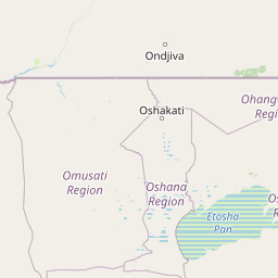
Etosha National Park landscape and geographic character
The physical landscape of Etosha is dominated by the extraordinary Etosha pan, a flat salt depression approximately 130 kilometers long and up to 50 kilometers wide. This vast salt flat creates a striking white expanse that forms the visual heart of the park and influences the entire regional ecology through its mineral dust carried by winds across the country. Surrounding the pan, the terrain transitions through several distinct vegetation zones, from bare salt-crusted ground near the pan's edges to increasingly dense savanna woodlands further from the center. The Dolomite Hills rise along the southern boundary near the Andersson entrance gate, featuring ancient rock formations and providing important habitat for leopards and other predators. These hills are known locally as Ondundozonananandana, a name translating to the place where young boys herding cattle went to never return, suggesting historically high predator populations. The western portion of the park features undulating terrain with dolomite ridges and the only population of mountain zebra found within the park. The landscape includes numerous natural springs and artificial waterholes that sustain wildlife throughout the year.
Etosha National Park ecosystems, habitats, and plant life
The ecological character of Etosha reflects a harsh but remarkably productive desert savanna environment where specialized plants and animals have adapted to dramatic seasonal variations. Mopane trees dominate the woodland areas, estimated to comprise approximately 80 percent of all trees in the park, creating a distinctive landscape of broad-leaved, semi-deciduous vegetation. The vegetation around the pan consists of halophytic grasses and succulents adapted to alkaline soils, while the sandveld in the northeastern corner features acacia and terminalia woodlands. The pan itself supports extremophile microorganisms capable of surviving the hypersaline conditions, and during the brief summer rainy season, the pan briefly fills with water, transforming into a shallow lake that attracts enormous flocks of flamingos and pelicans. The park's position at the transition between southern African biomes creates a mixing ground for species from different ecological communities, contributing to the park's remarkable biodiversity.
Etosha National Park wildlife and species highlights
Etosha supports an impressive diversity of wildlife despite its arid conditions, with approximately 114 mammal species, 340 bird species, 110 reptile species, and 16 amphibian species recorded within the park. The park holds particular importance for black rhinoceros conservation, serving as the global stronghold for this endangered species with significant populations protected within its boundaries. Large mammals commonly observed include African bush elephants, which represent the tallest population in Africa though they typically carry shorter tusks due to mineral deficiencies, as well as lions, leopards, giraffes, zebras, and various antelope species including springbok, gemsbok, blue wildebeest, and greater kudu. The bird population is exceptionally diverse, with notable species including massive colonies of flamingos that congregate at the pan during wet periods, large raptors such as martial eagles and bateleurs, and the distinctive secretarybird. Smaller mammals are well represented, with populations of meerkats, various mongoose species, bat-eared foxes, and the elusive aardvark. The park historically supported buffalo and wild dogs, though these species have been locally extinct since the mid-twentieth century.
Etosha National Park conservation status and protection priorities
Etosha National Park represents one of Africa's most important conservation areas, serving as the primary sanctuary for the world's black rhinoceros population and protecting a unique desert savanna ecosystem. The park's establishment in 1907 made it one of the first protected areas on the continent, and its continued protection has allowed wildlife populations to persist in what would otherwise be increasingly challenging agricultural lands. The Etosha Ecological Institute, opened in 1974, coordinates research activities within the park, focusing on vegetation classification, population studies of key species, and ecological research on elephants, lions, and wildebeest. The park faces significant conservation challenges, with poaching remaining a serious threat; 46 of the 61 black rhinos poached throughout Namibia in 2022 were killed within Etosha. The park's designation as a Lion Conservation Unit since 2005 reflects its importance for apex predator populations, and collaborative research programs with international universities support ongoing conservation efforts.
Etosha National Park cultural meaning and human context
The region surrounding Etosha has been inhabited for centuries by various indigenous peoples whose histories are intimately tied to the landscape. The Ovambo people historically inhabited areas north of the Etosha pan, while Otjiherero-speaking groups lived along the park's current boundaries. The Hai//om people, a Khoisan-speaking group, inhabited the areas directly adjacent to the Etosha pan, where they pursued a hunter-gatherer lifestyle and recognized the authority of the Ovambo chief at Ondonga. These communities were forcibly removed from the park in 1954, ending their traditional land use and forcing many to become farm laborers. The Namibian government has more recently acknowledged the Hai//om as the traditional inhabitants of the area, establishing a recognized Traditional Authority in 2004 and initiating programs to resettle displaced families on farms adjacent to the park. European exploration of the region began in the mid-nineteenth century when traders and explorers documented the Etosha pan while traveling with Ovambo copper ore merchants.
Top sights and standout views in Etosha National Park
The Etosha pan stands as the park's most dramatic feature, a vast salt flat that fills briefly with water during summer rains and attracts spectacular flocks of flamingos and pelicans. Game viewing at the park's numerous waterholes, particularly during the dry winter months from May through October, offers exceptional wildlife observation opportunities as animals congregate in large numbers to drink. The contrast between the stark white pan and the surrounding green savanna creates one of Africa's most photographed landscapes. Western Etosha's dolomite hills provide scenic variety and the chance to observe mountain zebras, the only place in the park where this species occurs. The park's conservation significance as the world's most important black rhino sanctuary makes it a critical destination for visitors interested in supporting rhino conservation efforts.
Best time to visit Etosha National Park
The optimal time to visit Etosha National Park is during the dry season from May through October, when wildlife congregates around waterholes and visibility is at its best. The winter months, particularly June through August, offer cooler daytime temperatures and excellent game viewing as animals remain active throughout the day. The landscape during this period is parched and brown, creating a stark, dramatic atmosphere perfect for photography. The wet season from November to April brings brief thunderstorms that transform the landscape temporarily, with grasses turning green and young animals appearing, though wildlife becomes more dispersed and harder to locate. The pan itself fills with water during particularly wet years, creating a spectacular shallow lake that attracts enormous numbers of flamingos, though this occurrence is unpredictable and depends on rainfall patterns.