Why Iona National Park stands out
Iona National Park is renowned for its exceptional desert landscapes, from towering sand dunes to rugged mountain outcrops along the coast. The park is famous as the primary habitat of Welwitschia mirabilis, an extraordinary living fossil plant that can live for thousands of years and derives moisture from coastal fog. The Skeleton Coast stretch within the park is famous for its shipwrecks and whale skeletons, a stark and haunting maritime graveyard. The park also represents one of Africa's most significant desert conservation challenges, with ongoing efforts to reintroduce wildlife including Angolan giraffes, cheetahs, and potential future returns of black rhino and lion. The transfrontier designation connecting Angolan and Namibian desert parks creates one of the largest contiguous protected desert ecosystems globally.
Iona National Park history and protected-area timeline
Iona National Park traces its origins to 1937 when the area was first proclaimed as a protected reserve, making it Angola's oldest protected area. The reserve was upgraded to national park status in 1964, taking its name from Iona, a commune located within the park's boundaries. For several decades following its establishment, the park functioned as a significant conservation area, protecting the unique desert ecosystems and wildlife of southwestern Angola.
The Angolan Civil War, which lasted from 1975 to 2002, inflicted severe damage on the park's ecosystems and infrastructure. Poaching and the destruction of facilities that had been built during the earlier period caused considerable degradation to what had once been a thriving protected area. Wildlife populations were decimated, with elephants and rhinos being completely eradicated from the park. The conflict essentially halted tourism and conservation activities for nearly three decades.
Beginning around 2009, concerted international efforts emerged to restore the park. A multinational programme under the United Nations Development Programme worked with Angola's Ministry of Environment and local leaders to rehabilitate infrastructure, train staff, and develop sound management practices. In 2018, the Iona-Skeleton Coast Transfrontier Conservation Area was established, creating a framework for coordinated conservation across the Angolan-Namibian border. African Parks, a prominent conservation NGO, assumed co-management responsibility in 2020, focusing on tourism development, community engagement, law enforcement, and wildlife restoration. The reintroduction of Angolan giraffes in 2023 and 2024 marked significant milestones in the park's recovery.
Iona National Park landscape and geographic character
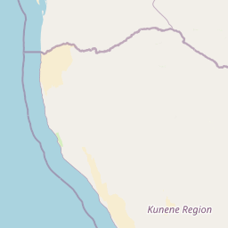
The landscape of Iona National Park presents a dramatic tableau of desert environments shaped by the interaction of ocean, wind, and ancient geological processes. The Namib Desert, within which the park lies, is considered one of the oldest deserts in the world, with origins dating back 55 to 80 million years. This ancient landscape stretches along the Atlantic coast, presenting a succession of shifting dunes, vast plains, and rugged mountain outcrops that create a visually stunning and ecologically complex environment.
The coastal zone is characterised by a stark beauty where massive sand dunes meet the Atlantic Ocean. The shore is famed for its shipwrecks, earning this stretch of coastline the evocative name Skeleton Coast. The cold waters of the Benguela Current generate heavy fogs that roll inland, creating an eerie atmosphere along the shore where the skeletal remains of whales and seals add to the haunting character of the landscape. Moving inland, the terrain transitions from coastal dunes to increasingly rocky substrate as the park rises toward the Great Escarpment.
To the east, the Tchamaline and Cafema mountains rise from the desert floor, marking the beginning of the interior plateau. These rough mountains and cliffs create significant topographic variation within the park, providing habitat diversity and visual drama. The northern boundary is marked by the Curoca River, an intermittent watercourse that flows only during seasonal rains but supports permanent lagoons in its lower reaches. The southern boundary follows the Cunene River, a permanent watercourse that reaches the ocean through marshy delta areas, providing a crucial wetland habitat in the otherwise arid landscape.
Iona National Park ecosystems, habitats, and plant life
The nature of Iona National Park is defined by the extreme conditions of the Namib Desert and the remarkable adaptations that allow life to thrive in this challenging environment. According to the Angola Ministry of Environment, three distinct vegetation types occur within the park: sub-coastal steppes with woody and herbaceous components dominated by Acacia, Commiphora, Colophosphormum, and various grass species; coastal steppes corresponding to sub-desert-like vegetation featuring Aristida, Cissus, Salvadora, and the extraordinary Welwitschia; and desert areas with moving dunes where specialized grasses like Odyssea and Sporobolus dominate.
Welwitschia mirabilis stands as the park's most celebrated botanical treasure, occurring primarily in the coastal fog zone. This ancient plant, often described as a living fossil, has survived in this region for millions of years. Its remarkable adaptation involves deriving moisture not from the scarce rainfall but from the sea fog that rolls inland from the Atlantic. The fog condenses on the leaves and is absorbed directly, allowing the plant to survive in conditions that would defeat most other vegetation.
The park's location at the transition between desert and ocean creates unique ecological conditions. The heavy fogs generated by the interaction of the cold Benguela Current with the hot desert air sustain a specialised fog-dependent ecosystem. This fog oasis effect supports vegetation and associated wildlife in a zone that would otherwise be completely sterile, making Iona one of the few places on Earth where desert and marine ecosystems interlock so intimately.
Iona National Park wildlife and species highlights
The wildlife of Iona National Park reflects the extreme desert environment and the park's position as a refuge for species adapted to arid conditions. The Kaokoveld Desert, of which Iona forms a part, supports a distinctive assemblage of endemic species, particularly among the reptiles. Of the 63 reptile species recorded in the broader ecoregion, eight are strictly endemic, including two lizards, three geckos, and three skinks. A 2022 survey documented 75 amphibian and reptile species within the park, with 40 of these recorded for the first time.
The mouth of the Cunene River supports a small but significant wetland area that serves as a crucial stopover for migrating birds. Bird surveys have recorded approximately 250 species as of 2024, including significant populations of waterbirds. A 2023 coastal survey documented 55,000 Cape cormorants along the shore. The park has historically supported important bird populations, including being one of the few remaining locations in Angola with breeding common ostriches and the only locality with recorded Greater kestrel breeding.
Large mammals have suffered significant declines due to the civil war, but active restoration efforts are underway. South African cheetahs were sighted in the park for the first time in 2010, representing a promising recovery. The park now supports viable populations of zebra, oryx, and springbok, with remnant populations of cheetah, leopard, and brown hyena. A major conservation milestone occurred in July 2023 when 14 Angolan giraffes were reintroduced to the park, the first giraffes seen there since the 1990s, followed by an additional 13 individuals in May 2024. Studies are underway to assess the feasibility of reintroducing black rhinos and lions.
Iona National Park conservation status and protection priorities
Iona National Park represents one of Africa's most significant desert conservation challenges and opportunities. The park's importance is amplified by its role as the anchor protected area for the Namib Desert ecosystem, forming part of a transfrontier conservation area that connects protected areas across Angola and Namibia. This continuous block of protected land spanning roughly 50,000 square kilometres represents one of the largest desert conservation initiatives globally, with the potential to preserve ecological processes across an entire bio-region.
Conservation efforts have focused intensively on restoration following the devastating impacts of the Angolan Civil War. The UNDP-supported rehabilitation programme from 2009 to 2019 made substantial progress in rebuilding infrastructure, training park staff, and establishing management systems. Key achievements included improvements to fencing, roads, water supply, and waste management, along with the development of comprehensive management plans. The establishment of the Iona-Skeleton Coast Transfrontier Conservation Area in 2018 created a framework for coordinated conservation monitoring and management across international boundaries.
The involvement of African Parks since 2020 has brought additional capacity and focus to conservation efforts. The organisation works across five strategic pillars: tourism, community engagement, inspection and law enforcement, conservation, and infrastructure development. With 135 employees as of 2024, the park is actively working to restore wildlife populations, with the giraffe reintroduction programme representing a major success. Ongoing feasibility studies are assessing the potential for reintroducing black rhinos and lions, species that once inhabited the park but were lost during the conflict period.
Iona National Park cultural meaning and human context
The cultural context of Iona National Park is closely tied to the indigenous communities who have historically inhabited the Namib Desert region. Local communities have maintained traditional land use practices within and around the park, particularly livestock pasturing and grazing. Research published in 2019 indicated that while local populations recognise the economic benefits that a functional national park can provide, they also express concerns about historical and current access to traditional lands.
The park contains the commune of Iona, which gives the protected area its name. This settlement represents the human presence within the park boundaries and illustrates the long history of human occupation in this harsh environment. The relationship between conservation objectives and traditional livelihood practices remains a central consideration for park management, particularly as efforts continue to balance wildlife restoration with the needs of surrounding communities.
The broader region holds cultural significance for the indigenous peoples of the Kaokoveld, whose traditional territories span across the Angolan-Namibian border. The transfrontier conservation arearecognises this cultural connection and seeks to manage protected lands in ways that respect traditional uses while ensuring long-term ecological sustainability. Economic benefits from tourism and related activities are intended to provide tangible value to these communities, creating incentives for community support of conservation efforts.
Top sights and standout views in Iona National Park
Iona National Park offers visitors an extraordinary combination of ancient desert landscapes, unique botanical treasures, and dramatic coastal scenery along the legendary Skeleton Coast. The opportunity to observe Welwitschia mirabilis, a plant that has survived for millions of years in this fog-sustained environment, represents a botanical experience found nowhere else on Earth. The park's vast size and relative remoteness provide an authentic wilderness experience, far from the crowds that visit more accessible African parks. The ongoing wildlife restoration, including the successful giraffe reintroduction programme, offers hope and tangible evidence of recovery from the park's troubled past. The transfrontier connection with Namibia's protected areas creates one of the most extensive desert conservation landscapes in the world, offering exceptional opportunities for understanding large-scale ecological processes.
Best time to visit Iona National Park
Iona National Park can be visited throughout the year, though the desert environment presents distinct seasonal characteristics. The cool, foggy conditions typical of the winter months from May to September often provide more comfortable conditions for outdoor activities, with daytime temperatures moderated by the coastal fog. The summer months from October to April bring hotter conditions but also the possibility of brief rainfall that can transform the desert landscape temporarily. Wildlife viewing is generally better during the drier winter months when animals congregate more visibly around remaining water sources. The dense coastal fogs that characterise the region are most prevalent during the winter season, creating an atmospheric quality that defines the Skeleton Coast experience. Visitors should be aware that the park's infrastructure and visitor facilities remain limited following the long period of neglect, and access requires careful planning.