Why Mupa National Park stands out
Mupa National Park is best known for its significant avian diversity, with the park holding particular importance for birdlife despite limited scientific study of its avifauna. The park's semi-arid savanna environment supports populations of large mammals including lion, leopard, wild dog, and spotted hyena. Historically, the park was established to protect the Angolan giraffe, a subspecies of giraffe endemic to the region, though this population has been lost. The park also represents an important conservation area in southern Angola, protecting representative examples of the region's woodland and savanna ecosystems.
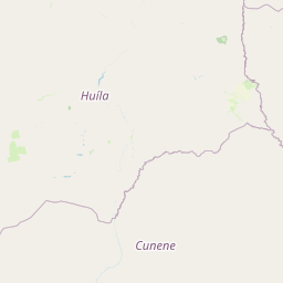
Mupa National Park history and protected-area timeline
Mupa National Park was officially proclaimed on December 26, 1964, during Angola's colonial period under Portuguese administration. The park was initially established with the specific goal of protecting the Angolan giraffe subspecies, Giraffa camelopardalis angolensis, which is native to the region. At the time of establishment, Angola was known as Portuguese West Africa, and the creation of national parks reflected broader colonial conservation efforts in southern Africa. However, by 1974,仅仅十年后,公园内的长颈鹿种群已经消失,这可能是由于栖息地丧失、狩猎压力或与当地社区冲突的结果。安哥拉独立后,该公园继续作为保护区运作,但在随后的几十年里面临着人类住区扩大、游牧牧民活动增加和矿产勘探等多重压力。这些威胁,加上缺乏积极的管理和执法,导致公园的野生动物大幅减少。今天,虽然Mupa仍然是安哥拉保护遗产的重要组成部分,但其实施和有效管理仍然存在挑战。
Mupa National Park landscape and geographic character
Mupa National Park encompasses a landscape of flat to gently rolling savanna terrain typical of southern Angola. The region experiences a semi-arid climate with distinct wet and dry seasons, where seasonal rainfall supports grassland and woodland vegetation communities. The park's terrain includes valley areas where seasonal watercourses flow during the rainy season, providing important water sources for wildlife. The vegetation consists predominantly of miombo woodland in some areas mixed with open grasslands and bushland. The landscape provides relatively open terrain with scattered trees and shrubs, creating habitat favorable for large mammals and ground-dwelling bird species. The region's flat topography allows for extensive views across the savanna, particularly during the dry season when grass cover is reduced.
Mupa National Park ecosystems, habitats, and plant life
The park's ecological character is defined by its semi-arid savanna environment, which supports a mix of woodland and grassland habitats. The miombo woodland, characterized by Brachystegia and Julbernardia tree species, dominates portions of the park, interspersed with more open grass-dominated areas. This mosaic of habitats supports diverse ecological communities, from large mammals to numerous bird species. The park's significance for avifauna is particularly notable, with the diverse birdlife representing one of the park's most important ecological attributes, though comprehensive surveys remain limited. The seasonal availability of water influences wildlife distribution within the park, with permanent and seasonal water sources playing crucial roles in supporting animal populations throughout the year.
Mupa National Park wildlife and species highlights
Mupa National Park supports populations of several notable large mammal species. Lion and African leopard occur within the park, representing the region's apex predators. The park also hosts populations of African wild dog, also known as Cape wild dog, a species of conservation concern across much of its range, and spotted hyena. Historically, the park was established to protect Angolan giraffe, but this subspecies has been extirpated from the park since the 1970s. The park's birdlife is considered particularly significant, with diverse avifauna expected throughout the area though much remains unstudied. The combination of savanna and woodland habitats creates suitable conditions for numerous bird species, including both resident and migratory species that utilize the region seasonally.
Mupa National Park conservation status and protection priorities
Mupa National Park represents an important conservation area in southern Angola, protecting representative examples of the region's savanna and woodland ecosystems. The park's establishment reflected an early recognition of the need to protect Angola's natural heritage and distinctive wildlife, including the endemic Angolan giraffe subspecies. However, the park faces significant conservation challenges from human settlement and activities within its boundaries. Approximately 18,000 people live within the park, engaged primarily in agriculture and cattle breeding, which creates pressure on wildlife habitats. Additional threats include nomadic pastoralists whose livestock competes with native wildlife for resources, and mineral prospecting activities that can damage habitat and disturb wildlife. The loss of the giraffe population highlights the challenges facing conservation in the region, though efforts to protect remaining species and potentially restore extirpated populations remain important priorities.
Mupa National Park cultural meaning and human context
Mupa National Park contains significant human presence within its boundaries, with approximately 18,000 residents living within the park area. These communities are primarily engaged in agriculture and cattle breeding, activities that have shaped the landscape and continue to influence wildlife populations. The presence of pastoralists, both settled agricultural communities and nomadic herders, reflects the broader cultural pattern of southern Angola where livestock keeping remains important to local livelihoods. The interaction between human communities and wildlife creates both challenges for conservation and opportunities for community-based natural resource management. The park's management must balance conservation objectives with the needs and rights of resident communities, a common challenge across African protected areas.
Top sights and standout views in Mupa National Park
Mupa National Park stands as one of Angola's oldest and largest protected areas, established in 1964 to protect the distinctive wildlife of the Cunene Province. The park's vast savanna landscapes support populations of lion, leopard, wild dog, and hyena, while its birdlife remains an understudied but significant ecological asset. The park's history, including the loss of its giraffe population, illustrates both the challenges and the importance of conservation in the region. As a semi-arid protected area in southern Africa, Mupa represents a distinct ecosystem type within Angola's network of national parks and contributes to regional biodiversity conservation efforts.
Best time to visit Mupa National Park
The best time to visit Mupa National Park is during the dry season, typically from May to October, when wildlife viewing is more accessible as vegetation thins and animals concentrate around remaining water sources. The cooler months from June to August offer more comfortable conditions for outdoor activities. However, visitors should note that the park's infrastructure and visitor facilities are limited, and access may be challenging. The wet season from November to April brings green landscapes but can make some areas difficult to access and wildlife more dispersed. Given the park's limited development as a tourism destination, visitors should prepare for a more adventurous and self-sufficient travel experience.