Mori Atlas logo
Protected areaFoge Islands

A detailed look at the seasonal wetland terrain and protected fluvial geography

Foge Islands Protected Area: Mapped Boundaries and Geographic Landscape in Sierra Leone

The Foge Islands represent a distinctive protected wetland landscape situated within the broader geographic context of Sierra Leone. This analysis maps the intricate boundaries and shifting terrain of these alluvial islands, providing a clear perspective on their role as a critical environmental habitat. Users can examine the physical geography and hydrological patterns that define this protected area, grounding the site within its regional environmental framework.

wetlandRamsar siteriver islandsreservoir habitatwaterbirdsSudanian eco-region

Foge Islands

Protected area

Park overview

Structured park overview, official facts, and landscape profile for Foge Islands

Foge Islands park facts, protected area profile, and essential visitor context

Review the core facts for Foge Islands, including designation, size, terrain, visitor scale, habitats, and operating context in one park-focused overview.

About Foge Islands

The Foge Islands occupy a distinctive niche within Nigeria's network of protected areas. Unlike many parks that protect terrestrial ecosystems in their natural state, the Foge Islands represent a dynamic wetland landscape created by the impoundment of the Niger River at Kainji. Designated as a Ramsar Wetland of International Importance in 2008, the site sits within the broader administrative framework of Kainji National Park, even though it functions ecologically as a freshwater island system rather than a savanna reserve.

The islands lie roughly 45 kilometers upstream of the Kainji dam wall. They include the main Foge Island and two smaller islands or sandbanks to the north. Because the islands originated from alluvial sediment deposited in the middle reaches of the Niger River when the reservoir was filled, their shape and exposed area change continuously with the seasonal water cycle. During the high-water months of October and November, much of the island system is partially submerged; during the low-water months that follow, channels, mudflats, and fringing vegetation become exposed, creating productive feeding and breeding grounds.

Ecologically, the Foge Islands belong to the Sudanian eco-region, a transition zone between the wetter Guinea zone to the south and the drier Sahel to the north. The region's tropical wet-and-dry climate, with a pronounced rainy season from May to October and a distinct dry season, shapes both the vegetation and the birdlife of the islands. The combination of flood-dependent grasses, aquatic plants such as water lilies and papyrus relatives, and seasonally shifting water levels gives the islands a unique character among Nigerian protected areas.

The site is administered jointly by the environmental and agricultural ministries of Niger State and Kebbi State, reflecting its cross-boundary position. While it is not a tourist destination in the conventional sense, it has strong scientific and conservation value as a reference site for Sudanian wetland ecology and for monitoring the ecological health of the Kainji Reservoir system.

Quick facts and research context for Foge Islands

Protected under the Ramsar Convention since April 30, 2008. Located in Niger State and Kebbi State, Nigeria, within the Kainji Reservoir. Classified by IUCN as Category II (National Park) because the site is administered as part of Kainji National Park. Total designated area is approximately 42 square kilometers, with year-round land area of less than five square kilometers. Average elevation around 150 meters above sea level, situated roughly 45 kilometers upstream of the Kainji dam.

Protection and recognition

Documented terrestrial designation history and management scope details

Foge Islands Protection Status and International Ramsar Recognition

Foge Islands maintains a documented terrestrial protection status established in 2008 alongside recorded Ramsar site recognition sources. Official designation records outline the historical conservation framework governing the protected landscape area.

International recognition

Protection details

Protection scope
Terrestrial
Designated year
2008
Transboundary protection
No
Park context

Deeper park guide and search-rich context for Foge Islands

Foge Islands history, landscape, wildlife, and travel context

Explore Foge Islands through its history, landscape character, ecosystems, wildlife, conservation priorities, cultural context, and seasonal travel timing in a structured park guide built for atlas discovery and search intent.

Why Foge Islands stands out

The Foge Islands are best known as a Ramsar-listed wetland inside the Kainji Reservoir, providing breeding and staging habitat for several notable waterbird species. The site stands out for its seasonal flood dynamics, where sediment-heavy 'white flood' waters from July and clearer 'black flood' waters from December create a shifting mosaic of channels, mudflats, and vegetated shallows. Their ecological character is defined by this hydrological rhythm rather than by a fixed terrestrial landscape. Termite mounds form the highest natural elevations, and the entire island system is essentially a sediment-built wetland embedded within one of West Africa's largest reservoirs, making it a focal point for Sudanian floodplain conservation.

Foge Islands history and protected-area timeline

The Foge Islands as a distinct ecological entity are entirely the product of the mid-twentieth-century transformation of the Niger River. Before the construction of the Kainji Dam, the islands did not exist; the Niger flowed through the region as a free river, and the area that now lies under the reservoir was a mix of river channels, floodplains, and the original dense forest cover.

When the dam was completed and the reservoir began filling, sediment carried by the Niger accumulated in the middle of the river channel, gradually forming a cluster of low islands. Over time, these alluvial deposits became stable enough to support grass and wetland vegetation, while higher points persisted as sandbanks. Because the original forest was cleared before the area was flooded, the islands developed an open landscape of grass savanna and aquatic vegetation rather than woodland.

International recognition of the site's importance came late in the site's ecological development. On April 30, 2008, the Foge Islands were formally inscribed on the List of Wetlands of International Importance under the Ramsar Convention. This designation acknowledged both the international value of the site for waterbird conservation and its broader role within the Sudanian eco-region. Today the islands are administered as part of Kainji National Park under the IUCN Category II framework.

Foge Islands landscape and geographic character

The Foge Islands are not a dramatic landscape in the conventional sense of cliffs, peaks, or sweeping escarpments. Instead, they are a low-relief wetland system dominated by the interplay of water and sediment. The highest natural points on the islands are termite mounds, which rise modestly above the otherwise flat terrain. This understated topography is a defining feature of the site.

The islands sit roughly 45 kilometers upstream of the Kainji Dam wall, well within the wider reservoir basin. They consist of the main Foge Island and two smaller islands or sandbanks to its north. The shape, area, and connectivity of these land surfaces shift with the reservoir's seasonal cycle, and during high water much of the system becomes a network of partially submerged banks and channels.

Climate and hydrology shape the islands' physical character as much as geology does. The region experiences a tropical wet-and-dry climate driven by the West African monsoon, with rainfall concentrated between May and October. The Niger River's annual flood is divided locally into two phases: a sediment-rich 'white flood' beginning around July, when the river carries heavy silt loads, and a clearer 'black flood' from December to February, when the water becomes visibly more transparent. The reservoir's water level peaks in October and gradually falls to its lowest level by the following July, exposing mudflats and channels that are biologically critical.

Foge Islands ecosystems, habitats, and plant life

The ecological character of the Foge Islands is defined by their position at the intersection of river, reservoir, and grassland. Because the original forest was cleared before the reservoir was filled, the islands now support a mosaic of open grass savanna and aquatic wetland vegetation rather than the dense woodland that once occupied the pre-dam riverbanks. Smaller channels cut across the islands, maintaining connections between submerged and exposed areas throughout the seasonal cycle.

Wetland vegetation is a core feature of the site. Characteristic aquatic and semi-aquatic plants include the tiger lotus (Nymphaea lotus), several species of Echinochloa grasses, including the so-called 'hippo grass' Echinochloa stagnina and Echinochloa pyramidalis, as well as Cyperus papyrus and a type of Vossia grass, all of which thrive in the seasonally flooded shallows. These plants create dense mats of vegetation that shelter invertebrates, fish, and waterbirds during periods of high water.

Surrounding the wetland patches, the open grassland areas are dominated by tall African grasses from the genera Hyperthelia, Hyparrhenia, and Andropogon. These grass savannas give the islands a relatively uniform structure but contribute to landscape heterogeneity through seasonal changes in growth and flowering. On the inhabited main island, residents also tend small plantings of citrus, mango, and guava, creating a subtle blend of natural and managed vegetation.

Foge Islands wildlife and species highlights

Despite their small size, the Foge Islands are of disproportionate importance for waterbirds in West Africa. The site supports significant breeding colonies for several species that are otherwise under pressure across the Sahel and Sudanian zones. Most notable is the white-faced whistling duck (Dendrocygna viduata), which uses the islands as a key breeding ground, along with the blue-cheeked bee-eater (Merops persicus), the collared pratincole (Glareola pratincola), and the spur-winged lapwing (Vanellus spinosus).

Beyond these breeding species, the islands regularly host a wide range of visiting and resident waterbirds. The glossy ibis (Plegadis falcinellus), the spur-winged goose (Plectropterus gambensis), the northern pintail (Anas acuta), and the African darter (Anhinga rufa) are commonly observed, especially during seasonal transitions when the exposed mudflats and shallow channels are most productive for foraging.

The wider reservoir context means that the islands also contribute to freshwater fish habitat and provide a productive foraging ground for wading birds and piscivorous species that depend on the reservoir's fisheries. While detailed wildlife inventories are limited, the combination of varied aquatic habitats and seasonal exposure makes the islands a focal point for birdwatching and ecological monitoring within the broader Kainji system.

Foge Islands conservation status and protection priorities

The Foge Islands derive their conservation significance primarily from their Ramsar designation, which they received on April 30, 2008. Listing under the Ramsar Convention signals international recognition of the site's ecological value and obligates ongoing management attention to maintain the wetland's character. The site is classified by IUCN as Category II (National Park) because it is administered as part of Kainji National Park, even though it functions predominantly as a wetland reserve rather than a dryland park.

Conservation value is closely linked to hydrology. The seasonal flood pulse, sediment deposition, and the resulting mosaic of aquatic vegetation and grass savanna are all central to the wetland's ecological integrity. Disruption of these rhythms, whether through upstream water management, sedimentation changes, or changes to the Kainji Reservoir's operation, could have outsized effects on the islands' habitat conditions.

Administration is shared between the environmental ministries of Niger State and Kebbi State and the agricultural ministries of the same states. This joint governance reflects the islands' cross-boundary position. Conservation priorities include maintaining waterbird breeding populations, preserving the integrity of floodplain vegetation, and managing the relationship between local livelihoods on the inhabited main island and the surrounding wetland habitat.

Foge Islands cultural meaning and human context

The Foge Islands have a relatively short human history because the islands themselves formed only after the construction of the Kainji Dam. However, the surrounding region carries a long heritage of communities living along the Niger River, and the river itself remains central to local identity, economy, and seasonal rhythms.

The main island is inhabited, and residents cultivate crops such as citrus, mango, and guava in addition to engaging in fishing and other activities tied to the reservoir. This ongoing human presence shapes the cultural dimension of the site, blending traditional riverine livelihoods with the modern reality of life around a large artificial lake. The islands are thus not only an ecological site but also a living landscape where local communities coexist with one of Nigeria's most important protected wetlands.

Top sights and standout views in Foge Islands

The Foge Islands distinguish themselves through a combination of Ramsar-level recognition, dynamic seasonal hydrology, and a strategic position within the Kainji Reservoir system. Their alluvial origin, seasonal water-level variation, and role as breeding habitat for waterbirds make them a compact but ecologically rich component of Nigeria's protected areas.

Best time to visit Foge Islands

Seasonality strongly influences what the Foge Islands look like and what visitors or researchers might observe. The flood cycle divides the year into distinct ecological phases. From July onward, the 'white flood' brings sediment-heavy waters and rising reservoir levels, peaking around October. During this period, much of the island area is partially submerged, and the emphasis shifts to aquatic vegetation and waterbird activity in the shallows.

From December to February, the 'black flood' brings clearer waters, and falling reservoir levels gradually expose mudflats and channels. This dry-season exposure creates productive conditions for observing wading birds and other waterbirds that depend on shallow feeding grounds. The cooler months around December and January are also when daily temperatures are at their most moderate, while the hottest period typically arrives in March and April.

For practical visitation, the cooler dry-season months tend to present the most accessible landscape and the most rewarding birdwatching conditions, while the wetter months from May to October bring lush vegetation but also more challenging access and higher water coverage across the islands.


Park location guide

Geography guide, regional context, and park location map for Foge Islands

Foge Islands park geography, regions, and map view in Sierra Leone

Understand where Foge Islands sits in Sierra Leone through a broader geographic reading of the surrounding landscape, nearby location context, and its mapped position within the national park landscape.

How Foge Islands fits into Sierra Leone

Sierra Leone is a West African country located on the Atlantic coast, bordered by Liberia to the southeast and Guinea to the north and east. The country has a tropical climate and diverse terrain ranging from coastal plains to mountainous interior regions. It was a British colony that gained independence in 1961 and became a republic in 1971. Following a devastating civil war that ended in 2002, Sierra Leone has experienced political stability and economic recovery.

Wider geography shaping Foge Islands in Sierra Leone

Sierra Leone is situated on the West African Atlantic coast, occupying a rectangular territory stretching from the Atlantic ocean inland. The country borders Liberia to the southeast and Guinea to the north and east. Terrain includes a coastal plain, the Sierra Leone Peninsula, the mountainous interior around the Loma Mountains, and an eastern plateau region.

Park atlas

Compare regional protected landscapes and connected wildlife habitats across the basin

Parks Near Foge Islands, Exploring Other Protected Areas and Wetland Reserves

Browsing nearby national parks and protected areas provides essential context for understanding the wider ecological networks surrounding Foge Islands. Expanding the geographic comparison highlights regional wetland reserves, river basin habitats, and comparable Sudanian conservation zones.
National parkNigeria
About 12 km away#1 closest

Kainji National Park: Nigeria's National Park for Geographic Discovery

Mapped protected landscape and regional geographic context.

Kainji National Park represents a significant protected landscape within Nigeria, offering a distinct focal point for geographic atlas exploration. As a national park, its mapped boundaries and regional context are essential for understanding the distribution of natural areas in West Africa. This entry provides a grounded perspective on its landscape, enabling detailed study for those interested in the structured geography of conservation lands.

Area
5,340.82 km²
Established
1978
IUCN
II
Relief
Lowland
Nature reserveBenin
About 139 km away#2 closest

Forêt classée des Trois Rivières: Geographic Context and Protected Landscape Map

Nature reserve protecting vital northern Benin river catchments.

Spanning over 2,595 square kilometers in northern Benin, Forêt classée des Trois Rivières functions as a critical watershed protector for the Sota, Tassiné, and Bouli rivers. The reserve sustains a fragile Sudano-Sahelian ecosystem where open tree savanna and gallery forests provide refuge for elephants and other wildlife. Its mapped boundaries offer a look at the historical and ecological struggle to maintain intact forest fragments within a landscape defined by agricultural expansion and river basin management.

Area
2,595 km²
Established
1949
IUCN
II
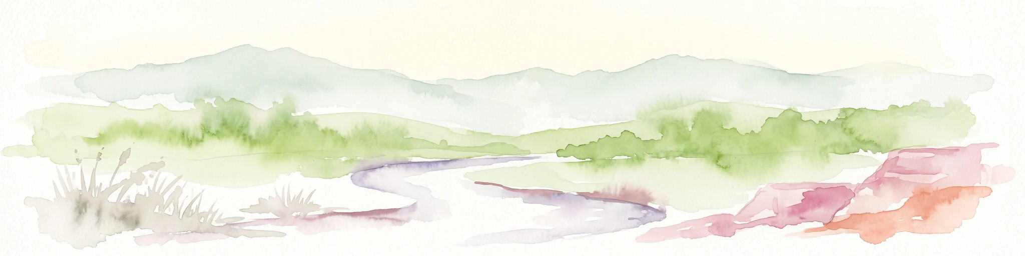
A soft watercolor painting of a winding river flowing through a green woodland savanna with hills in the background.
Protected areaAlibori
About 153 km away#3 closest

Forêt classée de la Sota: Exploring Protected Woodlands in the Alibori Department

A historic Sudano-Sahelian savanna and riverine ecosystem

Forêt classée de la Sota stands as a critical protected woodland in northeastern Benin. This expansive 53,000 hectare reserve protects unique Sudano-Sahelian terrain defined by the Sota River basin, supporting a diverse range of savanna wildlife and complex riparian habitats across the Alibori region.

Area
530 km²
Established
1947
Relief
Lowland
Climate
Tropical
Protected areaDosso Region
165 km away#4 closest

Dallol Maouri Protected Area: Geographic Overview of Niger's Fossilized Wetland Valleys

Mapping seasonal pond systems and floodplain corridors in the Dosso Region

Dallol Maouri serves as a quintessential example of the ancient drainage systems found in the Iullemmeden Basin. As a Ramsar-listed protected area, it features a unique north to south orientation that fosters a rich transition between dryland Sahel and Sudanian savanna. The valley is defined by its seasonal mares, palm groves, and intricate network of koris tributaries that shape the geography of southwestern Niger.

Area
3,175.2 km²
Established
2004
Relief
Lowland
Climate
Subtropical
Wildlife reserveDosso Region
165 km away#5 closest

Feuchtgebiet am mittleren Niger II: Wetland Geography and Wildlife Reserve Boundaries

A seasonal floodplain corridor in the Dosso Region of Niger.

Feuchtgebiet am mittleren Niger II offers a clear view into the flood-pulse ecology of the middle Niger River. The reserve comprises a complex network of channels, ponds, and riverine woodlands that shift with the annual rains. This protected site in the Dosso Region acts as a crucial transboundary conservation area, showcasing the unique interaction between riparian forests, baobab groves, and seasonal aquatic terrain.

Area
385.55 km²
Established
2004
Relief
Lowland
Scope
Terrestrial
Wildlife reserveNigeria
166 km away#6 closest

Lower Kaduna-Middle Niger Floodplain: Protected Wildlife Reserve and Wetland Atlas

An expansive floodplain corridor in the heart of Nigeria

Spanning the confluence of the Niger and Kaduna rivers, this wildlife reserve preserves a critical mosaic of swamps, sandbanks, and flooded grasslands. The area is defined by its seasonal inundation cycles and vital role as a refuge for bird populations within the Guinea savanna. Explore the mapped boundaries and natural terrain of this unique aquatic environment.

Area
2,290.54 km²
Established
2008
Relief
Lowland
Climate
Tropical
National parkNigeria
About 208 km away#7 closest

Kamuku National Park: Nigeria's Protected Savanna Ecosystem and Inselberg Landscape

Explore mapped boundaries and regional geography.

Delve into Kamuku National Park, a significant protected savanna ecosystem in Nigeria, recognized for its unique geological features such as the Goron Dutse inselberg and the Dogon Ruwa Waterfalls. This page offers an atlas-level view of the park's landscape, detailing its protected area status, its role as elephant habitat, and its exceptional biodiversity, providing a comprehensive geographic context for exploration.

Area
1,120 km²
Established
1999
IUCN
II
Relief
Lowland
Protected areaDosso
211 km away#8 closest

Feuchtgebiet am mittleren Niger: Protected Wetland Geography and River Floodplain Atlas

Geographic overview of floodplain terrain in Dosso, Niger

Feuchtgebiet am mittleren Niger preserves a vital mosaic of riverine channels, temporary ponds, and floodplain flats. This protected area stands as a distinctive aquatic corridor within the Sahel, characterized by diverse water-based habitats and seasonal vegetation shifts that define the regional geography of Dosso.

Area
521.8 km²
Established
2001
Relief
Lowland
Scope
Terrestrial

Common questions about visiting, size, designation, and location context for Foge Islands

Foge Islands FAQs for park facts, access, geography, and protected area context

Find quick answers about Foge Islands, including protected-area facts, park geography, trail and visitor context, and how the park fits into its surrounding country and regional landscape.
MoriAtlas Explorer

Continue Your Protected Areas Search Across the Global Atlas

Deepen your exploration by continuing the structured search for national parks and protected areas worldwide. Utilize the comprehensive filtering capabilities to compare different conservation landscapes and refine your understanding of global park geography. Discover more about the distribution and characteristics of protected natural areas.

Global natural geography