
Mori Atlas logo
Nature reserveGebiete zwischen Bisingen, Haigerloch und Rosenfeld

Analyzing the geographic distribution of calcareous grasslands and forest patches across the Swabian Alb foothills

Gebiete zwischen Bisingen, Haigerloch und Rosenfeld: A Fragmented Nature Reserve Mosaic in Baden-Württemberg

(FFH-Gebiet Gebiete zwischen Bisingen, Haigerloch und Rosenfeld)

The protected landscape of Gebiete zwischen Bisingen, Haigerloch und Rosenfeld forms a complex mosaic of fifteen distinct habitat parcels within the Zollernalbkreis of southwestern Germany. This nature reserve integrates diverse ecosystems, ranging from open juniper heaths and dry limestone grasslands to rich floodplain forests and spring mires, preserved within a wider agricultural matrix. The site serves as a vital component of the regional ecology, linking scattered natural terrain types through its protected boundaries and habitat corridors.

FFH-GebietNatura 2000Baden-WürttembergZollernalbkreiscalcareous grasslandsjuniper heaths
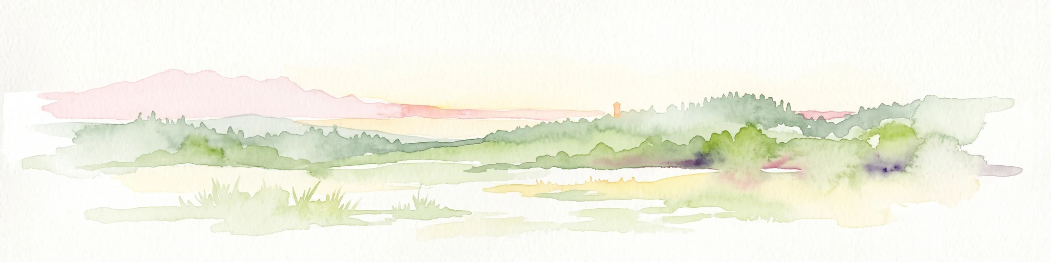
A digital illustration of a flat topped mountain or mesa set against a soft sunset sky, surrounded by rolling hills and stylized green trees.

Gebiete zwischen Bisingen, Haigerloch und Rosenfeld

Nature reserve

Park overview

Structured park overview, official facts, and landscape profile for Gebiete zwischen Bisingen, Haigerloch und Rosenfeld

Gebiete zwischen Bisingen, Haigerloch und Rosenfeld park facts, protected area profile, and essential visitor context

Review the core facts for Gebiete zwischen Bisingen, Haigerloch und Rosenfeld, including designation, size, terrain, visitor scale, habitats, and operating context in one park-focused overview.

About Gebiete zwischen Bisingen, Haigerloch und Rosenfeld

Gebiete zwischen Bisingen, Haigerloch und Rosenfeld represents a distinctive example of how Natura 2000 conservation in Germany is implemented on a fragmented, multi-parcel scale. Although the site is sometimes perceived as a single area, it is officially composed of fifteen separate component zones spread across six municipalities in the Zollernalbkreis. The fragments together preserve an ecological gradient that runs from the upper Neckar and Tauber Gäu plateau landscapes in the north to the lower-lying edges of the Swabian Keuper-Lias Land further south.

Ecologically, the area combines habitat types that are individually classified as priorities at the European level. Calcareous dry grasslands of the Festuco-Brometalia type and artenreiche montane Borstgrasrasen on siliceous soils form some of the most floristically important elements, alongside Flachland-Mähwiesen lowland hay meadows that maintain traditional agricultural values. The presence of Wacholderheiden, juniper scrub on former grazing land, is particularly noteworthy because this habitat has sharply declined across southwestern Germany and remains a conservation priority both for biodiversity and for cultural landscape character.

The hydrological components of the site add further ecological depth. Small calcareous spring mires known as Kalktuffquellen, transitional and quaking bogs, lowland calcareous fens, and tall-herb wetland fringes along watercourses are all represented. These wet features support floodplain woodlands with alder and ash, as well as species such as the small river mussel, the stone crayfish, and the narrow-mouthed whorl snail Vertigo angustior, which depend on intact spring systems and unpolluted small streams. The protection of these features is integral to the conservation purpose of the FFH designation.

At a landscape scale, the location amid the broad agricultural plains and gentle rises leading toward the Swabian Alb gives the site its character. Vista points within the area include Stettener Weinberg and views toward Hohenzollern Castle above the town of Bisingen. While the area does not present dramatic geological features, its combination of small-scale relief, traditional land-use remnants, and habitat heterogeneity makes it ecologically significant within the regional context.

Quick facts and research context for Gebiete zwischen Bisingen, Haigerloch und Rosenfeld

Gebiete zwischen Bisingen, Haigerloch und Rosenfeld is a Fauna-Flora-Habitat site under the European Habitats Directive, formally designated through a regulation issued by the Regierungspräsidium Tübingen on 5 November 2018 and entering into force on 11 January 2019. The site is identified by the Natura 2000 code DE7619311 and the national FFH identifier DE-7619-311, and is administered by the Tübingen regional council.

It lies entirely within the Zollernalbkreis of Baden-Württemberg and crosses the natural regions of the Neckar and Tauber Gäuplatten and the Swabian Keuper-Lias Land, spanning parts of the municipalities of Bisingen, Geislingen, Grosselfingen, Haigerloch, Hechingen, and Rosenfeld.

Protection and recognition

Review documented protection metrics and official registry records for this protected area.

Gebiete zwischen Bisingen, Haigerloch und Rosenfeld Protection Status and Recognition Data

Protected area designation records for Gebiete zwischen Bisingen, Haigerloch und Rosenfeld outline verified management boundaries and administrative status. Official registry entries provide factual baseline data regarding international recognition sources and conservation parameters.

Protection details

WDPA ID
555623524
Park context

Deeper park guide and search-rich context for Gebiete zwischen Bisingen, Haigerloch und Rosenfeld

Gebiete zwischen Bisingen, Haigerloch und Rosenfeld history, landscape, wildlife, and travel context

Explore Gebiete zwischen Bisingen, Haigerloch und Rosenfeld through its history, landscape character, ecosystems, wildlife, conservation priorities, cultural context, and seasonal travel timing in a structured park guide built for atlas discovery and search intent.

Why Gebiete zwischen Bisingen, Haigerloch und Rosenfeld stands out

The site is best known as a protected mosaic of fifteen separate habitat fragments that link the dry limestone grasslands and juniper heaths of the Swabian Alb foothills with scattered floodplain forests, wet meadows, and calcareous spring habitats. Its scattered composition is one of its defining characteristics: rather than enclosing one large reserve, conservation here depends on coordinating habitat protection across many small but ecologically distinct patches scattered through farmland. Another hallmark is its concentration of habitat types and species listed under the EU Habitats Directive. Juniper heaths on calcareous soils, species-rich matgrass swards, orchid-rich dry grasslands, Molinia fens, travertine spring communities, and alder-ash floodplain woodlands all occur here. This diversity supports protected fauna such as the yellow-bellied toad, the thick-shelled river mussel, and the stone crayfish.
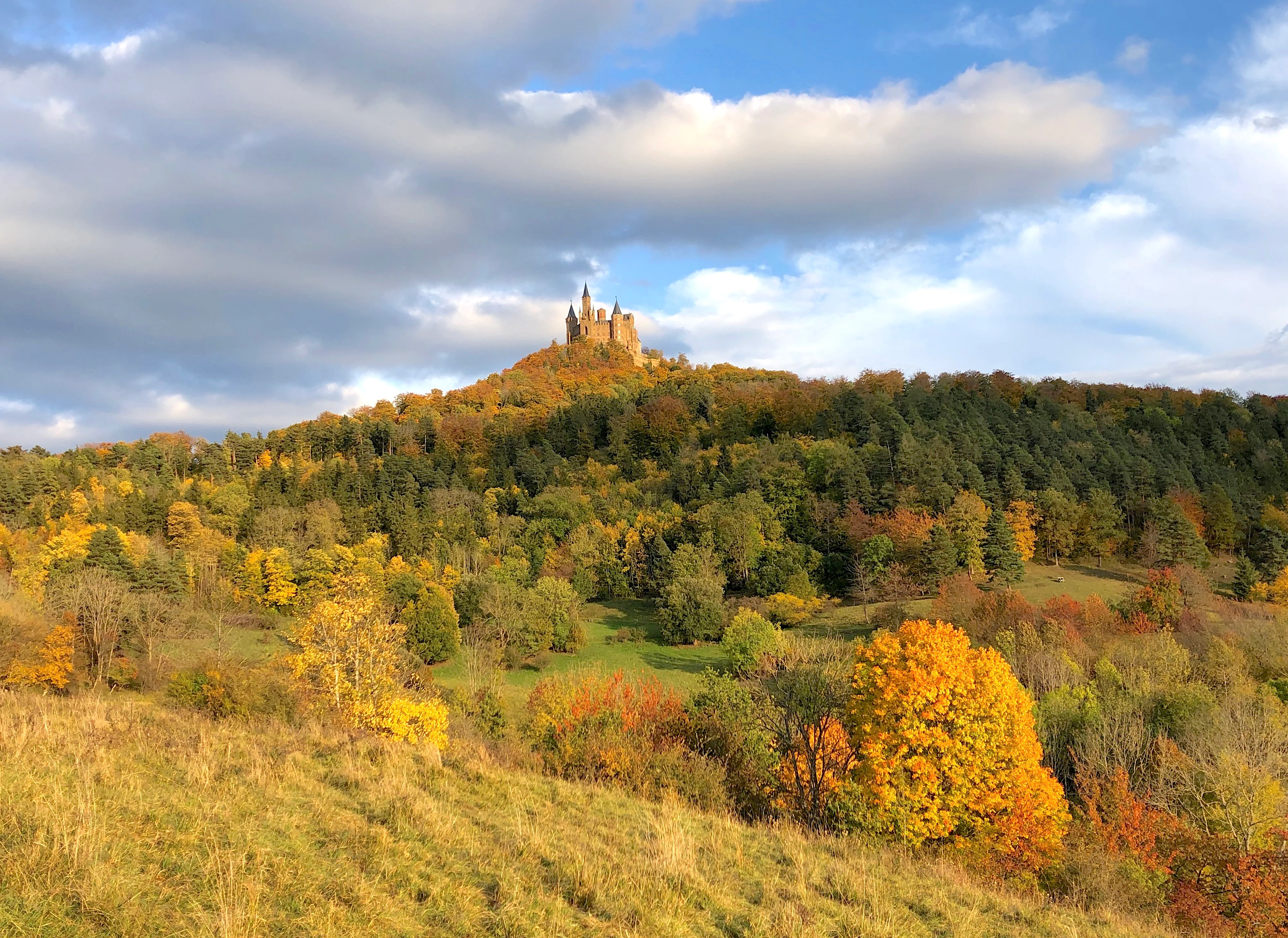
A wide view of a forested hillside with autumn foliage leading up to a stone castle on the hilltop under a partially cloudy blue sky.
Hohenzollern Castle perched atop the Zollernberg, seen from the Zollerhalde nature reserve during autumn.

Gebiete zwischen Bisingen, Haigerloch und Rosenfeld history and protected-area timeline

The site's origins as a conservation area lie in the European Union's Habitats Directive, which obliges member states to designate protected areas for habitat types and species of community interest. In 2005, the Regierungspräsidium Tübingen, the regional administrative authority responsible for much of Baden-Württemberg south of Stuttgart, formally proposed the candidacy of the Bisingen-Haigerloch-Rosenfeld area to the European Commission as part of Germany's contribution to the Natura 2000 network.

National legal protection followed more than a decade later. On 5 November 2018, the Regierungspräsidium Tübingen issued a regulation identifying areas of community importance in the region, and this regulation entered into force on 11 January 2019, formally establishing the FFH-Gebiet. The scattered structure of the site reflects its origin: instead of a single contiguous reserve, individual parcels with high ecological value were identified and grouped together under one designation.

Earlier designated areas also contribute to the current site. Several pre-existing nature reserves such as Häselteiche, Warrenberg, Owinger Bühl, Stettener Weinberg, Salenhofweiher, Breilried, Zollerhalde, Hessenbol, and Hohegert are linked within the FFH framework, ensuring that prior local protection efforts were integrated into the broader European conservation strategy.

Gebiete zwischen Bisingen, Haigerloch und Rosenfeld landscape and geographic character

The physical setting of the protected area is defined by the transitional terrain between the open Gäu plateaus of the upper Neckar and Tauber regions and the wooded foothills of the Swabian Keuper-Lias Land further south and east. Elevations vary only modestly across the site, producing a landscape of gentle slopes and small valleys rather than high mountains or deep gorges. Several parcels occupy shallow valleys with calcareous bedrock, while others sit on open plateaus.

Woodland cover includes canopy-forming broadleaf forest types such as Schlucht- und Hangmischwälder and Auenwälder with alder, ash, and willow, often restricted to narrow strips along small streams. Open areas are dominated by semi-natural dry grasslands on shallow, stony soils, where juniper bushes on former grazing land give the terrain a distinctive character.

Rocky outcrops of calcareous stone host Felsspaltenvegetation, and the area also contains small, non-tourist cave openings as part of its geological inheritance. Softer terrain features vary from the limestone cliffs that frame dryer sites to alluvial flats along watercourses that support floodplain vegetation. Together, these elements create a mosaic in which exposed rock, closed canopy, and open meadow alternate over short distances.

Gebiete zwischen Bisingen, Haigerloch und Rosenfeld ecosystems, habitats, and plant life

Ecologically, the site preserves a remarkable concentration of habitat types listed under Annex I of the EU Habitats Directive. Calcareous dry grasslands and their successional stages form the foundation of the open habitats, accompanied by orchid-rich matgrass swards, lowland hay meadows rich in forbs, and patches of juniper scrub that have developed on former grazing land. These grasslands are among the most threatened habitat types in southwestern Germany due to land-use change and intensification.

Wetland and aquatic habitats add a contrasting dimension. Fließgewässer with submerged vegetation of the Ranunculion and Callitricho-Batrachion types support fish species such as the bullhead, while calcareous spring mires and lowland fens host specialized vegetation adapted to consistent moisture and mineral-rich groundwater. Tall-herb fringes of the planaren bis alpinen Stufe line small watercourses and provide important structural habitat for amphibians and invertebrates.

Forests form the third major ecological layer. Schlucht- und Hangmischwälder on shaded slopes, floodplain woodlands of alder and ash, and smaller wooded patches create habitat continuity between otherwise open areas. The site thus spans a wide ecological gradient: dry and sun-exposed grasslands are juxtaposed with permanently moist spring mires and shaded forest valleys, supporting a broad spectrum of plant communities within a relatively small geographic footprint.

Gebiete zwischen Bisingen, Haigerloch und Rosenfeld wildlife and species highlights

The site supports several animal species of community interest under the EU Habitats Directive. Aquatic and semi-aquatic species are particularly well represented. The thick-shelled river mussel Unio crassus inhabits suitable stretches of small streams, depending on stable sediments and good water quality. The stone crayfish Austropotamobius torrentium is among the most range-restricted and threatened crayfish in central Europe and is a major conservation target for the area. The bullhead Cottus gobio, a small bottom-dwelling fish, also occurs in the area's watercourses.

On land, the yellow-bellied toad Bombina variegata is a key amphibian species recorded in the site. Its dependence on small, sun-exposed pools and shallow water bodies makes it sensitive to changes in agricultural practice and hydrology. Among invertebrates, the narrow-mouthed whorl snail Vertigo angustior is a particularly significant species, as it requires undisturbed calcareous and wet habitat conditions and has declined across much of Europe. The presence of this combination of aquatic, amphibian, and invertebrate species reflects the habitat heterogeneity of the protected area.

Botanically, the area is noted for populations of Bromus grossus, a grass species of community interest that becomes part of the broader conservation interest of the site. While the area's wildlife is not characterized by large charismatic mammals, the conservation focus on invertebrates, amphibians, and freshwater fauna gives it high ecological relevance.

Gebiete zwischen Bisingen, Haigerloch und Rosenfeld conservation status and protection priorities

The core conservation purpose of the site is the long-term preservation of habitat types and species listed in the European Union's Habitats Directive, with priority given to those marked as such. Calcareous dry grasslands, juniper heaths, species-rich matgrass swards, calcareous spring mires, and floodplain woodlands are all central targets, with the priority habitats among them receiving heightened protection.

Conservation management must balance ecological objectives with the continuation of traditional land uses. Many of the open habitat types, particularly juniper heaths and species-rich dry grasslands, depend on grazing or low-intensity mowing to maintain their character. Without active management, these open landscapes would drift toward scrub or forest closure. Floodplain and spring habitats, by contrast, depend on stable hydrology, limited nutrient input, and protection from drainage and pollution.

Within the broader European context, the site forms part of the Natura 2000 ecological network and contributes to the coherence of habitat protection across the Swabian Alb and its forelands. The integration of nine pre-existing nature reserves into the FFH framework strengthens the continuity of protection. The site also exemplifies the importance of small, fragmentary protected areas: even where individual parcels are modest in size, their concentration across a region can produce meaningful conservation outcomes when managed cooperatively.

Gebiete zwischen Bisingen, Haigerloch und Rosenfeld cultural meaning and human context

The cultural context of the site is shaped by centuries of small-scale agricultural use, particularly grazing and haymaking, which produced many of the open habitat types now protected. Juniper heaths, species-rich hay meadows, and caprock grasslands historically arose from this low-intensity land use and survive today primarily where traditional practices continue.

The site also lies within the visual sphere of Burg Hohenzollern, the ancestral seat of the House of Hohenzollern and one of the most recognizable castles in Germany. From parts of the protected landscape, including the Stettener Weinberg area, views toward the castle on its conical hill are an integral part of the regional cultural identity.

The region also carries broader Swabian cultural patterns: small villages, dispersed farmsteads, and a strong tradition of mixed farming. These human dimensions are inseparable from the conservation story of the site, because habitat preservation here depends on sustaining the land-use practices that created the biological richness of the area in the first place.

Top sights and standout views in Gebiete zwischen Bisingen, Haigerloch und Rosenfeld

The protected area's distinctiveness lies in the unusually high density of EU-protected habitat types compressed into a relatively small and geographically diverse area; the entanglement of conservation with traditional agricultural land use, especially grazing that maintains juniper heaths and dry grasslands; the presence of nine component nature reserves integrated into one FFH designation; and the combination of dry calcareous grasslands, calcareous spring mires, and small floodplain forests within a single regional landscape.

The involvement of species such as the thick-shelled river mussel, stone crayfish, and yellow-bellied toad adds a layer of freshwater and amphibian conservation significance that is rare at this scale. The visual presence of Hohenzollern Castle further ties the site's natural value to its strong cultural-geographic identity within the Zollernalbkreis.

Best time to visit Gebiete zwischen Bisingen, Haigerloch und Rosenfeld

Spring and early summer are typically the most rewarding seasons for experiencing the site, when lowland hay meadows, matgrass swards, and dry grasslands come into flower and species-rich plant communities become most visible. These months are also the main period for amphibian activity, including audible breeding choruses of species such as the yellow-bellied toad around suitable pools.

Late summer and early autumn offer drier conditions and clearer views across the open landscapes, including the visual link toward Burg Hohenzollern from elevated points such as Stettener Weinberg. Wet and open habitat features remain accessible year-round, but tall vegetation in mid to late summer can make observation of ground-level detail more challenging. Winter visits can be productive for structural landscape reading, when deciduous woodland structure and small valley forms are visible without foliage.

Monthly climate preview

Long term temperature and precipitation patterns recorded at representative coordinates in Baden Württemberg

Annual Climate Normals and Weather by Month for Gebiete zwischen Bisingen, Haigerloch und Rosenfeld

Representative coordinates for Gebiete zwischen Bisingen, Haigerloch und Rosenfeld record measured baseline temperatures ranging from subzero winter minima to summer maxima alongside steady daily precipitation amounts. Detailed twelve month climate statistics provide a complete monthly breakdown of average conditions across the protected terrain.
Annual mean8 °C
-1 °C18 °C
Jan-1°
Feb
Mar
Apr
May12°
Jun16°
Jul18°
Aug18°
Sep14°
Oct
Nov
Dec
Warmest month
July

18.1 °C

Coolest month
January

-0.9 °C

Wettest month
July

3.1 mm/day

Driest month
April

1.9 mm/day

Park location guide

Geography guide, regional context, and park location map for Gebiete zwischen Bisingen, Haigerloch und Rosenfeld

Gebiete zwischen Bisingen, Haigerloch und Rosenfeld park geography, regions, and map view in Germany

Understand where Gebiete zwischen Bisingen, Haigerloch und Rosenfeld sits in Germany through a broader geographic reading of the surrounding landscape, nearby location context, and its mapped position within the national park landscape.

How Gebiete zwischen Bisingen, Haigerloch und Rosenfeld fits into Germany

Germany is a federal republic in Western and Central Europe with a population of over 83 million across sixteen constituent states. It is Europe's largest economy by nominal GDP and a major global exporter and importer. The capital is Berlin, and the country borders Denmark, Poland, Czech Republic, Austria, Switzerland, France, Luxembourg, Belgium, and the Netherlands.

Wider geography shaping Gebiete zwischen Bisingen, Haigerloch und Rosenfeld in Germany

Germany is located in Western and Central Europe, spanning 357,022 km². It borders Denmark to the north, Poland and the Czech Republic to the east, Austria and Switzerland to the south, and France, Luxembourg, Belgium, and the Netherlands to the west. The country has coastlines on the Baltic Sea and North Sea to the north, with the Alps located in the southern region.

Map view of Gebiete zwischen Bisingen, Haigerloch und Rosenfeld

Use this park location map to pinpoint Gebiete zwischen Bisingen, Haigerloch und Rosenfeld in Germany, understand its exact geographic position, and read its mapped placement within the surrounding landscape more clearly.

Pigeon | © OpenStreetMap contributors

Location context for Gebiete zwischen Bisingen, Haigerloch und Rosenfeld

Baden-Württemberg

Visualizing the fragmented habitats, juniper heaths, and calcareous grasslands of the Swabian Alb foothills

Gebiete zwischen Bisingen, Haigerloch und Rosenfeld Photos, Landscapes, and Scenery

Photographs capture the diverse terrain of juniper heaths, limestone grasslands, and scattered floodplain forests across the protected mosaic. Visual records reveal the distinct ecological character and regional landscape features defining these fifteen separate conservation parcels.

A wide view of a forested hillside with autumn foliage leading up to a stone castle on the hilltop under a partially cloudy blue sky.

A wide, elevated view of a grassy meadow and hillside in the foreground, with a patch of forest on the right and a distant village and rolling hills in the background under a blue sky.

Park atlas

Discover related reserves and regional protected landscapes across the Swabian Alb foothills

Explore Protected Areas and Parks Near Gebiete zwischen Bisingen, Haigerloch und Rosenfeld

Compare adjacent habitat fragments and protected natural areas sharing the transitional terrain of the Zollernalbkreis. Reviewing surrounding regional reserves helps contextualize local conservation networks and calcareous landscape types.
Watercolor painting of a green valley with a winding river and a small group of trees under a light sky.
Protected landscapeZollernalbkreis
About 8.1 km away#1 closest

Northeast

Mittleres Starzeltal Protected Landscape: Mapping the Geography of the Zollernalbkreis District

A detailed look at the Starzel river valley and forest mosaic.

The Mittleres Starzeltal protected landscape represents a significant river corridor in the Zollernalbkreis district. This area spans through Hechingen and Bisingen, characterized by its traditional orchard meadows and dense forest slopes that frame the middle Starzel valley. Explore the boundaries and topographic features that define this protected territory within the Swabian Alb conservation network.

Area
12.454 km²
Established
1963
IUCN
V
Relief
Upland
Protected landscapeBaden-Württemberg
About 11 km away#2 closest

Northwest

Heselgraben Protected Landscape: Baden-Württemberg Regional Geography and Terrain Mapping

A classic mosaic of meadows and fields in the Obere Gäue region

Heselgraben represents a significant protected area within the Baden-Württemberg state, characterized by its intricate juxtaposition of small-scale agricultural habitats. Located between Muschelkalk and Keuper geological zones, the landscape provides a dense, mapped look at traditional European hedgerow and grassland management along the Empfinger Bach stream.

Area
0.378 km²
Established
1989
IUCN
V
Relief
Upland
A watercolor painting showing a wide view of a winding river flowing through a lush green valley with distant purple hills and forested ridges.
Protected landscapeLandkreis Tübingen
About 12 km away#3 closest

North

Oberes Neckartal mit den Seitentälern Rommelstal, Starzeltal und Eyachtal Protected Landscape

Geographic landscape analysis of the upper Neckar river valley and its forested tributaries.

Situated within Landkreis Tübingen, this protected landscape is defined by its distinct Muschelkalk geology and the interplay between deep valley slopes and open orchard meadows. The area encompasses the upper Neckar river valley along with the side valleys of Rommelstal, Starzeltal, and Eyachtal. This detailed landscape profile provides insight into the structured natural environment, forest coverage, and fluvial terrain that characterize this region of southwestern Germany.

Area
23.364 km²
Established
1981
IUCN
V
Relief
Upland
Watercolor painting of a rolling rural landscape with forested hills and open fields in muted green, yellow, and soft pink tones.
Protected landscapeBaden-Württemberg
About 14 km away#4 closest

East

Oberes Starzeltal und Zollerberg Protected Landscape: Regional Geography and Terrain

Swabian Alb limestone topography and river valley systems.

Oberes Starzeltal und Zollerberg represents a core landscape protection area on the western Swabian Alb, defined by its distinct Middle Jurassic limestone geology. The area connects critical habitats across the Zollernalbkreis district, featuring steep wooded slopes and open sheep-grazed grasslands. Through this atlas entry, visualize the environmental continuity between the Starzel river valley and the surrounding agricultural plateau, which together form a essential component of the regional protected-area network.

Area
79 km²
Established
1972
IUCN
V
Relief
Mountain
A graphic illustration of a deep forest gorge featuring a winding stream in the foreground, tall trees on both sides, and a cascading waterfall against high cliff walls in the background.
Protected landscapeBaden-Württemberg
About 15 km away#5 closest

Southwest

Waldenbachtal Protected Landscape: A Geographic Profile of a Sandstone Gorge in Baden-Württemberg

Forested Klingen valley and stream-carved terrain mapping

Waldenbachtal serves as an ecologically significant protected landscape within the Rottweil district of Baden-Württemberg. Its map profile highlights a narrow gorge incised into Stubensandstein, defined by a distinct coniferous forest cover and linear stream drainage. This site provides a clear view into the region's Middle Keuper geological history and valley-based conservation patterns.

Area
0.149 km²
Established
1982
IUCN
V
Watercolor painting of a pastoral river valley landscape with soft green hills and wooded ridgelines on a white background.
Protected landscapeBaden-Württemberg
About 16 km away#6 closest

Northwest

Oberes Neckartal Protected Landscape: Geography and Mapped Boundaries

A regional conservation area within the Obere Gäue natural region.

Spanning a distinct stretch of the upper Neckar river, Oberes Neckartal acts as a structural conservation corridor in Baden-Württemberg. The area is defined by its deep valley incision, flat agricultural meadows, and steep forest-covered slopes, which create a consistent landscape motif throughout the Freudenstadt district.

Area
6.275 km²
Established
2001
IUCN
V
Relief
Upland
Protected landscapeBaden-Württemberg
About 17 km away#7 closest

Northwest

Südhänge des Neckartales, Berghänge des Haugenloches, Alte Bildechinger Steige, Altheimer Tal und angrenzende Hochflächen

Protected Landscape in the Upper Neckar Valley, Baden-Württemberg

This protected area preserves a mosaic of forested slopes, juniper heaths, and agricultural plateaus along the Neckar. It offers a clear view into the cultural history and regional geography of the Obere Gäue in southwestern Germany.

Area
2.62 km²
Established
1965
IUCN
V
Nature reserveGermany
About 20 km away#8 closest

South

Hintere Harrasbachtalwiesen Nature Reserve: Swabian Alb Valley and Meadow Geography

A mapped protected landscape in Baden-Wurttemberg, Germany

Hintere Harrasbachtalwiesen is a protected valley landscape in the Tuttlingen district, characterized by its stream network and distinctive forest-encircled wet meadows. This compact reserve provides a clear example of local Swabian Alb topography, linking small-scale riparian corridors to the extensive regional Natura 2000 protected land network.

Area
0.08 km²
Established
1944
Relief
Upland
Climate
Temperate

Common questions about visiting, size, designation, and location context for Gebiete zwischen Bisingen, Haigerloch und Rosenfeld

Gebiete zwischen Bisingen, Haigerloch und Rosenfeld FAQs for park facts, access, geography, and protected area context

Find quick answers about Gebiete zwischen Bisingen, Haigerloch und Rosenfeld, including protected-area facts, park geography, trail and visitor context, and how the park fits into its surrounding country and regional landscape.
MoriAtlas Explorer

Continue Your Protected Areas Search Across the Global Atlas

Deepen your exploration by continuing the structured search for national parks and protected areas worldwide. Utilize the comprehensive filtering capabilities to compare different conservation landscapes and refine your understanding of global park geography. Discover more about the distribution and characteristics of protected natural areas.

Global natural geography