
Streams
Park geography
Detailed analysis of regional terrain, elevation ranges, and natural landscape features
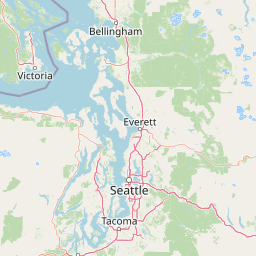
Comprehensive Geographic Profile and Mapped Boundaries of Glacier Peak Wilderness
This geographic profile provides structured data on Glacier Peak Wilderness, covering its extensive 2290.75 square kilometer protected boundary within Washington. Discover core terrain data including a maximum elevation of 3213 meters and associated environmental classifications like alpine meadows, montane forests, and glacial features.
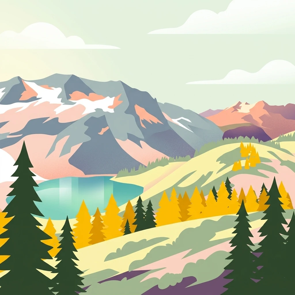
A remote, glacier-crowned volcanic wilderness in Washington's North Cascades.
Glacier Peak Wilderness
Glacier Peak Wilderness is a large designated wilderness area in the central Cascade Range of Washington State, sprawling across parts of Chelan, Snohomish, and Skagit counties within the Wenatchee and Mount Baker National Forests. The landscape is defined by steep forested valleys, glacier-clad summits, deep stream courses, and high mountain lakes, all anchored by 10,541-foot Glacier Peak itself, an isolated volcanic cone rising in the heart of the range. The wilderness is widely recognized as the most remote major volcanic peak in the Cascades, and Glacier Peak ranks among the most heavily glaciated volcanoes in the contiguous United States, surpassed only by Mount Rainier and Mount Baker. Its combination of dense coniferous forests, rugged glaciated terrain, and remoteness from roads makes it one of the wildest and least-accessible major alpine areas in the lower forty-eight states. Designated in 1960, four years before the federal Wilderness Act, the area has long served as a stronghold for North Cascade mountain wildlife, including deer, elk, black bear, mountain goat, and the increasingly rare Canada lynx. Its complex terrain, glacier headwaters, and old-growth forests also give it significant ecological and hydrological importance within the broader North Cascades ecosystem.
- Location
- United States of America
- Park type
- Wildlife reserve
- Established
- 1960
- Area
- 2,290.8 km²
- Highest point
- 3,213 m
Location overview
Recorded country and regional administrative memberships
Glacier Peak Wilderness Location and Regional Geography
Glacier Peak Wilderness is located within the United States of America and the state of Washington. Administrative records outline regional memberships without marine or transboundary designations.
- Countries
- United States of America
- Regions
- Washington
- Primary location
- Washington
- Geographic setting
- Inland
Boundary and coordinates
Interactive boundary geometry and calculated spatial measurements
Glacier Peak Wilderness Boundary Map and Geographic Extent
Mapped park outlines provide clear spatial context for analyzing the protected terrain. Derived area metrics and coordinate limits outline the geographic footprint of the protected area.
- Boundary area
- 2,291.8 km²
- Boundary perimeter
- 392.8 km
- Northernmost point
- 48.4759° N
- Southernmost point
- 47.8838° N
- Easternmost point
- 120.5277° W
- Westernmost point
- 121.4144° W
- Geographic centre
- 48.2013° N, 121.0198° W
- North–south span
- 65.8 km
- East–west span
- 65.9 km
Elevation and terrain
Mountain relief metrics and recorded natural features
Glacier Peak Wilderness Terrain and Elevation Profile
Glacier Peak Wilderness maintains a documented maximum elevation of 3213 meters across its mountainous terrain. Recorded natural feature cards detail associated peaks, streams, ridges, and saddles located within the protected boundary.
- Maximum elevation
- 3,213 m
- Highest point
- 3,213 m
Selected named natural features
Peaks
Mount Berge
Peaks
Tenpeak Mountain
2,505 m
Streams
Burn Creek
Mountain saddles
Buck Creek Pass
1,763 m
Streams
Goat Creek
Environmental setting
Alpine relief, major water systems, and forest cover profiles
Glacier Peak Wilderness Environmental Classifications and Physical Settings
Recorded landscape features, habitat types, and climate zones offer complementary ways to read physical settings across Glacier Peak Wilderness. Stored classifications connect recorded categories to relevant atlas destinations where available.
- Relief
- Mountain
- Climate
- Alpine
- Water
- Major water bodies
- Forest cover
- Mostly forested
- Seasonality
- Seasonal
Landscape features
Mountains · Valleys · Forest · Lakes · Rivers · Glacier · Volcano
Habitat types
Temperate coniferous forest · Montane forest · Alpine meadow · Lacustrine habitat · Riverine habitat · Glacial habitat
Park atlas
Compare regional mountain terrain, glaciated volcanic peaks, and adjacent wilderness areas.
Explore Parks Near Glacier Peak Wilderness and Surrounding Protected Landscapes
Browse protected areas and rugged mountain terrain located near Glacier Peak Wilderness in the central Cascade Range. Comparing adjacent natural landscapes provides broader regional context for alpine ecosystems and volcanic geography.
Protected landscapeChelan County
Park boundaries overlap#1 closest
Northeast

Lake Chelan National Recreation Area: Protected Geography and North Cascades Map
Glacial terrain and remote mountain valleys in Chelan County
Lake Chelan National Recreation Area protects a rare transition of alpine environments and river-carved valleys in north-central Washington. The terrain is dominated by the long, deep waters of the lake and the steep ridges of the North Cascades, creating an isolated habitat for wild landscapes and historic inland communities. Explore the physical boundaries and topographic features that define this rugged recreation area.
- Area
- 250.74 km²
- Established
- 1968
- IUCN
- V
- Visitors
- 38.2K annual

Protected landscapeWashington
Park boundaries overlap#2 closest
Southwest
Mount Baker, Snoqualmie National Forest: Mapped Geography and Protected Landscape Analysis
Exploratory atlas of Washington's primary Cascade Range wilderness
Delve into the structural geography of Mount Baker, Snoqualmie National Forest. This protected area corridor serves as a major ecological transition zone between the Puget Sound lowlands and the interior Cascades, characterized by extensive glaciers, wild river systems, and iconic stratovolcanoes that define the regional landscape of Washington state.
- Area
- 6,978 km²
- Established
- 1974
- Relief
- Mountain
- Climate
- Alpine
National parkWashington
Park boundaries overlap#3 closest
North
North Cascades National Park: US National Park Protected Landscape and Geographic Context
Explore mapped boundaries and regional Washington geography.
Gain insight into North Cascades National Park, a vital US National Park located in Washington. This entry focuses on its protected land status, mapped geographic extent, and its role within the regional atlas. Users seeking to understand the park's landscape character, natural terrain, and its specific location in Washington will find this an essential point for detailed park geography exploration and protected area discovery.
- Area
- 2,042.26 km²
- Established
- 1968
- IUCN
- II
- Visitors
- 16.5K annual

Protected landscapeWashington
Park boundaries overlap#4 closest
Northeast
Okanogan, Wenatchee National Forest: A Comprehensive Look at Washington's Protected Mountain Landscapes
Mapping ecological gradients and wilderness boundaries across the eastern Cascade Range
Spanning from the moist coniferous forests of the western Cascades to the arid plateaus of the Okanogan, this massive national forest protects an unmatched diversity of terrain. Explore the intricate geography of river-carved valleys, glacial cirques, and remote wilderness areas that characterize this critical environmental corridor in the Pacific Northwest.
- Area
- 6,066.33 km²
- Established
- 1911
- Visitors
- 397K annual
- Relief
- Mountain
Wildlife reserveWashington
1.2 km away#5 closest
Northeast
Lake Chelan-Sawtooth Wilderness: Geographic Atlas and Protected Landscape Overview
North Cascades Wilderness in Washington State
Located in the north-central Cascade Range of Washington, this protected wilderness area contains 63 glacial lakes and extensive alpine terrain. The region offers a complex landscape of cirques, subalpine meadows, and forested valleys that connect directly to the larger North Cascades protected network. Use this atlas to examine its mountainous geography and defined conservation boundaries.
- Area
- 619.4 km²
- Established
- 1984
- IUCN
- Ib
- Relief
- Mountain

Protected landscapeWashington
12 km away#6 closest
North
Ross Lake National Recreation Area: A Glacial Reservoir Landscape in Washington
Mapping the Skagit River and North Cascades alpine corridor
Located in the heart of Washington, Ross Lake National Recreation Area preserves a unique landscape of connected reservoirs and deep, glacier-cut valleys. This protected area acts as a vital geographic link within the North Cascades, offering access to high-altitude peaks, riverine forests, and the distinct turquoise waters of Diablo Lake.
- Area
- 475.81 km²
- Established
- 1968
- IUCN
- V
- Visitors
- 998K annual
Protected landscapeWashington
39 km away#7 closest
Northwest
Mount Baker National Recreation Area: An Atlas of Washington's Volcanic Terrain
Exploration of a remote, roadless Cascade protected landscape
The Mount Baker National Recreation Area provides a unique geographic window into the volcanic heart of the Pacific Northwest. Characterized by its glacier-clad massif and network of subalpine trails, the area serves as a vital protected habitat for elk, mountain goats, and diverse conifer forests. This record details the park's topography, ranging from deep glacial valleys to high-elevation ridges that overlook the broader North Cascades region.
- Area
- 34.29 km²
- Established
- 1984
- Relief
- Mountain
- Climate
- Alpine

Wildlife reserveWashington
40 km away#8 closest
Northwest
Mount Baker Wilderness: Mapped Volcanic Peaks and Glacial Geography in Washington State
Protected wilderness boundaries in the Northern Cascades
Mount Baker Wilderness encompasses a vast mountain landscape characterized by an active stratovolcano and significant permanent snowfields. The terrain features a vertical gradient from dense west side conifer forests to exposed alpine summits, creating a distinct ecological corridor connected to neighboring protected areas in the Pacific Northwest.
- Area
- 485.58 km²
- Established
- 1984
- IUCN
- Ib
- Relief
- Mountain
MoriAtlas Explorer
Continue Exploring the Protected Landscapes and Mapped Geography of Glacier Peak Wilderness
Deepen your understanding of Glacier Peak Wilderness through our structured geographic data. MoriAtlas provides a clear view into the rugged terrain, glaciated mountain basins, and forest ecosystems that characterize this remote volcanic reserve within the Washington Cascade Range.
Browse next
Global natural geography
Explore related park routes
Explore MoriAtlas Global ParksBrowse All MoriAtlas ParksGlobal Park Map DiscoveryMoriAtlas: Browse All CountriesBrowse All MoriAtlas ContinentsNational Park Environment AtlasGrand Canyon National Park AtlasYellowstone National Park AtlasYosemite National Park Atlas and GeographySerengeti National Park AtlasGalápagos National Park Protected LandscapeBanff National Park Geography and AtlasKruger National Park Atlas EntryUluṟu-Kata Tjuṯa National Park AtlasExplore Uluru-Kata Tjuta National Park GeographyPlitvice Lakes National Park AtlasFiordland National Park Protected LandscapeGreat Smoky Mountains National Park AtlasAfghanistan National Parks and Protected AreasAlbania National Parks and Protected AreasAlgeria National Parks and Protected AreasAmerican Samoa National Parks and Protected AreasAndorra National Parks and Protected AreasAngola National Parks and Protected AreasAntarctica National Parks and Protected AreasAntigua and Barbuda Park List