
Mori Atlas logo
Wildlife reserveGlacier Peak Wilderness

Understanding the mapped terrain, volcanic history, and glaciated features of this expansive wilderness area.

Glacier Peak Wilderness in Washington: A Comprehensive Geographic and Protected Landscape Atlas

Glacier Peak Wilderness stands as a profound protected landscape in the central Cascade Range of Washington, encompassing a vast network of forested river valleys and ice-clad summits. This atlas entry focuses on the distinct volcanic geography centered around the remote 10,541-foot Glacier Peak, highlighting its dense glacial cover, deep mountain basins, and rugged stream corridors. Through spatial context, users can trace the boundaries of this wilderness area and observe the transition from old-growth forest to high-altitude alpine terrain.

wilderness areaNorth Cascadesvolcanic landscapeglaciated peakalpine terrainold-growth forest
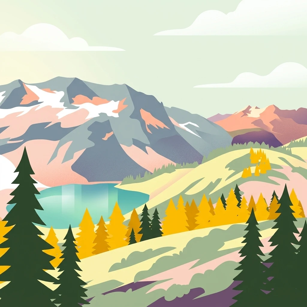
A stylized vector illustration of mountain peaks with snow patches, a turquoise lake, and yellow and green conifer trees in a hilly landscape.

Glacier Peak Wilderness

Wildlife reserve

Park overview

Structured park overview, official facts, and landscape profile for Glacier Peak Wilderness

Glacier Peak Wilderness park facts, protected area profile, and essential visitor context

Review the core facts for Glacier Peak Wilderness, including designation, size, terrain, visitor scale, habitats, and operating context in one park-focused overview.

About Glacier Peak Wilderness

Glacier Peak Wilderness occupies a substantial portion of the central North Cascades in Washington State, encompassing a roughly 35-mile-long, 20-mile-wide swath of forested ridges, river valleys, and glaciated highlands. The wilderness spreads across three counties and is administered by the U.S. Forest Service within the territorial framework of Wenatchee National Forest and Mount Baker National Forest. Although the boundaries include lower forested river corridors, the dominant elevation and visual identity of the area is shaped by the high alpine country surrounding its namesake volcano.

Glacier Peak itself is the centerpiece of the wilderness and the primary reason for the area's protected status. At 10,541 feet, it is a stratovolcanic cone composed of basalt, pumice, and ash laid down during repeated eruptions that coincided with major glaciations. Despite being lower in elevation than several other Cascade peaks, it carries an exceptional volume of glacial ice, ranking third in glacial coverage among volcanoes in the contiguous United States, behind Mount Rainier and Mount Baker. Its position well to the north of the main Cascade crest gives it a more isolated, harder-to-reach character than the other major Northwest stratovolcanoes.

Beyond the volcano itself, the wilderness includes a deep network of tributary valleys and high basins. The Suiattle, White Chuck, White, and Chiwawa river systems feed dense coniferous forests in the lower elevations, while the upper valleys host extensive subalpine meadows, glacial tarns, and a series of moraine-dammed lakes. No roads approach the mountain, and reaching its base typically requires multi-day hikes through remote and physically demanding terrain, which has helped preserve the wilderness character of the area.

The ecological significance of the wilderness is closely intertwined with this landscape complexity. The altitudinal gradient from low-elevation river forests up to glacial and alpine zones supports a wide range of habitats in close proximity, while the rugged topography and limited human access have allowed the area to retain much of its wild character. For visitors, researchers, and conservationists, Glacier Peak Wilderness represents one of the most complete examples of an intact, roadless, glacier-bearing volcanic landscape in the contiguous United States.

Quick facts and research context for Glacier Peak Wilderness

Glacier Peak Wilderness spans roughly 566,057 acres across Chelan, Snohomish, and Skagit counties in north-central Washington. The area is administered by the U.S. Forest Service and lies within portions of Wenatchee National Forest and Mount Baker National Forest. It is classified as a wilderness area under the U.S. federal system and is one of the largest contiguous wild blocks in the North Cascades.

The defining geographic feature is Glacier Peak, a 10,541-foot stratovolcanic cone built of basalt, pumice, and ash, which ranks as the third most heavily glaciated peak in the contiguous United States. The wilderness has no road access to the mountain itself, with all approaches requiring long hikes through steep, forested valleys.

Protection and recognition

Examine documented terrestrial conservation frameworks and administrative scope.

Glacier Peak Wilderness Protection Status and Territorial Designation Facts

Glacier Peak Wilderness maintains a defined terrestrial protection scope within its regional landscape. Conservation records track institutional recognition data and administrative boundaries for this protected area.

Protection details

Protection scope
Terrestrial
Transboundary protection
No
Park context

Deeper park guide and search-rich context for Glacier Peak Wilderness

Glacier Peak Wilderness history, landscape, wildlife, and travel context

Explore Glacier Peak Wilderness through its history, landscape character, ecosystems, wildlife, conservation priorities, cultural context, and seasonal travel timing in a structured park guide built for atlas discovery and search intent.

Why Glacier Peak Wilderness stands out

Glacier Peak Wilderness is best known for its namesake peak, Glacier Peak, an isolated Cascade stratovolcano that is also the most remote major volcano in the range. Unlike the more accessible volcanic giants of the Pacific Northwest, Glacier Peak rises deep within a vast forested wilderness, surrounded by some of the densest glacial cover in the contiguous United States outside Alaska. The area is equally known for the ruggedness of its terrain: steep-sided valleys carved by glacial and fluvial action, heavily forested stream corridors, dozens of high mountain lakes, and a long snow season that lingers into mid-summer. This combination of volcanic origin, heavy glaciation, and exceptional remoteness makes the wilderness one of the most distinctive protected landscapes in the American West.
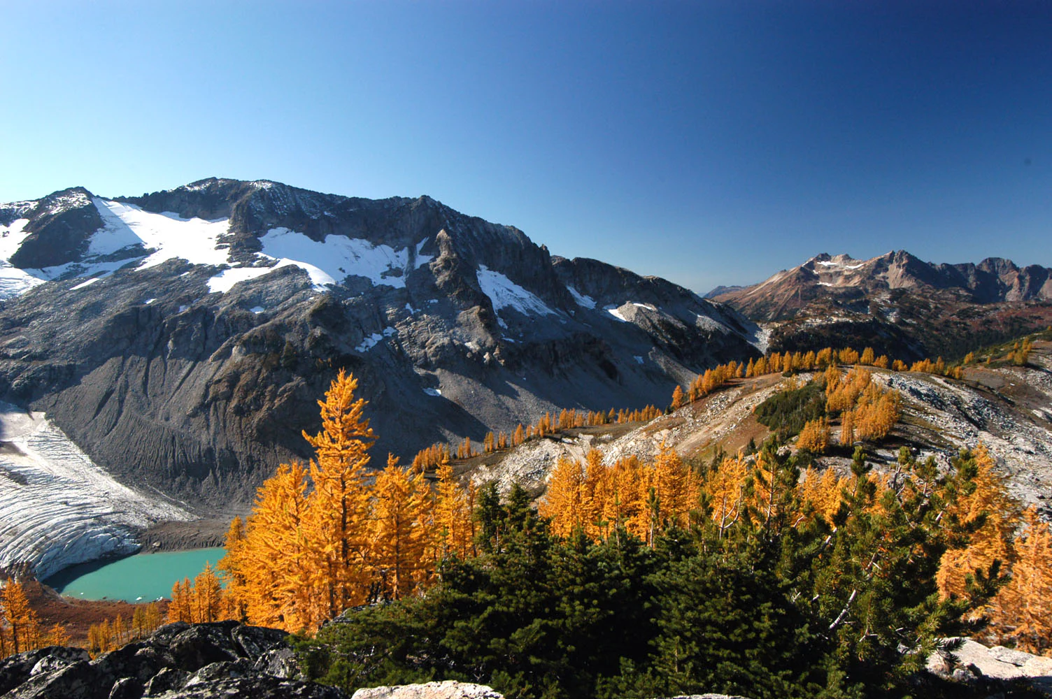
A wide mountain landscape featuring a bright turquoise glacial lake, a snow-covered glacier, and rugged peaks, with golden-yellow subalpine larch trees in the foreground and midground.
A scenic view of Lyman Glacier and the surrounding mountains in the Glacier Peak Wilderness, highlighting the golden colors of subalpine larch trees during autumn.

Glacier Peak Wilderness history and protected-area timeline

Glacier Peak Wilderness was established in 1960 through the efforts of the U.S. Forest Service and the North Cascades Conservation Council, four years before the federal Wilderness Act of 1964 brought wilderness designation into formal national policy. The area was recognized early as a landscape worthy of strong protection because of its combination of remote volcanic terrain, extensive glaciation, and largely unroaded forested valleys.

Its pre-wilderness history is closely connected to the broader logging and resource use of the surrounding national forests. Before designation, parts of the lower valleys and surrounding ridges were subject to timber harvest, mining exploration, and grazing, activities that left a visible legacy on some access routes and lower-elevation forests. As the wilderness concept gained traction in the late 1950s, advocates emphasized the need to preserve the area's wild character before further road-building and development fragmented the landscape.

The 1964 Wilderness Act and subsequent administrative actions reinforced the legal basis for the wilderness, locking in its protected status and limiting future infrastructure development. Over the following decades, Glacier Peak Wilderness became a cornerstone of the larger North Cascades protected landscape, complementing North Cascades National Park to the north and helping to anchor one of the largest contiguous wild regions in the contiguous United States.

Glacier Peak Wilderness landscape and geographic character

The landscape of Glacier Peak Wilderness is shaped by the interaction of volcanic activity and intense glaciation. The central landform is Glacier Peak itself, a steep-sided cone built of basalt, pumice, and ash that rises out of the surrounding ridges to over 10,000 feet. Radiating outward from the peak is a network of glacial cirques, arêtes, and moraines that descend into broad U-shaped valleys and connect to forested river corridors far below.

The lower elevations are dominated by deeply incised stream valleys, including the White Chuck, Suiattle, White, and Chiwawa river valleys. These valleys are heavily forested and often narrow, with steep slopes descending sharply from ridgelines down to the rivers. The combination of valley depth, slope steepness, and dense vegetation gives the wilderness a strong sense of enclosure in its lower sections, contrasting sharply with the open, exposed alpine terrain higher up.

At higher elevations, the terrain transitions into a classic high-alpine environment of rock, ice, and small glacial lakes. Numerous tarns occupy basins scoured by past glaciations, and high passes connect the various drainage systems. Snow lingers well into the summer at these elevations, often covering trails and passes into mid-August. The overall impression of the landscape is one of vertical drama and contrast: warm, dense coniferous forests at the bottom giving way within a relatively short distance to cold, glaciated rock and ice at the summit of Glacier Peak.
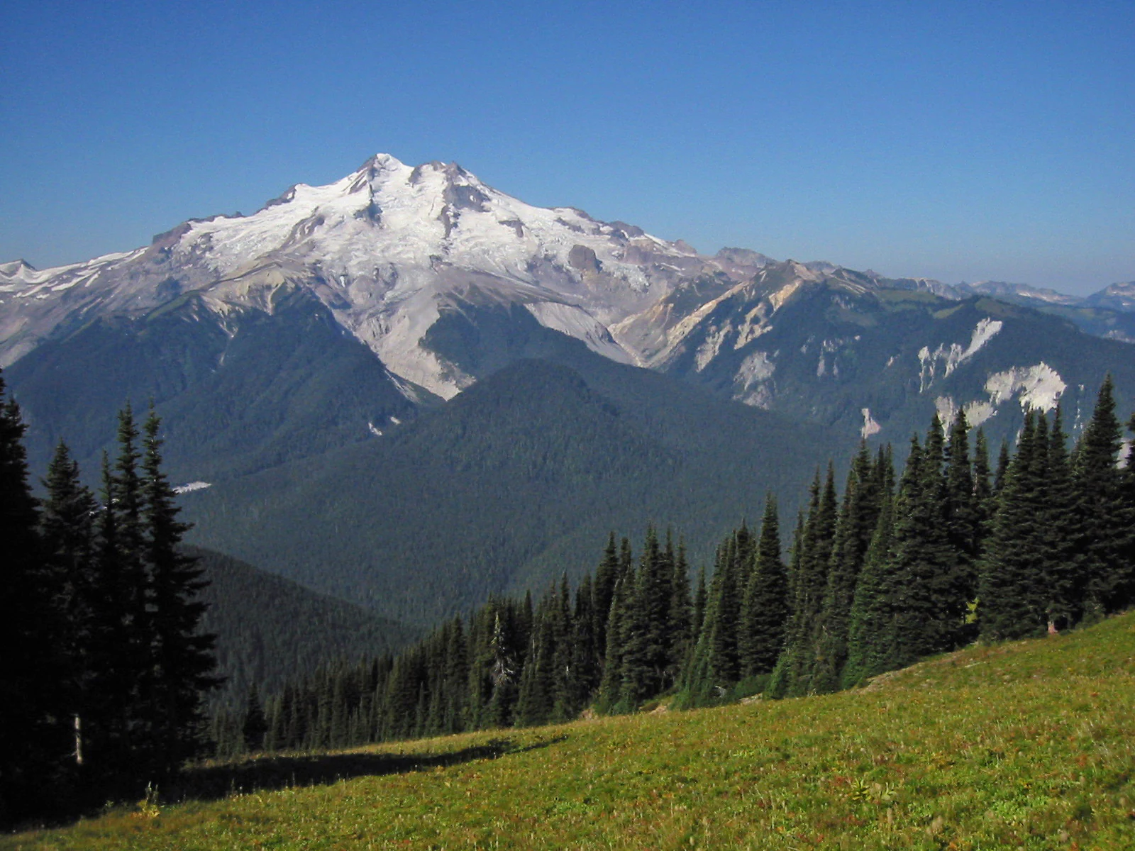
A wide angle view of the snow-capped, glaciated summit of Glacier Peak seen across a deep valley with coniferous forest slopes and a grassy meadow in the foreground.
A view of Glacier Peak rising above the dense forests and meadows of the Glacier Peak Wilderness.

Glacier Peak Wilderness ecosystems, habitats, and plant life

Glacier Peak Wilderness sits within the larger North Cascades ecosystem, one of the most ecologically complex temperate regions in North America. The altitudinal range of the wilderness, from low forested river valleys to glacial summits, creates a compressed but exceptionally diverse mosaic of vegetation zones. Western hemlock, Douglas fir, western red cedar, and Pacific silver fir dominate the moist lower and middle elevations, while subalpine fir and hardy mountain hemlock occupy the upper forested band.

Above the tree line, the wilderness gives way to subalpine parkland, alpine meadows, fellfields, and ultimately bare rock and permanent ice. Subalpine larch, a deciduous conifer adapted to long snowy winters, is one of the more distinctive species in this zone, often forming open stands on cold, rocky slopes. Around the higher lakes and meadows, a variety of herbaceous plants adapted to short growing seasons form seasonal wildflower displays after the snow finally retreats.

The wilderness also plays an important hydrological role, with snowfields and glaciers on Glacier Peak feeding the headwaters of several major river systems that flow outward into the broader Pacific Northwest. This concentration of meltwater and precipitation supports the dense forests below and contributes to the overall ecological productivity of the North Cascades.

Glacier Peak Wilderness wildlife and species highlights

The wildlife of Glacier Peak Wilderness reflects the area's combination of dense forests, alpine basins, and minimal human disturbance. Large mammals such as black bear, elk, mule deer, and mountain goat range across different elevation zones, with mountain goats typically associated with the rocky high country and elk and deer more common in the forested valleys. The wilderness also supports predators including cougar, black bear, and bobcat, along with smaller carnivores such as marten and Canada lynx.

Canada lynx, a federally listed species of conservation concern, is one of the most notable carnivores associated with the area. Deep winter snows and intact subalpine forests make parts of the wilderness well-suited to lynx habitat, and the roadless character of the area helps protect these conditions. Smaller mammals, including various vole species, are common in meadows and forest openings and form the base of the food web for many of the larger predators.

Avian life in the wilderness includes a mix of forest songbirds, raptors, and alpine-associated species, while the high lakes support populations of cutthroat trout and other fish during the ice-free season. Notably, the last confirmed grizzly bear sighting in the United States portion of the North Cascade ecosystem took place in this wilderness, underscoring both the wildness of the area and its historical significance as a stronghold for large carnivores in the region.

Glacier Peak Wilderness conservation status and protection priorities

Glacier Peak Wilderness holds significant conservation value as one of the largest designated wilderness areas in Washington State and a cornerstone of the broader North Cascades protected landscape. Its combination of roadless terrain, intact forest cover, and extensive glaciation gives it a level of ecological integrity that is increasingly rare in the lower forty-eight states. The wilderness functions as a refuge for species sensitive to human disturbance, including Canada lynx, mountain goat, and a range of subalpine-associated plants and animals.

From a hydrological and climatic perspective, the wilderness plays an outsized role in the regional ecosystem. The glaciers and snowfields of Glacier Peak serve as seasonal water storage, feeding several major rivers that supply freshwater downstream. Because climate change directly affects snowpack and glacial extent, the area has also become an important site for monitoring long-term changes in Cascade alpine environments.

Conservation management within the wilderness follows the standard federal framework for designated wilderness: no road-building, no motorized access, and restrictions on permanent infrastructure. This has helped keep the area relatively free of the fragmentation seen in many other mountainous regions of the West. The wilderness continues to be a focal point for regional conservation discussions, particularly around the future of Cascade glaciers, large carnivore recovery, and the protection of remaining old-growth forest in the surrounding valleys.

Top sights and standout views in Glacier Peak Wilderness

Glacier Peak Wilderness is defined by the towering presence of Glacier Peak, a remote and heavily glaciated Cascade stratovolcano that ranks among the most ice-covered peaks in the contiguous United States. The wilderness's deep, forested river valleys, glacially carved basins, and dozens of alpine lakes form a dramatic backdrop to the central peak, while the absence of roads preserves an exceptional sense of remoteness.

Standout features of the area include the Suiattle and White Chuck river approaches from the west, the Chiwawa and White River approaches from the east, and the western tip of Lake Chelan, all of which lead into the heart of the wilderness. Subalpine larch stands, high mountain meadows, and classic Cascade old-growth forest add botanical interest to a landscape otherwise dominated by rugged topography and ice.

Best time to visit Glacier Peak Wilderness

The most accessible season in Glacier Peak Wilderness typically runs from mid to late summer into early fall, roughly from late July through September. In most years the wilderness is still buried under deep snow well into spring, with many trails and high passes not reliably snow-free until mid-August. Even in mid-summer, snow and cold rain are possible, especially at higher elevations.

Late summer and early fall generally offer the most reliable conditions for long backcountry trips: warmer temperatures, stable weather windows, accessible high passes, and active wildlife movement in the meadows and forests. Travelers planning earlier or later in the season should expect significant snow at elevation and plan accordingly, while fall visitors can often find quieter conditions and the first hints of larch color in the subalpine zone.
Monthly climate preview

Long-term representative point measurements tracking monthly temperature and precipitation cycles

Glacier Peak Wilderness Climate Normals, Annual Temperature and Precipitation Rhythm

Representative coordinate records for Glacier Peak Wilderness outline a measured annual progression of changing monthly average temperatures alongside shifting precipitation volumes. Examining the complete twelve-month dataset reveals broader meteorological shifts across this protected Washington landscape.
Annual mean4 °C
-4 °C14 °C
Jan-3°
Feb-3°
Mar-1°
Apr
May
Jun10°
Jul14°
Aug14°
Sep11°
Oct
Nov
Dec-4°
Warmest month
August

14 °C

Coolest month
December

-3.7 °C

Wettest month
November

9.5 mm/day

Driest month
July

1.3 mm/day

Park location guide

Geography guide, regional context, and park location map for Glacier Peak Wilderness

Glacier Peak Wilderness park geography, regions, and map view in United States of America

Understand where Glacier Peak Wilderness sits in United States of America through a broader geographic reading of the surrounding landscape, nearby location context, and its mapped position within the national park landscape.

How Glacier Peak Wilderness fits into United States of America

The United States of America is a federal presidential republic and one of the world's largest countries by area and population. It consists of 50 states across a vast territory spanning multiple time zones, with its capital in Washington, D.C. and largest city in New York City. The nation has a diverse economy, influential political system, and significant cultural and military presence globally.

Wider geography shaping Glacier Peak Wilderness in United States of America

The United States occupies a vast territory in North America, bordered by Canada to the north and Mexico to the south. The 48 contiguous states stretch from the Atlantic to the Pacific Ocean, while Alaska occupies the northwestern region and Hawaii is an archipelago in the Pacific. The country encompasses diverse terrain including the Rocky Mountains, Appalachian Mountains, Great Plains, and extensive river systems.

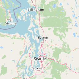
Map view of Glacier Peak Wilderness

Use this park location map to pinpoint Glacier Peak Wilderness in United States of America, understand its exact geographic position, and read its mapped placement within the surrounding landscape more clearly.

Pigeon | © OpenStreetMap contributors

Location context for Glacier Peak Wilderness

Washington
Natural feature types

Browse the Full Collection of Natural Features in Glacier Peak Wilderness

Deepen your understanding of the Cascade landscape by examining the specific natural features associated with Glacier Peak Wilderness. MoriAtlas maps these diverse landforms to reveal the complex interplay of ice, rock, and water that characterizes this remote Washington wilderness.
Recorded earthquake history

Review Historical Seismic Activity Near Glacier Peak Wilderness

Access a structured collection of recorded earthquake events linked by location to the Glacier Peak Wilderness. This catalogue provides a focused look at historical seismic data in the Washington Cascades, offering insights into regional activity patterns recorded near this protected wilderness.

Glacier Peak Wilderness Earthquake History

Catalogued events

69 events

Strongest magnitude

Magnitude 4.3

Most recent event

May 28, 2022

This history includes earthquakes recorded inside the park or within 50 km of its borders

Visual reference for alpine terrain, glaciated summits, and old growth forest habitats

Glacier Peak Wilderness Photos and Scenery: Exploring the Remote Volcanic Landscape

Examine detailed photography showcasing the rugged topography, glacier clad peaks, and dense river valleys of Glacier Peak Wilderness. Visual records reveal the dramatic contrasts between isolated alpine environments and sheltered lower forests across the protected landscape.

A wide mountain landscape featuring a bright turquoise glacial lake, a snow-covered glacier, and rugged peaks, with golden-yellow subalpine larch trees in the foreground and midground.

A expansive high-angle view of multiple snow-capped mountain peaks and deep valleys under a clear sky.

A wide angle view of the snow-capped, glaciated summit of Glacier Peak seen across a deep valley with coniferous forest slopes and a grassy meadow in the foreground.

Park atlas

Compare regional mountain terrain, glaciated volcanic peaks, and adjacent wilderness areas.

Explore Parks Near Glacier Peak Wilderness and Surrounding Protected Landscapes

Browse protected areas and rugged mountain terrain located near Glacier Peak Wilderness in the central Cascade Range. Comparing adjacent natural landscapes provides broader regional context for alpine ecosystems and volcanic geography.
A pale, minimalist watercolor painting depicting a calm lake surrounded by low, rolling mountains and forest under a soft pastel sky.
Protected landscapeChelan County
Park boundaries overlap#1 closest

Northeast

Lake Chelan National Recreation Area: Protected Geography and North Cascades Map

Glacial terrain and remote mountain valleys in Chelan County

Lake Chelan National Recreation Area protects a rare transition of alpine environments and river-carved valleys in north-central Washington. The terrain is dominated by the long, deep waters of the lake and the steep ridges of the North Cascades, creating an isolated habitat for wild landscapes and historic inland communities. Explore the physical boundaries and topographic features that define this rugged recreation area.

Area
250.74 km²
Established
1968
IUCN
V
Visitors
38.2K annual
A watercolor painting showing a panoramic view of mountain peaks in the distance above green foothills and plains.
Protected landscapeWashington
Park boundaries overlap#2 closest

Southwest

Mount Baker, Snoqualmie National Forest: Mapped Geography and Protected Landscape Analysis

Exploratory atlas of Washington's primary Cascade Range wilderness

Delve into the structural geography of Mount Baker, Snoqualmie National Forest. This protected area corridor serves as a major ecological transition zone between the Puget Sound lowlands and the interior Cascades, characterized by extensive glaciers, wild river systems, and iconic stratovolcanoes that define the regional landscape of Washington state.

Area
6,978 km²
Established
1974
Relief
Mountain
Climate
Alpine
National parkWashington
Park boundaries overlap#3 closest

North

North Cascades National Park: US National Park Protected Landscape and Geographic Context

Explore mapped boundaries and regional Washington geography.

Gain insight into North Cascades National Park, a vital US National Park located in Washington. This entry focuses on its protected land status, mapped geographic extent, and its role within the regional atlas. Users seeking to understand the park's landscape character, natural terrain, and its specific location in Washington will find this an essential point for detailed park geography exploration and protected area discovery.

Area
2,042.26 km²
Established
1968
IUCN
II
Visitors
16.5K annual
A watercolor painting of a mountain landscape with soft-colored rolling hills, a green forest line, and foreground vegetation on a white background.
Protected landscapeWashington
Park boundaries overlap#4 closest

Northeast

Okanogan, Wenatchee National Forest: A Comprehensive Look at Washington's Protected Mountain Landscapes

Mapping ecological gradients and wilderness boundaries across the eastern Cascade Range

Spanning from the moist coniferous forests of the western Cascades to the arid plateaus of the Okanogan, this massive national forest protects an unmatched diversity of terrain. Explore the intricate geography of river-carved valleys, glacial cirques, and remote wilderness areas that characterize this critical environmental corridor in the Pacific Northwest.

Area
6,066.33 km²
Established
1911
Visitors
397K annual
Relief
Mountain
Wildlife reserveWashington
1.2 km away#5 closest

Northeast

Lake Chelan-Sawtooth Wilderness: Geographic Atlas and Protected Landscape Overview

North Cascades Wilderness in Washington State

Located in the north-central Cascade Range of Washington, this protected wilderness area contains 63 glacial lakes and extensive alpine terrain. The region offers a complex landscape of cirques, subalpine meadows, and forested valleys that connect directly to the larger North Cascades protected network. Use this atlas to examine its mountainous geography and defined conservation boundaries.

Area
619.4 km²
Established
1984
IUCN
Ib
Relief
Mountain
A soft watercolor painting of a calm river or lake flowing through a green meadow with a forest and mountain range in the background.
Protected landscapeWashington
12 km away#6 closest

North

Ross Lake National Recreation Area: A Glacial Reservoir Landscape in Washington

Mapping the Skagit River and North Cascades alpine corridor

Located in the heart of Washington, Ross Lake National Recreation Area preserves a unique landscape of connected reservoirs and deep, glacier-cut valleys. This protected area acts as a vital geographic link within the North Cascades, offering access to high-altitude peaks, riverine forests, and the distinct turquoise waters of Diablo Lake.

Area
475.81 km²
Established
1968
IUCN
V
Visitors
998K annual
A watercolor painting showing a range of mountains in the background with soft pink, green, and yellow hues, with forest vegetation in the midground and foreground on a white background.
Protected landscapeWashington
39 km away#7 closest

Northwest

Mount Baker National Recreation Area: An Atlas of Washington's Volcanic Terrain

Exploration of a remote, roadless Cascade protected landscape

The Mount Baker National Recreation Area provides a unique geographic window into the volcanic heart of the Pacific Northwest. Characterized by its glacier-clad massif and network of subalpine trails, the area serves as a vital protected habitat for elk, mountain goats, and diverse conifer forests. This record details the park's topography, ranging from deep glacial valleys to high-elevation ridges that overlook the broader North Cascades region.

Area
34.29 km²
Established
1984
Relief
Mountain
Climate
Alpine
A horizontal watercolor painting showing a range of purple-tinted mountain peaks above a green forest and a light pinkish shoreline.
Wildlife reserveWashington
40 km away#8 closest

Northwest

Mount Baker Wilderness: Mapped Volcanic Peaks and Glacial Geography in Washington State

Protected wilderness boundaries in the Northern Cascades

Mount Baker Wilderness encompasses a vast mountain landscape characterized by an active stratovolcano and significant permanent snowfields. The terrain features a vertical gradient from dense west side conifer forests to exposed alpine summits, creating a distinct ecological corridor connected to neighboring protected areas in the Pacific Northwest.

Area
485.58 km²
Established
1984
IUCN
Ib
Relief
Mountain

Common questions about visiting, size, designation, and location context for Glacier Peak Wilderness

Glacier Peak Wilderness FAQs for park facts, access, geography, and protected area context

Find quick answers about Glacier Peak Wilderness, including protected-area facts, park geography, trail and visitor context, and how the park fits into its surrounding country and regional landscape.
MoriAtlas Explorer

Continue Your Protected Areas Search Across the Global Atlas

Deepen your exploration by continuing the structured search for national parks and protected areas worldwide. Utilize the comprehensive filtering capabilities to compare different conservation landscapes and refine your understanding of global park geography. Discover more about the distribution and characteristics of protected natural areas.

Global natural geography