
Why Lorze, Sihl Glacial Landscape with Höhronen Chain and Schwantenau stands out
This landscape is recognized for an unusually complete and clearly readable record of Pleistocene glaciation in the northern Swiss lowlands and Pre-Alps. The combined presence of the Lorze and Sihl river systems, the moraine arc of the Höhronen ridge, the drumlin field near Menzingen and the large Schwantenau bog complex creates a textbook example of fluvioglacial landscape formation. It is also valued for the way the glacial terrain still governs the modern drainage network, with the Sihl having been forced onto a roughly forty-kilometre detour to reach the Limmat at Zürich. Beyond its geomorphological significance, the area is known for ecologically rich and partly untouched habitats, including the riparian forests of the Sihlschlucht and Lorzetobel, dry orchid-rich pine woods and the nationally important raised bogs of the Schwantenau. The dense forest cover of the Höhronen ridge, long supplying timber since the Middle Ages and now serving as a research site for Swiss federal institutes, adds a further layer of national importance to the landscape.
Lorze, Sihl Glacial Landscape with Höhronen Chain and Schwantenau history and protected-area timeline
The visible form of the Lorze – Sihl landscape is largely the product of Pleistocene glaciation, when successive advances of the Reuss and Rhine-Linth glaciers, together with a short local Sihl glacier, deposited the moraines and glacial sediments that still define the terrain. After the first significant retreat phase of the Linth glacier, the broad outlines of the moraine ridges, drumlins and fluvioglacial valleys were established, and the Sihl was deflected onto its present long detour to the Limmat.
Human presence has shaped the area for centuries. Large parts of the Höhronen, originally part of the Pre-Alpine forest belt, have served as a source of construction timber since the Middle Ages. Streams with significant gradient were used for mills, trades and, from the nineteenth century onward, for hydroelectric power, including the Waldhalde power plant with its Teufenbachweiher reservoir fed by Sihl water. Beginning in the eighteenth century, peat cutting strongly modified the Schwantenau, while gravel extraction in the moraine belt near Neuheim and Menzingen has removed large quantities of Quaternary sediments, in places producing new pioneer habitats and amphibian spawning grounds.
In modern times, the landscape acquired formal protection through Switzerland's Federal Inventory of Landschaften und Naturdenkmäler von nationaler Bedeutung, where it is registered as object BLN 1307. Goal statements for the area include preserving the moraine landscape and its wealth of glacial forms, maintaining the natural dynamic of the Lorze and Sihl river corridors, protecting the largely intact silhouette of the Höhronen ridge and its quiet forested slopes, and safeguarding the raised bogs, fens and dry habitats, while also encouraging traditional culture-land use and preserving cultural and historical elements such as the historic Lorzentobel bridges. The forest on the Höhronen is partly owned by the canton of Zug and is used by the Swiss Federal Institute of Technology Zürich and the WSL federal research institute for forest, snow and landscape research.
Lorze, Sihl Glacial Landscape with Höhronen Chain and Schwantenau landscape and geographic character
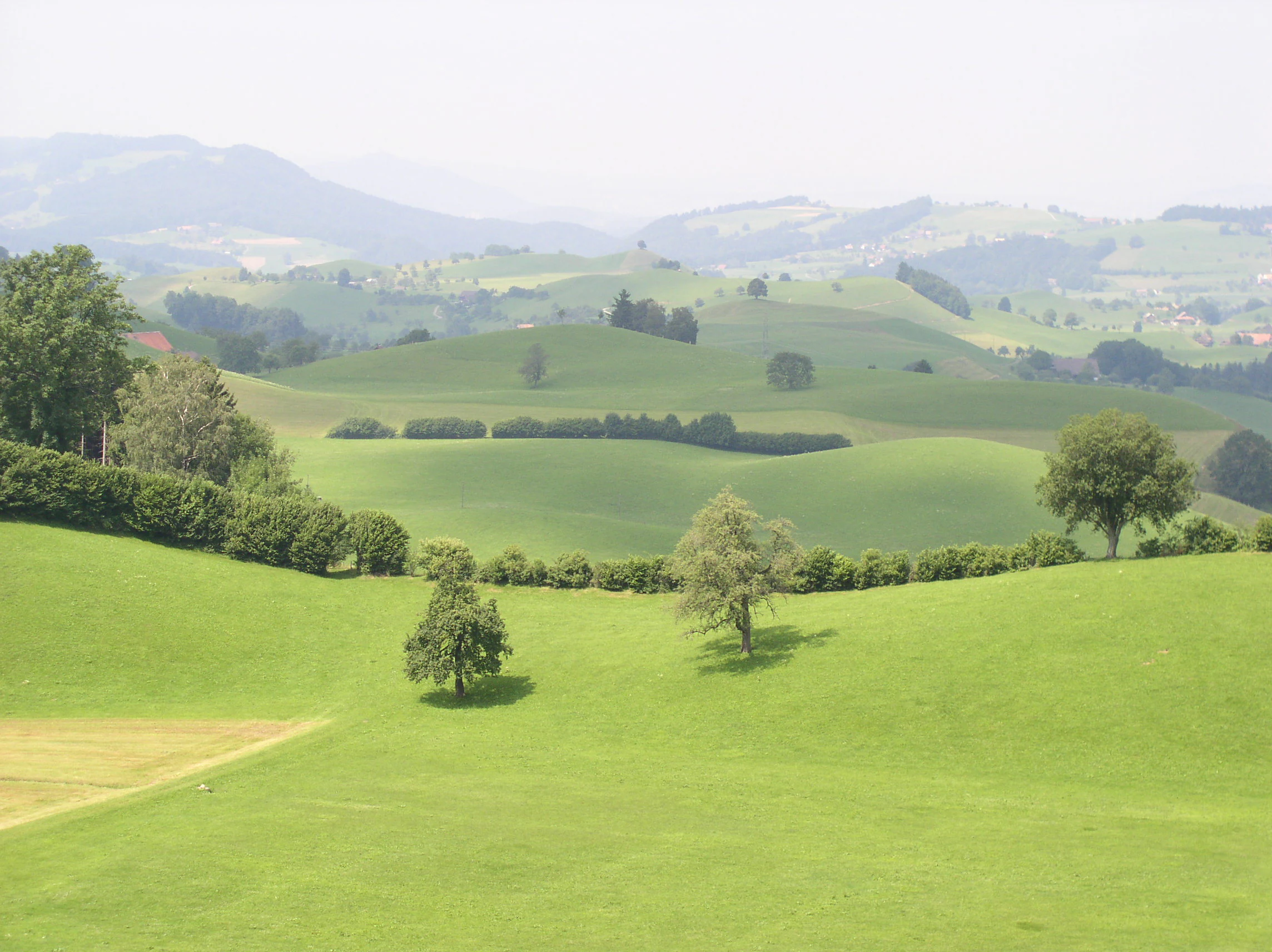
The landscape is a classic example of northern Swiss glacial terrain. The Höhronen, with its highest summit at 1,229 metres above sea level, runs as a roughly ten-kilometre forested ridge between the Biber high plateau to the south and the Sihl valley to the north. Its steep, mostly wooded flanks are drained by numerous spring streams, of which the Ijenbach on the southern side is the longest. The ridge forms the eastern portion of the protected area and creates a notable, mostly continuous forest silhouette.
Northwest of the ridge, the terrain opens into the moraine and drumlin landscape that characterizes the core of the area around Menzingen, Neuheim, Hausen am Albis, Hirzel and Horgen. Here, the surface is dominated by elongated moraine ridges, including the Hirzel–Höhi–Chapf ridge built from medial moraine of the Linth glacier, by rounded drumlin hills such as the Laubegg near Hütten, by ground moraine plateaus and by numerous small depressions. The Schwantenau, lying on a high plateau between the Sihl, the Alp and the Sihlsee, contains the third-largest raised bog biotope in Switzerland and the largest peatland area within the protected landscape.
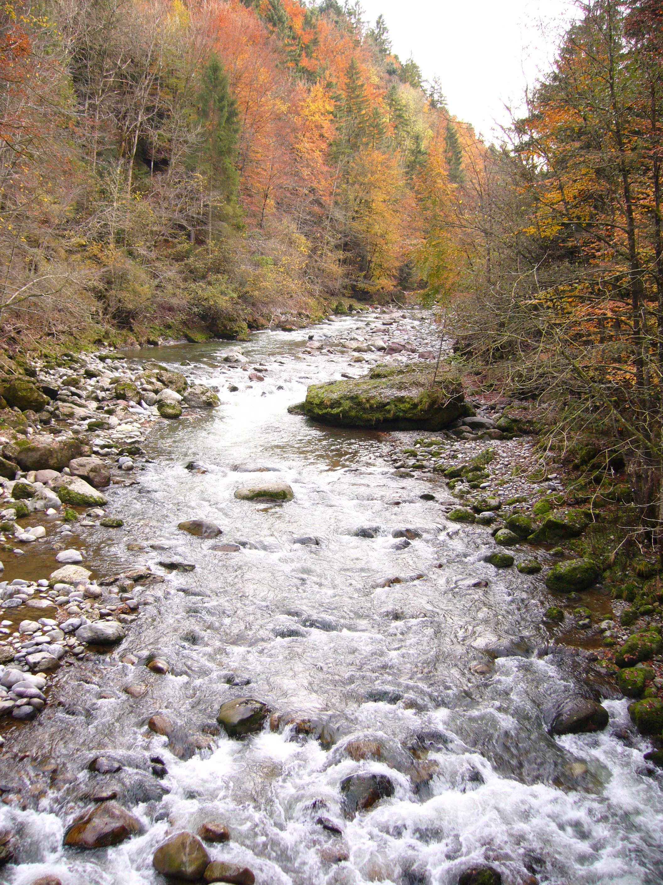
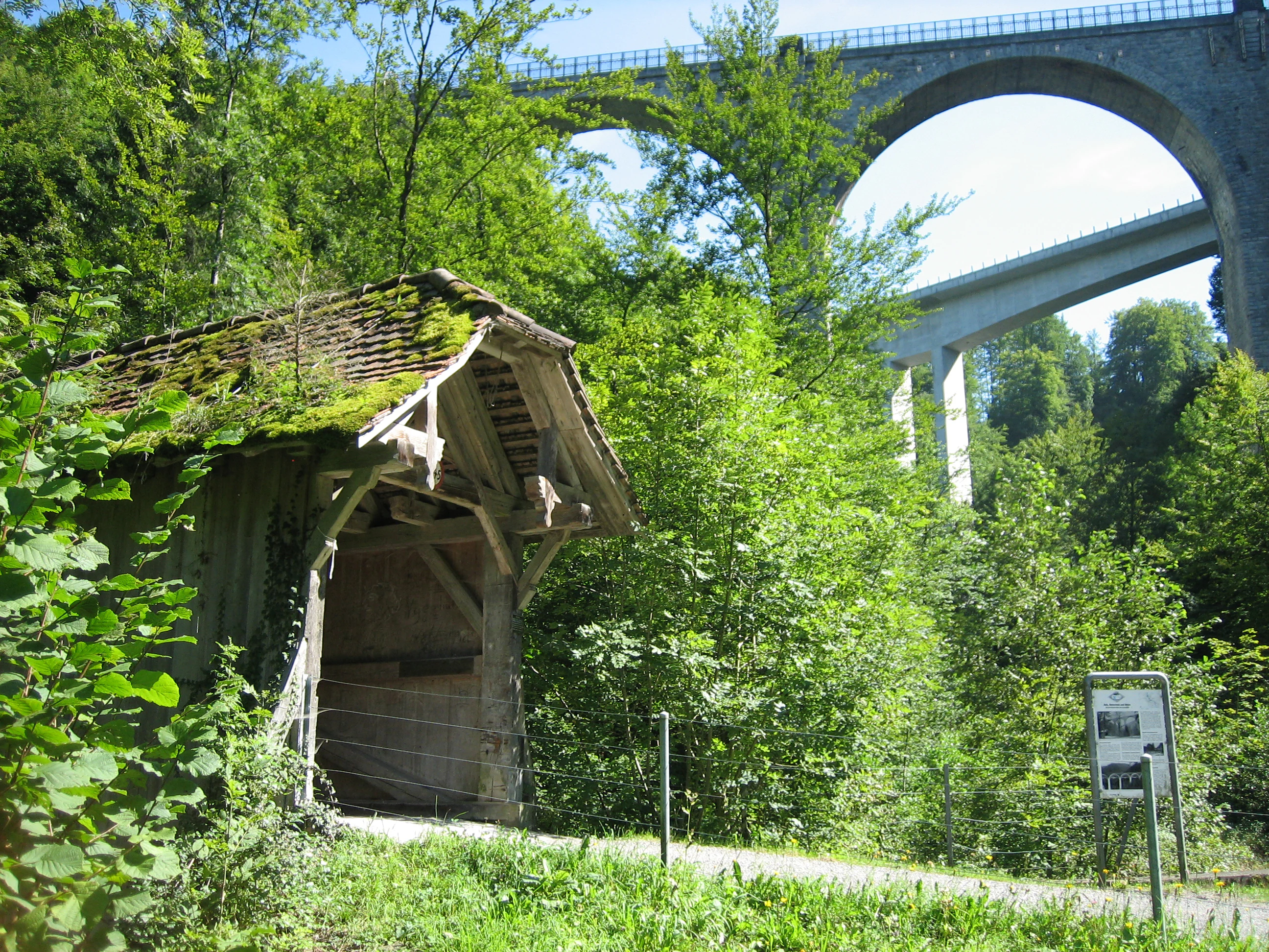
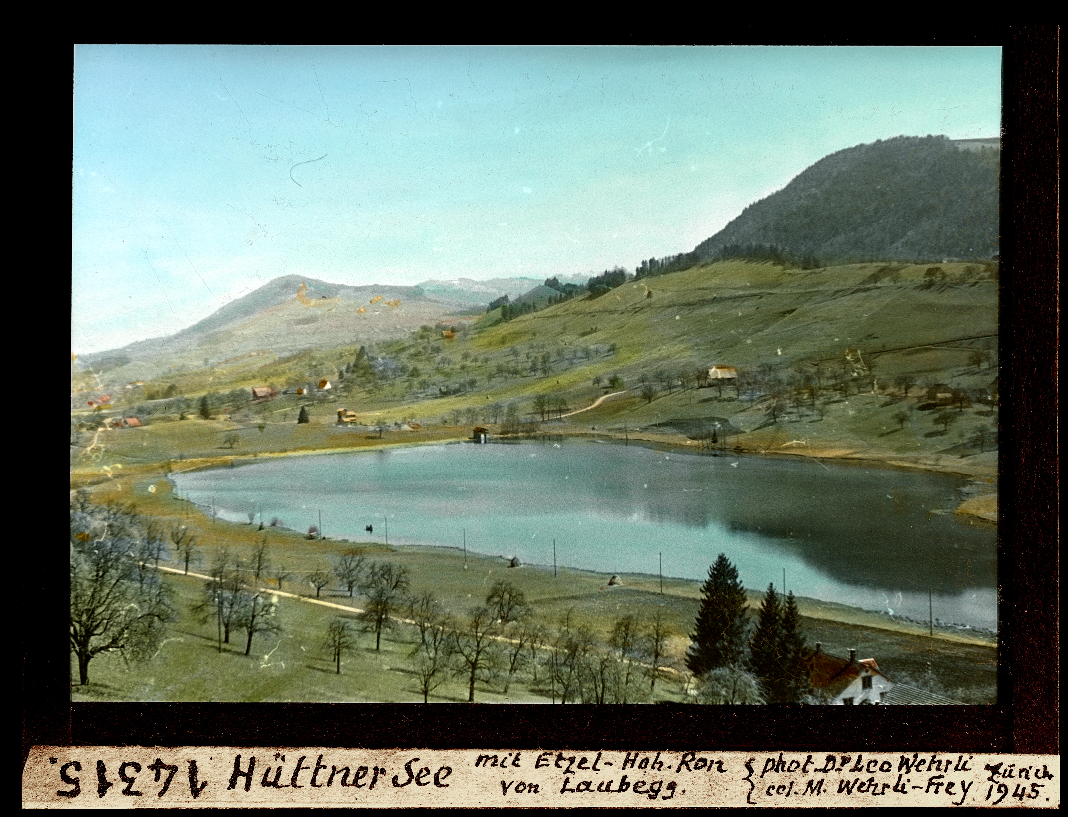
The hydrological landscape is equally distinctive. The Sihl cuts through a deep, narrow, often gorge-like valley, with the Sihlsprung rapids near the cantonal boundary as a dramatic feature. The Lorze and its tributaries have carved the Lorzetobel, where the historic Lorzentobel bridges cross on the main road from Zug to Sattel. In the depressions between moraine walls and in former dead-ice holes, small lakes such as the Hüttnersee near Samstagern and the Wilersee near Menzingen were formed; many other hollows silted up to form peat bogs and wet meadows. South of the Höhronen, the Biber and Alp rivers shape additional valleys, while the Hüttnersee and the Teufenbachweiher reservoir add still-water elements to the scenery.
Lorze, Sihl Glacial Landscape with Höhronen Chain and Schwantenau ecosystems, habitats, and plant life
The protected landscape covers a wide range of habitats, from deep river gorges to dry mountain slopes, raised bogs and coniferous forests. In the Sihlschlucht and the Lorzetobel, sections of riparian woodland have developed that include patches of the rare elm-ash-hardwood floodplain forest. On dry, sun-exposed marl slopes, orchid-rich pine woods are found, while near Menzingen there are also nationally inventoried dry meadows and pastures. Many of these dry and semi-natural grassland habitats are themselves protected at the national level.
The peatlands are a defining ecological element. In the Menzingen moraine belt, around the Raten pass and in the eastern Schwantenau, mires shelter specialized vegetation such as the rare pine-birch swamp forest, accompanied by relict subalpine plants on the Gottschalkenberg, where original pine woodland was once cleared for peat cutting. The Schwantenau fens contain large stands of small-sedge sedge marsh, tall-herb fen, and purple moor-grass meadow, surrounded by widespread black alder and birch woodland. The Hinterbergried near Schönenberg is itself a nationally inventoried flat bog, and the Abschwändi raised bog on the Gottschalkenberg preserves a rare example of an intact subalpine bog community.
The forest landscape around the Höhronen and Zimmerberg is dominated by spruce-fir-beech and silver fir-Norway spruce mixed forests, with silver fir-Norway spruce stands on the very humid north face of the Höhronen. These forests have been used for timber since the Middle Ages, and the Gutschwald forest nature reserve is an important protected woodland area. Old gravel pits and disused extraction sites in the moraine belt near Neuheim and Menzingen have been recolonized by pioneer plants and now serve as nationally significant amphibian spawning grounds, including the «Dreiwässeren» floodplain near Schindellegi.
Lorze, Sihl Glacial Landscape with Höhronen Chain and Schwantenau wildlife and species highlights
The varied terrain supports an unusually rich fauna for a densely populated part of Switzerland. The peatlands around Menzingen, on the Raten pass and in the Schwantenau act as refuges for threatened invertebrates such as the scarce swallowtail butterfly Skabiosen-Scheckenfalter and the small moor blue butterfly. The mire and forest mosaic also provides habitat for amphibians, with several nationally inventoried amphibian spawning grounds, including areas in the former gravel extraction zones and along the «Dreiwässeren» floodplain.
In the larger forests, the capercaillie, a threatened species listed on the Swiss Red List, is present in the Gutschwald forest nature reserve on the Höhronen. Several nationally important wildlife corridors cross the open and forested parts of the area, linking the bigger forest blocks on the margins of the Pre-Alps. These corridors include the Sihltobel between Menzingen and Schönenberg, the area north of Neuheim, and the Etzel ridge; the wildlife passage across main road 8 in the Chaltenboden near Schindellegi is of particular importance for large mammals moving through the landscape.
Lorze, Sihl Glacial Landscape with Höhronen Chain and Schwantenau conservation status and protection priorities
The Lorze – Sihl landscape is protected as BLN object 1307 in the Federal Inventory of Landschaften und Naturdenkmäler von nationaler Bedeutung, meaning its special geological, hydrological and ecological character is formally recognized as being of national importance. The protection goals include preserving the moraine landscape and its wealth of glacial forms, maintaining the natural flow dynamics and unspoiled character of the Lorze and Sihl river corridors, safeguarding the Höhronen ridge's largely intact silhouette and continuous forest cover, and protecting the raised bogs, flat mires and dry habitats, together with the characteristic plant and animal species they support.
Further protection comes from overlapping federal inventories for raised and transitional bogs, flat mires, dry meadows and pastures, amphibian spawning grounds and alluvial areas. Many sites within the landscape, including the Schwantenau, the Abschwändi raised bog, the Gutschwald forest nature reserve, the Hinterbergried and the Lorze gorge area, are individually protected nature reserves. The forest on the cantonal Zug side of the Höhronen serves research and education for the ETH Zürich and the WSL, integrating long-term ecological monitoring into the conservation approach. Cultural and visual goals, including preserving the bridges in the Lorzetobel and the traditional character of the cultural landscape, are also explicitly pursued.
Lorze, Sihl Glacial Landscape with Höhronen Chain and Schwantenau cultural meaning and human context
Although the area is dominated by forests and bogs, it carries a long history of human use. Forest clearance for timber and charcoal has been documented since the Middle Ages, particularly on the Höhronen. Streams were used for mills and traditional trades, and later for hydroelectric production. Peat cutting has shaped the Schwantenau since the eighteenth century, while gravel extraction has remained an important local industry in the Menzingen–Neuheim area, even as former pits have been turned into ecologically valuable habitats. Bridges in the Lorzetobel and crossings at Sihlbrugg and Biberbrugg reflect centuries of transport history, including the historic pilgrimage route from Zug to Einsiedeln via the Raten pass, today part of the long-distance Swiss Mobility route. Villages, hamlets and small towns, from Menzingen and Unterägeri to Wädenswil and Einsiedeln, weave a characteristic cultural landscape into the protected natural area.
Top sights and standout views in Lorze, Sihl Glacial Landscape with Höhronen Chain and Schwantenau
The landscape's most distinctive features are the unusually clear glacial landforms along the Lorze and Sihl valleys, including the elongated Hirzel–Höhi–Chapf moraine ridge, the drumlin field around Menzingen, the rounded Laubegg moraine hill and the dramatic Sihlsprung rapids. The protected area's identity is strongly reinforced by the Schwantenau raised bog complex, the third-largest in Switzerland, and by the long, heavily forested Höhronen ridge, whose north face hosts one of the most precipitation-rich silver fir-Norway spruce forests in the region.
Best time to visit Lorze, Sihl Glacial Landscape with Höhronen Chain and Schwantenau
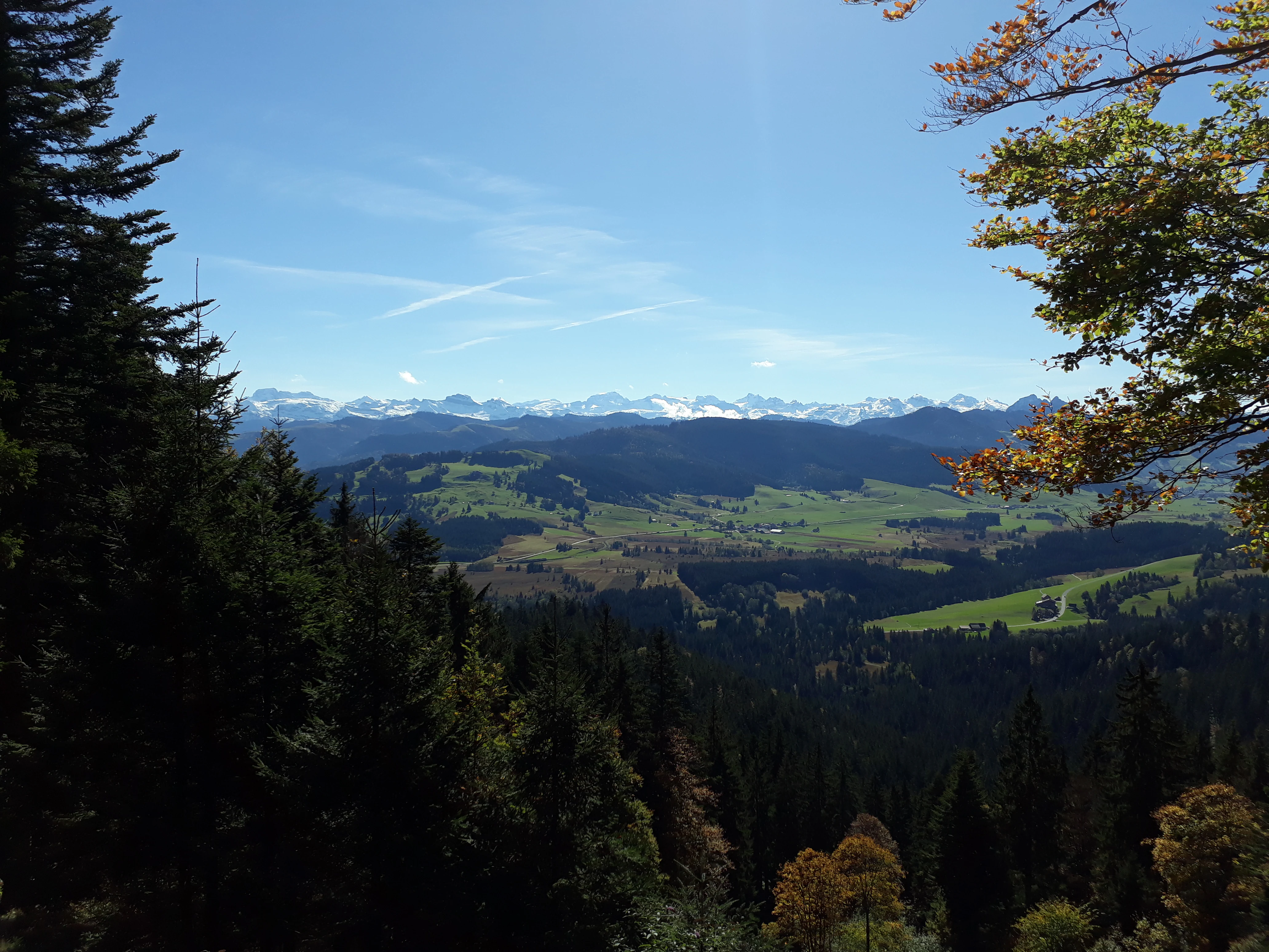
The landscape can be appreciated across the year, with each season emphasizing different qualities. Late spring and early summer bring the most active wildlife, flowering orchids in the dry pine forests near Menzingen and the beginning of bog vegetation in the Schwantenau. Summer is well suited to exploring the wooded gorges of the Sihl and Lorze and to combined hiking and swimming days around the Hüttnersee and Ägerisee. Autumn reveals the broad canopy of the Höhronen forests and clear views from the Gottschalkenberg and Raten passes, while winter often cloaks the ridge in snow and reduces traffic noise along the Sihl valley, emphasizing the area's quiet, remote character. Bogs and ice-age landforms remain accessible year-round via the established hiking network, including sections of the Swiss Mobility panorama route.