
Streams
Park geography
Detailed analysis of terrain types, administrative regions, and environmental features.
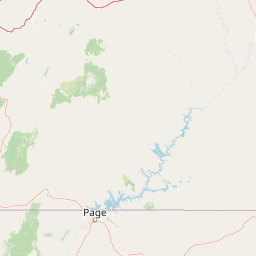
Geographic Profile and Mapped Boundaries of Glen Canyon National Recreation Area
This geographic profile tracks the spatial characteristics of Glen Canyon National Recreation Area across its 5075.23 square kilometer expanse in Arizona and Utah. Mapped data encompasses diverse upland terrain including canyon networks, riverine corridors, and desert habitats. Key features identified within the boundary range from named peaks and cliffs to extensive bay systems and fluvial drainages.
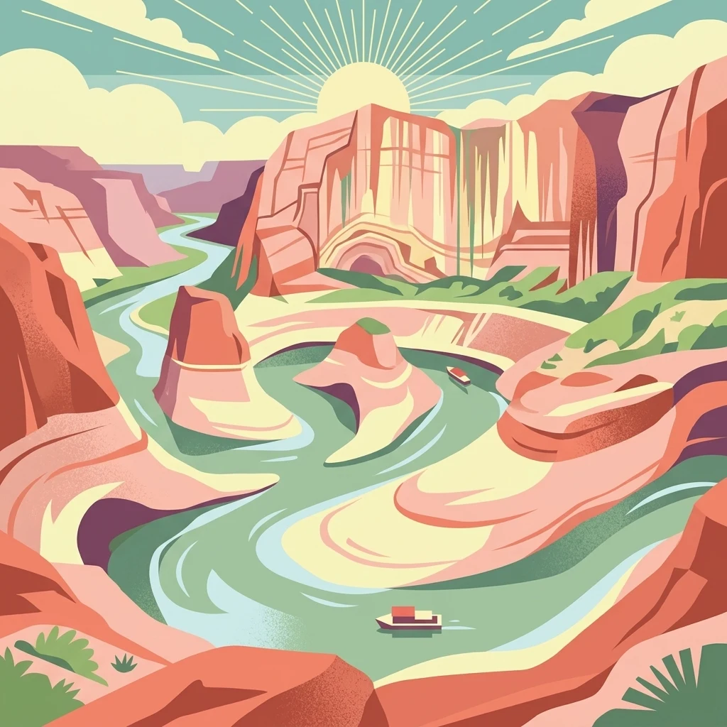
A vast reservoir-and-desert landscape straddling the Arizona, Utah border, centered on Lake Powell and the canyons of the Colorado River.
Glen Canyon National Recreation Area
Glen Canyon National Recreation Area is a large federal protected landscape in the southwestern United States, straddling the border between northern Arizona and southern Utah. It surrounds Lake Powell, the reservoir created by Glen Canyon Dam on the Colorado River, and extends through the rugged canyon country south of Canyonlands National Park. The recreation area preserves an immense stretch of high desert terrain shaped by rivers, wind, and ancient seas, with soaring sandstone cliffs, narrow side canyons, and broad slickrock benches. Unlike a strictly preserved national park, Glen Canyon NRA was created to balance public recreation with the protection of scenic, scientific, and historic values. Visitors come for houseboating, watersports, fishing, and sightseeing on Lake Powell, while also exploring tributary slot canyons and backcountry mesas. The recreation area is bordered by other iconic Colorado Plateau landscapes, including Capitol Reef, Canyonlands, Grand Staircase–Escalante, and the Navajo Nation, placing it firmly within one of the most geologically distinctive regions of the American West. The presence of the reservoir defines much of the modern experience of the recreation area, but the underlying landforms remain those of the Colorado Plateau: layered sandstones, canyon labyrinths, and arid mesas stretching toward the horizon. Glen Canyon NRA serves as both a major outdoor recreation destination and a gateway to the broader canyon country of the Four Corners region.
- Location
- United States of America
- Park type
- Protected landscape
- Established
- 1972
- Area
- 5,075.2 km²
Location overview
Recorded country memberships and administrative state regions
Glen Canyon National Recreation Area Location and Regional Geography
United States of America holds the recorded territorial authority across the designated Arizona and Utah state regions. Administrative records confirm non-transboundary, inland status without coastal, island, or marine designations.
- Countries
- United States of America
- Regions
- Arizona, Utah
- Primary location
- United States of America
- Geographic setting
- Inland
Boundary and coordinates
Interactive boundary geometry and calculated area metrics
Glen Canyon National Recreation Area Boundary Map and Spatial Extent
Mapped boundary outlines provide spatial context for the protected landscape and its regional spread. Derived measurement data details coordinate limits, center points, and total area coverage.
- Boundary area
- 5,059.9 km²
- Boundary perimeter
- 1,628.6 km
- Northernmost point
- 38.5° N
- Southernmost point
- 36.8163° N
- Easternmost point
- 109.945° W
- Westernmost point
- 111.6592° W
- Geographic centre
- 37.5157° N, 110.7735° W
- North–south span
- 186.9 km
- East–west span
- 151.3 km
Terrain and natural features
Catalog of upland terrain classifications and recorded landscape features
Glen Canyon National Recreation Area Terrain and Named Natural Features
Upland terrain classifications define the regional landscape spread across Glen Canyon National Recreation Area. Linked feature cards supply recorded names, types, and spatial relationships.
Selected named natural features
Cliffs
Trail Cliff
1,207 m
Streams
Piute Creek
Peaks
Johnson Point
1,149 m
Peaks
Rincon Point
1,476 m
Peaks
Trachyte Point
1,592 m
Environmental setting
Analyzed desert canyons, major water bodies, and upland terrain classifications
Glen Canyon National Recreation Area Environmental Classifications and Landscape Settings
Recorded landscape features, habitat types, and relief categories provide structured interpretive perspectives on the physical terrain. Stored classification records link directly to relevant atlas destinations for regional comparison.
- Relief
- Upland
- Water
- Major water bodies
- Forest cover
- No forest cover
- Seasonality
- Year-round
Landscape features
Canyon · Cliffs · Lakes · Rivers · Beach
Habitat types
Desert habitat · Riverine habitat · Lacustrine habitat
Park atlas
Discover adjacent protected areas, regional sandstone canyons, and connected desert terrain across the American Southwest.
Explore Parks Near Glen Canyon National Recreation Area and Surrounding Colorado Plateau Landscapes
Compare protected areas near Glen Canyon National Recreation Area to evaluate regional geological formations, high desert terrain, and connected canyon networks. Analyzing adjacent conservation landscapes reveals broader regional patterns across the Colorado Plateau and surrounding river basins.
National parkUtah
Park boundaries overlap#1 closest
Northeast

Canyonlands National Park: A Mapped Protected Landscape in Utah's Geography
Explore its vast geography and protected area boundaries.
Canyonlands National Park stands as a significant protected entity within the state of Utah, characterized by its immense scale and dramatic geological formations. This page facilitates an atlas-style exploration of its terrain, emphasizing its mapped boundaries and its crucial role as a protected landscape. Gain a deeper appreciation for its unique geographic setting and its place within the broader regional context.
- Area
- 1,366.21 km²
- Established
- 1964
- IUCN
- II
- Visitors
- 818.5K annual
National parkUtah
Park boundaries overlap#2 closest
North
Capitol Reef National Park: Utah National Park Protected Landscape and Geography
Explore Capitol Reef National Park's mapped terrain and boundaries.
Delve into the protected landscape and geographic identity of Capitol Reef National Park, a key national park in Utah. This resource provides detailed context on its mapped terrain and regional setting, supporting a structured understanding of protected areas for atlas exploration. Discover the specific geographic features and park boundaries that define this protected natural area.
- Area
- 978.95 km²
- Established
- 1971
- IUCN
- II
- Visitors
- 1.4M annual
National parkArizona
Park boundaries overlap#3 closest
Southwest
Grand Canyon National Park: Arizona National Park Protected Landscape & Geography
Explore mapped boundaries and regional atlas context.
Grand Canyon National Park stands as a premier national park, showcasing a unique protected landscape within Arizona's diverse geography. This detailed entry focuses on the park's specific geographic identity, its mapped boundaries, and its significance within the regional atlas. Discover the contours of this protected area and its place in the natural terrain of the American Southwest.
- Area
- 4,926.08 km²
- Established
- 1919
- IUCN
- II
- Visitors
- 4.9M annual

Protected landscapeUtah
14 km away#4 closest
North
Manti, La Sal National Forest: Geographic Overview of Utah's Mountain and Canyon Landscapes
Mapped protected forest boundaries across the Colorado Plateau
Spanning over one million acres, Manti, La Sal National Forest defines a critical segment of Utah geography. This protected landscape encompasses diverse terrain including subalpine mountains, aspen-rich uplands, and deep canyon networks. Use this atlas to examine the distinct environmental characteristics that separate the northern forested plateaus from the southern wilderness canyons.
- Area
- 5,143.09 km²
- Established
- 1950
- IUCN
- V
- Visitors
- 900K annual

Protected landscapeArizona
35 km away#5 closest
Southwest
Kaibab National Forest: Protected Plateau Landscapes and Forested Geography in Arizona
High-elevation forest terrain bordering the Grand Canyon
Spanning over 1.6 million acres in Arizona, Kaibab National Forest is characterized by its split geographic configuration, with distinct sections flanking the North and South rims of the Grand Canyon. The terrain ranges from the high-altitude Kaibab Plateau to volcanic uplands near Williams, encompassing four designated wilderness areas and varied forest ecosystems that provide a critical buffer for the surrounding canyon country.
- Area
- 6,500 km²
- Established
- 1909
- Relief
- Mountain
- Climate
- Temperate
National parkUtah
36 km away#6 closest
Northeast
Arches National Park: Utah National Park Protected Landscape Exploration
Explore mapped terrain and geographic context.
Delve into the specifics of Arches National Park, a protected national park located in Utah. This atlas-focused entry provides detailed insight into the park's protected landscape features and geographic distribution. Understand the mapped park boundaries and the unique natural terrain that shapes this significant conservation area within the United States' broader regional geography.
- Area
- 310.31 km²
- Established
- 1971
- IUCN
- II
- Visitors
- 1.5M annual
Wildlife reserveArizona
65 km away#7 closest
Southwest
Kanab Creek Wilderness: Protected Canyon Landscapes and Geography of Northern Arizona
Extensive tributary canyon systems and plateau terrain
Kanab Creek Wilderness represents a vast protected area in northern Arizona, defined by deep gorges and vertical cliffs etched into the Kanab and Kaibab Plateaus. This geographic atlas entry provides insights into the canyon network that feeds the Colorado River, highlighting the extreme elevation gradients and archaeological significance of this rugged wilderness.
- Area
- 305 km²
- Established
- 1984
- IUCN
- Ib
- Relief
- Upland
National parkUtah
66 km away#8 closest
Northwest
Bryce Canyon National Park: Utah's Mapped Protected Landscape and Geographic Context
Explore the unique geology and protected boundaries of Bryce Canyon National Park.
Bryce Canyon National Park offers a distinct protected landscape within the geography of Utah, characterized by its unique geological formations. This entry provides essential context for understanding its mapped boundaries and natural terrain, serving as a vital component for atlas-based discovery of protected areas. Investigate the specific geographic setting and conservation significance of this iconic national park.
- Area
- 145.02 km²
- Established
- 1928
- IUCN
- II
- Visitors
- 2.5M annual
MoriAtlas Explorer
Continue Exploring the Protected Landscapes of Glen Canyon National Recreation Area
Delve deeper into the mapped geography and environmental context of Glen Canyon National Recreation Area. This MoriAtlas destination provides a structured overview of the sandstone cliffs, slot canyons, and reservoir systems that define this significant American protected area.
Browse next
Global natural geography
Explore related park routes
Explore MoriAtlas Global ParksBrowse All MoriAtlas ParksGlobal Park Map DiscoveryMoriAtlas: Browse All CountriesBrowse All MoriAtlas ContinentsNational Park Environment AtlasGrand Canyon National Park AtlasYellowstone National Park AtlasYosemite National Park Atlas and GeographySerengeti National Park AtlasGalápagos National Park Protected LandscapeBanff National Park Geography and AtlasKruger National Park Atlas EntryUluṟu-Kata Tjuṯa National Park AtlasExplore Uluru-Kata Tjuta National Park GeographyPlitvice Lakes National Park AtlasFiordland National Park Protected LandscapeGreat Smoky Mountains National Park AtlasAfghanistan National Parks and Protected AreasAlbania National Parks and Protected AreasAlgeria National Parks and Protected AreasAmerican Samoa National Parks and Protected AreasAndorra National Parks and Protected AreasAngola National Parks and Protected AreasAntarctica National Parks and Protected AreasAntigua and Barbuda Park List