
Mori Atlas logo
Protected landscapeGlen Canyon National Recreation Area

A vast protected landscape defining the high desert geography of the American Southwest

Glen Canyon National Recreation Area: Atlas of Colorado Plateau Sandstone Canyons and Reservoirs

Glen Canyon National Recreation Area represents an immense protected landscape straddling the border of northern Arizona and southern Utah. This high desert terrain features massive sandstone cliffs, intricate tributary slot canyons, and the sprawling reservoir of Lake Powell carved into the Colorado Plateau. The mapped boundaries bridge the rugged canyon country between Capitol Reef, Canyonlands, and the Grand Staircase; serving as a central hub for understanding the region's unique stratigraphic geology.

national recreation areaLake PowellColorado RiverColorado Plateausandstone canyonshigh desert
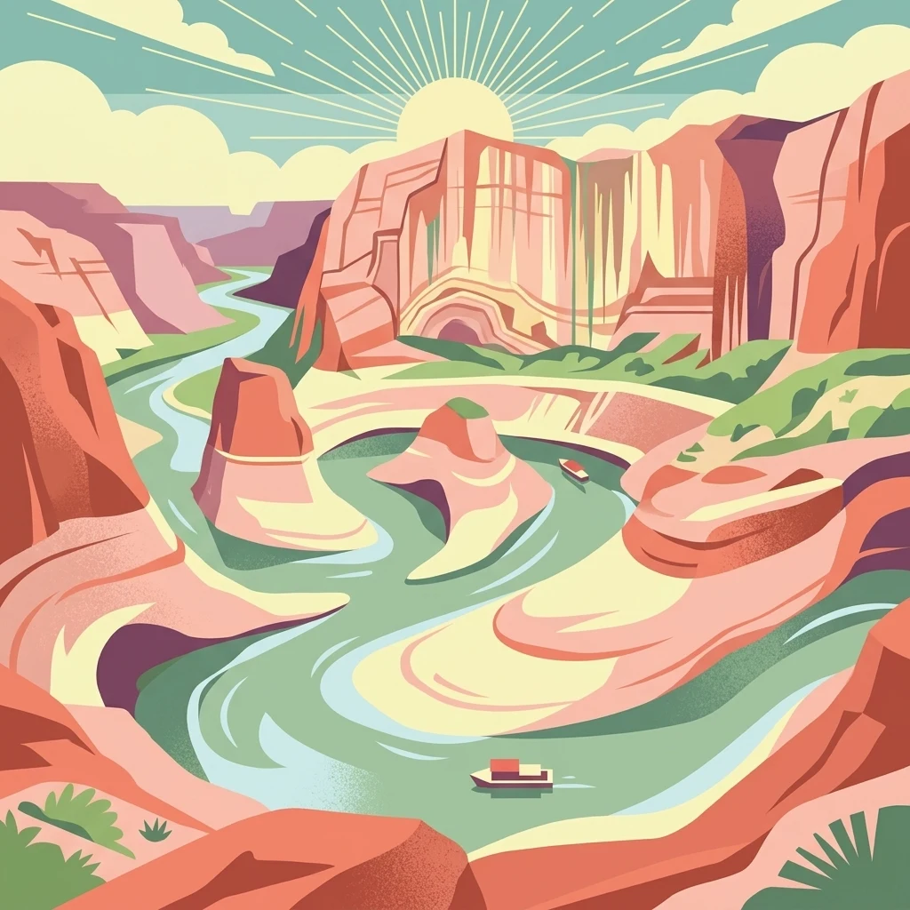
A stylized, colorful illustration of a winding river flowing through deep, layered desert canyon walls under a sunburst, with small boats on the water.

Glen Canyon National Recreation Area

Protected landscape

Park overview

Structured park overview, official facts, and landscape profile for Glen Canyon National Recreation Area

Glen Canyon National Recreation Area park facts, protected area profile, and essential visitor context

Review the core facts for Glen Canyon National Recreation Area, including designation, size, terrain, visitor scale, habitats, and operating context in one park-focused overview.

About Glen Canyon National Recreation Area

Glen Canyon National Recreation Area occupies a massive stretch of the Colorado Plateau along the Utah–Arizona border, centered on Lake Powell and the Colorado River corridor south of Canyonlands National Park. The recreation area encompasses rugged high desert terrain, deep sandstone canyons, and a reservoir whose winding arms reach into some of the most remote backcountry on the plateau. Its sheer size, in combination with the dramatic geological formations underfoot, makes it one of the defining landscapes of the American Southwest.

The recreation area was explicitly designed to serve a dual mission: providing public outdoor recreation while preserving the scientific, historic, and scenic character of the surrounding landscape. Unlike a traditional national park, where preservation may be the dominant concern, Glen Canyon NRA emphasizes recreation as a primary purpose. To support this role, the National Park Service has developed five marinas, multiple public campgrounds, small airports, and an infrastructure of houseboat and powerboat concessions around Lake Powell.

Geologically, the recreation area lies at the heart of the Colorado Plateau's exposed sedimentary record. The dominant rock layers belong to the Glen Canyon Group: the massive Navajo Sandstone, the layered Kayenta Formation, and the cliff-forming Wingate Sandstone. Together these layers produce towering canyon walls, sculpted arches, and smooth slickrock benches. Historic features like Double Arch, which stood above the lake before its collapse in 2024, illustrated the progressive erosion that continues to shape the canyon. Beyond the lake, tributary canyons, mesas, and benches extend the recreation area's landscape into classic Colorado Plateau country.

Ecologically and culturally, Glen Canyon NRA sits within a region long associated with Indigenous presence, river travel, and Western exploration. The nearby Navajo Nation, ancestral Puebloan sites, and historic river-running routes along the Colorado all frame the recreation area's human context. Its neighboring protected landscapes, including Capitol Reef, Canyonlands, Grand Staircase–Escalante, Vermilion Cliffs, and the northeasternmost reaches of Grand Canyon National Park, reinforce its role as a connective piece of one of the most remarkable concentrations of public lands in the United States.

Quick facts and research context for Glen Canyon National Recreation Area

Glen Canyon National Recreation Area is managed by the U.S. National Park Service, in cooperation with the Bureau of Reclamation, and spans portions of Kane, San Juan, Garfield, and Wayne counties in Utah along with Coconino County in Arizona. Established by Congress in 1972, it exists primarily as a recreation-focused conservation unit built around Lake Powell, the reservoir backed up behind Glen Canyon Dam.

The recreation area covers more than a million acres of rugged high desert and canyon terrain on the Colorado Plateau. It contains nearly 2,000 miles of shoreline along Lake Powell and is anchored by gateway communities such as Page, Arizona, and Bullfrog, Utah. Its geology is defined by the Glen Canyon Group, especially the Navajo Sandstone, along with the Kayenta and Wingate formations, producing the dramatic cliffs, arches, and side canyons the area is known for.

Protection and recognition

Documented terrestrial protection scope, management records, and international recognition details

Glen Canyon National Recreation Area Protection Status and Formal Recognition Data

Terrestrial protection status, management scope, and documented designation records for Glen Canyon National Recreation Area remain fully detailed across verified conservation databases. Complete recognition history and international status metrics provide clear reference points for researchers analyzing protected area management.

Protection details

Protection scope
Terrestrial
Transboundary protection
No
WDPA ID
810550
Park context

Deeper park guide and search-rich context for Glen Canyon National Recreation Area

Glen Canyon National Recreation Area history, landscape, wildlife, and travel context

Explore Glen Canyon National Recreation Area through its history, landscape character, ecosystems, wildlife, conservation priorities, cultural context, and seasonal travel timing in a structured park guide built for atlas discovery and search intent.

Why Glen Canyon National Recreation Area stands out

Glen Canyon National Recreation Area is best known for the striking desert scenery surrounding Lake Powell, where deep blue water winds through towering red and orange sandstone cliffs. The interplay between reservoir and canyon creates a landscape unlike almost any other in the American Southwest, with more than 1,900 miles of shoreline carved into the Colorado Plateau's sandstone formations. The area is also recognized for the commanding scale of its side canyons and slot canyons, including features like Reflection Canyon and the Golden Cathedral, as well as for the stratified geology that makes the region a textbook example of Colorado Plateau stratigraphy. Its combination of houseboating culture, scenic red-rock vistas, and proximity to Grand Staircase, Escalante, Capitol Reef, and Canyonlands helps define the broader identity of Utah's canyon country.
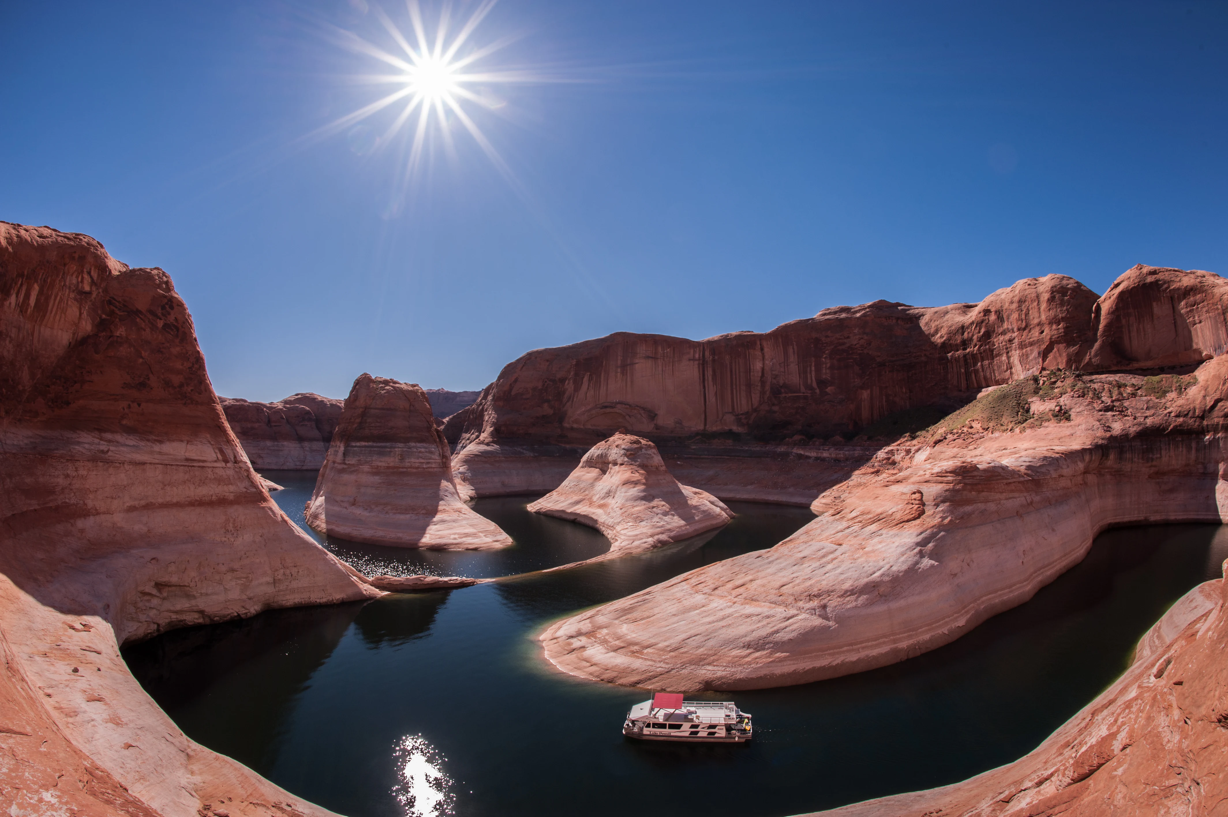
A wide angle shot of a white houseboat in a narrow, winding section of Lake Powell, bordered by deep orange sandstone cliffs under a clear blue sky with a bright sun star.
A houseboat navigates the winding blue waters of Lake Powell, surrounded by the towering sandstone cliffs of Reflection Canyon.

Glen Canyon National Recreation Area history and protected-area timeline

The origins of Glen Canyon National Recreation Area are tied directly to the construction of Glen Canyon Dam and the creation of Lake Powell on the Colorado River. In February 1957, Utah Senator Arthur V. Watkins asked Secretary of the Interior Fred A. Seaton to study whether federal lands around the reservoir could be set aside as a national recreation area. By June 1958, the National Park Service and the Bureau of Reclamation had reached an agreement to share administration of the upstream and downstream portions of the Colorado River around the dam, and Secretary Seaton announced the proposed Glen Canyon National Recreation Area.

Early administrative work began even before Congress formally acted. In January 1959, President Dwight D. Eisenhower included funding for road construction in the new recreation area in his proposed budget. Later that year, the National Park Service outlined a multi-year development plan, and James Milford Eden, previously superintendent of Organ Pipe Cactus National Monument, became the first superintendent of Glen Canyon NRA. He set up a trailer office near what would become Wahweap Marina, and the service soon acquired its first boats and began developing visitor facilities, including the initial Wahweap campground in late 1961.

Throughout the early 1960s, the National Park Service continued planning for expanded recreation infrastructure, including marinas, roads, housing, and a proposed bridge crossing the Colorado near the Dirty Devil River confluence. In August 1963, Utah Senator Frank Moss introduced legislation to formally establish Glen Canyon National Recreation Area, proposing an area of roughly 1.43 million acres. After years of revision, the final bill, Public Law 92-593, passed Congress and was signed into law by President Richard Nixon on October 27, 1972, creating the recreation area at its current size. Since then, Lake Powell, the surrounding canyons, and the developed marina system have become central elements of recreation on the Colorado Plateau, and the recreation area has also launched programs such as the Graffiti Removal and Intervention Team to address vandalism on its canyon walls.

Glen Canyon National Recreation Area landscape and geographic character

The landscape of Glen Canyon National Recreation Area is shaped by the geological forces of the Colorado Plateau and the hydrological footprint of Lake Powell. The terrain consists primarily of rugged high desert, dominated by deep canyons, towering sandstone cliffs, broad slickrock benches, and isolated mesas. The reservoir itself snakes through more than 1,900 miles of shoreline, filling canyons that were carved by the Colorado River and its tributaries over millions of years.

The defining landforms of the recreation area are products of the Glen Canyon Group, a sequence of layered sedimentary rocks that produces the region's characteristic cliffs, slopes, and rounded domes. Massive Navajo Sandstone forms rounded pale tan domes and high walls, while the red, cliff-forming Wingate Sandstone and the layered red Kayenta Formation add texture and color variation to canyon walls. Together these strata produce classic Colorado Plateau scenery, with steep canyon walls plunging toward quiet reservoir arms and narrow slot canyons twisting into the backcountry.

Beyond the lake, the landscape extends into tributary canyons, dry washes, and remote benches that retain the character of the original Glen Canyon landscape before it was flooded. Landmarks such as Reflection Canyon, the Golden Cathedral, and the now-collapsed Double Arch have highlighted the area's dramatic erosional and sculptural qualities. To the north, the recreation area abuts the wild canyon country of Canyonlands and Capitol Reef; to the west, it meets the terraces of Grand Staircase–Escalante; and to the southwest, the terrain transitions toward Vermilion Cliffs and the eastern edge of Grand Canyon country.
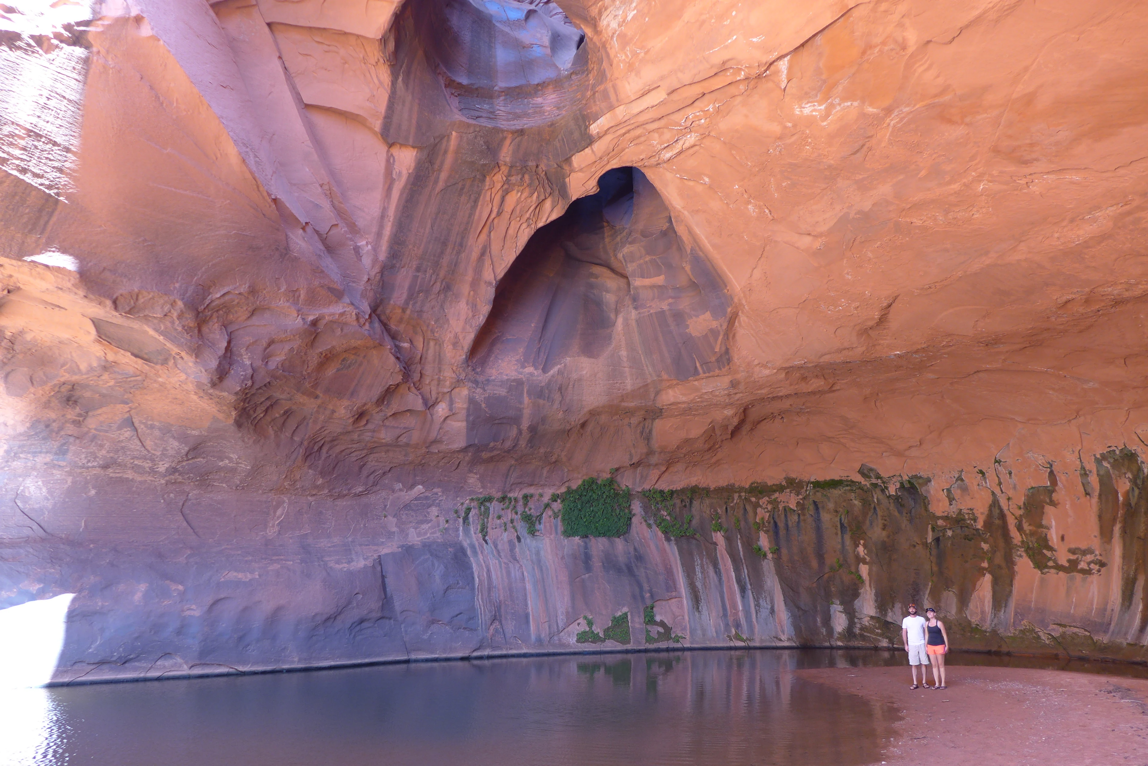
A wide view of the Golden Cathedral, a large orange sandstone alcove with deep pools of water at the base and two distinct circular openings in the high ceiling that allow light to stream into the shaded space. Two hikers stand on the shore near the water.
The Golden Cathedral, a distinctive sandstone alcove with natural skylights and a pool, located within the Glen Canyon region.

Glen Canyon National Recreation Area ecosystems, habitats, and plant life

Although much of Glen Canyon National Recreation Area is arid high desert, the reservoir and the surrounding rock country support distinct ecological zones. The lake itself has transformed parts of the former canyon system into an aquatic environment, creating habitat for warm-water fish species and reshaping the presence of water-dependent wildlife in the region. Side canyons and tributary drainages, meanwhile, retain pockets of riparian vegetation, including cottonwoods and willows that draw birds and other wildlife into otherwise dry surroundings.

The broader vegetation mosaic is typical of the Colorado Plateau, with sparse desert shrublands, juniper and pinyon woodlands on higher benches, and bare sandstone slickrock across large expanses of canyon country. Elevation changes between the canyon floors and the surrounding mesas create microclimates that shift plant communities over relatively short distances. These habitat contrasts are an important feature of the recreation area's ecological identity, even where vegetation cover is limited.

Wildlife in the recreation area ranges from desert-adapted mammals to raptors and migratory birds that travel the Colorado River corridor. The combination of water, cliff habitat, and adjacent desert makes Glen Canyon NRA a notable landscape for species that depend on canyon environments. Ecological health in the area is closely tied to the broader Colorado Plateau ecosystem, with conservation efforts there often coordinated with neighboring national parks, monuments, and tribal lands.
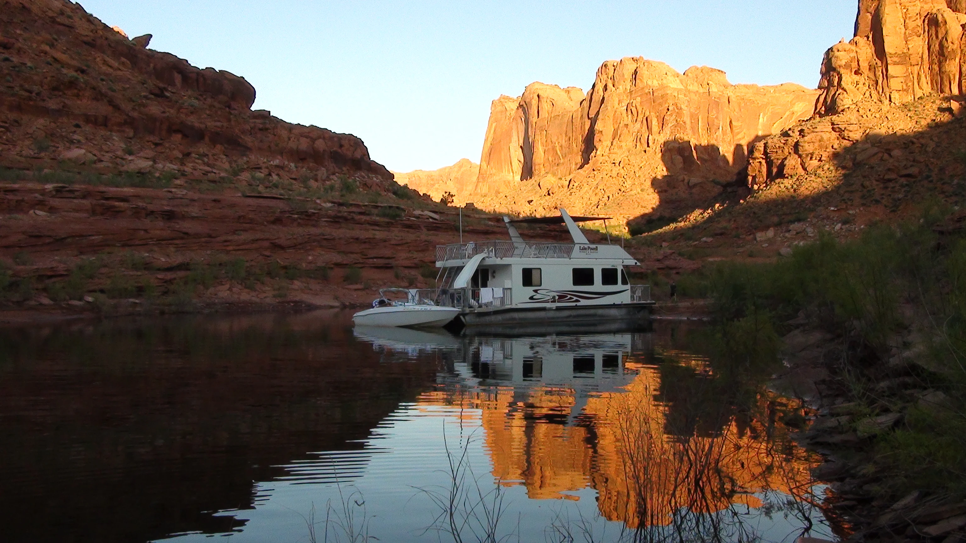
A houseboat and a small motorboat docked in a narrow canyon on a calm lake, with red sandstone cliffs reflecting in the water during golden hour.
A houseboat docked on the calm waters of Lake Powell, surrounded by towering red rock canyons.

Glen Canyon National Recreation Area wildlife and species highlights

Wildlife in Glen Canyon National Recreation Area reflects the meeting of aquatic and arid environments around Lake Powell and the surrounding canyonlands. The reservoir supports populations of warm-water sport fish, including largemouth bass, smallmouth bass, and striped bass, which have become central to the recreation area's fishing activity. These introduced and managed fisheries are part of why the area draws so many visitors, but they also shape the local aquatic food web.

Beyond the lake, the cliffs, mesas, and side canyons provide habitat for desert-adapted mammals such as mule deer, coyotes, bobcats, and various small rodents that thrive among the sandstone formations. Birds are among the most visible wildlife in the recreation area, with raptors like eagles and hawks using the canyon walls for nesting and hunting, and a wide variety of songbirds, waterbirds, and seasonal migrants passing through the river corridor. Reptiles, including lizards and snakes typical of the Colorado Plateau, are also common in the warmer, exposed portions of the landscape.

The interplay between reservoir habitat, riparian corridors along tributary drainages, and surrounding high desert makes wildlife observation a quietly significant part of the Glen Canyon NRA experience. Conservation programs in and around the recreation area address not only the preservation of native species but also the management of invasive species and the impacts of high visitor use on fragile desert environments.

Glen Canyon National Recreation Area conservation status and protection priorities

Glen Canyon National Recreation Area was established under a mandate that balanced public recreation with the protection of the region's scientific, historic, and scenic features. Its conservation role emphasizes the preservation of an immense tract of Colorado Plateau canyon country, including geological formations, vistas, and cultural sites that would otherwise face development pressure. The recreation area's sheer size, in combination with its location at the heart of the Colorado Plateau, gives it substantial ecological value beyond its recreational profile.

Protection efforts within the recreation area extend to the management of Lake Powell itself, which is jointly overseen by the National Park Service and the Bureau of Reclamation. This dual mandate reflects the recreation area's origins around Glen Canyon Dam and the recognition that the long-term character of the landscape depends on coordinated water and land management. Programs addressing visitor impact, including the Graffiti Removal and Intervention Team, or GRIT, demonstrate the National Park Service's effort to mitigate damage to fragile canyon wall resources from high visitor numbers.

Glen Canyon NRA also functions as a conservation link in a much broader network of protected landscapes. Its borders adjoin Capitol Reef National Park, Canyonlands National Park, Grand Staircase–Escalante National Monument, Vermilion Cliffs National Monument, and the easternmost edge of Grand Canyon National Park, while the Navajo Nation lies to the southeast. Together, these connected units form one of the largest contiguous blocks of protected canyon country in the United States, amplifying the conservation significance of any individual piece, including Glen Canyon itself.

Glen Canyon National Recreation Area cultural meaning and human context

The region surrounding Glen Canyon National Recreation Area carries deep and layered human history. The Colorado River corridor through Glen Canyon and the broader canyon country has been traveled, inhabited, and revered for centuries by Indigenous peoples, including ancestral Puebloan groups whose descendants include many of the tribes of the modern Southwest. The Navajo Nation borders the recreation area to the southeast, and the cultural and geographic ties between the recreation area and tribal lands remain a defining aspect of the region's identity.

In the modern era, the canyon country gained further cultural resonance through the rise of river running and exploration on the Colorado River. Respected writers such as Edward Abbey helped frame Glen Canyon as both a beloved natural landscape and a symbol of lost wilderness following the construction of Glen Canyon Dam. Lake Powell itself has since become a cultural landmark of the American Southwest, embedded in road-trip culture, popular imagery, and ongoing conversation about the costs and benefits of large-scale water projects in the West.

Within the recreation area, historic infrastructure from the early administrative period, including the development of Wahweap Marina and early ranger operations, also forms part of its cultural story. These elements reflect the deliberate planning that turned a remote stretch of canyon country into one of the most visited federal recreation landscapes in the United States.

Top sights and standout views in Glen Canyon National Recreation Area

Glen Canyon National Recreation Area is distinguished by the sheer scale of Lake Powell and its nearly 2,000 miles of fish-holding shoreline winding through red rock country. The contrast between deep blue reservoir water and the pale Navajo Sandstone walls is one of the most iconic visual signatures of the Colorado Plateau and a major reason the area draws millions of visitors each year.

Equally distinctive are the inland canyons and rock formations that frame the lake, from sculpted arches like the former Double Arch to side canyons such as Reflection Canyon and the Golden Cathedral. The recreation area's position between Capitol Reef, Canyonlands, Grand Staircase–Escalante, and the Navajo Nation allows it to function as both a destination in its own right and a connecting hub for travelers exploring the broader canyon country of the Four Corners region.

Best time to visit Glen Canyon National Recreation Area

The character of a visit to Glen Canyon National Recreation Area shifts meaningfully with the seasons. Spring and fall are widely regarded as the most comfortable periods, with milder temperatures that make both on-water activities and backcountry exploration more pleasant. Spring can bring vivid wildflower displays in the surrounding desert and active wildlife, while autumn offers cooler air, quieter conditions on Lake Powell, and strong light on the red rock cliffs.

Summer is the peak season, attracting large numbers of visitors for houseboating, swimming, and watersports on Lake Powell. Conditions are hot in the exposed desert, but the lake offers a cooling counterpoint and the marinas operate at full capacity. Winter visits tend to be quieter and cooler, with a different atmosphere around the reservoir and along the canyon rims, though some on-water activities are reduced. Across all seasons, the quality of light on the sandstone cliffs remains one of the area's most enduring appeals.

Monthly climate preview

Long-term representative coordinate records for monthly temperature and precipitation rhythms

Glen Canyon National Recreation Area Climate Normals and Average Temperature Patterns

Historical data records mean monthly temperatures ranging from near freezing to warm peaks alongside consistent precipitation averages across the reference period. Examining the complete twelve-month climate profile reveals deeper baseline metrics for comparative environmental analysis.
Annual mean13 °C
1 °C28 °C
Jan
Feb
Mar
Apr12°
May18°
Jun24°
Jul28°
Aug26°
Sep21°
Oct13°
Nov
Dec
Warmest month
July

27.5 °C

Coolest month
December

0.7 °C

Wettest month
August

0.9 mm/day

Driest month
June

0.2 mm/day

Park location guide

Geography guide, regional context, and park location map for Glen Canyon National Recreation Area

Glen Canyon National Recreation Area park geography, regions, and map view in United States of America

Understand where Glen Canyon National Recreation Area sits in United States of America through a broader geographic reading of the surrounding landscape, nearby location context, and its mapped position within the national park landscape.

How Glen Canyon National Recreation Area fits into United States of America

The United States of America is a federal presidential republic and one of the world's largest countries by area and population. It consists of 50 states across a vast territory spanning multiple time zones, with its capital in Washington, D.C. and largest city in New York City. The nation has a diverse economy, influential political system, and significant cultural and military presence globally.

Wider geography shaping Glen Canyon National Recreation Area in United States of America

The United States occupies a vast territory in North America, bordered by Canada to the north and Mexico to the south. The 48 contiguous states stretch from the Atlantic to the Pacific Ocean, while Alaska occupies the northwestern region and Hawaii is an archipelago in the Pacific. The country encompasses diverse terrain including the Rocky Mountains, Appalachian Mountains, Great Plains, and extensive river systems.

Map view of Glen Canyon National Recreation Area

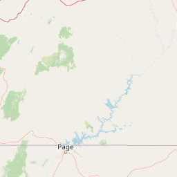
Use this park location map to pinpoint Glen Canyon National Recreation Area in United States of America, understand its exact geographic position, and read its mapped placement within the surrounding landscape more clearly.

Pigeon | © OpenStreetMap contributors

Location context for Glen Canyon National Recreation Area

ArizonaUtah
Natural feature types

Explore Named Natural Features of Glen Canyon National Recreation Area

Continue geographic discovery by examining the individual landforms, canyons, and reservoir features that define Glen Canyon National Recreation Area. Access structured data and mapping to understand the complex terrain of this significant Colorado Plateau landscape via MoriAtlas.
Recorded earthquake history

Review Recorded Earthquake History near Glen Canyon National Recreation Area

Access the comprehensive MoriAtlas catalogue of seismic events recorded in the vicinity of Glen Canyon National Recreation Area. Examine historical data regarding event magnitudes and epicentre proximity to understand the broader seismic context of this distinctive Colorado Plateau landscape.

Glen Canyon NRA Earthquake History

Catalogued events

36 events

Strongest magnitude

Magnitude 4

Most recent event

Jun 15, 2025

This history includes earthquakes recorded inside the park or within 50 km of its borders

Visualizing high desert terrain, sandstone cliffs, and protected Colorado Plateau habitats

Glen Canyon National Recreation Area Photos and Red Rock Landscape Scenery

Visual documentation captures the striking geological formations and vast desert reservoir environments found throughout Glen Canyon National Recreation Area. Detailed photography reveals layered sandstone stratigraphy, narrow slot canyons, and remote backcountry terrain across the protected landscape.

A wide angle shot of a white houseboat in a narrow, winding section of Lake Powell, bordered by deep orange sandstone cliffs under a clear blue sky with a bright sun star.

Panoramic view of a deep canyon with a winding green river at the bottom and a large concrete dam visible in the distance.

A wide view of the Golden Cathedral, a large orange sandstone alcove with deep pools of water at the base and two distinct circular openings in the high ceiling that allow light to stream into the shaded space. Two hikers stand on the shore near the water.

A houseboat and a small motorboat docked in a narrow canyon on a calm lake, with red sandstone cliffs reflecting in the water during golden hour.

Park atlas

Discover adjacent protected areas, regional sandstone canyons, and connected desert terrain across the American Southwest.

Explore Parks Near Glen Canyon National Recreation Area and Surrounding Colorado Plateau Landscapes

Compare protected areas near Glen Canyon National Recreation Area to evaluate regional geological formations, high desert terrain, and connected canyon networks. Analyzing adjacent conservation landscapes reveals broader regional patterns across the Colorado Plateau and surrounding river basins.
National parkUtah
Park boundaries overlap#1 closest

Northeast

Canyonlands National Park: A Mapped Protected Landscape in Utah's Geography

Explore its vast geography and protected area boundaries.

Canyonlands National Park stands as a significant protected entity within the state of Utah, characterized by its immense scale and dramatic geological formations. This page facilitates an atlas-style exploration of its terrain, emphasizing its mapped boundaries and its crucial role as a protected landscape. Gain a deeper appreciation for its unique geographic setting and its place within the broader regional context.

Area
1,366.21 km²
Established
1964
IUCN
II
Visitors
818.5K annual
National parkUtah
Park boundaries overlap#2 closest

North

Capitol Reef National Park: Utah National Park Protected Landscape and Geography

Explore Capitol Reef National Park's mapped terrain and boundaries.

Delve into the protected landscape and geographic identity of Capitol Reef National Park, a key national park in Utah. This resource provides detailed context on its mapped terrain and regional setting, supporting a structured understanding of protected areas for atlas exploration. Discover the specific geographic features and park boundaries that define this protected natural area.

Area
978.95 km²
Established
1971
IUCN
II
Visitors
1.4M annual
National parkArizona
Park boundaries overlap#3 closest

Southwest

Grand Canyon National Park: Arizona National Park Protected Landscape & Geography

Explore mapped boundaries and regional atlas context.

Grand Canyon National Park stands as a premier national park, showcasing a unique protected landscape within Arizona's diverse geography. This detailed entry focuses on the park's specific geographic identity, its mapped boundaries, and its significance within the regional atlas. Discover the contours of this protected area and its place in the natural terrain of the American Southwest.

Area
4,926.08 km²
Established
1919
IUCN
II
Visitors
4.9M annual
A watercolor painting showing a panoramic view of rolling green mountains with a winding stream through a forested valley.
Protected landscapeUtah
14 km away#4 closest

North

Manti, La Sal National Forest: Geographic Overview of Utah's Mountain and Canyon Landscapes

Mapped protected forest boundaries across the Colorado Plateau

Spanning over one million acres, Manti, La Sal National Forest defines a critical segment of Utah geography. This protected landscape encompasses diverse terrain including subalpine mountains, aspen-rich uplands, and deep canyon networks. Use this atlas to examine the distinct environmental characteristics that separate the northern forested plateaus from the southern wilderness canyons.

Area
5,143.09 km²
Established
1950
IUCN
V
Visitors
900K annual
A horizontal watercolor illustration showing a calm lake in the foreground, surrounded by grassy banks, evergreen trees, and rolling mountains in the distance under a pale sky.
Protected landscapeArizona
35 km away#5 closest

Southwest

Kaibab National Forest: Protected Plateau Landscapes and Forested Geography in Arizona

High-elevation forest terrain bordering the Grand Canyon

Spanning over 1.6 million acres in Arizona, Kaibab National Forest is characterized by its split geographic configuration, with distinct sections flanking the North and South rims of the Grand Canyon. The terrain ranges from the high-altitude Kaibab Plateau to volcanic uplands near Williams, encompassing four designated wilderness areas and varied forest ecosystems that provide a critical buffer for the surrounding canyon country.

Area
6,500 km²
Established
1909
Relief
Mountain
Climate
Temperate
National parkUtah
36 km away#6 closest

Northeast

Arches National Park: Utah National Park Protected Landscape Exploration

Explore mapped terrain and geographic context.

Delve into the specifics of Arches National Park, a protected national park located in Utah. This atlas-focused entry provides detailed insight into the park's protected landscape features and geographic distribution. Understand the mapped park boundaries and the unique natural terrain that shapes this significant conservation area within the United States' broader regional geography.

Area
310.31 km²
Established
1971
IUCN
II
Visitors
1.5M annual
A minimalist watercolor painting depicting a pale desert landscape with soft green hills and light reddish rock formations against a white background.
Wildlife reserveArizona
65 km away#7 closest

Southwest

Kanab Creek Wilderness: Protected Canyon Landscapes and Geography of Northern Arizona

Extensive tributary canyon systems and plateau terrain

Kanab Creek Wilderness represents a vast protected area in northern Arizona, defined by deep gorges and vertical cliffs etched into the Kanab and Kaibab Plateaus. This geographic atlas entry provides insights into the canyon network that feeds the Colorado River, highlighting the extreme elevation gradients and archaeological significance of this rugged wilderness.

Area
305 km²
Established
1984
IUCN
Ib
Relief
Upland
National parkUtah
66 km away#8 closest

Northwest

Bryce Canyon National Park: Utah's Mapped Protected Landscape and Geographic Context

Explore the unique geology and protected boundaries of Bryce Canyon National Park.

Bryce Canyon National Park offers a distinct protected landscape within the geography of Utah, characterized by its unique geological formations. This entry provides essential context for understanding its mapped boundaries and natural terrain, serving as a vital component for atlas-based discovery of protected areas. Investigate the specific geographic setting and conservation significance of this iconic national park.

Area
145.02 km²
Established
1928
IUCN
II
Visitors
2.5M annual

Common questions about visiting, size, designation, and location context for Glen Canyon National Recreation Area

Glen Canyon National Recreation Area FAQs for park facts, access, geography, and protected area context

Find quick answers about Glen Canyon National Recreation Area, including protected-area facts, park geography, trail and visitor context, and how the park fits into its surrounding country and regional landscape.
MoriAtlas Explorer

Continue Your Protected Areas Search Across the Global Atlas

Deepen your exploration by continuing the structured search for national parks and protected areas worldwide. Utilize the comprehensive filtering capabilities to compare different conservation landscapes and refine your understanding of global park geography. Discover more about the distribution and characteristics of protected natural areas.

Global natural geography